


Displaying items by tag: Marine Notice
Marine Notice: Survey for Fibre Optics in Site Investigations in North Irish Sea Next Month
The latest Marine Notice from the Department of Transport advises that a survey to investigate the use of fibre-optic cables in site investigations will be carried out in the North Irish Sea next month.
This survey from 16-25 March is being carried out in support of ongoing research at the Irish Centre for Research in Applied Geosciences (iCRAG).
The equipment and techniques to be used include:
- Distributed Acoustic Sensing (DAS) using fibre-optic cables: A 1000m length of fibre optic cable will be placed temporarily on the seabed in order to carry out the survey. The position of the cable will be marked using surface buoys.
- OBS deployment: Two ocean bottom seismometers will be deployed and will remain in position until retrieval at the end of the survey.
- Sparker seismic profiling: This will be carried out as mobile work towing a transducer a short distance behind the work vessel.
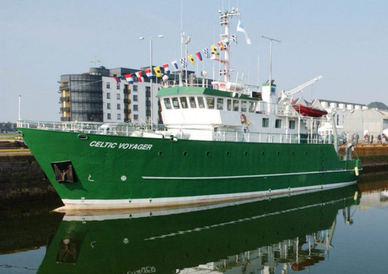
The survey will be conducted by the RV Celtic Voyager (Callsign EIQN) and Fionn Mac Cumhaill (Callsign EIDN2). The two vessels will work close by each other and the latter is assisting with marine mammal observer work.
The vessels will display appropriate lights and signals. Mariners should note that seismic surveying using DAS equipment will be performed during daylight hours.
Further details including relevant coordinates can be found in Marine Notice No 08 of 2021, a PDF of which can be downloaded below.
Marine Notice: SeaMonitor Survey in North Channel Sets Sail Later This Month
The Loughs Agency advises that it will carry out the SeaMonitor-EU Interreg Project (Survey CV21003) from Saturday 27 February to Friday 5 March.
The survey is being carried out in the North Channel in support of EU InterregVA project SeaMonitor.
A total of 108 Acoustic Listening Stations (ALS) are planned to be deployed at different locations covering a total of 63km between Malin Head in Co Donegal and Portnahaven on the Isle of Islay in western Scotland.
The first ALS on the Irish side is located 0.5 nautical miles from Inishtralhull Island at a depth of 20m. On the Scottish side, the first ALS is located 0.5nm from the shore at depths of 20-30m.
The survey will be conducted by the RV Celtic Voyager (Callsign EIQN) which will display appropriate lights and signals. Operations will be carried out during daylight hours to facilitate a safe deployment of acoustic receivers on the sea bed.
Further details including relevant coordinates can be found in Marine Notice No 07 of 2021, a PDF of which can be downloaded below.
Marine Notice: Geophysical Surveys for Dublin Array Wind Farm
Mariners have been given notice of a series of geophysical surveys for the Dublin Array Wind Farm taking place between next week and early May.
The Dublin Array is a project on the Kish and Bray banks some 10 km off the east coast of Ireland, immediately south of Dublin.
As previously reported on Afloat.ie, the proposed Irish-German venture could see as many as 100 wind turbines generate power for more than half a million homes.
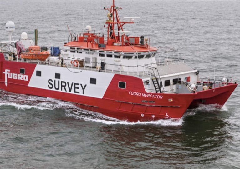
Fugro GB Marine Limited has been contracted for the geophysical surveys to characterise the offshore array and export cable search area, including exploring possible landfall options at Shanganagh Park and Poolbeg.
Operations across a total of four vessels are expected to begin next Tuesday 9 February and continue until Tuesday 11 May.
Details of the surveys and their coordinates are included in Fugro’s notice to mariners, which can be downloaded below.
Boaters Reminded to Brush Up on ‘Rules of the Road’ for Seafarers Following Disputed MCIB Report
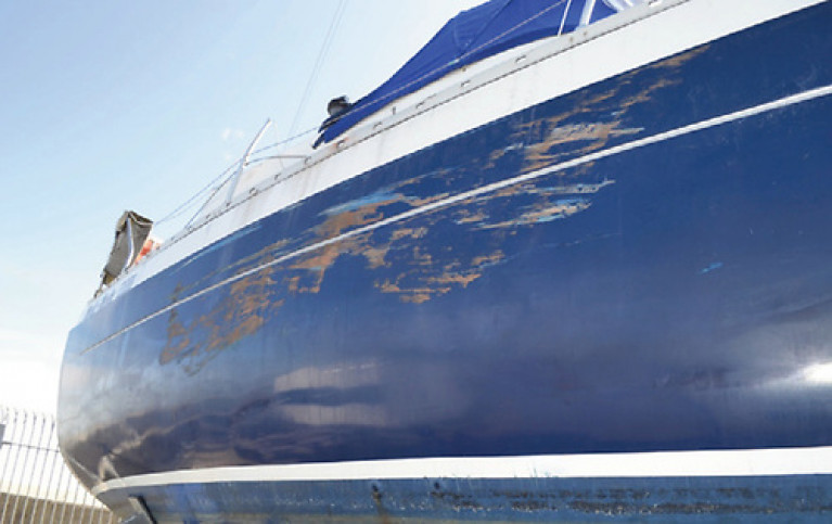
A collision involving a yacht and a tanker in August 2019 has prompted a reminder for boaters to brush up on the “rules of the road” for seafarers in the Department of Transport’s latest Marine Notice.
The 38ft yacht Medi Mode sustained extensive damage following the collision with the 88m chemical tanker off Greystones on the night of 23 August 2019. No one was injured in the incident.
As previously reported on Afloat.ie, the Marine Casualty Investigation Board (MCIB) report into the collision called on the Minister for Transport to alert recreational sailors and motorboat users to the need for “appropriate training” and compliance with international regulations on prevention of collisions at sea.
However, the two airline pilots who were sailing the yacht disputed the MCIB report’s criticism of their experience despite their lack of formal navigation qualifications.
Marine Notice No 05 of 2021 is available to download below.
Report on Fishing Vessel Fire Prompts Reminder on Safety Provisions in Code of Practice
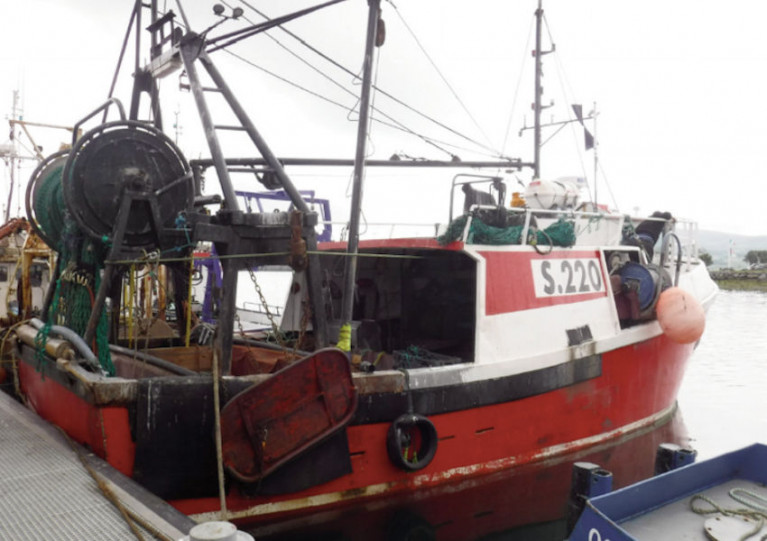
The latest Marine Notice from the Department of Transport brings the attention of fishing boat owners, skippers and crew to the safety provisions of the Code of Practice for fishing vessels less than 15m length overall.
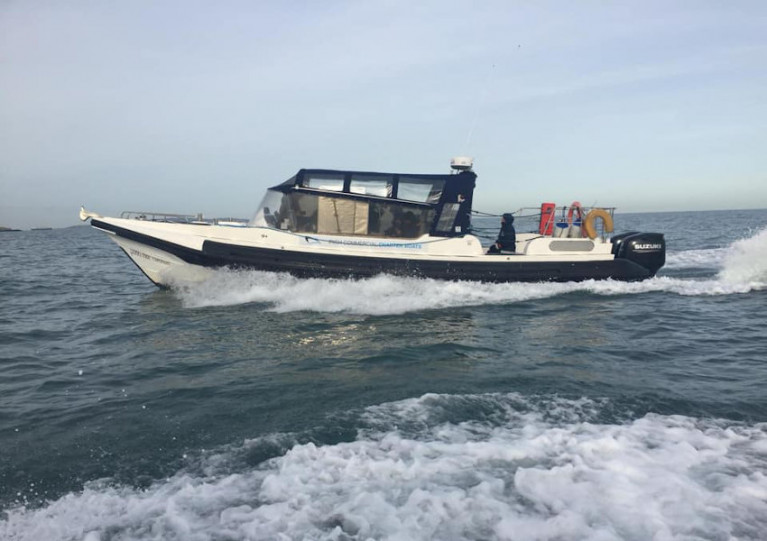
It follows the publication last month of the Marine Casualty Investigation Board’s (MCIB) report into an incident on the FV Kayleigh off Sheep’s Head in West Cork in March last year.
The vessel sank after a fire broke out in its engine compartment on the night of 3 March 2020.
Two crew with burn injuries caused by a fireball were recovered from a life raft at the scene and the vessel was abandoned, presumed to have sunk the following day.
In its analysis of the incident, the MCIB found that the crew’s injuries “may have been avoided if [they] had remembered to carry out the procedures for entering a compartment known to contain a fire”.
Marine Notice No 04 of 2021 outlines pertinent information for fishing vessel owners, skippers and crew including firefighting training requirements, and guidelines for fire detection and alarm systems on board.
The full notice is available to download below.
Irish Anglerfish & Megrim Survey 2021 Set for Next Month
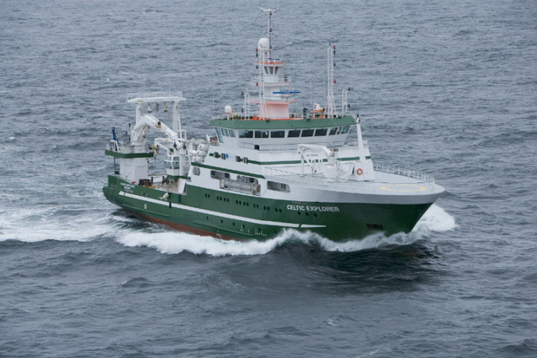
The first and second legs of the annual Irish Anglerfish and Megrim Survey (IAMS 2021) will be carried out from Monday 8 February to Thursday 4 March.
As with previous years, IAMS 2021 is a demersal trawl survey consisting of approximately 110 otter trawls (60 minutes) in ICES areas 7b, 7c, 7g, 7h, 7j and 7k off the West, South West and South Coasts of Ireland by the Marine Institute in fulfilment of Ireland’s Common Fisheries Policy (CFP) obligations.
The survey will be conducted by the RV Celtic Explorer (Callsign: EIGB) which will be towing a Jackson demersal trawl during fishing operations and will display appropriate lights and signals.
Commercial fishing and other marine operators are requested to keep a three-nautical-mile radius area around the tow points (indicated below) clear of any gear or apparatus during the survey period outlined above.
Further details of the survey, including co-ordinates of the survey stations, are included in Marine Notice No 03 of 2021, a PDF of which is available to download below.
New Legislation Provides for National Regulatory Regime for Smaller Passenger Vessels
The latest Marine Notice from the Department of Transport draws attention to the Merchant Shipping (Passenger Ship) Rules 2020 which were made law by Statutory Instrument on 15 December.
This new legislation provides a national regulatory regime for passenger ships of less than 24 metres in length and constructed of steel or aluminium on or after 1 July 1998 and engaged on domestic voyages.
Exempted from these rules are high-speed passenger craft, to which the European Union (Passenger Ships) Regulations 2019 (SI No 676 of 2019) apply.
The rules maintain an appropriate safety regime for such passenger ships following changes that took effect in 2019 in associated European Union legislation. They include safety standards and requirements in relation to ship construction, fire protection, life-saving appliances and radio communications.
A full briefing on the new rules is included in Marine Notice No 02 of 2021, a PDF of which is available to download below.
New Panel of Surveyors to Ensure Compliance with Code or Practice for Small Fishing Vessels

The Department of Transport has re-established a panel of surveyors to conduct surveys of small fishing vessels of less than 15m for compliance with the relevant Code of Practice, which was recently under review.
The panel was established three weeks ago on Wednesday 23 December and will continue until 22 December 2023. Contact details for all six panelists are included in Marine Notice No 01 of 2021, a PDF of which is available to download below.
Irish Coast Guard Confirms Recent Changes to VHF Working Channels
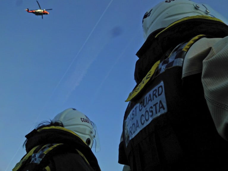
The Irish Coast Guard has has upgraded radio equipment at a number of VHF network remote locatosn in recent months.
Following these upgrades, the table below sets out the detail of the new coastguard working channels that are now in operation:
|
Site |
Radio Call Sign |
Current Channel |
New Channel |
|
Howth Hts |
Dublin Coast Guard |
CH 83 |
CH 03 |
|
Rosslare Hts |
Rosslare Coast Guard |
CH 23 |
CH 05 |
|
Mine Hd Hts |
Mine Head Coast Guard |
CH 83 |
CH 03 |
|
Cork Hts |
Cork Coast Guard |
CH 26 |
CH 02 |
|
Bantry Hts |
Bantry Coast Guard |
CH 23 |
CH 05 |
|
Valentia Hts |
Valentia Coast Guard |
CH 24 |
CH 62 |
|
Shannon Hts |
Shannon Coast Guard |
CH 28 |
CH 64 |
|
Belmullet Hts |
Belmullet Coast Guard |
CH 83 |
CH 63 |
|
Clifden Hts |
Clifden Coast Guard |
CH 26 |
CH 03 |
|
Malin Hd Hts |
Malin Head Coast Guard |
CH 23 |
CH 05 |
|
Scalp Mountain |
Malin Head Coast Guard |
CH 85 |
CH 01 |
|
Glen Hd Hts |
Glen Head Coast Guard |
CH 24 |
CH 03 |
The remaining sites of Carlingford (CH04), Wicklow (CH02), Mizen Head (CH04), Galway (CH04), Clew Bay (CH05), Donegal Bay (CH02), Lough Ree (CH62) and Lough Derg (CH61) will retain their respective currently assigned channel.
A map showing the radio sites including the new channels and a guide to transmissing VHF distress alerts are included in Marine Notice No 61 of 2020, which is available to download below
Subsea Exploration Works Off North West Coast Start This Week
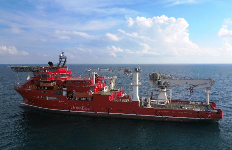
Ultra Deep Solutions will be carrying out subsea exploration activities off the North West Coast from tomorrow, Wednesday 16 December.
The work will be conducted a number of weeks, progress and weather depending, within the vicinity of 55° 19’N, 009° 41’W.
Vessel-mounted equipment, ROV and saturation divers will be operating from the MV Lichtenstein (Callsign C6DC6), which requests a wide berth from all other vessel due to its restricted ability to manoeuvre.
Further details are included in Marine Notice No 60 of 2020, which is available to download below.


