Menu

Ireland's sailing, boating & maritime magazine

Inland afloat headers


Displaying items by tag: lighthouse

Overnight stays in lighthouses across the island of Ireland have increased by 60 per cent since 2019, the Great Lighthouses of Ireland partnership says.

 As Afloat reported earlier, lighthouse tourism attracted 622,000 people last year.

 “Lighthouses have such a special and universal appeal and are located in some of our island’s most breathtaking coastal landscapes,”  Bobby Kerr, chair of the Great Lighthouses of Ireland, told a conference discussing further development of this type of coastal tourism.

 “Pre-Covid, the Great Lighthouses of Ireland delivered an estimated €16.8m economic benefit in under four years, and supported over 400 jobs,” Kerr noted at the gathering, which opened in Belfast on Sunday.

The three-day conference hosted by the partnership - which was initiated in 2015 by the Commissioners of Irish Lights -  involves sessions on Rathlin Island and Blackhead Lighthouse in Whitehead, Co Antrim.

  “Last year, overnight stays in lighthouses rose to an occupancy rate of 74% - that’s up from 46% in 2019 pre-Covid,” Kerr said.

Commissioners of Irish Lights chief executive Yvonne Shields O’Connor told the conference that lighthouse tourism is a  “ positive and sustainable way to preserve our maritime heritage”.

“It can provide income and jobs for coastal communities and increase visitor numbers to the island of Ireland,” she said.

 Irish Lights maintains some 340 general aids to navigation, including over 60 lighthouses right around the coast, with some of the keepers’ cottages now used for tourism.

Assistant keeper Gerald Butler at West Cork’s Galley Head says the sector is thriving as people are drawn to the tranquillity offered by lighthouse cottages.

Shields O’Connor cited Rathin Island off the Antrim coast as a good example of how lighthouse tourism works at local level.

The Royal Society for the Protection of Birds (RSPB) runs the island’s West Lighthouse and seabird sanctuary there, while the  Rathlin Development and Community Association are working on plans to repurpose the island’s East Lighthouse for visitors and the community.

Local ferry company Kintra Tours offers boat trips to view all three Rathlin lighthouses and spot puffins and dolphins en route.

Great Lighthouses of Ireland partners include Kintra Boat Tours, Maritime Belfast the Irish Landmark Trust, the Royal Society for Protection of Birds Northern Ireland RSPB, Forbairt Fhanada Teoranta (Fanad Community Group), Killybegs Sea Safari,  Ballycotton Sea Adventures, Cork County Council, Ionad Deirbhile, Hook Heritage limited, Valentia Island Development Company, Kerry County Council, Údarás na Gaeltachta, Clare Island Lighthouse, Cape Clear Ferries, Clare Co Council, and Kerry Aqua Terra Boat Adventure Tours  

Great Lighthouses of Ireland is also supported by Fáilte Ireland, Tourism Northern Ireland and Tourism Ireland.

Published in Lighthouses
Tagged under

Lighthouse tourism in Ireland has significantly increased, with a 60% rise in overnight stays in such facilities throughout the country since 2019, according to the Great Lighthouses of Ireland tourism initiative. Last year, over 622,000 people visited lighthouses and lighthouse tourism experiences throughout the country.

The Great Lighthouses of Ireland partnership, established in 2015 and led by Irish Lights, is composed of public, private, and community sector partners, and aims to preserve maritime heritage throughout the country. The partnership will host a three-day conference in Belfast from October 8 to plan future growth for lighthouse tourism throughout the country.

Bobby Kerr, chairperson of the Great Lighthouses of Ireland partnership, said, “Lighthouses have such a special and universal appeal and are located in some of our island’s most breathtaking coastal landscapes. Growing lighthouse tourism has multiple benefits. It’s a positive and sustainable way to preserve our maritime heritage. It can provide income and jobs for coastal communities and increase visitor numbers to the island of Ireland.”

Blackhead Lighthouse in County Antrim Photo: Malcolm McGettiganBlackhead Lighthouse in County Antrim Photo: Malcolm McGettigan

The Great Lighthouses of Ireland partnership has estimated that it provided an economic benefit of €16.8m in under four years and supported over 400 jobs before the COVID-19 pandemic. Irish Lights CEO Yvonne Shields O’Connor stated that the partnership’s recovery is underway and that it is well-positioned for the future.

“We share a vision and collaborate as partners to create truly inspiring and transformative visitor experiences. It’s time now to be more ambitious about what we can achieve together,” said O’Connor.

The Titanic Light, Belfast, is part of the Great Lighthouses of Ireland tourism initiativeThe Titanic Light, Belfast, is part of the Great Lighthouses of Ireland tourism initiative

The conference, which is scheduled for October 8-10, will explore a number of lighthouse-related projects throughout Northern Ireland, with the goal of developing sustainable visitor experiences based on maritime heritage and culture throughout the region.

Published in Lighthouses
Tagged under

Plans are being made to remove the Royal Sovereign lighthouse which was a familiar navigational mark for yachts off Britain’s east Sussex coast.

It is expected that it will take two years for marine contractors Herbosch-Kiere to complete the work, and the lantern tower may be retained in the local area for the community.

The lighthouse built at a cost of £1.5 million sterling was completed in 1971, and it replaced a lightship of the same name. The lightship had marked the Royal Sovereign shoal.

It was built in two parts on land, with a reinforced concrete supporting column placed in position first.

An upper deck/lantern with built-in accommodation for the keepers and a helicopter landing deck was added, and the column was raised to its full height.

The lighthouse was automated and converted to solar power in 1994.

Trinity House, responsible for lighthouses and navigational marks, announced in 2019 that the station was being decommissioned.

Published in Lighthouses
Tagged under

Amateur radio enthusiasts from across Ireland's midwest gathered at Loop Head Lighthouse Experience on the Shannon Estuary in County Clare over the weekend to participate in the 26th annual International Lighthouse and Lightship Weekend (ILLW). The event, which saw the Limerick Clare Radio Amateur Club broadcast non-stop for 48 hours from the West Clare lighthouse, involved using Morse Code and Single Sideband Radio to contact lighthouses and lightships around the world.

The Limerick Clare Radio Amateur Club has had great success in previous years, having contacted fellow radio amateurs in countries such as Australia, Brazil, and the US Virgin Islands. During this year's broadcast, visitors to the lighthouse were able to listen in on communications with some of the 500 lighthouses and lightships in over 40 countries that were activated by amateur radio enthusiasts.

Loop Head Lighthouse is an ideal location for long-distance radio communication attempts due to its isolated location on the edge of the Atlantic Ocean and the lack of radio interference in the general area. The Club operated two stations during the weekend, one of which was at the entrance to the Lighthouse so members of the public could listen to some of the transmissions.

Loop Head Lighthouse is one of 17 Great Lighthouses of Ireland and has become one of West Clare's most popular attractions since it first opened to visitors in 2011Loop Head Lighthouse is one of 17 Great Lighthouses of Ireland and has become one of West Clare's most popular attractions since it first opened to visitors in 2011

Joe Ryan, Secretary of the Limerick Clare Amateur Radio Club, expressed his gratitude to all the staff of Clare County Council and the Commissioners of Irish Lights for their help in planning the event and allowing them to use the grounds as part of the International Lighthouse and Lightships Weekend.

Loop Head Lighthouse Experience is one of 17 Great Lighthouses of Ireland and has become one of West Clare's most popular attractions since it first opened to visitors in 2011. The lighthouse also serves as one of two Signature Discovery Points in County Clare along the route of the Wild Atlantic Way.

Overall, the event was a great success and brought together radio enthusiasts from all over the world to share their love of communication and lighthouses.

See here for more information on the International Lighthouse and Lightships Weekend

Published in Shannon Estuary

Red Stripe Press has published Ireland’s Guiding Lights: Celebrating Our Lighthouses by Dennis Horgan, Gerald Butler and Tim McCarthy, a book full of aerial photography and rich stories from one of Ireland’s most celebrated lighthouse historians.

Ireland has a rich maritime heritage, and lighthouses have played a significant part in our history.

These unique structures ring our coast, providing safe passage for all those who sail our coastal waters, from mammoth ocean-going tankers to leisure craft and fishing vessels. Despite the advances in GPS technology, our lighthouses provide a permanent guiding presence by day and night.

Aerial photographer Dennis Horgan has spent many hours in light aircraft flying around the entire island of Ireland, capturing stunning images of these coastal sentinels from a rarely seen perspective.

Alongside these images, former Irish Lights keeper and lighthouse historian Gerald Butler contributes some fascinating insights into these lights and the dedicated people who manned them.

With a foreword by the chairman of the Commissioners of Irish Lights, Ireland’s Guiding Lights will appeal to all who have an interest in our coastal lighthouses.

Ireland’s Guiding Lights is available now from all good bookshops, www.redstripepress.com and www.dennishorgan.ie for €24.99.

Published in Book Review
Tagged under

Lee Maginnis notes the 200th anniversary of the great granite Haulbowline Lighthouse on the County Louth coast will be in 2024

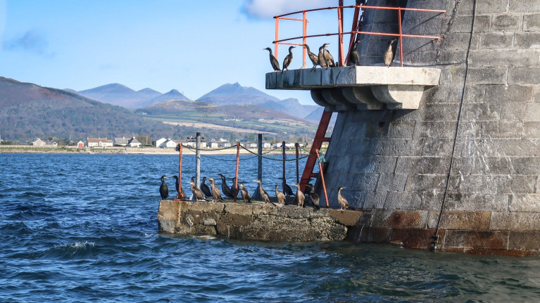
Haulbowline Lighthouse, that feat of granite engineering sitting on a wave-washed rock in the mouth of Carlingford Lough. Northern Ireland on one side, the Republic of Ireland on the other. Not that the nesting Cormorants on the window ledges know or care.

There was another lighthouse on Cranfield Point; it became a victim of the erosion going on a lot longer than many care to admit. But the old light had already been replaced by the time it fell into the sea.

It had been in the wrong place. Invisible to ships in the West and not marking the dangerous rocks at the mouth of the lough. George Haplin designed and built Haulbowline in 1824.

That makes the remarkable Haulbowline nearly 200 years old. Remarkable. Sitting out there on a rock that can rarely be seen. Battered by the waves. Strong currents racing past the base.

The tower was white until 1946. Now it is back to its natural stone.

Many other features have long gone. It seems a pity to many that they were not retained. The metal ball hoisted and lowered to indicate the tide level. The half-tide lantern displayed on the seaward side, halfway up. The red turning light. Explosive fog signals...

On 17 March 1965, Haulbowline had the dubious honour of becoming the first Irish major offshore light to be fully automated and remotely monitored and controlled from shore. The dataphonic system installed sent pre-recorded voice messages ashore by telephone about the status of the light and equipment. This was the beginning of the end of the lighthouse keeper.

Haulbowline in the past. Photographer unknownHaulbowline in the past. Photographer unknown

The fog signal sounded, and the light flashed if visibility was poor, day or night, back then.

The light still flashes three times every ten seconds. Still from a height of 32 metres in a tower 34 metres tall. But it is an LED now, range down to 10 nautical miles.

The fog signal is gone. It is missed by many.

Generators are no longer heard humming; now, a solar panel charges the batteries that provide power during the night.

Thankfully Haulbowline is still there and is listed. It is active. A monument to the past, but still capable of stirring up a strong sense of adventure and mystery today as it guides ships and guards the mouth of Carlingford Lough.

Kiwi Lee Maginnis lives in the countryside of Northern Ireland likes the outdoors, wildlife and sport. He has a keen interest in the sea and the environment. 

Published in Lighthouses

The summer season sees Carlingford Lough Ferry kicking off with the launch of its passenger 'cruise' schedule.

As Dundalk Democrat writes, last week dates were released for their June Sunset cruises, which commences this Saturday June 12th and tickets are already being snapped up.

Carlingford Lough is an area of outstanding natural beauty, and is at its most beautiful as the sun sets over the Cooley Peninsula and the majestic Mourne Mountains.

These new sunset lough cruises are specifically designed to offer customers the opportunity to take a safe and socially distanced cruise on the iconic Carlingford Lough.

While onboard (Aisling Gabrielle), passengers will enjoy a fascinating audio tour, that will offer insights into the myths and legends of this majestic Lough, its formation as a glacial fjord, and its abundance of wildlife and bird life, in addition to live music and entertainment.

Carlingford Lough Ferry launched it’s passenger cruise service, ‘Carlingford Lough Cruises’ in 2019, and these passenger cruises on the Lough have since proved extremely popular with the number of cruises increasing annually.

This summer, they are extending their range of cruises once again and offering a host of new cruise experiences.

Their popular Lough & Lighthouse cruises return throughout July and August, with June featuring a new Sunset inner Lough cruise to start the summer season of cruises.

For more details on other themed cruises and prices click here.

Published in Ferry

Valentia Island Lighthouse has announced the launch of a new visitor experience, ‘Leading Lights at Cromwell Point’ and the re-opening for the 2021 season.

‘Leading Lights at Cromwell Point’ will deliver a whole new experience to the visitors, a journey through time and history, featuring the bronze age standing stone, the 17th century well preserved Cromwellian fort, the Lightkeeper’s House with a 1920’s feel, and the Lighthouse Tower with fantastic 360-degree views of the area and across the Atlantic Ocean. The visitors will learn about how life was for people living on the edge of Europe and in particular what was like for a lightkeeper to live at the Lighthouse with his family. The rich history of the area is also presented at the Lighthouse from early Christianity until modern days. There is also a new Eco-room that displays information about marine life in the area and raises awareness about our seas. The new Interpretation project covers a vast spectrum of information and it is very appealing for visitors with different areas of interest.

The Lighthouse Project is managed by Valentia Island Development Company, a community group established by volunteers from Valentia Island.

The Lighthouse Project is managed by a community group established by volunteers from Valentia Island The Lighthouse Project is managed by a community group established by volunteers from Valentia Island

Speaking about the new visitor experience, Lucian Horvat, Manager at Valentia Island Lighthouse said:

“Despite these unprecedented times, the Lighthouse Committee and Management were determined to deliver the project in time for the return of domestic tourism in line with Government guidelines. I would like to take the opportunity to thank Fáilte Ireland for their vital support and guidance, the South Kerry Development Partnership who have supported us since Valentia Island Lighthouse opened to the public in 2013, the Great Lighthouses of Ireland group, an initiative of Irish Lights, and Mirador Media who worked around the clock to implement our vision for the historical site at Valentia Island Lighthouse. ‘Leading Lights at Cromwell Point’ is a great example of collaboration between agencies, stakeholders and local community groups.”

The ‘Leading Lights at Cromwell Point’ visitor experience was developed through Fáilte Ireland’s ‘New Horizons on the Wild Atlantic Way’ Grants Scheme. Wild Atlantic Way Manager at Fáilte Ireland, Josephine O’Driscoll, said: “The Visitor Experience Development Plan for the Skelligs Coast, which was developed in consultation with local stakeholders, tourism businesses and the community, identified a number of development projects to bring local experiences along the Skellig Coast to life to help drive and sustain tourism in the area. Following the launch of the plan, we invested in a number of projects including €120,000 in the development of ‘Leading Lights at Cromwell Point’ at Valentia Island Lighthouse and it is fantastic to see the project come to fruition just in time for the summer season. Innovative visitor experiences such as this are hugely important in attracting visitors and encouraging them to stay longer in the area and will be critical as we look towards the recovery of the tourism sector.”

Brian Morgan – Director VIDC and Lighthouse Committee Chairperson said: “Best wishes to Lucian and our team on the re-opening of the Lighthouse for the season 2021. Tremendous work has been done to create a new experience at the lighthouse. The visitor will see for themselves what life must have been like for the lighthouse keeper and his family, to live in such an isolated place under harsh conditions. The new and improved visitor attraction is looking forward to welcoming even more visitors this year.”

Published in Lighthouses
Tagged under

An abandoned lighthouse on the largest Aran island off Galway bay is for sale for over half a million euros.

As Times.ie reports today, the lighthouse and ruined buildings command a view of the Atlantic from the island’s highest point.

The site owned by an Aran island resident on about five acres takes its name from and is close to one of Inis Mór’s ring forts, Dún Eochalla.

Dún Eochalla was constructed with an inner stone fort and outer rampart, as one of a series of ring forts on the island – the best known being Dun Aonghasa.

The lighthouse several fields away has been advertised with a guide price of 550,000 euro.

It was constructed from about 1810, using island limestone, and took eight years to build.

The structure rose to 144 metres above sea level, and was visible from counties Galway, Clare, Mayo, Limerick and Kerry

It was decommissioned in 1857, however, as its use as a navigational aid was too limited. There were complaints that its beam could not be seen by shipping in heavy fog.

The residential quarters, now also in ruin, were built for lightkeepers and their families, who used to be stationed at lighthouses from the mid 19th century.

Joe Greaney of Keane Mahony Smith auctioneers in Galway said the property had potential as a “recreation project” for an investor with sufficient funds. It was used for a time as a museum, he said.

Read more at Times.ie here

Published in Island News
Tagged under

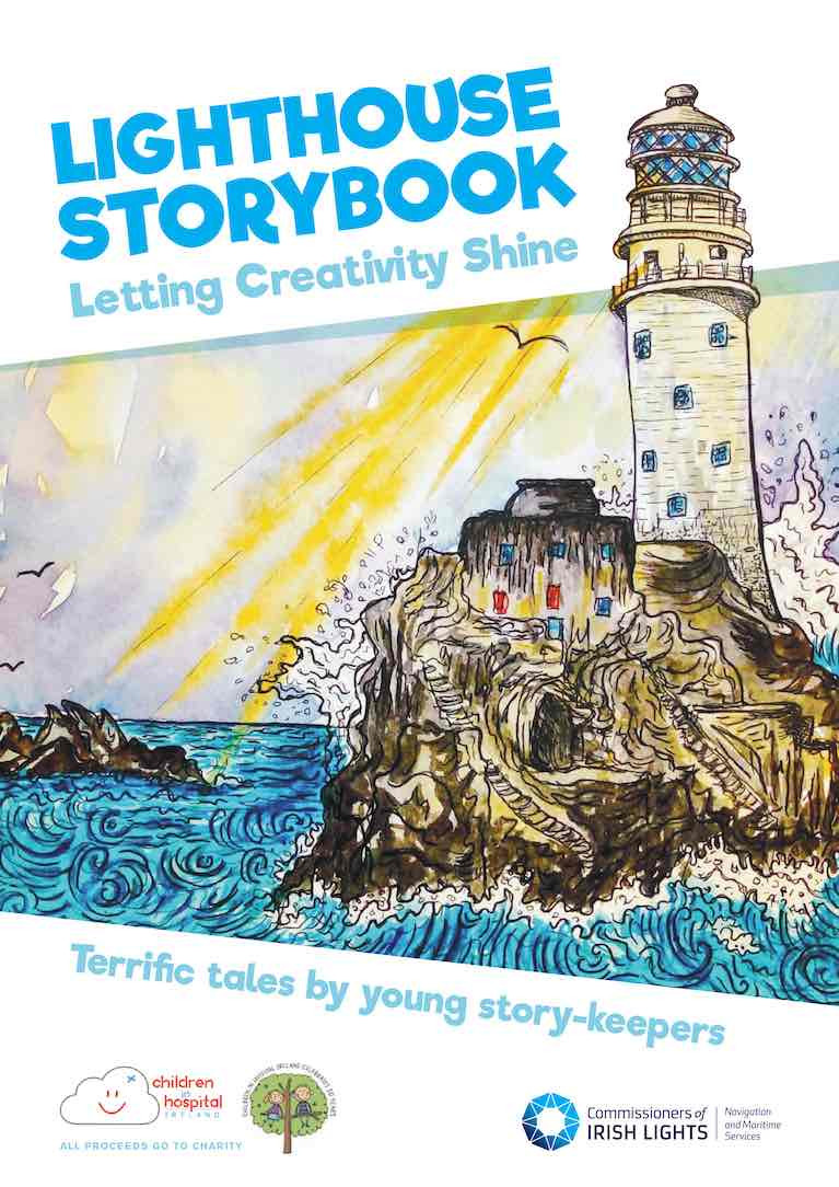
Young authors have contributed to a new book published by The Commissioners of Irish Lights (CIL) which aims to benefit two charities.

The organisation’s Young Storykeepers’ Project has put together The Lighthouse Storybook, a collection of stories written by young children. 

The project was developed through the tourism and community partnership, Great Lighthouses of Ireland, and creative writing organisation Fighting Words and captured over 1250 stories by children between seven and 12 years old. 

All proceeds from the sale of The Lighthouse Storybook will directly support the work of Children in Hospital Ireland and the Northern Ireland Hospice, CIL says.

CIL chief executive Yvonne Shields O’Connor praised “this wonderful storybook, which is a selection from many original stories, poems and illustrations that were submitted by young writers aged 7–12 years from every corner of the island of Ireland and beyond” 

“For hundreds of years, lighthouses have kept seafarers safe, helping them find their way with a guiding light and safe journey,”she said, and it was fitting that sales of the book would “support wonderful organisations who help children navigate through their time in hospital.” 

Children in Hospital Ireland is a non-profit organisation committed to promoting and ensuring the welfare of all children in hospital, and Northern Ireland Hospice offers specialist respite, symptom management and end of life palliative care to children and adults each year across Northern Ireland.

Fighting Words was co-founded by Roddy Doyle and Seán Love in 2009 to help children and young people – along with adults who did not have this opportunity as children- to “discover and harness the power of their own imaginations and creative writing skills”.

People wishing to purchase the book can visit here

Published in Lighthouses
Tagged under
Page 1 of 5

General Information on using Waterways Ireland inland navigations

Safety on the Water

All users of the navigations are strongly recommended to make themselves aware of safety on the water for whatever activity they are involved in and to read the advice offered by the various governing bodies and by:

The Dept. of Transport, Ireland: www.gov.ie/transport and The Maritime and Coastguard Agency, UK, The RNLI – Water Safety Ireland for information in terms of drowning prevention and water safety.

Registration of Vessels

All vessels using the Shannon Navigation, which includes the Shannon-Erne Waterways and the Erne System must be registered with Waterways Ireland. Only open undecked boats with an engine of 15 horsepower or less on the Shannon Navigation, and vessels of 10 horsepower or less on the Erne System, are exempt. Registration is free of charge.

Craft registration should be completed online at: https://www.waterwaysireland.org/online-services/craft-registration

Permits for use of the Grand and Royal Canals and the Barrow Navigation

All vessels using the Grand and Royal Canals and the Barrow Navigation must display appropriate valid Permit(s) i.e A Combined Mooring and Passage Permit (€126) and if not intending to move every five days, an Extended Mooring Permit (€152).

Permit applications should be completed online at: https://www.waterwaysireland.org/online-services/canal-permits

Passage on the Royal and Grand Canals – Dublin Area

For boat passage through the locks east of Lock 12 into / out of Dublin on either the Royal or Grand Canals, Masters are requested to contact the Waterways Ireland Eastern Regional Office (M-F 9.30am-4.30pm) on tel: +353(0)1 868 0148 or email [email protected] prior to making passage in order to plan the necessary lock-keeping assistance arrangements.

On the Grand Canal a minimum of two days notice prior to the planned passage should be given, masters should note that with the exception of pre-arranged events, a maximum of 2 boats per day will be taken through the locks, travelling either east or west.

Movements in or out of the city will be organised by prior arrangement to take place as a single movement in one day. Boaters will be facilitated to travel the system if their passage is considered to be safe by Waterways Ireland and they have the valid permit(s) for mooring and passage.

Newcomen Lifting Bridge

On the Royal Canal two weeks’ notice of bridge passage (Newcomen Lifting Bridge) is required for the pre-set lift date, and lock assistance will then also be arranged. A minimum of 2 boats is required for a bridge lift to go ahead.

Waterways Ireland Eastern Regional Office (Tel: +353(0)1 868 0148 or [email protected] ) is the point of contact for the bridge lift.

A maximum number of boats passing will be implemented to keep to the times given above for the planned lifts (16 for the Sat / Sun lifts & 8 for the weekday lifts). Priority will be given on a first come first served basis.

On day of lift, boaters and passengers must follow guidance from Waterways Ireland staff about sequence of passage under bridge & through Lock 1, and must remain within signed and designated areas.

Events Held on the Waterways

All organised events taking place on the waterways must have the prior approval of Waterways Ireland. This is a twelve week process and application forms must be accompanied with the appropriate insurance, signed indemnity and risk assessment. The application should be completed on the Waterways Ireland events page at :

https://www.waterwaysireland.org/online-services/event-approval

Time Limits on Mooring in Public Harbours

On the Shannon Navigation and the Shannon-Erne Waterway craft may berth in public harbours for five consecutive days or a total of seven days in any one month.

On the Erne System, revised Bye Laws state that: No master or owner shall permit a vessel, boat or any floating or sunken object to remain moored at or in the vicinity of any public mooring, including mooring at any other public mooring within 3 kilometres of that location, for more than 3 consecutive days and shall not moor at that same mooring or any other public mooring within 3 kilometres of that location within the following 3 consecutive days without prior permission by an authorised official.

Winter Mooring on the Shannon Navigation and Shannon Erne Waterway

Winter mooring may be availed of by owners during the period 1 Nov to 31 Mar by prior arrangement and payment of a charge of €63.50 per craft. Craft not availing of Winter Mooring must continue to comply with the “5 Day Rule”. Winter Mooring applications should be completed online at : https://www.waterwaysireland.org/online-services/winter-moorings-booking

Owners should be aware that electricity supply and water supply to public moorings is disconnected for the winter months. This is to protect against frost damage, to reduce running costs and to minimise maintenance requirements during the winter months.

Vessel owners are advised that advance purchasing of electricity on the power bollards leading up to the disconnection date should be minimal. Electricity credit existing on the bollards will not be recoverable after the winter decommissioning date. Both services will be reinstated prior to the commencement of the next boating season.

Smart Cards

Waterways Ireland smart cards are used to operate locks on the Shannon Erne Waterway, to access the service blocks, to use the pump-outs along the navigations, to avail of electrical power at Waterways Ireland jetties.

Berthing in Public Harbours

Masters are reminded of the following:

  • Equip their vessel with mooring lines of appropriate length and strength and only secure their craft to mooring bollards and cleats provided for this purpose.
  • Ensure the available berth is suitable to the length of your vessel, do not overhang the mooring especially on finger moorings on floating pontoon moorings.
  • Ensure mooring lines, electric cables and fresh water hoses do not create a trip hazard on public jetties for others users.
  • Carry sufficient fenders to prevent damage to your own vessel, other vessels and WI property.
  • Allow sufficient space between your vessel and the vessel ahead /astern (c.1m) for fire safety purposes and /or to recover somebody from the water.
  • Do not berth more than two vessels side by side and ensure there is safe access/egress at all times between vessels and onto the harbour itself.
  • Do not berth in such a way to prevent use of harbour safety ladders, slipways or pump-outs.
  • Do not allow the bow of your vessel to overhang the walkway of a floating mooring thus creating a hazard for others with an overhanging anchor or bow fendering.
  • Animals are not allowed to be loose or stray at any time.
  • Harbour and jetty infrastructure such as railings, power pedestals, fresh water taps, electric light poles, safety bollards, ladders etc are not designed for the purpose of mooring craft , they will not bear the strain of a vessel and will be damaged.
  • At Carrybridge on the Erne System, Masters of vessels are not permitted to use stern on mooring. Masters of vessels must use the mooring fingers for mooring of vessels and for embarkation / disembarkation from vessels.

Passenger Vessel Berths

Masters of vessels should not berth on passenger vessel berths where it is indicated that an arrival is imminent. Passenger vessels plying the navigations generally only occupy the berths to embark and disembark passengers and rarely remain on the berths for extended periods or overnight.

Lock Lead-in Jetties

Lead-in jetties adjacent to the upstream and downstream gates at lock chambers are solely for the purpose of craft waiting to use the lock and should not be used for long term berthing.

Vessel Wake

Vessel wake, that is, the wave generated by the passage of the boat through the water, can sometimes be large, powerful and destructive depending on the hull shape and engine power of the vessel. This wake can be detrimental to other users of the navigation when it strikes their craft or inundates the shoreline or riverbank. Masters are requested to frequently look behind and check the effect of their wake / wash particularly when passing moored vessels, on entering harbours and approaching jetties and to be aware of people pursuing other activities such as fishing on the riverbank.

Speed Restriction

A vessel or boat shall not be navigated on the Shannon Navigation at a speed in excess of 5 kph when within 200 metres of a bridge, quay, jetty or wharf, when in a harbour or canal or when passing within 100 metres of a moored vessel or boat.

Vessels navigating the Shannon-Erne Waterway should observe the general 5 kph speed limit which applies along the waterway. This is necessary in order to prevent damage to the banks caused by excessive wash from vessels.

Vessels navigating the Erne System should observe the statutory 5kt / 6mph / 10kph speed limit areas.

A craft on the Royal and Grand canals shall not be navigated at a speed in excess of 6km per hour.

A craft on the Barrow Navigation shall not be navigated at a speed in excess of 11km per hour except as necessary for safe navigation in conditions of fast flow.

Bank Erosion

Narrow sections of all the navigations are particularly prone to bank erosion due to the large wash generated by some craft. Masters are requested to be vigilant and to slow down to a speed sufficient to maintain steerage when they observe the wash of their craft inundating the river banks.

Unusual Waterborne Activity

Unusual waterborne vessels may be encountered from time to time, such as, hovercraft or amphibious aircraft / seaplanes. Masters of such craft are reminded to apply the normal “Rule of the Road” when they meet conventional craft on the water and to allow extra room to manoeuvre in the interest of safety.

Sailing Activity

Mariners will encounter large numbers of sailing dinghies from late June to August in the vicinity of Lough Derg, Lough Ree and Lower Lough Erne. Sailing courses are marked by yellow buoys to suit weather conditions on the day. Vessels should proceed at slow speed and with due caution and observe the rules of navigation when passing these fleets, as many of the participants are junior sailors under training.

Rowing

Mariners should expect to meet canoes and vessels under oars on any part of the navigations, but more so in the vicinity of Athlone, Carrick-on-Shannon, Coleraine, Enniskillen and Limerick. Masters are reminded to proceed at slow speed and especially to reduce their wash to a minimum when passing these craft as they can be easily upset and swamped due to their very low freeboard and always be prepared to give way in any given traffic situation.

Canoeing

Canoeing is an adventure sport and participants are strongly recommended to seek the advice of the sport’s governing bodies i.e Canoeing Ireland and the Canoe Association of Northern Ireland, before venturing onto the navigations.

Persons in charge of canoes are reminded of the inherent danger to these craft associated with operating close to weirs, sluice gates, locks and other infrastructure particularly when rivers are in flood and large volumes of water are moving through the navigations due to general flood conditions or very heavy localised precipitation e.g. turbulent and broken water, stopper waves. Shooting weirs is prohibited without prior permission of Waterways Ireland.

Canoeists should check with lockkeepers prior entering a lock to ensure passage is done in a safe manner. Portage is required at all unmanned locks.

Canoe Trail Network – "Blueways"

Masters of powered craft are reminded that a canoe trail network is being developed across all navigations and to expect more organised canoeing along these trails necessitating slow speed and minimum wash when encountering canoeists, rowing boats etc

Rockingham and Drummans Island Canals – Lough Key

It is expected that work on Rockingham and Drummans Island Canals on Lough Key will be completed in 2021. Access to these canals will be for non-powered craft only, eg canoes, kayaks, rowing boats.

Fast Powerboats and Personal Watercraft (Jet Skis)

Masters of Fast Powerboats (speed greater than 17kts) and Personal Watercraft (i.e.Jet Skis) are reminded of the inherent dangers associated with high speed on the water and especially in the confines of small bays and narrow sections of the navigations. Keeping a proper look-out, making early alterations to course and /or reducing speed will avoid conflict with slower vessels using the navigation. Personal Watercraft are not permitted to be used on the canals.

Towing Waterskiers, Wakeboarders, Doughnuts etc

Masters of vessels engaged in any of these activities are reminded of the manoeuvring constraints imposed upon their vessel by the tow and of the added responsibilities that they have to the person(s) being towed. These activities should be conducted in areas which are clear of conflicting traffic. It is highly recommended that a person additional to the master be carried to act as a “look-out” to keep the tow under observation at all times.

Prohibition on Swimming

Swimming in the navigable channel, particularly at bridges, is dangerous and is prohibited due to the risk of being run over by a vessel underway in the navigation.

Age Restrictions on operating of powered craft

In the Republic of Ireland, Statutory Instrument 921 of 2005 provides the legal requirements regarding the minimum age for operating of powered craft. The Statutory Instrument contains the following requirements:

- The master or owner of a personal watercraft or a fast power craft shall take all reasonable steps to ensure that a person who has not attained the age of 16 years does not operate or control the craft

- The master or owner of a pleasure craft powered by an engine with a rating of more than 5 horse power or 3.7 kilowatts shall take all reasonable steps to ensure that a person who has not attained the age of 12 years does not operate or control the craft.

Lifejackets and Personal Flotation Devices (PFDs)

Lifejackets and PFD’s are the single most important items of personal protective equipment to be used on a vessel and should be worn especially when the vessel is being manoeuvred such as entering / departing a lock, anchoring, coming alongside or departing a jetty or quayside.

In the Republic of Ireland, Statutory Instrument 921 of 2005 provides the legal requirements regarding the wearing of Personal Flotation Devices. The Statutory Instrument contains the following requirements:

- The master or owner of a pleasure craft (other than a personal watercraft) shall ensure, that there are, at all times on board the craft, sufficient suitable personal flotation devices for each person on board.

- A person on a pleasure craft (other than a personal watercraft) of less than 7 metres length overall shall wear a suitable personal flotation device while on board an open craft or while on the deck of decked craft, other than when the craft is made fast to the shore or at anchor.

- The master or owner of a pleasure craft (other than a personal watercraft) shall take all reasonable steps to ensure that a person who has not attained the age of 16 years complies with paragraph above.

- The master or owner of a pleasure craft (other than a personal watercraft), shall take all reasonable steps to ensure that a person who has not attained the age of 16 years wears a suitable personal flotation device while on board an open craft or while on the deck of a decked craft other than when it is made fast to the shore or at anchor.

- The master or owner of a pleasure craft (other than a personal watercraft) shall take all reasonable steps to ensure that a person wears a suitable personal flotation device, at all times while – (a) being towed by the craft, (b) on board a vessel or object of any kind which is being towed by the craft.

Further information is available at: http://www.irishstatutebook.ie/eli/2005/si/921/made/en/print

Firing Range Danger Area – Lough Ree

The attention of mariners is drawn to the Irish Defence Forces Firing Range situated in the vicinity of buoys No’s 2 and 3, on Lough Ree on the Shannon Navigation. This range is used regularly for live firing exercises, throughout the year, all boats and vessels should stay clear of the area marked with yellow buoys showing a yellow "X" topmark and displaying the word "Danger".

Shannon Navigation, Portumna Swing Bridge Tolls

No attempt should be made by Masters’ of vessels to pay the bridge toll while making way through the bridge opening. Payment will only be taken by the Collector from Masters when they are secured alongside the jetties north and south of the bridge.

Navigating from Killaloe to Limerick on the Shannon Navigation

The navigation from Killaloe to Limerick involves passage through Ardnacrusha locks, the associated headrace and tailrace and the Abbey River into Limerick City. Careful passage planning is required to undertake this voyage. Considerations include: lock passage at Ardnacrusha, water flow in the navigation, airdraft under bridges on Abbey River in Limerick, state of tide in Limerick

Users are advised to contact the ESB Ardnacrusha hydroelectric power station (00353 (0)87 9970131) 48 hours in advance of commencing their journey to book passage through the locks at Ardnacrusha. It is NOT advised to undertake a voyage if more than one turbine is operating (20MW), due to the increased velocity of flow in the navigation channel, which can be dangerous. To ascertain automatically in real time how many turbines are running, users can phone +353 (0)87 6477229.

For safety reasons the ESB has advised that only powered craft with a capacity in excess of 5 knots are allowed to enter Ardnacrusha Headrace and Tailrace Canals.

Passage through Sarsfield Lock should be booked on +353-87-7972998, on the day prior to travel and it should be noted also that transit is not possible two hours either side of low water.

A Hydrographic survey in 2020 of the navigation channel revealed that the approach from Shannon Bridge to Sarsfield Lock and the Dock area has silted up. Masters of vessels and water users are advised to navigate to the Lock from Shannon bridge on a rising tide one or two hours before High Tide.

Lower Bann Navigation

The attention of all users is drawn to the “Users Code for the Lower Bann”, in particular to that section covering “Flow in the River” outlining the dangers for users both on the banks and in the navigation, associated with high flow rates when the river is in spate. Canoeists should consult and carry a copy of the “Lower Bann Canoe Trail” guide issued by the Canoe Association of Northern Ireland. Users should also contact the DfI Rivers Coleraine, who is responsible for regulating the flow rates on the river, for advisory information on the flow rates to be expected on any given day.

DfI Rivers Coleraine. Tel: 0044 28 7034 2357 Email: [email protected]

Lower Bann Navigation – Newferry – No wake zone

A No Wake Zone exists on the Lower Bann Navigation at Newferry. Masters of vessels are requested to proceed at a slow speed and create no wake while passing the jetties and slipways at Newferry.

Overhead Power Lines (OHPL) and Air draft

All Masters must be aware of the dangers associated with overhead power lines, in particular sailing vessels and workboats with cranes or large air drafts. Voyage planning is a necessity in order to identify the location of overhead lines crossing the navigation.

Overhead power line heights on the River Shannon are maintained at 12.6metres (40 feet) from Normal Summer level for that section of navigation, masters of vessels with a large air draft should proceed with caution and make additional allowances when water levels are high.

If a vessel or its equipment comes into contact with an OHPL the operator should NOT attempt to move the vessel or equipment. The conductor may still be alive or re-energise automatically. Maintain a safe distance and prevent third parties from approaching due to risk of arcing. Contact the emergency services for assistance.

Anglers are also reminded that a minimum ground distance of 30 metres should be maintained from overhead power lines when using a rod and line.

Submarine Cables and Pipes

Masters of vessels are reminded not to anchor their vessels in the vicinity of submarine cables or pipes in case they foul their anchor or damage the cables or pipes. Look to the river banks for signage indicating their presence.

Water Levels - Precautions

Low Water Levels:

When water levels fall below normal summer levels masters should be aware of:

Navigation

To reduce the risk of grounding masters should navigate on or near the centreline of the channel, avoid short cutting in dog-legged channels and navigating too close to navigation markers.

Proceeding at a slow speed will also reduce “squat” effect i.e. where the vessel tends to sit lower in the water as a consequence of higher speed.

Slipways

Reduced slipway length available under the water surface and the possibility of launching trailers dropping off the end of the concrete apron.

More slipway surface susceptible to weed growth requiring care while engaged in launching boats, from slipping and sliding on the slope. Note also that launching vehicles may not be able to get sufficient traction on the slipway once the craft is launched to get up the incline.

Bank Erosion

Very dry riverbanks are more susceptible to erosion from vessel wash.

Lock Share

Maximising on the number of vessels in a lock will ensure that the total volume of water moving downstream is decreased. Lock cycles should be used for vessels travelling each way.

High Water Levels:

When water levels rise above normal summer level masters should be aware of:

Navigation

Navigation marks will have reduced height above the water level or may disappear underwater altogether making the navigable channel difficult to discern.

In narrow sections of the navigations water levels will tend to rise more quickly than in main streams and air draft at bridges will likewise be reduced.

There will also be increased flow rates particularly in the vicinity of navigation infrastructure such as bridges, weirs, locks etc where extra care in manoeuvring vessels will be required.

Harbours and Jetties

Due care is required in harbours and at slipways when levels are at or near the same level as the harbour walkways' as the edge will be difficult to discern especially in reduced light conditions. It is advised that Personal Flotation Devices be worn if tending to craft in a harbour in these conditions.

Slipways

Slipways should only be used for the purpose of launching and recovering of water craft or other objects from the water. Before using a slipway it should be examined to ensure that the surface has sufficient traction/grip for the intended purpose such as launching a craft from a trailer using a vehicle, that there is sufficient depth of water on the slipway to float the craft off the trailer before the concrete apron ends and that the wheels of the trailer do not drop off the edge of the slipway. That life-saving appliances are available in the vicinity, that the vehicle is roadworthy and capable of coping with the weight of the trailer and boat on the incline. It is recommended that slipway operations are conducted by two persons.

Caution to be Used in Reliance upon Aids to Navigation

The aids to navigation depicted on the navigation guides comprise a system of fixed and floating aids to navigation. Prudent mariners will not rely solely on any single aid to navigation, particularly a floating aid to navigation. With respect to buoys, the buoy symbol is used to indicate the approximate position of the buoy body and the ground tackle which secures it to the lake or river bed. The approximate position is used because of the practical limitations in positioning and maintaining buoys in precise geographical locations. These limitations include, but are not limited to, prevailing atmospheric and lake/river conditions, the slope of and the material making up the lake/river bed, the fact that the buoys are moored to varying lengths of chain, and the fact that the buoy body and/or ground tackle positions are not under continuous surveillance. Due to the forces of nature, the position of the buoy body can be expected to shift inside and outside the charted symbol.

Buoys and perches are also moved out of position or pulled over by those mariners who use them to moor up to instead of anchoring. To this end, mariners should always monitor their passage by relating buoy/perch positions with the published navigation guide. Furthermore, a vessel attempting to pass close by always risks collision with a yawing buoy or with the obstruction that the buoy or beacon/perch marks.

Masters of Vessels are requested to use the most up to date Navigation guides when navigating on the Inland Waterways.

Information taken from Special Marine Notice No 1 of 2023