Menu

Ireland's sailing, boating & maritime magazine

Inland afloat headers


Displaying items by tag: Cat Hunt
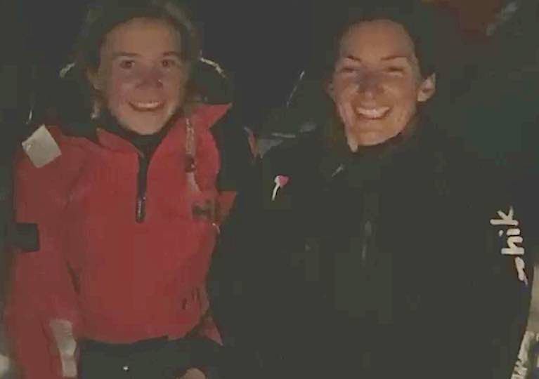
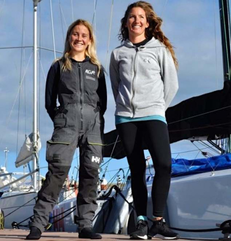
Female Two-handed Round Ireland Speed Record: The Iarracht Maigeanta Two-Handed Round Ireland Record Challenge by Pamela Lee and Cat Hunt of Greystones Harbour Sailing Club just got better and better through yesterday evening and last night as they swept – with impressively consistent speed - through the final hundred miles southward from the Antrim coast to a new record in Dublin Bay, riding on a potent combination of good sailing in a very workable mostly east to southeast breeze, and a fortuitously timed combination of favourable tides to finish at 0327 hrs this (Saturday) morning.

Yet at 1600hrs yesterday afternoon, as their Figaro 3 sat off the Antrim coast between Glenarm and Larne, virtually becalmed and locked in an adverse tide, few would have thought that such a magnificent performance could have been achieved following a frustating afternoon in which expected winds had failed to materialize.

But the transformation of their prospects was already complete by 1800 hrs yesterday evening. With the wind back again from the east and a strong new flood tide pushing them south along the Count Down coast with speeds soon getting into double figures, the possible time for their arrival at the World Sailing Speed Records Committee line in Dublin Bay from the Kish Lighthouse to Dun Laoghaire's East Pier in Dublin Bay just kept getting better and better.

Sailing Magenta Round Ireland Tracker

Yesterday afternoon, the hope of making it round within four days – that is, finishing before 0745 hrs on Saturday - was starting to look like a long shot. Yet by 2200 hrs last night, the continuing combination of favourable conditions was such that the four day circuit seemed well within sight and it was a question of by how much, with a finish time between 0400 and 0500 looking increasingly likely.

Well, they did even better than that again. In due course the very deliberative workings of the WSSRC will come up with their final figure. But according to the Yellowbrick Tracker loaned for the Iarracht Maigeanta/RL Sailing challenge by the Irish Sea Offshore Racing Association, Iarracht Maigeanta and her tired but very happy crew were home and dry around 0327 hrs.

For temporary convenience, let's conservatively call it 0330hrs. Thus Pam Lee and Cat Hunt have completed the circuit in 3 days 19 hours and 45 minutes. It's a fabulous performance, as the previous best two-hander by Aodhan Fitzgerald and Yannick Lemonnier in a Figaro 2 in the 2004 Round Ireland Race from Wicklow was 4 days and 6 hours, and that has long been thought an impressive figure.

We'll be doing a more detailed analysis of it all in the fullness of time. But just to give it further perspective and its proper historic position, the much-admired record established by Denis Doyle in the fully-crewed Frers 51 Moonduster in 1984 stood at 3 days 16 hours and 15 minutes. That a much smaller Figaro 3 sailed double-handed should get within three and a half hours of that monumental time is really very exceptional indeed, and the mood in Greystones, where Iarrache Maigeanta is now serenely home in her marina berth, is very rightly on a high as Pamela Lee and Cat Hunt take their well-earned chance to do a bit of serious sleeping for Ireland.

Read all of Afloat's coverage of this Round Ireland speed record in one handy link here

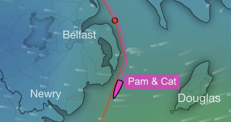
Female Two-handed Round Ireland Record Day Four 2100hrs: The situation became transformed. It was like the clicking of a switch. Or so it seemed to those on the edge of their seats ashore, as they watched on screen as the Figaro 3 Iarracht Maigenta struggled with little wind against the last of the ebb tide off the Antrim coast at Glenarm. First, there came the breath of a fresher breeze from between southeast and east to bring the boat to life. And then by 1800hrs, the new flood tide was surging them on their way, zapping two-handed crew Pam Lee and Cat Hunt south across Belfast Lough and past Mew Island in jig time, such that they were tearing along the County Down coast with their speed over the ground comfortably into the double digits.

Admittedly the pace slowed a little as they swept past the South Rock at 2000 hrs and began to get away from the most powerful stream of tide. But they'll still have something of it in their favour until St John's Point is abeam, provided the breeze keeps up.

Sailing Magenta Round Ireland Tracker

On the present rate of going, St John's will be there - though well to the west – around 2130, and this is where things start to get extra-interesting. If they can keep up their beam reaching speed around the 8 knots mark through the water, they can then make the classic hop of going from the last of the south-going flood as it peters out east of the entrance to Carlingford Lough, and make the leap across slack water for an hour or so until they then begin to feel the very first of the ebb in the new tidal system where the flood goes north, but the ebb is favourably going south.

It will be doing so with real determination as it accelerates south past Rockabill. As of 2100, Rockabill is still 48 miles away, while the finish line is 63 miles distant. You do the maths. If this good easterly breeze keeps up and they can be hovering between 7 and 8 knots through the water, the four day circuit is a distinct possibility, as to do it they've to be past the Kish by 0745 hrs tomorrow (Saturday) morning, and the current rate of progress allows them a bit of leeway on that.

But as we've seen, the winds today are in a capricious mood, even if a proper southeaster is in the offing. The tension in this project will be maintained right to the end.

Published in Offshore

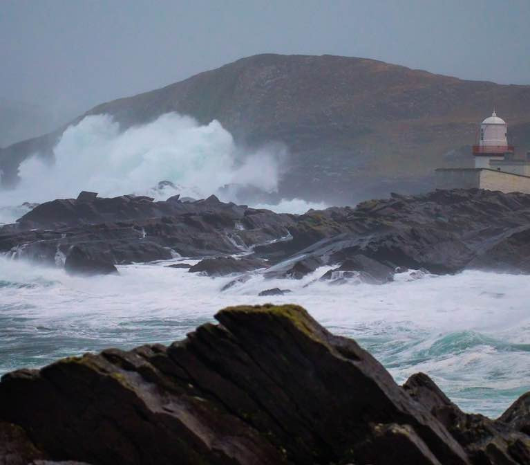
Female Two-handed Round Ireland Record Day Four 1500hrs:  The North Channel is one very unforgiving bit of water to go sailing on. It only gives you the gift of a fair tide for just long enough to begin to think that the dark cliffs of the inappropriately-named Fair Head and the gloom-inducing Mull of Kintyre aren't such oppressive bits of coastline after all as you buzz merrily along in the morning sunshine. And then the tide turns. The wind shuts down. And in near calm, you can appreciate only too well the sheer unfeasibly enormous vastness of this bulk of water moving in the wrong direction, struggling as you are to squeeze enough speed out of your boat simply to hold your own until the tide turns again. Meanwhile, the steep coastline becomes spookily claustrophobic.

We left round Ireland two-handed record challengers Pam Lee and Cat Hunt this morning as merry as grigs after they'd swept in past Rathlin with a grand fair flood tide at sometimes better than 12 knots over the ground. And we hoped that there was still enough life left in the flood to carry them well on their way towards the South Rock off the County Down coast, where tidal streams start to be less dominant.

But was not to be. At least they'd got a far as Glenarm, and south of the very worst of the foul tide. But the new ebb soon built up to strength, the wind – such as it was - drew more from the south and eased, and speeds of 2 knots or less over the ground became the order of the day.

Sailing Magenta Round Ireland Tracker

It will be 6 o'clock this evening before they have significant tide in their favour, but then it's good news, as every bit of southing they make taking them closer to the Irish Sea's relatively tide-free western sector. And it all brings them closer to the bit of more active weather that's distantly developing to the far southwest of Ireland, and should be preceded by a decent sou'easter which might even be the leading wind to bring them into Dublin Bay to complete the circuit within four days – deadline is 0745 tomorrow (Saturday).

But for now, they can have to live with seeing the Antrim coast in slow detail, and imagining life in Glenarm Castle up on the heights. It's the stronghold of the Mac Donnells, the Earls of Antrim, who were originally the Lords of the Isles in the Hebrides, but moved their HQ south when they found the real estate was of better quality in Ireland.

However, they never lost their love of the isles, so by tradition, each deceased member of the family is buried upright in the family graveyard on top of the hill so that he or she can look out over the coasts and islands and waterways that were their extensive domain.

But once upon a time, a notably unpopular member of the family died, and none of his relatives could be bothered to come home for the funeral. So the faithful retainers of the descendants of the Lords of the Isles struggled on their own up the hillside with the loathed one's very heavy coffin and buried him head down.

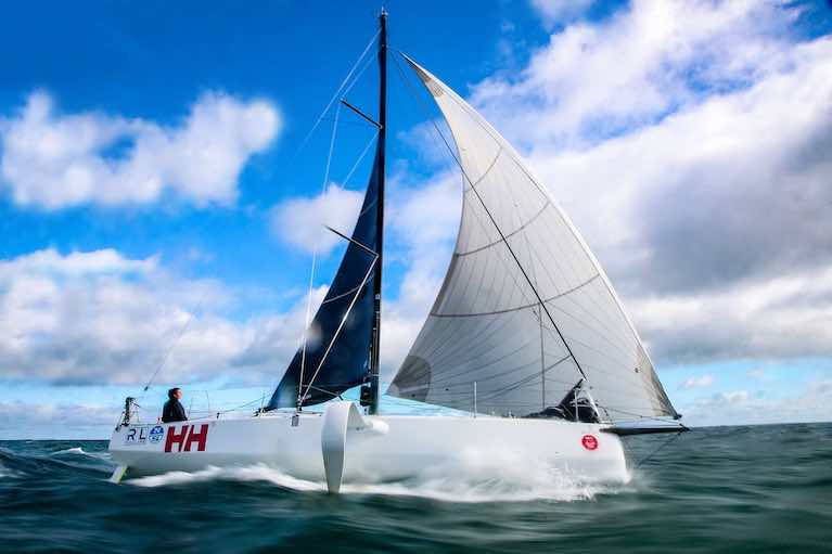
Female Two-handed Round Ireland Record Day Three 2000hrs: When the going is good, the good get going - and they get going fast. This has been the mantra of Pam Lee and Cat Hunt, who brought their Beneteau Figaro 3 in past Tory Island and on to Ireland's North Coast at 1745 this evening (Thursday), just 34 hours after departing Dublin Bay with very focused use of favourable conditions in a clockwise circuit of Ireland, their mission being - as the Commissioner for Ireland for the World Sailing Speeds Record Committee has officially informed us today – the creation of "The Initial Women's Double-handed Around Ireland Record".

The semantics of it all can be resolved in the fullness of time. Right now, it's pay-up time. After hundreds of miles of favourable winds, they have the much more immediate problem of the southeasterly wind having a bit too much east in it, while lacking real oomph – the North Coast is proving to be hard work. Thus our hopes that they'd be just about able to lay Inishtrahull from Tory have been frustrated, as they're now hard on the wind and about 20 degrees below the required course. But at least the Figaro 3 is a performer, and at 1930hrs they were making 7.2 knots.

Regardless of its direction, so long as there's wind of some sort they can make progress, or can until they get into the seriously big tides east of Inishtrahull, and especially along and around Rathlin Island, which is not so much a tidal gate as more of a brutally uncompromising tidal drawbridge.

Sailing Magenta Round Ireland Tracker

East of Inishtrahull, it'll be a dead beat towards Rathlin, and as the tide will start running against them towards midnight, they may find it advantageous to tack inshore in slacker tides by Portrush, close past the spot where, in another life and about a million years ago, Shane Lowry was carving triumph for us all out of the Open Golf Championship.

Just as everyone was with Shane 15 months ago, so now the entire Irish sailing community is with the crew of Iarracht Maugeanta as the Date with Destiny at Rathlin draws nearer. Roughly speaking for the next two or three tides, the stream will be with them between 6 o'clock and 12 o'clock, so peak No-Go Time at Rathlin will be between one o'clock and 5 o'clock, regardless of day or night.

Admittedly the mighty tides at Rathlin are so weird that close in along the north cliffs, the stream is always running to the eastward. But to take advantage of that you have to be so close inshore that the cliffs play merry hell with the wind. One upon a time we were doing the Round Ireland Race in an ancient 83ft Maxi with a huge battered old mainsail which looked like it merited a tillage grant. With the ebb roaring outside, we were clawing along in daylight right inshore at Rathlin, and the cliff-nesting seabirds became so confused with this monster mainsail that some of them tried to alight on it. That's the kind of thing that happens racing past Rathlin - it's an otherworldly sort of place, not really part of Planet Earth at all.

The beating along the north coast by Iarracht Maigeanta was not unexpected, and with any luck when they finally get onto the northeast coast of Ireland, they may find themselves back on a beam reach and the knots buzzing merrily upwards. But for tonight, it's a case of known unknowns, and unknown unknowns. We wish them luck, and hope they close in on Rathlin through one of the favourable tidal windows.

Female Two-handed Round Ireland Record Day Three 0900hrs: At 0745 hours this morning, Pamela Lee and Catherine Hunt in the Beneteau Figaro 3 Iarracht Maigeanta had put County Mayo's northwest headlands of Eagle Island and Erris Head well astern, and were reaching across Donegal Bay towards their next major turning point of Tory Island off northwest Donegal in a moderate southeast breeze which provided reasonably smooth seas and steady progress.

Behind this deceptively humdrum progress report, there is a universe of achievement and competent campaigning. For 0745 hrs marked just two days into their circuit, which started from Dublin Bay on Tuesday morning. Yet by having the entire west coast of Connacht astern before those two days had elapsed, they were already well into the second half of their voyage.

Any boat sailing round Ireland from Dublin Bay in whatever direction reaches the halfway stage at Slyne Head off southwest Connemara, and in our signing-off report yesterday evening, we hoped they might be getting there near midnight. It was a qualified hope, as some forecasts were showing last night's cold calms over central Ireland spreading mistly over the Atlantic coast. But on the contrary, the coastal and offshore easterlies held up well, and while it was cold, progress was improving, and bang on time at midnight they were on the latitude of Slyne Head, though well at sea and sailing smoothly on course towards Achill at 8.8 knots.

Sailing Magenta Round Ireland Tracker

As they've reported to Shore Manager Kenneth Rumball, once they'd got north of the lumpier seas around the Blasket Islands yesterday, the steadier going enabled them to catch up on some sleep, but the uneven nature of the generally easterly wind's gradual progress of settling into being a steady breeze meant busy sail changes from time to time, yet they were still strengthening their mental and physical reserves for what looked like being a long cold night.

It was a cold night, but with the useful breeze on the beam and "the wind off the grass", the great headlands went past like clockwork, with Achill astern by 0330, and the dawn still barely hinting as Erris Head went by at 0615. Speeds were briefly reduced to 6.8 knots, but with the knots now up to 8.3 again as they make their way in a sou'easterly across towards Donegal at 0830 this morning, it's nicely on track.

Conditions are looking good for steady progress as far as Ireland's north point at Malin Head, as the course from Tory to the edge of the Malin and Inishtrahull outlying rocks is sufficiently north of east to continue to give them a leading wind. After Malin, it's a different sailing game entirely, as they're effectively into the beginnings of the North Channel's sailing problems of strong tides and frequent local wind variations all the way to the South Rock light off the County Down Coast.

It's always one of the trickiest stages. But as of now, with a real element of an easterly direction already being accommodated into their course to show they're homeward bound, the Pamela Hunt and Catherine Lee Two-Handed Round Ireland Challenge is going very well indeed.

Tagged under

Female Two-handed Round Ireland Record Day Two 0900hrs:  The Magenta Round Ireland two-handed record challenge Record campaign from Dublin Bay by Pam Lee and Cat Hunt of RL Sailing and Greystones has logged an excellent start in its first 24 hours. They put the Fastnet Rock astern at 0400hrs this morning, and at 0745 hrs – just 24 hours after they started from the official records Kish Lighthouse-Dun Laoghaire Pier line in Dublin Bay – they were passing Dursey Head, the first headland of the majestic Kerry coast.

Having made many good miles in sometimes boisterous but always favourable northwest to northeast wind, they are now facing lighter conditions off the southwestern seaboard, something which had been predicted as the breeze veers until eventually, it's hoped, it will settle in more firmly as an easterly to give fair winds as far as distant northwest Mayo, when it's even possible another veering will provide a reach across to Tory Island.

Pam Lee and Cat Hunt at 0945 this morning off the County Kerry coast. Scroll down for live tracker belowPam Lee and Cat Hunt at 0945 this morning off the County Kerry coast. Scroll down for live tracker below

That's some time in the future. Meanwhile, the Magenta Shore Team, headed by Kenneth Rumball, are well pleased by the relatively steady progress past the often tricky stage from the Fastnet to Dursey. And while at Dursey Head itself there was a slight pause as speed fell back to 5.5 knots, they'd soon found the veering nor'easter had settled in with more vigour to give them better than 8 knots, and comfortably on track for the next course adjustment at Skellig Michael.

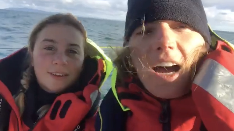
It's said that any single sailor, soldier or airman on active service needs about seven people providing background comprehensive support ashore, and while the Magenta Project direct shore management team doesn't quite reach the total of 14 this might suggest, nevertheless it's an impressive international array of talent. Headed by Kenneth Rumball of Irish National Sailing School, it includes communications co-ordination by Volvo Ocean Race media veteran Brian Carlin (originally of Kerry), while tactical and strategic advice is continuously available from ashore through Miles Seddon and Libby Greenhalgh, and additional support comes from Hannah Hunt (Cat's sister) and Abby Elher of the Agenta Project.

Brian Carlin of Kerry headed the international press team on the 2017 Volvo Ocean Race, and is much involved on he shore team with the Magenta ChallengeBrian Carlin of Kerry headed the international press team on the 2017 Volvo Ocean Race and is much involved on the shore team with the Magenta Challenge

Behind it all is the benevolent but very effective presence of Big Daddy. aka Marcus Hutchinson of Howth, Kinsale and Brittany, whose exceptional knowledge of campaigning a Figaro boat is rivalled only by his access to boat resources in areas like IMOCA 60s and the entire Figaro selection. It was Uncle Marcus who came up with the state-of-the-art Figaro 3 which had made this possible, and much helpful advice and encouragement with practical support has come from him with it.

There are many other less direct supporters in technical, equipment and sail services, while the stamp of officialdom is provided by Chris Moore of Dun Laoghaire, the former National YC Commodore who is currently in the onerous role of DBSC Honorary Secretary, yet somehow finds time to be Ireland's World Sailing Speed Records Commissioner too, and thus his presence on the start line yesterday morning in DBSC's Committee Boat Freebird made it all very official.

Chris Moore of DBSC and the NYC is Ireland's World Sailing Records CommissionerChris Moore of DBSC and the NYC is Ireland's World Sailing Records Commissioner

Yet even with all the shoreside support and widespread goodwill, for much of the time, it comes down to two female sailors very much on their own out in the Atlantic in volatile weather. Although the next underlying problem may well eventually be a softness of wind strength as high pressure gradually comes to dominate the weather systems, yesterday evening there was plenty of wind about from the north as Magenta Project scooted along far at sea off the coast of East Cork, and at 1910hrs there was a sudden adjustment of course downwind and an easing of speed which caused concern for those ashore about sail or rigging damage.

But instead, it was a prudent easing of the pressure in order to change as safely as possible from the A5 spinnaker - which had carried them so well and so quickly from Dublin Bay - to the now more useful Code Zero, and in the relatively conservative approach which had underlined the first day of the challenge, this was very much the right way to do it, and soon they were back to 12.5 knots, and blasting west into the night, on towards the Fastnet.

Sailing Magenta Round Ireland Record Tracker

Female Two-handed Round Ireland Record Day One 2000 hrs: The Round Ireland two-handed record challenge by Pamela Lee and Catherine Hunt, which started from the Kish in Dublin Bay at 0745 this morning, had been accelerating westward well out to sea off the East Cork coast, putting them due south of Capel Island at 1930hrs and making 12.5 knots. Their Beneteau Figaro 3 was beginning to feel the effects as the strong north to northeast winds - 25 knots and more in the Irish Sea and St George's Channel all afternoon - start spreading vigorously into the Atlantic.

Not that the Magenta team need more pressure power, as they've had a very handy favourable breeze all day. But through the early part of the night they've been having to handle this extra challenge of keeping up speed without sustaining any damage before the blast of extra wind has gone through, and at 1910hrs a problem arose and they peeled off for twenty minutes on a downwind course, but still sailing at 8.3 knots. Yet now (1940 hours) they're back up to 12.4 knots and it seems to be all systems go again.

Ironically, although they're on a record-establishing mission, they don't want to arrive down at the Fastnet Rock too early, as on the current setup, it gets very bumpy thereafter. From The Rock northwestwards, the wind has been more then fresh from the north along the Kerry and West Cork coasts through today, and as any Round Ireland and indeed Dun Laoghaire-Dingle Race veteran can affirm, slugging into a strong northerly off Kerry is no cakewalk.

But fortunately for the two co-skippers, the wind is expected to veer markedly and ease as it draws from the east, helping them round the corner and past Ireland's most westerly point, the unmarked Great Foze Rock west of the Blaskets, a lonely and mysterious place which is best avoided by night or day.

For now, however, that's in the future as supporters ashore wait to hear what caused the sudden alteration of course at 1910hrs, hoping that it was only a blip rather than the loss of an important sail or some rigging damage.

Sailing Magenta Round Ireland Record Tracker

General Information on using Waterways Ireland inland navigations

Safety on the Water

All users of the navigations are strongly recommended to make themselves aware of safety on the water for whatever activity they are involved in and to read the advice offered by the various governing bodies and by:

The Dept. of Transport, Ireland: www.gov.ie/transport and The Maritime and Coastguard Agency, UK, The RNLI – Water Safety Ireland for information in terms of drowning prevention and water safety.

Registration of Vessels

All vessels using the Shannon Navigation, which includes the Shannon-Erne Waterways and the Erne System must be registered with Waterways Ireland. Only open undecked boats with an engine of 15 horsepower or less on the Shannon Navigation, and vessels of 10 horsepower or less on the Erne System, are exempt. Registration is free of charge.

Craft registration should be completed online at: https://www.waterwaysireland.org/online-services/craft-registration

Permits for use of the Grand and Royal Canals and the Barrow Navigation

All vessels using the Grand and Royal Canals and the Barrow Navigation must display appropriate valid Permit(s) i.e A Combined Mooring and Passage Permit (€126) and if not intending to move every five days, an Extended Mooring Permit (€152).

Permit applications should be completed online at: https://www.waterwaysireland.org/online-services/canal-permits

Passage on the Royal and Grand Canals – Dublin Area

For boat passage through the locks east of Lock 12 into / out of Dublin on either the Royal or Grand Canals, Masters are requested to contact the Waterways Ireland Eastern Regional Office (M-F 9.30am-4.30pm) on tel: +353(0)1 868 0148 or email [email protected] prior to making passage in order to plan the necessary lock-keeping assistance arrangements.

On the Grand Canal a minimum of two days notice prior to the planned passage should be given, masters should note that with the exception of pre-arranged events, a maximum of 2 boats per day will be taken through the locks, travelling either east or west.

Movements in or out of the city will be organised by prior arrangement to take place as a single movement in one day. Boaters will be facilitated to travel the system if their passage is considered to be safe by Waterways Ireland and they have the valid permit(s) for mooring and passage.

Newcomen Lifting Bridge

On the Royal Canal two weeks’ notice of bridge passage (Newcomen Lifting Bridge) is required for the pre-set lift date, and lock assistance will then also be arranged. A minimum of 2 boats is required for a bridge lift to go ahead.

Waterways Ireland Eastern Regional Office (Tel: +353(0)1 868 0148 or [email protected] ) is the point of contact for the bridge lift.

A maximum number of boats passing will be implemented to keep to the times given above for the planned lifts (16 for the Sat / Sun lifts & 8 for the weekday lifts). Priority will be given on a first come first served basis.

On day of lift, boaters and passengers must follow guidance from Waterways Ireland staff about sequence of passage under bridge & through Lock 1, and must remain within signed and designated areas.

Events Held on the Waterways

All organised events taking place on the waterways must have the prior approval of Waterways Ireland. This is a twelve week process and application forms must be accompanied with the appropriate insurance, signed indemnity and risk assessment. The application should be completed on the Waterways Ireland events page at :

https://www.waterwaysireland.org/online-services/event-approval

Time Limits on Mooring in Public Harbours

On the Shannon Navigation and the Shannon-Erne Waterway craft may berth in public harbours for five consecutive days or a total of seven days in any one month.

On the Erne System, revised Bye Laws state that: No master or owner shall permit a vessel, boat or any floating or sunken object to remain moored at or in the vicinity of any public mooring, including mooring at any other public mooring within 3 kilometres of that location, for more than 3 consecutive days and shall not moor at that same mooring or any other public mooring within 3 kilometres of that location within the following 3 consecutive days without prior permission by an authorised official.

Winter Mooring on the Shannon Navigation and Shannon Erne Waterway

Winter mooring may be availed of by owners during the period 1 Nov to 31 Mar by prior arrangement and payment of a charge of €63.50 per craft. Craft not availing of Winter Mooring must continue to comply with the “5 Day Rule”. Winter Mooring applications should be completed online at : https://www.waterwaysireland.org/online-services/winter-moorings-booking

Owners should be aware that electricity supply and water supply to public moorings is disconnected for the winter months. This is to protect against frost damage, to reduce running costs and to minimise maintenance requirements during the winter months.

Vessel owners are advised that advance purchasing of electricity on the power bollards leading up to the disconnection date should be minimal. Electricity credit existing on the bollards will not be recoverable after the winter decommissioning date. Both services will be reinstated prior to the commencement of the next boating season.

Smart Cards

Waterways Ireland smart cards are used to operate locks on the Shannon Erne Waterway, to access the service blocks, to use the pump-outs along the navigations, to avail of electrical power at Waterways Ireland jetties.

Berthing in Public Harbours

Masters are reminded of the following:

  • Equip their vessel with mooring lines of appropriate length and strength and only secure their craft to mooring bollards and cleats provided for this purpose.
  • Ensure the available berth is suitable to the length of your vessel, do not overhang the mooring especially on finger moorings on floating pontoon moorings.
  • Ensure mooring lines, electric cables and fresh water hoses do not create a trip hazard on public jetties for others users.
  • Carry sufficient fenders to prevent damage to your own vessel, other vessels and WI property.
  • Allow sufficient space between your vessel and the vessel ahead /astern (c.1m) for fire safety purposes and /or to recover somebody from the water.
  • Do not berth more than two vessels side by side and ensure there is safe access/egress at all times between vessels and onto the harbour itself.
  • Do not berth in such a way to prevent use of harbour safety ladders, slipways or pump-outs.
  • Do not allow the bow of your vessel to overhang the walkway of a floating mooring thus creating a hazard for others with an overhanging anchor or bow fendering.
  • Animals are not allowed to be loose or stray at any time.
  • Harbour and jetty infrastructure such as railings, power pedestals, fresh water taps, electric light poles, safety bollards, ladders etc are not designed for the purpose of mooring craft , they will not bear the strain of a vessel and will be damaged.
  • At Carrybridge on the Erne System, Masters of vessels are not permitted to use stern on mooring. Masters of vessels must use the mooring fingers for mooring of vessels and for embarkation / disembarkation from vessels.

Passenger Vessel Berths

Masters of vessels should not berth on passenger vessel berths where it is indicated that an arrival is imminent. Passenger vessels plying the navigations generally only occupy the berths to embark and disembark passengers and rarely remain on the berths for extended periods or overnight.

Lock Lead-in Jetties

Lead-in jetties adjacent to the upstream and downstream gates at lock chambers are solely for the purpose of craft waiting to use the lock and should not be used for long term berthing.

Vessel Wake

Vessel wake, that is, the wave generated by the passage of the boat through the water, can sometimes be large, powerful and destructive depending on the hull shape and engine power of the vessel. This wake can be detrimental to other users of the navigation when it strikes their craft or inundates the shoreline or riverbank. Masters are requested to frequently look behind and check the effect of their wake / wash particularly when passing moored vessels, on entering harbours and approaching jetties and to be aware of people pursuing other activities such as fishing on the riverbank.

Speed Restriction

A vessel or boat shall not be navigated on the Shannon Navigation at a speed in excess of 5 kph when within 200 metres of a bridge, quay, jetty or wharf, when in a harbour or canal or when passing within 100 metres of a moored vessel or boat.

Vessels navigating the Shannon-Erne Waterway should observe the general 5 kph speed limit which applies along the waterway. This is necessary in order to prevent damage to the banks caused by excessive wash from vessels.

Vessels navigating the Erne System should observe the statutory 5kt / 6mph / 10kph speed limit areas.

A craft on the Royal and Grand canals shall not be navigated at a speed in excess of 6km per hour.

A craft on the Barrow Navigation shall not be navigated at a speed in excess of 11km per hour except as necessary for safe navigation in conditions of fast flow.

Bank Erosion

Narrow sections of all the navigations are particularly prone to bank erosion due to the large wash generated by some craft. Masters are requested to be vigilant and to slow down to a speed sufficient to maintain steerage when they observe the wash of their craft inundating the river banks.

Unusual Waterborne Activity

Unusual waterborne vessels may be encountered from time to time, such as, hovercraft or amphibious aircraft / seaplanes. Masters of such craft are reminded to apply the normal “Rule of the Road” when they meet conventional craft on the water and to allow extra room to manoeuvre in the interest of safety.

Sailing Activity

Mariners will encounter large numbers of sailing dinghies from late June to August in the vicinity of Lough Derg, Lough Ree and Lower Lough Erne. Sailing courses are marked by yellow buoys to suit weather conditions on the day. Vessels should proceed at slow speed and with due caution and observe the rules of navigation when passing these fleets, as many of the participants are junior sailors under training.

Rowing

Mariners should expect to meet canoes and vessels under oars on any part of the navigations, but more so in the vicinity of Athlone, Carrick-on-Shannon, Coleraine, Enniskillen and Limerick. Masters are reminded to proceed at slow speed and especially to reduce their wash to a minimum when passing these craft as they can be easily upset and swamped due to their very low freeboard and always be prepared to give way in any given traffic situation.

Canoeing

Canoeing is an adventure sport and participants are strongly recommended to seek the advice of the sport’s governing bodies i.e Canoeing Ireland and the Canoe Association of Northern Ireland, before venturing onto the navigations.

Persons in charge of canoes are reminded of the inherent danger to these craft associated with operating close to weirs, sluice gates, locks and other infrastructure particularly when rivers are in flood and large volumes of water are moving through the navigations due to general flood conditions or very heavy localised precipitation e.g. turbulent and broken water, stopper waves. Shooting weirs is prohibited without prior permission of Waterways Ireland.

Canoeists should check with lockkeepers prior entering a lock to ensure passage is done in a safe manner. Portage is required at all unmanned locks.

Canoe Trail Network – "Blueways"

Masters of powered craft are reminded that a canoe trail network is being developed across all navigations and to expect more organised canoeing along these trails necessitating slow speed and minimum wash when encountering canoeists, rowing boats etc

Rockingham and Drummans Island Canals – Lough Key

It is expected that work on Rockingham and Drummans Island Canals on Lough Key will be completed in 2021. Access to these canals will be for non-powered craft only, eg canoes, kayaks, rowing boats.

Fast Powerboats and Personal Watercraft (Jet Skis)

Masters of Fast Powerboats (speed greater than 17kts) and Personal Watercraft (i.e.Jet Skis) are reminded of the inherent dangers associated with high speed on the water and especially in the confines of small bays and narrow sections of the navigations. Keeping a proper look-out, making early alterations to course and /or reducing speed will avoid conflict with slower vessels using the navigation. Personal Watercraft are not permitted to be used on the canals.

Towing Waterskiers, Wakeboarders, Doughnuts etc

Masters of vessels engaged in any of these activities are reminded of the manoeuvring constraints imposed upon their vessel by the tow and of the added responsibilities that they have to the person(s) being towed. These activities should be conducted in areas which are clear of conflicting traffic. It is highly recommended that a person additional to the master be carried to act as a “look-out” to keep the tow under observation at all times.

Prohibition on Swimming

Swimming in the navigable channel, particularly at bridges, is dangerous and is prohibited due to the risk of being run over by a vessel underway in the navigation.

Age Restrictions on operating of powered craft

In the Republic of Ireland, Statutory Instrument 921 of 2005 provides the legal requirements regarding the minimum age for operating of powered craft. The Statutory Instrument contains the following requirements:

- The master or owner of a personal watercraft or a fast power craft shall take all reasonable steps to ensure that a person who has not attained the age of 16 years does not operate or control the craft

- The master or owner of a pleasure craft powered by an engine with a rating of more than 5 horse power or 3.7 kilowatts shall take all reasonable steps to ensure that a person who has not attained the age of 12 years does not operate or control the craft.

Lifejackets and Personal Flotation Devices (PFDs)

Lifejackets and PFD’s are the single most important items of personal protective equipment to be used on a vessel and should be worn especially when the vessel is being manoeuvred such as entering / departing a lock, anchoring, coming alongside or departing a jetty or quayside.

In the Republic of Ireland, Statutory Instrument 921 of 2005 provides the legal requirements regarding the wearing of Personal Flotation Devices. The Statutory Instrument contains the following requirements:

- The master or owner of a pleasure craft (other than a personal watercraft) shall ensure, that there are, at all times on board the craft, sufficient suitable personal flotation devices for each person on board.

- A person on a pleasure craft (other than a personal watercraft) of less than 7 metres length overall shall wear a suitable personal flotation device while on board an open craft or while on the deck of decked craft, other than when the craft is made fast to the shore or at anchor.

- The master or owner of a pleasure craft (other than a personal watercraft) shall take all reasonable steps to ensure that a person who has not attained the age of 16 years complies with paragraph above.

- The master or owner of a pleasure craft (other than a personal watercraft), shall take all reasonable steps to ensure that a person who has not attained the age of 16 years wears a suitable personal flotation device while on board an open craft or while on the deck of a decked craft other than when it is made fast to the shore or at anchor.

- The master or owner of a pleasure craft (other than a personal watercraft) shall take all reasonable steps to ensure that a person wears a suitable personal flotation device, at all times while – (a) being towed by the craft, (b) on board a vessel or object of any kind which is being towed by the craft.

Further information is available at: http://www.irishstatutebook.ie/eli/2005/si/921/made/en/print

Firing Range Danger Area – Lough Ree

The attention of mariners is drawn to the Irish Defence Forces Firing Range situated in the vicinity of buoys No’s 2 and 3, on Lough Ree on the Shannon Navigation. This range is used regularly for live firing exercises, throughout the year, all boats and vessels should stay clear of the area marked with yellow buoys showing a yellow "X" topmark and displaying the word "Danger".

Shannon Navigation, Portumna Swing Bridge Tolls

No attempt should be made by Masters’ of vessels to pay the bridge toll while making way through the bridge opening. Payment will only be taken by the Collector from Masters when they are secured alongside the jetties north and south of the bridge.

Navigating from Killaloe to Limerick on the Shannon Navigation

The navigation from Killaloe to Limerick involves passage through Ardnacrusha locks, the associated headrace and tailrace and the Abbey River into Limerick City. Careful passage planning is required to undertake this voyage. Considerations include: lock passage at Ardnacrusha, water flow in the navigation, airdraft under bridges on Abbey River in Limerick, state of tide in Limerick

Users are advised to contact the ESB Ardnacrusha hydroelectric power station (00353 (0)87 9970131) 48 hours in advance of commencing their journey to book passage through the locks at Ardnacrusha. It is NOT advised to undertake a voyage if more than one turbine is operating (20MW), due to the increased velocity of flow in the navigation channel, which can be dangerous. To ascertain automatically in real time how many turbines are running, users can phone +353 (0)87 6477229.

For safety reasons the ESB has advised that only powered craft with a capacity in excess of 5 knots are allowed to enter Ardnacrusha Headrace and Tailrace Canals.

Passage through Sarsfield Lock should be booked on +353-87-7972998, on the day prior to travel and it should be noted also that transit is not possible two hours either side of low water.

A Hydrographic survey in 2020 of the navigation channel revealed that the approach from Shannon Bridge to Sarsfield Lock and the Dock area has silted up. Masters of vessels and water users are advised to navigate to the Lock from Shannon bridge on a rising tide one or two hours before High Tide.

Lower Bann Navigation

The attention of all users is drawn to the “Users Code for the Lower Bann”, in particular to that section covering “Flow in the River” outlining the dangers for users both on the banks and in the navigation, associated with high flow rates when the river is in spate. Canoeists should consult and carry a copy of the “Lower Bann Canoe Trail” guide issued by the Canoe Association of Northern Ireland. Users should also contact the DfI Rivers Coleraine, who is responsible for regulating the flow rates on the river, for advisory information on the flow rates to be expected on any given day.

DfI Rivers Coleraine. Tel: 0044 28 7034 2357 Email: [email protected]

Lower Bann Navigation – Newferry – No wake zone

A No Wake Zone exists on the Lower Bann Navigation at Newferry. Masters of vessels are requested to proceed at a slow speed and create no wake while passing the jetties and slipways at Newferry.

Overhead Power Lines (OHPL) and Air draft

All Masters must be aware of the dangers associated with overhead power lines, in particular sailing vessels and workboats with cranes or large air drafts. Voyage planning is a necessity in order to identify the location of overhead lines crossing the navigation.

Overhead power line heights on the River Shannon are maintained at 12.6metres (40 feet) from Normal Summer level for that section of navigation, masters of vessels with a large air draft should proceed with caution and make additional allowances when water levels are high.

If a vessel or its equipment comes into contact with an OHPL the operator should NOT attempt to move the vessel or equipment. The conductor may still be alive or re-energise automatically. Maintain a safe distance and prevent third parties from approaching due to risk of arcing. Contact the emergency services for assistance.

Anglers are also reminded that a minimum ground distance of 30 metres should be maintained from overhead power lines when using a rod and line.

Submarine Cables and Pipes

Masters of vessels are reminded not to anchor their vessels in the vicinity of submarine cables or pipes in case they foul their anchor or damage the cables or pipes. Look to the river banks for signage indicating their presence.

Water Levels - Precautions

Low Water Levels:

When water levels fall below normal summer levels masters should be aware of:

Navigation

To reduce the risk of grounding masters should navigate on or near the centreline of the channel, avoid short cutting in dog-legged channels and navigating too close to navigation markers.

Proceeding at a slow speed will also reduce “squat” effect i.e. where the vessel tends to sit lower in the water as a consequence of higher speed.

Slipways

Reduced slipway length available under the water surface and the possibility of launching trailers dropping off the end of the concrete apron.

More slipway surface susceptible to weed growth requiring care while engaged in launching boats, from slipping and sliding on the slope. Note also that launching vehicles may not be able to get sufficient traction on the slipway once the craft is launched to get up the incline.

Bank Erosion

Very dry riverbanks are more susceptible to erosion from vessel wash.

Lock Share

Maximising on the number of vessels in a lock will ensure that the total volume of water moving downstream is decreased. Lock cycles should be used for vessels travelling each way.

High Water Levels:

When water levels rise above normal summer level masters should be aware of:

Navigation

Navigation marks will have reduced height above the water level or may disappear underwater altogether making the navigable channel difficult to discern.

In narrow sections of the navigations water levels will tend to rise more quickly than in main streams and air draft at bridges will likewise be reduced.

There will also be increased flow rates particularly in the vicinity of navigation infrastructure such as bridges, weirs, locks etc where extra care in manoeuvring vessels will be required.

Harbours and Jetties

Due care is required in harbours and at slipways when levels are at or near the same level as the harbour walkways' as the edge will be difficult to discern especially in reduced light conditions. It is advised that Personal Flotation Devices be worn if tending to craft in a harbour in these conditions.

Slipways

Slipways should only be used for the purpose of launching and recovering of water craft or other objects from the water. Before using a slipway it should be examined to ensure that the surface has sufficient traction/grip for the intended purpose such as launching a craft from a trailer using a vehicle, that there is sufficient depth of water on the slipway to float the craft off the trailer before the concrete apron ends and that the wheels of the trailer do not drop off the edge of the slipway. That life-saving appliances are available in the vicinity, that the vehicle is roadworthy and capable of coping with the weight of the trailer and boat on the incline. It is recommended that slipway operations are conducted by two persons.

Caution to be Used in Reliance upon Aids to Navigation

The aids to navigation depicted on the navigation guides comprise a system of fixed and floating aids to navigation. Prudent mariners will not rely solely on any single aid to navigation, particularly a floating aid to navigation. With respect to buoys, the buoy symbol is used to indicate the approximate position of the buoy body and the ground tackle which secures it to the lake or river bed. The approximate position is used because of the practical limitations in positioning and maintaining buoys in precise geographical locations. These limitations include, but are not limited to, prevailing atmospheric and lake/river conditions, the slope of and the material making up the lake/river bed, the fact that the buoys are moored to varying lengths of chain, and the fact that the buoy body and/or ground tackle positions are not under continuous surveillance. Due to the forces of nature, the position of the buoy body can be expected to shift inside and outside the charted symbol.

Buoys and perches are also moved out of position or pulled over by those mariners who use them to moor up to instead of anchoring. To this end, mariners should always monitor their passage by relating buoy/perch positions with the published navigation guide. Furthermore, a vessel attempting to pass close by always risks collision with a yawing buoy or with the obstruction that the buoy or beacon/perch marks.

Masters of Vessels are requested to use the most up to date Navigation guides when navigating on the Inland Waterways.

Information taken from Special Marine Notice No 1 of 2023