Menu

Ireland's sailing, boating & maritime magazine

Inland afloat headers


Displaying items by tag: Flag

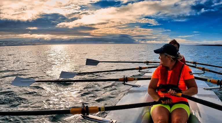
The home of this week's Olympic Gold medallist scullers, Skibbereen Rowing Club in West Cork, is one of 62 coastal community groups that has received funding today by Fisheries Local Action Groups under the Department’s EMFF Programme.

Marine Minister Charlie McConalogue T.D announced the grants worth €915,295 by the seven Fisheries Local Action Groups.

The home club of Olympic champions Fintan McCarthy and Paul O'Donovan was awarded €6,620 under the scheme for a new safety boat. Neighbouring Schull Regatta in West Cork was awarded €2,000 for its 2021 Regatta.

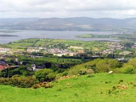
In the border region, Rosses Point Development Association CLG & Sligo County Council received €48,465 for a feasibility study for Sligo Community Boat Park. Sligo Rowing Club Co Ltd also received a grant to purchase a safety launch boat of €7,348.

The grants are awarded to mostly local community groups and micro-enterprises. The grants are co-funded by the Government of Ireland and the European Union. 

2021 FLAG grant awards2021 FLAG grant awards

Announcing the grant awards, Minister McConalogue said: “The FLAG Scheme under my Department’s EMFF Seafood Development Programme has been a huge success.  With the grant awards I am announcing today, the seven FLAGs have successfully dispersed their full €12 million allocations under my Department’s EMFF Programme.  

In other marine leisure related grants announced as part of the FLAG scheme,  Valentia Rowing Club in County Kerry was awarded €5,000 towards a one design rowing racing boat & oars, a traditional 4 oar boat trailer & launching trolley.

Ballyglass Crew received €2,650 for its Ballyglass Crew Yachtmaster project. 

The Irish Coastal Rowing Federation was grant-aided €16,438 for the All-Ireland Coastal Rowing Championships 2021

The FLAG Scheme has been operating since just 2017, following a short pilot in the previous programme and has gone from strength to strength.  This is a testament not just to the demand for such local development funding in our coastal communities but very much to the hard work of the local volunteers, many drawn from our seafood and wider marine sectors, who make up the boards of each of our seven FLAGs”. 

Minister McConalogue added: “I believe that the FLAG initiative has significant additional potential in the years ahead to drive further start-ups and the development of seafood and marine businesses in our coastal communities and can be a key element of our strategy in mitigating the impacts of Brexit on our coastal communities”.

The FLAG scheme is now closed, having expended its full allocation. A process will be initiated as part of preparing the new Seafood Development Programme 2021-27 to appoint FLAGs for the next programme period. 

The new FLAGs will be operational in 2022. To see each of the 62 individual awards click here

Published in News Update

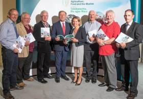
A third tranche of grant awards worth €558,039 to 33 local community groups and micro-enterprises were made today by the Minister for Agriculture Food and the Marine, Charlie McConalogue T.D. See the full breakdown of awards below.

In the South, Ring Rowing Club got an 80% grant of €5,200 for equipment. Likewise, Courtmacsherry Rowing Club was awarded €7,988

Baltimore Community Council’s Croí Na Mara project got €14,940 towards its memorial to commemorate those lost to the sea in the coastal village in West Cork

In the North, Donegal County Council were awarded €15,840 for Harbour facilities.

The awards by five of the Fisheries Local Action Groups were established under Ireland’s European Maritime and Fisheries Fund Programme. The grants are co-funded by the Government of Ireland and the European Union.

Announcing the third tranche of awards, Minister McConalogue said, “I am delighted to announce today a further 33 coastal projects to benefit from EMFF funding through the Fisheries Local Action Groups established as part of my Department’s EMFF Programme supporting the development of our seafood sector and coastal communities. These latest grant awards mean a total of €3.3 million FLAG funding has been awarded this year alone to 188 coastal projects.”

Minister McConalogue added, “These projects will provide valuable economic and social benefits to our coastal communities during a difficult period for many. This is just one of the ways in which my Department’s EMFF Programme is making a positive difference to our coastal communities.”

Flag South

Applicant

Project Title

Rate

Total Cost

Grant Aid

Ring Rowing Club

Equipment

80%

6,500.00

5,200.00

Courtmacsherry Rowing Club CLG

Equipment

80%

9,985.00

7,988.00

Oceans of Discovery

Oceans of Discovery Scuba Diving & Marine Education / Promoting Corks Underwater World

50%

20,063.00

10,031.50

Wild Atlantic Glamping Ltd.

Equipment

50%

11,252.00

5,626.00

Clean Coasts Ballynamona

Equipment

80%

31,666.80

25,333.44

Bantry Inshore Search & Rescue Association CLG

Equipment

80%

22,448.00

17,958.40

Gecko Adventures

Watersports Equipment

50%

30,016.00

15,008.00

Ballycotton Development Company Limited

Village Island Mural

80%

1,142.00

913.60

Elln Hutchins 

Seaweed Educational Supports

80%

9,902.00

7,921.60

Baltimore Community Council

Croí Na Mara

60%

24,900.00

14,940.00


Total


167,874.80

110,920.54


Flag North

Applicant

Project Title

Rate

Total Cost

Grant Aid

Donegal County Council

Harbour Facilities

60%

26,400.00

15,840.00

Coiste Forbartha na Carraige

Footbridge

80%

32,627.12

26,101.70

On the Rocks

Pods

40%

69,800.00

27,920.00

Muileann Coirce Leitir CTR

Siúlóid Abhainn na Timpeallachta (Environmental River Walk)

80%

43,803.32

35,042.66


Total


172,630.44

104,904.35


FLAG Northwest

Applicant

Project Title

Rate

Total Cost

Grant Aid

Mayo North Destination Steering Group

Support for Mayo North Tourism promotion and development plan 2020 – 2023

80%

22,623.27

18,098.62

Jasmin Priegelmeir

Cré Clare Island Pottery Shop

40%

14,698.05

5,879.22

Mayo County Council/Belmullet Tidy Towns

Mayo County Council/Belmullet Tidy Towns

33%

150,000.00

50,000.00

Ceide Coast Community

Feasibility study for Ceide Coast Incubation Hub

80%

20,000.00

16,000.00


Total


207,321.32

89,977.84


FLAG West

Applicant

Project Title

Rate

Total Cost

Grant Aid

J & S Ocean Products

Upgrading Processing Equipment

80%

16,549.00

13,239.20

Séamus Ó Flatharta

Inis Oírr Glamping and Campsite

40%

17,460.00

6,984.00

Oranmore Castle

Oranmore Castle Cultural Centre

40%

42,553.21

17,021.28

Calluragh House Concerts

Workshop Improvements

40%

7,801.00

3,120.40

Loop Head Tourism Ltd

Development of the tourism product on Loop Head peninsula which will have a positive effect on the local communities

80%

4,900.00

3,920.00

Cuan Beo CLG

Cuan Beo - Implementing a holistic approach to sustainability in Galway Bay 2020

80%

16,191.55

12,953.24

Spiddal Craft & Design Centre

Online marketing campaign

80%

6,500.00

5,200.00

Owen O Connell

Training

50%

2,000.00

1,000.00

Údarás na Gaeltachta

Slí Chonamara Trail

100%

43,070.58

43,070.58


Total


157,025.34

106,508.70


Overall Total


887,011.50

558,039.12


Published in Fishing

Fisheries Local Action Groups (FLAGs) from across Europe will be meeting in Bantry next month to discuss “smart” ways to tackle coastal challenges.

The Smart Coastal Areas seminar, hosted by FLAG South and Bord Iascaigh Mhara at the Westlodge Hotel from Tuesday 2 to Thursday 4 April, aims to provide ideas and guidance on ‘smart’ development — including activities, development models and ways of working to boost the fisheries industry and coastal regions in an innovative way.

In 2017, the GDP of the Irish seafood sector was estimated at €1.15 billion. More than 14,000 people are employed in Ireland’s seafood sector, many of whom work and live in rural coastal communities.

Fisheries and coastal areas are impacted by factors such as depopulation, ageing population, climate change and economic decline.

The EU’s European Maritime and Fisheries Fund (EMFF) was set up to support initiatives by local fisheries communities through Community-Led Local Development (CLLD). FLAGs can use this money to implement projects that support sustainable small-scale fisheries and aquaculture production, and coastal communities.

However, funding is not the only answer, as creativity and strategic action is also needed.

The Smart Coastal Areas seminar will highlight:

  • Smart partnerships (creating win-win situations between different interest groups)
  • Smart resource use (optimising local resources and production systems)
  • Smart financing (reaching small-scale beneficiaries: micro-credit, etc)
  • Smart services (adapting services to ensure their viability: smart harbours, connecting remote areas, etc)

The seminar will include presentations on FLAG projects in EU countries that demonstrate smart approaches to rural sustainability and development. Local examples from the Cork coast are Courtmacsherry Community Shop and Schull Bait Bins, both supported by Ireland’s FLAG South.

Also included with the seminar will be a field visit to local fisheries-related businesses as well as Whiddy Island to view the progress of a tourism-related project.

Published in Coastal Notes

#Fishing - Marine Minister Michael Creed has announced €12 million funding under the European Maritime and Fisheries Fund (EMFF) Operational Programme for seven Fisheries Local Action Groups (FLAGs) to fund local development initiatives in Ireland’s coastal communities.

The seven new groups – South West (Kerry), West (Galway, Clare), Northwest (Mayo, Sligo), North (Donegal), South (Cork), Northeast (Louth, Meath, Dublin) and Southeast (Wicklow, Wexford, Waterford) – were selected as part of a competitive process under the community led local development element of the €240 million EMFF Operational Programme.

Each FLAG received a sum between €1.5 million and €1.98 million in funding that is 50% financed by the EU.

“This funding will be allocated by and to those communities by the seven FLAGs recently established,” said the minister. “The FLAGs are made up of local actors from the fisheries and aquaculture sectors and others with a strong interest in fostering the development of our coastal communities.

“The funding will be available to the FLAGs over the period 2017 to 2021 approximately and is an eight-fold increase on the €1.5m that was available under the previous FLAG scheme.”

Bord Iascaigh Mhara chief executive Tara McCarthy added: “As the State agency responsible for providing a range of administrative and technical supports to the FLAGs, we welcome the significant increase in funding for a programme that has already contributed €1.5 million in direct and indirect investment to our coastal communities.

“Each of the FLAG groups represents 7 coastal communities where the importance of the Irish Seafood Sector from our fishermen to seafood processors and retailers is paramount. This increase in funding will enable BIM to assist the FLAG groups to develop strategic plans that will enhance and in some cases diversify their existing marine related resource and enterprise.

“On behalf of BIM, I would like to thank all of the FLAG members for their dedication to this programme.”

FLAG Name Coastal areas of County EMFF Allocation
South West FLAG Kerry €1.53 m
West FLAG Galway, Clare €1.80 m
Northwest FLAG Mayo, Sligo €1.50 m
North FLAG Donegal €1.95 m
South FLAG Cork €1.98 m
Northeast FLAG Louth, Meath, Dublin €1.56 m
Southeast FLAG Wicklow, Wexford, Waterford €1.68 m
  TOTAL €12 m
Published in Fishing

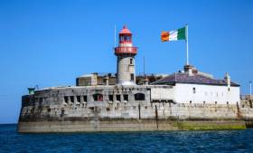
The giant Irish flag 'stolen' from its prominent position on Dun Laoghaire's East pier has been recovered.

The tricolour went missing last night from the flag pole at 7pm. 

Afloat.ie sources tell us that it is now back with its rightful owners and the hope is that it will be flying from the pier head again soon.

Tagged under

General Information on using Waterways Ireland inland navigations

Safety on the Water

All users of the navigations are strongly recommended to make themselves aware of safety on the water for whatever activity they are involved in and to read the advice offered by the various governing bodies and by:

The Dept. of Transport, Ireland: www.gov.ie/transport and The Maritime and Coastguard Agency, UK, The RNLI – Water Safety Ireland for information in terms of drowning prevention and water safety.

Registration of Vessels

All vessels using the Shannon Navigation, which includes the Shannon-Erne Waterways and the Erne System must be registered with Waterways Ireland. Only open undecked boats with an engine of 15 horsepower or less on the Shannon Navigation, and vessels of 10 horsepower or less on the Erne System, are exempt. Registration is free of charge.

Craft registration should be completed online at: https://www.waterwaysireland.org/online-services/craft-registration

Permits for use of the Grand and Royal Canals and the Barrow Navigation

All vessels using the Grand and Royal Canals and the Barrow Navigation must display appropriate valid Permit(s) i.e A Combined Mooring and Passage Permit (€126) and if not intending to move every five days, an Extended Mooring Permit (€152).

Permit applications should be completed online at: https://www.waterwaysireland.org/online-services/canal-permits

Passage on the Royal and Grand Canals – Dublin Area

For boat passage through the locks east of Lock 12 into / out of Dublin on either the Royal or Grand Canals, Masters are requested to contact the Waterways Ireland Eastern Regional Office (M-F 9.30am-4.30pm) on tel: +353(0)1 868 0148 or email [email protected] prior to making passage in order to plan the necessary lock-keeping assistance arrangements.

On the Grand Canal a minimum of two days notice prior to the planned passage should be given, masters should note that with the exception of pre-arranged events, a maximum of 2 boats per day will be taken through the locks, travelling either east or west.

Movements in or out of the city will be organised by prior arrangement to take place as a single movement in one day. Boaters will be facilitated to travel the system if their passage is considered to be safe by Waterways Ireland and they have the valid permit(s) for mooring and passage.

Newcomen Lifting Bridge

On the Royal Canal two weeks’ notice of bridge passage (Newcomen Lifting Bridge) is required for the pre-set lift date, and lock assistance will then also be arranged. A minimum of 2 boats is required for a bridge lift to go ahead.

Waterways Ireland Eastern Regional Office (Tel: +353(0)1 868 0148 or [email protected] ) is the point of contact for the bridge lift.

A maximum number of boats passing will be implemented to keep to the times given above for the planned lifts (16 for the Sat / Sun lifts & 8 for the weekday lifts). Priority will be given on a first come first served basis.

On day of lift, boaters and passengers must follow guidance from Waterways Ireland staff about sequence of passage under bridge & through Lock 1, and must remain within signed and designated areas.

Events Held on the Waterways

All organised events taking place on the waterways must have the prior approval of Waterways Ireland. This is a twelve week process and application forms must be accompanied with the appropriate insurance, signed indemnity and risk assessment. The application should be completed on the Waterways Ireland events page at :

https://www.waterwaysireland.org/online-services/event-approval

Time Limits on Mooring in Public Harbours

On the Shannon Navigation and the Shannon-Erne Waterway craft may berth in public harbours for five consecutive days or a total of seven days in any one month.

On the Erne System, revised Bye Laws state that: No master or owner shall permit a vessel, boat or any floating or sunken object to remain moored at or in the vicinity of any public mooring, including mooring at any other public mooring within 3 kilometres of that location, for more than 3 consecutive days and shall not moor at that same mooring or any other public mooring within 3 kilometres of that location within the following 3 consecutive days without prior permission by an authorised official.

Winter Mooring on the Shannon Navigation and Shannon Erne Waterway

Winter mooring may be availed of by owners during the period 1 Nov to 31 Mar by prior arrangement and payment of a charge of €63.50 per craft. Craft not availing of Winter Mooring must continue to comply with the “5 Day Rule”. Winter Mooring applications should be completed online at : https://www.waterwaysireland.org/online-services/winter-moorings-booking

Owners should be aware that electricity supply and water supply to public moorings is disconnected for the winter months. This is to protect against frost damage, to reduce running costs and to minimise maintenance requirements during the winter months.

Vessel owners are advised that advance purchasing of electricity on the power bollards leading up to the disconnection date should be minimal. Electricity credit existing on the bollards will not be recoverable after the winter decommissioning date. Both services will be reinstated prior to the commencement of the next boating season.

Smart Cards

Waterways Ireland smart cards are used to operate locks on the Shannon Erne Waterway, to access the service blocks, to use the pump-outs along the navigations, to avail of electrical power at Waterways Ireland jetties.

Berthing in Public Harbours

Masters are reminded of the following:

  • Equip their vessel with mooring lines of appropriate length and strength and only secure their craft to mooring bollards and cleats provided for this purpose.
  • Ensure the available berth is suitable to the length of your vessel, do not overhang the mooring especially on finger moorings on floating pontoon moorings.
  • Ensure mooring lines, electric cables and fresh water hoses do not create a trip hazard on public jetties for others users.
  • Carry sufficient fenders to prevent damage to your own vessel, other vessels and WI property.
  • Allow sufficient space between your vessel and the vessel ahead /astern (c.1m) for fire safety purposes and /or to recover somebody from the water.
  • Do not berth more than two vessels side by side and ensure there is safe access/egress at all times between vessels and onto the harbour itself.
  • Do not berth in such a way to prevent use of harbour safety ladders, slipways or pump-outs.
  • Do not allow the bow of your vessel to overhang the walkway of a floating mooring thus creating a hazard for others with an overhanging anchor or bow fendering.
  • Animals are not allowed to be loose or stray at any time.
  • Harbour and jetty infrastructure such as railings, power pedestals, fresh water taps, electric light poles, safety bollards, ladders etc are not designed for the purpose of mooring craft , they will not bear the strain of a vessel and will be damaged.
  • At Carrybridge on the Erne System, Masters of vessels are not permitted to use stern on mooring. Masters of vessels must use the mooring fingers for mooring of vessels and for embarkation / disembarkation from vessels.

Passenger Vessel Berths

Masters of vessels should not berth on passenger vessel berths where it is indicated that an arrival is imminent. Passenger vessels plying the navigations generally only occupy the berths to embark and disembark passengers and rarely remain on the berths for extended periods or overnight.

Lock Lead-in Jetties

Lead-in jetties adjacent to the upstream and downstream gates at lock chambers are solely for the purpose of craft waiting to use the lock and should not be used for long term berthing.

Vessel Wake

Vessel wake, that is, the wave generated by the passage of the boat through the water, can sometimes be large, powerful and destructive depending on the hull shape and engine power of the vessel. This wake can be detrimental to other users of the navigation when it strikes their craft or inundates the shoreline or riverbank. Masters are requested to frequently look behind and check the effect of their wake / wash particularly when passing moored vessels, on entering harbours and approaching jetties and to be aware of people pursuing other activities such as fishing on the riverbank.

Speed Restriction

A vessel or boat shall not be navigated on the Shannon Navigation at a speed in excess of 5 kph when within 200 metres of a bridge, quay, jetty or wharf, when in a harbour or canal or when passing within 100 metres of a moored vessel or boat.

Vessels navigating the Shannon-Erne Waterway should observe the general 5 kph speed limit which applies along the waterway. This is necessary in order to prevent damage to the banks caused by excessive wash from vessels.

Vessels navigating the Erne System should observe the statutory 5kt / 6mph / 10kph speed limit areas.

A craft on the Royal and Grand canals shall not be navigated at a speed in excess of 6km per hour.

A craft on the Barrow Navigation shall not be navigated at a speed in excess of 11km per hour except as necessary for safe navigation in conditions of fast flow.

Bank Erosion

Narrow sections of all the navigations are particularly prone to bank erosion due to the large wash generated by some craft. Masters are requested to be vigilant and to slow down to a speed sufficient to maintain steerage when they observe the wash of their craft inundating the river banks.

Unusual Waterborne Activity

Unusual waterborne vessels may be encountered from time to time, such as, hovercraft or amphibious aircraft / seaplanes. Masters of such craft are reminded to apply the normal “Rule of the Road” when they meet conventional craft on the water and to allow extra room to manoeuvre in the interest of safety.

Sailing Activity

Mariners will encounter large numbers of sailing dinghies from late June to August in the vicinity of Lough Derg, Lough Ree and Lower Lough Erne. Sailing courses are marked by yellow buoys to suit weather conditions on the day. Vessels should proceed at slow speed and with due caution and observe the rules of navigation when passing these fleets, as many of the participants are junior sailors under training.

Rowing

Mariners should expect to meet canoes and vessels under oars on any part of the navigations, but more so in the vicinity of Athlone, Carrick-on-Shannon, Coleraine, Enniskillen and Limerick. Masters are reminded to proceed at slow speed and especially to reduce their wash to a minimum when passing these craft as they can be easily upset and swamped due to their very low freeboard and always be prepared to give way in any given traffic situation.

Canoeing

Canoeing is an adventure sport and participants are strongly recommended to seek the advice of the sport’s governing bodies i.e Canoeing Ireland and the Canoe Association of Northern Ireland, before venturing onto the navigations.

Persons in charge of canoes are reminded of the inherent danger to these craft associated with operating close to weirs, sluice gates, locks and other infrastructure particularly when rivers are in flood and large volumes of water are moving through the navigations due to general flood conditions or very heavy localised precipitation e.g. turbulent and broken water, stopper waves. Shooting weirs is prohibited without prior permission of Waterways Ireland.

Canoeists should check with lockkeepers prior entering a lock to ensure passage is done in a safe manner. Portage is required at all unmanned locks.

Canoe Trail Network – "Blueways"

Masters of powered craft are reminded that a canoe trail network is being developed across all navigations and to expect more organised canoeing along these trails necessitating slow speed and minimum wash when encountering canoeists, rowing boats etc

Rockingham and Drummans Island Canals – Lough Key

It is expected that work on Rockingham and Drummans Island Canals on Lough Key will be completed in 2021. Access to these canals will be for non-powered craft only, eg canoes, kayaks, rowing boats.

Fast Powerboats and Personal Watercraft (Jet Skis)

Masters of Fast Powerboats (speed greater than 17kts) and Personal Watercraft (i.e.Jet Skis) are reminded of the inherent dangers associated with high speed on the water and especially in the confines of small bays and narrow sections of the navigations. Keeping a proper look-out, making early alterations to course and /or reducing speed will avoid conflict with slower vessels using the navigation. Personal Watercraft are not permitted to be used on the canals.

Towing Waterskiers, Wakeboarders, Doughnuts etc

Masters of vessels engaged in any of these activities are reminded of the manoeuvring constraints imposed upon their vessel by the tow and of the added responsibilities that they have to the person(s) being towed. These activities should be conducted in areas which are clear of conflicting traffic. It is highly recommended that a person additional to the master be carried to act as a “look-out” to keep the tow under observation at all times.

Prohibition on Swimming

Swimming in the navigable channel, particularly at bridges, is dangerous and is prohibited due to the risk of being run over by a vessel underway in the navigation.

Age Restrictions on operating of powered craft

In the Republic of Ireland, Statutory Instrument 921 of 2005 provides the legal requirements regarding the minimum age for operating of powered craft. The Statutory Instrument contains the following requirements:

- The master or owner of a personal watercraft or a fast power craft shall take all reasonable steps to ensure that a person who has not attained the age of 16 years does not operate or control the craft

- The master or owner of a pleasure craft powered by an engine with a rating of more than 5 horse power or 3.7 kilowatts shall take all reasonable steps to ensure that a person who has not attained the age of 12 years does not operate or control the craft.

Lifejackets and Personal Flotation Devices (PFDs)

Lifejackets and PFD’s are the single most important items of personal protective equipment to be used on a vessel and should be worn especially when the vessel is being manoeuvred such as entering / departing a lock, anchoring, coming alongside or departing a jetty or quayside.

In the Republic of Ireland, Statutory Instrument 921 of 2005 provides the legal requirements regarding the wearing of Personal Flotation Devices. The Statutory Instrument contains the following requirements:

- The master or owner of a pleasure craft (other than a personal watercraft) shall ensure, that there are, at all times on board the craft, sufficient suitable personal flotation devices for each person on board.

- A person on a pleasure craft (other than a personal watercraft) of less than 7 metres length overall shall wear a suitable personal flotation device while on board an open craft or while on the deck of decked craft, other than when the craft is made fast to the shore or at anchor.

- The master or owner of a pleasure craft (other than a personal watercraft) shall take all reasonable steps to ensure that a person who has not attained the age of 16 years complies with paragraph above.

- The master or owner of a pleasure craft (other than a personal watercraft), shall take all reasonable steps to ensure that a person who has not attained the age of 16 years wears a suitable personal flotation device while on board an open craft or while on the deck of a decked craft other than when it is made fast to the shore or at anchor.

- The master or owner of a pleasure craft (other than a personal watercraft) shall take all reasonable steps to ensure that a person wears a suitable personal flotation device, at all times while – (a) being towed by the craft, (b) on board a vessel or object of any kind which is being towed by the craft.

Further information is available at: http://www.irishstatutebook.ie/eli/2005/si/921/made/en/print

Firing Range Danger Area – Lough Ree

The attention of mariners is drawn to the Irish Defence Forces Firing Range situated in the vicinity of buoys No’s 2 and 3, on Lough Ree on the Shannon Navigation. This range is used regularly for live firing exercises, throughout the year, all boats and vessels should stay clear of the area marked with yellow buoys showing a yellow "X" topmark and displaying the word "Danger".

Shannon Navigation, Portumna Swing Bridge Tolls

No attempt should be made by Masters’ of vessels to pay the bridge toll while making way through the bridge opening. Payment will only be taken by the Collector from Masters when they are secured alongside the jetties north and south of the bridge.

Navigating from Killaloe to Limerick on the Shannon Navigation

The navigation from Killaloe to Limerick involves passage through Ardnacrusha locks, the associated headrace and tailrace and the Abbey River into Limerick City. Careful passage planning is required to undertake this voyage. Considerations include: lock passage at Ardnacrusha, water flow in the navigation, airdraft under bridges on Abbey River in Limerick, state of tide in Limerick

Users are advised to contact the ESB Ardnacrusha hydroelectric power station (00353 (0)87 9970131) 48 hours in advance of commencing their journey to book passage through the locks at Ardnacrusha. It is NOT advised to undertake a voyage if more than one turbine is operating (20MW), due to the increased velocity of flow in the navigation channel, which can be dangerous. To ascertain automatically in real time how many turbines are running, users can phone +353 (0)87 6477229.

For safety reasons the ESB has advised that only powered craft with a capacity in excess of 5 knots are allowed to enter Ardnacrusha Headrace and Tailrace Canals.

Passage through Sarsfield Lock should be booked on +353-87-7972998, on the day prior to travel and it should be noted also that transit is not possible two hours either side of low water.

A Hydrographic survey in 2020 of the navigation channel revealed that the approach from Shannon Bridge to Sarsfield Lock and the Dock area has silted up. Masters of vessels and water users are advised to navigate to the Lock from Shannon bridge on a rising tide one or two hours before High Tide.

Lower Bann Navigation

The attention of all users is drawn to the “Users Code for the Lower Bann”, in particular to that section covering “Flow in the River” outlining the dangers for users both on the banks and in the navigation, associated with high flow rates when the river is in spate. Canoeists should consult and carry a copy of the “Lower Bann Canoe Trail” guide issued by the Canoe Association of Northern Ireland. Users should also contact the DfI Rivers Coleraine, who is responsible for regulating the flow rates on the river, for advisory information on the flow rates to be expected on any given day.

DfI Rivers Coleraine. Tel: 0044 28 7034 2357 Email: [email protected]

Lower Bann Navigation – Newferry – No wake zone

A No Wake Zone exists on the Lower Bann Navigation at Newferry. Masters of vessels are requested to proceed at a slow speed and create no wake while passing the jetties and slipways at Newferry.

Overhead Power Lines (OHPL) and Air draft

All Masters must be aware of the dangers associated with overhead power lines, in particular sailing vessels and workboats with cranes or large air drafts. Voyage planning is a necessity in order to identify the location of overhead lines crossing the navigation.

Overhead power line heights on the River Shannon are maintained at 12.6metres (40 feet) from Normal Summer level for that section of navigation, masters of vessels with a large air draft should proceed with caution and make additional allowances when water levels are high.

If a vessel or its equipment comes into contact with an OHPL the operator should NOT attempt to move the vessel or equipment. The conductor may still be alive or re-energise automatically. Maintain a safe distance and prevent third parties from approaching due to risk of arcing. Contact the emergency services for assistance.

Anglers are also reminded that a minimum ground distance of 30 metres should be maintained from overhead power lines when using a rod and line.

Submarine Cables and Pipes

Masters of vessels are reminded not to anchor their vessels in the vicinity of submarine cables or pipes in case they foul their anchor or damage the cables or pipes. Look to the river banks for signage indicating their presence.

Water Levels - Precautions

Low Water Levels:

When water levels fall below normal summer levels masters should be aware of:

Navigation

To reduce the risk of grounding masters should navigate on or near the centreline of the channel, avoid short cutting in dog-legged channels and navigating too close to navigation markers.

Proceeding at a slow speed will also reduce “squat” effect i.e. where the vessel tends to sit lower in the water as a consequence of higher speed.

Slipways

Reduced slipway length available under the water surface and the possibility of launching trailers dropping off the end of the concrete apron.

More slipway surface susceptible to weed growth requiring care while engaged in launching boats, from slipping and sliding on the slope. Note also that launching vehicles may not be able to get sufficient traction on the slipway once the craft is launched to get up the incline.

Bank Erosion

Very dry riverbanks are more susceptible to erosion from vessel wash.

Lock Share

Maximising on the number of vessels in a lock will ensure that the total volume of water moving downstream is decreased. Lock cycles should be used for vessels travelling each way.

High Water Levels:

When water levels rise above normal summer level masters should be aware of:

Navigation

Navigation marks will have reduced height above the water level or may disappear underwater altogether making the navigable channel difficult to discern.

In narrow sections of the navigations water levels will tend to rise more quickly than in main streams and air draft at bridges will likewise be reduced.

There will also be increased flow rates particularly in the vicinity of navigation infrastructure such as bridges, weirs, locks etc where extra care in manoeuvring vessels will be required.

Harbours and Jetties

Due care is required in harbours and at slipways when levels are at or near the same level as the harbour walkways' as the edge will be difficult to discern especially in reduced light conditions. It is advised that Personal Flotation Devices be worn if tending to craft in a harbour in these conditions.

Slipways

Slipways should only be used for the purpose of launching and recovering of water craft or other objects from the water. Before using a slipway it should be examined to ensure that the surface has sufficient traction/grip for the intended purpose such as launching a craft from a trailer using a vehicle, that there is sufficient depth of water on the slipway to float the craft off the trailer before the concrete apron ends and that the wheels of the trailer do not drop off the edge of the slipway. That life-saving appliances are available in the vicinity, that the vehicle is roadworthy and capable of coping with the weight of the trailer and boat on the incline. It is recommended that slipway operations are conducted by two persons.

Caution to be Used in Reliance upon Aids to Navigation

The aids to navigation depicted on the navigation guides comprise a system of fixed and floating aids to navigation. Prudent mariners will not rely solely on any single aid to navigation, particularly a floating aid to navigation. With respect to buoys, the buoy symbol is used to indicate the approximate position of the buoy body and the ground tackle which secures it to the lake or river bed. The approximate position is used because of the practical limitations in positioning and maintaining buoys in precise geographical locations. These limitations include, but are not limited to, prevailing atmospheric and lake/river conditions, the slope of and the material making up the lake/river bed, the fact that the buoys are moored to varying lengths of chain, and the fact that the buoy body and/or ground tackle positions are not under continuous surveillance. Due to the forces of nature, the position of the buoy body can be expected to shift inside and outside the charted symbol.

Buoys and perches are also moved out of position or pulled over by those mariners who use them to moor up to instead of anchoring. To this end, mariners should always monitor their passage by relating buoy/perch positions with the published navigation guide. Furthermore, a vessel attempting to pass close by always risks collision with a yawing buoy or with the obstruction that the buoy or beacon/perch marks.

Masters of Vessels are requested to use the most up to date Navigation guides when navigating on the Inland Waterways.

Information taken from Special Marine Notice No 1 of 2023