Menu

Ireland's sailing, boating & maritime magazine

Inland afloat headers


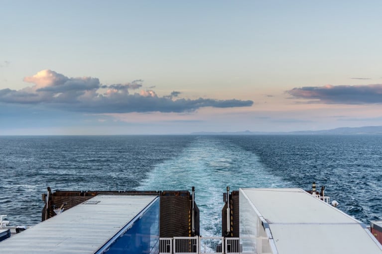
Displaying items by tag: Freight

Mayo county councillors have called for a formal letter demanding that Dublin Port Company reverse its decision to end the regular rail freight service to Ballina, as The Western People reports.

At a meeting of Ballina Municipal District this morning (Wednesday 16 June), local councillors expressed their dismay at the sudden cessation of the seven-times weekly service from Dublin last Thursday.

One councillor branded the move as a “thump in the face for north Mayo”, suggesting that protests akin to those highlighting the mica crisis in the North West could be in the offing, while another said port management should be pressed to find a solution to the congestion issues cited in the decision.

The Western People has much more on the story HERE.

Published in Dublin Port
Tagged under

A call from Irish hauliers to ferry operators to shut all bars and restaurants at sea and to provide room service to individual drivers in their own cabins to keep them shielded from Covid-19, reported Independent.ie

The Freight Transport Association of Ireland (FTAI) issued its appeal as Brittany Ferries which Afloat also reported on Monday, became the first operator to suspend some of its sea links with the island.

FTAI general manager Aidan Flynn said truck drivers were critical for ensuring that agri-food and other essential supplies travel uninterrupted between Ireland, Britain and Europe.

Mr Flynn said ferry firms should “prioritise the safety and welfare of commercial drivers during the Covid-19 pandemic. Their safety should take precedence to ensure our supply chain is protected at all costs.”

The association wants ferries to provide all passengers - but particularly lorry drivers - their own individual cabins and to deliver meals and drinks directly to those cabins. It says all bars and restaurants should be shut to reduce potential virus transmission.

For more on this story which refers to other ferry operators, click here and whenever the newspaper (homepage) has more and in addition to their 'Travel News' here.

Afloat has listed the ferry operators websites below with an important range of travel advice and information with FAQ relating to Covid-19.

Irish Ferries and for sailing updates by clicking here

Stena Line and for sailing updates click here

Brittany Ferries for sailing updates here 

It is strongly advised to consult these operators frequently for updates.

In addition to consulting the Irish Department of Foreign Affairs and Trade (DFA) website HERE for the latest advice on travelling overseas and from the UK Foreign and Commonwealth Office (FCO) HERE (re: Ireland) and also HERE.

According to today's TheJournal.ie as of midnight tonight, Ryanair flight schedules will be cut by over 80%. The airline says that almost all of its flights (“if not all”) will be grounded next week, from midnight of Tuesday, 24 March. 

Published in Ferry

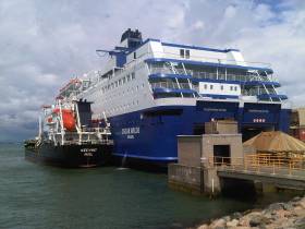
#ferry - Minister for Transport has been accused of not doing enough to get a replacement for the Irish Ferries service linking Rosslare with Cherbourg.

The company according to the Irish Examiner, announced just before Christmas that it was unlikely to operate the route in 2019.

Verona Murphy from the Irish Road Hauliers Association says the response so far from Minister Shane Ross has been poor.

"Shane Ross should be actively looking for somebody to come into Rosslare and usurp the route that will provide what's needed for the exports of Ireland, to keep that foreign-direct investment that we've garnered and keep Irish people in jobs so that the economy will not suffer worse," she said.

"That route is primary. It's our shortest distance to mainland Europe."

Afloat adds the newspaper's photo is of the Normandy, which was replaced by Oscar Wilde in 2007.

Published in Ferry
Tagged under

Dublin Port Company has published its latest trade figures showing growth of 4.2% to the end of Q3 2017. Overall, volumes in Dublin Port have grown by 30.1% in just five years.

A continuation in the current pace of growth would mean a third successive record year for Dublin Port.

Summary of YTD September 2017 Trade Statistics

Gross tonnes

Q3 2017

Q3 2016

% change

Imports

16.0m

15.4m

3.5%

Exports

11.2m

10.6m

5.2%

Total Throughput 

27.1m

26.0m

4.2%

Ro-Ro units

736,462

699,361

5.3%

Lo-Lo TEU

515,718

495,511

4.1%

Ferry passengers

 1,496,025

1,460,585

2.4%

Tourist vehicles

 411,921

400,949

2.7%

Cruise ships

127

103

23.3%

Trade vehicles

73,252

77,494

-5.5%

Total throughput (imports and exports) for the nine months to the end of September was 27.1 million gross tonnes, with 5,932 ship arrivals during the period.

Consecutive Growth over the past five years

This is the fifth year in a row for Dublin Port to see substantial growth in the first nine months.

Trade Period

% growth
year on year

Q3 2013

3.1%

Q3 2014

7.2%

Q3 2015

5.8%

Q3 2016

6.8%

Q3 2017

4.2%

New Ro-Ro Service

Growth was particularly strong in Ro-Ro freight with 736,462 units in the first nine months, an increase of 5.3% on the previous year. Within this total, Ro-Ro services between Ireland and Britain grew strongly at 6.2%. Elsewhere, Lo-Lo containers grew by 4.1% to 515,718 TEU.

As Afloat.ie previously reported, In a new development, Dublin Port Company has confirmed that it will welcome the maiden call of CLdN’s mv Celine at the end of October.  Her arrival will provide additional capacity and flexibility for customers trading with markets in Continental Europe, particularly post BREXIT.

Celine will operate between Dublin Port and the ports of Zeebrugge and Rotterdam.  With a capacity of 8,000 lane-metres, Celine can carry over 600 freight units and is approaching twice the size of the largest ferry currently operating from Dublin Port.

The volume of new imported trade vehicles through Dublin Port declined by -5.5% during the period, reflecting the large increase in recent times of second-hand vehicle imports from the UK.

Ferry & Cruise Tourism Growth

Tourism volumes on ferries grew strongly in the first nine months, with passenger numbers ahead by 2.4% to 1.5 million. Cruise tourism is also growing in Dublin with 127 cruise ships calling in the first nine months of what is already a record year for Dublin Port.

Eamonn O’Reilly, Chief Executive, Dublin Port Company, said: “Dublin Port’s volumes continue to grow strongly. It is clear that the trend of year on year increases that we saw in the decades before the crash of 2008 has returned.  We have now seen five years of consistent growth and each of the last three years has been a record year. 

“Notwithstanding the uncertainty generated by BREXIT, Dublin Port has seen Ro-Ro freight volumes on routes to Britain grow by 6.2% over the first three quarters of 2017 with ferry passenger numbers growing by 2.4%.  

“We are increasing the capacity of the port on the basis that growth will continue for many years to come.  Work is continuing on our first major Masterplan project, the Alexandra Basin Redevelopment (ABR) Project. 

“We are seeing increasing demand for direct freight services to Continental Europe.  The introduction by CLdN of the 8,000 lane metre Celine will greatly increase the capacity on direct services to Continental Europe.  BREXIT is creating a lot of uncertainty and the introduction of the new ship shows the shipping sector beginning to provide additional capacity to create more options for importers and exporters.  We expect to see more new services to Continental Europe during 2018.

“Before year end, we will commence construction of a bridge over the Covanta and ESB cooling water outfall on the Poolbeg Peninsula now that the construction of the waste to energy plant is complete.  This bridge will bring unused port lands on the Poolbeg Peninsula into use and allow us to increase the capacity of our berths on South Bank Quay.  This is the first step towards the ultimate development of all Dublin Port lands on the Poolbeg Peninsula under our Masterplan 2012-2040. 

“We welcome the recognition in the recently approved Planning Scheme for the Poolbeg West SDZ that port lands are for port uses.  This follows on from the recognition in the draft National Planning Framework of the importance for the country of the continued addition of port capacity in Dublin.”

Published in Dublin Port
Tagged under
2nd February 2012

Fastnet Line Closes For Good

#FERRY NEWS - The Fastnet Line ferry service between Cork and Swansea is to close with the loss of 78 jobs.

As previously reported on Afloat.ie, the operator had been in examinership since last November, and a restructured business plan had been submitted with a view to resuming high-season service in April.

However, in a statement the owners of the Fastnet Line said they had been unable to raise the €1m-plus investment required and that the examinership had "failed".

All 78 jobs will be lost as the company is set to be placed in receivership or liquidation later today.

The Fastnet Line - which was worth around €30 million to Cork in tourist spending - made its maiden voyage from Swansea to Cork in 2010, and was the only direct passenger and freight link between Wales and the south coast of Ireland.

The Irish Times has more on the story HERE.

Published in Ferry
3rd September 2011

Bon Voyage to Stena Voyager

The Stena Voyager high-speed ferry will make its final crossing between Belfast and Stranraer in mid-November.
BBC News cites the high cost of running the service, as well as its limited freight capacity, as reasons for the mothballing of the Stena HSS (High Speed Service).
The world's biggest high-speed ferry was a revelation when it was launched in 1996. The catamaran could reach speeds of up to 40 knots powered by enormous gas turbine engines.
But the rising cost of oil prompted a reduction in the ferry's cruising speed to save costs, making room for competition from conventional ferry routes with larger freight capacities.
The Voyager's fate was sealed when Stena Line announced plans to move its Stranraer port to a new location that will shave 20 minutes off the crossing for the two new but standard ferries that will replace it.
As previously reported on Afloat.ie, the Stena HSS between Dun Laoghaire and Holyhead will also be suspended from later this month, though it is planned to resume service in 2012 for the summer season.

The Stena Voyager high-speed ferry will make its final crossing between Belfast and Stranraer in mid-November.

BBC News cites the high cost of running the service, as well as its limited freight capacity, as reasons for the mothballing of the Stena HSS (High Speed Service).

The world's biggest high-speed ferry was a revelation when it was launched in 1996. The catamaran could reach speeds of up to 40 knots powered by enormous gas turbine engines.

But the rising cost of oil prompted a reduction in the ferry's cruising speed to save costs, making room for competition from conventional ferry routes with larger freight capacities.

The Voyager's fate was sealed when Stena Line announced plans to move its Stranraer port to a new location that will shave 20 minutes off the crossing for the two new but standard ferries that will replace it. 

As previously reported on Afloat.ie, the Stena HSS between Dun Laoghaire and Holyhead will also be suspended from later this month, though it is planned to resume service in 2012 for the summer season.

Published in Ferry

Celtic Link Ferries are to introduce a replacement ferry on their Rosslare-Cherbourg port route later this year, writes Jehan Ashmore.

The current ship serving the route to France is a modern 26,500 tonnes ro-pax ferry Norman Voyager which entered service for Celtic Link Ferries less than two years ago. The ferry (photo) has a service speed of 22.9 knots and takes 18-hours to travel on the direct route between Ireland and France.  

A spokesperson for the company claimed that bookings for the thrice-weekly round-trip sailings for this season are faster in uptake compared to this time last year. The Norman Voyager can take 800-passengers and 200 vehicles and facilities include 110 cabins, bar, restaurant, lounges, cinema and a shop.

The charter of Norman Voyager ceases in October and this will see the introduction of the acquired vessel on the year-round operated service. A competition is to be run and open to the public so to establish a new name for the vessel.

The new vessel the Cartour Beta (photo) is slightly larger at 27,552 tonnes and will be able to offer facilities with a wider choice of bars, restaurents and play areas. She has a speed of 25 knots, an increased passenger capacity of nearly 1,000 passengers, 800 cars or 150 freight vehicles.

Cartour Beta in the meantime operates on an Italian ferry service run by Caronte and Tourist (C&T) on two routes between Salerno to Messina and Termini Imerese in Sicily.  

Externally in appearance the vessels are very similar except that the Cartour Beta has a continues superstructure that extends to surround the funnel whereas on the Norman Voyager this area is occupied by an open upper vehicle deck.

In fact the replacement vessel is more alike to Stena Line Irish Sea Ferries Belfast-Birkenhead route-ship sisters Lagan Viking and Mersey Viking. Like the Norman Voyager all these vessels are derived from a popular series built by Visentini, an Italian shipyard in Donada near Venice.  

Since Celtic Link Ferries took over the route from P&O Irish Sea in 2005, the company has kept to a keenly priced policy with competition from other operators on the continental routes that also run out of Rosslare Harbour and from Cork.

For other Ferry News click here
Published in Ferry
30th November 2009

Rosslare Europort

Rosslare Europort

Rosslare-Europort is located on the south-eastern tip of Ireland, and is the closest point in the south of the country to the UK and continental Europe.

There are regular sailings to Fishguard (with Stena Line); to Pembroke, Cherbourg, and Roscoff (with Irish Ferries); to Cherbourg (with Celtic Link Ferries); and to Le Havre (with UECC).

Rosslare-Europort, being the closest point from the southern part of Ireland to the UK and the European Mainland, is a hub of all the major RORO Passenger and Freight services operating the southern Irish Sea and Continental routes.

Enquiries relating to timetables, rates, fares, etc. on existing services should be addressed directly to the relevant shipping line (contact information is available on their respective websites – see links below).

Ferry Reservations – Please visit our partner site, aferry.to, to find out about the route schedules and booking information.

Getting to/from Rosslare Harbour by Sea – There are regular services to Cherbourg, Fishguard, Le Havre, Pembroke, and Roscoff. Book a sailing here.

Getting to/from Rosslare Harbour by Rail – There is a railway station in the port itself, Rosslare-Europort station. There are services to Dublin, Waterford, Cork, Kerry, and Limerick. See Irish Rail's website for more information.

Getting to/from Rosslare Harbour by Bus – Bus Eireann provide good services at Rosslare, linking it with Dublin, Cork, Waterford, Wexford, and it is possible to get connecting buses from there to your final destination. For more information, see Bus Éireann's website.

Getting to/from Rosslare Harbour by Car – Rosslare Harbour is located on the N25 route, which runs across the south of the country, connecting Rosslare with Waterford and Cork. If travelling from Dublin, take the N11 south to Wexford, from where you can turn onto the N25 east to Rosslare Harbour. If hiring a car, check out our car hire guide.

Rosslare Harbour Accommodation – Please see our Rosslare Harbour Accommodation page.

More Information – Rosslare Europort is operated by Iarnród Éireann (Irish Rail), and more information can be found on their website.


Trade enquiries regarding port access, rates, etc. should be addressed to:

Rosslare Europort  John P Lynch, General Manager Rosslare Europort, Iarnród Éireann, Terminal Building, Rosslare Europort, Co Wexford. Tel: +353 (0) 53 915 7970 , ax: +353 (0) 1 886 0511 , or email: [email protected]

Published in Rosslare Europort

General Information on using Waterways Ireland inland navigations

Safety on the Water

All users of the navigations are strongly recommended to make themselves aware of safety on the water for whatever activity they are involved in and to read the advice offered by the various governing bodies and by:

The Dept. of Transport, Ireland: www.gov.ie/transport and The Maritime and Coastguard Agency, UK, The RNLI – Water Safety Ireland for information in terms of drowning prevention and water safety.

Registration of Vessels

All vessels using the Shannon Navigation, which includes the Shannon-Erne Waterways and the Erne System must be registered with Waterways Ireland. Only open undecked boats with an engine of 15 horsepower or less on the Shannon Navigation, and vessels of 10 horsepower or less on the Erne System, are exempt. Registration is free of charge.

Craft registration should be completed online at: https://www.waterwaysireland.org/online-services/craft-registration

Permits for use of the Grand and Royal Canals and the Barrow Navigation

All vessels using the Grand and Royal Canals and the Barrow Navigation must display appropriate valid Permit(s) i.e A Combined Mooring and Passage Permit (€126) and if not intending to move every five days, an Extended Mooring Permit (€152).

Permit applications should be completed online at: https://www.waterwaysireland.org/online-services/canal-permits

Passage on the Royal and Grand Canals – Dublin Area

For boat passage through the locks east of Lock 12 into / out of Dublin on either the Royal or Grand Canals, Masters are requested to contact the Waterways Ireland Eastern Regional Office (M-F 9.30am-4.30pm) on tel: +353(0)1 868 0148 or email [email protected] prior to making passage in order to plan the necessary lock-keeping assistance arrangements.

On the Grand Canal a minimum of two days notice prior to the planned passage should be given, masters should note that with the exception of pre-arranged events, a maximum of 2 boats per day will be taken through the locks, travelling either east or west.

Movements in or out of the city will be organised by prior arrangement to take place as a single movement in one day. Boaters will be facilitated to travel the system if their passage is considered to be safe by Waterways Ireland and they have the valid permit(s) for mooring and passage.

Newcomen Lifting Bridge

On the Royal Canal two weeks’ notice of bridge passage (Newcomen Lifting Bridge) is required for the pre-set lift date, and lock assistance will then also be arranged. A minimum of 2 boats is required for a bridge lift to go ahead.

Waterways Ireland Eastern Regional Office (Tel: +353(0)1 868 0148 or [email protected] ) is the point of contact for the bridge lift.

A maximum number of boats passing will be implemented to keep to the times given above for the planned lifts (16 for the Sat / Sun lifts & 8 for the weekday lifts). Priority will be given on a first come first served basis.

On day of lift, boaters and passengers must follow guidance from Waterways Ireland staff about sequence of passage under bridge & through Lock 1, and must remain within signed and designated areas.

Events Held on the Waterways

All organised events taking place on the waterways must have the prior approval of Waterways Ireland. This is a twelve week process and application forms must be accompanied with the appropriate insurance, signed indemnity and risk assessment. The application should be completed on the Waterways Ireland events page at :

https://www.waterwaysireland.org/online-services/event-approval

Time Limits on Mooring in Public Harbours

On the Shannon Navigation and the Shannon-Erne Waterway craft may berth in public harbours for five consecutive days or a total of seven days in any one month.

On the Erne System, revised Bye Laws state that: No master or owner shall permit a vessel, boat or any floating or sunken object to remain moored at or in the vicinity of any public mooring, including mooring at any other public mooring within 3 kilometres of that location, for more than 3 consecutive days and shall not moor at that same mooring or any other public mooring within 3 kilometres of that location within the following 3 consecutive days without prior permission by an authorised official.

Winter Mooring on the Shannon Navigation and Shannon Erne Waterway

Winter mooring may be availed of by owners during the period 1 Nov to 31 Mar by prior arrangement and payment of a charge of €63.50 per craft. Craft not availing of Winter Mooring must continue to comply with the “5 Day Rule”. Winter Mooring applications should be completed online at : https://www.waterwaysireland.org/online-services/winter-moorings-booking

Owners should be aware that electricity supply and water supply to public moorings is disconnected for the winter months. This is to protect against frost damage, to reduce running costs and to minimise maintenance requirements during the winter months.

Vessel owners are advised that advance purchasing of electricity on the power bollards leading up to the disconnection date should be minimal. Electricity credit existing on the bollards will not be recoverable after the winter decommissioning date. Both services will be reinstated prior to the commencement of the next boating season.

Smart Cards

Waterways Ireland smart cards are used to operate locks on the Shannon Erne Waterway, to access the service blocks, to use the pump-outs along the navigations, to avail of electrical power at Waterways Ireland jetties.

Berthing in Public Harbours

Masters are reminded of the following:

  • Equip their vessel with mooring lines of appropriate length and strength and only secure their craft to mooring bollards and cleats provided for this purpose.
  • Ensure the available berth is suitable to the length of your vessel, do not overhang the mooring especially on finger moorings on floating pontoon moorings.
  • Ensure mooring lines, electric cables and fresh water hoses do not create a trip hazard on public jetties for others users.
  • Carry sufficient fenders to prevent damage to your own vessel, other vessels and WI property.
  • Allow sufficient space between your vessel and the vessel ahead /astern (c.1m) for fire safety purposes and /or to recover somebody from the water.
  • Do not berth more than two vessels side by side and ensure there is safe access/egress at all times between vessels and onto the harbour itself.
  • Do not berth in such a way to prevent use of harbour safety ladders, slipways or pump-outs.
  • Do not allow the bow of your vessel to overhang the walkway of a floating mooring thus creating a hazard for others with an overhanging anchor or bow fendering.
  • Animals are not allowed to be loose or stray at any time.
  • Harbour and jetty infrastructure such as railings, power pedestals, fresh water taps, electric light poles, safety bollards, ladders etc are not designed for the purpose of mooring craft , they will not bear the strain of a vessel and will be damaged.
  • At Carrybridge on the Erne System, Masters of vessels are not permitted to use stern on mooring. Masters of vessels must use the mooring fingers for mooring of vessels and for embarkation / disembarkation from vessels.

Passenger Vessel Berths

Masters of vessels should not berth on passenger vessel berths where it is indicated that an arrival is imminent. Passenger vessels plying the navigations generally only occupy the berths to embark and disembark passengers and rarely remain on the berths for extended periods or overnight.

Lock Lead-in Jetties

Lead-in jetties adjacent to the upstream and downstream gates at lock chambers are solely for the purpose of craft waiting to use the lock and should not be used for long term berthing.

Vessel Wake

Vessel wake, that is, the wave generated by the passage of the boat through the water, can sometimes be large, powerful and destructive depending on the hull shape and engine power of the vessel. This wake can be detrimental to other users of the navigation when it strikes their craft or inundates the shoreline or riverbank. Masters are requested to frequently look behind and check the effect of their wake / wash particularly when passing moored vessels, on entering harbours and approaching jetties and to be aware of people pursuing other activities such as fishing on the riverbank.

Speed Restriction

A vessel or boat shall not be navigated on the Shannon Navigation at a speed in excess of 5 kph when within 200 metres of a bridge, quay, jetty or wharf, when in a harbour or canal or when passing within 100 metres of a moored vessel or boat.

Vessels navigating the Shannon-Erne Waterway should observe the general 5 kph speed limit which applies along the waterway. This is necessary in order to prevent damage to the banks caused by excessive wash from vessels.

Vessels navigating the Erne System should observe the statutory 5kt / 6mph / 10kph speed limit areas.

A craft on the Royal and Grand canals shall not be navigated at a speed in excess of 6km per hour.

A craft on the Barrow Navigation shall not be navigated at a speed in excess of 11km per hour except as necessary for safe navigation in conditions of fast flow.

Bank Erosion

Narrow sections of all the navigations are particularly prone to bank erosion due to the large wash generated by some craft. Masters are requested to be vigilant and to slow down to a speed sufficient to maintain steerage when they observe the wash of their craft inundating the river banks.

Unusual Waterborne Activity

Unusual waterborne vessels may be encountered from time to time, such as, hovercraft or amphibious aircraft / seaplanes. Masters of such craft are reminded to apply the normal “Rule of the Road” when they meet conventional craft on the water and to allow extra room to manoeuvre in the interest of safety.

Sailing Activity

Mariners will encounter large numbers of sailing dinghies from late June to August in the vicinity of Lough Derg, Lough Ree and Lower Lough Erne. Sailing courses are marked by yellow buoys to suit weather conditions on the day. Vessels should proceed at slow speed and with due caution and observe the rules of navigation when passing these fleets, as many of the participants are junior sailors under training.

Rowing

Mariners should expect to meet canoes and vessels under oars on any part of the navigations, but more so in the vicinity of Athlone, Carrick-on-Shannon, Coleraine, Enniskillen and Limerick. Masters are reminded to proceed at slow speed and especially to reduce their wash to a minimum when passing these craft as they can be easily upset and swamped due to their very low freeboard and always be prepared to give way in any given traffic situation.

Canoeing

Canoeing is an adventure sport and participants are strongly recommended to seek the advice of the sport’s governing bodies i.e Canoeing Ireland and the Canoe Association of Northern Ireland, before venturing onto the navigations.

Persons in charge of canoes are reminded of the inherent danger to these craft associated with operating close to weirs, sluice gates, locks and other infrastructure particularly when rivers are in flood and large volumes of water are moving through the navigations due to general flood conditions or very heavy localised precipitation e.g. turbulent and broken water, stopper waves. Shooting weirs is prohibited without prior permission of Waterways Ireland.

Canoeists should check with lockkeepers prior entering a lock to ensure passage is done in a safe manner. Portage is required at all unmanned locks.

Canoe Trail Network – "Blueways"

Masters of powered craft are reminded that a canoe trail network is being developed across all navigations and to expect more organised canoeing along these trails necessitating slow speed and minimum wash when encountering canoeists, rowing boats etc

Rockingham and Drummans Island Canals – Lough Key

It is expected that work on Rockingham and Drummans Island Canals on Lough Key will be completed in 2021. Access to these canals will be for non-powered craft only, eg canoes, kayaks, rowing boats.

Fast Powerboats and Personal Watercraft (Jet Skis)

Masters of Fast Powerboats (speed greater than 17kts) and Personal Watercraft (i.e.Jet Skis) are reminded of the inherent dangers associated with high speed on the water and especially in the confines of small bays and narrow sections of the navigations. Keeping a proper look-out, making early alterations to course and /or reducing speed will avoid conflict with slower vessels using the navigation. Personal Watercraft are not permitted to be used on the canals.

Towing Waterskiers, Wakeboarders, Doughnuts etc

Masters of vessels engaged in any of these activities are reminded of the manoeuvring constraints imposed upon their vessel by the tow and of the added responsibilities that they have to the person(s) being towed. These activities should be conducted in areas which are clear of conflicting traffic. It is highly recommended that a person additional to the master be carried to act as a “look-out” to keep the tow under observation at all times.

Prohibition on Swimming

Swimming in the navigable channel, particularly at bridges, is dangerous and is prohibited due to the risk of being run over by a vessel underway in the navigation.

Age Restrictions on operating of powered craft

In the Republic of Ireland, Statutory Instrument 921 of 2005 provides the legal requirements regarding the minimum age for operating of powered craft. The Statutory Instrument contains the following requirements:

- The master or owner of a personal watercraft or a fast power craft shall take all reasonable steps to ensure that a person who has not attained the age of 16 years does not operate or control the craft

- The master or owner of a pleasure craft powered by an engine with a rating of more than 5 horse power or 3.7 kilowatts shall take all reasonable steps to ensure that a person who has not attained the age of 12 years does not operate or control the craft.

Lifejackets and Personal Flotation Devices (PFDs)

Lifejackets and PFD’s are the single most important items of personal protective equipment to be used on a vessel and should be worn especially when the vessel is being manoeuvred such as entering / departing a lock, anchoring, coming alongside or departing a jetty or quayside.

In the Republic of Ireland, Statutory Instrument 921 of 2005 provides the legal requirements regarding the wearing of Personal Flotation Devices. The Statutory Instrument contains the following requirements:

- The master or owner of a pleasure craft (other than a personal watercraft) shall ensure, that there are, at all times on board the craft, sufficient suitable personal flotation devices for each person on board.

- A person on a pleasure craft (other than a personal watercraft) of less than 7 metres length overall shall wear a suitable personal flotation device while on board an open craft or while on the deck of decked craft, other than when the craft is made fast to the shore or at anchor.

- The master or owner of a pleasure craft (other than a personal watercraft) shall take all reasonable steps to ensure that a person who has not attained the age of 16 years complies with paragraph above.

- The master or owner of a pleasure craft (other than a personal watercraft), shall take all reasonable steps to ensure that a person who has not attained the age of 16 years wears a suitable personal flotation device while on board an open craft or while on the deck of a decked craft other than when it is made fast to the shore or at anchor.

- The master or owner of a pleasure craft (other than a personal watercraft) shall take all reasonable steps to ensure that a person wears a suitable personal flotation device, at all times while – (a) being towed by the craft, (b) on board a vessel or object of any kind which is being towed by the craft.

Further information is available at: http://www.irishstatutebook.ie/eli/2005/si/921/made/en/print

Firing Range Danger Area – Lough Ree

The attention of mariners is drawn to the Irish Defence Forces Firing Range situated in the vicinity of buoys No’s 2 and 3, on Lough Ree on the Shannon Navigation. This range is used regularly for live firing exercises, throughout the year, all boats and vessels should stay clear of the area marked with yellow buoys showing a yellow "X" topmark and displaying the word "Danger".

Shannon Navigation, Portumna Swing Bridge Tolls

No attempt should be made by Masters’ of vessels to pay the bridge toll while making way through the bridge opening. Payment will only be taken by the Collector from Masters when they are secured alongside the jetties north and south of the bridge.

Navigating from Killaloe to Limerick on the Shannon Navigation

The navigation from Killaloe to Limerick involves passage through Ardnacrusha locks, the associated headrace and tailrace and the Abbey River into Limerick City. Careful passage planning is required to undertake this voyage. Considerations include: lock passage at Ardnacrusha, water flow in the navigation, airdraft under bridges on Abbey River in Limerick, state of tide in Limerick

Users are advised to contact the ESB Ardnacrusha hydroelectric power station (00353 (0)87 9970131) 48 hours in advance of commencing their journey to book passage through the locks at Ardnacrusha. It is NOT advised to undertake a voyage if more than one turbine is operating (20MW), due to the increased velocity of flow in the navigation channel, which can be dangerous. To ascertain automatically in real time how many turbines are running, users can phone +353 (0)87 6477229.

For safety reasons the ESB has advised that only powered craft with a capacity in excess of 5 knots are allowed to enter Ardnacrusha Headrace and Tailrace Canals.

Passage through Sarsfield Lock should be booked on +353-87-7972998, on the day prior to travel and it should be noted also that transit is not possible two hours either side of low water.

A Hydrographic survey in 2020 of the navigation channel revealed that the approach from Shannon Bridge to Sarsfield Lock and the Dock area has silted up. Masters of vessels and water users are advised to navigate to the Lock from Shannon bridge on a rising tide one or two hours before High Tide.

Lower Bann Navigation

The attention of all users is drawn to the “Users Code for the Lower Bann”, in particular to that section covering “Flow in the River” outlining the dangers for users both on the banks and in the navigation, associated with high flow rates when the river is in spate. Canoeists should consult and carry a copy of the “Lower Bann Canoe Trail” guide issued by the Canoe Association of Northern Ireland. Users should also contact the DfI Rivers Coleraine, who is responsible for regulating the flow rates on the river, for advisory information on the flow rates to be expected on any given day.

DfI Rivers Coleraine. Tel: 0044 28 7034 2357 Email: [email protected]

Lower Bann Navigation – Newferry – No wake zone

A No Wake Zone exists on the Lower Bann Navigation at Newferry. Masters of vessels are requested to proceed at a slow speed and create no wake while passing the jetties and slipways at Newferry.

Overhead Power Lines (OHPL) and Air draft

All Masters must be aware of the dangers associated with overhead power lines, in particular sailing vessels and workboats with cranes or large air drafts. Voyage planning is a necessity in order to identify the location of overhead lines crossing the navigation.

Overhead power line heights on the River Shannon are maintained at 12.6metres (40 feet) from Normal Summer level for that section of navigation, masters of vessels with a large air draft should proceed with caution and make additional allowances when water levels are high.

If a vessel or its equipment comes into contact with an OHPL the operator should NOT attempt to move the vessel or equipment. The conductor may still be alive or re-energise automatically. Maintain a safe distance and prevent third parties from approaching due to risk of arcing. Contact the emergency services for assistance.

Anglers are also reminded that a minimum ground distance of 30 metres should be maintained from overhead power lines when using a rod and line.

Submarine Cables and Pipes

Masters of vessels are reminded not to anchor their vessels in the vicinity of submarine cables or pipes in case they foul their anchor or damage the cables or pipes. Look to the river banks for signage indicating their presence.

Water Levels - Precautions

Low Water Levels:

When water levels fall below normal summer levels masters should be aware of:

Navigation

To reduce the risk of grounding masters should navigate on or near the centreline of the channel, avoid short cutting in dog-legged channels and navigating too close to navigation markers.

Proceeding at a slow speed will also reduce “squat” effect i.e. where the vessel tends to sit lower in the water as a consequence of higher speed.

Slipways

Reduced slipway length available under the water surface and the possibility of launching trailers dropping off the end of the concrete apron.

More slipway surface susceptible to weed growth requiring care while engaged in launching boats, from slipping and sliding on the slope. Note also that launching vehicles may not be able to get sufficient traction on the slipway once the craft is launched to get up the incline.

Bank Erosion

Very dry riverbanks are more susceptible to erosion from vessel wash.

Lock Share

Maximising on the number of vessels in a lock will ensure that the total volume of water moving downstream is decreased. Lock cycles should be used for vessels travelling each way.

High Water Levels:

When water levels rise above normal summer level masters should be aware of:

Navigation

Navigation marks will have reduced height above the water level or may disappear underwater altogether making the navigable channel difficult to discern.

In narrow sections of the navigations water levels will tend to rise more quickly than in main streams and air draft at bridges will likewise be reduced.

There will also be increased flow rates particularly in the vicinity of navigation infrastructure such as bridges, weirs, locks etc where extra care in manoeuvring vessels will be required.

Harbours and Jetties

Due care is required in harbours and at slipways when levels are at or near the same level as the harbour walkways' as the edge will be difficult to discern especially in reduced light conditions. It is advised that Personal Flotation Devices be worn if tending to craft in a harbour in these conditions.

Slipways

Slipways should only be used for the purpose of launching and recovering of water craft or other objects from the water. Before using a slipway it should be examined to ensure that the surface has sufficient traction/grip for the intended purpose such as launching a craft from a trailer using a vehicle, that there is sufficient depth of water on the slipway to float the craft off the trailer before the concrete apron ends and that the wheels of the trailer do not drop off the edge of the slipway. That life-saving appliances are available in the vicinity, that the vehicle is roadworthy and capable of coping with the weight of the trailer and boat on the incline. It is recommended that slipway operations are conducted by two persons.

Caution to be Used in Reliance upon Aids to Navigation

The aids to navigation depicted on the navigation guides comprise a system of fixed and floating aids to navigation. Prudent mariners will not rely solely on any single aid to navigation, particularly a floating aid to navigation. With respect to buoys, the buoy symbol is used to indicate the approximate position of the buoy body and the ground tackle which secures it to the lake or river bed. The approximate position is used because of the practical limitations in positioning and maintaining buoys in precise geographical locations. These limitations include, but are not limited to, prevailing atmospheric and lake/river conditions, the slope of and the material making up the lake/river bed, the fact that the buoys are moored to varying lengths of chain, and the fact that the buoy body and/or ground tackle positions are not under continuous surveillance. Due to the forces of nature, the position of the buoy body can be expected to shift inside and outside the charted symbol.

Buoys and perches are also moved out of position or pulled over by those mariners who use them to moor up to instead of anchoring. To this end, mariners should always monitor their passage by relating buoy/perch positions with the published navigation guide. Furthermore, a vessel attempting to pass close by always risks collision with a yawing buoy or with the obstruction that the buoy or beacon/perch marks.

Masters of Vessels are requested to use the most up to date Navigation guides when navigating on the Inland Waterways.

Information taken from Special Marine Notice No 1 of 2023