


Displaying items by tag: Irish Lights
General Lighthouse Authorities Research and Development Team Changes Name
#Lighthouses - The Research and Radionavigation team (R&RNAV) that supports the three General Lighthouse Authorities (GLAs) of the UK and Ireland - Irish Lights, the Northern Lighthouse Board and Trinity House will now be known as GLA Research and Development (GRAD).
GRAD will continue with its work to undertake research and development of physical and radio marine aids to navigation, support systems and their integration to support the GLAs’ mission to deliver a reliable, efficient and cost-effective aids to navigation service for the benefit and safety of all mariners.
In recent years, the team’s successes have included a number of world firsts in the fields of Radionavigation and visual signalling; GRAD and its staff are recognised the world over for their knowledge and achievements in the provision and future provision of marine aids to navigation.
The big impact made by this small team not only reflects well on GRAD but on all the GLAs and the UK and Ireland. GRAD will continue to support the GLAs’ objectives, strategies and plans while supporting operational requirements over the coming years.
More information about the work of GRAD can be found at www.gla-rad.org
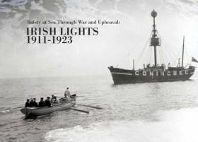
‘Safety at Sea Through War and Upheaval’ is the title of an exhibition now running at the dlr Lexicon in Dun Laoghaire, highlighting the history of Ireland’s lighthouses between the years 1911 and 1923.
Using resources from the Irish Lights archive, the exhibition – which runs till 7 January — next year explores the mission of safe navigation at sea in the context of the wider political and economic changes in Ireland at the time: independence, civil war, electrification and more.
A deeper focus on the years of the Great War is afforded by a new exhibition on the SS Hare and SS Adela in Dublin Port, which comes to dlr Lexicon this Monday (8 October) and tells the story of both ill-fated vessels during the rise of the U-boat threat from 1914 to 1918.
Keeping with the maritime theme, the late Des Branigan is the subject of a new display (opened yesterday, Friday 5 October) of archive material from photographs to books that give a rounded picture of a humble, ordinary seaman who achieved extraordinary things.
All exhibitions are open free to the public during library opening hours.
Irish Lights today launched a new five-year strategy which maps out its vision for the delivery of next generation maritime services to protect lives, property, trade and the environment, at the organisation’s HQ in Dún Laoghaire. Irish Lights is a statutory maritime safety organisation delivering 24/7 safety and navigation services around the coast of Ireland (North and South) 365 days a year.
The Safe Seas – Connected Coasts 2018-2023 Strategy commits Irish Lights to implementing a combination of new and existing navigation technology, engineering and data management solutions to facilitate Safe Navigation at Sea for commercial shipping, fishing, leisure craft and passenger vessels. Irish Lights provides a range of services to ensure that the Irish and UK Governments comply with the requirements of the international Safety of Life at Sea Convention (SOLAS). With over 340 General Aids to Navigation in the form of lighthouses, buoys, beacons and a range of digital services, the Irish Lights operational network constitutes a critical coastal infrastructure for the safety of all at sea and our coastal communities.
The Safe Seas – Connected Coasts Strategy builds on a number of advances made by Irish Lights across its operations in recent years to improve services, reduce costs and deliver positive economic and community benefits. This includes upgrading lighthouse stations and navigation buoys with energy efficient LED technology, with a reduction of 35% in overall CO2 emissions since 2009. The lighthouse and buoy energy efficiency upgrade programmes will see Irish Lights Aids to Navigation fully powered by renewable energy by 2023.
Irish Lights will continue its work to protect and develop its heritage assets for the benefit of the Irish public. The Great Lighthouses of Ireland North-South tourism and heritage initiative, saw 140,000 visitors to lighthouses around Ireland in 2017. In addition, over 19,000 bed-nights are now available in lighthouse keepers’ cottages at some of the most spectacular locations on the coast. This network of regional tourism initiatives has been developed in partnership with tourism agencies and local communities and is resulting in significant economic spin-off to coastal communities. Building on the success of this initiative, Irish Lights plans to work with partners to identify opportunities to have the extensive Irish Lights historical archive and records, which date from the early 1800s, professionally curated, secured, stored and catalogued, to be available in digital format for research, tourism and education purposes.
The strategy also affirms Irish Lights’ commitment to developing new services with the development of its Coastal Data Service providing reliable access to accurate, near real time weather and sea state observations at selected locations, to promote and contribute to safer navigation at sea.
John Coyle, Chairman of Irish Lights, said “As the provider of General Aids to Navigation around the island of Ireland, Irish Lights has a long and respected track record of service to the maritime community dating back to 1786. In more recent times, the context in which that service must be delivered has changed. Rapid technological advances, pressures on the marine and coastal environment and more diverse stakeholder needs, all require a greater emphasis on collaboration across agencies and with international organisations. We look forward to collaborating with all of our stakeholders in taking this ambitious strategy forward.”
Yvonne Shields, Chief Executive of Irish Lights said: “This strategy underlines the importance of continuing to provide a reliable, high quality and efficient infrastructure of visual and electronic Aids to Navigation around the coast of Ireland North and South. It builds on our current programme of technological and energy-efficiency upgrades to lighthouse stations and navigation buoys and strengthens our commitment to working with international partners to test and evaluate new navigation solutions which we expect to emerge in the next five to ten years. Safe navigation at local level also features prominently in our strategy, which includes a stronger focus on supporting local lighthouse authorities that are responsible for over 3,200 local aids to navigation around the coast.
“Looking ahead we recognise the need for all organisations with a mandate in the marine area to contribute to the sustainable development of our marine resources. As part of our strategy over the next five years, we will ensure that our services and the technical expertise and operational experience that exists in Irish Lights, contribute to the wider development of the maritime economy.
“We will work in partnership with other agencies and with industry to maximise opportunities to deliver value-added services to support industry and coastal communities. For example, we will use our coastal infrastructure to generate sea state observations which can be accessed by a broad range of users to plan marine activities more safely and also to monitor long-term trends in environmental conditions at sea. We will also collaborate with researchers and technology developers to test and develop new equipment, technologies and services.
“Lastly, an important additional objective for us in the next two years is to work with others to ensure that safe and efficient navigation is fully considered in Maritime Spatial Planning process”.
#tallships- Last year a visit to Scotland was made to investigate a former Irish Lights lightship dating to 1910 that in much more recent years had been a museumship there but is now to be found relocated in England to finally begin restoration work, writes Jehan Ashmore.
Launched as the lightship, Penguin for the Commissioners of Irish Lights at the Dublin Drydock Company, the vessel now named Arctic Penguin of Glasgow is now a rare surviving example of an Irish built vessel. Constructed of an iron hull on a steel frame. Above decks a fixed lantern was fitted to warn off shipping from the dangers along our coasts. Between 1910 and 1920 the Penguin was located at the Daunt Rock Station. After that decade the vessel served as a spare lightship.
In 1966 the lightship was sold and throughout the last half century has served several subsequent owners. Notably, in 1982 a conversion took place that saw an engine installed on the vessel that became a three-masted schooner offering sail training excursions.
The attractive town of Inveraray on Loch Fyne has been home to this floating landmark for many years. Since 2010, however the ship's role there as a maritime museum ceased. In addition access to the deterioting pier has been closed to locals and tourists alike by Argyl and Bute Council.
Arctic Penguin was towed away this year from the stunning scenery of the Scottish loch to the Cumbrian port of Barrow-in-Furness. Since arrival initial repairs have taken place to the 100ft vessel that is to be drydocked on the Wirral, from where the ship will be restored to seagoing condition.
Instead of operating from the Scottish west coast as previously reported, Arctic Penguin will be based out of Barrow. Earlier this year the north-west English port marked its 150th anniversary with celebrations that included vessels among them Arctic Penguin (see pictured) calling closer to the town quays.
At 107 years old, Arctic Penguin is rightly recognised as a vessel of importance, as the former lighship is listed on the National Register of Historic Vessels (NRHV) which comprises of more than 1,300 vessels. This register is one of several organised by the National Historic Ships UK, the official voice for historic vessels in the UK.
Irish Lights Are at the Core of Our Maritime Identity
The functioning of the Commissioners of Irish Lights is within a matrix in partnership with the Northern Lighthouse Board in Scotland and the Isle of Man, and Trinity House in England and Wales. They co-operate actively through a grouping known as the General Lighthouse Authorities, which in turn operates with larger supra-national inter-linking associations and authorities that extend a global reach. Their shared mission is to provide the world’s seaways and shipping with a uniform and effective system of navigational aids and regulatory systems.
Yet each constituent authority such as the Commissioners of Irish Lights (CIL, Coimisineiri Soilse na hEireann) has its own strong identity, for each in turn has emerged – usually over many centuries - from uniquely local conditions and particular historical circumstances. Globalisation has inevitably spread a strong element of uniformity, and the accelerating capacity and capability of computers is resulting in massive changes both in the way the Lighthouse Authorities function, and the number of staff they require to fulfill their vital role. But as W M Nixon discovered during an informative visit this week to Irish Lights headquarters in Dun Laoghaire - a visit which included a highly instructive tour of their familiar service vessel Granuaile - there is definitely something reassuringly Irish about the Commissioners of Irish Lights.
Although Irish Lights provide, maintain, develop and monitor a wide variety of aids to navigation all round our long, complex and often challenging coastline, for most people in Ireland it is the remarkable selection of 81 distinctive lighthouses which still provide the perception of what Irish Lights is all about.
As you’d expect, it is our most maritime-minded county of Cork which has the greatest number of these uniquely attractive and purposeful buildings – 16 in all – while next in line is Donegal with 11, reflecting the fact that while Cork has a long and complex coastline on the busier southwestern corner of Ireland. Donegal presents many navigational challenges for all vessels approaching the northwest corner.
Ireland being the size it is, most of us will be familiar with the presence of at last one lighthouse, while many of us will have several favourites. But although there has been a marked opening-up of the activities of Irish Lights in recent years, with the Twelve Great Lighthouses scheme providing holiday accommodation at some very special venues in what were formerly the houses of lighthouse keepers and their families, most of us still harbour at least part of the mindset which thinks that there should be something mysterious and perhaps a little sacred about the lighthouse service and its workings.
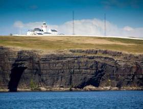
Certainly in the case of Ireland, the sacred aspect has historical resonance. For although the Commissioners of Irish Lights were officially established in 1786 and headquartered in Dublin, the earliest record of an Irish lighthouse service is in Wexford at Hook Head at the east side of the entrance to Waterford Estuary, where a monk called Dubhan started tending a lighted beacon in the Fifth Century, and his successors maintained it more or less continuously until Cromwell’s invasion of Ireland in 1641. It all started here. Dawn at Hook Head, County Wexford, where a warning light for mariners was first shown in the 5th Century
The provision of lights for navigation inevitably followed the main lines of shipping routes and sea trade, and in the late medieval period and on through Tudor and Stuart times, this put an emphasis on providing services for all ports between Youghal and Drogheda, places which came under the influence of the mighty (and often rather ruthless) city-port of Bristol.
In time, despite its shallow entrance, Dublin emerged as the main Irish port. But it was a slow long process through a number of grandly-named - or indeed oddly-named - bodies, their roles sometimes over-lapping before 1786, when Irish Lights was set up (Motto: In Salutem Omnium: For the Safety of All) to rationalize many local organisations, and provide an all-Ireland service which radiates out from Dublin to this day.
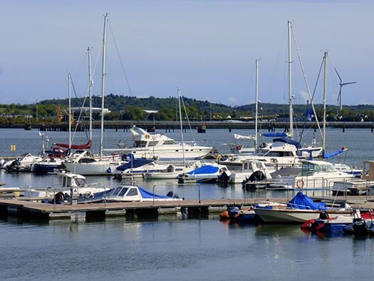
In fact, its focus is now totally through Dun Laoghaire, where Irish Lights have had their shore headquarters since 2008 in a striking modern award-winning circular building designed by star architects Scott Tallon Walker, and located on site together with the CIL workshops, research and development departments and the extensive “buoy yard” in a busy harbourside complex where their service vessel, the 2,625 ton Granuaile, can come alongside for direct access two hours either side of high water.
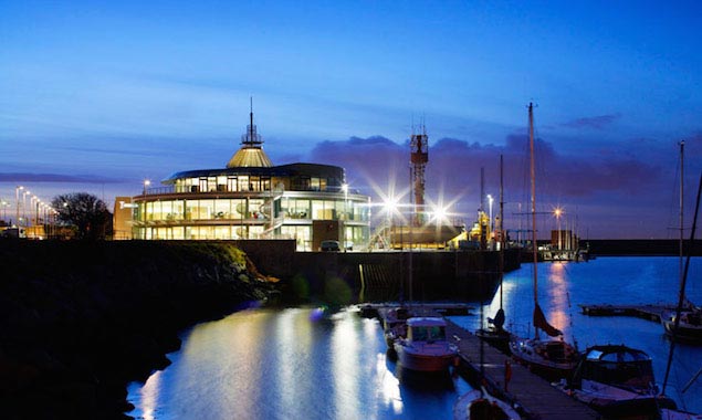 Here’s where it is now. Irish Lights HQ in Dun Laoghaire
In times past, the organisaton seemed to function in more leisurely styles in keeping with the pace of each era, with the main offices located in a fine terrace of Georgian buildings in Pembroke Street in the heart of fashionable Dublin 2, while what was at one stage a flotilla of service vessels if all were gathered together at the Dublin quays. But that was a rare enough event, as usually they were away on their allocated duties on specific parts of the coast.
Yet nowadays, even though the pace and location is more intensely focused, with personnel cut back as computers and automation take over many aspects of a service which was formerly labour-intensive, there still is a certain attractive air of mystery about the way in which Irish Lights carry out their activities.
To a considerable extent these days, this is because staff numbers are minimized, and Chief Executive Yvonne Shields has to oversee an extremely efficient and focused organisation whose functioning is always under scrutiny. Although other lighthouse authorities get most if not all of their income from shipping dues, Irish circumstances are such that Irish Lights relies on a government subvention to top up its funding, and when public money is directly involved, you’re working in a special environment.
Yet even in the past when lighthouses were still being built as a matter of course – the Fastnet was completed as recently as 1904, the “new” light on Inishtrahull in 1958, and the light on the extended East Pier at Howth in 1981 – the fact of there being an element of public works in CIL’s activity did little to make their activities more public. They were seen as a very specialised service, there were many recognized “light service families”, and generally it was felt that the less the public knew about their well-trained and ethos-laden activities, the better.
But now, as its core staff get smaller but even busier, Irish Lights is letting the light in, so to speak. This week a party of three dozen or so of us from the Small Craft Group of the Royal Institute of Navigation, the Irish Cruising Club, and the Dublin Bay Old Gaffers Association spent an informative day with CIL, and came away hugely impressed with the dedication and expertise of the entire operation.
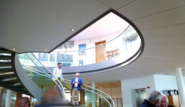 The interior of the award-winning Irish Lights HQ is elegant and functional. Photo: W M Nixon
If you’re wondering at the eclectic makeup if those attending, it’s because we’d to close in on Wednesday September 6th when the Granuaile would be in port making her 28-day complete crew changeover. The people at CIL felt that information time in the offices, research units, workshops and buoy yard would only make sense if afterwards we saw the ship in detail to give us an insight into the means whereby their products and services are conveyed to locations all round the coast of Ireland. Thus as Paul Bryans and Darryl Hughes run the RIN Small Craft Group for all that they spend substantial chunks of their time in Ireland, and both are members of the ICC while Darryl is active in the DBOGA, we soon had the required numbers of people who were seriously interested in what CIL does, and how it does it.
For me it was of special interest, as my last close encounter with Irish Lights had been Before the Revolution. Irish Lights is always working hard to be in the vanguard of technology, yet until the early 1980s this was at a fairly leisurely pace. But then electronics and computers with remote monitoring began to sweep through. The manning of lighthouses was gradually discontinued, lightships and their crews were replaced by large equipment-filled buoys, and the entire economic environment changed.
Yet the dedicated and generally cheerful attitude of Irish Lights staff prevailed even as their numbers were inevitably diminishing. Thanks to a well-selected board of Commissioners and high staffing standards, the personnel management was sound, and CIL was set on a course which seemed eventually and inevitably to lead to a very focused operation based entirely in Dun Laoghaire, and operating with just one extremely busy ship.
But the most visible aspects of this transformation were still well in the future when I shipped as a guest of one of the Commissioners aboard the Granuaile’s predecessor, the yacht-like 1970-built 2000-ton vessel also known as Granuaile which, despite her relatively recent construction, really was a last relic of ould dacency.
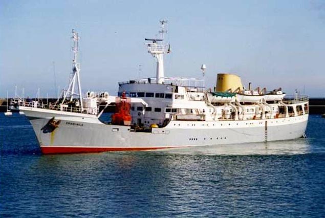 The 1970-built Granuaile was the second Irish Lights vessel to carry the name. With her tiny workspace right forward and enormous allocation of luxurious accommodation, she was about as different as possible from the current ship
The Commissioners kept a close eye on the workings of their cherished organisation, and every summer they had a working cruise round Ireland aboard the Granuaile inspecting the lights and other aids to navigation under their charge. In order to accommodate them, the ship had emerged as about 80% filled with the engine room, crews quarters, bridge space, officers cabins and rather luxurious accommodation for the Commissioners, but barely 20% was given over to an inconveniently small working space on the foredeck right under the bridge served by a small derrick, while around it were various workshops located in the part of the ship most prone to violent motion if she was at sea.
The section of the Irish Lights circuit I did in 1986 was from Bangor on Belfast Lough round to Killybegs, and while everyone worked extremely hard during days which started early, each night in some agreeable anchorage – for the local knowledge of Irish Lights crews is unrivalled - the Commissioners dined on board like the Lords of Creation, and if they went ashore it was to visit one of the choicest hostelries on the coast, while from the shore were brought out the most interesting and informed of local characters.
That stage of the cruise concluded with an on-board black tie dinner in Killybegs hosted by the Captain, Paddy Mangan from Kerry, who looked splendid in his full dress uniform, with CIL’s head inspector Dennis Gray in particularly fine form. As to the work done during the cruise, it was considerable, varied, and thorough, and all the time I was impressed by the technical expertise in some specific area of CIL activity which each Commissioner seemed to have made his speciality. In fact, some of them sometimes had little enough to say until their area of expertise came up the agenda, when they’d leap to life with information and advice which was world class.
But while the ship was lovely, she was already an anachronism, totally out of kilter with the new area of utility and functionality, and in due course Dennis Gray identified a service vessel for sale in the North Sea which was so useful for a temporary replacement for the very out-dated Granuaile that the delighted Commissioners called her Gray Seal.
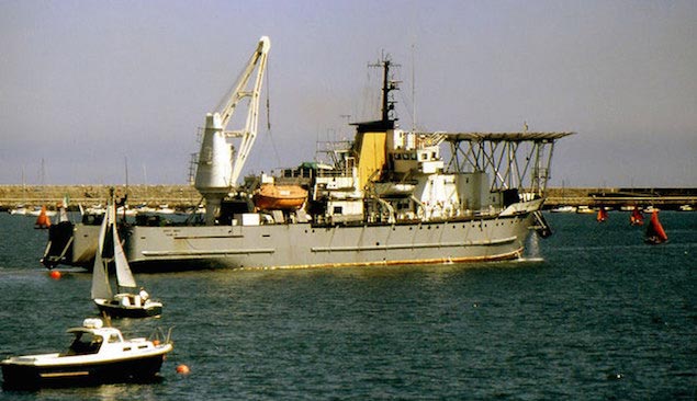 The temporary replacement. Gray Seal in Dun Laoghaire – she provided useful lessons for designing the new Granuaile in 2000
Gray Seal was in turn only in use while a pioneering replacement ship was planned to be built from new, a total purpose-functioned vessel which Irish Lights would commission to be the prototype for light services the world over, and this was the new Granuaile, built in 2000, aboard which we were to spend the afternoon.
It says everything about the quality of the presentation given by Captain Robert McCabe, Director of Operations and Navigation Services, backed up by his Strategic Support provider Barbara Fogarty with further input by Technology and Development Services director John Burke, that the morning in the boardroom, offices and workshops was ever bit as interesting as the afternoon on the ship.
Light Commissioners the world over provide an increasing number of services despite the fact that some amateur sailors might reckon things like lighthouses to be superfluous thanks to modern electronics navigation aids (a navaid is aboard ship, an aid to navigation is not). But time and again it has been demonstrated this isn’t so, and you certainly wouldn’t want to get on the wrong side of some legal dispute trying to show that aids to navigation are superfluous. So the way ahead for Lights Commissioners is to make the running of their lighthouses as economical as possible, and increase their input into all areas of seafaring.
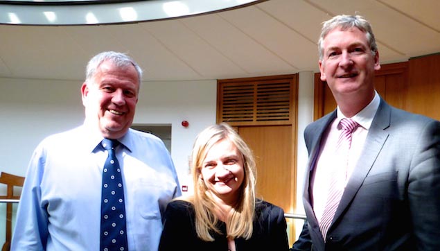 Captain Robert McCabe, Barbara Fogarty and John Burke of Irish Lights. Photo: W M Nixon
Ireland has been an ideal testing ground for developing ways of saving money in running a lighthouse, as we have such a variety of them to work with. It seems that one of the most expensive lighthouses in the world used to be the Bull Rock off County Kerry northwest of Dursey Island. It was just remote enough to be a special challenge, it often called for helicopters, and in the days when keepers lived on it, the money just ran out the door.
So Irish Lights started their own line of researching in developing economical LED (Light-emitting Diode) lights for use in lighthouses, and the one they fitted to the Bull Rock was a first of its type. It has been operating successfully since 2012, and now the main work project is replacing the famous light on Mew Island with a LED setup, while transferring the entire old-style Mew Island light equipment to the Titanic Centre in Belfast.
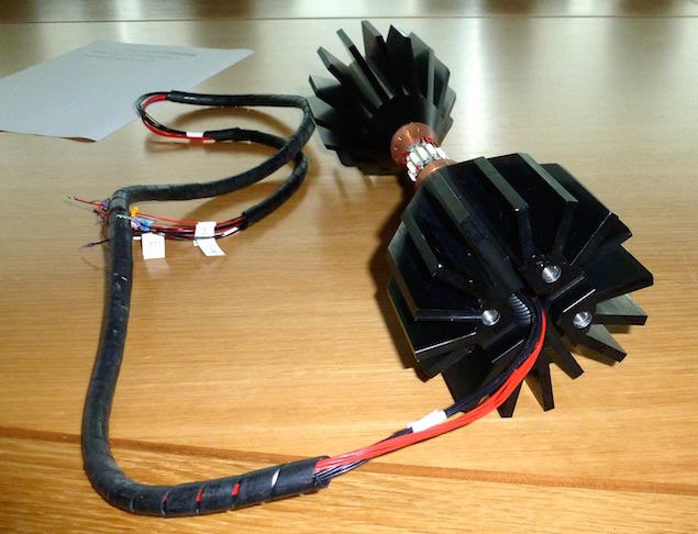 A LED light developed by Irish Lights. The LED light is the narrow bit in the middle – just visible are the Light Emitting Diodes. The big black fins on either side are the heatsinks, whose function is to take all the heat away as quickly as possible from the electronics and LEDs. Photo: W M Nixon
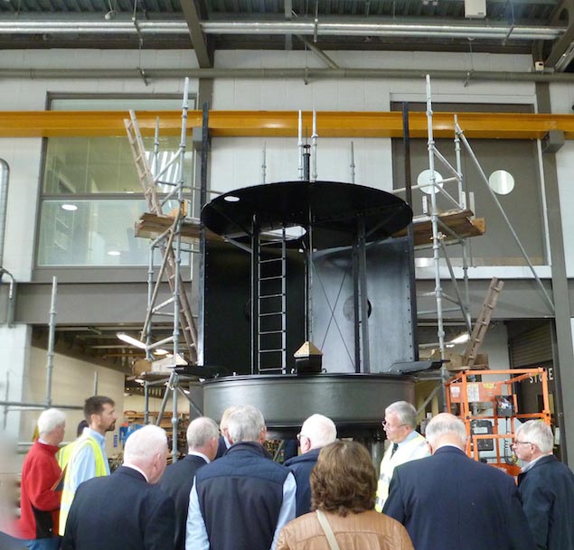 The Mew Island light being restored in Dun Laoghaire. It has been replaced by one of Irish Light’s own LEDs, and when the restoration is complete, this old light unit will go on display at the Titanic Centre in Belfast. Photo: W M Nixon
This interaction with local communities is not new – the Maritime Museum in Dun Laoghaire has the impressive old Kish optic as a feature display – but now it is taken for granted, and Irish Lights, as a visible presence with many skills and a remarkable multi-purpose ship, inevitably finds itself at the centre of many maritime operations such as last weekend’s emergency exercise off Dunmore East, while they also played a special role in the search mission after the RS 116 tragedy at Black Rock in Mayo.
Looking to the future, they see interaction with other agencies as naturally increasing, so it may well that far in the future – for everyone’s now planning to 2030 and beyond - some recreational sailors will find the passing Irish Lights vessel taking a friendly interest in them, for the harsh fact is that nearly 50% of fatalities at sea come from the recreational sector.
Preoccupied with such thoughts, it was a welcome change to tour the workshops which vary from specialist micro-work benches to a fully fitted high-ceiling place – it has been used for public gatherings – which is also maybe the last wooden boat-building premises on the entire Dublin City and County waterfront. It seems that for their ocean-operating workboats which get launched by davits from the side of the ship with the crew already on board, the Irish Lights seamen still prefer to use a wooden boat of a well-proven type.
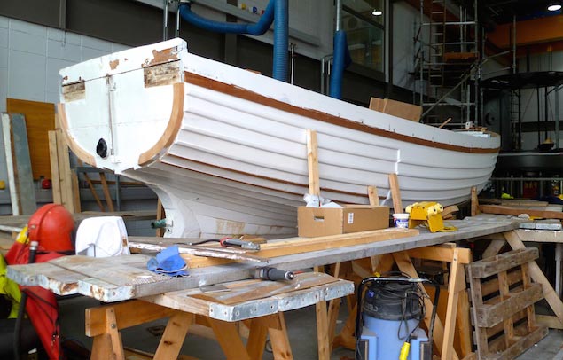 The Irish Lights workshop in Dun Laoghaire is one of the very few places left in Dublin where it is still possible to see traditional boat-building under way in a waterfront environment. Photo: W M Nixon
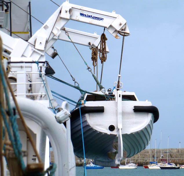 One of Irish Lights’ wooden boats in the davits on the Granuaile. When the boat is being sent off on some task, the crew simply step aboard with the boat like this, and are then lowered onto the sea. Photo: W M Nixon
Outside was the extensive buoy-yard which had the complete range, everything from new buoys testing plastic construction through solar-powered smart buoys to a rusty old veteran which had somehow come across the Atlantic from Nova Scotia, and we all were lucky that no-one sailed into it during its slow progress, for it would have given as good as it got.
 Don’t they want it back? This buoy drifted across the Atlantic from Nova Scotia. The Nova Scotian buoyage authority are probably too embarrassed by the failure of their mooring to ask for it back. Photo: W M Nixon
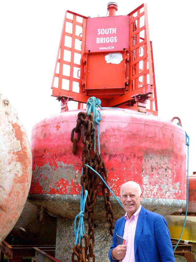 “One of the buoys that were buoys when I was a boy….” Paul Bryans with the South Briggs Buoy from Belfast Lough. Photo: W M Nixon
As Paul Bryans and I started our sailing on Belfast Lough, we were delighted to find in the buoy cluster one of the buoys that were buoys when we were boys, the South Briggs which marks a reef between the lough and Donaghadee Sound. Suitably elated by one of the worst jokes of the year, we made our way in a condition of information overload for a spot of welcome lunch at the Royal Irish Yacht Club and then headed east for the Carlisle Pier where the Granuaile was one very busy ship.
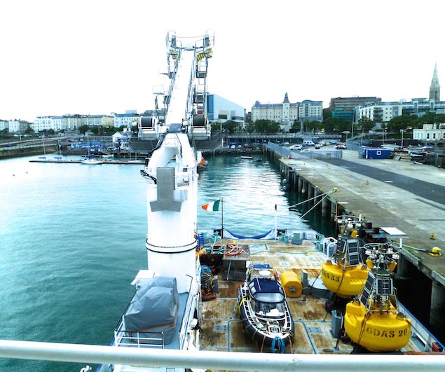
She certainly earns her keep. She works her way round the coast of Ireland more or less every 28 days, and is then back in Dun Laoghaire for one day of complete crew change and a detailed and thorough handover. You’d think that a crew in the middle of this would have more than enough to do, but we were graciously welcomed, and with the party divided in two, were able to get to know a fantastic ship.
Everything about the new Granuaile is expressive of the times in which we live. Functionality and internationalism is everything. She was built in Romania and finished in the Netherlands in 2000. And at every crucial stage of her construction, the Irish Lights specialists were invited to be present to make their input into the layout of this new type of vessel.
 A mighty workspace. Granuaile’s generous afterdeck and huge derrick. Photo: W M Nixon
But some things don’t change, and Irish Lights is always strengthened by its sense of family involvement and tradition. Thus one of the key people in deciding how the unbelievably spacious bridge should be laid out to make best use of its 360 degrees control sphere was Declan Gray, the son of Dennis Gray with whom I’d gone along the coast on Donegal on the old Granuaile back in the previous millennium. And when we went up to the fantastic bridge, there to welcome us was Captain Declan Gray, very much dressed down as he was in the final go-everywhere stages of taking over the ship for the next 28 days, yet with us to talk to, it was clear that his enthusiasm for the new Granuaile burns as brightly as it did when she was brand new 17 years ago.
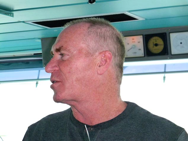 Captain Declan Gray – as enthusiastic today about the Granuaile as he was 17 years ago when she was new. Photo: W M Nixon
As the photos clearly show, everything is focused on work getting done, and keeping an eye on it wherever it may be happening. Everything is devoted to keeping control of the ship and what happens aboard her, regardless of the sea conditions.
Her engines, which are completely backed up, provide 4,000hp of diesel electric power, transmitted through two thrusters, one on each quarter which, together with a bow thruster, can either be operated independently or operated together – manually or by computer – to position the boat precisely.
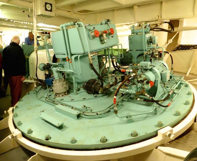 Deep down in the stern of the ship, the starboard thruster is slightly reminiscent of a giant saildrive. It obviates the need for rudders. Photo: W M Nixon
The only change that might be made to the concept of 2000 is that the bow thruster be replaced with two independent thrusters, but as it is they’ve pinpoint control with none of your old-fashioned rudder nonsense – those thrusters on the quarters look after all steering.
As for a steering wheel – forget it. The passage control centre at the forward end of the bridge is all special thrust controllers and joysticks, as is the position command control panel at the starboard aft side of the bridge. Declan Gray can work it all with confidence and a real flourish, and the result is 2,600 tons of ship which can be placed on a one cent piece.
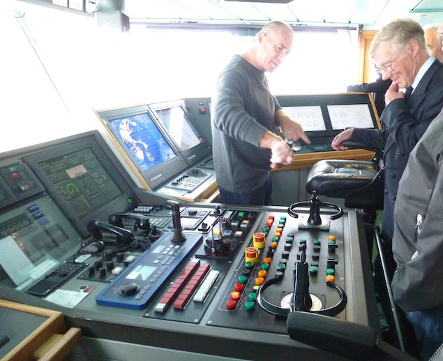 The steering position….there’s no wheel, just thruster controls. Photo: W M Nixon
 On the starboard side aft in the spacious bridge, the position control panel has everything you need including computer input to position the vessel exactly. Photo: W M Nixon
As for accommodation, she’s certainly comfortable, for regular crew and specialist staff can be on board for 28 days at a stretch, but there’s definitely not the applied opulence of the old ship. Everything is built around work requirements with usefully low freeboard around a huge working deck space aft, a king size derrick, and fully-equipped workshops below in the position of least motion.
Thus the new Granuaile can do the work which in the old days required two or three ships, and she can do it without requiring costly service yards in distant parts of the country, as modern heavy trucks means that a large item can be moved by road from Dun Laoghaire as and when she needs it, and delivered to any quayside where she has her own gear to lift it aboard.
It’s curious that this hive of working activity should be at the heart of what is increasingly seen as the recreational harbour of Dun Laoghaire. And the people at Irish lights are frank in discussing how some things in an otherwise orderly move out from Dublin have not gone as they expected. For instance, when the new main building was being planned in 2002-2008, they underestimated just how much the expansion in computer capabilities would reduce their need for office space. But it ultimately wasn’t a major problem. They decided that their needs could be fully met by using just the upper storeys, and letting out the ground floor offices to outside users.
Happily, the situation is now stabilisised, and Irish Lights, while continuing in its traditional functions, has successfully expanded into other related income-generating areas. But under-pinning everything, there is still that instinctive sense of duty and loyalty to a remarkable organization.
A classic Irish Lights story tells of James Kavanagh, the Wicklow stonemason who built the Fastnet Rock. Although increasingly ill, he insisted on staying on the rock into June 1903 in order to see the last enormous stone into place on the top course, number 89. He collapsed as it went perfectly into place, and was taken ashore in a semi-coma, having personally set every stone on the lighthouse.
James Kavanagh died in July 1903, and he has become a byword for the spirit of Irish Lights. Currently, Kevin Whitney, one of the Chief Officers on the Granuaile, is teaching classes in a Naval Reserve course in Haulbowline during his periods ashore between the 28-day spells on the ship. The 2017-2018 intake into these courses is called the James Kavanagh Year.
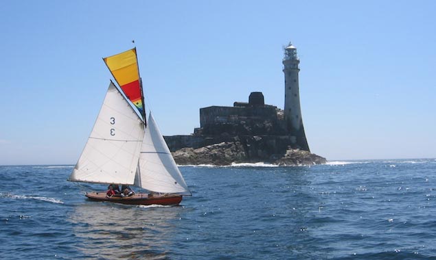 The 1898-built Howth 17 Leila (Roddy Cooper) rounding the Fastnet Rock in July 2003, a hundred after James Kavanagh laid the final stone to complete the great lighthouse. Photo: W M Nixon
#lighthousePics - The guardians of some of Ireland's most iconic lighthouses, the Commissioners of Irish Lights are looking for new and exciting images of Lighthouses located along our stunning coastline.
Whether you are a professional photographer or just a budding enthusiast who likes to take snaps on your compact camera or smartphone, Irish Lights want you to share your best pictures with them.
From time to time Irish Lights may use these pictures in their publications for both internal corporate and external public viewing and if they do you can rest assured that all credit for your picture will go to you. This is a great way to get your work seen and to share in our passion and commitment to serving the mariner.
If you would like to share your photos with Irish Lights email any image to the dedicated email address [email protected]
Please make sure you include your name and a note to state that the picture is an original and was taken by you, and that you give permission for its use if we so choose.
For more about Irish Lights in general visit their website here.
New Stamps Commemorate Irish Lights
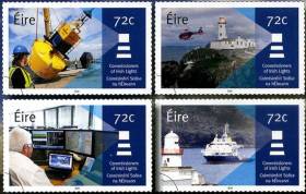
#IrishLights - An Post has today (Thursday 6 October) a set of stamps to commemorate the Commissioners of Irish Lights.
There are four stamps in the collection designed by Vermillion Design, featuring Irish Lights staff working on a buoy; a helicopter at work near Fanad lighthouse in Donegal; the technology Irish Lights offers to sea users; and the ILV Granuaile, the service’s multifunctional vessel.
Each highlights a different aspect of the agency’s navigation and maritime services which go beyond the many lighthouses in its coastal network, including some 4,000 local navigation aids such a buoys and marks on dangerous wrecks outside harbour areas.
The stamp set is available from post offices nationwide or online from the Irish Stamps website.
€93m For Ireland's Maritime Programme Under Transport Budget Increase
#Budget2016 - €93m has been earmarked for Ireland's maritime programme for the next year - a 7% increase on 2015 spending – in the latest Budget announced yesterday (Tuesday 13 October).
Key among the targets of this funding, according to the Department of Transport, Tourism and Sport (DTTAS), are maintaining the quality and level of service through the Irish Coast Guard's search and rescue helicopter contract, and helping the Commissioner of Irish Lights transition to a new funding model.
"The Irish Coast Guard service requires a strong resource commitment on the part of the Exchequer," said a statement from the DTTAS yesterday (Tuesday 13 October). "The SAR helicopter has seen a step change in the quality of service on offer and that will remain a priority.
"Future developments in IT will also ensure the coastguard service remains best in class internationally."
The funding rise comes via an 8% increase in the departmental budget, as welcomed by Transport Minister Paschal Donohoe and Minister of State for Tourism Michael Ring yesterday.
That includes €2 million in additional funding for tourism initiatives such as the Wild Atlantic Way and the new Ireland's Ancient East.
Meanwhile, the 14% increase in the Public Service Obligation subvention for transport will be further good news to Aran Islands residents, coming after Aer Arann reached an agreement with the Government to extend its contract till the end of September next year, according to Galway Bay FM.
As previously reported on Afloat.ie, Marine and Defence Minister Simon Coveney also welcomed the €904 million allocation to defence funding for 2016 to facilitate the implementation of the department's White Paper proposals – which includes the commissioning of three new patrol ships.
Tuskar Rock Lighthouse Celebrates 200th Birthday
#Tuskar200th – The Tuskar Rock Lighthouse off Ireland's south-east coast celebrates its 200th anniversary this year.
The lighthouse perched on the Tuskar Rock 7 miles off Co. Wexford is a familar sight to those taking ferry services in and out of Rosslare Harbour.
For two hundred years the lighthouse has helped provide safe navigation to mariners and sailors alike since its light was first exhibited on 4 June 1815.
The white tower is topped with a light that operates at night and in poor visibility during daylight hours.
Paraffin vapour burners were the light source until the light was converted to electric on 7th July 1938.
Electricity allowed the use of a 3000 W lamp giving two white flashes every 7.5 seconds.
On 31st March 1993 the lighthouse was converted to automatic operation and the keepers were withdrawn from the station.
The station is in the care of an Attendant and Assistant Attendant and the aids to navigation are also monitored via a telemetry link from the Commissioners of Irish Lights headquarters in Dun Laoghaire.
There is a much more detailed history of the lighthouse courtesy of Irish Lights which has dedicated a page on the their website here.

#dlharbour – Hostile questions were asked in the Dail on Wednesday by local TD Richard Boyd Barrett on the proposed development of Dun Laoghaire Harbour as a cruise liner port. They were deflected in ministerial replies about legislation currently being drafted, and the two possible viable ways forward for the harbour's administration. But the underlying pace is accelerating towards a resolution of the future of this unique example of Victorian design, engineering and construction. W M Nixon finds that, in recent days and weeks, his views on the possible uses of this magnificent artificial harbour have undergone considerable change.
Embarrassment is a powerful stimulant for change. Change of attitude, change in ways in behaving, change in ways of looking at things, change to entrenched ways of thinking. I was hugely embarrassed by something seen in Dun Laoghaire nine days ago. And within seconds, there came a complete epiphany, with the sudden awareness that an entrenched attitude towards the development of Dun Laoghaire as a cruise liner port had turned through about 140 degrees.
It made for the complete 180 degrees, as the first 40 degrees of the turn had already been achieved a couple of weeks previously, while spending two completely absorbing if mentally exhausting hours with the maverick Alistair Rumball and his team at the Irish National Sailing School beside the inner recesses of Dun Laoghaire's inner harbour, which is still called the Coal Harbour even though it's very many years since anyone offloaded any lumps of the black gold there.
Be that as it may, as we parted we were shooting the breeze about the proposed development of Dun Laoghaire as a cruise liner port, which has been top of the local agenda since the end of March, and handily gave us one of our choicer April Fool's Day stories here on Afloat.ie - it proved so effective we had to add a health warning.
When a story provides you with something like that, you develop a certain affection for it. So while Alistair and I agreed that that the absolute dream solution for Dun Laoghaire Harbour would be a top-of-the-line government-funded National Monument Preservation Scheme, with the entire place given over exclusively to recreation afloat and ashore, and no commercial shipping of any significant size whatsoever allowed about the place, we knew it was pie in the sky.
"How on earth would they really pay for it?" he asked. "This place is huge, it costs a fortune to run and maintain. A cruise liner berth offers the best and most compact method of providing a worthwhile income stream. And as we in our sailing school – being a commercial operation – have to be rigorous in observing harbour regulations and keeping clear of the established in-harbour shipping lanes, we know that you can continue to sail small boats in large areas of the harbour without any undue sense of space restrictions".
Subsequently, I've been spending some time around Cork Harbour, where circumstances are so different from Dublin Bay that, unlikely as it may seem, you end up feeling sorry for the sailors of south Dublin. For while Cork is almost embarrassed by its riches in natural amenities for sailing, and it's all in a large and attractive harbour where marinas can be put down almost anywhere with no more than a floating breakwater to provide the necessary minimum of shelter, Dublin Bay by contrast is a hugely deprived area in terms of natural waterfront facilities for sailing, yet any attempts to provide man-made shoreline amenities for boats and sailors are dogged with local opposition every inch of the way.
Around Cork Harbour, it only needs a floating breakwater and, hey presto, you've suddenly got a marina - as seen here at Monkstown. Photo: W M Nixon
Thoughts of this struggle, and how things change, emerged again for various reasons in Dun Laoghaire nine days ago, at the reception in Irish Lights HQ to launch the Great Lighthouses Tourism Initiative. Time was when our many fine lighthouses were places of mystery, and permission to visit took quite a bit of arranging if it could be managed at all. But my word, times have changed. In this electronic age, there are those who wonder if we need all our lighthouses. Yet Irish Lights is legally obliged to maintain them, and the built structures around them.
So Yvonne Shields, the CEO of Irish Lights, whom we'd describe as very switched on and extremely bright were we not talking of the top executive in a lights organisation, unveiled this sensible scheme whereby twelve of our greatest lighthouses are being transformed into stations on a tourist trail, while continuing as working lighthouses.
As the greatest and most monumental lighthouses on land tend to be on rugged headlands in remote areas, in the eyes of Brussels they're in peripheral areas deserving special aid. So there's €2 million of Eurodosh going into this project, which sees what had become increasing liabilities being transformed into tourist resources. And if we're going to be sniffy about that, let's face it: the kind of tourist who'll want to visit a remote lighthouse will not be the kind of tourist who would keep you well clear of Temple Bar.
So the old grey matter was churning briskly away on the business of seeing lighthouses in a new way as we headed home past the Coal Harbour, and there it was: The Embarrassment. For this was the evening at the end of the day when the majestic and rather handsome cruise liner Queen Mary 2 was anchored off Dun Laoghaire in a near gale from the southwest which had delayed the morning's arrangements to ferry passengers ashore in the ship's own tenders to the special landing pontoon installed by the Harbour Company in the inner harbour.
By this time, they were trying to return on board, waiting patiently in a queue which ran the length of the inner pier and more as the two ship's tenders bustled the mile and a half plus out to the ship, yet still more buses turned up to disgorge more passengers, such that for a while the long length of the queue seemed to stay persistently the same.
Perhaps it's because we Irish don't do queuing that I found the entire thing acutely embarrassing to behold. And it wasn't even as if it was raining, which it well could have been. Nevertheless it struck me as being a Third World sort of scenario. Yet obviously these people were keen to visit Dun Laoghaire – most of the thousands of passengers on board had elected to go ashore.
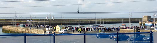
This just won't do at all – images of Third World destinations came to mind on seeing the passengers from the Queen Mary 3 queuing in the Coal Harbour in Dun Laoghaire to get back out to their ship anchored in the bay. Photo: W M Nixon
So the epiphany came with the essential flashing great light. If we're going to have cruise liners calling at Dun Laoghaire, boomed this disembodied voice, then let's do it properly and provide them with a proper berth. Otherwise, don't have them about the place at all. But please, please – no more buzzing in and out in little tenders in this Irish climate, and no more queuing on a comfortless pier. It's an affront to our best traditions of hospitality.
This sudden firing-up with all the zeal of the recent convert (for until then, I'd wanted Dun Laoghaire to stay exactly as it is, and damn the expense) resulted in my being right into the dragon's den four days later. It was meant to be a short and businesslike meeting with Gerry Dunne, the CEO of Dun Laoghaire Harbour Company, to discuss the Cruise Liner Berth Proposals. But so many ideas were flying around that we ran well over time.
Please be assured, though, that I did my best to represent the needs of the boat-owning and sailing community while accepting that since Stena Sealink withdrew from running a ferry service from Dun Laoghaire to Holyhead, something very serious indeed needs to be done to pay for the maintenance of the harbour.
We have to remember that, among Ireland's main sailing centres, Cork and Kinsale are blessed with such good natural harbours that any marinas located in either harbour do not need fixed breakwaters. As for Bangor Marina on Belfast Lough, it may need a very substantial solid breakwater on its north side, but otherwise - thanks to being located in a bay - three of its four sides are naturally sheltered. But Dun Laoghaire is badly done by – it's so totally an artificial harbour in an exposed location that three of its four sides are protected by large man-made breakwaters, and while they are constructed in monumental style, continuous monitoring and maintenance is essential.
This is costly, but it would become even more so were standards allowed to slip for even a year or two. Even with the present high standards, there can be underlying wear and tear which in time needs major capital expenditure, and according to one recent report, hidden erosion on the most exposed section of the East Pier may eventually need up to €5 million for a proper remedial job.
As it is, the current basic running costs of the harbour are between €2 and €2.5 million a year. Were it kept as a purely recreational harbour and general public amenity, this figure could perhaps be slightly reduced. Yet the Dun Laoghaire recreational boating market still could not withstand paying the full amount out of its own resources and expected annual expenditure, so the shortfall would have to be made up by Government subvention.
But would the sailing and boating people of Dun Laoghaire really like to feel that they're beholden to taxpayers throughout Ireland for their continuing enjoyment of this wonderful amenity at affordable prices? There's something unpleasantly artificial about the idea of such an arrangement, whereas a harbour which is providing a modest but genuine profit is something which has a much healthier feel to it.
Surely if a way can be found of generating a worthwhile income stream without unduly distorting the traditional functioning of the harbour, then that idea should at the very least be actively explored, and recreational boating groups should be prepared to reach out towards compromises in the knowledge that, in turn, such arrangements would make the Harbour Company more accountable to all.
However, local representative Richard Boyd Barrett TD of the People Before Profit party, and Chair of Dun Laoghaire Save Our Seafront Group, sees it differently, and he has called for "a major campaign of people power against the planned cruise berth, and to protect the future of the harbour as a public amenity". His three main objections to a cruise berth plan are "(1) That the cost and financing of the project at €18 million means that the Harbour Company will have to borrow using its existing assets, where no proper business case has been produced. This puts the very future of the harbour at risk. (2) The entire plan has been hatched by an unelected board of the Harbour Company, Council Executives, and local business people who ran a sham of a public consultation over the two weeks of the Easter Holidays, and (3) The scale of the luxury liners at 300 metres long and 59 metres high will dwarf the harbour and reduce public access and public enjoyment of the most intact Victorian harbour in Britain and Ireland".
So with a Harbour Company which is government-owned, yet is charged with maximizing the economic benefit and exploiting the commercial opportunities provided by Dun Laoghaire Harbour, clearly there is something of a divide between the two sides. In fact, "light years apart" just about sums it up.
Nevertheless, politics being the art of the possible, it has to be possible to bring people together sufficiently to see that perhaps a proper sympathetically-designed cruise liner berth might indeed be the answer. After all, although it was built between 1817 and 1842 purely as a harbour of refuge for sailing ships with no thought of any interaction between sea and land, it very quickly became a ferry port for cross-channel steamships. At the height of this activity, with frequent roll-on roll-off ferries and their unpleasant shoreside traffic dominating the waterfront, Dun Laoghaire had lost much of its charm.
For the life of me I can't see that the much more limited shoreside traffic generated by the visits of cruise liners in the summer months can be seen as being anything like as obnoxious as the previous waves of road and rail traffic for the ferries, which was readily tolerated, and helped to keep the place going for 180 years.
And in any case, with the end of the ferry services, Dun Laoghaire definitely lacks purpose. In the Irish climate, it is very difficult to maintain a sense of vitality around a harbour which is purely devoted to personal recreation, whether afloat and ashore. It could be argued that, regardless of the economic benefits, it would be good for the mental spirit and communal well-being of Dun Laoghaire to be a cruise liner port of call, as a cruise liner strikes a neat balance between work and play. Like it or not, all work and no play may make Jack a dull boy, but all play and no work makes him mad.
But even if we accept that the shoreside traffic will be much less than it was with the regular ferries even if there is a cruise liner in port every other day, that is only part of the equation. How does the town itself shape up as a desirable cruise liner destination?
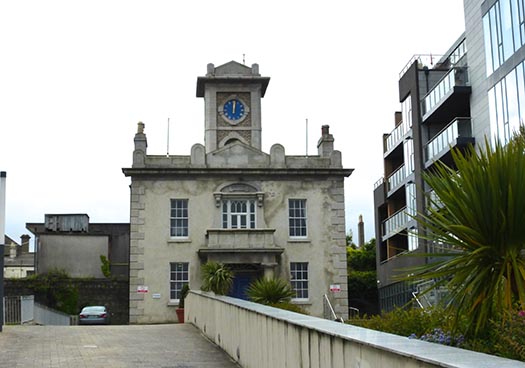
The Harbour Lodge is symbolic of today's Dun Laoghaire, a classical building from an earlier age, but now enclosed by modernity. Photo: W M Nixon
When we get down to the nitty gritty like this, Gerry Dunne is in his element. He's an affable guy, and good company, but I wouldn't like to get into a row with him, as there's steel underneath it all. So in the sedate setting of Harbour Lodge – which he cheerfully admits his opponents and friends have nick-named "Mussolini's Palace" – he's just the man to fight off the brickbats and work his way towards several objectives. But although he actually lives in Dun Laoghaire within walking distance of his office, he's not really into boat and water sports, yet that's no drawback, as personal preferences definitely don't come into it at all as he plans the way ahead.
He makes no bones about admitting that his attitude is strongly commercial. Before taking over the reins at Dun Laoghaire Harbour Company, he was Commercial Director at RTE, a job description which boggles the mind. Before that, he honed his skills in the UK, working for several large Irish food companies. If that gives you a vision of ditzy little artisan cheeses selling in agreeable country shops, then perish the thought – the big Irish food industries provide as tough a business environment as you could imagine.

The many moods of Gerry Dunne.Toughened by a varied and demanding career in business and marketing, he has brought a fresh mind to the problems of making Dun Laoghaire harbour economically viable. Photos: W M Nixon
He joined the Harbour Company in 2009, when talk of Stena's withdrawal was already in the wind. So he got Dun Laoghaire moving towards the cruise liner market in a small way, with the miniature 53-passenger Quest in 2011. Finding Quest an in-harbour berth was no problem, and she provided invaluable information on what Dun Laoghaire can provide as a USP for discerning cruise liner passengers. For Quest's rather specialist group, it was the easy access to the Wicklow Hills and particularly Mount Ussher Gardens, and they definitely didn't want to have to travel through Dublin City to get there.
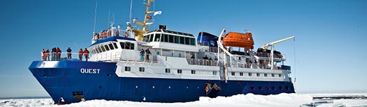
The mini liner Quest – seen here in the Arctic - began the programme of attracting cruise ships to Dun Laoghaire in 2011
So far so good, but Gerry Dunne really struck gold when he started going to the cruise liner fairs in America and Europe. Gradually he built up a useful network, and again he struck gold when he got a report on the potential attractions of Dun Laoghaire from the Vice President (Itineraries) of one of the biggest American cruise liner conglomerates. Asked to sum up in one word the attraction of the Dun Laoghaire for visitors coming in from sea, her answer was: "Serenity".
We've become accustomed to Venice being talked of as The Most Serene Republic - The Serenissima. But it makes you sit up and take notice to hear of Dun Laoghaire being so described by a tough American businesswoman. Yet that's the impression the waterfront area, with its combination of the old yacht clubs, the station, the Town Hall and the Royal Marine Hotel, apparently makes on seaborn visitors from cruise liners, even if their liners are at present anchored outside the harbour and they have to be ferried in to land by ship's tenders. It seems they can blank out the less attractive buildings, and are left with the abiding impression of relaxed elegance with an easygoing way of life.
This takes a bit of getting used to, as it's so much at variance with the perception in Ireland of Dun Laoghaire as a place where they'd argue over anything and everything all the time, while just up the street there's the real problem of the dreary array of boarded-up shops. But like it or lump it, here it is folks – the reality is the yacht clubs and other other historically significant and stylish buildings of the Dun Laoghaire waterfront area – including the pleasantly under-stated Victorian residential terraces - are the town's greatest tourist asset.
Quite what some of the more senior members of the yacht clubs will make of that we can only guess, but the word is that the clubs have indicated that they'll be prepared to welcome some cruiser liner guests to their premises at pre-arranged times. So perhaps we should see the cruise liners as no more than extra-super super yachts......And there's no doubt that many rugged sailing folk from Dun Laoghaire are themselves only too happy to tootle off on a cruise liner when the peak of the sailing season is over.
The artist's impression was just that – an artist's impression. If the new berth goes ahead, cruise liners will actually have their sterns towards the town.
But what is the reality if the new berth is agreed? Well, you can forget about your artist's impressions showing a liner facing the town. Space will be restricted, so the liners will come in stern first, thereby enabling them to make an elegant departure for the benefit of crowds down the end of the piers, which could become a popular occurrence.
The new liner pier will be as short as possible, though it will have an underpass for small craft, while the bows of the ships themselves will be held in place by dolphins, as was the HSS ferry. If you think that getting into this berth will involve impossibly ticklish manoeuvring, consider this recent photo of the three Cunard Queens up close and friendly in Southampton, and note that there's no lack of small craft nipping about among them.
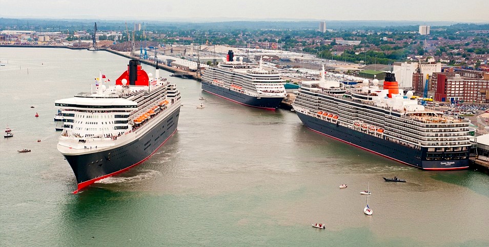 The three Cunarders can manoeuvre unaided at close quarters even with several small craft nipping about their heels, as seen here in Southampton
One of the other drawbacks about the current setup, with the ships anchoring off and people disembarking in the Coal Harbour, is that there's very little space for buses to move about, but the present waterfront marshalling yard left behind by the exit of Sealink will greatly relieve that problem if the new berth is built. At the moment, it is planned that passengers will walk the short length of the pier to reach their buses, but my own feeling is that the pier should be made a bit wider with a turning circle in order that passengers may board their buses almost directly from the ship, for we're not talking long distance athletes here.
That said, those who are fitter can come and go as they please, with the town within easy reach, whereas being anchored off can cause cabin fever. In other words, if Dun Laoghaire is going to have a cruise liner berth, let it be done properly – half measures involving long walks to buses just won't do, but equally for those who do walk, the town must feel accessible and welcoming.
As to the amount of space the ship will take up in the harbour, that will vary from ship to ship, but some are indeed enormous. And their wind-deflecting presence will certainly add an extra interest to in-harbour dinghy racing. As for the interest of the in-harbour racing for the visitors on the ship, that in turn will all be part of Dun Laoghaire's colourful charm, for which their ship will provide a grandstand view.
In line with that, we should remember that the leading in-harbour class, the historic Water Wags, have only just returned from showing themselves off at Morbihan Sailing week in France. Thus they'll scarcely be unduly bothered about providing a source of fascination for passengers on cruise liners, some of whom will probably be former dinghy racers themselves.
The Water Wags find it easy to sail freely within Dun Laoghaire Marina on their way out to race in the main harbour, so their only problem with a cruise liner berthed in mid-harbour will be the effect it has on wind flow. Photo: W M Nixon
But what the in-harbour dinghy racers are already becoming happily accustomed to is the newly-emptied eastern half of the harbour, with space now provided where boats used to moor. And this area will not be at risk from maneuvering cruise liners – there's not the depth for them. Finally, as to the height or otherwise of the ships in relation to other structures in Dun Laoghaire, I think we've been righteously indignant about this on a mistaken premise – since the new library was pushed into place, all bets about skyline heights and an elegant relationship with other waterfront buildings are clearly off.
So if the sailing and boating community can be more accepting of the cruise liners which will ultimately provide a real source of income to maintain the harbour which makes their activities possible, what can they expect in return?
They're in a strong negotiating position. After all, the Harbour Company's research has shown it is the comfortable presence of the yacht clubs which underpins this vision of serenity which is Dun Laoghaire's most appealing attraction for the kind of people who enjoy the cruise liner experience. So it's very much in the Harbour Company's interest to keep the clubs in good health.
By today's standards, the Royal Irish YC is thriving, thanks in no small part to its location within the marina against whose creation, ironically, the club fought tooth and nail. But the other three clubs – the Royal St George, the National, and the Dun Laoghaire MYC – are blighted by the limited and relatively unsheltered pontoon berthing at their clubhouses.
It may well be – and I'm only guessing – that the Marina Company's agreement with the Harbour Company includes a clause that these three clubs are not allowed to have their own adjacent marinas. But if such a clause exists, then it should be deleted for the greater good of the harbour and the vitality of the waterfront in general, and the three clubs should be facilitated in providing 150-boat marinas – with proper breakwaters for the George and National - in front of each clubhouse.
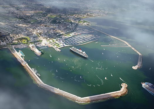
Dun Laoghaire from the southeast. If the new cruise liner berth is installed at mid-harbour, a longterm plan could be the installation of breakwaters in front of the Royal St George YC and the National YC in the foreground to shelter two new 150-boat marinas, as the location of the Royal Irish YC within the main marina gives it an unfair advantage in providing facilities for its members.
As to how Dun Laoghaire town can benefit, that's another matter altogether. The much stronger income and improved employment going through the Harbour Company will undoubtedly be a tangible good, though how seasonal it will be – with liners expected only between April and October – remains to be seen.
But personal expenditure by cruise liner passengers in the town is an imponderable. In fact, some cruise liners in the popular sunshine destinations are notorious for disembarking guests who feel that they made their total investment with the purchase of the ticket back home, so they don't plan to spend any more.
The historic little Venetian city-port of Dubrovnik on the Adriatic – which doesn't have a proper liner port – recently banned cruise liners from coming anywhere near the place, as their thousands of passengers made the narrow streets very uncomfortably crammed at peak times, yet the average expenditure ashore in Dubrovnik by each cruise liner passenger was precisely €6. There's food for thought. But we will of course get a better class of cruise liner passenger in Dun Laoghaire...


 Michael Murphy Schull Harbour Sailing Club (SHSC), Eric Coogan Heineken Ireland, Mark Murphy, Commodore SHSC, Jack Allen SHSC, Carmel O'Regan SHSC, Cornelious Ndlovu, Schull Harbour Hotel Operations Manager and Derval Murphy SHSC")

