Menu

Ireland's sailing, boating & maritime magazine

Inland afloat headers


Displaying items by tag: Irish

Volvo Dun Laoghaire Regatta and the Brewin Dolphin Scottish Series are jointly promoting reduced entry fees in a tue up between the two big Irish Sea regattas.  50% discounts off entry fees is available for boats entering both events.

"The way this works is that the Clyde Cruising Club are offering a 25% rebate for boats from the 4 Dun Laoghaire Clubs (DMYC, NYC, RIYC, RStGYC) that enter the Brewin Dolphin Scottish series before the expiration of the early bird discount period which expires on April 22nd explained Dun Laoghaire event secretary, Ciara Dowling.

As a reciprocal arrangement the committee of the Volvo Dun Laoghaire Regatta are offering a discount of 50% from the full entry fee to all boats that enter both regattas. To avail of this, boats must register for the early bird entry fee in the Volvo Dun Laoghaire Regatta prior to 2 May 2011. Note the 50% discount will be applied to the full entry fee rate and not the early bird rate.

To avail of this arrangement for the Scottish Series contact the Brewin Dolphin Scottish Series office for details, [email protected] 0044141 221 2774.

To avail of this arrangement for the Volvo Dun Laoghaire regatta visit the event website at www.dlregatta.org or email [email protected]

The Scottish Series takes place from 27–30 May and the Dun Laoghaire regatta from July 7th–10th 2011.

In a further boost for Dun Laoghaire sailors heading north the feeder race from Bangor to Tarbert has been re-instated.

Troon and Largs Marinas are offering competitors berthing rate discounts around Scottish Series.

Competitors from Scotland coming to Dun Laoghaire are reminded that the entry fee to the regatta includes free berthing for the duration of the event.

The official Notice of Race and Online Entry are now available at www.dlregatta.org

Published in Volvo Regatta

The Irish Cruising Club's acclaimed Sailing Directions, in two volumes, offer comprehensive coverage of the entire coast of Ireland, and their price has recently been reduced by £10.00 to £27.50 each (€32.50).
These are the only cruising guides for the Irish coast to be frequently and comprehensively updated, with corrections available free at www.irishcruisingclub.com.
The 310 page South and West volume was reviewed in Cruising magazine, Sept 2010: "If you are intending to cruise these coasts, or even if you are only thinking of doing so, it is essential. As Sailing Directions they are well-nigh perfect."
Written, edited, designed and printed on the island of Ireland, these handsome hardback books are carried as an aid to navigation and pilotage by the Irish Naval Service, the Irish Coast Guard and the Commissioners of Irish Lights, and they are used as a reference source by the UK Hydrographic Office.

ICC_both_SDs

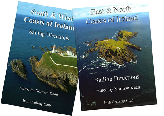
ICC SDs are available from chandlers and booksellers, and are distributed in Great Britain and the rest of the world by Imray, and in Ireland by Todd Chart Services. East and North Coasts Directions ISBN 978 0 9558 199 1 9; South and West Coasts Directions ISBN 978 0 9558 199 2 6.

Published in Cruising

In one of her last official functions as Minister for Sport, outgoing local TD Mary Hanafin attended the Irish Sailing Association's annual Ball last Saturday in the Royal Marine Hotel in Dun Laoghaire.

Attended by 315 people the black tie ball featured an awards ceremony that has been hailed  'a great success' by the association.

On Saturday afternoon the association elected a new President, Niamh McCutcheon, the first female ISA President since the organisation was founded in 1945.

A collection in aid of the RNLI raised over €2,250.

Award details below:

ISA Sailing Achievement of the Year
This award is presented by the ISA to recognise the outstanding achievement in a sailing craft by an Irish person or in Ireland during 2010.
Winner: Nicholas 'Nin' O'Leary, Royal Cork Yacht Club
Nicholas' achievements included narrowly beating his father Anthony at the ISA All Ireland Championships in 2010 by just a single point after a nail-biting finale in difficult conditions off Kinsale in November. The win made it three-in-a-row for this remarkable young 24 year old sailor - the only person to achieve this in the 64 years of the event's history.

ISA Volunteer of the Year
This award is given to a member of an ISA affiliated club or class who has made a significant voluntary contribution to their sport during 2010.
Winner: Brian Craig, Royal St. George Yacht Club.
Brian has been nominated by the Royal St. George Yacht Club for the vital role he has played in developing sailing in Ireland and specifically Dun Laoghaire over the past 40 years. His most recent success was winning the bid for Dun Laoghaire to host the 2012 ISAF Youth Worlds.

ISA Youth Sailor of the Year
This award is presented by the ISA to recognise the outstanding achievement by a sailor competing in ISA Performance Pathway boats during 2010.
Winner: Finn Lynch, Blessington Sailing Club
Placing 2nd overall at the Topper World Championships in 2010 left the Carlow sailor in good stead for a Youth Sailor nomination. A determined sailor and strong character, it's clear that with these strengths Finn has the potential to go far in our sport.

ISA Instructor of the Year
This award recognises the role instructors have in providing access to our sports. The final 5 have been nominated by their students with the ultimate winner selected by an ISA judging panel.
Winner: Aine Carroll, Rush Sailing Club
Aine has been an ISA instructor for the last 11 years, instructing both adult and junior sailors in Rush Sailing Club. A keen Mermaid sailor, her love of sailing, her enthusiasm for the sport and willingness to give her time to her sailors have been infectious and remarkable. Apparently the kids at the club think she is a 'legend' and 'cool'!

ISA Training Centre of the Year
The face of ISA water sports to thousands of participants. The best in 2010 as nominated by their students.
Winner: University of Limerick Activity Centre
Situated on the sheltered shores of Lough Derg, University of Limerick Activity Centre has been in operation for over a decade. ULAC provides a varied programme of adventure activities to the general public. The University of Limerick Activity Centre runs ISA courses in sailing dinghies, windsurfers, powerboat as well as emergency care training courses.

Published in ISA

With boat sales falling by as much as 80%, marina business down 20%, retail sales in chandlery down up to 38%, insurance down 12.5% the marine industry in Ireland and Wales had to take some action to ensure the marine trade and leisure industry survives.

An unusual industry conference took place in Dun Laoghaire today and yesterday with the objective of understanding where the industry is right now and how it needs to act to ensure that it survives the downturn in our economies.

Over 125 marine businesses from both sides of the Irish Sea will be attending in what will be the largest marine leisure Industry gathering ever brought together.

A joint address was given by the Executive Director of the British Marine Federation, Howard Pridding and David O'Brien the Chairman of the Irish Marine Federation set the scene as to where the industry is on both sides of the Irish Sea.

The conference heard from 3 companies who operate in the sector. One from each region, North Wales, South Wales and Ireland who will share with the conference their experiences in the current economic climate on how they are surviving and thriving in the downturn. Business tactics that need to be deployed were explored with a leading business and innovation specialist from Wales together with joint talks by Visit Wales and Failte Ireland on the development of marine leisure tourism.

Leading economist Jim Power delivered a talk on the economic situation and when we might begin to see some consumer confidence return to our markets.

The Pembroke Coastal Forum told how they have managed their coastline and environment and how they have facilitated marine leisure tourism through proper marine spatial planning.

The conference is being organised by irish-sea.org and Ireland/Wales Interreg IV A Programme funded by the European Region Development Fund.

Irish-sea.org has three partners, North Wales Watersports, South West Wales Marine Federation and the Irish Marine Federation.

Published in Marine Federation

Over 120 marine trade and leisure companies from Ireland and Wales are coming together in Dun Laoghaire this week to examine ways to combat the current economic downturn on both sides of the Irish Sea.

Speakers at the conference at the Royal Marine Hotel are drawn from Industry representative organisations, tourism bodies, marine leisure companies, business development specialists, economists and irish-sea.org will provide insights and share knowledge on how to survive the downturn and emerge leaner and stronger when the recovery arrives.

The conference will also provide an industry wide networking opportunity for companies from Ireland and Wales to share experiences and develop business links across the Irish Sea.

Irish-sea.org is an Ireland/Wales Interreg IVA Programme to develop the Irish Sea into a marine leisure centre of excellence.

The programme provides help and support to the sector on both sides of the Irish Sea through marketing, business and vocational training and assisting in the acquisition of research data.

Published in Marine Federation

There will be no match racing on the south coast this year following a rejig of the fixtures calendar.

After two years of expansion for match racing in terms of events the theme for 2011 is consolidation.

Changes to the ISA SailFleet schedule for the boats mean that we have had to go through a rejigging of the match racing calendar.

The major impact is that Royal Cork YC are to take the boats latter than originally hoped meaning that they will be unable to host a leg of the Tour.

With Kinsale not taking part in the SailFleet scheme this year that means no match racing on the south coast for the first time in a couple of years.

With no tie up with the Dun Laoghaire Festival of Cultures available this year a date of July 23rd and 24th has been settled on for the Ireland vs The World International.

The highlight of last year this event will once again pit Irelands 6 best match racers against 6 teams from the rest of the world. Once again National and Tour champion John Sheehy will captain the Irish team.

The Leinster Match Racing Open, to be hosted by the Royal Irish Yacht Club, has been moved to July 16th and 17th to allow it to act as qualification for the Irish team for the following weekend and to give Laura Dillion and the Gladiators (Sam Hunt, Paddy Blackley, Peter Bayly, Richard Murphy) competitive practice immediately before heading over to Poland to represent the country at the ISAF Nations Cup.

Howth Yacht Club's, Dublin Match Racing Open stays with a date of September 3rd and 4th before we head for Lough Derg and the Womens (October 15th and 16th) and Open National Championships (November 5th And 6th).

All of the above means that here will be no Munster Match Racing Open this year and work continues to find a host for the IUSA Student Match Racing Nationals with Galway a potential for early April. There has been considerable work on the cost of entry for events over the winter and the majority of events will have a basic entry of €330 this year. All events will be run at ISAF grade 3.

Revised calendar

July 16-17th – Leinster Match Racing Open, Royal Irish Yacht Club
July 23-24th – Ireland vs The World International, Royal St George Yacht Club
September 3rd and 4th – Dublin Match Racing Open, Howth Yacht Club
October 15th and 16th - Womens Match Racing Championships, Lough Derg Yacht Club
November 5th and 6th – National Match Racing Championships, Lough Derg Yacht Club

Published in Match Racing
12th November 2010

An Irish Maritime Foundation

I wonder whether there might be interest in forming an Irish Maritime Foundation?

I raise the question having discussed the possibility with those who run the UK Maritime Foundation and whose views about the sea about the sea impressed me when I met them in London. The Foundation traces its history back to 1981 when shipowners, senior retired naval officers and people involved in the financial industry reacted to changes in British Government policy that were regarded as failing to protect the importance of the UK maritime industry. It is a registered charity with the purpose of promoting and raising interest in the maritime sector amongst the public, the media and Parliament. To do so it is involved in assisting development of maritime education, training and research.

The British are a magnanimous people in my view. It was an honour to accept the Desmond Wettern Award from the Foundation. Desmond Wettern was a distinguished UK maritime journalist for over 30 years and the awards were established in his name. This year the Society for Nautical Research joined the awards project.

In responding I used one of my favourite descriptions - "the Family of the Sea," which I have used on radio. It drew a lot of interest from those present. I believe there is a "family of the sea" which spans oceans and seas, linking those who appreciate the sea as essential to human survival.

"Everyone who has an interest in the sea would recognise that there are and will continue to be, increasing pressures on its use and on the exploitation of its finite resources, but also a number of opportunities," according to Rear Admiral Christopher Perry, Chairman of the UK Marine Management Organisation. Those views and others I discussed with some of those amongst the 200 attending the function, who came from various parts of the world. Professor Richard Harding of the Society for Nautical Research which is marking its centenary, expressed this opinion: "There is a disturbing sense of sea-blindness in the British Government, amongst the general public at large and in the media."

There is certainly sea-blindness in our Government and in much of the media, though I am hopeful that there is growing awareness of the importance of the marine sector amongst the general public. If Ireland had an organisation like the Maritime Foundation, I would be very pleased.

• This article is reprinted by permission of the EVENING ECHO newspaper, Cork, where Tom MacSweeney writes maritime columns twice weekly. Evening Echo website: www.eecho.ie

Published in Island Nation

Commodore Barry Rose is urging Cruiser Racers fans to support this weekend's eighth annual ICRA conference at the Carrigaline Court hotel in Carragaline, County Cork.

There's a big line up for the one day event that includes a presentation on an innovative concept to develop a 30 Footer one design concept that can also sail under IRC handicap. The idea is that it will be trailerable to attend ICRA Nationals and other events around Ireland. Rory Staunton travels from the UK to make the 30 footer presentation.

Rose says Saturday's event gives an opportunity to exchange 'constructive opinions to promote and develop the cruiser/racing', the biggest sector of Irish Sailing.

The event includes a celebration dinner for the Commodores Cup team at the Royal Cork Yacht Club.

Designers John Corby and Mark Mills will be present to update us on IRC developments and boat design and their thoughts on where boat design is heading. More HERE

Published in ICRA

Cork Week Revealed

with Eddie English (reprinted from Afloat 2006)

32-33.jpg

Eddie English stands high on Cobh’s historic waterfront and looks out across Cork Harbour, south towards Roche’s Point lighthouse and the entrance to the natural sailing sanctuary. Immediately below, a huge Brittany Ferries ship heads slowly out to sea; it’s not even close in size to a previous visitor to the former Queenstown, but then again, the RMS Titanic belonged to a different era.

To his left, the inshore waters north of the Whitegate oil refinery hide the channel to East Ferry where the Marlogue Inn stands over its marina and just opposite, the legendary Murphs on the mainland shore.

On his right, the channel between Spike and Haulbowline Islands and Cobh is the main shipping route for the Port of Cork for ferries, commercial shipping and the Irish Naval Service base.

But it’s the view straight out to sea that confirms one of the magic ingredients that have made Cork Week an international regatta of worldwide repute: vast tracts of open, unobstructed water and all within easy reach of the shoreside facilities of the hosts at the Royal Cork Marina at Crosshaven. 

When it comes to local knowledge, few are as expert as English. Not only is he a former chairman of the event's racing committee, not only does he run a long-established sailing school in the harbour, but when you are offered an insight from someone who takes his dog for a walk on notorious mud banks at low water springs, they tend to be nuggets of the golden variety.

"The harbour course is the key to Cork Week," says English. "It's the decider where the event is won or lost and has the most variables involved." So this, then, is the Eddie English step-by-step guide to gaining an edge for that course, plus the coastal, wind/leeward and Olympic-type courses at Cork Week.

COPYRIGHT – AFLOAT MAGAZINE 2006 

Published in Cork Week
17th December 2009

Cork Week and How You Can Win

eddie_english.jpgHow you can win at Cork Week

with more than a little help from local expert Eddie English [pictured left]Cork Week 2004 (reprinted from Afloat July 2004). For all the up to date information and news on Cork Week click here.

Eddie English stands high on Cobh’s historic waterfront and looks out across Cork Harbour, south towards Roche’s Point Lighthouse and the entrance to the natural sanctuary. Immediately below, a huge Brittany Ferries ship heads slowly out to sea; it’s not even close in size to a previous visitor to the former Queenstown, but then again, the RMS Titanic belonged to a different era.

To his left, the inshore waters north of the Whitegate oil refinery hide the channel to East Ferry where the Marlogue Inn stands over its marina and just opposite, the legendary Murphs on the mainland shore.

On his right, the channel between Spike and Haulbowline Islands and Cobh is the main shipping route for the Port of Cork for ferries, commercial shipping and the Irish Naval Service base.

But it’s the view straight out to sea that confirms one of the magic ingredients that have made Cork Week an international regatta of worldwide repute: vast tracts of open, unobstructed water and all within easy reach of the shoreside facilities of the hosts at the Royal Cork Marina at Crosshaven.

When it comes to local knowledge, few are as expert as English. Not only is he chairman of the event's racing committee, not only does he run a long-established sailing school in the harbour, but when you are offered an insight from someone who takes his dog for a walk on notorious mud banks at low water springs, they tend to be nuggets of the golden variety.

crk01.jpg
Left: Sigma 33s negotiate Roche’s Point

"The harbour course is the key to Cork Week," says English. "It's the decider where the event is won or lost and has the most variables involved." So this, then, is the Eddie English step-by-step guide to gaining an edge for that course, plus the coastal, wind/leeward and Olympic-type courses at Cork Week 2004.


Harbour Race

Above all, be conservative at the start of the Harbour Race if the tide is with you on the start off Weaver's Point. There can be two knots of tide here typically and an OCS in any fleet represents the end of the story with recovery improbable. Ideally, a short tour of the harbour during the weekend registration stage of Cork Week will pay dividends. If you can, borrow a RIB and take the tour at low-water.

Two marks form part of this course outside the harbour and rounding order will depend on wind-direction on the day. The first is off Ringabella to the south-west shore heading towards Kinsale. If there’s a flood tide, hug the shore. In fact, if the breeze is SW, go right, even in an ebb.

The second is off Trabolgan, east of Roche's Point. Crucially, beware of the strength of tide when traversing the channel across the harbour entrance. Don't just rely on the GPS – plot the tidal vectors to find the true course to steer. Once to the east of Roche's Point, there’s negligible tide and often a tide line can be observed.

This course then takes the fleet into the harbour but beware when entering on the east side of the Harbour mouth – the Cow and Calf rocks are extensions of Roche's Point up to one cable off the shore.

crk05.jpg
Above: Hugging the shoreline for a tactical advantage

Most races will come into a buoy east of Cobh, making this a long leg in, but offer plenty of hazards on a falling tide. After the Cow and Calf, it’s possible to dodge into White Bay but be wary of rocks and shallows on the south end of the bay close to Roche's Point.

The Dog's Nose promontory is next and it’s possible to cut into the area north of here though close inshore it shallows and the Black Rock is marked by a perch as the main hazard.

Bear in mind the sailing instructions that require clearance of 50 metres off the oil refinery jetty at all times. A listening watch on VHF Ch. 12 is useful for avoiding shipping.

cork04.jpg

Above: The fleet at anchor – everyone’s gone to the pub...

Once past the refinery jetty, the tide running north-east/south-west for the East Ferry channel can suck you in or push you out.

The alternative to the eastern shore approach is to hug the western shore and involves rock-hopping from Ringabella in past Weaver's Point. An option is to duck into the Owenbue River at Crosshaven – the tide ebbs here up to 30–40 minutes before HW Cobh.

North of here, the Curlane Bank, south of Spike Island, offers an option but beware of shallows. The area south-east of Spike is littered with rocks and, in particular, off the eastern end is a large rock marked by a perch.

The Spit Bank is the biggest in the harbour and is located from the north end of Spike from the lighthouse to the corner off Haulbowline. On very low spring tides, football is played on this bank. The key here is: go as close as you dare. The bank is mostly mud except for ‘The Seven Stones’ aka The Ballast Rocks located approximately two cables east south-east of the No. 20 (Port) Buoy.

Having made the turn for the final approach to the Cobh rounding buoy, one of the showcase marks in the entire event set beneath the picturesque back-drop of the town, this leg from ‘Cuskinny Turn’ offers several options in tide. With the tide is a straight-forward matter of choosing the deepest water so check the charts. Usually, the north shore offers no significant gains. Keep a sharp watch for the passenger ferries running from Cobh to Spike and Haulbowline Islands.

From Cobh, the Harbour Race will have a new finishing line in 2004, moving to the No. 7 (starboard) buoy south of the refinery.


Coastal Course

Going west from the start in a south-westerly or filling sea-breeze, taking the right-handside of the course, pays off, thanks to lifts off the shore. Use the bays to get out of the tide, with the exception of the first bay after Robert's Head/Daunt buoy – it’s called Rocky Bay and it is!

The tide here follows a south-west/north-east direction in line with the heads with a one-knot maximum. Keep the harbour entrance strategy from the previous course notes in mind too.

For 2004, the former south-east mark located approximately three miles east of Roche's Point has been renamed Moonduster as a tribute to the late Denis Doyle and his legendary 51-foot yacht that is synonymous with Cork.  


All Courses

The Olympic and windward/leeward are located outside the harbour so allow plenty of time to get afloat – some courses could take you up to an hour to reach as the number of yachts leaving Crosshaven at one time can mean congestion. The furthest course is three miles south-east of Roche's Point which in turn is two miles from Crosshaven. Don't assume the Race Officers will wait – best advice is to follow the professionals' example and leave early to be at sea on time with an opportunity to practice a few crew drills.

These courses usually have no significant tidal factors as most are located outside the harbour and beyond the main entrance tide line. More importantly, if a sea breeze builds, this will be of more use to you.

If a sea-breeze applies, it generally tends to build from around 11am, peaks at 3pm and is gone by 6pm. It will usually begin in the south/south-east provided the gradient doesn't block it. It tends to veer throughout the day until it comes from the SSW to SW – always moving right as the day progresses. Be vigilant to spot it building as it applies to all courses.

Published in Cork Week
Page 3 of 17

General Information on using Waterways Ireland inland navigations

Safety on the Water

All users of the navigations are strongly recommended to make themselves aware of safety on the water for whatever activity they are involved in and to read the advice offered by the various governing bodies and by:

The Dept. of Transport, Ireland: www.gov.ie/transport and The Maritime and Coastguard Agency, UK, The RNLI – Water Safety Ireland for information in terms of drowning prevention and water safety.

Registration of Vessels

All vessels using the Shannon Navigation, which includes the Shannon-Erne Waterways and the Erne System must be registered with Waterways Ireland. Only open undecked boats with an engine of 15 horsepower or less on the Shannon Navigation, and vessels of 10 horsepower or less on the Erne System, are exempt. Registration is free of charge.

Craft registration should be completed online at: https://www.waterwaysireland.org/online-services/craft-registration

Permits for use of the Grand and Royal Canals and the Barrow Navigation

All vessels using the Grand and Royal Canals and the Barrow Navigation must display appropriate valid Permit(s) i.e A Combined Mooring and Passage Permit (€126) and if not intending to move every five days, an Extended Mooring Permit (€152).

Permit applications should be completed online at: https://www.waterwaysireland.org/online-services/canal-permits

Passage on the Royal and Grand Canals – Dublin Area

For boat passage through the locks east of Lock 12 into / out of Dublin on either the Royal or Grand Canals, Masters are requested to contact the Waterways Ireland Eastern Regional Office (M-F 9.30am-4.30pm) on tel: +353(0)1 868 0148 or email [email protected] prior to making passage in order to plan the necessary lock-keeping assistance arrangements.

On the Grand Canal a minimum of two days notice prior to the planned passage should be given, masters should note that with the exception of pre-arranged events, a maximum of 2 boats per day will be taken through the locks, travelling either east or west.

Movements in or out of the city will be organised by prior arrangement to take place as a single movement in one day. Boaters will be facilitated to travel the system if their passage is considered to be safe by Waterways Ireland and they have the valid permit(s) for mooring and passage.

Newcomen Lifting Bridge

On the Royal Canal two weeks’ notice of bridge passage (Newcomen Lifting Bridge) is required for the pre-set lift date, and lock assistance will then also be arranged. A minimum of 2 boats is required for a bridge lift to go ahead.

Waterways Ireland Eastern Regional Office (Tel: +353(0)1 868 0148 or [email protected] ) is the point of contact for the bridge lift.

A maximum number of boats passing will be implemented to keep to the times given above for the planned lifts (16 for the Sat / Sun lifts & 8 for the weekday lifts). Priority will be given on a first come first served basis.

On day of lift, boaters and passengers must follow guidance from Waterways Ireland staff about sequence of passage under bridge & through Lock 1, and must remain within signed and designated areas.

Events Held on the Waterways

All organised events taking place on the waterways must have the prior approval of Waterways Ireland. This is a twelve week process and application forms must be accompanied with the appropriate insurance, signed indemnity and risk assessment. The application should be completed on the Waterways Ireland events page at :

https://www.waterwaysireland.org/online-services/event-approval

Time Limits on Mooring in Public Harbours

On the Shannon Navigation and the Shannon-Erne Waterway craft may berth in public harbours for five consecutive days or a total of seven days in any one month.

On the Erne System, revised Bye Laws state that: No master or owner shall permit a vessel, boat or any floating or sunken object to remain moored at or in the vicinity of any public mooring, including mooring at any other public mooring within 3 kilometres of that location, for more than 3 consecutive days and shall not moor at that same mooring or any other public mooring within 3 kilometres of that location within the following 3 consecutive days without prior permission by an authorised official.

Winter Mooring on the Shannon Navigation and Shannon Erne Waterway

Winter mooring may be availed of by owners during the period 1 Nov to 31 Mar by prior arrangement and payment of a charge of €63.50 per craft. Craft not availing of Winter Mooring must continue to comply with the “5 Day Rule”. Winter Mooring applications should be completed online at : https://www.waterwaysireland.org/online-services/winter-moorings-booking

Owners should be aware that electricity supply and water supply to public moorings is disconnected for the winter months. This is to protect against frost damage, to reduce running costs and to minimise maintenance requirements during the winter months.

Vessel owners are advised that advance purchasing of electricity on the power bollards leading up to the disconnection date should be minimal. Electricity credit existing on the bollards will not be recoverable after the winter decommissioning date. Both services will be reinstated prior to the commencement of the next boating season.

Smart Cards

Waterways Ireland smart cards are used to operate locks on the Shannon Erne Waterway, to access the service blocks, to use the pump-outs along the navigations, to avail of electrical power at Waterways Ireland jetties.

Berthing in Public Harbours

Masters are reminded of the following:

  • Equip their vessel with mooring lines of appropriate length and strength and only secure their craft to mooring bollards and cleats provided for this purpose.
  • Ensure the available berth is suitable to the length of your vessel, do not overhang the mooring especially on finger moorings on floating pontoon moorings.
  • Ensure mooring lines, electric cables and fresh water hoses do not create a trip hazard on public jetties for others users.
  • Carry sufficient fenders to prevent damage to your own vessel, other vessels and WI property.
  • Allow sufficient space between your vessel and the vessel ahead /astern (c.1m) for fire safety purposes and /or to recover somebody from the water.
  • Do not berth more than two vessels side by side and ensure there is safe access/egress at all times between vessels and onto the harbour itself.
  • Do not berth in such a way to prevent use of harbour safety ladders, slipways or pump-outs.
  • Do not allow the bow of your vessel to overhang the walkway of a floating mooring thus creating a hazard for others with an overhanging anchor or bow fendering.
  • Animals are not allowed to be loose or stray at any time.
  • Harbour and jetty infrastructure such as railings, power pedestals, fresh water taps, electric light poles, safety bollards, ladders etc are not designed for the purpose of mooring craft , they will not bear the strain of a vessel and will be damaged.
  • At Carrybridge on the Erne System, Masters of vessels are not permitted to use stern on mooring. Masters of vessels must use the mooring fingers for mooring of vessels and for embarkation / disembarkation from vessels.

Passenger Vessel Berths

Masters of vessels should not berth on passenger vessel berths where it is indicated that an arrival is imminent. Passenger vessels plying the navigations generally only occupy the berths to embark and disembark passengers and rarely remain on the berths for extended periods or overnight.

Lock Lead-in Jetties

Lead-in jetties adjacent to the upstream and downstream gates at lock chambers are solely for the purpose of craft waiting to use the lock and should not be used for long term berthing.

Vessel Wake

Vessel wake, that is, the wave generated by the passage of the boat through the water, can sometimes be large, powerful and destructive depending on the hull shape and engine power of the vessel. This wake can be detrimental to other users of the navigation when it strikes their craft or inundates the shoreline or riverbank. Masters are requested to frequently look behind and check the effect of their wake / wash particularly when passing moored vessels, on entering harbours and approaching jetties and to be aware of people pursuing other activities such as fishing on the riverbank.

Speed Restriction

A vessel or boat shall not be navigated on the Shannon Navigation at a speed in excess of 5 kph when within 200 metres of a bridge, quay, jetty or wharf, when in a harbour or canal or when passing within 100 metres of a moored vessel or boat.

Vessels navigating the Shannon-Erne Waterway should observe the general 5 kph speed limit which applies along the waterway. This is necessary in order to prevent damage to the banks caused by excessive wash from vessels.

Vessels navigating the Erne System should observe the statutory 5kt / 6mph / 10kph speed limit areas.

A craft on the Royal and Grand canals shall not be navigated at a speed in excess of 6km per hour.

A craft on the Barrow Navigation shall not be navigated at a speed in excess of 11km per hour except as necessary for safe navigation in conditions of fast flow.

Bank Erosion

Narrow sections of all the navigations are particularly prone to bank erosion due to the large wash generated by some craft. Masters are requested to be vigilant and to slow down to a speed sufficient to maintain steerage when they observe the wash of their craft inundating the river banks.

Unusual Waterborne Activity

Unusual waterborne vessels may be encountered from time to time, such as, hovercraft or amphibious aircraft / seaplanes. Masters of such craft are reminded to apply the normal “Rule of the Road” when they meet conventional craft on the water and to allow extra room to manoeuvre in the interest of safety.

Sailing Activity

Mariners will encounter large numbers of sailing dinghies from late June to August in the vicinity of Lough Derg, Lough Ree and Lower Lough Erne. Sailing courses are marked by yellow buoys to suit weather conditions on the day. Vessels should proceed at slow speed and with due caution and observe the rules of navigation when passing these fleets, as many of the participants are junior sailors under training.

Rowing

Mariners should expect to meet canoes and vessels under oars on any part of the navigations, but more so in the vicinity of Athlone, Carrick-on-Shannon, Coleraine, Enniskillen and Limerick. Masters are reminded to proceed at slow speed and especially to reduce their wash to a minimum when passing these craft as they can be easily upset and swamped due to their very low freeboard and always be prepared to give way in any given traffic situation.

Canoeing

Canoeing is an adventure sport and participants are strongly recommended to seek the advice of the sport’s governing bodies i.e Canoeing Ireland and the Canoe Association of Northern Ireland, before venturing onto the navigations.

Persons in charge of canoes are reminded of the inherent danger to these craft associated with operating close to weirs, sluice gates, locks and other infrastructure particularly when rivers are in flood and large volumes of water are moving through the navigations due to general flood conditions or very heavy localised precipitation e.g. turbulent and broken water, stopper waves. Shooting weirs is prohibited without prior permission of Waterways Ireland.

Canoeists should check with lockkeepers prior entering a lock to ensure passage is done in a safe manner. Portage is required at all unmanned locks.

Canoe Trail Network – "Blueways"

Masters of powered craft are reminded that a canoe trail network is being developed across all navigations and to expect more organised canoeing along these trails necessitating slow speed and minimum wash when encountering canoeists, rowing boats etc

Rockingham and Drummans Island Canals – Lough Key

It is expected that work on Rockingham and Drummans Island Canals on Lough Key will be completed in 2021. Access to these canals will be for non-powered craft only, eg canoes, kayaks, rowing boats.

Fast Powerboats and Personal Watercraft (Jet Skis)

Masters of Fast Powerboats (speed greater than 17kts) and Personal Watercraft (i.e.Jet Skis) are reminded of the inherent dangers associated with high speed on the water and especially in the confines of small bays and narrow sections of the navigations. Keeping a proper look-out, making early alterations to course and /or reducing speed will avoid conflict with slower vessels using the navigation. Personal Watercraft are not permitted to be used on the canals.

Towing Waterskiers, Wakeboarders, Doughnuts etc

Masters of vessels engaged in any of these activities are reminded of the manoeuvring constraints imposed upon their vessel by the tow and of the added responsibilities that they have to the person(s) being towed. These activities should be conducted in areas which are clear of conflicting traffic. It is highly recommended that a person additional to the master be carried to act as a “look-out” to keep the tow under observation at all times.

Prohibition on Swimming

Swimming in the navigable channel, particularly at bridges, is dangerous and is prohibited due to the risk of being run over by a vessel underway in the navigation.

Age Restrictions on operating of powered craft

In the Republic of Ireland, Statutory Instrument 921 of 2005 provides the legal requirements regarding the minimum age for operating of powered craft. The Statutory Instrument contains the following requirements:

- The master or owner of a personal watercraft or a fast power craft shall take all reasonable steps to ensure that a person who has not attained the age of 16 years does not operate or control the craft

- The master or owner of a pleasure craft powered by an engine with a rating of more than 5 horse power or 3.7 kilowatts shall take all reasonable steps to ensure that a person who has not attained the age of 12 years does not operate or control the craft.

Lifejackets and Personal Flotation Devices (PFDs)

Lifejackets and PFD’s are the single most important items of personal protective equipment to be used on a vessel and should be worn especially when the vessel is being manoeuvred such as entering / departing a lock, anchoring, coming alongside or departing a jetty or quayside.

In the Republic of Ireland, Statutory Instrument 921 of 2005 provides the legal requirements regarding the wearing of Personal Flotation Devices. The Statutory Instrument contains the following requirements:

- The master or owner of a pleasure craft (other than a personal watercraft) shall ensure, that there are, at all times on board the craft, sufficient suitable personal flotation devices for each person on board.

- A person on a pleasure craft (other than a personal watercraft) of less than 7 metres length overall shall wear a suitable personal flotation device while on board an open craft or while on the deck of decked craft, other than when the craft is made fast to the shore or at anchor.

- The master or owner of a pleasure craft (other than a personal watercraft) shall take all reasonable steps to ensure that a person who has not attained the age of 16 years complies with paragraph above.

- The master or owner of a pleasure craft (other than a personal watercraft), shall take all reasonable steps to ensure that a person who has not attained the age of 16 years wears a suitable personal flotation device while on board an open craft or while on the deck of a decked craft other than when it is made fast to the shore or at anchor.

- The master or owner of a pleasure craft (other than a personal watercraft) shall take all reasonable steps to ensure that a person wears a suitable personal flotation device, at all times while – (a) being towed by the craft, (b) on board a vessel or object of any kind which is being towed by the craft.

Further information is available at: http://www.irishstatutebook.ie/eli/2005/si/921/made/en/print

Firing Range Danger Area – Lough Ree

The attention of mariners is drawn to the Irish Defence Forces Firing Range situated in the vicinity of buoys No’s 2 and 3, on Lough Ree on the Shannon Navigation. This range is used regularly for live firing exercises, throughout the year, all boats and vessels should stay clear of the area marked with yellow buoys showing a yellow "X" topmark and displaying the word "Danger".

Shannon Navigation, Portumna Swing Bridge Tolls

No attempt should be made by Masters’ of vessels to pay the bridge toll while making way through the bridge opening. Payment will only be taken by the Collector from Masters when they are secured alongside the jetties north and south of the bridge.

Navigating from Killaloe to Limerick on the Shannon Navigation

The navigation from Killaloe to Limerick involves passage through Ardnacrusha locks, the associated headrace and tailrace and the Abbey River into Limerick City. Careful passage planning is required to undertake this voyage. Considerations include: lock passage at Ardnacrusha, water flow in the navigation, airdraft under bridges on Abbey River in Limerick, state of tide in Limerick

Users are advised to contact the ESB Ardnacrusha hydroelectric power station (00353 (0)87 9970131) 48 hours in advance of commencing their journey to book passage through the locks at Ardnacrusha. It is NOT advised to undertake a voyage if more than one turbine is operating (20MW), due to the increased velocity of flow in the navigation channel, which can be dangerous. To ascertain automatically in real time how many turbines are running, users can phone +353 (0)87 6477229.

For safety reasons the ESB has advised that only powered craft with a capacity in excess of 5 knots are allowed to enter Ardnacrusha Headrace and Tailrace Canals.

Passage through Sarsfield Lock should be booked on +353-87-7972998, on the day prior to travel and it should be noted also that transit is not possible two hours either side of low water.

A Hydrographic survey in 2020 of the navigation channel revealed that the approach from Shannon Bridge to Sarsfield Lock and the Dock area has silted up. Masters of vessels and water users are advised to navigate to the Lock from Shannon bridge on a rising tide one or two hours before High Tide.

Lower Bann Navigation

The attention of all users is drawn to the “Users Code for the Lower Bann”, in particular to that section covering “Flow in the River” outlining the dangers for users both on the banks and in the navigation, associated with high flow rates when the river is in spate. Canoeists should consult and carry a copy of the “Lower Bann Canoe Trail” guide issued by the Canoe Association of Northern Ireland. Users should also contact the DfI Rivers Coleraine, who is responsible for regulating the flow rates on the river, for advisory information on the flow rates to be expected on any given day.

DfI Rivers Coleraine. Tel: 0044 28 7034 2357 Email: [email protected]

Lower Bann Navigation – Newferry – No wake zone

A No Wake Zone exists on the Lower Bann Navigation at Newferry. Masters of vessels are requested to proceed at a slow speed and create no wake while passing the jetties and slipways at Newferry.

Overhead Power Lines (OHPL) and Air draft

All Masters must be aware of the dangers associated with overhead power lines, in particular sailing vessels and workboats with cranes or large air drafts. Voyage planning is a necessity in order to identify the location of overhead lines crossing the navigation.

Overhead power line heights on the River Shannon are maintained at 12.6metres (40 feet) from Normal Summer level for that section of navigation, masters of vessels with a large air draft should proceed with caution and make additional allowances when water levels are high.

If a vessel or its equipment comes into contact with an OHPL the operator should NOT attempt to move the vessel or equipment. The conductor may still be alive or re-energise automatically. Maintain a safe distance and prevent third parties from approaching due to risk of arcing. Contact the emergency services for assistance.

Anglers are also reminded that a minimum ground distance of 30 metres should be maintained from overhead power lines when using a rod and line.

Submarine Cables and Pipes

Masters of vessels are reminded not to anchor their vessels in the vicinity of submarine cables or pipes in case they foul their anchor or damage the cables or pipes. Look to the river banks for signage indicating their presence.

Water Levels - Precautions

Low Water Levels:

When water levels fall below normal summer levels masters should be aware of:

Navigation

To reduce the risk of grounding masters should navigate on or near the centreline of the channel, avoid short cutting in dog-legged channels and navigating too close to navigation markers.

Proceeding at a slow speed will also reduce “squat” effect i.e. where the vessel tends to sit lower in the water as a consequence of higher speed.

Slipways

Reduced slipway length available under the water surface and the possibility of launching trailers dropping off the end of the concrete apron.

More slipway surface susceptible to weed growth requiring care while engaged in launching boats, from slipping and sliding on the slope. Note also that launching vehicles may not be able to get sufficient traction on the slipway once the craft is launched to get up the incline.

Bank Erosion

Very dry riverbanks are more susceptible to erosion from vessel wash.

Lock Share

Maximising on the number of vessels in a lock will ensure that the total volume of water moving downstream is decreased. Lock cycles should be used for vessels travelling each way.

High Water Levels:

When water levels rise above normal summer level masters should be aware of:

Navigation

Navigation marks will have reduced height above the water level or may disappear underwater altogether making the navigable channel difficult to discern.

In narrow sections of the navigations water levels will tend to rise more quickly than in main streams and air draft at bridges will likewise be reduced.

There will also be increased flow rates particularly in the vicinity of navigation infrastructure such as bridges, weirs, locks etc where extra care in manoeuvring vessels will be required.

Harbours and Jetties

Due care is required in harbours and at slipways when levels are at or near the same level as the harbour walkways' as the edge will be difficult to discern especially in reduced light conditions. It is advised that Personal Flotation Devices be worn if tending to craft in a harbour in these conditions.

Slipways

Slipways should only be used for the purpose of launching and recovering of water craft or other objects from the water. Before using a slipway it should be examined to ensure that the surface has sufficient traction/grip for the intended purpose such as launching a craft from a trailer using a vehicle, that there is sufficient depth of water on the slipway to float the craft off the trailer before the concrete apron ends and that the wheels of the trailer do not drop off the edge of the slipway. That life-saving appliances are available in the vicinity, that the vehicle is roadworthy and capable of coping with the weight of the trailer and boat on the incline. It is recommended that slipway operations are conducted by two persons.

Caution to be Used in Reliance upon Aids to Navigation

The aids to navigation depicted on the navigation guides comprise a system of fixed and floating aids to navigation. Prudent mariners will not rely solely on any single aid to navigation, particularly a floating aid to navigation. With respect to buoys, the buoy symbol is used to indicate the approximate position of the buoy body and the ground tackle which secures it to the lake or river bed. The approximate position is used because of the practical limitations in positioning and maintaining buoys in precise geographical locations. These limitations include, but are not limited to, prevailing atmospheric and lake/river conditions, the slope of and the material making up the lake/river bed, the fact that the buoys are moored to varying lengths of chain, and the fact that the buoy body and/or ground tackle positions are not under continuous surveillance. Due to the forces of nature, the position of the buoy body can be expected to shift inside and outside the charted symbol.

Buoys and perches are also moved out of position or pulled over by those mariners who use them to moor up to instead of anchoring. To this end, mariners should always monitor their passage by relating buoy/perch positions with the published navigation guide. Furthermore, a vessel attempting to pass close by always risks collision with a yawing buoy or with the obstruction that the buoy or beacon/perch marks.

Masters of Vessels are requested to use the most up to date Navigation guides when navigating on the Inland Waterways.

Information taken from Special Marine Notice No 1 of 2023