


Displaying items by tag: National Marine Planning Framework
How Can We Improve the Health of Our Seas? Public Consultation on Ireland’s Marine Strategy Now Open
The Department of Housing, Local Government and Heritage has opened a public consultation on Ireland’s Marine Strategy.
They’re inviting observations, views and comments on the review and development of Ireland’s Marine Strategy Part 3: Programme of Measures, under the Marine Strategy Framework Directive (MSFD, 2008/56/EC).
Ireland’s Programme of Measures will be developed to ensure we have clean, healthy, biologically diverse and sustainably used marine waters.
Scientists around the world conclude that the health of the ocean, including the North Atlantic, is at risk and that action is needed to address the loss of biodiversity and the functioning of the marine ecosystems. Challenges include:
- pollution
- over-exploitation of living resources
- incidental by-catch
- non-indigenous species
- underwater noise
- damage to the seabed
Marine litter, including microplastics, continues to blight our seas and cause impacts on the marine environment.
Climate change is also causing fundamental and possibly irreversible changes to the ocean. These changes include warming of the sea, rising sea levels and loss of oxygen. Increased levels of carbon dioxide are also causing the ocean to become more acidic.
The Marine Strategy Framework Directive (MSFD) is the mechanism by which EU member states set policy on the marine environment and, amongst other things, take action to tackle these challenges. Within the directive this is known as good environmental status (GES).
Core to the work of achieving the goal of good environmental status is ensuring that interested parties (the public, stakeholders, maritime sectors and others) have the chance to participate in the process.
This consultation forms part of that participation and focuses specifically on the measures Ireland intends to put in place to achieve good environmental status.
In 2020, Ireland updated its environmental targets from 2013 to describe what a healthy sea should look like. The actions (known as the programme of measures, or PoM) that Ireland proposes to put in place are designed to meet these targets.
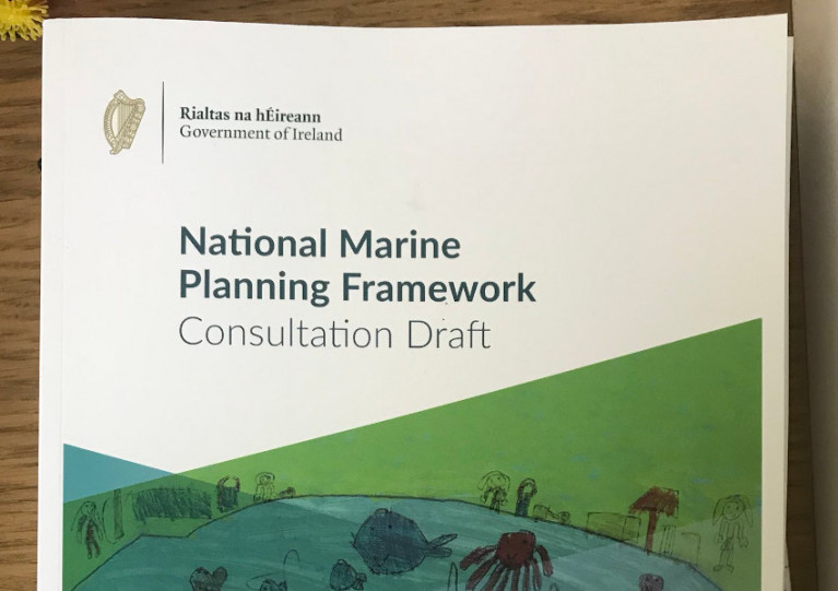
These environmental targets form part of the National Marine Planning Framework and through its implementation aim to ensure that human activity is at sustainable levels and that the ecosystem is protected.
One measure, which is specifically required under the directive, is the development of Marine Protected Areas (MPAs). Stand-alone legislation to enable the identification, designation and management of MPAs in accordance with Ireland’s national and international commitments is ongoing.
The Department of Housing, Local Government and Heritage is inviting consultation on the revision of the PoM to give everyone the chance propose new measures to sustain and improve the health of our seas.
Their online survey can be found HERE and the deadline for submissions is 5pm on Friday 20 May 20.
The full notice for this public consultation can be found on the Gov.ie website HERE.
Ireland’s ‘First Marine Spatial Planning Portal’ Website Goes Live
Ireland’s “first marine spatial planning portal” is now live at MarinePlan.ie.
The site links planning within the maritime area and the relevant policies for each marine sector or activity listed in the National Marine Planning Framework.
It covers three main areas, with maps for activities and policies as well as a list of activities in greater detail. There is also an information page showing all Government departments and agencies with a role in the maritime area.
The Activities Map will display marine activities which can be activated layer by layer by clicking the eye icon.
Users can learn more about the Environmental, Economic and Social sections of the framework’s overarching marine planning policies in the Activities section. Here users can also find more information about each sector or activity in the plan’s Key Sectoral/Activity Policies.
The Policies Map allows users to draw a shape on the map to select an area of interest and the relevant framework policies will be displayed. These can then be expanded to show the full policy wording or explored in more detail using the “More Info” link.
More information on the National Marine Planning Framework can be found on Gov.ie.
Environmental Coalitions Call on Government to Give "Necessary" Dáil Time to Maritime Area Planning Bill
Two Irish environmental coalitions are calling on the Government to ensure the necessary Dáil Committee time is given to debating the new Maritime Area Planning Bill.
The Sustainable Water Network (SWAN) and the Environmental Pillar say that Ireland is “marching itself towards widespread obstacles for renewable energy, longstanding depleted marine habitats and compromised coastal communities if it does not immediately change course”.
The MAP Bill, as it is known, is due to begin the committee stage in the Dáil this week, and over 300 amendments have been tabled, they state.
The long-awaited legislation aims to create a new planning and consent system for marine development.
The overall structure was provided by the National Marine Planning Framework (NMPF) approved earlier this year.
“If the Government railroad this legislation through as is, space for offshore renewables allocation will proceed ahead of the much-needed designation of Marine Protected Areas (MPAs),” SWAN and the Environmental Pillar state in a joint statement.
“ This means areas that need protection, including our most vulnerable areas, may not be adequately designated, and offshore renewables could be planned for development in environmentally unsuitable areas,” they say.
In our new marine planning system safeguards for our marine environment are missing ?
— SWAN (@swanireland) October 21, 2021
And without meeting our environmental obligations we could face delays to offshore renewables ?
Share this video if you share our concerns.@DarraghOBrienTD @noonan_malcolm @EamonRyan pic.twitter.com/JTObnF1TsZ
“ The result being that our vital offshore renewable developments and the health of our essential marine environment will both be put at risk at a time where we cannot afford to do so, “they add.
“Beyond our moral obligations to our marine environment, we are legally obligated to implement a network of MPAs in order to restore our oceans under the EU Maritime Spatial Planning Directive and the Marine Strategy Framework Directive,” the coalitions explain.
“ Failing to comply with these will have serious consequences, including litigation from non-compliance that will hinder the widespread and effective rollout of decarbonising our energy,” they say.
Birdwatch Ireland policy officer Fintan Kelly, who is part of the Environmental Pillar, said that a “huge amount of pressure in advancing the bill has been applied to facilitate the expansion of offshore renewables in order to meet the Government’s renewable energy targets for the end of the decade”.
“While we recognise the need for offshore renewables, we are concerned that without putting in place key safeguards, the Bill threatens to further degrade our marine environment at a time when we need to urgently restore the health and resilience of marine ecosystems,”he said.
“A short-sighted ‘land grab’ will threaten wildlife, but also our fishing communities that depend on healthy fish and shellfish populations to make a living,” he said.
“What's more, if we fail to address our legal obligations to protect and restore our marine environment, it will likely result in litigation that will delay much-needed offshore infrastructure and result in a lose-lose situation for all involved.
SWAN policy officer Ellen MacMahon said the Government “seems to be forgetting that Ireland was officially one of the first countries to recognise our environmental crisis”.
“The Dáil recognised both a climate and a biodiversity emergency in 2019 - that means both warrant the same degree of action and that neither is pursued at the expense of the other,” she said.
“Additionally, by protecting our oceans we are increasing the amount of carbon they can absorb. This ‘blue carbon’ is carbon that is captured and stored by seaweed and seagrass, seafloor sediment, and even by the wildlife that coast through our waters,” McMahon said.
“We are asking the Government to meet the standard of urgency it set two years ago for both of these emergencies and to make sure we lay a solid foundation now to have the best chance we can at a liveable future,” she said.
Marine Leisure stakeholders have welcomed the launch of the National Marine Planning Framework (NMPF) at Dun Laoghaire Harbour today by An Taoiseach Michéal Martin TD and fellow Ministers.
The plan is Ireland’s first national framework for managing marine activities.
The framework, which will apply to a maritime area of approximately 495,000km², outlines a vision for how we want to use, protect and enjoy our seas in the years up to 2040.
He launched the NMPF alongside Ministers Darragh O’Brien TD, Eamon Ryan TD and Peter Burke TD at the Commissioners for Irish Lights Headquarters in Dún Laoghaire.
The Taoiseach also confirmed the publication of the Maritime Area Planning Bill 2021, legislation to manage marine development, which was approved by Cabinet on 29 June.
LIVE: An Taoiseach @MichealMartinTD launches the National Marine Planning Framework & the Maritime Area Planning Bill in Dún Laoghaire, with @DarraghOBrienTD @peterburkefg and @EamonRyan #Marine2040 #marineplanning @MSP_Ireland @DeptHousingIRL @Dept_ECC https://t.co/S8aaXFWuKL
— MerrionStreet.ie (@merrionstreet) July 1, 2021
Speaking at the launch, the Taoiseach said: “As an island nation, Ireland has a special relationship with our coasts and seas.
“The Programme for Government has clear priorities for our maritime area – firstly to create a statutory marine spatial plan, and secondly to bring forward legislation for a new marine planning system.
 was launched at Dun Laoghaire Harbour") The National Marine Planning Framework (NMPF) was launched at Dun Laoghaire Harbour
The National Marine Planning Framework (NMPF) was launched at Dun Laoghaire Harbour
“I am delighted to officially launch Ireland’s first national Marine Spatial Plan, the National Marine Planning Framework. This provides us, for the first time in our history, with a proper long-term framework for the effective management of marine activities and more sustainable use of our marine resources. It enables us to set a clear direction for managing our seas, and to clarify environmental, economic and social priorities.”
 IMF Chairman Paal Janson represented the marine leisure sector on the Ministerial Stakeholder Advisory Group
"Today is an historic day for marine planning and governance in Ireland. After several years of hard work and much consultation, the National Marine Planning Framework legislation has finally been launched and put into practice", Paal Janson Chairman of the Irish Marine Federation told Afloat.
The IMF represented the marine leisure sector on the Ministerial Stakeholder Advisory Group in drawing up today's framework.
"Our voice has been heard and this is reflected in the published framework document. Our industry now looks forward to having the clarity and certainty which allows it to invest in infrastructure and jobs, where previously this was an unnecessarily complicated and uncertain procedure", Janson said.
Minister O’Brien will now bring the bill to the Oireachtas to seek enactment. This legislation is critical to ensuring Ireland meets its ambitious offshore renewable targets. The Bill, when enacted, will establish in law a new planning regime for the maritime area. It will replace existing State and development consent regimes and streamline arrangements on the basis of a single consent principle, i.e. one State consent (Maritime Area Consent) to enable occupation of the Maritime Area and one development consent (planning permission), with a single environmental assessment.
The NMPF contains a vision, objectives and planning policies for all marine-based human activities. It outlines how those activities will interact with each other in an increasingly pressured ocean space. It is the key decision-making tool for Government departments, State agencies, regulatory authorities and policy makers for decisions on marine activities up to 2040. Decisions will include planning applications as well as policies, projects and strategies. The Framework is a parallel document to the National Planning Framework, which guides terrestrial planning and development.
Commenting on the forthcoming Maritime Area Planning Bill, the Minister for Housing, Local Government and Heritage, Darragh O’Brien TD, said:
“My Department is leading an extensive marine management reform programme, the likes of which the State has never seen. The Maritime Area Planning Bill, which Cabinet has approved, is further evidence of this Government’s intent to modernise the State’s approach to marine management. It will represent a giant leap forward towards meeting our ambitious climate action goals and targets.”
Minister of State for Planning and Local Government, Peter Burke TD, who has specific responsibility for marine planning, said:
“The adoption of the NMPF marks an important Programme for Government milestone, delivering on the Government’s long-term commitment to protecting our seas for future generations. With such a diverse range of activities occurring within our marine area, the need for a coordinated and coherent approach to decision-making and governance cannot be emphasised enough.”
Minister for the Environment, Climate, Communications and Transport, Eamon Ryan TD, said:
“Ireland’s ocean area is home to an amazing array of marine life. Our offshore wind resources are also a wonderful opportunity for us to break free from fossil fuels and reach our ambitious climate goals. My department has been closely involved in the development of this framework and the related legislation, which will create a streamlined planning and consent regime. We are determined that as we develop our resources, we do so in a way that protects and restores our marine environment and its biodiversity. Additional legislation to follow on Marine Protected Areas will be crucial in helping us achieve that.”
The Minister for Agriculture, Food and the Marine, Charlie McConalogue TD, welcomed the Framework’s role in future development of fisheries and aquaculture licensing:
“As Minister for Agriculture, Food and the Marine, my Department is responsible for sea fishers and Aquaculture licensing. The seafood industry is an important long standing, pre-existing and traditional activity in the marine environment. Therefore, careful planning, including early consultation with and consideration of potential impacts on this sector will be essential to ensuring the ocean economy in all its forms can successfully co-exist and develop under the Plan. Staff from my Department have worked closely with staff in the Department of Housing, Local Government and Heritage on this plan and I look forward to working in future with the Department on the establishment of Project Ireland Marine 2040.”
The Minister for Tourism, Culture, Arts, Gaeltacht, Sport and Media, Catherine Martin TD, welcomed the NMPF’s launch:
“As Minister for Tourism I have a particular interest in how the NMPF will influence the shaping of our marine areas in the future. We all know how important our beaches and marine areas have been for people who have lived near them during the pandemic. Now, with restrictions lifting, more people are looking forward to getting back to the coastline and marine activities. I believe that the National Marine Planning Framework will play an important role in supporting the short-term recovery of tourism. With longer term planning it will have a positive impact on our most significant natural resource, our maritime area.”
The Minister for Public Expenditure and Reform, Michael McGrath TD, said:
“Project Ireland 2040 is the Government’s long-term overarching strategy to make Ireland a better country for all of its people. The National Development Plan and the National Planning Framework, which make up Project Ireland 2040, focus on terrestrial infrastructure. The addition of the National Marine Planning Framework sets out the policies for the sustainable development of our maritime area. This will support business and communities in our coastal areas and is of vital importance to Ireland’s recovery after the unprecedented impact of Covid-19.”
Commenting on the passing of the legislation for the National Marine Planning Framework (NMPF) by Dáil Eireann Dr Conor Norton, President of the Irish Planning Institute, described the legislation as “a game-changer for our maritime area.”
“The National Marine Planning Framework represents a comprehensive and integrated system for planning, protecting and managing Ireland’s extensive marine area, our coastal areas, ports and harbours. It provides the framework for the sustainable development of the many and growing range of activities and demands on the marine area, including offshore energy, marine transport, fisheries, tourism and aquaculture.”
Dr Norton added. “The NMPF provides a shared vision and strategy on which decisions on marine developments and activities can be more holistically and objectively assessed and reviewed. The passing of the legislation for the NMPF is a major milestone for planning in Ireland. It is the fruit of a broad and collaborative effort involving government, the various marine sectors and interests, professional bodies, scientists and communities. For the first time, we will benefit from an open and accessible planning system for our marine area, which is integrated with our established planning system.”
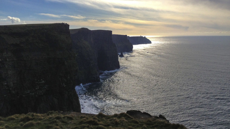
Marine planning is a process that brings together multiple users of the ocean to make informed and coordinated decisions about how to use marine resources sustainably. The National Marine Planning Framework (NMPF) is the first-ever plan for Ireland’s maritime area, setting out a 20-year vision of how we use, protect and enjoy our seas. Ireland’s maritime area is seven times the size of its landmass.
Planners have long argued that a cohesive and integrated marine and terrestrial spatial planning system is imperative for an island such as Ireland. The sustainable development of competing uses in the maritime environment will require balanced consideration in terms of the associated economic, environmental and social consequences. As Ireland seeks to reach its renewable energy targets use of significant offshore resources will be a major part of this.
Nonetheless, the Irish Planning Institute cautions that the National Marine Planning Framework will place significant resource demand on already over-stretched coastal Planning Authorities and An Bord Pleanála. The Irish Planning Institute is currently undertaking a major capacity study to analyse the capacity of professional planners across the planning system from planning consultancies to planning authorities and Regional Assemblies to meet the obligations of the National Planning Framework and the National Marine Planning Framework.
“Education and Continued Professional Development for Professional Planners will also be crucial to the successful implementation of this new Framework. The Institute will actively collaborate with Planning Schools and Employers of Planners to ensure its Members are equipped to deliver on the objectives of The National Marine Planning Framework,” Dr Norton concluded.
Political Storm Brews Over Marine Planning Framework Bill
Minister for Housing, Local Government and Heritage, Darragh O’Brien has been accused of “railroading” the National Marine Planning Framework through the Dáil without pre-legislative scrutiny, as The Irish Times reports.
Opposition TDs say that while they broadly support the framework — which will provide key guidance for planning within Ireland’s marine and coastal areas — they should have more time to scrutinise the 300-page document and explore two specific concerns.
One relates to the fact that the framework would be passed before Ireland’s expanded Marine Protected Area network is fully mapped out.
The other concerns fears among inshore fishing organisations that their livelihoods will be impacted by the development of large-scale offshore wind farms.
The Irish Times has much more on the story HERE.
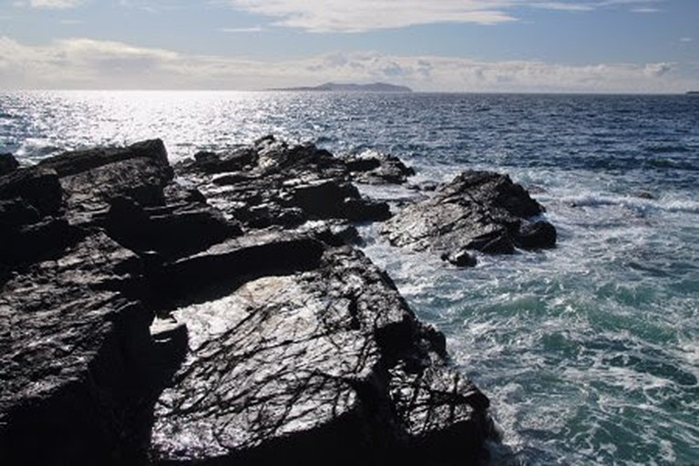
New Survey Asks Public To Share Views On Irish Seascapes
The people of Ireland are being invited to share their views on Irish coastal seascapes.
And the feedback gathered will inform Ireland’s Seascape Character Assessment Report, a key technical study for the National Marine Planning Framework.
The new survey follows an online poll this past summer to help classify and describe the essential character of Ireland’s coastal areas and communities.
The responses gathered have informed a draft assessment on which the Marine Institute is now seeking public input — from today, Wednesday 7 October, to Friday 30 October.
“Seascapes are very much about the relationship between people and place and how humans have settled and interacted in and along our coastline — from the earliest inhabitants on this island right up to today,” said Caitríona Nic Aonghusa, manager of marine spatial planning at the Marine Institute.
“By identifying, classifying and describing our seascape character in a holistic way, we can provide a baseline to better inform the planning and management of our seascapes.”
In addition to the public survey, a series of online workshops will be held for those interested in further discussion of the draft assessment.
These will take place next week, on Monday 12 October from 2pm–3pm and Tuesday 13 and Wednesday 14 October from 8pm–9pm. To attend any of these online workshops, email [email protected]
And to celebrate and raise awareness of International Landscape Day on Tuesday 20 October, the Marine Institute is also encouraging people across the island of Ireland to share photographs of seascapes on social media.
Post your photos of Ireland’s seascapes on that date on social media with #IrishSeascapes and tag the Marine Institute on Twitter or Facebook.
Online Survey To Help Classify Ireland’s Seascapes
A new online survey aims to deepen our understanding of Ireland’s ‘seascapes’.
Commissioned by the Marine Institute, the survey seeks responses from the public that will help identify classify and describe Ireland’s the essential character of Ireland’s coastal areas and communities.
The end results, including a final report and maps, will support the implementation of the National Marine Planning Framework.
“Seascapes are an important part of our sense of identity and culture,” the Marine Institute says. “Our experience of the character of seascapes includes coastal and marine history, folklore, art, nature and recreational and commercial activities that take place on and close to the sea.
“Seascapes can also include views from land to sea, from sea to land and along the coastline. When we describe seascape character, we are essentially talking about a sense of place — what makes one part of our sea and coast distinctive and different from another?
“Often this relates to natural influences such as the rock type, depth of sea and coastline, the force of the sea and how humans have settled and interacted in and along our seascapes – from the earliest inhabitants on this island right up to today.”
Minogue and Associates have been commissioned to carry out the study and get a better understanding of how Irish people value the coast and seas.
The short online survey aims to capture thoughts and comments about the seascapes that you are familiar with, and asks you to indicate on a map where these are. The survey is completely anonymous and the information will be used only to identify draft Seascape Character Areas.
Additionally, the research team hopes to facilitate small, online group-based discussions on the draft areas over the month of July, using online resources. Register your interest (name/interest/organisation) by emailing [email protected]

Due to the current situation regarding Covid-19, upcoming public events on the National Marine Planning Framework planned for Kinsale next Monday 23 March and Wexford on Tuesday 31 March have been cancelled.
Department of Housing, Planning and Local Government says its Marine Planning Policy and Development team are available via [email protected] to answer any queries in relation to the draft framework.
The closing date for the receipt of submissions for the public consultation on the draft remains 3pm on the Thursday 9 April.
Marine Spatial Planning Meetings Resume This Evening In Arklow
Public meetings to discuss marine spatial planning and the Government’s draft national framework resume this evening in Arklow, with a focus on offshore renewable energy.
The Arklow Bay Hotel will host the event from 6pm to 8pm, with speakers from the Department of Housing, Planning and Local Government; Department of Communications, Climate Action and Environmental; Sustainable Energy Authority of Ireland (SEAI); and Irish Wind Energy Association (IWEA).
The next event on the calendar is next Monday 17 February, at St Laurence’s in TU Dublin, Grangegorman from 11am to 1pm, with a focus on the marine environment.
Previously postponed events in Killybegs (on fisheries, LYIT School of Tourism), Kinsale (also fisheries, Kinsale Hotel & Spa) and Wexford town (ports and harbours, Wexford Town Library) have been rescheduled for Monday 2 March, Monday 23 March and Tuesday 31 March respectively, all from 6pm to 8pm.


 Michael Murphy Schull Harbour Sailing Club (SHSC), Eric Coogan Heineken Ireland, Mark Murphy, Commodore SHSC, Jack Allen SHSC, Carmel O'Regan SHSC, Cornelious Ndlovu, Schull Harbour Hotel Operations Manager and Derval Murphy SHSC")

