Menu

Ireland's sailing, boating & maritime magazine

Inland afloat headers


Displaying items by tag: RV Celtic Explorer

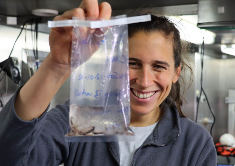
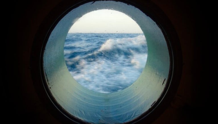
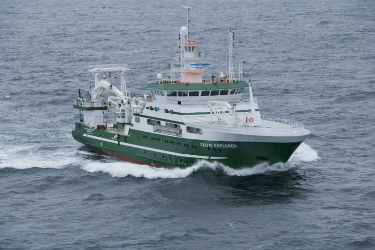
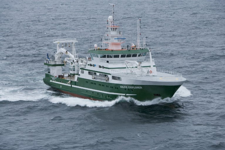
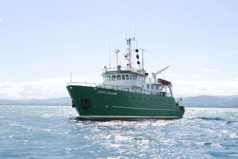
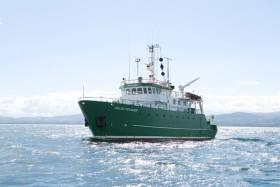
An Irish-led team of marine scientists on board the RV Celtic Explorer returns to Galway Harbour today (Wednesday 16 September) after more than three weeks investigating historic climate change in the Arctic region.

Scientists from NUI Galway, University of Southampton, University of Bremen and Bergen University had been capturing data in the Nordic and Greenland Seas as part of the CIAAN survey (Constraining the Impact of Arctic Amplification in the Nordic Sea: A biogeochemical approach).

This survey aims to provide new insight into how essential climate variables are recorded in geologic archives.

Assessing the impact and magnitude of past (pre-industrial) climate changes is critical to further our understanding of how the climate system will respond to a rapidly changing Arctic ecosystem, the scientists explain.

‘One of the key challenges in climate change science is assessing the magnitude of future climate change’

Lead scientist Dr Audrey Morley, from the School of Geography and Archaeology at NUI Galway, says: “One of the key challenges in climate change science is assessing the magnitude of future climate change, due to our short observational records which are limited to the past 150 years.

“Our research is unique, as we are not only observing modern essential climate variables, but we will also look into the past to assess how essential climate variables have evolved since before pre-industrial conditions.

“This long-term perspective is crucial and will help us to better understand our environment and the environmental consequences of human activities.”

Dr Morley notes that the Arctic is an especially sensitive and vulnerable environment with regards to contemporary climate change.

“The North Atlantic and Nordic Seas are a key region for the formation of North Atlantic deepwater and the uptake of atmospheric carbon dioxide. Whether or not this region will remain a carbon sink during rapidly warming climates is a question that remains to be answered,” she says.

As part of this research survey, the RV Celtic Explorer travelled to 79 degrees north in the Greenland Sea, which is the highest latitude reached by the marine research vessel.

‘The RV Celtic Explorer is crucial to facilitate this type of international research’

In order to operate in the Arctic region, the RV Celtic Explorer was required to obtain a Polar Code Certification — becoming the first Irish vessel to achieve this status, which greatly increases its ocean research capabilities.

“The RV Celtic Explorer is crucial to facilitate this type of international research,” says Marine Institute chief executive Dr Paul Connolly.

“This research in the Arctic region will deepen our knowledge of the region and will improve models that can forecast changes to our oceans and climate. This will inform effective policy and management decisions to meet the challenges posed by climate change.”

Published in Marine Science

An art project involving multiple collaborators and many years in the making will soon invite the public to connect, both in person and online, with one of the last unknown spaces on earth — the ocean wilderness.

Aerial/Sparks was created by artist Louise Manifold as part of Galway’s European Capital of Culture programme for 2020, as previously reported on Afloat.ie.

Manifold brought together seven artists, writers and composers from across Europe who produced a series of standalone artworks for exhibition and radio broadcast, inspired by their experiences on research expeditions aoard the Marine Institute’s RV Celtic Explorer.

Inis Oírr, the smallest of the Aran Islands and with a deep-rooted maritime culture, is the setting for the Aerial/Sparks Art Trail from 11-27 September.

At just 3km long by 3km wide, the island can easily be traversed by foot to discover sound works housed in a lighthouse, the local church, an old handball alley and Áras Éanna, Europe’s most westerly arts centre.

Louise Manifold created Aerial/Sparks to explore the potential of radio communication to reimagine our relationship with the ocean

‘Garden Galway’ — a virtual programme of events for Ars Electronica 2020, the world-renowned festival for art, technology and society — will accompany the main exhibition from 9-13 September, and will include a series of conversations between artists and marine science experts.

Manifold created Aerial/Sparks to explore the potential of radio communication to reimagine our relationship with the ocean.

And each artist’s experience of ocean and water masses around Ireland and Europe has informed the production of individual works for audio and radio listening.

Highlights include author Kevin Barry’s ‘Island Time’, a monologue in nine chapters for a lovelorn lighthouse keeper as he dreams of distant lands, sited at Inis Oírr Lighthouse.

German composer David Stalling’s ‘Palace of Ships’ was created in collaboration with seismologist Sergei Lebedev, while visual artist Carol Anne Connolly’s acoustic portrayals of the ocean were inspired by the use of sound waves in acoustic mapping to create visuals of the sea bed.

Meanwhile, UK radio artist Magz Hall’s ‘Waves of Resistance’ is a broadcast created in the spirit of transnationalism, relaying a message of peace, hope and unity across all borders.

Manifold says Inis Oírr is the ideal home for these sound works.

“I wanted to find a place more than a space for this presentation, a place rich with silence, where organic and human sound floats and carries through the wind,” she explains. “I wanted each work to be experienced in a way that would connect with and charge our experience of place.”

Aerial/Sparks is the result of a long-term collaboration with the Marine Institute. Since 2017, artists from Ireland, Germany, England and Slovenia have taken part in seven ocean surveys and a passage from Galway to Hamburg on the RV Celtic Explorer, which the institute says is one of the few marine research vessels with sonic capabilities.

‘An innovative opportunity for artists and marine scientists to connect and engage with the wider community’

These expeditions have opened up "unique opportunities to foster connections between art and science", the Marine Institute says, as artists work side-by-side with scientists monitoring our marine biodiversity and human impact on the ocean environment.

“The collaboration between the Marine Institute and Aerial/Sparks has created an innovative opportunity for artists and marine scientists to connect and engage with the wider community through mediums such as art and music,” says Marine Institute chief executive Dr Paul Connolly.

“Using the concept of sound and the sea is a unique way of showing how both the arts and sciences can come together to highlight the value, opportunities and societal benefits of our ocean.”

Marilyn Gaughan Reddan, head of programme at Galway European Capital of Culture 2020, added: "Aerial/Sparks is a notable example of what a European Capital of Culture can bolster — new ways of thinking, new ways of working, new conversations and new partnerships.”

The Inis Oírr exhibition will be open from 11-27 September, Wednesday to Sunday between 11am and 5pm. For more information visit aerialsparks.org

Published in Marine Science

Surface ocean carbon dioxide observations collected by the Marine Institute’s RV Celtic Explorer have been published in the 2020 version of the Surface Ocean Carbon Atlas (SOCAT).

These data provide scientists, climate researchers and international policy makers with essential information on ocean carbon dioxide measurements.

About 36 billion tonnes of carbon dioxide are added to the atmosphere each year as a result of human activities. The ocean absorbs about one-quarter of these emissions, which helps to slow down climate change by removing CO2 from the atmosphere.

However, absorbing additional CO2 increases the acidity of seawater. This process is known as ocean acidification, and it could have dramatic consequences for marine life.

The impacts of ocean acidification would extend up the food chain, threatening food security for millions of people

If sea water is too acidic, it can make it difficult for marine organisms such as coral, oysters and mussels to form shells and skeletons.

Ocean acidification may impact some plankton species, which form the base of marine food webs and would impact larger animals like fish and whales.

The impacts of ocean acidification would extend up the food chain, affecting fisheries and aquaculture, threatening food security for millions of people, as well as the tourism industry.

Ocean acidification is a global problem. The European Union has committed to cut its greenhouse gas emissions by at least 40% below 1990 levels by 2030 and aims to be climate-neutral — an economy with net-zero greenhouse gas emissions — by 2050.

To understand the Earth’s changing climate, it is essential to collect high-quality data on surface ocean CO2 levels.

Since 2017, the Marine institute has been measuring dissolved carbon dioxide (pCO2) in Irish and Atlantic surface waters using a General Oceanics pCO2 system on board the RV Celtic Explorer. This system enables near-continuous and high-accuracy carbon dioxide measurements in surface water and the atmosphere when the vessel is at sea.

The close collaboration between the Marine Institute and P&O Maritime Services, with support from GEOMAR in Germany, has resulted in the successful collection of this data.

SOCAT has become a milestone in research co-ordination, data access, climate research and in informing policy

The high-quality measurements of CO2 collected by the Marine Institute are now included in the 2020 version of the Surface Ocean Carbon Atlas (SOCAT) and fill “a notable data gap”, according to the Irish State agency for marine research.

The Marine Institute submitted data from nine surveys in 2017 and a further 15 surveys in 2018 to SOCAT, whose data set os used globally by climate researchers and contribute to the work of the Intergovernmental Panel on Climate Change (IPCC).

SOCAT has become a milestone in research co-ordination, data access, climate research and in informing policy, the Marine Institute says.

And this work further contributes to collaborative research on ocean carbon and acidification undertaken over the last decade by the institute and NUI Galway.

Margot Cronin, chemist at the Marine Institute, said: “Measuring carbon dioxide in Irish and Atlantic waters provides essential data that increases the understanding of our oceans and climate.

“The Marine Institute is contributing to global science, providing advanced scientific knowledge which will help inform policy and our response to a changing ocean.”

As previously reported on Afloat.ie, the Marine Institute’s latest Oceans of Learning series focuses on our changing ocean climate with videos, interactive activities and downloadable resources.

Published in Marine Science

The first and second leg of 2020’s Irish Anglerfish and Megrim Survey will be carried out from next weekend off the West, South West and South Coasts of Ireland by the Marine Institute, in fulfilment of Ireland’s Common Fisheries Policy obligations.

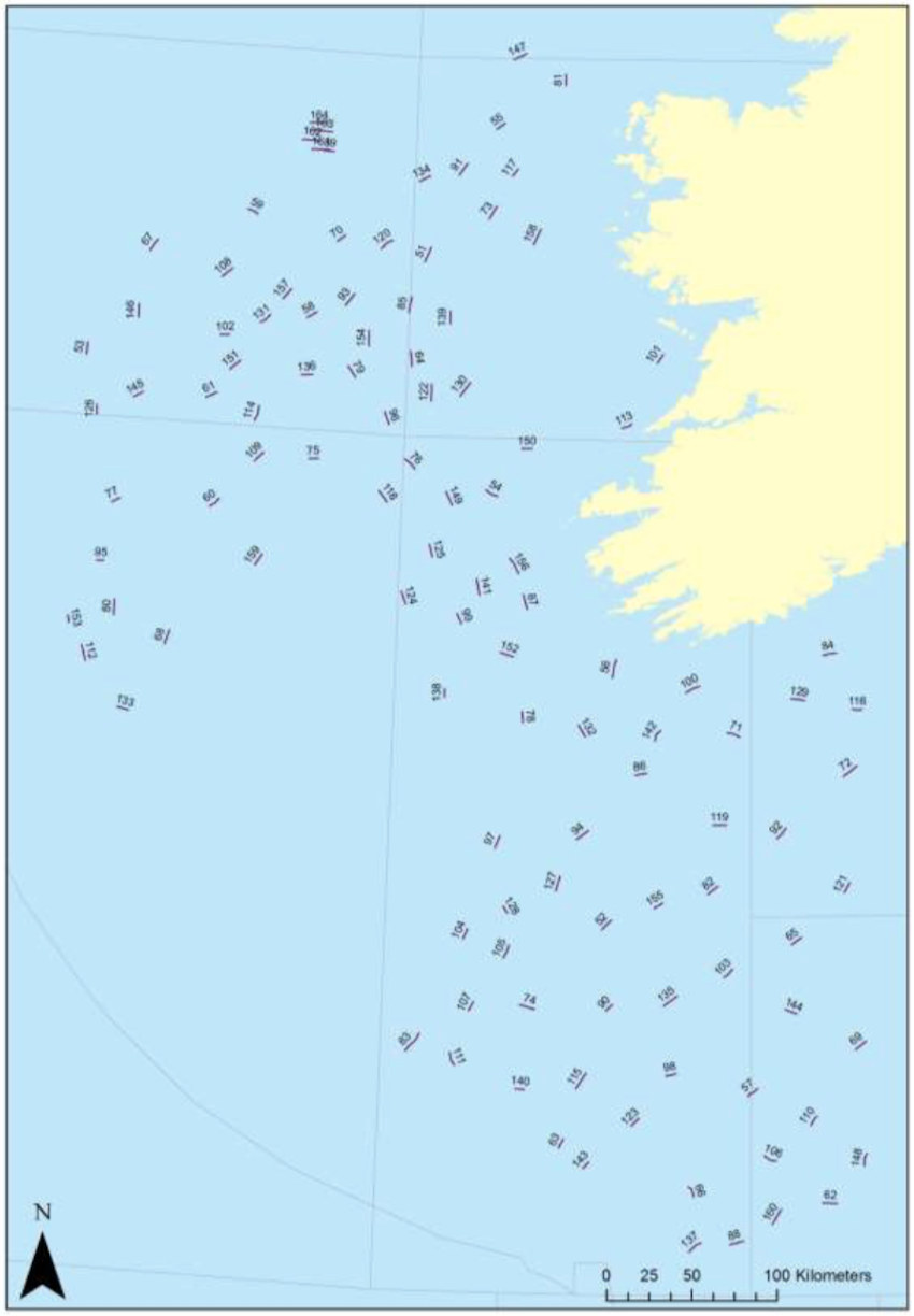
As with previous years, IAMS 2020 — which will run from Sunday 23 February to Wednesday 18 March — is a demersal trawl survey consisting of approximately 110 otter trawls (60 minutes) in ICES areas 7b, 7c, 7g, 7h, 7j and 7k.

The survey will be conducted by the RV Celtic Explorer (Callsign: EIGB) which will be towing a Jackson demersal trawl during fishing operations and will display appropriate lights and signals.

Commercial fishing and other marine operators are requested to keep a three-nautical-mile radius area around the tow points (indicated below) clear of any gear or apparatus during the survey period outlined above.

Further details of the survey, including co-ordinates of the survey stations, are included in Marine Notice No 07 of 2020, a PDF of which is available to read or download HERE.

IAMS 2020 survey stations

Published in Fishing

The Marine Institute in collaboration with the Strategic Marine Alliance for Research and Training (SMART) is offering 22 bursaries on dedicated FEAS surveys throughout 2020 on the RV Celtic Explorer and RV Celtic Voyager.

Bursaries include groundfish, acoustic and underwater TV surveys (UWTV) on 13 survey legs between February and December of this year on the shelf waters of the Irish EEZ.

Successful applicants will receive a Student at Sea Bursary at a fixed rate of €95 per survey night.

Participants will receive hands-on training in data collection and sampling techniques, be fully integrated into the survey work programme and make an important contribution to achieving the survey goals for marine science.

In so doing they will gain valuable sea going experience and assist the Marine Institute in building the necessary capacity for offshore research and monitoring.

Applicants should be marine-oriented graduates, postgraduates, researchers or practitioners in marine-oriented enterprises. They must hold current ENG11 medical and Personal Survival Techniques (PST STCW95) certificates, and should have some prior sea-going experience.

Further information on the available bursaries can be found on the SMART website, which also has details of the online application process.

Published in Marine Science

TV documentary Ireland’s Deep Atlantic will feature in new online classroom resources for Junior Cert students, it has been announced.

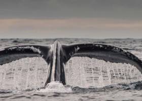
Ireland’s Deep Atlantic — produced by Sea Fever Productions and supported by the Marine Institute, BAI and the Environmental Protection Agency — sees filmmaker Ken O'Sullivan embark on a series of voyages in the North Atlantic in search of blue whales, sharks and deep-water coral reefs.

O’Sullivan filmed part of the series on board the Marine Institute’s research vessel the RV Celtic Explorer and documented coral reefs at a depth of 3,000 metres using the ROV Holland 1.

The series joins two other Irish-produced and publicly funded TV programmes used to create the new online classroom resources.

Business Studies students will use the series, including video clips of the RV Celtic Explorer and scientists, to learn about consumer behaviour and sustainable development, and the impact of economic growth on society and the environment.

Geography students, meanwhile, will learn about the ‘Real Map of Ireland’ and the importance of Ireland's ocean territory. The students will also learn about the exploitation of water, fish stocks, forestry, and soil and the relationships between the physical world, tourism and transport.

Ken O’Sullivan welcomed the new resources, saying: “It’s just wonderful now to realise that every teenager in Ireland will see our beautiful, fertile oceans and learn not just about the rich life within them, but the impact of human behaviour on our oceans with things like consumer spending habits, marine plastics and also the value of eco-tourism to coastal communities.

“Ireland’s Deep Atlantic is the first documentary to be used in this way and the platform has now been built for RTÉ to host many more publicly funded documentaries in this way for the secondary school education curriculum.”

Teachers and students can access the educational material and the programme clips referenced from the RTÉ Learn website.

Published in Marine Science

The annual Irish Groundfish Survey (IGFS 2019) will take place off the North, West and South Coasts for six weeks from 31 October.

Carried out by the Marine Institute, the IGFS is a demersal trawl survey consisting of around 170 fishing hauls, each of of 30 minutes’ duration, in ICES areas VIa, VIIb, VIIg and VIIj.

As part of the requirements for the 2019 survey, fishing will take place within a 2-nautical-mile radius of indicated positions.

The survey will be conducted by the RV Celtic Explorer (callsign EIGB) which will display appropriate lights and signals.

The vessel will be towing a high headline GOV 36/47 demersal trawl during fishing operations.

IGFS 2019

Co-ordinates and approximate locations of these hauls are included in Marine Notice No 47 of 2019, a PDF of which is available to read or download HERE.

The Marine Institute requests that commercial fishing and other marine operators keep a 2nm area around the tow mid-points clear of any gear or apparatus during the survey period between Thursday 31 October and Friday 14 December.

This survey follows the annual Irish Anglerfish and Megrim Survey which was conducted off the West South West and South Coasts in March.

Published in Fishing

Marine scientists from University College Cork have discovered plastic at the bottom of a deep submarine canyon while investigating cold-water coral habitats.

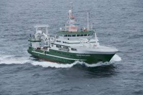
UCC’s Marine Geology Research Group has been investigating cold-water coral habitats in the Porcupine Bank Canyon, some 320km due west of Dingle, on a research expedition led by UCC’s Dr Aaron Lim on board the Marine Institute’s RV Celtic Explorer.

The team had recovered eight novel monitoring stations, called ‘landers’, worth €450,000 and deployed between 700m and 2500m water depth by the Marine Institute’s Remotely Operated Vehicle (ROV) Holland 1 earlier this summer.

The monitoring stations record the speed, temperatures and direction of the currents around these habitats as well as trapping samples of the food, sediments and microplastic being deposited around the corals, to understand conditions and how the corals are coping with changing oceans.

The researchers found plastic in the bottom of one canyon at 2,125m water depth — as deep as ten Eiffel Towers stacked on top of one another.

The reach of human plastic waste is now confirmed as this deep, even 320km offshore.

“It’s always sad to see plastic rubbish in these otherwise pristine habitats. It’s quite incredible that our plastic waste can get this far out and so deep in the oceans,” said Professor Andy Wheeler of UCC, who has pioneered research on cold-water coral mounds offshore of Ireland over the past 20 years.

“I don’t think people think about this when that dump their rubbish. We’re also trying to see if microplastics are being fed to the corals from above. We’ve just got the samples; let’s hope we're wrong.”

“ROVROV Holland 1 recovering one of the monitoring stations | Photo: UCC

The Porcupine Bank Canyon is teeming with a whole range of cold-water coral habitats, just on Ireland’s doorstep, says Dr Lim.

“The environment is much more dynamic than we thought, with two of the monitoring stations knocked over by the currents; food supply for the coral is variable but the corals are doing okay.

“Some of these habitats have existed for millions of years and have grown so large they resemble hills made of coral, called coral mounds.

“This is the first time eight of these monitoring stations have been deployed and collected using the ROV Holland 1. It will provide scientists with an insight into the processes affecting these cold-water coral habitats, food sources and the impact of microplastics.”

Dr Lim said Ireland’s cold-water coral reefs are found in the cold, dark ocean at water depths of 600m to 1,000m along our continental margin.

“Not only is this expedition vital for understanding these habitats and our impact upon them, it also acts as a baseline to start monitoring how our deep-water habitats here are changing,” he added.

The team has a research agenda which will see them return to the canyon and other habitats alike for a number of years, to monitor the changes in the environment around these habitats. The monitoring stations will be brought back to UCC for detailed analyses.

This research survey is carried out with the support of the Marine Institute, funded under the Marine Research Programme 2014-2020 by the Government to support and promote the Atlantic Ocean Research Alliance, which facilitates common research and knowledge exchange for us to provide healthy, resilient oceans for our future generations.

The survey has also received funding from Science Foundation Ireland, Geological Survey Ireland and UCC.

Published in Marine Science

A shark species previously unrecorded in Irish waters has been sighted in the Celtic Sea.

A smooth hammerhead shark was reported on the edge of the continental shelf, south-west of Ireland, during a recent fisheries survey on the Marine Institute’s RV Celtic Explorer.

The sighting was made by experienced marine mammal observer John Power and bird observer Paul Connaughton during the Marine Institute’s Western European Shelf Pelagic Acoustic Survey (WESPAS).

“While scanning the ocean surface, we sighted a dorsal fin unlike anything we had encountered before,” said Power.

“It was quite different to the fins seen on basking sharks and blue sharks. After consulting available ID keys, we agreed that the shark must be a smooth hammerhead.”

The large, tall and slender dorsal fin of the smooth hammerhead shark distinguishes it from other shark species. The smooth hammerhead also has a single-notch in the centre of its rounded head and is up to four metres in length.

The species gives birth to live young and the pups are usually found in the shallow sandy waters near Florida, the Caribbean and West Africa. However, the species has been recorded as far north as England and Wales.

The smooth hammerhead was sighted during the WESPAS survey, which surveys the waters from France to Scotland and the West of Ireland each year.

Marine scientists collect acoustic and biological data on herring, boarfish and horse mackerel, which is used to provide an independent measure of these fish stocks in Irish waters. Scientists also monitor plankton, sea birds and marine mammals during this survey.

This is an exciting encounter, especially since a rare deep-water shark nursery was discovered by Irish scientists last year

Dr Paul Connolly, director of fisheries and ecosystems services at the Marine Institute, said: “Our Irish waters support a range of marine life and diverse ecosystems, including 35 known species of sharks.

“This is an exciting encounter, especially since a rare deep-water shark nursery, 200 miles west of Ireland, was discovered by Irish scientists last year using the Marine Institute's Remotely Operated Vehicle [ROV Holland 1].”

He added: “This sighting of a new shark species shows the importance of our fishery surveys to monitor our marine environment, and to observe changes in our oceans and marine ecosystems.

“Observing and understanding a changing ocean, is essential for protecting and managing our marine ecosystems for the future.”

The hammerhead shark poses little risk to humans, and there have been no known fatalities from hammerhead sharks anywhere in the world to date.

The species is listed as Vulnerable on the International Union for Conservation of Nature (IUCN) Red List of Threatened Species, and is being increasingly targeted for the shark fin trade as its large fins are highly valued.

Thirty-five species of sharks have been recorded in Irish waters, including the blue shark, porbeagle shark, lesser spotted dogfish and the second-largest shark in the world, the basking shark — a regular visitor inshore during the summer months.

Published in Sharks

The first in a series of hydrographic and geophysical surveys to be undertaken in the Celtic Sea and Atlantic Ocean under the INFOMAR programme between April and October 2019 is now under way.

The RV Celtic Voyager (callsign EIQN) set off on Friday 12 April for an 18-day survey, the first of four over the next five months 18 May-6 June, 12-28 July, 29 August-14 September).

The RV Celtic Explorer (callsign EIGB) will follow up with an 18-day survey from 21 September to 8 October. Both vessels will be towing a magnetometer sensor with a single cable of up to 200 metres in length.

Other survey vessel involved include the Geological Survey Ireland vessels RV Keary (callsign EI-GO-9), RV Geo (callsign EI-DK-6), RV Mallet (callsign EI-SN-9) and RV Lir (callsign EI-HI-2).

All will display appropriate lights and markers and will be listening on VHF Channel 16 throughout the course of the surveys.

Full details of the survey areas are included in Marine Notice No 8 of 2019, a PDF of which is available to read or download HERE.

Published in Marine Science
Page 3 of 8

General Information on using Waterways Ireland inland navigations

Safety on the Water

All users of the navigations are strongly recommended to make themselves aware of safety on the water for whatever activity they are involved in and to read the advice offered by the various governing bodies and by:

The Dept. of Transport, Ireland: www.gov.ie/transport and The Maritime and Coastguard Agency, UK, The RNLI – Water Safety Ireland for information in terms of drowning prevention and water safety.

Registration of Vessels

All vessels using the Shannon Navigation, which includes the Shannon-Erne Waterways and the Erne System must be registered with Waterways Ireland. Only open undecked boats with an engine of 15 horsepower or less on the Shannon Navigation, and vessels of 10 horsepower or less on the Erne System, are exempt. Registration is free of charge.

Craft registration should be completed online at: https://www.waterwaysireland.org/online-services/craft-registration

Permits for use of the Grand and Royal Canals and the Barrow Navigation

All vessels using the Grand and Royal Canals and the Barrow Navigation must display appropriate valid Permit(s) i.e A Combined Mooring and Passage Permit (€126) and if not intending to move every five days, an Extended Mooring Permit (€152).

Permit applications should be completed online at: https://www.waterwaysireland.org/online-services/canal-permits

Passage on the Royal and Grand Canals – Dublin Area

For boat passage through the locks east of Lock 12 into / out of Dublin on either the Royal or Grand Canals, Masters are requested to contact the Waterways Ireland Eastern Regional Office (M-F 9.30am-4.30pm) on tel: +353(0)1 868 0148 or email [email protected] prior to making passage in order to plan the necessary lock-keeping assistance arrangements.

On the Grand Canal a minimum of two days notice prior to the planned passage should be given, masters should note that with the exception of pre-arranged events, a maximum of 2 boats per day will be taken through the locks, travelling either east or west.

Movements in or out of the city will be organised by prior arrangement to take place as a single movement in one day. Boaters will be facilitated to travel the system if their passage is considered to be safe by Waterways Ireland and they have the valid permit(s) for mooring and passage.

Newcomen Lifting Bridge

On the Royal Canal two weeks’ notice of bridge passage (Newcomen Lifting Bridge) is required for the pre-set lift date, and lock assistance will then also be arranged. A minimum of 2 boats is required for a bridge lift to go ahead.

Waterways Ireland Eastern Regional Office (Tel: +353(0)1 868 0148 or [email protected] ) is the point of contact for the bridge lift.

A maximum number of boats passing will be implemented to keep to the times given above for the planned lifts (16 for the Sat / Sun lifts & 8 for the weekday lifts). Priority will be given on a first come first served basis.

On day of lift, boaters and passengers must follow guidance from Waterways Ireland staff about sequence of passage under bridge & through Lock 1, and must remain within signed and designated areas.

Events Held on the Waterways

All organised events taking place on the waterways must have the prior approval of Waterways Ireland. This is a twelve week process and application forms must be accompanied with the appropriate insurance, signed indemnity and risk assessment. The application should be completed on the Waterways Ireland events page at :

https://www.waterwaysireland.org/online-services/event-approval

Time Limits on Mooring in Public Harbours

On the Shannon Navigation and the Shannon-Erne Waterway craft may berth in public harbours for five consecutive days or a total of seven days in any one month.

On the Erne System, revised Bye Laws state that: No master or owner shall permit a vessel, boat or any floating or sunken object to remain moored at or in the vicinity of any public mooring, including mooring at any other public mooring within 3 kilometres of that location, for more than 3 consecutive days and shall not moor at that same mooring or any other public mooring within 3 kilometres of that location within the following 3 consecutive days without prior permission by an authorised official.

Winter Mooring on the Shannon Navigation and Shannon Erne Waterway

Winter mooring may be availed of by owners during the period 1 Nov to 31 Mar by prior arrangement and payment of a charge of €63.50 per craft. Craft not availing of Winter Mooring must continue to comply with the “5 Day Rule”. Winter Mooring applications should be completed online at : https://www.waterwaysireland.org/online-services/winter-moorings-booking

Owners should be aware that electricity supply and water supply to public moorings is disconnected for the winter months. This is to protect against frost damage, to reduce running costs and to minimise maintenance requirements during the winter months.

Vessel owners are advised that advance purchasing of electricity on the power bollards leading up to the disconnection date should be minimal. Electricity credit existing on the bollards will not be recoverable after the winter decommissioning date. Both services will be reinstated prior to the commencement of the next boating season.

Smart Cards

Waterways Ireland smart cards are used to operate locks on the Shannon Erne Waterway, to access the service blocks, to use the pump-outs along the navigations, to avail of electrical power at Waterways Ireland jetties.

Berthing in Public Harbours

Masters are reminded of the following:

  • Equip their vessel with mooring lines of appropriate length and strength and only secure their craft to mooring bollards and cleats provided for this purpose.
  • Ensure the available berth is suitable to the length of your vessel, do not overhang the mooring especially on finger moorings on floating pontoon moorings.
  • Ensure mooring lines, electric cables and fresh water hoses do not create a trip hazard on public jetties for others users.
  • Carry sufficient fenders to prevent damage to your own vessel, other vessels and WI property.
  • Allow sufficient space between your vessel and the vessel ahead /astern (c.1m) for fire safety purposes and /or to recover somebody from the water.
  • Do not berth more than two vessels side by side and ensure there is safe access/egress at all times between vessels and onto the harbour itself.
  • Do not berth in such a way to prevent use of harbour safety ladders, slipways or pump-outs.
  • Do not allow the bow of your vessel to overhang the walkway of a floating mooring thus creating a hazard for others with an overhanging anchor or bow fendering.
  • Animals are not allowed to be loose or stray at any time.
  • Harbour and jetty infrastructure such as railings, power pedestals, fresh water taps, electric light poles, safety bollards, ladders etc are not designed for the purpose of mooring craft , they will not bear the strain of a vessel and will be damaged.
  • At Carrybridge on the Erne System, Masters of vessels are not permitted to use stern on mooring. Masters of vessels must use the mooring fingers for mooring of vessels and for embarkation / disembarkation from vessels.

Passenger Vessel Berths

Masters of vessels should not berth on passenger vessel berths where it is indicated that an arrival is imminent. Passenger vessels plying the navigations generally only occupy the berths to embark and disembark passengers and rarely remain on the berths for extended periods or overnight.

Lock Lead-in Jetties

Lead-in jetties adjacent to the upstream and downstream gates at lock chambers are solely for the purpose of craft waiting to use the lock and should not be used for long term berthing.

Vessel Wake

Vessel wake, that is, the wave generated by the passage of the boat through the water, can sometimes be large, powerful and destructive depending on the hull shape and engine power of the vessel. This wake can be detrimental to other users of the navigation when it strikes their craft or inundates the shoreline or riverbank. Masters are requested to frequently look behind and check the effect of their wake / wash particularly when passing moored vessels, on entering harbours and approaching jetties and to be aware of people pursuing other activities such as fishing on the riverbank.

Speed Restriction

A vessel or boat shall not be navigated on the Shannon Navigation at a speed in excess of 5 kph when within 200 metres of a bridge, quay, jetty or wharf, when in a harbour or canal or when passing within 100 metres of a moored vessel or boat.

Vessels navigating the Shannon-Erne Waterway should observe the general 5 kph speed limit which applies along the waterway. This is necessary in order to prevent damage to the banks caused by excessive wash from vessels.

Vessels navigating the Erne System should observe the statutory 5kt / 6mph / 10kph speed limit areas.

A craft on the Royal and Grand canals shall not be navigated at a speed in excess of 6km per hour.

A craft on the Barrow Navigation shall not be navigated at a speed in excess of 11km per hour except as necessary for safe navigation in conditions of fast flow.

Bank Erosion

Narrow sections of all the navigations are particularly prone to bank erosion due to the large wash generated by some craft. Masters are requested to be vigilant and to slow down to a speed sufficient to maintain steerage when they observe the wash of their craft inundating the river banks.

Unusual Waterborne Activity

Unusual waterborne vessels may be encountered from time to time, such as, hovercraft or amphibious aircraft / seaplanes. Masters of such craft are reminded to apply the normal “Rule of the Road” when they meet conventional craft on the water and to allow extra room to manoeuvre in the interest of safety.

Sailing Activity

Mariners will encounter large numbers of sailing dinghies from late June to August in the vicinity of Lough Derg, Lough Ree and Lower Lough Erne. Sailing courses are marked by yellow buoys to suit weather conditions on the day. Vessels should proceed at slow speed and with due caution and observe the rules of navigation when passing these fleets, as many of the participants are junior sailors under training.

Rowing

Mariners should expect to meet canoes and vessels under oars on any part of the navigations, but more so in the vicinity of Athlone, Carrick-on-Shannon, Coleraine, Enniskillen and Limerick. Masters are reminded to proceed at slow speed and especially to reduce their wash to a minimum when passing these craft as they can be easily upset and swamped due to their very low freeboard and always be prepared to give way in any given traffic situation.

Canoeing

Canoeing is an adventure sport and participants are strongly recommended to seek the advice of the sport’s governing bodies i.e Canoeing Ireland and the Canoe Association of Northern Ireland, before venturing onto the navigations.

Persons in charge of canoes are reminded of the inherent danger to these craft associated with operating close to weirs, sluice gates, locks and other infrastructure particularly when rivers are in flood and large volumes of water are moving through the navigations due to general flood conditions or very heavy localised precipitation e.g. turbulent and broken water, stopper waves. Shooting weirs is prohibited without prior permission of Waterways Ireland.

Canoeists should check with lockkeepers prior entering a lock to ensure passage is done in a safe manner. Portage is required at all unmanned locks.

Canoe Trail Network – "Blueways"

Masters of powered craft are reminded that a canoe trail network is being developed across all navigations and to expect more organised canoeing along these trails necessitating slow speed and minimum wash when encountering canoeists, rowing boats etc

Rockingham and Drummans Island Canals – Lough Key

It is expected that work on Rockingham and Drummans Island Canals on Lough Key will be completed in 2021. Access to these canals will be for non-powered craft only, eg canoes, kayaks, rowing boats.

Fast Powerboats and Personal Watercraft (Jet Skis)

Masters of Fast Powerboats (speed greater than 17kts) and Personal Watercraft (i.e.Jet Skis) are reminded of the inherent dangers associated with high speed on the water and especially in the confines of small bays and narrow sections of the navigations. Keeping a proper look-out, making early alterations to course and /or reducing speed will avoid conflict with slower vessels using the navigation. Personal Watercraft are not permitted to be used on the canals.

Towing Waterskiers, Wakeboarders, Doughnuts etc

Masters of vessels engaged in any of these activities are reminded of the manoeuvring constraints imposed upon their vessel by the tow and of the added responsibilities that they have to the person(s) being towed. These activities should be conducted in areas which are clear of conflicting traffic. It is highly recommended that a person additional to the master be carried to act as a “look-out” to keep the tow under observation at all times.

Prohibition on Swimming

Swimming in the navigable channel, particularly at bridges, is dangerous and is prohibited due to the risk of being run over by a vessel underway in the navigation.

Age Restrictions on operating of powered craft

In the Republic of Ireland, Statutory Instrument 921 of 2005 provides the legal requirements regarding the minimum age for operating of powered craft. The Statutory Instrument contains the following requirements:

- The master or owner of a personal watercraft or a fast power craft shall take all reasonable steps to ensure that a person who has not attained the age of 16 years does not operate or control the craft

- The master or owner of a pleasure craft powered by an engine with a rating of more than 5 horse power or 3.7 kilowatts shall take all reasonable steps to ensure that a person who has not attained the age of 12 years does not operate or control the craft.

Lifejackets and Personal Flotation Devices (PFDs)

Lifejackets and PFD’s are the single most important items of personal protective equipment to be used on a vessel and should be worn especially when the vessel is being manoeuvred such as entering / departing a lock, anchoring, coming alongside or departing a jetty or quayside.

In the Republic of Ireland, Statutory Instrument 921 of 2005 provides the legal requirements regarding the wearing of Personal Flotation Devices. The Statutory Instrument contains the following requirements:

- The master or owner of a pleasure craft (other than a personal watercraft) shall ensure, that there are, at all times on board the craft, sufficient suitable personal flotation devices for each person on board.

- A person on a pleasure craft (other than a personal watercraft) of less than 7 metres length overall shall wear a suitable personal flotation device while on board an open craft or while on the deck of decked craft, other than when the craft is made fast to the shore or at anchor.

- The master or owner of a pleasure craft (other than a personal watercraft) shall take all reasonable steps to ensure that a person who has not attained the age of 16 years complies with paragraph above.

- The master or owner of a pleasure craft (other than a personal watercraft), shall take all reasonable steps to ensure that a person who has not attained the age of 16 years wears a suitable personal flotation device while on board an open craft or while on the deck of a decked craft other than when it is made fast to the shore or at anchor.

- The master or owner of a pleasure craft (other than a personal watercraft) shall take all reasonable steps to ensure that a person wears a suitable personal flotation device, at all times while – (a) being towed by the craft, (b) on board a vessel or object of any kind which is being towed by the craft.

Further information is available at: http://www.irishstatutebook.ie/eli/2005/si/921/made/en/print

Firing Range Danger Area – Lough Ree

The attention of mariners is drawn to the Irish Defence Forces Firing Range situated in the vicinity of buoys No’s 2 and 3, on Lough Ree on the Shannon Navigation. This range is used regularly for live firing exercises, throughout the year, all boats and vessels should stay clear of the area marked with yellow buoys showing a yellow "X" topmark and displaying the word "Danger".

Shannon Navigation, Portumna Swing Bridge Tolls

No attempt should be made by Masters’ of vessels to pay the bridge toll while making way through the bridge opening. Payment will only be taken by the Collector from Masters when they are secured alongside the jetties north and south of the bridge.

Navigating from Killaloe to Limerick on the Shannon Navigation

The navigation from Killaloe to Limerick involves passage through Ardnacrusha locks, the associated headrace and tailrace and the Abbey River into Limerick City. Careful passage planning is required to undertake this voyage. Considerations include: lock passage at Ardnacrusha, water flow in the navigation, airdraft under bridges on Abbey River in Limerick, state of tide in Limerick

Users are advised to contact the ESB Ardnacrusha hydroelectric power station (00353 (0)87 9970131) 48 hours in advance of commencing their journey to book passage through the locks at Ardnacrusha. It is NOT advised to undertake a voyage if more than one turbine is operating (20MW), due to the increased velocity of flow in the navigation channel, which can be dangerous. To ascertain automatically in real time how many turbines are running, users can phone +353 (0)87 6477229.

For safety reasons the ESB has advised that only powered craft with a capacity in excess of 5 knots are allowed to enter Ardnacrusha Headrace and Tailrace Canals.

Passage through Sarsfield Lock should be booked on +353-87-7972998, on the day prior to travel and it should be noted also that transit is not possible two hours either side of low water.

A Hydrographic survey in 2020 of the navigation channel revealed that the approach from Shannon Bridge to Sarsfield Lock and the Dock area has silted up. Masters of vessels and water users are advised to navigate to the Lock from Shannon bridge on a rising tide one or two hours before High Tide.

Lower Bann Navigation

The attention of all users is drawn to the “Users Code for the Lower Bann”, in particular to that section covering “Flow in the River” outlining the dangers for users both on the banks and in the navigation, associated with high flow rates when the river is in spate. Canoeists should consult and carry a copy of the “Lower Bann Canoe Trail” guide issued by the Canoe Association of Northern Ireland. Users should also contact the DfI Rivers Coleraine, who is responsible for regulating the flow rates on the river, for advisory information on the flow rates to be expected on any given day.

DfI Rivers Coleraine. Tel: 0044 28 7034 2357 Email: [email protected]

Lower Bann Navigation – Newferry – No wake zone

A No Wake Zone exists on the Lower Bann Navigation at Newferry. Masters of vessels are requested to proceed at a slow speed and create no wake while passing the jetties and slipways at Newferry.

Overhead Power Lines (OHPL) and Air draft

All Masters must be aware of the dangers associated with overhead power lines, in particular sailing vessels and workboats with cranes or large air drafts. Voyage planning is a necessity in order to identify the location of overhead lines crossing the navigation.

Overhead power line heights on the River Shannon are maintained at 12.6metres (40 feet) from Normal Summer level for that section of navigation, masters of vessels with a large air draft should proceed with caution and make additional allowances when water levels are high.

If a vessel or its equipment comes into contact with an OHPL the operator should NOT attempt to move the vessel or equipment. The conductor may still be alive or re-energise automatically. Maintain a safe distance and prevent third parties from approaching due to risk of arcing. Contact the emergency services for assistance.

Anglers are also reminded that a minimum ground distance of 30 metres should be maintained from overhead power lines when using a rod and line.

Submarine Cables and Pipes

Masters of vessels are reminded not to anchor their vessels in the vicinity of submarine cables or pipes in case they foul their anchor or damage the cables or pipes. Look to the river banks for signage indicating their presence.

Water Levels - Precautions

Low Water Levels:

When water levels fall below normal summer levels masters should be aware of:

Navigation

To reduce the risk of grounding masters should navigate on or near the centreline of the channel, avoid short cutting in dog-legged channels and navigating too close to navigation markers.

Proceeding at a slow speed will also reduce “squat” effect i.e. where the vessel tends to sit lower in the water as a consequence of higher speed.

Slipways

Reduced slipway length available under the water surface and the possibility of launching trailers dropping off the end of the concrete apron.

More slipway surface susceptible to weed growth requiring care while engaged in launching boats, from slipping and sliding on the slope. Note also that launching vehicles may not be able to get sufficient traction on the slipway once the craft is launched to get up the incline.

Bank Erosion

Very dry riverbanks are more susceptible to erosion from vessel wash.

Lock Share

Maximising on the number of vessels in a lock will ensure that the total volume of water moving downstream is decreased. Lock cycles should be used for vessels travelling each way.

High Water Levels:

When water levels rise above normal summer level masters should be aware of:

Navigation

Navigation marks will have reduced height above the water level or may disappear underwater altogether making the navigable channel difficult to discern.

In narrow sections of the navigations water levels will tend to rise more quickly than in main streams and air draft at bridges will likewise be reduced.

There will also be increased flow rates particularly in the vicinity of navigation infrastructure such as bridges, weirs, locks etc where extra care in manoeuvring vessels will be required.

Harbours and Jetties

Due care is required in harbours and at slipways when levels are at or near the same level as the harbour walkways' as the edge will be difficult to discern especially in reduced light conditions. It is advised that Personal Flotation Devices be worn if tending to craft in a harbour in these conditions.

Slipways

Slipways should only be used for the purpose of launching and recovering of water craft or other objects from the water. Before using a slipway it should be examined to ensure that the surface has sufficient traction/grip for the intended purpose such as launching a craft from a trailer using a vehicle, that there is sufficient depth of water on the slipway to float the craft off the trailer before the concrete apron ends and that the wheels of the trailer do not drop off the edge of the slipway. That life-saving appliances are available in the vicinity, that the vehicle is roadworthy and capable of coping with the weight of the trailer and boat on the incline. It is recommended that slipway operations are conducted by two persons.

Caution to be Used in Reliance upon Aids to Navigation

The aids to navigation depicted on the navigation guides comprise a system of fixed and floating aids to navigation. Prudent mariners will not rely solely on any single aid to navigation, particularly a floating aid to navigation. With respect to buoys, the buoy symbol is used to indicate the approximate position of the buoy body and the ground tackle which secures it to the lake or river bed. The approximate position is used because of the practical limitations in positioning and maintaining buoys in precise geographical locations. These limitations include, but are not limited to, prevailing atmospheric and lake/river conditions, the slope of and the material making up the lake/river bed, the fact that the buoys are moored to varying lengths of chain, and the fact that the buoy body and/or ground tackle positions are not under continuous surveillance. Due to the forces of nature, the position of the buoy body can be expected to shift inside and outside the charted symbol.

Buoys and perches are also moved out of position or pulled over by those mariners who use them to moor up to instead of anchoring. To this end, mariners should always monitor their passage by relating buoy/perch positions with the published navigation guide. Furthermore, a vessel attempting to pass close by always risks collision with a yawing buoy or with the obstruction that the buoy or beacon/perch marks.

Masters of Vessels are requested to use the most up to date Navigation guides when navigating on the Inland Waterways.

Information taken from Special Marine Notice No 1 of 2023