


Displaying items by tag: VOR
Brunel Makes A Bold Move As Volvo Ocean Race Fleet Begins Last Thousand Miles To Auckland
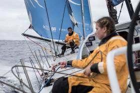
#VOR - Team Brunel emerged from Stealth Mode overnight as the furthest east in the Volvo Ocean Race fleet, and by the 1pm Irish time/UTC position report today (Saturday 24 February), Bouwe Bekking’s team was in second place as measured on distance to finish, despite being the northernmost boat in the fleet.
“Yesterday, it was obvious we were falling off the pressure the three leading boats had,” Bekking said. “You can keep following them, but then you know you’re going to keep losing.
“The models we had were telling us to sail the direct course towards the north cape of New Zealand. That’s why we went in Stealth Mode… Fortunately for us, the others kept reaching (out to the west), so we didn’t lose any distance to the mark to these boats. That was the good thing about going into Stealth.”
It’s clear now that Brunel will be pushing the direct route to New Zealand. They will be sailing far fewer miles than the other leading group who are committed to the west, hoping to find more wind to compensate for the additional distance sailed.
“The key goal for us is to get south,” said Scallywag navigator Libby Greenhalgh. “The forecast is still uncertain, but there is definitely pressure to the south and the more we can hook into that the closer we’ll get to New Zealand before the forecast becomes very unclear.
“It’s one of those situations where you kind of have to pick your side and try to win your side. For us, if we can catch AkzoNobel and beat them to win our side, then the worst case scenario is a fourth and best case you win the leg.”
Behind and taking a middle option on the east/west axis are Dongfeng and MAPFRE, the top two boats on the overall leaderboard, now racing in unfamiliar territory at the back of the fleet.
But all hope is not lost as they claw their way back in terms of distance to the leader, which is now down to just 37 miles.
“The weather forecast keeps changing quite a lot in the files we receive during the day,” said MAPFRE skipper Xabi Fernández. “We have nearly 1000 nautical miles to go so we will keep our hope until the very end.
“The crew is having as much rest as possible and getting ready for any opportunity that may come at the end of the race. Our particular race with Dongfeng keeps being exhausting and we all know it is going to be that way the whole way to Auckland. Let’s see how it finishes. Hopefully we can have Brunel join the battle too.”
Scallywag’s Greenhalgh agrees it could be a fantastic finish: “This is going to be another spic finish with the teams exceptionally close and possibly a full foam up coming in. Will be awesome to watch as fingers crossed we arrive in daylight.”
Leg 6 Position Report, Saturday 24 February (Day 18) at 1pm Irish time/UTC:
- Sun Hung Kai/Scallywag - DTF 883.3 nautical miles
- Team Brunel +5.47 nautical miles
- Team AkzoNobel +6.42
- Turn the Tide on Plastic +9.95
- MAPFRE +31.79
- Dongfeng Race Team +37.69
Turn The Tide Loses VOR Pole To AkzoNobel As Drag Race South Begins
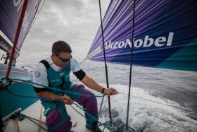
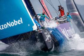
#VOR - Team AkzoNobel has emerged as clear leaders of Leg 6 of the Volvo Ocean Race on Friday (23 February) with the top three crews lining up south of New Caledonia for the crucial last phase.
Skipper Simeon Tienpont’s team made the most of slightly better wind and angle as they sailed round the outside of previous frontrunners Turn the Tide on Plastic along with Sun Hung Kai/Scallywag.
A little bit of luck then came AkzoNobel’s way when a tropical cloud appeared in between them and closest chasers Scallywag, scuppering their rival team’s speed while they slipped away at pace.
The three teams had been neck-and-neck approaching the northern tip of New Caledonia, with AkzoNobel and Scallywag lined up to the west of Turn the Tide on Plastic.
Dee Caffari’s Turn the Tide team gambled on sailing between New Caledonia’s barrier reef in a bid to gain precious miles but as Leg 6 entered its 17th day it was clear the punt had not paid.
At 1pm Irish time/UTC, AkzoNobel had accelerated to 25 miles in front of Scallywag, while Turn the Tide on Plastic were 65 miles northeast. But another 1,000 miles of race course still lie between them and the Auckland finish line.
“Of all the six boats in the fleet I would rather be on this one right now,” AkzoNobel’s Cécile Laguette said. “We are in a good spot, looking at where the breeze is coming from right now and where we need to be positioned in the next few days.
“But there is still a long way to go and until we get to the northern tip of New Zealand with a good lead then we probably shouldn't talk about anything.”
Leg 4 winners Scallywag have been working overtime to regain ground on AkzoNobel since losing the Leg 6 lead a few days ago.
Just when they thought they had reeled their rivals in, disaster struck in the form of a cloud that reduced their speed to less than a knot. AkzoNobel, still travelling at 13 knots, made their escape once more.
John Fisher, helmsman on Scallywag, said: “It was the middle of the night and we were heading round the reef at the top end of New Caledonia. We were only two or three miles from Akzo when a cloud came right between us. It was one of those very frustrating hour-long stints when you just want to pull your hair out. We’re just heading south as quickly as we can go.”
Team Brunel were in fourth place on the Leg 6 leaderboard before opting to go into stealth mode, whereby their position is hidden from the race tracker for 24 hours.
Stealth mode is most commonly deployed when the teams want to attempt a big tactical manoeuvre – but the teams and fans alike will have to wait until they reappear with on Saturday’s 1am position report to find out if it has paid off.
After passing the top of New Caledonia and breaking free from the doldrums, backmarkers MAPFRE and Dongfeng have adopted a slightly higher angle as they try to maximise boat speed and claw back miles on the front four.
“We are starting to get out of the Doldrums and the conditions are starting to be close to the south easterly winds, though the trade winds aren’t established 100 per cent yet,” MAPFRE navigator Juan Vila said.
“We have periods of ten knots of winds alternating with slightly lighter winds of five to six knots. We hope it will be more established in the next hours and tomorrow we will already have wind around 10-15 knots.”
Leg 6 Position Report, Friday 23 February (Day 17) at 7pm Irish time/UTC:
- Team AkzoNobel - DTF 1123.3 nautical miles
- Turn the Tide on Plastic +1.6 nautical miles
- Sun Hung Kai/Scallywag +2.8
- MAPFRE +55.1
- Dongfeng Race Team +61.9
- Team Brunel in stealth mode
Turn The Tide On Plastic Turns The Tables On Volvo Ocean Race Fleet
#VOR - Turn the Tide on Plastic became the new leaders of Leg 6 of the Volvo Ocean Race on Wednesday (21 February) as the sprint from Hong Kong to Auckland moved inside 1,500 miles.
Dee Caffari’s talented young sailors — among them Ireland’s own Annalise Murphy — ghosted past Team Sun Hung Kai/Scallywag as they capitalised on the tiniest puffs of breeze in an otherwise windless doldrums.
The temporary acceleration from less than a knot to more than four was welcomed by Turn the Tide on Plastic after two days of painstakingly slow progress in the Southern Hemisphere.
The 1pm UTC/Irish time position update showed a 17-mile lead for Caffari’s crew, no strangers to the top spot in the doldrums having previously led the fleet through the Intertropical Convergence Zone on Leg 4 from Melbourne to Hong Kong.
But with around six days still to sail before reaching the Auckland finish line, navigator Nico Lunven was keen to urge caution.
“On the ranking we’re first but it’s calculated on the distance to Auckland,” Lunven said, “and we won’t be going there a straight line.”
The dilemma facing the teams over the past 48 hours has been where to position themselves as they approach the island chain of Vanuatu. If and when the new wind arrives, it should do so from the east, and Turn the Tide on Plastic’s overnight gain is testament to the advantages on offer from getting it first.
However, as Lunven alluded, the forecast suggests a routing to the west of New Caledonia, some 300 miles to the south, will be quickest. It could yet be that Scallywag, some 45 miles to the west, and Team Akzonobel, another 15 miles past them, leapfrog their rivals into the top spot once more.
After several days in front, conceding any miles to Turn the Tide on Plastic has been a bitter pill to swallow for Dave Witt’s Scallywag crew.
“For us it’s about limiting the damage,” said Scallywag’s Marcus Ashley Jones. “Hopefully we’ll get a little bit of luck with a puff. We’re still in touch, still in the game, but it’s always disappointing to go from being the peacock to the feather duster.”
Almost 100 miles behind the pacesetters, Dongfeng Race Team and MAPFRE continued their match race. At times the two teams, first and second on the overall leaderboard, were practically side by side after nearly 4,000 miles of racing.
Although speeds were up around seven knots today, the teams face another 24 hours before they reach New Caledonia and start accelerating towards Auckland, their progress buoyed by stronger winds.
Meanwhile, construction of the Race Village at the Viaduct Basin in Auckland is continuing in anticipation of opening day this Saturday 24 February.
Leg 6 Position Report, Wednesday 21 February (Day 15) at 1pm Irish time/UTC:
- Turn the Tide on Plastic - DTF 1444.49 nautical miles
- Sun Hung Kai/Scallywag +17.05 nautical miles
- Team Brunel +18.90
- Team AkzoNobel +20.15
- MAPFRE +80.93
- Dongfeng Race Team +87.00
No Pain, No Gain For Volvo Ocean Race Fleet As Doldrums Take Their Toll
#VOR - The Volvo Ocean Race fleet is facing another 48 hours of excruciating sailing as the teams plugged deeper into a massive expanse of windless ocean on Tuesday (20 February).
Lying ahead of them is a 400-mile gulf that stretches as far south as New Caledonia, severely hampering progress towards New Zealand as Leg 6 entered its 14th day.
And with the finish line in Auckland still more than 1,500 miles away, a glance at the forecast provides little relief with no sign of breeze materialising in the short term.
As well as battling the elements, the fights on the water have become personal, with the six-strong fleet splitting into pairs, essentially forming three mid-ocean match races.
Team Sun Hung Kai/Scallywag and Team AkzoNobel continue to lead the way south, with Turn the Tide on Plastic and Team Brunel neck-and-neck around 50 miles to the north-east, but only 20 miles behind on distance to finish. This leverage to the east could prove decisive over the coming days.
Fifty miles further south, and 75 miles behind the leaders, MAPFRE and Dongfeng Race Team continue their hunt for a way back into the leg, split by less than a mile.
While full-on storm conditions are physically exhausting, a lack of breeze pushes the sailors to the limit of mental tiredness as they search desperately for a route that might provide the tiniest speed advantage over their rivals.
“It’s tricky… snakes and ladders,” said David Witt, skipper of Scallywag, after they overhauled AkzoNobel to take the top spot. “There’s two more days of this, so there’s not much sleep coming up.”
The cause of the giant wind hole is a huge storm – Gita – currently battering the south island of New Zealand that has killed the trade winds, allowing the doldrums to swell to epic proportions.
All the teams can do is take their best guess at the quickest route south, make the most of whatever local weather comes their way, and keep their fingers crossed that the forecasts are wrong.
The uncertainty and frustration is shared throughout the fleet.
“It feels like we are in three match races, we’re just are not sure who is playing the finals, who is playing the semi-finals and who is playing for the wooden spoon,” a bemused Turn the Tide on Plastic skipper Dee Caffari said.
Bouwe Bekking, skipper of nearby Team Brunel, added: “Sometimes we think we have the greatest sport there is, but on days like these I think the majority of the crew think that it can be a stupid sport as well.”
The one bonus is that the teams are not alone in their struggle. The windless zone is so huge that it has ensnared all six teams, and what affects one affects them all.
“Since the start we’ve been together with Dongfeng, and today’s just another day that we’re within a mile of each other,” MAPFRE skipper Xabi Fernández said.
“We had a few clouds this morning and lost about four miles but now we’re back with them. It’s very hard to overtake them and it’s hard for them to overtake us. At least we’re very well entertained by each other.”
The key to escape will be picking up the new breeze first. But which pair will find salvation first remains to be seen.
Leg 6 Position Report, Tuesday 20 February (Day 14) at 1pm Irish time/UTC:
- Sun Hung Kai/Scallywag - DTF 1575.57 nautical miles
- Team AkzoNobel +1.29 nautical miles
- Turn the Tide on Plastic +19.48
- Team Brunel +20.68
- Dongfeng Race Team +73.09
- MAPFRE +73.48
Volvo Ocean Race Leaders Hold On As Leg 6 Rankings Tighten
#VOR - It will have been a massively stressful 24 hours from Sunday 18 to Monday 19 February for the leading pair on Leg 6 of the Volvo Ocean Race to Auckland, New Zealand.
As Team AkzoNobel and Sun Hung Kai/Scallywag bumped up against an area of calm, those chasing were enjoying 10 to 15 knots of wind and making impressive gains.
In fact, the distance from first to last has nearly been halved in 24 hours.
Still, the last two position reports have been kinder to the leaders, who have managed to hold their nerve and even extend a few miles again. But not before some uncomfortable moments on board.
“It’s a bit stressful when you can feel the hot breath from the other boats breathing down your neck,” said Annemieke Bes from Scallywag. “But I think we’ve managed to come out the other side. It’s a big relief.”
Her skipper David Witt, sitting beside her on deck, admitted he was “throwing all my toys out of the pram” as the trailing boats closed the gap.
“This is normal,” Bes laughed.
At the back of the fleet, the reaction to the big gains made over the past 24 hours was relatively muted, in consideration of how much work is still left to do.
“We had been gaining big chunks on each sked,” said MAPFRE’s Blair Tuke. “But the last ones haven’t been as good for us. We had a big cloud and both ourselves and Dongfeng had to sail around it.
“We were still moving, but not towards the finish line, so the (leading boats) gained on us. It’s stretched out again to around (90 miles). That’s better than 300 miles, but…”
The good news for the trailing boats is that there is still a long way to go.
The navigators are talking about a band of light and variable conditions that stretch ahead for over 400 miles. If that scenario comes to pass, there will be many more nervous moments, and many more opportunities for a shake up in the rankings.
“We’re still going through a lot of clouds,” cautioned AkzoNobel's Martine Grael, whose team continues to duel for the lead with Scallywag, and now Team Brunel as well, who have worked hard to push into the leading pair.
“We can still have a park up where everybody catches us… You just have to deal with it. It’s part of the race.”
The psychological pressure is on. If only the wind would match it.
Leg 6 Position Report, Monday 19 February (Day 13) at 1pm Irish time/UTC:
- Sun Hung Kai/Scallywag - DTF 1713.36 nautical miles
- Team AkzoNobel +2.78 nautical miles
- Team Brunel +19.31
- Turn the Tide on Plastic +38.83
- Dongfeng Race Team +93.52
- MAPFRE +93.98
Volvo Ocean Race Leg 6 Update: AkzoNobel & Scallywag Seize Opportunity In The Doldrums
#VOR - Team AkzoNobel and Sun Hung Kai/Scallywag are the big winners over the past 24 hours as both have had a relatively fast transition through the doldrums.
This has allowed them to gain about 100 miles on the chasing pack in the Volvo Ocean Race fleet, who have suffered through some painful moments.
Dongfeng Race Team and MAPFRE have had the worst of it. Languishing for hour after hour in extremely light and variable winds, while at the same time AkzoNobel and Scallywag were hurrying south at speeds up to 20 knots.
In the middle, Team Brunel and Turn the Tide on Plastic made their escape ahead of the final pair, and at 1pm Irish time/UTC today (Saturday 17 February) they find themselves making good speed chasing down the leaders.
The next 24 hours look to be slightly more settled with the fleet racing south in moderate westerly winds. But by Sunday night (UTC) the leaders will be bumping into the second half of this doldrums crossing.
This looks to be a more complicated transition than usual, with cyclone activity to the south of the fleet disrupting the normal weather patterns.
It will make the start of the week extremely challenging, and there is likely to be some kind of compression in the fleet with the back markers making gains as the leaders slow.
Regrettably, non-safety communication with the fleet has been disrupted since Friday evening UTC. Inmarsat confirms that it is currently experiencing an outage of its I-4 F1, L-band satellite, which covers the Asia Pacific region.
The cause has been identified as a spacecraft altitude control issue. Inmarsat is currently implementing the specific recovery activities to establish a safe return to normal operations as soon as possible.
This outage has impacted the onboard reporters being able to send media off the boat. However, the safety of the fleet has not been affected as Race Control is still able to track the boats and send basic messages to the fleet by email via an alternative Inmarsat satellite.
Leg 6 Position Report, Saturday 17 February (Day 11) at 1pm Irish time/UTC:
- Team AkzoNobel - DTF 2118.07 nautical miles
- Sun Hung Kai/Scallywag +54.79 nautical miles
- Team Brunel +129.86
- Turn the Tide on Plastic +183.34
- Dongfeng Race Team +224.09
- MAPFRE +237.29
#VOR - With the Volvo Ocean Race fleet racing south in trade wind conditions on Wednesday 14 February, Team AkzoNobel leads the charge towards the doldrums, still some 600 miles away.
The fleet is becoming more aligned from north to south, with less east/west leverage than 24 hours ago.
Scallywag, still furthest west, is making a concerted effort to get to the east with the rest of the fleet, narrowing their exposure by about 20 miles. But it’s come at a cost of more than 20 miles on the leaderboard.
The Scallywags remain in second place however, behind the leading AkzoNobel who are sailing fast and on a favourable angle south.
“We are a few miles ahead of the guys behind us and we have Scallywag to leeward,” said AkzoNobel’s Nicolai Sehested. “It’s a tricky position as we don’t know how it will play out with Scallywag.
“Boatspeed is crucial. A little bit of luck, you need that as well… Buy we’re in a strong position right now because we’ve been fast the last few days. We’ve locked the boat into a good mode. I can’t say what we’ve been doing but we’ve been fast and we’re feeling comfortable.
“Hopefully our speed gets us first to the doldrums. And if first in means first out that would be really, really good for us.”
MAPFRE, locked into a battle with Dongfeng, are match racing their closest opposition on the overall race leaderboard as they head towards the doldrums.
“We’ve currently got Dongfeng about a mile and half to windward, and bow-even… it’s a pretty tight battle. Not much in it at all,” said MAPFRE’s Blair Tuke.
“AkzoNobel and Scallywag are ahead and to leeward of us. AkzoNobel has gone quite well on all the skeds, but we’ve managed to come back on Scallywag a little bit. Hopefully this next transition works in our favour and we can catch them up like they got us in the last one.”
For Dongfeng skipper Charles Caudrelier, the intensity is nothing new. But he still took time to make a Valentine’s Day phone call to his mates on MAPFRE.
“Since 24 hours the maximum distance between us and MAPFRE has been about 500 meters, less than on our last excellent inshore race in China,” he noted.
“I tried to call them earlier but they were probably not in good mood just after we had passed them this morning and I had no answer.
“Now all the fleet is running in the same direction and looking for the best passage through this terrible doldrums ahead of us and we use this time to have a rest after the first tough days.”
Rest won’t be on the cards for long, as the doldrums will be in play by the weekend.
Leg 6 Position Report, Wednesday 14 February (Day 8) at 1pm Irish time/UTC:
- Team AkzoNobel - DTF 3087.54 nautical miles
- Sun Hung Kai/Scallywag +28.93 nautical miles
- MAPFRE +47.32
- Dongfeng Race Team +49.02
- Team Brunel +59.42
- Turn the Tide on Plastic +83.35
Wet, Wild & Fast Sailing As Volvo Ocean Race Fleet Charges Southeast
#VOR - Conditions are fast, wet and wild for the Volvo Ocean Race fleet on Sunday(11 February) as they charge to the southeast, finally heading in a direction where miles sailed translate into miles towards the finish in New Zealand, still more than 4,000 nautical miles away.
With the passage of a front, the wind has shifted to the north and the boats are on a tight reach in 18 to 25 knots of wind, making 20 to 25 knots of boat speed. It’s not comfortable. But it’s fast.
“Since the front hit it’s been pretty full on,” said Blair Tuke from on board MAPFRE, which maintains the lead by a hair from Team Brunel. “To start with it was about as good sailing as you can get, 20 to 25 knots of breeze and flat, flat water.
“But over the last few hours, things have just got gradually a little bit worse. Sea state and water on deck, it’s probably the most water I’ve ever seen.”
“This is a great way to gain some miles after some slow upwind sailing that we have been doing,” agreed Dee Caffari from Turn the Tide on Plastic, still in fourth position within 14 nautical miles of the lead boat.
“There is water pouring down the deck, everyone is wet, everything is wet inside and out but no one is complaining as we all know this is short lived and we will cover some serious miles while we are at it. And the water is warm, 19 degrees, matching the air temperature.”
The fleet is still largely in two groups, with MAPFRE and Team Brunel chased by Dongfeng Race Team and Turn the Tide on Plastic.
The second group of Team AkzoNobel and Sun Hung Kai/Scallywag had been much further behind, but have closed the gap by some 50 miles over the last 24 hours, with Scallywag charting a southern route and cutting the corner. It was a strategy that worked on Leg 4; we’ll see over the coming hours if it is successful again.
Leg 6 Position Report, Sunday 11 February (Day 5) at 1pm Irish time/UTC:
- MAPFRE - DTF 4179.54 nautical miles
- Team Brunel +0.37 nautical miles
- Dongfeng Race Team +3.88
- Turn the Tide on Plastic +13.90
- Team AkzoNobel +51.06
- Sun Hung Kai/Scallywag +57.97
Volvo Ocean Race Fleet Heading North To Get South To New Zealand
#VOR - Saturday 10 February sees the Volvo Ocean Race fleet continuing the perverse scenario of sailing away from the finish line in New Zealand.
While the fleet is split in two, reflecting differing tactical choices, all six boats have pushed well to the north, with the finish line in Auckland far to the south.
The reasoning behind the northerly routing is weather-based, a classic trade-off of sailing more miles in exchange for better conditions and speed.
The calculation the navigators have made is that the increased speed will more than compensate for the extra distance.
On board MAPFRE, the team is taking a light-hearted view of the situation where the boat has been heading northeast to get to a finish line in New Zealand, which is far to the south.
“Are you sure we’re heading to Auckland? If we’re heading northeast…?” asks Louis Sinclair, getting the joke started.
“Yes, it’s that way, it’s on the bow. We cannot be wrong, they’re following us,” replies Pablo Arrarte from the helm, gesturing at the other boats in view.
“Pablo, I’m pretty sure New Zealand is that way – southeast,” retorts Blair Tuke, his arm outstretched and pointing. “It’s my home, mate. I’d know!”
Eventually, the fleet will turn to the south, negotiate the doldrums, and push into the trade winds that will carry them to Auckland.
But not just yet. There is still plenty of intense, close racing ahead.
As of 1pm Irish time/UTC on Saturday, the leading group of four was separated by less than seven miles, with MAPFRE leading Dongfeng Race Team, Team Brunel and Turn the Tide on Plastic — the latter with 2016 Volvo Irish Sailor of the Year Annalise Murphy on deck for this leg.
“It's been intense since the beginning,” said Dongfeng navigator Pascal Bidégorry. “I have the impression that we have not stopped working. Many manoeuvres, even last night, we may have been a bit too greedy with the sail changes.
“But things are going well. There was an important decision to make earlier and we did not make the mistake of tacking too early after Taiwan. Now, we are going around the anticyclone, with a front and a second anticyclone coming closer to us, but that will be for tomorrow…”
The important decision Bidégorry is referring to was the tactical choice to tack hard north immediately after passing the southern tip of Taiwan.
Both SHK/Scallywag and Team AkzoNobel made this choice and for the moment, it has left them over 100 miles behind the leading pack, who waited to tack and appear to have escaped light winds close to the east side of Taiwan.
However, the trailing pair has finally picked up the favourable northerly shift they’d been looking for.
For most of the day, they’ve been sailing in stronger winds and the deficit has come down by 20 miles over the past five hours.
Whether that trend continues for long enough to make up for the early losses is something we’ll know by this time tomorrow.
Leg 6 Position Report, Saturday 10 February (Day 4) at 1pm Irish time/UTC:
- MAPFRE - DTF 4588.01 nautical miles
- Dongfeng Race Team +2.58 nautical miles
- Team Brunel +2.95
- Turn the Tide on Plastic +6.73
- Team AkzoNobel +100.13
- Sun Hung Kai/Scallywag +110.28
Volvo Ocean Race Fleet Leaves Hong Kong For Auckland On Leg 6
#VOR - Skipper Simeon Tienpont’s Team AkzoNobel led the Volvo Ocean Race fleet away from the Hong Kong start line on Monday morning as Leg 6 got underway.
Racing started in a light 8-10 knot easterly with AkzoNobel, SHK/Scallywag and Team Brunel the first across the line, slipping upwind under full sail, with the spectator fleet in tow.
But shortly after clearing land, the wind started to increase to 15-20 knots, and the enormous Code 0 sails were furled in favour of smaller headsails. Conditions are forecast to deteriorate further over the next 24 hours.
“It’s predominantly upwind, so it’s going to be a tough first few days,” said Turn the Tide on Plastic skipper Dee Caffari, whose boat has slipped three miles behind the leading pack over the course of today’s racing.
“It could be quite rough out of Hong Kong,” agreed AkzoNobel’s Tienpont. “I wouldn’t be surprised to see some pretty strong winds.”
With a tropical cyclone forecast to produce heavy sea conditions, race officials have added a Tropical Storm Exclusion Zone extending across 20 degrees of longitude to the east of the Philippines.
Most weather routing software suggests the fastest route is to the north and east of the exclusion zone but this will ensure the fleet avoids the worst of the sea conditions.
Leg 6 of the Volvo Ocean Race will take the fleet through the Luzon Strait and then on an easterly heading before the boats dive south through the Doldrums and then southeast to the northern tip of New Zealand.
“It’s a long leg to Auckland, around 6,000 nautical miles, and nearly the reverse of Leg 4 to get here,” said Xabi Fernández, the skipper of the overall race leader MAPFRE, which is currently third in this leg. “The start is going to be important, as usual.”
“If we look at the weather models then it will immediately be full-on for the first 36 to 48 hours,” said Brunel skipper Bouwe Bekking. “There are different route options. If you choose wrong it can immediately seem like you are hundreds of miles behind.”
No such worry yet for Bekking – three hours into Leg 6 and Brunel was at the head of a compact leaderboard, with New Zealand some 6,000 nautical miles away.
Leg 6 Position Report, Wednesday 7 February (Day 1) at 6pm Irish time/UTC:
- Team Brunel - DTF 5433.7 nautical miles
- Dongfeng Race Team +0.72
- MAPFRE +1.32
- Team AkzoNobel +1.46
- Sun Hung Kai/Scallywag +1.73
- Turn the Tide on Plastic +4.76


 Michael Murphy Schull Harbour Sailing Club (SHSC), Eric Coogan Heineken Ireland, Mark Murphy, Commodore SHSC, Jack Allen SHSC, Carmel O'Regan SHSC, Cornelious Ndlovu, Schull Harbour Hotel Operations Manager and Derval Murphy SHSC")

