Menu

Ireland's sailing, boating & maritime magazine

Inland afloat headers


Displaying items by tag: Wind Farms

Join the conversation on Ireland’s offshore wind challenges at a public information meeting at the Fitzpatrick Castle Hotel in Killiney this Tuesday 12 March at 7.30pm.

Hosted in association with Dalkey Community Council and Killiney Bay Community Council, ‘Windfarms & Wildlife: Protecting the Bay’s Habitats — Uncover the Realities, Explore the Concerns’ will hear from guest speakers Dr Michael O'Meara of the Blue Horizon citizens group and chartered environmental scientist Marie Louise Heffernan.

A nationally recognised expert in the Habitats Directive, Marie Louise Heffernan specialises in biodiversity planning in the coastal zone, has expertise in marine breeding birds and her overall interest is balancing sustainable development with environmental protection. Her presentation for Tuesday is titled ‘From Terns to Turbines: Sustaining Dublin Bay's Rich Ecology’.

Dr Michael O'Meara has a longstanding appreciation of nature and the sea, and holds the record for kayaking solo around Ireland since 2015. He brings this passion for nature and his knowledge of the sea and coastal environment to the Blue Horizon campaign which calls for a 22km turbine-free zone off the Waterford coast in order to protect marine biodiversity, the local fishing economy, seascapes and tourism interests.

Admission to this information event is free but space is limited and only a few tickets remain. Reserve your spot via Eventbrite HERE.

Published in Power From the Sea
Tagged under

“We are in a race for survival…”

The words of Mark Mellett, chair of MARA, the State’s first marine planning regulatory authority, which has just opened for business in Wexford.

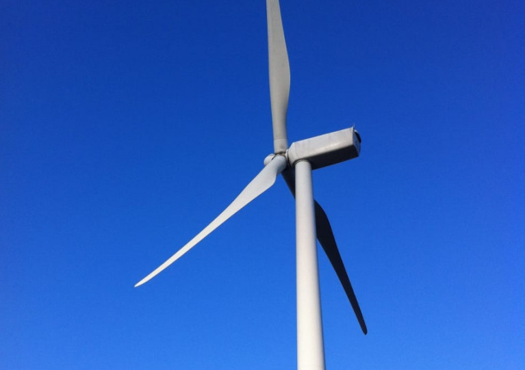
If Government targets on renewable energy offshore are met, there will be up to 2,500 wind turbines off the south, west and east coasts, Mellett, former head of the Defence Forces, said in an interview with Wavelengths.

While just five turbines would yield enough power to match Ardnacrusha’s hydroelectric output on the Shannon, more will be needed for creating sustainable aviation fuels and other requirements, Mellett says.

However, this will not be a “developer-led” industry, he said, as the Government is taking a “plan-led approach” to locations, he says, and he pledged commitment to citizen engagement.

He also said he believes there will be “biodiversity net gain” in between offshore wind farm locations.

MARA - Darragh O'Brien T.D. Minister for Housing, Local Government and Heritage, Eamon Ryan TD, Minister for the Environment, Climate, Communications and Transport, Laura Brien Chief Executive of the Maritime Area Regulatory Authority (MARA) and Simon Coveney TD, Minister for Enterprise, Trade and Employment. Photograph: Patrick BrowneMARA is launched in Wexford - Darragh O'Brien T.D. Minister for Housing, Local Government and Heritage, Eamon Ryan TD, Minister for the Environment, Climate, Communications and Transport, Laura Brien Chief Executive of the Maritime Area Regulatory Authority (MARA) and Simon Coveney TD, Minister for Enterprise, Trade and Employment. Photograph: Patrick Browne

Headed by chief executive Laura Brien, MARA’s role will include assessing applications for maritime area consents (MACs), which are required before developers of offshore wind and other projects in the maritime area can make a planning application.

Here is the full interview below

Published in Wavelength Podcast

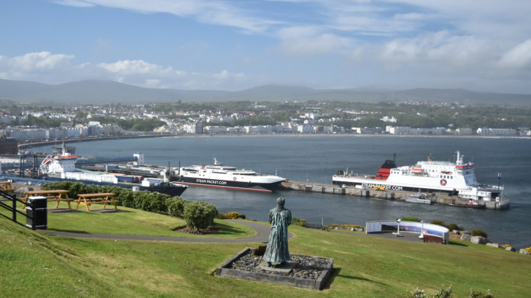
'Serious concerns' have been raised by the Isle of Man Steam Packet in regards to the effect of growing windfarms in the Irish Sea.

As 3FM reports, the ferry operator has concerns following proposals for the windfarm of 'Morecambe and Morgan' which would be based in the Irish Sea.

The proposed windfarm would be in an area south-east of the Island along the route taken by the company's fast-ferry operating between Douglas and Liverpool. The 69 nautical mile route links the Manx capital to Merseyside where a new terminal is currently under construction.

Across the Island, leaflets have been posted asking for views expressed from the public. In addition a consultation process has been launched online which gives details of consultation venues and dates aswell as for pop-events noting an online event is scheduled for 10 November. 

The Steam Packet posted on its website to say that it's 'supportive of sustainability and renewable energy' - and 'broadly speaking' the company supports initiatives to tackle energy challgenges.

More here on this renewable energy project story.

Published in Ferry

The Dutch Safety Board says it has initiated an investigation into the “increasing congestion” caused by wind farms and shipping in the North Sea.

The safety board, which investigates shipping, aviation, railway and industrial accidents in the Dutch State, said that “the construction of wind farms, among other things, and the increase in shipping with increasingly larger ships” means the North Sea is becoming busier.

It said it will “investigate the risks associated with the increasing use of the North Sea and what effect this may have on the safety of shipping in the area”.

The Dutch Safety Board said that the reason for this research was the drift of the Maltese bulk carrier Julietta D during Storm Corrie in late January 2022.

“ During the drift towards the Dutch coast, the bulk carrier first hit another ship and then two structures of a wind farm under construction,” it said.

The collision occurred after Julietta D’s anchor failed as Storm Corrie whipped up the North Sea. The second ship, Pechora Star, was reported stable and not taking on water, but Julietta D started sinking, and the crew of 18 was rescued by the Dutch Coast Guard.

The Dutch Safety Board said the Maltese investigative body, Transport Malta, is also investigating this incident and is focusing specifically on the collision.

Published in Power From the Sea
Tagged under

According to Manx Radio, two huge wind farms proposed for the Irish Sea would have serious implications for ferry operator the Isle of Man Steam Packet Company.

Managing Director, Brian Thomson, says the Mona and Morgan wind farms would cut across the company's routes to both Heysham and Liverpool.

The contract to build the farms has been won by BP and a German firm as a 50-50 joint venture, and would generate sufficient electricity to power 3.4 million UK homes.

Mr Thomson says the Steam Packet and other operators in the Irish Sea are involved in consultations, but if the farms go ahead in the areas proposed, there would be consequences.

Click this link and scroll down page for a podcast from the ferry's M.D.

Also Manx Radio yesterday reported that Tynwald, the Manx parliament has approved an additional spend of £32.6m towards completion of the new Liverpool terminal, see previous story.

For further reading on this separate yet ferry related story, click here and again scroll down the page to listen to several podcasts.

Published in Ferry

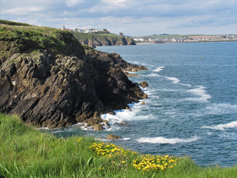
A community group of stakeholders, Blue Horizon, is calling for all offshore wind projects to located at 22 km from the Waterford coast line.

According to Ocean Focus, this would follow the EU approach where the average ‘bottom fixed’ site is 59km from shore in an average water depth of 33 metres.

Blue Horizon says ‘yes’ to offshore wind but ‘no’ to nearshore wind, and is calling for a 22km wind turbine free zone of the Waterford coast in alignment with ‘EU best practices to protect biodiversity, the local fishing economy, the stunning seascapes and the tourism industry’.

The Waterford coast has several Special Areas of Conservation and Special Protection Areas under EU law, along with the Copper Coast UNESCO Geopark.

Some of the largest offshore wind farms ‘on the planet’ are planned for the Waterford coast, according to Blue Horizon.

These include: SSE Celtic Sea (25km); ESB Equinor, Helvick (10km); DP Energy, Inis Ealga (8.5km); Energia, Helvick Head (5km).

For more on the EU versus Waterford, click here. 

Published in Power From the Sea
Tagged under

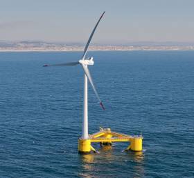
Cork HarbourA floating offshore wind developer, Simply Blue Group, has appointed Captain Brian FitzGerald as Director of External Affairs and Stakeholder Liaison, Ireland.

Captain Fitzgerald will represent the company, focusing on the Emerald and Western Star portfolios, as exemplars in community engagement and trust building.

Having served at sea all around Ireland for much of his career, Capt. FitzGerald brings additional sea-borne perspectives to Simply Blue. His love of the sea, desire to protect Ireland’s maritime interests and his extensive career experience, make him an excellent fit for its external relations and stakeholder liaison role.

Capt. FitzGerald said: “Simply Blue offers the opportunity to address the challenge of climate change and energy security, by harnessing the abundance of offshore wind and wave resource that Ireland possesses. In meeting this vital challenge, I am delighted to be able to work with south and west coast communities and stakeholders as part of a collective effort to protect our future. It is through our values of responsibility, integrity, courage, diversity and passion that we will achieve that.

Val Cummins, Project MD of Simply Blue Energy Kinsale, said: “Floating offshore wind provides Ireland with the opportunity to address climate change and to develop a whole new economic sector. As a blue economy developer, we are deeply committed to meaningful community engagement. Brian’s experience and passion for the sustainable development of Ireland’s offshore wind resource bring further value and credibility to our Irish team”.

Capt. FitzGerald enjoyed a long and successful career with Ireland’s Naval Service including two periods as a ship’s Captain before ultimately serving as the Navy’s Operational Commander.

He also obtained specialist qualifications in Maritime Law, Mediation and Public Relations and to his wide-ranging naval qualifications. In addition to his ‘islander’s’ perspective and championing of the Cork Harbour region as Ireland’s Maritime Quarter is well known.

Earlier this year, Simply Blue Group announced a joint venture partnership with Shell. This will see the development of the Emerald floating wind farm off the Cork coast in the vicinity of the Kinsale gas field, which is currently being decommissioned.

Simply Blue is also developing the Western Star floating wind and wave project off West Clare.

Published in Power From the Sea
Tagged under

Seven offshore renewable energy projects have been designated as ‘Relevant Projects’ by the Ministers for Urban Development and Climate Action and approved for transition to the upcoming new marine planing regime.

These are offshore wind projects that either applied for or were granted a lease under the Foreshore Act 1933, or offshore wind projects that are eligible to be processed to receive a valid grid connection offer.

The seven projects that have been approved include two by Innogy Renewables, at Bray and Kish Banks; two comprising the Codling Wind Park off Co Wicklow; Fuinneamh Sceirde Teoranta’s Skerd Rocks scheme off Connemara; and the North Irish Sea Array and Oriel Wind Farm, both off Co Louth.

The approval aims to further the objectives of the Climate Action Plan, which commits to increasing our offshore wind capacity to 3.5GW as part of our overall ambition to reach 70% renewable energy by 2030.​

Urban Development Minister Damien English said: “I am pleased to announce a way forward for these offshore renewable energy projects which will now be determined under the planning regime to be introduced in the Marine Planning and Development Management Bill, 2020.

“Under this new marine planning regime, these projects will apply for final development consent to An Board Pleanála which will provide further opportunities for public consultation on the individual projects.”

Climate Action Minister Richard Bruton added: “This now sets out a clear development path for these offshore wind projects which will play a key role in decarbonising our electricity system.

“This is a clear example of the Government’s determination to deliver on our climate and renewable energy ambitions to deliver 70% of our electricity from renewable sources by 2030.”

The announcement means that these projects can continue to work and update a number of aspects to put them in a position to apply under the new marine planning regime, once enacted, which will be introduced by the Marine Planning and Development Management Bill 2020.

Published in Marine Planning

A €1.5 billion offshore wind farm stretching from Booterstown to Greystones could generate enough electricity to power 600,000 homes.

The Irish Times reports on proposals by an Irish-German partnership for the ‘Dublin Array’ offshore energy venture that could see as many as 100 wind turbines installed over 2,440 hectares, partly in Dublin Bay.

Saorgus and Innogy are now seeing a foreshore licence to conduct surveys in the intended locations of the Kish Bank and Bray Bank.

Pledges have been made to work with shipping companies, fishing interests, sailing clubs and other water users during this process, as the venture promises a “meaningful approach to supporting local communities”.

It is also hoped that the project would benefit from new Government supports guaranteeing revenue for renewable energy generators, a scheme which is currently under EU scrutiny.

The Irish Times has much more on the story HERE.

Published in Dublin Bay

Likely objections about “visual impact” would hamper any attempts to develop offshore wind farms in Northern Ireland for the time being, according to a new Stormont report.

As BBC News reports, the paper from the Department for the Economy highlights “significant issues” with regard to expected objections to wind farm projects within 13km of the shore.

As well as “visual impact”, there are also concerns relating to protected habitats around Northern Ireland’s coastline.

Northern Ireland has been exclused from the Crown Estate’s latest leasing round for such schemes. It had been hoped that the coast from Carlingford Lough to Belfast Lough would be considered for leasing.

BBC News has more on the story HERE.

Published in Power From the Sea
Page 1 of 2

General Information on using Waterways Ireland inland navigations

Safety on the Water

All users of the navigations are strongly recommended to make themselves aware of safety on the water for whatever activity they are involved in and to read the advice offered by the various governing bodies and by:

The Dept. of Transport, Ireland: www.gov.ie/transport and The Maritime and Coastguard Agency, UK, The RNLI – Water Safety Ireland for information in terms of drowning prevention and water safety.

Registration of Vessels

All vessels using the Shannon Navigation, which includes the Shannon-Erne Waterways and the Erne System must be registered with Waterways Ireland. Only open undecked boats with an engine of 15 horsepower or less on the Shannon Navigation, and vessels of 10 horsepower or less on the Erne System, are exempt. Registration is free of charge.

Craft registration should be completed online at: https://www.waterwaysireland.org/online-services/craft-registration

Permits for use of the Grand and Royal Canals and the Barrow Navigation

All vessels using the Grand and Royal Canals and the Barrow Navigation must display appropriate valid Permit(s) i.e A Combined Mooring and Passage Permit (€126) and if not intending to move every five days, an Extended Mooring Permit (€152).

Permit applications should be completed online at: https://www.waterwaysireland.org/online-services/canal-permits

Passage on the Royal and Grand Canals – Dublin Area

For boat passage through the locks east of Lock 12 into / out of Dublin on either the Royal or Grand Canals, Masters are requested to contact the Waterways Ireland Eastern Regional Office (M-F 9.30am-4.30pm) on tel: +353(0)1 868 0148 or email [email protected] prior to making passage in order to plan the necessary lock-keeping assistance arrangements.

On the Grand Canal a minimum of two days notice prior to the planned passage should be given, masters should note that with the exception of pre-arranged events, a maximum of 2 boats per day will be taken through the locks, travelling either east or west.

Movements in or out of the city will be organised by prior arrangement to take place as a single movement in one day. Boaters will be facilitated to travel the system if their passage is considered to be safe by Waterways Ireland and they have the valid permit(s) for mooring and passage.

Newcomen Lifting Bridge

On the Royal Canal two weeks’ notice of bridge passage (Newcomen Lifting Bridge) is required for the pre-set lift date, and lock assistance will then also be arranged. A minimum of 2 boats is required for a bridge lift to go ahead.

Waterways Ireland Eastern Regional Office (Tel: +353(0)1 868 0148 or [email protected] ) is the point of contact for the bridge lift.

A maximum number of boats passing will be implemented to keep to the times given above for the planned lifts (16 for the Sat / Sun lifts & 8 for the weekday lifts). Priority will be given on a first come first served basis.

On day of lift, boaters and passengers must follow guidance from Waterways Ireland staff about sequence of passage under bridge & through Lock 1, and must remain within signed and designated areas.

Events Held on the Waterways

All organised events taking place on the waterways must have the prior approval of Waterways Ireland. This is a twelve week process and application forms must be accompanied with the appropriate insurance, signed indemnity and risk assessment. The application should be completed on the Waterways Ireland events page at :

https://www.waterwaysireland.org/online-services/event-approval

Time Limits on Mooring in Public Harbours

On the Shannon Navigation and the Shannon-Erne Waterway craft may berth in public harbours for five consecutive days or a total of seven days in any one month.

On the Erne System, revised Bye Laws state that: No master or owner shall permit a vessel, boat or any floating or sunken object to remain moored at or in the vicinity of any public mooring, including mooring at any other public mooring within 3 kilometres of that location, for more than 3 consecutive days and shall not moor at that same mooring or any other public mooring within 3 kilometres of that location within the following 3 consecutive days without prior permission by an authorised official.

Winter Mooring on the Shannon Navigation and Shannon Erne Waterway

Winter mooring may be availed of by owners during the period 1 Nov to 31 Mar by prior arrangement and payment of a charge of €63.50 per craft. Craft not availing of Winter Mooring must continue to comply with the “5 Day Rule”. Winter Mooring applications should be completed online at : https://www.waterwaysireland.org/online-services/winter-moorings-booking

Owners should be aware that electricity supply and water supply to public moorings is disconnected for the winter months. This is to protect against frost damage, to reduce running costs and to minimise maintenance requirements during the winter months.

Vessel owners are advised that advance purchasing of electricity on the power bollards leading up to the disconnection date should be minimal. Electricity credit existing on the bollards will not be recoverable after the winter decommissioning date. Both services will be reinstated prior to the commencement of the next boating season.

Smart Cards

Waterways Ireland smart cards are used to operate locks on the Shannon Erne Waterway, to access the service blocks, to use the pump-outs along the navigations, to avail of electrical power at Waterways Ireland jetties.

Berthing in Public Harbours

Masters are reminded of the following:

  • Equip their vessel with mooring lines of appropriate length and strength and only secure their craft to mooring bollards and cleats provided for this purpose.
  • Ensure the available berth is suitable to the length of your vessel, do not overhang the mooring especially on finger moorings on floating pontoon moorings.
  • Ensure mooring lines, electric cables and fresh water hoses do not create a trip hazard on public jetties for others users.
  • Carry sufficient fenders to prevent damage to your own vessel, other vessels and WI property.
  • Allow sufficient space between your vessel and the vessel ahead /astern (c.1m) for fire safety purposes and /or to recover somebody from the water.
  • Do not berth more than two vessels side by side and ensure there is safe access/egress at all times between vessels and onto the harbour itself.
  • Do not berth in such a way to prevent use of harbour safety ladders, slipways or pump-outs.
  • Do not allow the bow of your vessel to overhang the walkway of a floating mooring thus creating a hazard for others with an overhanging anchor or bow fendering.
  • Animals are not allowed to be loose or stray at any time.
  • Harbour and jetty infrastructure such as railings, power pedestals, fresh water taps, electric light poles, safety bollards, ladders etc are not designed for the purpose of mooring craft , they will not bear the strain of a vessel and will be damaged.
  • At Carrybridge on the Erne System, Masters of vessels are not permitted to use stern on mooring. Masters of vessels must use the mooring fingers for mooring of vessels and for embarkation / disembarkation from vessels.

Passenger Vessel Berths

Masters of vessels should not berth on passenger vessel berths where it is indicated that an arrival is imminent. Passenger vessels plying the navigations generally only occupy the berths to embark and disembark passengers and rarely remain on the berths for extended periods or overnight.

Lock Lead-in Jetties

Lead-in jetties adjacent to the upstream and downstream gates at lock chambers are solely for the purpose of craft waiting to use the lock and should not be used for long term berthing.

Vessel Wake

Vessel wake, that is, the wave generated by the passage of the boat through the water, can sometimes be large, powerful and destructive depending on the hull shape and engine power of the vessel. This wake can be detrimental to other users of the navigation when it strikes their craft or inundates the shoreline or riverbank. Masters are requested to frequently look behind and check the effect of their wake / wash particularly when passing moored vessels, on entering harbours and approaching jetties and to be aware of people pursuing other activities such as fishing on the riverbank.

Speed Restriction

A vessel or boat shall not be navigated on the Shannon Navigation at a speed in excess of 5 kph when within 200 metres of a bridge, quay, jetty or wharf, when in a harbour or canal or when passing within 100 metres of a moored vessel or boat.

Vessels navigating the Shannon-Erne Waterway should observe the general 5 kph speed limit which applies along the waterway. This is necessary in order to prevent damage to the banks caused by excessive wash from vessels.

Vessels navigating the Erne System should observe the statutory 5kt / 6mph / 10kph speed limit areas.

A craft on the Royal and Grand canals shall not be navigated at a speed in excess of 6km per hour.

A craft on the Barrow Navigation shall not be navigated at a speed in excess of 11km per hour except as necessary for safe navigation in conditions of fast flow.

Bank Erosion

Narrow sections of all the navigations are particularly prone to bank erosion due to the large wash generated by some craft. Masters are requested to be vigilant and to slow down to a speed sufficient to maintain steerage when they observe the wash of their craft inundating the river banks.

Unusual Waterborne Activity

Unusual waterborne vessels may be encountered from time to time, such as, hovercraft or amphibious aircraft / seaplanes. Masters of such craft are reminded to apply the normal “Rule of the Road” when they meet conventional craft on the water and to allow extra room to manoeuvre in the interest of safety.

Sailing Activity

Mariners will encounter large numbers of sailing dinghies from late June to August in the vicinity of Lough Derg, Lough Ree and Lower Lough Erne. Sailing courses are marked by yellow buoys to suit weather conditions on the day. Vessels should proceed at slow speed and with due caution and observe the rules of navigation when passing these fleets, as many of the participants are junior sailors under training.

Rowing

Mariners should expect to meet canoes and vessels under oars on any part of the navigations, but more so in the vicinity of Athlone, Carrick-on-Shannon, Coleraine, Enniskillen and Limerick. Masters are reminded to proceed at slow speed and especially to reduce their wash to a minimum when passing these craft as they can be easily upset and swamped due to their very low freeboard and always be prepared to give way in any given traffic situation.

Canoeing

Canoeing is an adventure sport and participants are strongly recommended to seek the advice of the sport’s governing bodies i.e Canoeing Ireland and the Canoe Association of Northern Ireland, before venturing onto the navigations.

Persons in charge of canoes are reminded of the inherent danger to these craft associated with operating close to weirs, sluice gates, locks and other infrastructure particularly when rivers are in flood and large volumes of water are moving through the navigations due to general flood conditions or very heavy localised precipitation e.g. turbulent and broken water, stopper waves. Shooting weirs is prohibited without prior permission of Waterways Ireland.

Canoeists should check with lockkeepers prior entering a lock to ensure passage is done in a safe manner. Portage is required at all unmanned locks.

Canoe Trail Network – "Blueways"

Masters of powered craft are reminded that a canoe trail network is being developed across all navigations and to expect more organised canoeing along these trails necessitating slow speed and minimum wash when encountering canoeists, rowing boats etc

Rockingham and Drummans Island Canals – Lough Key

It is expected that work on Rockingham and Drummans Island Canals on Lough Key will be completed in 2021. Access to these canals will be for non-powered craft only, eg canoes, kayaks, rowing boats.

Fast Powerboats and Personal Watercraft (Jet Skis)

Masters of Fast Powerboats (speed greater than 17kts) and Personal Watercraft (i.e.Jet Skis) are reminded of the inherent dangers associated with high speed on the water and especially in the confines of small bays and narrow sections of the navigations. Keeping a proper look-out, making early alterations to course and /or reducing speed will avoid conflict with slower vessels using the navigation. Personal Watercraft are not permitted to be used on the canals.

Towing Waterskiers, Wakeboarders, Doughnuts etc

Masters of vessels engaged in any of these activities are reminded of the manoeuvring constraints imposed upon their vessel by the tow and of the added responsibilities that they have to the person(s) being towed. These activities should be conducted in areas which are clear of conflicting traffic. It is highly recommended that a person additional to the master be carried to act as a “look-out” to keep the tow under observation at all times.

Prohibition on Swimming

Swimming in the navigable channel, particularly at bridges, is dangerous and is prohibited due to the risk of being run over by a vessel underway in the navigation.

Age Restrictions on operating of powered craft

In the Republic of Ireland, Statutory Instrument 921 of 2005 provides the legal requirements regarding the minimum age for operating of powered craft. The Statutory Instrument contains the following requirements:

- The master or owner of a personal watercraft or a fast power craft shall take all reasonable steps to ensure that a person who has not attained the age of 16 years does not operate or control the craft

- The master or owner of a pleasure craft powered by an engine with a rating of more than 5 horse power or 3.7 kilowatts shall take all reasonable steps to ensure that a person who has not attained the age of 12 years does not operate or control the craft.

Lifejackets and Personal Flotation Devices (PFDs)

Lifejackets and PFD’s are the single most important items of personal protective equipment to be used on a vessel and should be worn especially when the vessel is being manoeuvred such as entering / departing a lock, anchoring, coming alongside or departing a jetty or quayside.

In the Republic of Ireland, Statutory Instrument 921 of 2005 provides the legal requirements regarding the wearing of Personal Flotation Devices. The Statutory Instrument contains the following requirements:

- The master or owner of a pleasure craft (other than a personal watercraft) shall ensure, that there are, at all times on board the craft, sufficient suitable personal flotation devices for each person on board.

- A person on a pleasure craft (other than a personal watercraft) of less than 7 metres length overall shall wear a suitable personal flotation device while on board an open craft or while on the deck of decked craft, other than when the craft is made fast to the shore or at anchor.

- The master or owner of a pleasure craft (other than a personal watercraft) shall take all reasonable steps to ensure that a person who has not attained the age of 16 years complies with paragraph above.

- The master or owner of a pleasure craft (other than a personal watercraft), shall take all reasonable steps to ensure that a person who has not attained the age of 16 years wears a suitable personal flotation device while on board an open craft or while on the deck of a decked craft other than when it is made fast to the shore or at anchor.

- The master or owner of a pleasure craft (other than a personal watercraft) shall take all reasonable steps to ensure that a person wears a suitable personal flotation device, at all times while – (a) being towed by the craft, (b) on board a vessel or object of any kind which is being towed by the craft.

Further information is available at: http://www.irishstatutebook.ie/eli/2005/si/921/made/en/print

Firing Range Danger Area – Lough Ree

The attention of mariners is drawn to the Irish Defence Forces Firing Range situated in the vicinity of buoys No’s 2 and 3, on Lough Ree on the Shannon Navigation. This range is used regularly for live firing exercises, throughout the year, all boats and vessels should stay clear of the area marked with yellow buoys showing a yellow "X" topmark and displaying the word "Danger".

Shannon Navigation, Portumna Swing Bridge Tolls

No attempt should be made by Masters’ of vessels to pay the bridge toll while making way through the bridge opening. Payment will only be taken by the Collector from Masters when they are secured alongside the jetties north and south of the bridge.

Navigating from Killaloe to Limerick on the Shannon Navigation

The navigation from Killaloe to Limerick involves passage through Ardnacrusha locks, the associated headrace and tailrace and the Abbey River into Limerick City. Careful passage planning is required to undertake this voyage. Considerations include: lock passage at Ardnacrusha, water flow in the navigation, airdraft under bridges on Abbey River in Limerick, state of tide in Limerick

Users are advised to contact the ESB Ardnacrusha hydroelectric power station (00353 (0)87 9970131) 48 hours in advance of commencing their journey to book passage through the locks at Ardnacrusha. It is NOT advised to undertake a voyage if more than one turbine is operating (20MW), due to the increased velocity of flow in the navigation channel, which can be dangerous. To ascertain automatically in real time how many turbines are running, users can phone +353 (0)87 6477229.

For safety reasons the ESB has advised that only powered craft with a capacity in excess of 5 knots are allowed to enter Ardnacrusha Headrace and Tailrace Canals.

Passage through Sarsfield Lock should be booked on +353-87-7972998, on the day prior to travel and it should be noted also that transit is not possible two hours either side of low water.

A Hydrographic survey in 2020 of the navigation channel revealed that the approach from Shannon Bridge to Sarsfield Lock and the Dock area has silted up. Masters of vessels and water users are advised to navigate to the Lock from Shannon bridge on a rising tide one or two hours before High Tide.

Lower Bann Navigation

The attention of all users is drawn to the “Users Code for the Lower Bann”, in particular to that section covering “Flow in the River” outlining the dangers for users both on the banks and in the navigation, associated with high flow rates when the river is in spate. Canoeists should consult and carry a copy of the “Lower Bann Canoe Trail” guide issued by the Canoe Association of Northern Ireland. Users should also contact the DfI Rivers Coleraine, who is responsible for regulating the flow rates on the river, for advisory information on the flow rates to be expected on any given day.

DfI Rivers Coleraine. Tel: 0044 28 7034 2357 Email: [email protected]

Lower Bann Navigation – Newferry – No wake zone

A No Wake Zone exists on the Lower Bann Navigation at Newferry. Masters of vessels are requested to proceed at a slow speed and create no wake while passing the jetties and slipways at Newferry.

Overhead Power Lines (OHPL) and Air draft

All Masters must be aware of the dangers associated with overhead power lines, in particular sailing vessels and workboats with cranes or large air drafts. Voyage planning is a necessity in order to identify the location of overhead lines crossing the navigation.

Overhead power line heights on the River Shannon are maintained at 12.6metres (40 feet) from Normal Summer level for that section of navigation, masters of vessels with a large air draft should proceed with caution and make additional allowances when water levels are high.

If a vessel or its equipment comes into contact with an OHPL the operator should NOT attempt to move the vessel or equipment. The conductor may still be alive or re-energise automatically. Maintain a safe distance and prevent third parties from approaching due to risk of arcing. Contact the emergency services for assistance.

Anglers are also reminded that a minimum ground distance of 30 metres should be maintained from overhead power lines when using a rod and line.

Submarine Cables and Pipes

Masters of vessels are reminded not to anchor their vessels in the vicinity of submarine cables or pipes in case they foul their anchor or damage the cables or pipes. Look to the river banks for signage indicating their presence.

Water Levels - Precautions

Low Water Levels:

When water levels fall below normal summer levels masters should be aware of:

Navigation

To reduce the risk of grounding masters should navigate on or near the centreline of the channel, avoid short cutting in dog-legged channels and navigating too close to navigation markers.

Proceeding at a slow speed will also reduce “squat” effect i.e. where the vessel tends to sit lower in the water as a consequence of higher speed.

Slipways

Reduced slipway length available under the water surface and the possibility of launching trailers dropping off the end of the concrete apron.

More slipway surface susceptible to weed growth requiring care while engaged in launching boats, from slipping and sliding on the slope. Note also that launching vehicles may not be able to get sufficient traction on the slipway once the craft is launched to get up the incline.

Bank Erosion

Very dry riverbanks are more susceptible to erosion from vessel wash.

Lock Share

Maximising on the number of vessels in a lock will ensure that the total volume of water moving downstream is decreased. Lock cycles should be used for vessels travelling each way.

High Water Levels:

When water levels rise above normal summer level masters should be aware of:

Navigation

Navigation marks will have reduced height above the water level or may disappear underwater altogether making the navigable channel difficult to discern.

In narrow sections of the navigations water levels will tend to rise more quickly than in main streams and air draft at bridges will likewise be reduced.

There will also be increased flow rates particularly in the vicinity of navigation infrastructure such as bridges, weirs, locks etc where extra care in manoeuvring vessels will be required.

Harbours and Jetties

Due care is required in harbours and at slipways when levels are at or near the same level as the harbour walkways' as the edge will be difficult to discern especially in reduced light conditions. It is advised that Personal Flotation Devices be worn if tending to craft in a harbour in these conditions.

Slipways

Slipways should only be used for the purpose of launching and recovering of water craft or other objects from the water. Before using a slipway it should be examined to ensure that the surface has sufficient traction/grip for the intended purpose such as launching a craft from a trailer using a vehicle, that there is sufficient depth of water on the slipway to float the craft off the trailer before the concrete apron ends and that the wheels of the trailer do not drop off the edge of the slipway. That life-saving appliances are available in the vicinity, that the vehicle is roadworthy and capable of coping with the weight of the trailer and boat on the incline. It is recommended that slipway operations are conducted by two persons.

Caution to be Used in Reliance upon Aids to Navigation

The aids to navigation depicted on the navigation guides comprise a system of fixed and floating aids to navigation. Prudent mariners will not rely solely on any single aid to navigation, particularly a floating aid to navigation. With respect to buoys, the buoy symbol is used to indicate the approximate position of the buoy body and the ground tackle which secures it to the lake or river bed. The approximate position is used because of the practical limitations in positioning and maintaining buoys in precise geographical locations. These limitations include, but are not limited to, prevailing atmospheric and lake/river conditions, the slope of and the material making up the lake/river bed, the fact that the buoys are moored to varying lengths of chain, and the fact that the buoy body and/or ground tackle positions are not under continuous surveillance. Due to the forces of nature, the position of the buoy body can be expected to shift inside and outside the charted symbol.

Buoys and perches are also moved out of position or pulled over by those mariners who use them to moor up to instead of anchoring. To this end, mariners should always monitor their passage by relating buoy/perch positions with the published navigation guide. Furthermore, a vessel attempting to pass close by always risks collision with a yawing buoy or with the obstruction that the buoy or beacon/perch marks.

Masters of Vessels are requested to use the most up to date Navigation guides when navigating on the Inland Waterways.

Information taken from Special Marine Notice No 1 of 2023