Menu

Ireland's sailing, boating & maritime magazine

Inland afloat headers


Displaying items by tag: marine wildlife

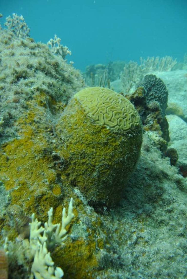
Coral reefs are under pressure from hurricanes, pollution, bleaching and global warming, and scientists have now confirmed the extent of the threat from an aggressive alga.

The algae, known as peyssonnelid algal crusts (PAC), are colonising reefs in the Caribbean at such an aggressive rate that they are interfering with the reef’s natural ecosystem, according to new research.

Marine biologists from the University of Oxford, California State University Northridge and the Carnegie Institution for Science who have been studying the issue for four years describe the extent of the threat in the Scientific Reports.

The golden-brown, crust-like alga is rapidly overgrowing shallow reefs, and has been described as an “ecological winner” by Dr Bryan Wilson of the University of Oxford’s department of zoology.

“It aggressively occupies any vacant space on the reefs, rapidly overgrows and kills live corals, prevents free-swimming coral larvae from settling on the benthos and becoming adult colonies, and is unaffected by the regular destructive hurricanes that sweep through the area,”he says.

‘It is also seemingly resistant to grazing by fish, and as far as we know, is only fed upon by a single creature, the black spiny urchin (Diadema antillarum),”he said.

The spiny urchin was once abundant in the Caribbean, but was effectively wiped out in the 1980s by a mysterious disease, he says.

“Our research has initially looked into the microbiology of PAC and compared it with that of close relatives (the crustose coralline algae, or CCA) which are known to stimulate the recruitment of coral larvae to reefs,”Dr Wilson says.

A key finding was that the PAC alga manages to inhibit the growth of beneficial marine bacteria which otherwise produce chemical compounds that attract coral larvae to the seafloor.

This means that reefs colonised by the alga are unlikely to host corals again.

The alga is described as having a “dark brown and dirty orange veneer” which stands out among the white sands and light greens, pinks, yellows and other colours that make up the reef.

The scientists say it is unclear if PAC is made up of one algal species or several, and they don’t know what is causing its rapid spread – but describe it as an “alarming trend”

They say that the next stage of their research will be to unravel the alga's “complex physiological mechanisms for this ecological success”, through studying its genome. Ultimately, they say they “hope to find ways to mitigate against this new threat”.

Published in Marine Wildlife
Tagged under

Taking 20 minutes to listen to music inspired by five oceans is the focus of a new release by a Dublin songwriter and musician Dan Fitzpatrick.

Fitzpatrick, also known as Badhands, combines acoustic and electronic instrumentation to reflect what he calls "the pulse of the ocean" and its "many moods, ranging from calm and serene to explosive and dangerous".

Vocals are also used to explore themes such as escapism, the dangers which oceans pose to humans and vice-versa.

"I'm hoping people can find 20 minutes to listen to the record and think about their own relationship with the sea and what it means to them," he says.

Fitzpatrick composed the soundtrack to the RTE wildlife series, a Wild Irish Year, and the soundtrack for the award-winning Wild Cuba documentary. The music for the two-part film won a Jackson Wild award in the US.

Speaking about the inspiration for the Indian Ocean track on his EP, Fitzpatrick said an unseasonal storm put an end to a friend's attempt to sail alone, non-stop, around the world, and this made him realise the "power and vastness of the ocean".

Fitzpatrick availed of an Arts Council initiative to support artists during Covid.

The EP is freely available on bandcamp.com and can be heard on Soundcloud with the track 'Waves' below

Published in Marine Wildlife
Tagged under

The BBC has reported that a wild swan found dead earlier this week at Lough Beg near Toomebridge, a small village on the North West corner of Lough Neagh has tested positive for Bird Flu. Lough Beg is a small freshwater lake on the border between County Londonderry and County Antrim.

The Lower River Bann flows into it from Lough Neagh at the southern end and continues its route to the sea from the northern end. It has been designated a Ramsar Site which is a wetland site designated to be of international importance under the Ramsar Convention.

Preliminary results confirmed that the swan had a similar strain of the disease to that found in poultry flocks and wild birds in Britain. Public health officials have advised that the risk to public health from this strain of avian influenza is very low, as is the threat to food safety. A dead falcon found in County Limerick also tested positive in recent days.

The chief vet Dr Robert Huey urged poultry keepers to tighten their biosecurity measures to stop transmission to commercial flocks.

The swan was found by environmentalist Chris Murphy who was assessing the impact of A6 roadworks on overwintering birds at the lough - an internationally important protected site. Further tests will now be carried out to establish whether the disease is a highly pathogenic strain or one which is less virulent.

On Wednesday a bird flu prevention zone was declared across Britain after the discovery of the disease there. Where it is detected in poultry flocks, the birds are destroyed, and prevention zones are established around affected premises. It can also lead to restrictions on trade.

Northern Ireland's Chief Vet Robert Huey urged anyone with poultry to tighten their biosecurity to prevent interaction between wild birds and their flocks.

Published in Marine Wildlife

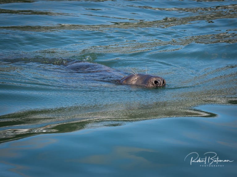
One of the most difficult, controversial and upsetting marine environment stories I have reported in my time as a marine correspondent concerns seals. I've seen them rehabilitated by a sanctuary and marvelled at the work put into healing injured, sick seals and releasing them back into the sea. I've seen fishermen provide fish to feed those seals being rehabilitated.

I've also heard fishermen claim, in anger and fury, that their catches were taken from their nets, partially eaten and then discarded useless by seals.

I've seen injured seals and heard allegations by animal welfare groups and environmentalists that fishermen had taken the law into their own hands against protected species.

Under the Wildlife Acts 1976 to 2018, cetaceans and seals are protected species.

Under the Wildlife Acts 1976 to 2018, cetaceans and seals are protected speciesSeals are a protected species Photo: Bob Bateman

Dáil debate

In recent weeks the whole issue has come to the fore again, after a Dáil debate when national media reported that licences could be given to fishermen for a cull to shoot seals. There was another outburst of fury, particularly on social media. But what is the truth of this issue?

Inland Fisheries Ireland

Official records show that the State agency responsible for the conservation, protection and management of Ireland's inland fisheries and sea angling applied three times for licences to shoot seals. A spokesperson for Inland Fisheries Ireland confirmed that it had applied for Section 42 authorisations from the National Parks and Wildlife Service on three occasions in the last 10 years. No application has been made this year. "One seal has been removed under a Section 42 authorisation in the last 10 years for reasons of public safety," the IFI said.

National Inshore Fishermen's Association

The National Inshore Fishermen's Association said there had been "biased reporting by mainstream media" which never interviewed anyone from the inshore fisheries sector. "If you take the time to listen and consider fishermen's complaints, you'll understand there are two separate aspects. The first is the amount of fish seals eat and the impact it has on fish stocks. The second is the economic impact seals have on fishers' livelihoods."

So, for this week's podcast, I spoke to the Secretary of the Inshore Fishermen's Association, Alex Crowley.

Listen to the Podcast here

Published in Tom MacSweeney
Tagged under

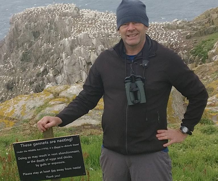
COVID-19’s impact on visits to offshore islands may be benefiting the gannet seabird colony on Wexford’s Great Saltee.

A new University College Cork (UCC) study has recorded the level of disturbance to the birds caused by tourists in the summer of 2017.

Great Saltee does not have a warden, and many tourists unwittingly cause a disturbance, leading to parents leaving their nests temporarily, exposing them to predators who quickly seize the opportunity and steal the gannets’ one and only egg, the report says.

Gannet colony on the Great Saltee Islands off the County Wexford coastGannet colony on the Great Saltee Islands off the County Wexford coast

Many tourists, especially those looking for that perfect photograph of birds on their nests, got too close to the gannets, often to within less than one metre.

This led to a 60% reduction in breeding success compared with birds at undisturbed parts of the colony, according to Debs Allbrook, a UCC masters in science student.

“On one occasion we saw nine disturbance events over a two-hour period. This directly led to eggs from nine gannet nests being stolen by herring gulls, who seem to have learned to watch the interactions between tourists and people,” she said,

“ One photographer ran right through the colony trying to retrieve his camera lens rolling downhill, leading to disturbance of about 30 nests,” she said.

As part of her research, Debs Allbrook tested to see if tourists would pay attention to an information sign warning them that their actions could be damaging.

The sign said: “These birds are breeding. Under the Wildlife Act (1976) it is illegal to disturb nesting birds. Please do not approach the colony as doing so may result in the abandonment of eggs or the death of chicks. Thank you for your consideration.”

The vast majority of people paid attention to the sign. People stayed away from the birds and fewer disturbance events were observed.

“This showed that it was largely lack of knowledge that led to the disturbance in the first place. People did not understand the harm they were causing,” she noted.

“The disturbance often caused confusion in the colony and it only took a second for a gull to zip in and steal an egg,” she said.

The full publication can be accessed now online here

Published in Marine Wildlife

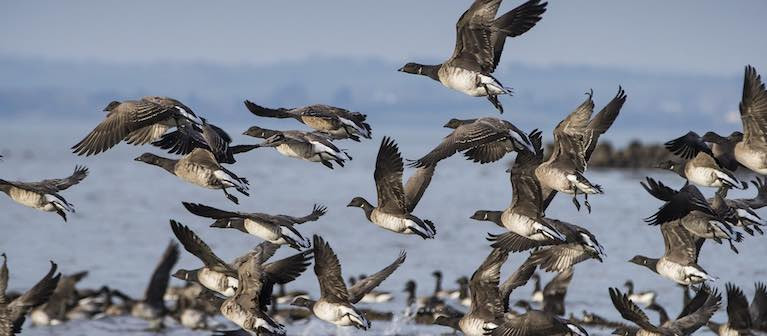
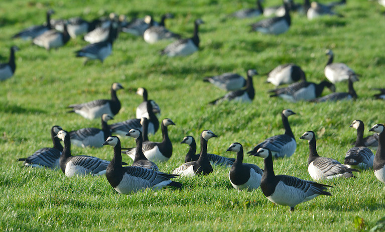
Strangford Lough is world-famous as the main arrival site for most of the migrating Canadian population (up to 80%) of pale-bellied Brent geese. Every autumn thousands of these birds leave their breeding grounds in eastern Canada and travel to Ireland to spend the winter. They leave Canada in late summer, travelling across Greenland, stopping off briefly in Iceland for a quick refuel before arriving in Ireland where they overwinter. Like their ancestors before them, most will arrive on the mudflats of Strangford to refuel on the nutritious eelgrass that grows in the intertidal sand and mudflats, although they will graze in the fields neighbouring the shore.

To protect these overwintering birds who arrive with their young, tired and hungry and in need of rest and food, the Strangford and Lecale Partnership has erected 'Share the Shore' panels in several sites around the Lough and at Killough Bay, (about 8km south-west of Downpatrick, on the County Down coast).

Strangford and Lecale Partnership has erected 'Share the Shore' panels in several sites around the Lough and at Killough Bay 'Share the Shore' panels are located in several sites around the Lough and at Killough Bay

The Share the Shore project out of a study in 2015/16 where the effects of dog walking on the bird population in Strangford Lough was monitored on a particular site – Greyabbey Bay on the east shore. From this study, it was concluded that a disturbance event affecting over-wintering birds occurs approximately once every hour. The data showed that most of this disruption is caused by dogs being walked off the lead and that excluding unknown and natural causes, off lead dogs cause the most severe response from the birds.

The birds have a small window to feed on the shore - as the tide goes out. Every time they are forced to take flight, they expend a great deal of energy and lose valuable feeding time. The panels give advice on dog walking to allow the birds to feed undisturbed.

The panels give advice on dog walking to allow the birds to feed undisturbedThe panels give advice on dog walking to allow the birds to feed undisturbed

The six panels are located in Kircubbin, Cunningburn and the Floodgates on the east side; at Island Hill and Whiterock on the western shore and at Killough on the coast.
The message is " Please take the time to consider the advice on these panels and always keep your dog on a lead!".

The Strangford and Lecale Partnership's aim is to conserve the magnificent natural and built heritage for future generations. They work with, and for, local people to achieve prosperity and social well-being, particularly through heritage, tourism, and sustainable outdoor recreation.

Published in Marine Wildlife

The waters off the south coast of Ireland have been selected as the study location for Ireland’s first real-time acoustic monitoring project of large whales, with the aim to relay warning alerts to maritime traffic to reduce the risk of disturbance and ship strikes.

The Automated Cetacean Acoustics Project (ACAP) is being undertaken by Ocean Research & Conservation Ireland, a “for-impact” non-profit organisation based in Cork, in partnership with the Rainforest Connection and supported by Huawei Ireland.

Huawei Ireland is providing a research grant with technological support through its global TECH4ALL initiative. TECH4ALL is Huawei’s digital inclusion initiative, using technology, applications and skills to empower people and organisations everywhere.

90% of Ireland’s international trade travels by sea, with the South Coast of Ireland one of the busiest heavy ship shipping lanes in the world. Thousands of large container ships pass through it from Eastern Canada to Liverpool and other European ports annually, as well as additional pleasure boats, speed crafts and eco-tour operators.

The South Coast is also an important foraging, resting and reproductive habitat for 25 cetacean species (whales, dolphins and porpoise) and particularly for large Humpback, Fin and Minke whales. Heavy ship traffic places whales at an increased risk of ship strikes causing injury or even death, and also raises the ambient noise pollution affecting all the species present.

The new study will see the deployment of acoustic monitoring equipment in the Celtic Sea at locations where sightings of whales and other wildlife have been recorded. The equipment will be able to listen for movements of whales, and with the help of machine learning models to enhance data analysis, for the first time provide near real-time detection. This will provide multiple benefits - helping with the identifying and classification of species in Irish waters, their distribution and behaviour, and most importantly, the development of an early warning system that will enable ships to reduce their speed in time to lessen the considerable risk of ship strikes.

The project will see Ireland leading the way in the advancement of policy and programmes that respect and protect marine wildlife informed by near real-time data available for the first time, with the help of Rainforest Connection and Huawei Ireland. Not only will the detections be able to help inform policy and decision-makers in the establishment and management of potential marine protected areas (MPA’s), they will also be used for education and made available to the wider public to hear the symphony of cetacean sounds.

Commenting, lead researcher Emer Keaveney, Marine Mammal Ecologist, Ocean Research & Conservation Ireland said: “Recent advances in technology provide increasing opportunity to use these innovations for good and to enhance our understanding of the natural world. This is such an exciting time as now we have a chance to peer inside the secret world of whales in Irish waters, and directly improve their welfare and conservation”.

“We are a voluntary organisation that relies heavily on third party and private assistance, so we are delighted to have this opportunity to work with Huawei Ireland.”

Emer Keaveney will discuss the project via livestream as part of the annual Huawei Connect summit, which takes place in Shanghai and online between 23rd - 26th September. Emer Keaveney is the only Irish speaker at the summit, which focuses on AI, 5G and digital innovation.

Commenting on the announcement, Tony Yangxu, CEO Huawei Ireland said: “Huawei has been a trusted partner for over 16 years in Ireland, and we are excited to be supporting Ocean Conservation & Research Ireland as our very first fully funded TECH4ALL initiative in Ireland.”

“Huawei believes that no one should be left behind in the digital world and we have made it our mission to put digital inclusion front and centre of our business. Our TECH4ALL programme centers on developing digital inclusion and empowerment initiatives with measureable outcomes. One of its many purposes is to help accelerate the UN’s SDGs and we hope that this project with ORC Ireland can contribute to that.”

Published in Marine Wildlife

110 years ago Robert Lloyd Praeger brought a group of eminent European scientists to Clare Island to map the flora, fauna, geology and archaeology of the small, exposed Atlantic island off the coast of Mayo. The Royal Irish Academy’s New Survey of Clare Island, a unique multidisciplinary endeavour that together with Praeger’s first Clare Island Survey provides an invaluable body of research informing future conservation of the natural and built heritage of Ireland and Europe.

In a new book, New Survey of Clare Island. Volume 9: Birds, published on Monday, 17 August to celebrate Heritage Week 2020, the editor Tom Kelly traces the story of the birds from Clare Island.

One of the most dramatic changes has been the arrival on Clare Island of the formidable and spectacular seabird the Great Skua—or Bonxie—which now breeds further south in Ireland than it does in Great Britain. This unexpected change—a species moving south rather than vice versa—at a time of global warming remains to be explained.

Great SkuaA Great Skua Photo: Richard T. Mills

Clare Island became separated from Ireland about 8,000 years ago by rising sea levels brought about by the melting of the massive ice sheets that formed during the last Ice Age. Although this dramatic event would have had a minimal impact on the birds that made the island their home.

The Lapland bunting and the snow bunting probably arrived first, followed by more sedentary species including the rock ptarmigan and gyrfalcon as well as many wildfowl and wading bird species.

In the three millennia that followed the formation of Clare Island, mature woodland developed allowing a woodland bird community to develop.

clare island bird bookThe Clare Island survey

Neolithic man arrived about 4,000yBP (years Before Present). Over the succeeding 3,500 years or so, the woodland element was gradually removed and about 400 years ago the modern agricultural landscape was established. The woodland bird community on Clare Island has become mostly extinct probably because its habitat gradually disappeared over the millennia, In addition, the famines of the early to mid-nineteenth century had an impact on the ecology of the inhabited offshore islands. The abandonment of land as a result of famine, and the peoples who occupied that land, is well known to cause the departure of synanthropic bird species.

Nevertheless, agricultural activity and the expansion of grasslands created opportunities for seed-eating species and ground-nesting forms such as the skylark and meadow pipit and migrants such as the northern wheatear and corncrake, and the extraction of peat created opportunities for wetland species. Well-known species such as the house sparrow, European robin, song thrush and perhaps the barn swallow have colonised the island.

Published in Marine Wildlife

Oceans given human-induced change, writes GreenNews.ie, may have been affected as much as half of the Atlantic, Pacific and Indian Oceans, a new study has revealed.

A new article in Nature Climate Change predicted through climate modelling that 20 to 55 per cent of the Atlantic, Pacific and Indian basins would have an “emergent anthropogenic signal” in 2020 and that figure would climb to between 40 and 65 per cent by the middle of this century.

The current model projects that the percentage will fall between 55 and 80 per cent in 2080.

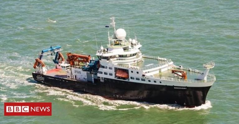
Oceanic change (Atlantic see: BBC News) as a result of the climate crisis affects both temperature and salinity, which results in “widespread and irreversible impacts”, according to the authors of the study.

While the most pronounced change is found in the upper ocean, research has indicated that changes in water masses at depth have been identified and “will probably strengthen in the future”, they added.

The first indications of global ocean heat content change was identified in the early 2000s and studies have continued to investigate trends ever since.

Anthropogenic change remains undetected in “vast regions of the World Ocean”, according to the study, but the authors note that the lack of recorded change could be due to poor observational coverage.

Further maintenance and augmentation of an ocean observing system capable of detecting and monitoring persistent anthropogenic changes therefore is needed in order to monitor the ocean, the study concluded.

For more on the effects of a changing ocean click here and scroll down. 

Published in Marine Science

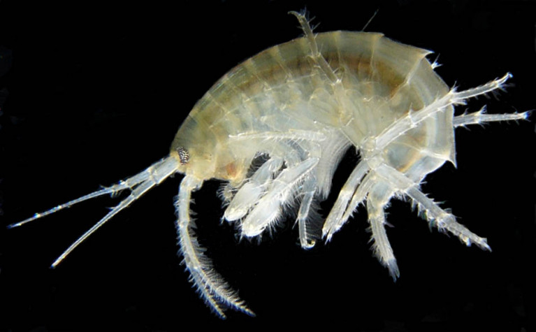
Small freshwater animals are breaking down microplastics into nanoplastic fragments which can enter the food chain, according to new research by University College Cork (UCC).

In less than four days, the freshwater amphipod, Gammarus duebeni, is able to fragment microplastics into different shapes and sizes, including nanoplastics, the research has found.

These invertebrate animals inhabit Irish streams and are part of a larger group found around the world in freshwater and ocean environments.

Microplastics are plastic pieces smaller than 5 mm, and nanoplastics created by the crustaceans within hours are at least five thousand times smaller in size.

Breakdown of plastics had been thought to occur mainly through very slow processes in the marine environment such as sunlight or wave action.

The findings have “ substantial consequences for the understanding of the environmental fate of microplastics”, study leader Dr Alicia Mateos-Cárdenas, of UCC’s School of BEES and Environmental Research Institute says:

The study also has consequences in terms of the impacts of plastics, she said.

While microplastics can become stuck in the gut of seabirds and fish, current understanding suggests that the smaller nanoplastic particles could penetrate cells and tissues where their effects could be much harder to predict, she noted.

“These invertebrates are very important in ecosystems because they are prey for fish and birds, hence any nanoplastic fragments that they produce may be entering food chains” Dr Mateos-Cárdenas added, urging further “urgently needed” research.

The study was funded by the Environmental Protection Agency, and published in the journal Scientific Reports this week, here

Published in Marine Science
Page 7 of 59

General Information on using Waterways Ireland inland navigations

Safety on the Water

All users of the navigations are strongly recommended to make themselves aware of safety on the water for whatever activity they are involved in and to read the advice offered by the various governing bodies and by:

The Dept. of Transport, Ireland: www.gov.ie/transport and The Maritime and Coastguard Agency, UK, The RNLI – Water Safety Ireland for information in terms of drowning prevention and water safety.

Registration of Vessels

All vessels using the Shannon Navigation, which includes the Shannon-Erne Waterways and the Erne System must be registered with Waterways Ireland. Only open undecked boats with an engine of 15 horsepower or less on the Shannon Navigation, and vessels of 10 horsepower or less on the Erne System, are exempt. Registration is free of charge.

Craft registration should be completed online at: https://www.waterwaysireland.org/online-services/craft-registration

Permits for use of the Grand and Royal Canals and the Barrow Navigation

All vessels using the Grand and Royal Canals and the Barrow Navigation must display appropriate valid Permit(s) i.e A Combined Mooring and Passage Permit (€126) and if not intending to move every five days, an Extended Mooring Permit (€152).

Permit applications should be completed online at: https://www.waterwaysireland.org/online-services/canal-permits

Passage on the Royal and Grand Canals – Dublin Area

For boat passage through the locks east of Lock 12 into / out of Dublin on either the Royal or Grand Canals, Masters are requested to contact the Waterways Ireland Eastern Regional Office (M-F 9.30am-4.30pm) on tel: +353(0)1 868 0148 or email [email protected] prior to making passage in order to plan the necessary lock-keeping assistance arrangements.

On the Grand Canal a minimum of two days notice prior to the planned passage should be given, masters should note that with the exception of pre-arranged events, a maximum of 2 boats per day will be taken through the locks, travelling either east or west.

Movements in or out of the city will be organised by prior arrangement to take place as a single movement in one day. Boaters will be facilitated to travel the system if their passage is considered to be safe by Waterways Ireland and they have the valid permit(s) for mooring and passage.

Newcomen Lifting Bridge

On the Royal Canal two weeks’ notice of bridge passage (Newcomen Lifting Bridge) is required for the pre-set lift date, and lock assistance will then also be arranged. A minimum of 2 boats is required for a bridge lift to go ahead.

Waterways Ireland Eastern Regional Office (Tel: +353(0)1 868 0148 or [email protected] ) is the point of contact for the bridge lift.

A maximum number of boats passing will be implemented to keep to the times given above for the planned lifts (16 for the Sat / Sun lifts & 8 for the weekday lifts). Priority will be given on a first come first served basis.

On day of lift, boaters and passengers must follow guidance from Waterways Ireland staff about sequence of passage under bridge & through Lock 1, and must remain within signed and designated areas.

Events Held on the Waterways

All organised events taking place on the waterways must have the prior approval of Waterways Ireland. This is a twelve week process and application forms must be accompanied with the appropriate insurance, signed indemnity and risk assessment. The application should be completed on the Waterways Ireland events page at :

https://www.waterwaysireland.org/online-services/event-approval

Time Limits on Mooring in Public Harbours

On the Shannon Navigation and the Shannon-Erne Waterway craft may berth in public harbours for five consecutive days or a total of seven days in any one month.

On the Erne System, revised Bye Laws state that: No master or owner shall permit a vessel, boat or any floating or sunken object to remain moored at or in the vicinity of any public mooring, including mooring at any other public mooring within 3 kilometres of that location, for more than 3 consecutive days and shall not moor at that same mooring or any other public mooring within 3 kilometres of that location within the following 3 consecutive days without prior permission by an authorised official.

Winter Mooring on the Shannon Navigation and Shannon Erne Waterway

Winter mooring may be availed of by owners during the period 1 Nov to 31 Mar by prior arrangement and payment of a charge of €63.50 per craft. Craft not availing of Winter Mooring must continue to comply with the “5 Day Rule”. Winter Mooring applications should be completed online at : https://www.waterwaysireland.org/online-services/winter-moorings-booking

Owners should be aware that electricity supply and water supply to public moorings is disconnected for the winter months. This is to protect against frost damage, to reduce running costs and to minimise maintenance requirements during the winter months.

Vessel owners are advised that advance purchasing of electricity on the power bollards leading up to the disconnection date should be minimal. Electricity credit existing on the bollards will not be recoverable after the winter decommissioning date. Both services will be reinstated prior to the commencement of the next boating season.

Smart Cards

Waterways Ireland smart cards are used to operate locks on the Shannon Erne Waterway, to access the service blocks, to use the pump-outs along the navigations, to avail of electrical power at Waterways Ireland jetties.

Berthing in Public Harbours

Masters are reminded of the following:

  • Equip their vessel with mooring lines of appropriate length and strength and only secure their craft to mooring bollards and cleats provided for this purpose.
  • Ensure the available berth is suitable to the length of your vessel, do not overhang the mooring especially on finger moorings on floating pontoon moorings.
  • Ensure mooring lines, electric cables and fresh water hoses do not create a trip hazard on public jetties for others users.
  • Carry sufficient fenders to prevent damage to your own vessel, other vessels and WI property.
  • Allow sufficient space between your vessel and the vessel ahead /astern (c.1m) for fire safety purposes and /or to recover somebody from the water.
  • Do not berth more than two vessels side by side and ensure there is safe access/egress at all times between vessels and onto the harbour itself.
  • Do not berth in such a way to prevent use of harbour safety ladders, slipways or pump-outs.
  • Do not allow the bow of your vessel to overhang the walkway of a floating mooring thus creating a hazard for others with an overhanging anchor or bow fendering.
  • Animals are not allowed to be loose or stray at any time.
  • Harbour and jetty infrastructure such as railings, power pedestals, fresh water taps, electric light poles, safety bollards, ladders etc are not designed for the purpose of mooring craft , they will not bear the strain of a vessel and will be damaged.
  • At Carrybridge on the Erne System, Masters of vessels are not permitted to use stern on mooring. Masters of vessels must use the mooring fingers for mooring of vessels and for embarkation / disembarkation from vessels.

Passenger Vessel Berths

Masters of vessels should not berth on passenger vessel berths where it is indicated that an arrival is imminent. Passenger vessels plying the navigations generally only occupy the berths to embark and disembark passengers and rarely remain on the berths for extended periods or overnight.

Lock Lead-in Jetties

Lead-in jetties adjacent to the upstream and downstream gates at lock chambers are solely for the purpose of craft waiting to use the lock and should not be used for long term berthing.

Vessel Wake

Vessel wake, that is, the wave generated by the passage of the boat through the water, can sometimes be large, powerful and destructive depending on the hull shape and engine power of the vessel. This wake can be detrimental to other users of the navigation when it strikes their craft or inundates the shoreline or riverbank. Masters are requested to frequently look behind and check the effect of their wake / wash particularly when passing moored vessels, on entering harbours and approaching jetties and to be aware of people pursuing other activities such as fishing on the riverbank.

Speed Restriction

A vessel or boat shall not be navigated on the Shannon Navigation at a speed in excess of 5 kph when within 200 metres of a bridge, quay, jetty or wharf, when in a harbour or canal or when passing within 100 metres of a moored vessel or boat.

Vessels navigating the Shannon-Erne Waterway should observe the general 5 kph speed limit which applies along the waterway. This is necessary in order to prevent damage to the banks caused by excessive wash from vessels.

Vessels navigating the Erne System should observe the statutory 5kt / 6mph / 10kph speed limit areas.

A craft on the Royal and Grand canals shall not be navigated at a speed in excess of 6km per hour.

A craft on the Barrow Navigation shall not be navigated at a speed in excess of 11km per hour except as necessary for safe navigation in conditions of fast flow.

Bank Erosion

Narrow sections of all the navigations are particularly prone to bank erosion due to the large wash generated by some craft. Masters are requested to be vigilant and to slow down to a speed sufficient to maintain steerage when they observe the wash of their craft inundating the river banks.

Unusual Waterborne Activity

Unusual waterborne vessels may be encountered from time to time, such as, hovercraft or amphibious aircraft / seaplanes. Masters of such craft are reminded to apply the normal “Rule of the Road” when they meet conventional craft on the water and to allow extra room to manoeuvre in the interest of safety.

Sailing Activity

Mariners will encounter large numbers of sailing dinghies from late June to August in the vicinity of Lough Derg, Lough Ree and Lower Lough Erne. Sailing courses are marked by yellow buoys to suit weather conditions on the day. Vessels should proceed at slow speed and with due caution and observe the rules of navigation when passing these fleets, as many of the participants are junior sailors under training.

Rowing

Mariners should expect to meet canoes and vessels under oars on any part of the navigations, but more so in the vicinity of Athlone, Carrick-on-Shannon, Coleraine, Enniskillen and Limerick. Masters are reminded to proceed at slow speed and especially to reduce their wash to a minimum when passing these craft as they can be easily upset and swamped due to their very low freeboard and always be prepared to give way in any given traffic situation.

Canoeing

Canoeing is an adventure sport and participants are strongly recommended to seek the advice of the sport’s governing bodies i.e Canoeing Ireland and the Canoe Association of Northern Ireland, before venturing onto the navigations.

Persons in charge of canoes are reminded of the inherent danger to these craft associated with operating close to weirs, sluice gates, locks and other infrastructure particularly when rivers are in flood and large volumes of water are moving through the navigations due to general flood conditions or very heavy localised precipitation e.g. turbulent and broken water, stopper waves. Shooting weirs is prohibited without prior permission of Waterways Ireland.

Canoeists should check with lockkeepers prior entering a lock to ensure passage is done in a safe manner. Portage is required at all unmanned locks.

Canoe Trail Network – "Blueways"

Masters of powered craft are reminded that a canoe trail network is being developed across all navigations and to expect more organised canoeing along these trails necessitating slow speed and minimum wash when encountering canoeists, rowing boats etc

Rockingham and Drummans Island Canals – Lough Key

It is expected that work on Rockingham and Drummans Island Canals on Lough Key will be completed in 2021. Access to these canals will be for non-powered craft only, eg canoes, kayaks, rowing boats.

Fast Powerboats and Personal Watercraft (Jet Skis)

Masters of Fast Powerboats (speed greater than 17kts) and Personal Watercraft (i.e.Jet Skis) are reminded of the inherent dangers associated with high speed on the water and especially in the confines of small bays and narrow sections of the navigations. Keeping a proper look-out, making early alterations to course and /or reducing speed will avoid conflict with slower vessels using the navigation. Personal Watercraft are not permitted to be used on the canals.

Towing Waterskiers, Wakeboarders, Doughnuts etc

Masters of vessels engaged in any of these activities are reminded of the manoeuvring constraints imposed upon their vessel by the tow and of the added responsibilities that they have to the person(s) being towed. These activities should be conducted in areas which are clear of conflicting traffic. It is highly recommended that a person additional to the master be carried to act as a “look-out” to keep the tow under observation at all times.

Prohibition on Swimming

Swimming in the navigable channel, particularly at bridges, is dangerous and is prohibited due to the risk of being run over by a vessel underway in the navigation.

Age Restrictions on operating of powered craft

In the Republic of Ireland, Statutory Instrument 921 of 2005 provides the legal requirements regarding the minimum age for operating of powered craft. The Statutory Instrument contains the following requirements:

- The master or owner of a personal watercraft or a fast power craft shall take all reasonable steps to ensure that a person who has not attained the age of 16 years does not operate or control the craft

- The master or owner of a pleasure craft powered by an engine with a rating of more than 5 horse power or 3.7 kilowatts shall take all reasonable steps to ensure that a person who has not attained the age of 12 years does not operate or control the craft.

Lifejackets and Personal Flotation Devices (PFDs)

Lifejackets and PFD’s are the single most important items of personal protective equipment to be used on a vessel and should be worn especially when the vessel is being manoeuvred such as entering / departing a lock, anchoring, coming alongside or departing a jetty or quayside.

In the Republic of Ireland, Statutory Instrument 921 of 2005 provides the legal requirements regarding the wearing of Personal Flotation Devices. The Statutory Instrument contains the following requirements:

- The master or owner of a pleasure craft (other than a personal watercraft) shall ensure, that there are, at all times on board the craft, sufficient suitable personal flotation devices for each person on board.

- A person on a pleasure craft (other than a personal watercraft) of less than 7 metres length overall shall wear a suitable personal flotation device while on board an open craft or while on the deck of decked craft, other than when the craft is made fast to the shore or at anchor.

- The master or owner of a pleasure craft (other than a personal watercraft) shall take all reasonable steps to ensure that a person who has not attained the age of 16 years complies with paragraph above.

- The master or owner of a pleasure craft (other than a personal watercraft), shall take all reasonable steps to ensure that a person who has not attained the age of 16 years wears a suitable personal flotation device while on board an open craft or while on the deck of a decked craft other than when it is made fast to the shore or at anchor.

- The master or owner of a pleasure craft (other than a personal watercraft) shall take all reasonable steps to ensure that a person wears a suitable personal flotation device, at all times while – (a) being towed by the craft, (b) on board a vessel or object of any kind which is being towed by the craft.

Further information is available at: http://www.irishstatutebook.ie/eli/2005/si/921/made/en/print

Firing Range Danger Area – Lough Ree

The attention of mariners is drawn to the Irish Defence Forces Firing Range situated in the vicinity of buoys No’s 2 and 3, on Lough Ree on the Shannon Navigation. This range is used regularly for live firing exercises, throughout the year, all boats and vessels should stay clear of the area marked with yellow buoys showing a yellow "X" topmark and displaying the word "Danger".

Shannon Navigation, Portumna Swing Bridge Tolls

No attempt should be made by Masters’ of vessels to pay the bridge toll while making way through the bridge opening. Payment will only be taken by the Collector from Masters when they are secured alongside the jetties north and south of the bridge.

Navigating from Killaloe to Limerick on the Shannon Navigation

The navigation from Killaloe to Limerick involves passage through Ardnacrusha locks, the associated headrace and tailrace and the Abbey River into Limerick City. Careful passage planning is required to undertake this voyage. Considerations include: lock passage at Ardnacrusha, water flow in the navigation, airdraft under bridges on Abbey River in Limerick, state of tide in Limerick

Users are advised to contact the ESB Ardnacrusha hydroelectric power station (00353 (0)87 9970131) 48 hours in advance of commencing their journey to book passage through the locks at Ardnacrusha. It is NOT advised to undertake a voyage if more than one turbine is operating (20MW), due to the increased velocity of flow in the navigation channel, which can be dangerous. To ascertain automatically in real time how many turbines are running, users can phone +353 (0)87 6477229.

For safety reasons the ESB has advised that only powered craft with a capacity in excess of 5 knots are allowed to enter Ardnacrusha Headrace and Tailrace Canals.

Passage through Sarsfield Lock should be booked on +353-87-7972998, on the day prior to travel and it should be noted also that transit is not possible two hours either side of low water.

A Hydrographic survey in 2020 of the navigation channel revealed that the approach from Shannon Bridge to Sarsfield Lock and the Dock area has silted up. Masters of vessels and water users are advised to navigate to the Lock from Shannon bridge on a rising tide one or two hours before High Tide.

Lower Bann Navigation

The attention of all users is drawn to the “Users Code for the Lower Bann”, in particular to that section covering “Flow in the River” outlining the dangers for users both on the banks and in the navigation, associated with high flow rates when the river is in spate. Canoeists should consult and carry a copy of the “Lower Bann Canoe Trail” guide issued by the Canoe Association of Northern Ireland. Users should also contact the DfI Rivers Coleraine, who is responsible for regulating the flow rates on the river, for advisory information on the flow rates to be expected on any given day.

DfI Rivers Coleraine. Tel: 0044 28 7034 2357 Email: [email protected]

Lower Bann Navigation – Newferry – No wake zone

A No Wake Zone exists on the Lower Bann Navigation at Newferry. Masters of vessels are requested to proceed at a slow speed and create no wake while passing the jetties and slipways at Newferry.

Overhead Power Lines (OHPL) and Air draft

All Masters must be aware of the dangers associated with overhead power lines, in particular sailing vessels and workboats with cranes or large air drafts. Voyage planning is a necessity in order to identify the location of overhead lines crossing the navigation.

Overhead power line heights on the River Shannon are maintained at 12.6metres (40 feet) from Normal Summer level for that section of navigation, masters of vessels with a large air draft should proceed with caution and make additional allowances when water levels are high.

If a vessel or its equipment comes into contact with an OHPL the operator should NOT attempt to move the vessel or equipment. The conductor may still be alive or re-energise automatically. Maintain a safe distance and prevent third parties from approaching due to risk of arcing. Contact the emergency services for assistance.

Anglers are also reminded that a minimum ground distance of 30 metres should be maintained from overhead power lines when using a rod and line.

Submarine Cables and Pipes

Masters of vessels are reminded not to anchor their vessels in the vicinity of submarine cables or pipes in case they foul their anchor or damage the cables or pipes. Look to the river banks for signage indicating their presence.

Water Levels - Precautions

Low Water Levels:

When water levels fall below normal summer levels masters should be aware of:

Navigation

To reduce the risk of grounding masters should navigate on or near the centreline of the channel, avoid short cutting in dog-legged channels and navigating too close to navigation markers.

Proceeding at a slow speed will also reduce “squat” effect i.e. where the vessel tends to sit lower in the water as a consequence of higher speed.

Slipways

Reduced slipway length available under the water surface and the possibility of launching trailers dropping off the end of the concrete apron.

More slipway surface susceptible to weed growth requiring care while engaged in launching boats, from slipping and sliding on the slope. Note also that launching vehicles may not be able to get sufficient traction on the slipway once the craft is launched to get up the incline.

Bank Erosion

Very dry riverbanks are more susceptible to erosion from vessel wash.

Lock Share

Maximising on the number of vessels in a lock will ensure that the total volume of water moving downstream is decreased. Lock cycles should be used for vessels travelling each way.

High Water Levels:

When water levels rise above normal summer level masters should be aware of:

Navigation

Navigation marks will have reduced height above the water level or may disappear underwater altogether making the navigable channel difficult to discern.

In narrow sections of the navigations water levels will tend to rise more quickly than in main streams and air draft at bridges will likewise be reduced.

There will also be increased flow rates particularly in the vicinity of navigation infrastructure such as bridges, weirs, locks etc where extra care in manoeuvring vessels will be required.

Harbours and Jetties

Due care is required in harbours and at slipways when levels are at or near the same level as the harbour walkways' as the edge will be difficult to discern especially in reduced light conditions. It is advised that Personal Flotation Devices be worn if tending to craft in a harbour in these conditions.

Slipways

Slipways should only be used for the purpose of launching and recovering of water craft or other objects from the water. Before using a slipway it should be examined to ensure that the surface has sufficient traction/grip for the intended purpose such as launching a craft from a trailer using a vehicle, that there is sufficient depth of water on the slipway to float the craft off the trailer before the concrete apron ends and that the wheels of the trailer do not drop off the edge of the slipway. That life-saving appliances are available in the vicinity, that the vehicle is roadworthy and capable of coping with the weight of the trailer and boat on the incline. It is recommended that slipway operations are conducted by two persons.

Caution to be Used in Reliance upon Aids to Navigation

The aids to navigation depicted on the navigation guides comprise a system of fixed and floating aids to navigation. Prudent mariners will not rely solely on any single aid to navigation, particularly a floating aid to navigation. With respect to buoys, the buoy symbol is used to indicate the approximate position of the buoy body and the ground tackle which secures it to the lake or river bed. The approximate position is used because of the practical limitations in positioning and maintaining buoys in precise geographical locations. These limitations include, but are not limited to, prevailing atmospheric and lake/river conditions, the slope of and the material making up the lake/river bed, the fact that the buoys are moored to varying lengths of chain, and the fact that the buoy body and/or ground tackle positions are not under continuous surveillance. Due to the forces of nature, the position of the buoy body can be expected to shift inside and outside the charted symbol.

Buoys and perches are also moved out of position or pulled over by those mariners who use them to moor up to instead of anchoring. To this end, mariners should always monitor their passage by relating buoy/perch positions with the published navigation guide. Furthermore, a vessel attempting to pass close by always risks collision with a yawing buoy or with the obstruction that the buoy or beacon/perch marks.

Masters of Vessels are requested to use the most up to date Navigation guides when navigating on the Inland Waterways.

Information taken from Special Marine Notice No 1 of 2023