


Displaying items by tag: research
Symposium Celebrates 10 Years Of Marine Economics & Policy Research
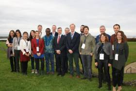
The 10th Annual Marine Economics Policy Research Symposium, recently held at the Marine Institute’s Oranmore headquarters, provided a forum for researchers, scientists, economists and policy makers to present and exchange views on a wide range of topics.
Organised by the Socio-Economic Marine Research Unit (SEMRU) of NUI Galway’s Whitaker Institute with the support of the Marine Institute, the event was a space to discuss issues from the public perceptions of the oceans and marine spatial planning to marine and coastal tourism.
The 10th annual symposium also showcased the international collaborations that have been established between SEMRU and partner institutes through a number of EU projects.
The Marine Institute’s new chief executive Dr Paul Connolly welcomed the researchers, noting that SEMRU “has played a vital role in establishing a sustainable method of valuing our oceans”.
He added that the unit has “also undertaken complex research initiatives across a broad spectrum of areas, such as fisheries, maritime transport tourism and natural capital accounting”.
“Today, economic evidence is available to show the value — market and non-market — of our ocean resources with Ireland's marine sector recognised by Government and the State as an important national asset,” he said.
SEMRU presented the latest economic figures to Government in June 2019 as part of the Our Ocean Wealth Summit.
The latest figures show that Ireland’s ocean economy had a turnover of €6.23 billion and provided employment for 34,132 people (full time equivalents). The total direct and indirect value of Ireland's ocean economy is estimated by SEMRU to be in excess of €4.2 billion GVA (Gross Valued Added), equivalent to 2% of GDP.
Ireland’s integrated marine plan, Harnessing Our Ocean Wealth, outlines the Government’s target to increase the turnover from our ocean economy to exceed €6.4 billion by 2020 and double its value to 2.4% of GDP by 2030.
The symposium welcomed speakers from the Marine Institute; NUI Galwa; Department of Housing, Planning and Local Government; Údarás na Gaeltachta; Galway-Mayo Institute Technology; Trinity College Dublin; Queen’s University Belfast; and ABPmer.
Top women’s surfer turned marine biologist Dr Easkey Britton was among the international list of speakers whose presentations are available to download from the SEMRU website HERE.
New Research On Improving Biotoxin Monitoring In Shellfish
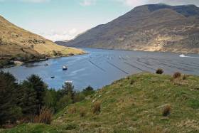
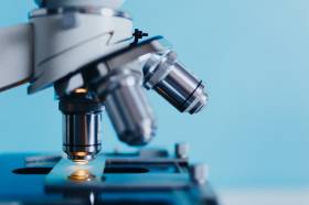
A postgraduate researcher is investigating the biotoxin production potential of Azadinium and related species in Irish waters, particularly in estuaries used for shellfish aquaculture such as Killary Harbour and Bantry Bay.
Stephen McGirr — a PhD candidate at the Institute of Technology Sligo and a Cullen Fellow at the Marine Institute — is studying Azadinium, a planktonic single-celled plant that lives in marine waters around Ireland.
Under certain conditions, Azadinium produces biotoxins which can build up in shellfish that feed on them. If eaten by humans, this can lead to shellfish poisoning.
Understanding more about the biology of this species would help both the shellfish aquaculture industry and protect human health.
“The genus Azadinium was first linked to incidents of shellfish poisoning in the 1990s and both toxic and non-toxic forms of the Azadinium species have since been identified in Irish waters,” McGirr says.
“More knowledge of the biology of the species is needed to support monitoring efforts currently underway to assist the aquaculture industry.”
Ireland’s aquaculture industry employed 1,925 people on 288 aquaculture production units, according to Bord Iascaigh Mhara’s Business of Seafood Report 2018. In 2018 it is estimated that Ireland produced 24,200 tonnes of farmed shellfish valued at €56 million.
“Aquaculture is a valuable industry to our national economy as well as for many of Ireland's coastal communities,” McGirr adds.
“The closure of aquaculture production sites due to biotoxins produced by organisms such as Azadinium impacts the industry and can also be detrimental to local economies.”
Stephen’s research supports the Marine Institute's National Phytoplanton Monitoring Programme, which monitors phytoplankton populations and dynamics around the Irish coastline.
‘Aquaculture is a valuable industry to our national economy as well as for many of Ireland's coastal communities’
McGirr says the Marine Institute’s Cullen Fellowship Programme is giving him the opportunity to learn and develop his skillset, working alongside scientists who are experts in their field, as well as gaining hands-on experience using state-of-the art equipment in the Institute's laboratories.
“I have joined two surveys on the RV Celtic Voyager along the south and western coastline of Ireland to collect both water column and sediment samples for our analyses.
“I have also presented my research at international conferences, including the International Conference on Molluscan Shellfish Safety held in Galway and the International Conference on Harmful Algae, held in Nantes, France.”
McGirr is currently focusing his efforts on translating the product of his research into articles for peer-reviewed scientific journals. His research supervisors are Joe Silke, Marine Institute and Dr Nicolas Touzet, IT Sligo.
The Cullen Fellowship Programme builds marine research capacity and capability by equipping graduates with the skills and expertise in raising awareness about our ocean, as well as Ireland's rich marine biodiversity and ecosystems.
The programme has provided grant aid to the value of €2.06 million supporting 24 PhD and three MSc students over the last five years. The research addresses a number of the 15 research themes identified in the National Marine Research and Innovation Strategy 2017-2021.
This project (Grant-Aid Agreement No CF/15/01) is carried out with the support of the Marine Institute and funded under the Marine Research Programme by the Irish Government.
Researchers Talk Ocean Science At Marine Institute Symposium
The development of an app to help fishermen target areas with fish for which they have quota and avoid fish for which they don’t is just one of the innovations being developed by researchers at the Marine Institute.
The app, presented by Dr Julia Calderwood, is part of the EU-funded DiscardLess project, helping to ensure that the discarding of non-quota fish catches is phased out under the Common Fisheries Policy.
It is just one of many research projects that were presented at the Marine Institute’s Research Symposium on Thursday (24 October).
Seventy researchers from across the institute gathered to present their work, to brainstorm, and to identify ways to work better together.
Researchers presented short overviews and took questions on their work and on the future direction of research at the Marine Institute. There was also a poster session giving further overviews of research.
The institute says its initiative to try to integrate better research across areas such as fisheries science, climate change, oceanography, fish health, seafood safety and ocean chemistry is a critical goal of the its strategy, Building Ocean Knowledge, Delivering Ocean Services.
The Research Symposium featured presentations from principal investigators to PhD students on research projects that support important policy areas for Government. The outputs from a project tracking the migration patterns of bluefin tuna, for example, support key policy areas for the Department of Agriculture, Food & the Marine.
The fate, impact and new approaches to persistent pollutants in the marine environment were also addressed and the outputs of this work support key policy areas for the Department of Housing, Planning and Local Government.
Research that supports the seafood sector was addressed with food safety issues around marine biotoxins being presented. Research into the genetic basis for natural starvation in wild Atlantic salmon was presented which will, through manipulation of diet and temperature, help to reduce the time taken for farmed fish to reach a stage of maturity where they can go out to sea cages, thus reducing grow-out time and costs for the salmon farmer.
Research and innovation is a key component of the Marine Institute’s Strategic Plan 2018-2022, and is aligned to the provision of scientific advice and services.
New Marine Institute chief executive Dr Paul Connolly explained the thinking behind the Research Symposium: “The Marine Institute provides essential scientific evidence and advice to Government and to stakeholders to ensure that we are sustainably managing our marine resources and our extensive maritime territory, which is about 10 times the size of our landmass.
“Our research is central to providing the knowledge we need to inform policy and to address challenges such as climate change and ocean pollution while helping to build sustainable maritime sectors such as aquaculture, ocean renewable energy and marine and coastal tourism.”
The Marine Institute Research Symposium is intended to be an annual event, forming part of the efforts being made to deliver knowledge and services that are safeguarding our ocean resources and supporting a healthy and sustainable ocean economy in Ireland.
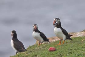
New research on Irish puffins has revealed that the sea birds swap the skies for the sea and make use of strong total currents to save energy when they search for food.
The two-year study by MaREI and conservation charity ZSL tracked puffins from Little Saltee, Co Wexford by GPS — and discovered that the birds are using the strong tidal currents in the region for a ‘free ride’ across feeding areas, saving them close to half of their usual energy usage.
Previous seabird tracking studies have shown that birds travel between often distant patches at sea where they concentrate feeding, requiring considerable effort — particularly for puffins, whose wings are short and adapted for swimming underwater.
“Our puffins have completely dispensed with the need to fly between patches of food,” said lead author Ashley Bennison, a researcher at MaREI.
It is as yet unclear exactly how the Saltee Islands’ puffins came to adapt their behaviour.
But the study, which marks the first time Irish puffins have been tracked in this manner, concludes that such behaviours are likely to be found elsewhere.
“We have long suspected that animals are able to adapt their foraging behaviour to the local environment, and this is an excellent example of how animals can surprise us with their ingenuity,” Bennison said.
The full study is published in the journal Biology Letters.
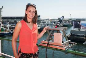
PhD student Catherine Jordan will bring her research on phytoplankton blooms to the third annual Soapbox Science even in Galway tomorrow afternoon (Saturday 29 June).
She will be among 12 female scientists standing on their soapboxes to talk about their groundbreaking research in the areas of science, technology, engineering, mathematics and medicine at the city’s Spanish Arch from noon to 3pm.
Jordan, a PhD candidate through the Marine Institute’s Cullen Fellowship Programme and NUI Galway, will discuss her research on using satellite technology to observe and identify phytoplankton blooms in North-East Atlantic waters.
“When conditions are right, phytoplankton appear in high numbers and produce green and dark red hues in the water and are known as ‘algal blooms’,” she explains.
“As these blooms can sometimes be visible from space, satellites provide a useful tool in monitoring the location and extent of these blooms.
“In most cases phytoplankton blooms are of benefit to the ecosystem, but a small proportion of phytoplankton species produce toxins which may affect other marine life.
“Satellites may be able to assist in providing early wide-scale warnings of the presence of algal blooms, by using ocean colour sensors. A lot of my research focuses on measuring optical properties of light by using different instruments and methods, as well as validating satellite measurements.”
Jordan recently joined the Marine Institute’s annual ocean climate research survey on the RV Celtic Explorer to collect plankton samples and hyperspectral radiometer data as part of her PhD research.
Speaking about the Soapbox Science even, Jordan said: “I am very passionate about my field of science and also promoting how women can work on marine research vessels and spend weeks at sea.
“It is very important to engage the public in learning about marine science in interactive ways in order to explain very complex matters. Soapbox Science is an excellent platform for promoting women in science and encouraging the public to discuss topics they may not have encountered before.”
Soapbox Science Galway began two years ago, and talks this year will cover a diverse range of topics such as enhancing farming using insects, the marvels of human milk, the internet as a force for good, and statistical thinking for real-life questions.
The event will also be held in Dublin and Cork, as well as in several countries around the world including the UK, US, Canada, Australia, Sweden, Germany, Brazil and South Africa.
For the full list of participants and more information about Soapbox Science visit soapboxscience.org
Ireland Collaborating With Cyprus On Centre Of Excellence For Marine & Maritime Research
A new joint initiative between Ireland and Cyprus for a Centre of Excellence for Marine and Maritime Research has been awarded a €15 million grant from the European Commission.
The funding under Horizon 2020: Widespread’s Coordination and Support Action call goes to the project titled CMMI MaRITeC-X, whose main objective is to establish a marine science and maritime research centre in Cyprus, the Cyprus Marine and Maritime Institute (CMMI), within the next seven years.
In this initiative, the Marine Institute and SmartBay Ireland is partnering with Cypriot government bodies (Municipality of Larnaka), private companies and organisations (GeoImaging Ltd, Maritime Institute of Eastern Mediterranean, SignalGenerix Ltd and Limassol Chamber of Commerce) as well as with the University of Southampton, UK.
The new institute to be formed in Cyprus will focus on research, technology development and innovation in several sectors critical for the Cypriot economy, such as maritime transport, marine ecosystems, offshore energy and other societal needs in the Eastern Mediterranean.
Currently in grant agreement preparation, the project is expected to kick off by end of the second quarter this year.
The Marine Institute says project complements the ambitions set out for Ireland in Harnessing Our Ocean Wealth relating to the development of our shipping and maritime industry by enabling Ireland to build expertise in these areas.
More broadly, the Harnessing Our Ocean Wealth strategy sets out clear targets in terms of turnover from the marine economy by 2020, and increasing the industry’s contribution to GDP to 2.4% a year by 2030.
The MaRITeC-X project will contribute to these objectives and is also consistent with Ireland’s Marine Research & Innovation Strategy. This strategy supports the implementation of Innovation 2020, Ireland’s national research and innovation strategy, which identifies the marine sector as one of eight areas of focus for social progress and the economy.
The Marine Institute’s contribution to the project (with a combined award of €2m) will be managed jointly by the Irish Maritime Development Office (IMDO) and SmartBay Ireland.
It’s expected that the project will allow Ireland to build national research and development capacity and to collaborate with institutions and organisations across Europe as it contributes to expertise in building marine and maritime clusters.
Marine Institute chief executive Peter Heffernan said: “We are delighted at news of the MaRITeC-X award. The award acknowledges the excellence and leadership that both the Marine Institute and SmartBay demonstrate in the European maritime landscape.
“We look forward to cooperating and collaborating with our Cypriot partners to the benefit of both innovation-led maritime economies.”
Garrett Murray, national director for Horizon 2020 at Enterprise Ireland, added: “Ireland continues to perform well under the programme and there is significant competitive funding available for Irish researchers and companies under Horizon 2020 with 40% of the budget remaining.
“EI and partner agencies are committed to supporting participation in H2020 to realise the Irish Government’s target of winning €1.2bn from the EU’s €70bn Horizon 2020 R&I budget.”
John Breslin, general manager of SmartBay Ireland said his company would be “reaching out to Irish businesses and research organisations who wish to collaborate with CMMI and its stakeholders, to help broker the development of joint projects and funding opportunities”.
New Irish Research On Atlantic Salmon Scale Growth
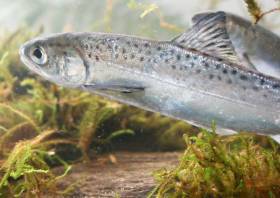
Research from Dr Katie Thomas of the Marine Institute has investigated the mechanisms for growth mark formation in scales of Atlantic salmon (Salmo salar Linnaeus) and the cause of variations in scale growth measurements.
Dr Thomas recently graduated with her PhD on her thesis, titled Scale Growth Analysis of Atlantic salmon (Salmo salar L) Unlocking Environmental Histories, from the Galway-Mayo Institute of Technology (GMIT) under the supervision of Dr Niall Ó Maoiléidigh, Marine Institute; Dr Deirdre Brophy, GMIT; and Tom Hansen, Institute of Marine Research Norway.
The PhD was funded by the Marine Institute, the Institute of Marine Research Norway and the Loughs Agency, Northern Ireland.
The Atlantic salmon is native to the temperate and sub-Arctic regions of the North Atlantic Ocean, utilising rivers for spawning and nursery and the marine environment for adult feeding, development and rapid growth.
Direct observation of the salmon’s life is challenging and costly, so scales are widely used to assess and monitor changes in growth.
“The entire life history of an individual fish is recorded on a scale which begins to form during the fry stage of the lifecycle,” Dr Thomas said.
“As the scale develops, it lays down concentric ridges or rings called circuli, which look similar to rings on a tree. The number of circuli on a scale and the distances between each circuli are measured to provide a history of individual and population growth histories.
“These changes over time can be used to infer the salmons use of the ecosystem, and indicate whether changes in growth are apparent over time and between populations.”
Scale measurements are taken from a specific body location as recommended by the International Council for Exploration of the Seas (ICES) to standardise scale analysis globally.
The first aim of Dr Thomas’ research was to compare wild Atlantic salmon growth measurements from different body areas and to establish a calculation or a conversion that could be applied to match the measurements from the standard sampling location.
“Because scales do not form at the same time, the size and shapes of scales can look very different to each other. The next part of my research was to take size and shape measurements from scales across the body and produce a calculation that determines where on the body a scale may have originated,” she added.
Overall salmon survival during the marine phase is strongly linked to the post-smolt growth period, which is the scale growth from when a young salmon migrates to sea up to the first winter at sea.
It is widely believed that circuli form on the scale every seven days during the summer and every 14 days during the winter and also the wider the distance between the circuli, the better overall growth is
As this had never been experimentally validated before, the next aim of the research was to undertake experiments in the Institute of Marine Research laboratory (Matre) in Norway.
Dr Thomas explained: “Results from the experiments showed that circuli formation rates are not constant but ranged between four to 18 days. In addition, the spacing between the circuli did not reflect growth rate suggesting that wide spacing between each circuli was not necessarily an indication of good growth.”
In the last stage of the research, scales from Atlantic salmon collected from three Irish rivers — Burrishoole, Moy and Shannon — between 1954 and 2008 were analysed to determine if marine growth had changed during that period.
The research showed that post-smolt scale growth declined over the decades corresponding to declines in return rates of Atlantic salmon, but the change in growth was not consistent between the different rivers.
This highlighted that the trends observed in one national index river may not be representative of change across all Irish populations, and that more than one index river should be used to investigate survival rates in our salmon populations.
The new knowledge generated from the PhD thesis supports more accurate interpretation of scale growth measurements, furthers our understanding of the factors affecting the survival of the wild Irish salmon and ultimately benefits the future management of this iconic species.
Dr Niall Ó Maoiléidigh of the Marine Institute said: “Dr Thomas’ research feeds directly into the institute’s long-term monitoring and stock assessment programme for Irish salmon stocks and the ongoing programme of research in the Burrishoole national index river initiated in the 1960s.
“These results are helping unravel the complicated links between climate change and factors which are causing persistent declines in salmon returns to rivers, not just in Ireland, but in countries on both sides of the Atlantic where salmon occur.”
Dr Thomas’ thesis is available on the Marine Institute’s Open Access Repository. A paper from this thesis titled ‘Experimental Investigation of the effects of temperature and feeding regime on scale growth in Atlantic salmon Salmo salar post-smolts’ was also recently published in the Journal of Fish Biology.
Dr Thomas’ current research is funded under Ireland’s DCF Pollack Programme, which is supported by the European Maritime and Fisheries Fund (EMFF).
Minister Welcomes Signing Of MOU Between Inland Fisheries Ireland & Trinity College Dublin
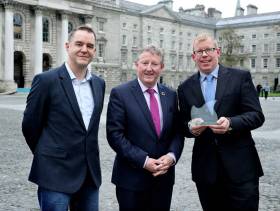
Inland Fisheries Ireland and the School of Natural Sciences at Trinity College Dublin have signed a memorandum of understanding (MOU).
The MOU will enable both institutions to collaborate across fisheries research projects.
Sean Canney, Minister of State with responsibility for the inland fisheries sector, attended the signing and welcomed the formalisation of the partnership across fisheries research.
The MOU is a culmination of a 20-year relationship between the two organisations and aims to bring greater synergy to their working relationship. It will increase opportunities for more collaborative projects through direct co-operation and sharing of resources.
The MOU was signed by Professor Andrew Bowie, associate dean of research at Trinity College Dublin, and Dr Ciaran Byrne, chief executive of Inland Fisheries Ireland (IFI).
Commenting on the significance of the partnership, Minister Canney said: “I hope that the MOU will act as an impetus to move forward with joint research to support the conservation and development of our natural resource.”
In the year ahead, research around climate change and the challenges it presents for the fisheries resource will continue to be a focus for both organisations.
IFI has established a national climate monitoring programme in water bodies nationwide with a view to producing high-quality research to inform management strategies for freshwater and marine fish species experiencing the effects of climate change.
Trinity College Dublin recently appointed two academic staff to the School of Natural Sciences whose expertise are centred on marine ecology and fish biology. Those appointments bolster the existing capacity within the School of Natural Sciences for impactful and innovative research that is highly relevant to IFI’s broad remit.
Dr Byrne said IFI “is a unique research agency, where high-level scientific expertise in fisheries ecology is supported by a nationwide sampling programme which includes index river catchments that provide invaluable ecological time series.
“We collaborate in numerous research programmes, conducting applied science to inform expert advice on the management of Ireland’s inland fisheries resource.
“The natural affinity of Inland Fisheries Ireland and the School of Natural Sciences at Trinity College Dublin has been formalised today by the signing of this MOU. Both institutions have long histories of scientific discovery and producing high quality research; by consolidating future collaborations the inland and marine fisheries resource will benefit from the combined expertise of our researchers to deliver excellent research, which will support conservation and management of a precious natural resource.”
Prof Bowie added: “Our zoology department conducts world-leading research on the impacts of climate change across marine, freshwater and terrestrial systems.
“That department’s team of computation modellers, ecosystem ecologists, and conservation biologists represent a critical mass of expertise that should prove valuable partners for addressing broad questions with Inland Fisheries Ireland about climate impacts on fisheries resources.”
Applications Close Tomorrow For Eurofleets Plus Temporary Team Leader Role With Marine Institute
There’s still time to apply for the Marine Institute’s vacancy for a temporary team leader for its Eurofleets Plus and Marine Robots projects.
Applications close at noon tomorrow, Monday 28 January for the position, in which the successful candidate will act as project manager for the Eurofleets Plus project.
Eurofleets Plus is a four-year advanced community research infrastructure project which has been awarded funding via Horizon 2020, and aims to unify oceanic research fleets across Europe for shared purposes and common goals.
Among other requirements, the Marine Institute is looking for applicants with degree in a scientific or technical subject am with a proven background in working in marine research projects, ideally in a co-ordination capacity.
The Marine Institute website has more on the role and how to apply HERE.
Marine Institute Welcomes Irish Commitments To Ocean Research
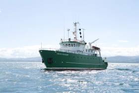
The Marine Institute has welcomed Irish commitments announced at the recent Our Ocean Conference in Bali which include the provision of €25 million for a 50-metre modern research vessel to replace the RV Celtic Voyager.
“The vessel will provide critical national infrastructure to enable Ireland to address the considerable challenges of Brexit and the Common Fisheries Policy as well as climate-induced impacts on our oceans,” Marine Institute chief executive Dr Peter Heffernan said.
In addition, the Marine Institute says it has committed €2 million towards a new five-year programme of ocean and climate research.
With 50% funding from the EU ERDF scheme, the Marine Institute is running a competitive funding call to support the establishment of a principal investigator-led research team in an Irish higher education iSnstitution.
“This is a key investment to build capacity in an area of research prioritised under the National Marine Research and Innovation Strategy (2017-2021),” Dr Heffernan said.
“The research funded under this programme will deliver societally relevant knowledge aimed at better understanding the complex interactions between the ocean and climate change.”
Minister Creed also announced the continued commitment to the Environmental Educational module of Ireland’s Green Schools programme, and the continued support of the Clean Coasts programme.
“These programmes aim to build on Ireland’s marine and maritime heritage by increasing awareness of the value, opportunities and social benefits of our ocean wealth and identity, further supporting the Marine Institute’s Explorers Education Programme,” Dr Heffernan said.
Other announcements by Ireland include the provision of €10m to the local authority sector in Ireland to aid in the establishment of four Climate Action Regional Offices (CAROs) and €1m over a five-year period (2019-2024) towards a new programme of ocean and climate research.
The Marine Institute also welcomes commitments announced by the European Commission which include €300 million for EU-funded initiatives for projects to tackle plastic pollution, make the ‘blue economy’ more sustainable and improve research and marine surveillance.


 Michael Murphy Schull Harbour Sailing Club (SHSC), Eric Coogan Heineken Ireland, Mark Murphy, Commodore SHSC, Jack Allen SHSC, Carmel O'Regan SHSC, Cornelious Ndlovu, Schull Harbour Hotel Operations Manager and Derval Murphy SHSC")

