


Displaying items by tag: Surveys
The first in a series of hydrographic and geophysical surveys to be undertaken in the Celtic Sea and Atlantic Ocean under the INFOMAR programme between April and October 2019 is now under way.
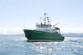
The RV Celtic Voyager (callsign EIQN) set off on Friday 12 April for an 18-day survey, the first of four over the next five months 18 May-6 June, 12-28 July, 29 August-14 September).
The RV Celtic Explorer (callsign EIGB) will follow up with an 18-day survey from 21 September to 8 October. Both vessels will be towing a magnetometer sensor with a single cable of up to 200 metres in length.
Other survey vessel involved include the Geological Survey Ireland vessels RV Keary (callsign EI-GO-9), RV Geo (callsign EI-DK-6), RV Mallet (callsign EI-SN-9) and RV Lir (callsign EI-HI-2).
All will display appropriate lights and markers and will be listening on VHF Channel 16 throughout the course of the surveys.
Full details of the survey areas are included in Marine Notice No 8 of 2019, a PDF of which is available to read or download HERE.
New Project Uses Seabed Mapping To Study Behaviour Of Fish

#MarineScience - Ciaran O’Donnell, a specialist in fisheries acoustic research with Fisheries Ecosystem Advisory services at the Marine Institute, has just begun a PhD research project that will link fisheries and seabed mapping acoustic technologies.
By using both technologies, he aims to learn more about how fish behave during acoustic surveys and therefore increase the precision of fish stock assessments.
O’Donnell’s research will focus on pelagic species – fish that swim in the water column – to see if there is avoidance behaviour during acoustic surveys and also to look at schooling behaviour and preferred habitat.
He’ll use the state-of-the-art multibeam echosounder system that has just been installed on the RV Celtic Explorer to look beyond the data normally captured during acoustic fisheries surveys to see if some or any of the fish being targeted by the survey are moving away from the research vessel as it passes overhead them.
“I’m really looking forward to the sea trials of the new multibeam next week (16-24 February) when we’ll get a chance to use the most advanced seabed mapping technology alongside acoustic fisheries technology. We should be able to see a much broader picture than before," said O'Donnell, a chief scientist on annual surveys for blue whiting, Celtic Sea herring and boarfish.
“Acoustic surveys are very targeted and focussed and this will allow us to capture new information about what the fish are doing beyond the target of the downward-looking fisheries echosounder. It will be like getting enhanced peripheral vision of the sea around the ship.
“We’ll be able to see if fish are moving away from the research vessel and out of the survey path and therefore will potentially enhance the precision of our current survey methods.”
The project will bring together technology and data from fisheries and seabed mapping and O’Donnell will work closely with the INFOMAR team and the advanced mapping services at the Marine Institute.
The research project, originally designed by the INFOMAR team, brings together a number of experienced researchers including Dr Chris McGonigle and Dr Rory Quinn of the University of Ulster, Dr Fabio Sacchetti of INFOMAR and the Marine Institute, and Dr David Reid of the Marine Institute and UCC.
Irish to Lead Europe in Research Vessel Productivity
These figures compare favourably with our European counterparts, reflecting a high level of activity on national and international research and monitoring programmes.
Work duties in 2011 for the Galway based vessels will range from fisheries surveys to underwater mapping and from climate studies to deepwater surveys with the remotely operated submersible ROV Holland 1. The work schedule will facilitate training missions and to carry out essential maintenance work on Ireland's network of data buoys that, in parallel to their research function, supply the vital information on which weather and shipping forecasts are based.
The increased activity of the research vessels reflects the growing imperative to understand and sustainably manage the economic potential of our offshore marine territories, an area over ten times that of Ireland itself.
A major role of the ships' workload will be commercial fish stock assessments. Together they are to devote 141 days on stock surveys in support of the sustainable management of Ireland's fisheries.
The RV Celtic Voyager will conduct underwater television surveys of valuable prawn stocks off the Aran Islands, the Irish and Celtic Seas, working on blue whiting, a survey of herring stocks in the north-west. In addition a comprehensive 54-day annual Irish Groundfish Survey which will take place in stages all around the Irish coast from September to December.
The survey will be the largest undertaken by an Irish research vessel and is essential to providing the scientific data used to inform the annual quota negotiations required in Brussels each year.
For the 2011 schedule for both vessels is available to view by clicking HERE and the Maritime Institute website click this link.
At 65.5m RV Celtic Explorer (2,425grt) accommodates 35 personnel and up to 21 scientists and 31.4m RV Celtic Voyager (340grt) with up to 8 scientists and a maximum endurance of 14-day days. For detailed technical specifications of the Dutch built vessels, RV Celtic Explorer, click here to download a PDF file and for the RV Celtic Voyager click here
For further information contact: Dr John Joyce, Communications Manager of Marine Institute on 087 2250871


 with (from left) the Marine Institute’s Fiona Grant, Dr Niall McDonough and Joe Silke during her visit to the institute’s Galway headquarters on Friday 5 April")


 Michael Murphy Schull Harbour Sailing Club (SHSC), Eric Coogan Heineken Ireland, Mark Murphy, Commodore SHSC, Jack Allen SHSC, Carmel O'Regan SHSC, Cornelious Ndlovu, Schull Harbour Hotel Operations Manager and Derval Murphy SHSC")


