


Displaying items by tag: INFOMAR
The latest Marine Notice from the Department of Transport advises that INFOMAR will undertake a hydrographic and geographic survey operation in the Celtic Sea and Atlantic Ocean for six months from this April.
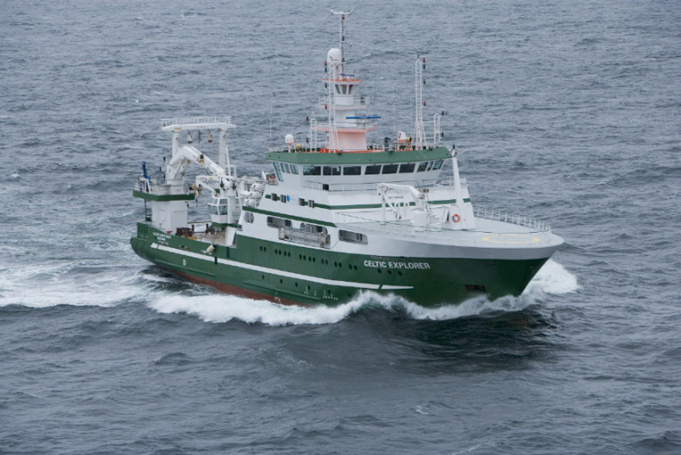
The massive operation will involve research vessels from Geological Survey Ireland (Keary, Geo, Lir, Gale and Mallet) and the Marine Institute (Celtic Voyager and Celtic Explorer) in a variety of surveys — along the South-West Coast from Roaringwater Bay to Kilkee, and offshore south of Mizen Head and between Kerry Head and the Aran Islands.
All vessels will be listening on VHF Channel 16 throughout the survey, and will display appropriate lights and markers. The RVs Celtic Voyager and Celtic Explorer will also be towing a magnetometer sensor with a single cable up to 200m in length, and a moving vessel profiler cable of variable length up to 200m.
Full details of the surveys, including dates, maps and coordinates, can be found in Marine Notice No 10 of 2021, a PDF of which can be downloaded below.
Ireland Just Five Years Away from Mapping its Entire Marine Territory
Ireland’s internationally important seabed mapping project has been profiled in The Irish Times as it enters the final years of its mission to fully chart the nation’s marine territory.
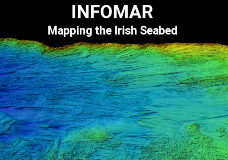
INFOMAR, a joint initiative of the Marine Institute and Geological Survey Ireland, is the latest iteration of a more than 20-year effort to map what’s one the largest seabed territories in Europe — an achievement that would also be a world first.
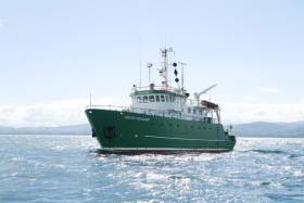
Making use of a range of research vessels, including the RV Celtic Explorer, INFOMAR regularly samples and collates data from the depths using a variety of techniques like multibeam sonar.
Experts use this data for models that are critical for the planning of offshore infrastructure such as undersea cables and wind farms — as well as the study of wildlife habitats and development in coastal communities.
And the project has even inspired a new Master’s degree course that aims to produce the next generation of marine mapping specialists.
The Irish Times has much more on the story HERE.
Marine Institute Scientists Join ‘Mission Atlantic’ To Map & Assess Sustainable Ocean’s Development
Marine scientists from Ireland will join an international group of ocean experts in a project to map and assess the Atlantic Ocean’s current and future risks from climate change, natural hazards and human activities.
Mission Atlantic brings the Marine Institute together with scientists from Europe, Brazil, South Africa, Canada and the USA to develop the first Integrated Ecosystem Assessments (IEAs) at the scale of the Atlantic basin.
Using high-resolution ocean models; data collected with marine robots and acoustic sensors; artificial neural networks; risk assessment methods; and advanced statistical analysis, the international partnership will assess the pressures imposed on the Atlantic’s marine ecosystems — especially those related to plankton and fish distribution — and identify the parts most at risk.
The Marine Institute says this “unique” project — funded by a €11.5 million grant from the European Union’s Horizon 2020 programme — will engage scientists, managers of marine resources and other stakeholders in balancing the need for environmental protection with sustainable development.
‘Mission Atlantic will contribute to a better and more sustainable future for life on Earth’
“In an era of rapid transformations affecting our societies and our lives, we are asked to provide the scientific knowledge necessary to face future challenges and to guarantee a sustainable future for the next generations,” says project co-ordinator Patrizio Mariani.
“By studying the complex Atlantic Ocean ecosystems, Mission Atlantic will contribute to a better and more sustainable future for life on Earth.”
The Marine Institute is leading the IEA approach for each of the seven case study areas throughout the Atlantic. In the Celtic Sea, this will be underpinned by regional data from INFOMAR, Ireland’s ongoing seabed mapping programme.
Marine Institite chief executive Dr Paul Connolly said: “The comprehensive mapping of the depth, character and benthic habitat of our seabed is critical to assess change, manage resources and risks, and to predict understand and realise the potential of our marine resource.”
Mission Atlantic will also focus on improving education, professional development opportunities and maritime policy in countries that border the Atlantic Ocean, north and south.
More information on the project will be available soon at www.missionatlantic.eu
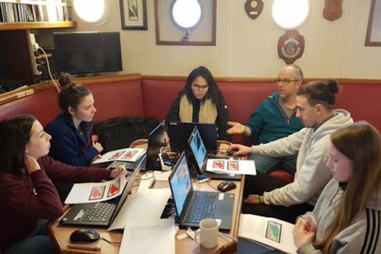
A new Master’s course specialising in remote sensing and the principles of seabed mapping has been successfully delivered by a joint partnership between the Department of Geography at the Maynooth University and Ireland’s marine mapping programme INFOMAR.
The level 9 post-graduate module teaches students about the science of seabed mapping by providing a combination of class-based learning and practical offshore survey experience.
The course outlines the importance and impact of seabed mapping, and features a range of topics including how seabed data are collected and processed to produce high resolution maps of seafloor depth, type and habitat.
Lectures illustrate how scientists measure and describe the seafloor in incredible detail, using state of the art acoustic sonar, positioning, and optical instrumentation.
The use of satellite imagery analysis is explained in studying coastal seabed depth and shape, with practical examples utilising images of Dublin Bay acquired on the Sentinel-2 satellite’s sensor almost 800km above the Earth’s surface.
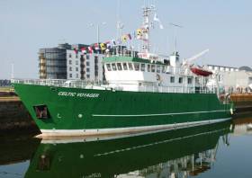
The module includes a two-day offshore practical where students are given an opportunity to apply the theoretical learning aboard the RV Celtic Voyager.
This is one of six survey platforms deployed by INFOMAR during seabed mapping operations, tasked with operating along the continental shelf and coastal waters.
Students get exposure to the dry and wet/chemical laboratories, as well as to operating an array of scientific equipment including the multibeam sonars and associated oceanographic instrumentation.
Participants boarded the RV Celtic Voyager in the Port of Cork and departed to the outer reaches of Cork Harbour where the offshore element of the module was conducted successfully on 15 and 16 February.
Training activities undertaken onboard included a marine mammal observation deck watch, survey computers and software use, benthic ecology, sedimentology classification, sound velocity probe deployment, multibeam echosounder, and sub-bottom profiler data gathering.
‘This module … demonstrates the welcome influence of Irish seabed mapping expertise on new sectors of society’
After exposure to the scientific equipment, workflows and data processing onboard, the students were tasked with the design, planning and implementation of a real-life survey scenario. This enabled them to apply their newly acquired seabed mapping knowledge as a team of scientists would in real-world conditions.
Overall the INFOMAR MSc module gave Maynooth students an overview of remote sensing techniques, helping them to understand bathymetric data products, to recognise data limitations, and to identify key systems and practices used in the field of seafloor surveying.
Students also developed a technical grounding in mapping at different resolutions, and the importance of instrumentation calibration, quality control and processing of bathymetry datasets, before product delivery to end users.
In addition, students learned how to source marine data online from INFOMAR’s Interactive Web Data Delivery System and online Webviewers, and via web-based portals operated by the European Marine Observation and Data Network (EMODnet) and the Copernicus Marine Environment Service.
Importantly, says the Marine Institute, the module was taught within the context of end users, stakeholders and the policy framework underpinning ocean science and ocean literacy, highlighting both the relevance and importance of mapping the Earth’s seafloor.
Participants benefited from the fact that the course was delivered directly by the INFOMAR team, who have extensive experience of offshore surveying, and were able to share their own experiences and varied employment backgrounds with the students.
Sean Cullen, of the Geological Survey Ireland and INFOMAR joint programme manager, said: “I’m pleased to see the very positive feedback on the course overall both from the students and the tutors.
“This module, newly developed by the INFOMAR team, with steering from the Department of Geography at Maynooth, demonstrates the welcome influence of Irish seabed mapping expertise on new sectors of society and is timely addition to the INFOMAR education initiative as we face into the United Nations Decade of Ocean Science for Sustainable Development.
“The collaboration is an encouraging sign that seabed science belongs in the space of third level education, and sets to further promote Ireland as leaders in marine science and of ocean literacy on an international stage.”
Thomas Furey, INFOMAR joint programme manager from the Marine Institute, added: “It is critical that we create a legacy to build on Ireland’s world leading role in seabed mapping, and through launching our third level delivery of INFOMAR specific training, we are contributing to capacity build, marine economy growth, and Ireland’s marine plan, Harnessing Our Ocean Wealth.”

Hydrographic and geophysical survey operations will be undertaken by INFOMAR in the Celtic Sea and Atlantic Ocean between April and October this year, according to a recent Marine Notice from the Department of Transport, Tourism and Sport.
Covering some 125,000 sq km of underwater territory, INFOMAR will produce integrated mapping products covering the physical, chemical and biological features of the seabed.
Both Marine Institute vessels, the RV Celtic Voyager (callsign EIQN) and RV Celtic Explorer (callsign EIGB), will be employed for these survey operations, towing a magnetometer sensor with a single cable of up to 200m in length and a Moving Vessel Profiler cable of variable length up to a maximum of 200m.
Geological Survey Ireland will also operate four vessels, the RV Keary (callsign EI-GO-9), RV Geo (callsign EI-DK-6), RV Mallet (callsign EI-SN-9) and RV Lir (call sign EI-HI-2).
All vessels will display appropriate lights and markers and will be listening on VHF Channel 16 throughout the course of the survey.
Further details, including co-ordinates of the survey areas, are included in Marine Notice No 11 of 2020, a PDF of which is available to download below.
Applications Open For EurofleetsPlus ‘Floating University’ In Cork Harbour
The EurofleetsPlus project is calling for applications from early-stage researchers of marine-related sciences to take part in a ‘Floating University’ on the RV Celtic Voyager next spring.
Applications are open until next Friday 22 November for the scheme co-ordinated in Ireland by the Marine Institute.
Mapping the Ocean Floor: An Introduction to Practical Aspects of Hydrographic Surveying will take place on board the RV Celtic Voyager in Cork Harbour from 19-25 February next year.
Teaching will focus on the operation of multi-beam echosounders and sub-bottom profiling and their applications for mapping and characterising the seabed. Offshore training will be supported by lectures, workshops and online resources.
On completion, participants of the Floating University will be able to demonstrate competence in designing and executing an offshore hydrographic survey, articulate understanding of the principles and methods applied to seabed surveying, as well as practice data acquisition and data processing for multi-beam echosounders and sub-bottom profiler systems.
Instruction will be from expert practitioners from the INFOMAR project with guest lecturers from the Marine Geology Research Group, University College Cork, and the National Institute of Oceanography and Applied Geophysics (OGS) in Italy.
A total of eight places are available for European postgraduate students (students of all nationalities enrolled at European universities) and online applications must be received by next Friday. Details of the Floating University and how to apply can be found HERE.
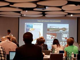
Annual INFOMAR Seminar in Dingle to Focus on Role of Seabed Mapping in Coastal Communities
The annual INFOMAR Seminar is a celebration of the year’s work by Ireland’s national seabed mapping programme. INFOMAR is funded by the Department of Communications, Climate Action and Environment and is jointly managed and operated by Geological Survey Ireland and the Marine Institute.
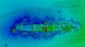
Attendees at the seminar, which will be held in Dingle, Co Kerry, on 16 and 17 October, will be among the first to see details of more than 8,500 of seafloor mapped, over 20 shipwrecks surveyed, and new 3D visuals of the coastal landscapes developed during the 2019 survey season.
The event will focus on Irish seabed mapping activities related to marine science, biodiversity, heritage and tourism in coastal communities. The event will feature an exciting line-up of experts presenting on; shipwreck mapping and archaeology, ocean literacy, marine ecology, ocean energy and infrastructure, as well as submerged and coastal landscapes and the connection between marine tourism and Fáilte Ireland’s Wild Atlantic Way.
Koen Verbruggen, Director of Geological Survey Ireland stated; “The INFOMAR seabed mapping programme continues to create significant positive impact at national, European and international levels, however this year’s annual conference in Dingle, Co Kerry, reflects INFOMAR’s prioritisation of engagement with local maritime communities who remain key stakeholders in Ireland’s national seabed mapping programme.”
“Ireland is an exemplar internationally in demonstrating best practice in ocean governance, through mapping, observing, predicting and managing our marine territory and resources. Connecting society with the value and importance of our ocean wealth is critical if we are to address today’s challenges, including climate change and population growth” said Dr. Peter Heffernan, CEO, Marine Institute.
Minister Canney stated; “INFOMAR, Ireland’s internationally renowned seabed mapping programme is an impressive example of inter-agency cooperation within the Government of Ireland. By holding its annual seminar event in Dingle Co. Kerry, I’m delighted to see the programme engage with its stakeholders at a local level, conveying its role in supporting the development of industry, research, heritage and tourism within coastal maritime communities”.
The INFOMAR Seminar will take place in the Dingle Skellig Hotel on Wednesday 16 and Thursday 17 October 2019. The event will include a special commemoration of the achievements of the Irish Baselines Project, and a live cast to MAREANO, the Norwegian marine mapping programme. Norway has just announced a new coastal mapping programme similar to INFOMAR which will complement the offshore activities of MAREANO. The event will conclude with a behind the scenes visit to Dingle OceanWorld Aquarium and to one of Ireland’s State research vessels, the RV Keary.
The event is open to all members of the public and interested people should register through the INFOMAR website www.infomar.com
Third Expedition Completes ROV-ing Of Ireland’s Offshore Reef Habitats
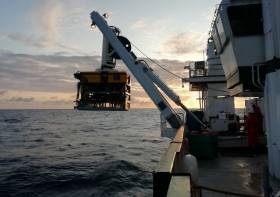
An Irish-led, international team of marine scientists on board the RV Celtic Explorer recently completed the third and final leg of an extensive offshore reef study using the Marine Institute’s remote operated vehicle (ROV) Holland 1.
The 21-day expedition investigating sensitive deep-sea habitats at the outer extent of the continental shelf off the southwest of Ireland was part of the SeaRover (Sensitive Ecosystem Assessment and ROV Exploration of Reef) project.
During their time at sea, the survey team mapped 154 separate locations within Ireland's marine territory, in what the Marine Institute describes as one of the most significant deep water benthic habitat assessments undertaken in this country.
The data and findings will contribute to good fisheries practice and the sustainable management of Ireland's marine biodiversity, the institute adds.
The survey used the ROV Holland 1 to capture high-definition footage of reef habitats up to 3000 metres deep, and to recover biological and sediment samples from 52 locations along the continental margin.
“Sensitive reef habitats form fragile ecosystems and attract a variety of marine species, such as sea pens, sponges, fish and crustaceans,” said survey chief scientist Yvonne Leahy, of the National Parks and Wildlife Service (NPWS).
“Surveying these habitats enables us to better understand Ireland’s deep sea territory so that we can protect and monitor our marine biodiversity and sustainably manage Ireland's marine resources effectively.”
Scientists from NUI Galway and University of Plymouth also joined the expedition to gather a range of biological samples to enable further research into population genetics studies, ecological modelling, and the harvesting of sponges for potential novel compounds for use in bio-medical applications.
Sediment samples will also be utilised for microplastics studies by NUI Galway and Galway-Mayo Institute of Technology (GMIT).
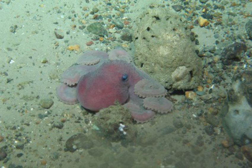 An octopus 1,000 metres below the surface | Photo: Marine Institute
The three SeaRover surveys between since 2017 have involved a combined 63 days at sea, recorded 332 hours of high-definition video from the seafloor — almost 14 days of footage — and have undertaken detailed studies of 350km of seabed along a shelf extent of nearly 2,500km.
The surveys have explored 154 different locations along Ireland’s continental margin, including the Rockall and Porcupine Banks, the Goban Spur and the Whittard Canyon.
The HD camera picks up fine detail of deep-water coral species. The first SeaRover survey in 2017 included the discovery of the deepest known occurrence of the cold-water coral Solenosmilia variabilis, forming reefs in Irish waters at depths of 1,600m.
In 2018 the team discovered a rare shark nursery, 200 miles west of Ireland. A large number of egg cases were filmed on the seafloor at depths reaching 750m, and a large school of blackmouth catshark (Galeus melastomus) were present at the site. There were also numerous recordings of different coral species observed in Irish waters for the first time.
“After three years, the survey team has created an extensive data set which represents one of the most comprehensive assessments of Ireland's marine biodiversity,” said Leonie O'Dowd, Marine Institute section manager and European Maritime and Fisheries Fund (EMFF) programme co-ordinator.
“The success of these surveys is thanks to the coordination and collaboration across many organisations and government departments, and will benefit national policy development as well as researchers and scientists exploring our marine territory in the future.”
Thomas Furey, the Marine Institute’s joint INFOMAR programme manager, added: “It is fantastic to see the underlying INFOMAR seabed mapping data being used to strategically identify and target such vulnerable marine ecosystems for detailed studies in support of future marine management plans.
“In funding INFOMAR, the Department of Communications, Climate Action and Environment are supporting key evidence based investigations of our ever changing marine environment.”
The three-year SeaRover project was commissioned and jointly funded by the Irish Government and the EU’s European Maritime and Fisheries Fund (EMFF).
The cross-government initiative was supported by the Department of Agriculture, Food and Marine, Department of Culture, Heritage and Gaeltacht, and Department of Communications, Climate Action and Environment as part of the Marine Institute’s implementation of the EMFF Marine Biodiversity scheme.
Survey operations were led by the Marine Institute, INFOMAR and NPWS, accompanied by scientists from NUI Galway and the Marine Biology and Ecology Research Centre at the University of Plymouth, and supported by scientists in Geological Survey Ireland and the Norwegian Marine Institute.
The first in a series of hydrographic and geophysical surveys to be undertaken in the Celtic Sea and Atlantic Ocean under the INFOMAR programme between April and October 2019 is now under way.
The RV Celtic Voyager (callsign EIQN) set off on Friday 12 April for an 18-day survey, the first of four over the next five months 18 May-6 June, 12-28 July, 29 August-14 September).
The RV Celtic Explorer (callsign EIGB) will follow up with an 18-day survey from 21 September to 8 October. Both vessels will be towing a magnetometer sensor with a single cable of up to 200 metres in length.
Other survey vessel involved include the Geological Survey Ireland vessels RV Keary (callsign EI-GO-9), RV Geo (callsign EI-DK-6), RV Mallet (callsign EI-SN-9) and RV Lir (callsign EI-HI-2).
All will display appropriate lights and markers and will be listening on VHF Channel 16 throughout the course of the surveys.
Full details of the survey areas are included in Marine Notice No 8 of 2019, a PDF of which is available to read or download HERE.
Big Presence For INFOMAR At Major Seabed Mapping Conference
#MarineScience - The extensive work carried out jointly by the Marine Institute and Geological Survey Ireland through the INFOMAR programme received substantial exposure and recognition at the 16th Forum for the Exchange of Mutual Multibeam Experiences (FEMME) in Bordeaux last week.
Hosted by the Kongsberg Maritime User Forum and focussing on seabed mapping, FEMME provides an international platform for hydrographic professionals to meet, exchange experiences and ideas, provide inspiration and contribute to improved system performance and the future of underwater mapping technologies.
High-profile attendees include the secretary general of the International Hydrographic Organization (IHO), chief hydrographers from the Service Hydrographique et Océanographique de la Marine (SHOM), and Seabed 2030 leaders.
An overview of the Department of Communications, Climate Action and Environment-funded INFOMAR programme was provided by Dr Fabio Sacchetti, who updated the audience on future plans as well as recent achievements of the Irish national seabed mapping initiative.
Dr Sacchetti highlighted 10 case studies featuring multiple applications of multibeam technologies in support of sectors including coastal engineering, marine conservation and marine heritage and tourism.
In addition, a recent high-profile collaboration between INFOMAR and various US and Canadian research institutes was presented by international research partners in attendance.
INFOMAR featured prominently in a talk by Prof John Hughes Clarke (CCOM/University of New Hampshire) when describing research into the impact of internal wave activity on multibeam bathymetry in an Irish/Celtic Sea context, based on work conducted onboard the RV Celtic Explorer.
Prof Clarke has been collaborating with INFOMAR since 2015, and he is particularly focused on using hydrographic and fisheries sonar systems, combined with oceanographic data, to gain a deeper understanding of the dynamics and complexities of the Celtic Sea.
Jose Cordero, of Instituto Hidrografico dela Marina (Spain), demonstrated how improved sound speed control through remotely detecting thermocline undulations can be achieved.
The study was the result of a collaboration carried out in 2017 onboard the RV Celtic Explorer during a routine INFOMAR survey.
Finally, Anand D Hiroji (HSRC/University of Southern Mississippi) showed how unambiguous radiation pattern extraction methods can improve data derived from multisector multibeam Sonars. Once again, this study was carried out using data acquired by INFOMAR onboard the RV Celtic Explorer.
As Ireland continues toward completion of its seabed mapping programme in 2026, the Marine Institute says it is “widely acknowledged internationally” that our best practice approach towards open and integrated data acquisition, integration and exploitation “is a valued model, and one which gives Irish researchers and technology developers a global audience, and market.”


 with (from left) the Marine Institute’s Fiona Grant, Dr Niall McDonough and Joe Silke during her visit to the institute’s Galway headquarters on Friday 5 April")


 Michael Murphy Schull Harbour Sailing Club (SHSC), Eric Coogan Heineken Ireland, Mark Murphy, Commodore SHSC, Jack Allen SHSC, Carmel O'Regan SHSC, Cornelious Ndlovu, Schull Harbour Hotel Operations Manager and Derval Murphy SHSC")


