


Displaying items by tag: Seabed Mapping
Ireland Will Be First To Complete Seabed Mapping
Ireland is on course to become the first country in the world to complete seabed mapping.
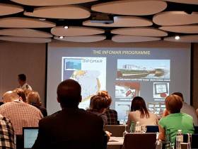
The mapping of the seabed off the Burren and the Cliffs of Moher on the Clare coast will be one of the keynote topics at Geopark Academy 2024, a two-day conference organised by the Burren and Cliffs of Moher UNESCO Global Geopark as part of European Geoparks Network Week to be held on Saturday, May 25 and Sunday, May 26.
Limestone rocks were formed in shallow, warm, tropical seas there, 10 degrees South of the Equator, 330 million years ago.
Geological Survey Ireland (GSI) will provide an update on its groundbreaking seabed mapping project at the event, which will be held at the Burren College of Art in Ballyvaughan. This year, the college is marking its 30th anniversary of foundation.
Felim O’Toole, a Hydrographic Surveyor with GSI, will be one of the keynote speakers and will update on the Integrated Mapping for the Sustainable Development of Ireland’s Marine Resource (INFOMAR) project, which has been mapping Ireland’s coastal seabed in comprehensive detail. The INFOMAR programme team, which includes the Marine Institute, aims to complete Ireland’s seabed mapping by the end of 2026, when it could be the first country globally to do so. Mr. O’Toole’s talk will focus on mapping the seabed off the Burren and Cliffs of Moher.
Dr. Eamon Doyle, a Geologist with the UNESCO Global Geopark, who will open the conference, says the Burren holds many “fascinating clues to conditions on Earth more than 300 million years ago. The oldest rocks visible on the Burren’s surface were formed during the Carboniferous period, approximately 330 million years ago. These limestone rocks formed in shallow, warm, tropical seas. Scientists come from all over the world to see what we have here.”
INFOMAR’s Bluescale Map Series Concludes With Aran Islands as All 18 Maps Are Released As Gaeilge
Ireland’s national seabed mapping programme, INFOMAR completes its Bluescale Map Series with the release of its stunning map of the Aran Islands.
Now all 18 maps in the series are available for free to the public, in English and now as Gaeilge.
Staring on 11 August this year, INFOMAR released a new instalment each week in its series of bespoke, high-resolution bathymetric maps of Irish coastal waters.
Developed by a dedicated team of hydrographers, data processors and cartographers, the maps highlight the topography of the coast in remarkable detail.
Thomas Furey, INFOMAR joint programme manager at the Marine Institute, emphasised the dual significance of this release.
“The Bluescale Map Series is a testament on our commitment to both data quality and improving public accessibility of data,” he said. “The release of all maps as Gaeilge also represents our efforts in promoting linguistic inclusivity and connecting with Gaeltacht communities nationwide.”
 The full map of the Aran Islands and Galway Bay in the Irish language, released along with all 17 other maps as Gaeilge | Credit: INFOMAR
The series’ final map of the Aran Islands showcases some of Ireland’s most unique and dynamic coastal landscapes.
The Aran Islands are a group of three islands at the mouth of Galway Bay, off the West Coast of Ireland, with a total area around 46 sq km (18 sq mi). From west to east, the islands are Inis Mór (Árainn), which is the largest; Inis Meáin, the second-largest; and Inis Oírr, the smallest. There are also several islets.
The islands’ geology is mainly karst limestone, related to the Burren in Co Clare to the east, not the granites of Connemara to the north. Solutional processes have widened and deepened the grykes of the limestone pavement.
Pre-existing lines of weakness in the rock (vertical joints) contribute to the formation of extensive fissures separated by clints (flat, pavement-like slabs). The rock karstification facilitates the formation of subterranean drainage.
Speaking about the addition of maps as Gaeilge, Seán Cullen, INFOMAR joint programme manager at the Geological Survey Ireland said: “These maps aim to offer Irish Speakers an opportunity to engage with marine science in their native tongue and provide a means of communicating complex scientific data to the broader public.”
Michael Gillooly, interim CEO of the Marine Institute added: “The Gaeltacht constitutes 25% of the overall Irish coastline so I am delighted to see this new series of unique maps now available as Gaeilge.”
Explore the depths of Dublin Bay, from Killiney to Howth, in remarkable detail thanks to a new addition to INFOMAR’s Bluescale Map Series.
As previously reported on Afloat.ie, the collection when complete will comprise 18 high-resolution bathymetric maps highlighting the topography of Ireland’s coastal waters in unprecedented detail.
The newest high-resolution map highlights the unique and intricate landscapes that lie beneath the waves of Ireland’s capital, from Ireland’s Eye to Dalkey Island.
Co Dublin has a coastline of approximately 170km and showcases some of the Ireland’s most unique coastal landscapes. The latest in the new map series is the bluescale bathymetric map of Dublin Bay, which reveals the iconic Irish Sea and complex sandbanks across the capital’s coastline.
Dublin Bay is a C-shaped inlet of the Irish Sea on Ireland’s east coast, spanning approximately 10km wide at its base and 7km in length from Howth Head to Dalkey Island.
 Detail of Howth Head on the north side of Dublin Bay, highlighting some of the numerous shipwrecks mapped by INFOMAR in the Irish Sea | Credit: INFOMAR
The bay encompasses notable features such as North Bull Island, housing a 5km sandy beach known as Dollymount Strand and an internationally recognised wildfowl reserve.
Dublin Bay once had two inshore sand banks, the North Bull and the South Bull; the construction of the Bull Wall resulted in the rapid formation of North Bull Island, while the Great South Wall failed to create an island, leaving the South Bull as mud flats and strand.
Offshore, there are additional sandbanks, including Kish Bank with its lighthouse. 135 Clontarf or Mud Island, previously depicted on maps, has since disappeared.
INFOMAR is making this and all other maps in the Bluescale Map Series available for free to the public to download in high resolution JPEG format. Follow the journey each week until mid December as a new map is released on the INFOMAR website and join the conversation on Twitter, Instagram and Facebook.
Latest INFOMAR Bluescale Maps Show Wexford Coastline in Stunning Detail
See the iconic Wexford coastline, from Hook Head to Carnsore Point, in remarkable detail thanks to a new series of maps added to INFOMAR’s Bluescale Map Series.
As previously reported on Afloat.ie, the collection will comprise 18 high-resolution bathymetric maps highlighting the topography of Ireland’s coastal waters in unprecedented detail.
The latest high-resolution maps, charting the area from Rosslare Harbour to Cahore Point, highlight the unique and intricate landscapes that lie beneath the waves.
Co Wexford has a coastline of some 273km and showcases some of the Ireland’s most unique coastal landscapes.
The first of the Model County maps, released on Friday 3 November, is the Bluescale bathymetric map of Hook Head.
Historically called Rindowan, Hook Head is a headland on the east side of the estuary of The Three Sisters (Rivers Nore, Suir and Barrow). It is part of the Hook Peninsula and is adjacent to the historic townland of Loftus Hall.
This area is the location of Hook Lighthouse, the oldest working lighthouse in the world and one of 70 lighthouses operated by the Commissioners of Irish Lights around the coast of Ireland, playing a vital role in maritime safety.
The Hook Peninsula is composed of many rock types including sedimentary limestone and sandstone. The outcrops around Hook Head consist of abundant exposures of Lower Carboniferous rocks in foreshore platforms, containing beautifully preserved crinoids, bryozoans, bivalves, corals and brachiopods.
 An excerpt from the bluescale map of Carnsore Point and environs in Co Wexford that will be released by INFOMAR on Friday 10 November
Next Friday (10 November) the second Model County map, of Carnsore Point, will be made available.
Carnsore Point is marks the southernmost point of the Irish Sea, on the western side of St George’s Channel. A large, offshore area wrapped around the point is a Marine Protected Area (MPA) for its reefs and species-rich underwater life.
The intertidal and offshore reefs are formed of Carnsore granite, a coarse pinkish-brown rock, and range from very exposed to moderately exposed to wave action. In water at depths of 11-30m there are excellent examples of sea squirt communities. Intricate sandbanks lie due east of the headland and north into the Irish Sea.
Since 2006, INFOMAR’s seabed mapping efforts have been instrumental in enhancing our understanding of Ireland's underwater landscape.
The Bluescale Map series offers a new and unique way not only to showcase the mapping effort to date, but also to visualise and communicate complex scientific information to the wider public.
As with all INFOMAR data, these high-resolution maps are available for free to download and have huge potential to communicate with local coastal communities and raise awareness on the importance of maintaining the health and integrity of our marine environment.
INFOMAR is making all 18 maps available for free to the public to download in high resolution JPEG format. Follow the journey each week until mid December as a new map is released on the INFOMAR website and join the conversation on Twitter, Instagram and Facebook.
INFOMAR, Ireland’s national seabed mapping programme, has released its latest data update which encompasses essential enhancements including higher resolution data of the Irish continental shelf and offshore areas.
“This valuable update marks a significant stride in providing comprehensive and up-to-date information on Ireland’s seabed, crucial for various marine-related activities, including navigation, resource management, offshore renewable energy and environmental conservation,” said Thomas Furey, joint programme manager at the Marine Institute.
Key highlights of the latest INFOMAR data release include:
- 2m Survey Leg Data: The inclusion of newly derived 2m survey leg data offers increased availability for the Irish inshore, with planned regular updates during the coming months.
- Merged Surfaces (Bathymetry): INFOMAR now provides merged bathymetric surfaces at 5m, 10m and 25m resolutions for the Irish Shelf (0-200m water depth). 25m and 100m Resolution data is also available for the Irish Offshore (>200m water depth).
- Merged Surfaces (Backscatter): A single, homogenised backscatter surface at 40m resolution is available for the offshore, with 10m resolution available for inshore areas.
All bathymetric and backscatter datasets are now available in a three-star open standard format which improves user access across all GIS environments. All data is available for download or via a data request through INFOMAR’s data download portal.
INFOMAR has also updated various facets of its website to include new vector data, imagery, standard operating procedures and value-added products.
Sean Cullen, joint programme manager at the Geological Survey Ireland said: “INFOMAR [is] committed to providing accurate, accessible and up-to-date marine data to support Ireland’s maritime stakeholders. INFOMAR encourages users to explore and utilise this data for scientific research, maritime planning and decision-making processes.”
INFOMAR has launched its Bluescale Map Series — a collection that will comprise 18 high-resolution bathymetric maps highlighting the topography of Ireland’s coastal waters in unprecedented detail.
The series is the culmination of over a decade of work and highlights the intricate landscapes that lie beneath the waves.
Developed by a dedicated team of hydrographers, data processors and cartographers, each map is carefully drawn to include the latest high-resolution INFOMAR bathymetry data.
From this week until mid December, INFOMAR will be releasing a new map of a different section of Ireland’s 3,171km coastline, which boasts some of the most unique and dynamic environments in Europe, to download for free.
The first in the series is the bluescale bathymetric map of Galway Bay. Follow the journey each week as a new map is released on the INFOMAR website and join the conversation on Twitter, Instagram and Facebook.
In 2006, the INFOMAR (Integrated Mapping for the Sustainable Development of Ireland’s Marine Resource) programme was established and is currently one of the world’s largest and leading seabed mapping programmes.
Funded by the Department of the Environment, Climate and Communications, the programme is a joint venture by the Marine Institute and Geological Survey Ireland and aims to map Ireland’s seabed and deliver a comprehensive baseline bathymetry dataset to underpin the future management of Ireland’s marine resource.
I-MORE Mapping Survey of North Irish Sea in New Year
The latest Marine Notice from the Department of Transport advises that the Informing and Mapping the Offshore Renewable Environment (I-MORE) Survey will be carried out in the North Irish Sea from early in the New Year.
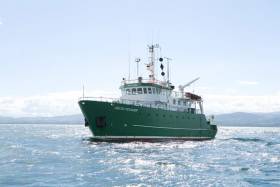
From 4-13 January 2022, the RV Celtic Explorer (callsign EIGB) will carry out the survey on a 24-hour schedule using the Manta–200 Seabed Cone Penetration Testing (CPT) system.
The aim of this survey is to gather critical seabed data to feed into existing postdoc and group research across a range of disciplines, including marine geotechnics and physical geology, to better understand the geology and engineering properties of the sediment in this area and to identify potential geohazards to infrastructure development.
 Map of the proposed iMORE survey area
Coodinates of the survey area and other details can be found in Marine Notice No 66 of 2021, available to download below.
Big Presence For INFOMAR At Major Seabed Mapping Conference
#MarineScience - The extensive work carried out jointly by the Marine Institute and Geological Survey Ireland through the INFOMAR programme received substantial exposure and recognition at the 16th Forum for the Exchange of Mutual Multibeam Experiences (FEMME) in Bordeaux last week.
Hosted by the Kongsberg Maritime User Forum and focussing on seabed mapping, FEMME provides an international platform for hydrographic professionals to meet, exchange experiences and ideas, provide inspiration and contribute to improved system performance and the future of underwater mapping technologies.
High-profile attendees include the secretary general of the International Hydrographic Organization (IHO), chief hydrographers from the Service Hydrographique et Océanographique de la Marine (SHOM), and Seabed 2030 leaders.
An overview of the Department of Communications, Climate Action and Environment-funded INFOMAR programme was provided by Dr Fabio Sacchetti, who updated the audience on future plans as well as recent achievements of the Irish national seabed mapping initiative.
Dr Sacchetti highlighted 10 case studies featuring multiple applications of multibeam technologies in support of sectors including coastal engineering, marine conservation and marine heritage and tourism.
In addition, a recent high-profile collaboration between INFOMAR and various US and Canadian research institutes was presented by international research partners in attendance.
INFOMAR featured prominently in a talk by Prof John Hughes Clarke (CCOM/University of New Hampshire) when describing research into the impact of internal wave activity on multibeam bathymetry in an Irish/Celtic Sea context, based on work conducted onboard the RV Celtic Explorer.
Prof Clarke has been collaborating with INFOMAR since 2015, and he is particularly focused on using hydrographic and fisheries sonar systems, combined with oceanographic data, to gain a deeper understanding of the dynamics and complexities of the Celtic Sea.
Jose Cordero, of Instituto Hidrografico dela Marina (Spain), demonstrated how improved sound speed control through remotely detecting thermocline undulations can be achieved.
The study was the result of a collaboration carried out in 2017 onboard the RV Celtic Explorer during a routine INFOMAR survey.
Finally, Anand D Hiroji (HSRC/University of Southern Mississippi) showed how unambiguous radiation pattern extraction methods can improve data derived from multisector multibeam Sonars. Once again, this study was carried out using data acquired by INFOMAR onboard the RV Celtic Explorer.
As Ireland continues toward completion of its seabed mapping programme in 2026, the Marine Institute says it is “widely acknowledged internationally” that our best practice approach towards open and integrated data acquisition, integration and exploitation “is a valued model, and one which gives Irish researchers and technology developers a global audience, and market.”
Commitments To €6M Funding For Seabed Mapping & Marine Research Welcomed

#MarineScience - The Marine Institute has welcomed commitments of €6 million in funding for seabed mapping and marine research announced at the fourth Our Ocean Conference in Malta last week.
Ciaran Cannon, Minister of State for International Development, addressed representatives from more than 200 countries at the EU conference, stressing the importance of promoting and protecting the world's marine resources for present and future generations.
Aside from the new funding for mapping and research, Minister Cannon also announced the roll-out of a 'groundbreaking' Global Citizenship marine environment education module for school children from September 2017 onwards.
“This programme will increase ocean literacy by fostering understanding of the important role our oceans play in our lives, how individual actions can affect them and how we can act together to protect them,” he said.
Marine Institute chief executive Dr Peter Heffernan explained that the new module supports the aims of the institute’s own Explorers Education Programme “to build on Ireland's marine and maritime heritage by increasing awareness of the value, opportunities and social benefits of our ocean wealth and identity.”
Meanwhile, Minister Cannon committed to €320,000 in funding to the 2017 Clean Coasts programme and its more than 550 volunteer groups established in Ireland to date.
Also noted was an expansion of the 2015 Fishing for Litter programme, and continued contributions to support developing countries engagement at the UN on issues relating to marine governance.
In addition, Minister Cannon reaffirmed Ireland's commitment to prohibit the sale or manufacture of certain products containing microbeads, announced at the UN in June of this year.
#MarineNotice - Mariners of the South Coast are advised that PSE Kinsale Energy will undertake a seabed mapping survey in the Kinsale Head and Seven Heads Gas Fields next week.
The survey is expected to begin on Monday 12 June and last for five or six days, subject to weather conditions.
The multi-beam mapping survey is to confirm the seabed status adjacent to subsea gas production infrastructure such as wellheads, manifolds and jacket/platform structures, collecting data for ongoing field maintenance operations and future planning.
The RV Celtic Voyager (Callsign EIQN) is scheduled to carry out the survey operations at specific locations to assess the status of the subsea infrastructure in relation to the adjacent seabed. A total of 15 multi-beam mapping locations are anticipated.
There will be a regular safety message broadcasting on VHF Channel 16 throughout the project. All vessels, particularly those engaged in fishing, are requested to give the RV Celtic
Voyager a wide berth and keep a sharp lookout in the relevant areas.
Full details of the survey area are included in Marine Notice No 24 of 2017, a PDF of which is available to read or download HERE.


 LÉ Aoibhinn and LÉ Gobnait at the Naval Service Base at Haulbowline, Cork Harbour. They are to carry out fishery duties, etc on the Irish Sea, east and south-east.")


