Displaying items by tag: Waterways Ireland
Winter Mooring on Shannon Navigation & Shannon-Erne Waterway Extended Until End of April
Waterways Ireland has announced that the winter mooring period on the Shannon Navigation and Shannon-Erne Waterway has been extended by another month until Friday 30 April.
There will be no additional cost for this extension, but masters of vessels are reminded that all locks and service blocks on these navigations remain closed until further notice.
Waterways Ireland is also encouraging all users of Ireland’s inland waterways not to take part in any activity on the water under the prevailing pandemic restrictions.

Waterways Ireland advises users of the new Royal Canal Greenway in Co Longford that the towpath on the 44th level of the inland waterway at Killashee will be closed from next Monday 29 March to Monday 12 April to facilitate essential maintenance works.
These investigate works have been classified as critical infrastructure works so they will continue over the current period of increased Covid-19 restrictions.
The Historic 130km Royal Canal Greenway Officially Launches
The Royal Canal Greenway, a scenic 130km walking and cycling amenity stretching alongside the historic 225-year-old canal, officially launches today ahead of the summer 2021 season. The €12 million project co-ordinated by Waterways Ireland is the country’s longest Greenway, traversing through Kildare, Meath, Westmeath and Longford. Those wishing to experience the Royal Canal Greenway are advised to adhere to Government guidelines on movement and social distancing.
The newest outdoor adventure tourism attraction for the country, the Royal Canal Greenway is a former towpath for barges featuring 90 bridges, 33 locks, 17 harbours and four aqueducts. Greenway users can choose to complete the entire 130km flat, off-road trail in one visit or explore the shorter designated routes — ranging from 6km to 15km — between the 14 connecting access points and towns.
 Longford Bridge, Ballymahon in County Longford on the Royal Canal Greenway
High-profile attractions linking onto the Royal Canal Greenway are trails to Carton House in Maynooth; Corlea Trackway Visitor Centre — one of the largest prehistoric roads in Europe — in Longford; and Center Parcs. The 165km self-guided National Famine Way also travels largely along the Greenway, following the footsteps of 1,490 emigrants who walked from Roscommon to Dublin at the peak of the famine in 1847.
Speaking on the official Greenway opening, Minister for Transport, Eamon Ryan TD said: “We are delighted to launch the Royal Canal Greenway, a game changer for outdoor tourism, and leisure in Ireland and part of a growing network of greenways we will fund over the lifetime of this government. As Ireland’s longest greenway, stretching from the towns of Maynooth, Enfield, Mullingar, Longford and Cloondara, the Royal Canal Greenway has huge potential to serve as a haven for so many looking to get out and get active.
“In the past year, Ireland’s great outdoors has proved to be a lifeline for the nation, with a surge in those running, walking and cycling. When we travel again, the Royal Canal Greenway will be a fantastic attraction ready to be enjoyed by all and is easily accessible from towns and cities across Ireland including via public transport. There really is no better way to experience the unspoilt open scenery, wonderful waterways, peaceful atmosphere and rich history of Ireland’s Ancient East and Hidden Heartlands than on the off-road Royal Canal Greenway.”
 The Royal Canal Greenway at Westmeath
The Greenway has been completed in partnership with Waterways Ireland; the four local authorities of Kildare, Longford, Meath and Westmeath County Councils; the Department of Transport, and Transport Infrastructure Ireland.
Minister of State at the Department of Housing, Local Government and Heritage, Malcolm Noonan, TD added: “This is a Greenway that has a remarkable past. From its tragic connection with the famine, to its heyday in the mid-1880s when it was the motorway of its time, the Royal Canal Greenway is an amenity that is continually reimagining and reinventing itself. It is fantastic to see it become a significant outdoor tourism and leisure amenity for Ireland — a 225-year-old engineering marvel that is now a respite for the modern age. As we look to a greener future, this Greenway will be an instrumental vehicle for the promotion and development of sustainable tourism in Ireland.”
CEO of Waterways Ireland John McDonagh stated: “We thank all stakeholders for their involvement, in particular the local communities who have been so invested in this Greenway. For them, this will have added economic benefits through job and new business creation with a wide range of accommodation options, bike hire offerings, attractions, as well as restaurants and cafes along the route. We ask the people of Ireland, when safe to do so, to uncover the treasures of the Royal Canal Greenway, an unforgettable new addition to the Irish outdoor adventure scene.”
 Kilcock Harbour in Kildare on the Royal Canal Greenway
The Royal Canal Greenway also forms part of EuroVelo 2, a 5,000km “Capitals Route” that passes through Ireland, the UK, the Netherlands, Germany, Poland, Belarus and Russia.
Virtual Launch of the Royal Canal Greenway This Wednesday
Transport Minister Eamon Ryan will be joined by Malcolm Noonan, Minister of State at the Department of Housing, Local Government and Heritage, for the virtual launch of the Royal Canal Greenway this coming Wednesday 24 March.
No pre-registration is required for the Waterways Ireland live stream, which will be available from 10am HERE.
Royal Canal Towpath Works Near Phibsborough
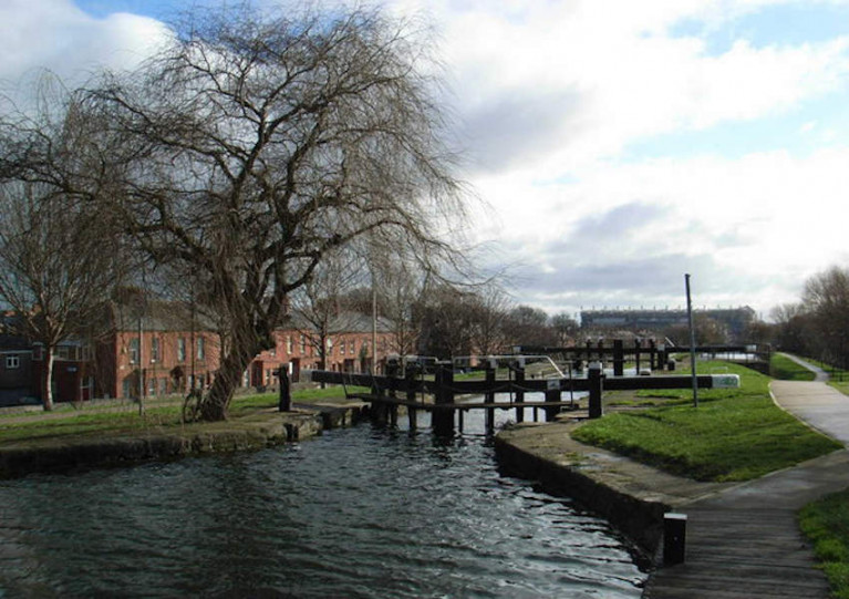
Waterways Ireland advises that site investigation works will take place on the Royal Canal towpath east of Phibsborough until next Wednesday 10 March.
These investigate works have been classified as critical infrastructure works so they will continue over the current period of increased COVID-19 restrictions.
The towpath will remain open but Waterways Ireland says users should exercise due care and caution when passing any vehicles or plant machinery along the path.
Shannon Tourism Masterplan Launching Tomorrow
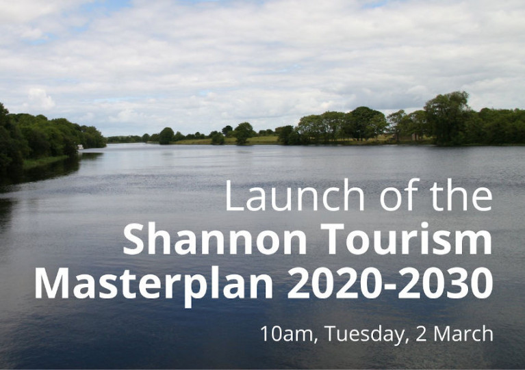
Tomorrow morning, Tuesday 2 March, will see the launch of the Shannon Tourism Masterplan by Heritage Minister Darragh O'Brien and Tourism Minister Catherine Martin as its implementation has already begun.
As previously reported on Afloat.ie, the Shannon Tourism Masterplan sets out a bold and integrated framework for sustainable tourism development along the Shannon and Shannon-Erne Waterway, repositioning the region as a key tourism destination within Ireland’s Hidden Heartlands with world-class visitor experiences based on the region’s natural and cultural assets.
The plan was developed by Waterways Ireland in association with Fáilte Ireland and with the support of the 10 local authorities adjoining the River Shannon and Shannon-Erne Waterway: Leitrim, Cavan, Roscommon, Longford, Westmeath, Galway, Offaly, Tipperary, Clare and Limerick.
Find out more about the objectives and plans for the Shannon and Shannon-Erne inland waterways corridors from 10am on Tuesday 2 March on the Waterways Ireland website HERE.
Waterways Ireland Appoints New Finance & Personnel Director

Waterways Ireland has appointed Linda Megahey as finance and personnel director to strengthen corporate leadership as the organisation primes itself for an ambitious growth path in the future.
The move has been described as the latest in a series of “strategic appointments” as the cross-border authority for Ireland’s inland waterways prepares to publish its 10-year strategy in the coming months.
Linda has over 25 years’ experience in commercial and financial management working across a number of sectors and latterly in the food and agri sector with Devenish Nutrition and Bawnbua Foods.
She is a professional chartered accountant with membership of ACCA and is currently a board member and treasurer of Aware Northern Ireland.
Commenting on Megahey’s appointment, Waterways Ireland chief executive John McDonagh said: “Linda brings a wealth of corporate and commercial experience to the organisation and she is ideally placed to support our ambitions for growth.
“Over the next 10 years we will pursue a clearly defined strategy which will have many opportunities and a share of challenges. I’m confident that Linda has the skills and expertise required to enable Waterways Ireland to thrive both now and into the future.”
Megahey said: “I’m delighted to be appointed finance and personnel director of Waterways Ireland and look forward to working with my new colleagues and other stakeholders in contributing further to the future success and growth of Waterways Ireland.”
Essential Maintenance on Rail Bridge Over Grand Canal at Tullamore
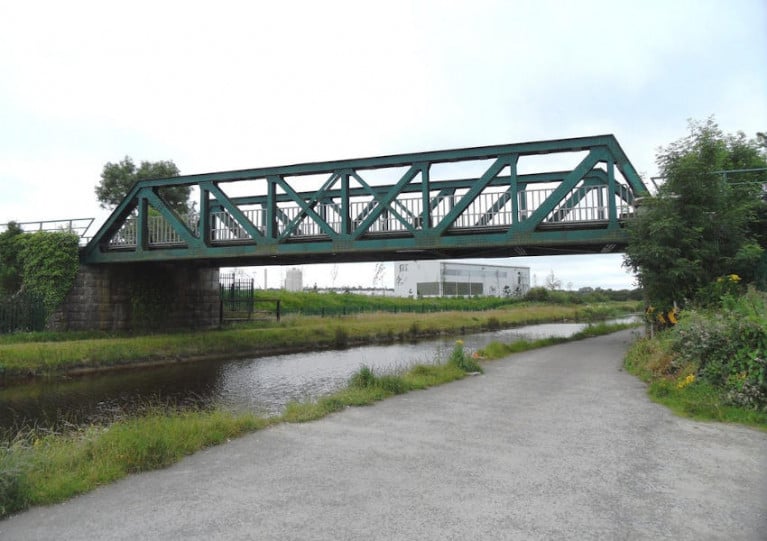
Waterways Ireland advises inland waterways users that essential maintenance works are taking place on the rail bridge over the Grand Canal west of Tullamore until further notice. The maximum safe air draft for passing vessels is 3.2m (10.4ft).
Waterways Ireland Confirms Plans to Sell Off Grand Canal Graving Docks
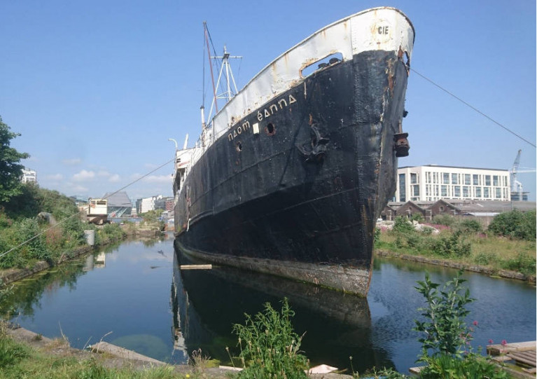
The Irish Times reports that Waterways Ireland has confirmed plans to sell off the heritage graving docks at Dublin’s Grand Canal Dock.
The inland waterways authority says it is “currently considering a range of options” regarding the sale of the site, which is one of the last undeveloped land parcels of the Docklands Strategic Development Zone.
Dating from the 1790s, the dry docks have most recently hosted the base of operations for Viking Splash Tours — purchased last month by a Liverpool firm after facing liquidation amid continued pandemic restrictions — as well as the historic former Aran Islands ferry Naomh Éanna.
Four years ago, suggestions that Waterways Ireland had been planning to sell what’s regarded as a key piece of the canal basin’s Georgian architecture prompted a local activist group to appeal to the then Heritage Minister to intervene.
And campaigners have again expressed their dismay, claiming that Waterways Ireland has “reneged on previous assurances” that the docks would be restored for the benefit of the local community.
The Irish Times has more on the story HERE.
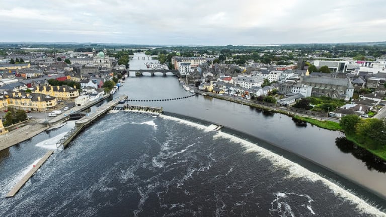
Shannon Navigation Closure at Tarmonbarry for Lock Gate Repairs
Waterways Ireland advises that emergency repair works to the lock gates at Tarmonbarry on the Shannon Navigation will take place from Monday 8 March to Wednesday 28 April.
Passage through Tarmonbarry Lock in Co Roscommon will not be possible during this seven-week-plus period as the inland waterway here will be closed.
An alternative route via the Camlin River (subject to Government COVID-19 restrictions) will be available during the works.
Masters of vessels and inland are advised to check their airdraft prior to undertaking the passage on the Camlin River due to the low bridge on the N5 road.


