Menu

Ireland's sailing, boating & maritime magazine

Dublin Bay Boating News and Information

Displaying items by tag: Added Capacity

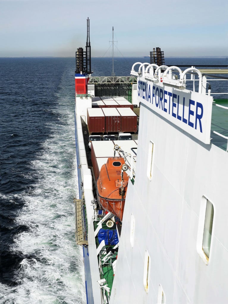
Two Stena ferries will sail on Tuesday to alleviate the pressure on Irish transport companies and add capacity to direct routes to mainland Europe.

Shipping operator Stena Line is adding a second ferry on its direct route between Ireland and France from Tuesday to allow hauliers avoid Britain and Covid-related travel restrictions.

The company said it would be bringing forward plans to double the capacity and frequency of its direct sailings by two weeks from an original planned January 4th start date to cope with demand for post-Brexit freight traffic.

For more The Irish Times reports.

As Afloat previously reported DFDS on 2nd January is to launch a new freight-only route of Rosslare- Dunkirk, northern France served by three ships. They are DFDS Optima Seaways and a pair of chartered ferries, Visby from Baltic Sea operations and Kerry that previously served Brittany Ferries.

The French operator already provides sailings to Bilbao in northern Spain from where ropax Connemara (replaced Kerry last month) was tracked by Afloat.ie to arrive in the Wexford ferryport this afternoon.

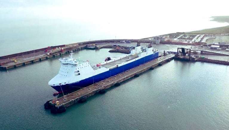
In efforts to alleviate the UK land-bridge, Brittany Ferries on 22 March is to open a new Rosslare-Cherbourg service in direct competition with Stena Line.

Published in Stena Line

The Irish Exporters Association (IEA) has welcomed the announcement that Rosslare Europort will from January 2021 accommodate an additional sailing to Cherbourg, operated by Stena Line.

The additional 'freight-only' ferry, that will commence sailing from 4th January 2021, is a welcomed development, with which Irish exporters will factor into their Brexit proofing plans.

IEA Chief Executive, Simon McKeever added: “Alternatives to the landbridge are a key consideration for exporters and importers. I am urging IEA members to analyse their supply chain operations and look for ways to limit the shock of Brexit, which is looming large at the moment.

The announcement by Rosslare Europort reaffirms the port’s commitment to Irish exporters and importers alike. Ensuring the swift, timely and direct transit of goods to and from the continent is a paramount consideration and announcements such as this gives traders more options to bring their goods to the single market.”

Published in Rosslare Europort

#FreightCapacity - Irish freight heading to and from mainland Europe via the UK landbridge will have additional freight capacity as Stena Line respond to demand on a North Sea route to the Netherlands.

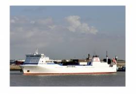
The operator on the Killingholme-Rotterdam (Europoort and Hoek van Holland) route are to introduce a second ship from the Killingholme to Europoort. RoRo vessel Caroline Russ is to be enter service to operate three times weekly from Killingholme on the UK east coast to Europoort, with the first departure from the Dutch port on October 31.

The ship will join current RoRo ship, Stena Scotia (a former Irish Sea freightferry) on the route. The frequency will hereby increase to six departures per week in each direction. The Stena Scotia was introduced on the route September 2014 as a complement to the two freight ships, the Stena Transit and Stena Transporter on the Killingholme-Hoek van Holland route.

Annika Hult, Route Manager at Stena Line North Sea says: “We have seen a strong growth in the transport market to the UK over the past several years. We introduced our freight ship the Stena Scotia in 2014 in order to accommodate growing volumes of traffic. I am very pleased to announce that we will now take the next step in the strategic development of our Killingholme-Rotterdam (Europoort) route.”

“We expect trade to remain strong and want to be in the best place to service our customers and meet additional demands. Europoort continues to develop as an important freight hub for Stena Line and we are confident our customers will react positively to our expanded service”.

Facts: Caroline Russ

Type of ship: RoRo

Trailers: 102

Passengers: 12 

Year of construction: 1999

Length: 153 m

Width: 20.6 m

Max speed: 20 kn


Published in Ferry

Dublin Bay

Dublin Bay on the east coast of Ireland stretches over seven kilometres, from Howth Head on its northern tip to Dalkey Island in the south. It's a place most Dubliners simply take for granted, and one of the capital's least visited places. But there's more going on out there than you'd imagine.

The biggest boating centre is at Dun Laoghaire Harbour on the Bay's south shore that is home to over 1,500 pleasure craft, four waterfront yacht clubs and Ireland's largest marina.

The bay is rather shallow with many sandbanks and rocky outcrops, and was notorious in the past for shipwrecks, especially when the wind was from the east. Until modern times, many ships and their passengers were lost along the treacherous coastline from Howth to Dun Laoghaire, less than a kilometre from shore.

The Bay is a C-shaped inlet of the Irish Sea and is about 10 kilometres wide along its north-south base, and 7 km in length to its apex at the centre of the city of Dublin; stretching from Howth Head in the north to Dalkey Point in the south. North Bull Island is situated in the northwest part of the bay, where one of two major inshore sandbanks lie, and features a 5 km long sandy beach, Dollymount Strand, fronting an internationally recognised wildfowl reserve. Many of the rivers of Dublin reach the Irish Sea at Dublin Bay: the River Liffey, with the River Dodder flow received less than 1 km inland, River Tolka, and various smaller rivers and streams.

Dublin Bay FAQs

There are approximately ten beaches and bathing spots around Dublin Bay: Dollymount Strand; Forty Foot Bathing Place; Half Moon bathing spot; Merrion Strand; Bull Wall; Sandycove Beach; Sandymount Strand; Seapoint; Shelley Banks; Sutton, Burrow Beach

There are slipways on the north side of Dublin Bay at Clontarf, Sutton and on the southside at Dun Laoghaire Harbour, and in Dalkey at Coliemore and Bulloch Harbours.

Dublin Bay is administered by a number of Government Departments, three local authorities and several statutory agencies. Dublin Port Company is in charge of navigation on the Bay.

Dublin Bay is approximately 70 sq kilometres or 7,000 hectares. The Bay is about 10 kilometres wide along its north-south base, and seven km in length east-west to its peak at the centre of the city of Dublin; stretching from Howth Head in the north to Dalkey Point in the south.

Dun Laoghaire Harbour on the southside of the Bay has an East and West Pier, each one kilometre long; this is one of the largest human-made harbours in the world. There also piers or walls at the entrance to the River Liffey at Dublin city known as the Great North and South Walls. Other harbours on the Bay include Bulloch Harbour and Coliemore Harbours both at Dalkey.

There are two marinas on Dublin Bay. Ireland's largest marina with over 800 berths is on the southern shore at Dun Laoghaire Harbour. The other is at Poolbeg Yacht and Boat Club on the River Liffey close to Dublin City.

Car and passenger Ferries operate from Dublin Port to the UK, Isle of Man and France. A passenger ferry operates from Dun Laoghaire Harbour to Howth as well as providing tourist voyages around the bay.

Dublin Bay has two Islands. Bull Island at Clontarf and Dalkey Island on the southern shore of the Bay.

The River Liffey flows through Dublin city and into the Bay. Its tributaries include the River Dodder, the River Poddle and the River Camac.

Dollymount, Burrow and Seapoint beaches

Approximately 1,500 boats from small dinghies to motorboats to ocean-going yachts. The vast majority, over 1,000, are moored at Dun Laoghaire Harbour which is Ireland's boating capital.

In 1981, UNESCO recognised the importance of Dublin Bay by designating North Bull Island as a Biosphere because of its rare and internationally important habitats and species of wildlife. To support sustainable development, UNESCO’s concept of a Biosphere has evolved to include not just areas of ecological value but also the areas around them and the communities that live and work within these areas. There have since been additional international and national designations, covering much of Dublin Bay, to ensure the protection of its water quality and biodiversity. To fulfil these broader management aims for the ecosystem, the Biosphere was expanded in 2015. The Biosphere now covers Dublin Bay, reflecting its significant environmental, economic, cultural and tourism importance, and extends to over 300km² to include the bay, the shore and nearby residential areas.

On the Southside at Dun Laoghaire, there is the National Yacht Club, Royal St. George Yacht Club, Royal Irish Yacht Club and Dun Laoghaire Motor Yacht Club as well as Dublin Bay Sailing Club. In the city centre, there is Poolbeg Yacht and Boat Club. On the Northside of Dublin, there is Clontarf Yacht and Boat Club and Sutton Dinghy Club. While not on Dublin Bay, Howth Yacht Club is the major north Dublin Sailing centre.

© Afloat 2020