Menu

Ireland's sailing, boating & maritime magazine

Dublin Bay Boating News and Information

Displaying items by tag: Cammel Laird shipyard

#Shipbuilder - UK shipbuilder Cammell Laird saw profits and sales fall last year – but the shipyard on Merseyside which Afloat has noted is where Irish Ferries flagship Ulysses awaits drydocking, remains upbeat that it will win more new contracts.

As the Liverpool Echo writes the Birkenhead company reported turnover for the year to March 2016 of £99m – down from £115m in 2015 – thanks to an expected lull in military work.

Pre-tax profits fell by three quarters to £2.5m, down from £10m, accounts filed at Companies House show. But the group is hopeful it will win more military contracts and more work in the renewable energy and offshore wind power sector.

Cammell Laird had warned last year that it expected turnover to fall as there was a pause in military work.

In 2013 it signed a five-year contract extension to maintain nine Royal Fleet Auxiliary (RFA) vessels.

During the year it completed refits of the Royal Fleet Auxiliary’s vessels Wave Knight, Black Rover, Fort Austin, Wave Ruler and Fort Rosalie. The latter replenishment stores supply ship Afloat adds is berthed in the facility's wet basin. Ulysses is also berthed here having completed a Dublin-Holyhead sailing then continued to Merseyside to arrive on Wednesday.  

The yard also completed work on parts of the Prince of Wales aircraft carrier, and did work for BAE Systems on the Astute Submarine.

Cammell Laird also completed contracts with firms including Irish Ferries, P&O and the Isle of Man Steam Packet Company.

In November 2015, Cammell Laird won the contract to design and build the new polar research vessel the RRS Sir David Attenborough – the boat almost named Boaty McBoatface. The project secured more than 400 jobs at the yard and another 100 jobs with local suppliers.

Sir David visited the shipyard last October for the keel-laying ceremony.

The Merseyside newspaper has more to report on  the shipyard's activities here.

Afloat adds that the yard also won a £6m contract to build a new carferry, Strangford II. The newbuild however during berthing trials last month on Strangford Lough as previously reported encountered vehicle ramp issues.

Published in Ports & Shipping

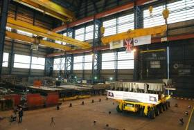
#NewPortaFERRY -A newbuild for the Strangford-Portaferry service under construction at Cammel Laird, Birkenhead as previously reported on Afloat.ie is expected to deliver the 28 car / 260 passenger ferry in August this year.

According to Cammel Laird’s winter edition newsletter, the project is running on schedule with 75% of the vessel structurally complete. The yard facing opposite Liverpool’s famous waterfront on the Mersey, saw Northern Ireland Minister for Regional Development Michelle McIlveen view the progress on the newbuild Strangford Ferry which is to serve the lough route at the Narrows.

The Minister said: “It is really impressive to see the progress being made by Cammell Laird on the new ferry. The build is on schedule and I look forward to seeing the new vessel in operation by late summer 2016. This £6 million investment by the NI Executive will see the replacement of the existing MV Strangford, which is now over 40 years old. The new modern ferry has been designed specifically for this important route and will provide a more reliable and efficient ferry service for the public in the years ahead.”

The newbuild’s pipework and machinery is now being fitted, with all key equipment now on site and undergoing installation. This includes 2 Cummins engines, 2 Voith propulsion units, 2 Cummins generator sets, a Hamworthy Sewage Treatment Plant, and a full Desmi pump set.

A passenger Lounge, changing rooms, crew mess and wheelhouse have now been installed. There are currently 50 workers on the project, with over 20% of this number being made up by apprentices. A further 4 second year apprentices are expected to have joined the project in the new year to gain some invaluable new-build experience.

The newbuild met her ‘sister’, Portaferry II, for the first time in November when the vessel returned to the Mersey for her first dry docking in 14 years since being launched onto the Mersey.

Afloat, adds that this also took place on the Wirral Peninsula, when the newbuild was then completed at the nearby McTay Marine yard at Bromborough.

While the new ferry is a completely new design, many of the successful design features on the Portaferry II are reflected in it notably having the same car and passenger capacity. The two ferries will together run on the Strangford-Portaferry service operated by Transport NI.

Afloat also adds that taking place of Portaferry II's roster on the short estuary crossing is the reserve ferry, Strangford. 

Published in Ferry

Dublin Bay

Dublin Bay on the east coast of Ireland stretches over seven kilometres, from Howth Head on its northern tip to Dalkey Island in the south. It's a place most Dubliners simply take for granted, and one of the capital's least visited places. But there's more going on out there than you'd imagine.

The biggest boating centre is at Dun Laoghaire Harbour on the Bay's south shore that is home to over 1,500 pleasure craft, four waterfront yacht clubs and Ireland's largest marina.

The bay is rather shallow with many sandbanks and rocky outcrops, and was notorious in the past for shipwrecks, especially when the wind was from the east. Until modern times, many ships and their passengers were lost along the treacherous coastline from Howth to Dun Laoghaire, less than a kilometre from shore.

The Bay is a C-shaped inlet of the Irish Sea and is about 10 kilometres wide along its north-south base, and 7 km in length to its apex at the centre of the city of Dublin; stretching from Howth Head in the north to Dalkey Point in the south. North Bull Island is situated in the northwest part of the bay, where one of two major inshore sandbanks lie, and features a 5 km long sandy beach, Dollymount Strand, fronting an internationally recognised wildfowl reserve. Many of the rivers of Dublin reach the Irish Sea at Dublin Bay: the River Liffey, with the River Dodder flow received less than 1 km inland, River Tolka, and various smaller rivers and streams.

Dublin Bay FAQs

There are approximately ten beaches and bathing spots around Dublin Bay: Dollymount Strand; Forty Foot Bathing Place; Half Moon bathing spot; Merrion Strand; Bull Wall; Sandycove Beach; Sandymount Strand; Seapoint; Shelley Banks; Sutton, Burrow Beach

There are slipways on the north side of Dublin Bay at Clontarf, Sutton and on the southside at Dun Laoghaire Harbour, and in Dalkey at Coliemore and Bulloch Harbours.

Dublin Bay is administered by a number of Government Departments, three local authorities and several statutory agencies. Dublin Port Company is in charge of navigation on the Bay.

Dublin Bay is approximately 70 sq kilometres or 7,000 hectares. The Bay is about 10 kilometres wide along its north-south base, and seven km in length east-west to its peak at the centre of the city of Dublin; stretching from Howth Head in the north to Dalkey Point in the south.

Dun Laoghaire Harbour on the southside of the Bay has an East and West Pier, each one kilometre long; this is one of the largest human-made harbours in the world. There also piers or walls at the entrance to the River Liffey at Dublin city known as the Great North and South Walls. Other harbours on the Bay include Bulloch Harbour and Coliemore Harbours both at Dalkey.

There are two marinas on Dublin Bay. Ireland's largest marina with over 800 berths is on the southern shore at Dun Laoghaire Harbour. The other is at Poolbeg Yacht and Boat Club on the River Liffey close to Dublin City.

Car and passenger Ferries operate from Dublin Port to the UK, Isle of Man and France. A passenger ferry operates from Dun Laoghaire Harbour to Howth as well as providing tourist voyages around the bay.

Dublin Bay has two Islands. Bull Island at Clontarf and Dalkey Island on the southern shore of the Bay.

The River Liffey flows through Dublin city and into the Bay. Its tributaries include the River Dodder, the River Poddle and the River Camac.

Dollymount, Burrow and Seapoint beaches

Approximately 1,500 boats from small dinghies to motorboats to ocean-going yachts. The vast majority, over 1,000, are moored at Dun Laoghaire Harbour which is Ireland's boating capital.

In 1981, UNESCO recognised the importance of Dublin Bay by designating North Bull Island as a Biosphere because of its rare and internationally important habitats and species of wildlife. To support sustainable development, UNESCO’s concept of a Biosphere has evolved to include not just areas of ecological value but also the areas around them and the communities that live and work within these areas. There have since been additional international and national designations, covering much of Dublin Bay, to ensure the protection of its water quality and biodiversity. To fulfil these broader management aims for the ecosystem, the Biosphere was expanded in 2015. The Biosphere now covers Dublin Bay, reflecting its significant environmental, economic, cultural and tourism importance, and extends to over 300km² to include the bay, the shore and nearby residential areas.

On the Southside at Dun Laoghaire, there is the National Yacht Club, Royal St. George Yacht Club, Royal Irish Yacht Club and Dun Laoghaire Motor Yacht Club as well as Dublin Bay Sailing Club. In the city centre, there is Poolbeg Yacht and Boat Club. On the Northside of Dublin, there is Clontarf Yacht and Boat Club and Sutton Dinghy Club. While not on Dublin Bay, Howth Yacht Club is the major north Dublin Sailing centre.

© Afloat 2020