Displaying items by tag: Department of Transport, Tourism and Sport
Department Moves to Highlight Fatal Incident Caused by the Inhalation of Toxic Gases Onboard Trawler
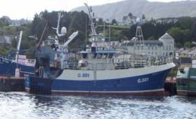
The Department of Transport, Tourism and Sport has moved to highlight a recent report published by the Marine Casualty Investigation Board of the fatal incident on board “FV Oileán an Óir” as reported on Afloat.ie
The fatalities occurred due to the inhalation of lethal levels of hydrogen sulphide (H2S) accompanied by elevated levels of ammonia (NH3) that were present in the atmosphere in refrigerated seawater.
Entry into any enclosed or unventilated space should only take place after the space has been tested and proven to be free from toxic or suffocating gases. Measurement of Oxygen content alone should not be taken to indicate that the atmosphere is safe.
Owners and Skippers of vessels fitted with Refrigerated Sea Water Systems should ensure that notices are displayed onboard highlighting the dangers.
Marine Notice: East-West Interconnector Works in Irish Sea
#MARINE WARNING - The latest Marine Notice from the Department of Transport, Tourism and Sport (DTTAS) advises on preliminary work on the East-West interconnector power cable in the Irish Sea between Ireland and Wales over the next few weeks.
Briggs Marine commenced pre-lay grapnel runs along the line of the cable route on Sunday 1 April, and this work will be carried out over three weeks from the vessel Kingdom of Fife (call sign 2BKR2).
This work will continue on a 24-hour basis, and the vessel will display appropriate day shapes and lights as required, with a continuous watch on VHF Channel 16 and DSC.
Complete details including co-ordinates of the work area are included in Marine Notice No 14 of 2012, a PDF of which is available to read and download HERE.
Marine Notice: Rock Placement Offshore at Rush Beach

#MARINE NOTICE - The latest Marine Notice from the Department of Transport, Tourism and Sport (DTTAS) advises on rock placement operations offshore at North Beach in Rush, Co Dublin and in the Irish Sea.
Works commenced on 19 January to continue for around 14 days, subject to weather delays, undertaken by DPFPV Tideway Rollingstone (call sign PHYR) which is operating on a 24-hour basis.
The vessel is transmitting an AIS signal and will be keeping a listening watch on VHF Channel 16 at all times. It is also displaying appropriate day shapes and lights.
The works - which involve the deployment of survey ROV and fall pipe - will restrict the vessel's ability to manoeuvre, so all vessels in the vicinity (particular fishing boats) have been given warning to give the vessel and her equipment a wide berth.
Complete details including co-ordinates of work areas are included in Marine Notice No 4 of 2012, a PDF of which is available to read and download HERE.
Marine Notice: Hydrographic Survey in Irish Sea

#MARINE WARNING - The latest Marine Notice from the DTTAS advises all seafarers in the Irish Sea between north Dublin and north Wales to give a wide berth to the hydrographic and oceanographic survey operation in the area this week.
The SV Bibby Tethra (callsign 2EGF8) commenced survey operations yesterday (Monday 16 January) from offshore at North Beach in Rush to approximately 16 miles offshore north of Anglesey. The survey is scheduled for seven days, subject to weather delays.
The vessel will operate on a 24-hour basis, displaying appropriate day shapes and lights during survey operations, and will transmit an AIS signal. The vessel will be keeping a listening watch on VHF Channel 16 at all times during the operations.
Survey operations will involve towing survey equipment up to 100m astern of the vessel along pre-defined survey lines, which will restrict the vessel’s ability to manoeuvre.
Details of the survey area are included in a PDF of Marine Notice No 2 of 2012, which is available to read or download HERE.
Marine Notice on Exemptions from EU Regulations for Recreational Water Craft

#NEWS UPDATE - A recent Marine Notice from the Department of Transport, Tourism and Sport (DTTAS) advises consumers, retailers and manufacturers on the types of craft to which the EU recreation water craft regulations do not apply.
In general recreational craft and related products must meet the essential safety, health, environmental protection and consumer protection requirements of the Recreational Craft Directive as set out in the Recreational Craft Regulations.
However, these regulations do not apply to craft intended solely for racing; canoes and kayaks; gondolas and pedalos; surfboards; historical water craft and replicas; experimental craft and ones built for own use; commercial craft; and a number of others.
These exceptions are however still subject to the EU's General Product Safety Directive.
Complete details are included in Marine Notice No 56 of 2011, a PDF of which is available to read and download HERE.
- Marine Notice
- water craft
- regulations
- EU
- Department of Transport, Tourism and Sport
- DTTAS
- consumers
- retailers
- manufacturers
- recreational craft
- Safety
- Health
- environmental protection
- Recreational Craft Directive
- Recreational Craft Regulations
- racing
- Canoes
- Kayaks
- gondolas
- pedalos
- surfboards
- historical
- replica
Marine Notice on Construction in Castletownbere Harbour

#IRISH HARBOURS - The latest Marine Notice from the Department of Transport, Tourism and Sport (DTTAS) advises on construction works at Castletownbere Fishery Harbour Centre in Co Cork this week.
The works involve the installation of four steel piles - two in the navigation channel to the inner harbour and two to the west of Dinish Pier.
The works are being advanced by civil engineering crews working from a jack-up barge, which will display the relevant day signals and navigation lights in accordance with collision regulations.
For safety reasons, mariners are requested to proceed slowly and with caution in the approach channel to the Fishery Harbour Centre and to give the works a wide berth. Wave-wash from vessels should also be avoided.
These works are expected to be on-going until mid-December, weather permitting.
Complete details for shipowners, ship operations, shipmasters and seafarers are included in Marine Notice No 57 of 2011, a PDF of which is available to read and download HERE.
Marine Notice on Changes to Lifeboat Release Mechanisms

#NEWS UPDATE - A recent Marine Notice from the Department of Transport, Tourism and Sport (DTTAS) advises on the adoption of new international resolutions pertaining to SOLAS regulations and changes to the International Life-Saving Appliance (LSA) Code.
The changes are intended to establish new stricter safety standards for lifeboat release and retrieval systems, aimed at preventing accidents during lifeboat launching, and will require the assessment and possible replacement of a large number of lifeboat release hooks.
Both of these changes are expected to come into force from 1 January 2013 with a view to full compliance by July 2019.
The Maritime Safety Committee of the International Maritime Organisation has also approved new guidelines for the evaulation and replaceent of lifeboat release systems, in which the DTTAS will require fall preventer devises, or FPDs, to be fitted.
Complete details for shipowners, ship operations, shipmasters and seafarers are included in Marine Notice No 54 of 2011, a PDF of which is available to read and download HERE.


