Displaying items by tag: DiadES
Interactive Game Workshop to Highlight Impact of Climate Change on Migratory Fish
This Thursday 2 March, Inland Fisheries Ireland (IFI) in Waterford is hosting a workshop with a twist — to play a serious game called DiadESland, about managing diadromous fish species.
DiadESland is an interactive role-playing engagement tool developed through the Interreg DiadES project. It gives stakeholders and managers an opportunity to discuss the impact of climate change on migratory fish, rivers and catchments through an imaginary environment.
Participants will team up and play the role of catchment managers, making management decisions to achieve a set of goals for their catchment.
It is an excellent opportunity for networking in an informal setting but with an important objective: to discuss the serious issues facing diadromous fish species in the context of climate change.
This session will also allow IFI to discuss future strategies and management recommendations.
EU Interreg AA funding allows for providing players with a fully catered workshop, and travel costs will be refunded (as required).
There is no requirement for expertise in fish or fish management to play the game and all sectors involved with fish management or commercialisation are warmly invited.
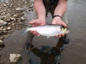
Inland Fisheries Ireland (IFI) is relying on the knowledge and experience as a ‘citizen scientist’ anglers in a new survey about less well-known fish species.
Some migratory fish species like salmon and lesser-known species such as shad and the extremely rare sturgeon, among others, are in decline in many European countries. These species spend much of their lifecycle at sea and periods in riverine habitats.
As part of the multinational European project DiadES, IFI and other project partners are assessing the recreational fishing interest in several of these species including shad, thin-lipped mullet, smelt and flounder via an online survey which will also record the economic benefits that the species support.
Dr William Roche, senior research officer at IFI, said: “We are urging anglers who fish for these species to participate in this online survey as it will help us get a more comprehensive view of these less common species in Irish waters.
“In this way we can contribute to providing better information to inform future policy and management of these species, and the economic, social and cultural activities associated with them.”
Future predictions suggest that some of these species will see northward and southward changes in distribution under climate change scenarios, IFI says.
This may increase or decrease their availability to recreational fishing and the economic benefits they bring to businesses in local areas, as well as the enjoyment and associated health and social benefits for fishers.
The online survey consists of questions about fish-catching activities and will take approximately 10 minutes to complete.
In Ireland the DiadES case study area comprises the Suir, Nore and Barrow Rivers and the Waterford Harbour catchment but IFI is also seeking details on the named fish species generally within Ireland.
Ireland’s Role In Europe-Wide Research Programme To Preserve Threatened Migratory Fish
#MarineWildlife - A new project which aims to promote international action and co-operation to conserve vulnerable migratory fish species launched yesterday, Thursday 28 March.
The DiadES initiative will see 30 partners from different countries participate in this European project, with Inland Fisheries Ireland (IFI) leading out on the project in Ireland.
The project launches as migratory fish and their habitats continue to come under pressure as a result of human activity and climate change.
It will focus on fish such as shads, lampreys, salmon, trout and mullet which are known as ‘diadromous’ fish as they migrate between fresh and salt waters to reproduce or feed.
The DiadES initiative intends to improve knowledge of the ecological, economic and cultural benefits offered by these migratory species while assessing the possibility of these species changing their locations due to climate change.
It will also examine the emergence of new interactions between fish territories as a result of these relocations.
In addition to collaboration across research and knowledge sharing between countries, the project will take a global multidisciplinary approach.
It will focus on several species across different geographical areas and involve researchers in the field of natural sciences and environmental economists as well as an experienced network of fish managers.
As part of the research, a transnational interactive atlas will be produced which will outline the current distribution of diadromous fish and how they help the ecosystem. This will forecast trends in the geographical distribution of various species and look at possible redistribution of some species as a result of climate change.
The programme will also design a platform for stakeholders to explore different management strategies.
Dr Cathal Gallagher, head of research and development at IFI, said: “Throughout their life cycle, diadromous fish provide ‘ecosystem services’. This means they provide food, regulate and support the ecosystem through the nutrient cycle and offer a recreational pursuit to local communities. All of these fish generate significant ecological, economic and cultural benefits for local communities across Europe.
“We are keen to play our role in assessing and enhancing the role these fish play while also assisting them as they navigate the effects of climate change which has resulted in a reduction in their distribution.”
The DiadES project is led by the French research institute Irstea and is financed by the Interreg Atlantic Area Programme of the European Regional Development Fund (ERDF) to the value of €2.2 million.


