Menu

Ireland's sailing, boating & maritime magazine

Dublin Bay Boating News and Information

Displaying items by tag: Freight Assoc

Freight distribution and logistics sectors has faced unprecedented upheaval in 2021, as a consequence of adopting to the post-Brexit trading environment, dealing with the Covid pandemic, global supply chain issues, rising fuel costs, and an ongoing skills shortage.

These issues as the Irish Examiner reports, are testing the sector's flexibility and ability to change. It gives credence to the quote from the world-renowned management consultant Peter Drucker who said: “the greatest danger in times of turbulence is not the turbulence, it is to act with yesterday’s logic”.

The recent announcement of the resignation of the UK Brexit Minister David Frost compounds the uncertainty for traders looking to 2022 for a steadying of the paradigm shift in the supply chain.

The full and meaningful implementation of the Trade and Co-operation Agreement (TCA), signed by the UK and the EU 12 months ago, is reliant on trust and strong political relations between the two parties. This has been tested to the extreme as the Northern Ireland Protocol has acted as the catalyst to distract all from concurrently looking to implement trade easements as mandated under the TCA.

More reading from this link

Published in Ports & Shipping

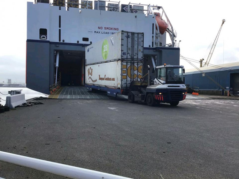
An Irish logistics industry association has called on the Government to subsidise the increased costs hauliers must pay to use viable direct shipping routes to access continental Europe.

The recommendation was made by the Freight Transport Association of Ireland (FTAI) submission, seen by the Sunday Independent, to the Government’s 10-year haulage strategy. The FTAI sent its submission to the Government in late July.

According to the submission, the direct shipping routes to and from Europe that avoid the UK landbridge used by some hauliers are more expensive. FTAI has called on the Brexit Adjustment Reserve to be used to subsidise the additional cost to hauliers.

The submission states additional costs – in time, administration, and costs to market – are providing more difficulties to operators in the sector. It requests a system similar to a Public Service Obligation (PSO) established, as it would act to reduce the higher costs for haulage operators to access continental Europe.

Click the Independent.ie's link here for further coverage.

Published in Ports & Shipping

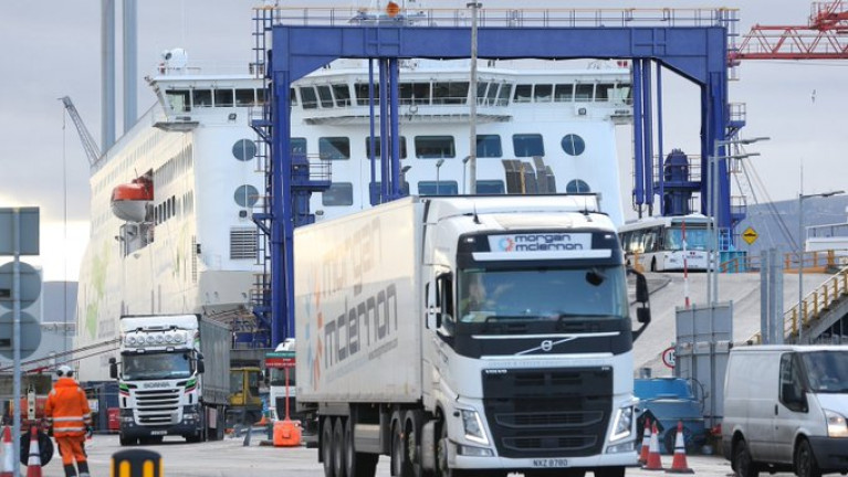
A letter from the Irish Freight Transport Association to the Taoiseach warns of huge disruption in the coming weeks as the impact of Brexit fully takes hold of trade between Ireland, the UK and Europe.

The letter, seen by RTÉ News, warns of disappearing supply chains, empty supermarket shelves and rising unemployment, and calls for a six month adjustment period.

The communication warned that one consignment of pharmaceutical products had missed both a ferry and airline slot because of paperwork problems.

The letter to Micheál Martin paints a stark picture and adds to a growing number of warnings that an initial slump in the volumes of trucks moving goods in and out of Ireland to the UK and across the land-bridge to continental Europe, as well as pre-Christmas stockpiling, have masked the true impact of Brexit.

That impact could now properly hit when trade volumes rise to their true levels.

According to the Freight Transport Association, new customs and food safety formalities are causing lorries to remain stranded at Dublin Port, or to remain stuck in the UK.

Click here for more on what the letter outlined.

Published in Ferry

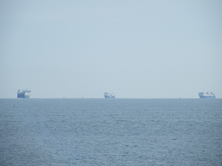
In Ireland a leading freight organisation has questioned a new government report which suggests that there is sufficient alternative capacity on continental shipping routes in the event of major delays at British ports following Brexit. 

As Afloat reported on Friday, the Irish Maritime Development Office (IMDO) published a report that said it does not believe the government needs to intervene to provide extra services for hauliers using the landbridge at present. 

For more the Business Post reports on the Freight Transport Association of Ireland's response on the report's conclusion.  

Published in Ports & Shipping

Dublin Bay

Dublin Bay on the east coast of Ireland stretches over seven kilometres, from Howth Head on its northern tip to Dalkey Island in the south. It's a place most Dubliners simply take for granted, and one of the capital's least visited places. But there's more going on out there than you'd imagine.

The biggest boating centre is at Dun Laoghaire Harbour on the Bay's south shore that is home to over 1,500 pleasure craft, four waterfront yacht clubs and Ireland's largest marina.

The bay is rather shallow with many sandbanks and rocky outcrops, and was notorious in the past for shipwrecks, especially when the wind was from the east. Until modern times, many ships and their passengers were lost along the treacherous coastline from Howth to Dun Laoghaire, less than a kilometre from shore.

The Bay is a C-shaped inlet of the Irish Sea and is about 10 kilometres wide along its north-south base, and 7 km in length to its apex at the centre of the city of Dublin; stretching from Howth Head in the north to Dalkey Point in the south. North Bull Island is situated in the northwest part of the bay, where one of two major inshore sandbanks lie, and features a 5 km long sandy beach, Dollymount Strand, fronting an internationally recognised wildfowl reserve. Many of the rivers of Dublin reach the Irish Sea at Dublin Bay: the River Liffey, with the River Dodder flow received less than 1 km inland, River Tolka, and various smaller rivers and streams.

Dublin Bay FAQs

There are approximately ten beaches and bathing spots around Dublin Bay: Dollymount Strand; Forty Foot Bathing Place; Half Moon bathing spot; Merrion Strand; Bull Wall; Sandycove Beach; Sandymount Strand; Seapoint; Shelley Banks; Sutton, Burrow Beach

There are slipways on the north side of Dublin Bay at Clontarf, Sutton and on the southside at Dun Laoghaire Harbour, and in Dalkey at Coliemore and Bulloch Harbours.

Dublin Bay is administered by a number of Government Departments, three local authorities and several statutory agencies. Dublin Port Company is in charge of navigation on the Bay.

Dublin Bay is approximately 70 sq kilometres or 7,000 hectares. The Bay is about 10 kilometres wide along its north-south base, and seven km in length east-west to its peak at the centre of the city of Dublin; stretching from Howth Head in the north to Dalkey Point in the south.

Dun Laoghaire Harbour on the southside of the Bay has an East and West Pier, each one kilometre long; this is one of the largest human-made harbours in the world. There also piers or walls at the entrance to the River Liffey at Dublin city known as the Great North and South Walls. Other harbours on the Bay include Bulloch Harbour and Coliemore Harbours both at Dalkey.

There are two marinas on Dublin Bay. Ireland's largest marina with over 800 berths is on the southern shore at Dun Laoghaire Harbour. The other is at Poolbeg Yacht and Boat Club on the River Liffey close to Dublin City.

Car and passenger Ferries operate from Dublin Port to the UK, Isle of Man and France. A passenger ferry operates from Dun Laoghaire Harbour to Howth as well as providing tourist voyages around the bay.

Dublin Bay has two Islands. Bull Island at Clontarf and Dalkey Island on the southern shore of the Bay.

The River Liffey flows through Dublin city and into the Bay. Its tributaries include the River Dodder, the River Poddle and the River Camac.

Dollymount, Burrow and Seapoint beaches

Approximately 1,500 boats from small dinghies to motorboats to ocean-going yachts. The vast majority, over 1,000, are moored at Dun Laoghaire Harbour which is Ireland's boating capital.

In 1981, UNESCO recognised the importance of Dublin Bay by designating North Bull Island as a Biosphere because of its rare and internationally important habitats and species of wildlife. To support sustainable development, UNESCO’s concept of a Biosphere has evolved to include not just areas of ecological value but also the areas around them and the communities that live and work within these areas. There have since been additional international and national designations, covering much of Dublin Bay, to ensure the protection of its water quality and biodiversity. To fulfil these broader management aims for the ecosystem, the Biosphere was expanded in 2015. The Biosphere now covers Dublin Bay, reflecting its significant environmental, economic, cultural and tourism importance, and extends to over 300km² to include the bay, the shore and nearby residential areas.

On the Southside at Dun Laoghaire, there is the National Yacht Club, Royal St. George Yacht Club, Royal Irish Yacht Club and Dun Laoghaire Motor Yacht Club as well as Dublin Bay Sailing Club. In the city centre, there is Poolbeg Yacht and Boat Club. On the Northside of Dublin, there is Clontarf Yacht and Boat Club and Sutton Dinghy Club. While not on Dublin Bay, Howth Yacht Club is the major north Dublin Sailing centre.

© Afloat 2020