Menu

Ireland's sailing, boating & maritime magazine

Dublin Bay Boating News and Information

Displaying items by tag: Freighthauliers

Diplomat, the original ferry that started operations for Celtic Link Ferries in 2005 has been sold to Indian ship-breakers after serving a spell on charter in the Caribbean, writes Jehan Ashmore.
Since leaving the Rosslare-Cherbourg port route in late 2009, the Diplomat has run between Santo Domingo (Dominican Republic) and San Juan (Peurto Rico) for Marine Express. For more click HERE. The freight-ferry was built by Hyundai Heavy Industries in Ulsan, South Korea in 1978 and she was the final 'Searunner' class of 11 ordered by the Stena Rederi.

Launched as the Stena Tranporter, the career of the 16,000 tonnes has spanned over three decades in which the 151m vessel changed through several owners and subsequent vessel renamings.

It was when she served under the name Baltic Ferry, that her most notable career took place in 1982 during her wartime deployment as part of the
Falklands Islands Task Force. The 151m vessel was requisitioned by the British Ministry of Defence which saw the ship engaged in military operations when RAF Harrier Jump-Jet aircraft transferred store supplies from the deck of the ship as part of the war-effort in the South Atlantic Ocean.

In 2001 the vessel undertook ferry operations to Ireland as the European Diplomat on the Dublin-Liverpool route for the P&O (Irish Sea) route network. The following year she was transferred on the direct route to France until P&O pulled the plug on the continental service in December 2004, leaving Irish Ferries as the sole operator.

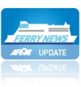
It was not until February 2005 that the route resumed service but this time under new owners Celtic Link Ferries. The O'Flaherty brothers, owners of a large fishing fleet in Kilmore Quay purchased the vessel and renamed her Diplomat. See PHOTO.

For the next four years she built up a steady customer loyalty between freight-hauliers drivers and car-only accompanying passengers who were accommodated in the ship which had a limited passenger certificate for 114 passengers. In addition she had a license to transport livestock.

Currently Celtic Link Ferries operate the ferry Norman Voyager but the 800-passenger / 200-car ro-pax vessel will only remain on the route until an October debut of a larger sistership the Cartour Beta.

The vessel is running this season between Italy and Sicily and with an added deck the 27,552 tonnes vessel has an increased capacity for passengers, cars and enhanced range of facilities. Recently the company had run a competition to name the new vessel which is to begin a five-year charter on the service between Wexford and Normandy.

Published in Ferry

Dublin Bay

Dublin Bay on the east coast of Ireland stretches over seven kilometres, from Howth Head on its northern tip to Dalkey Island in the south. It's a place most Dubliners simply take for granted, and one of the capital's least visited places. But there's more going on out there than you'd imagine.

The biggest boating centre is at Dun Laoghaire Harbour on the Bay's south shore that is home to over 1,500 pleasure craft, four waterfront yacht clubs and Ireland's largest marina.

The bay is rather shallow with many sandbanks and rocky outcrops, and was notorious in the past for shipwrecks, especially when the wind was from the east. Until modern times, many ships and their passengers were lost along the treacherous coastline from Howth to Dun Laoghaire, less than a kilometre from shore.

The Bay is a C-shaped inlet of the Irish Sea and is about 10 kilometres wide along its north-south base, and 7 km in length to its apex at the centre of the city of Dublin; stretching from Howth Head in the north to Dalkey Point in the south. North Bull Island is situated in the northwest part of the bay, where one of two major inshore sandbanks lie, and features a 5 km long sandy beach, Dollymount Strand, fronting an internationally recognised wildfowl reserve. Many of the rivers of Dublin reach the Irish Sea at Dublin Bay: the River Liffey, with the River Dodder flow received less than 1 km inland, River Tolka, and various smaller rivers and streams.

Dublin Bay FAQs

There are approximately ten beaches and bathing spots around Dublin Bay: Dollymount Strand; Forty Foot Bathing Place; Half Moon bathing spot; Merrion Strand; Bull Wall; Sandycove Beach; Sandymount Strand; Seapoint; Shelley Banks; Sutton, Burrow Beach

There are slipways on the north side of Dublin Bay at Clontarf, Sutton and on the southside at Dun Laoghaire Harbour, and in Dalkey at Coliemore and Bulloch Harbours.

Dublin Bay is administered by a number of Government Departments, three local authorities and several statutory agencies. Dublin Port Company is in charge of navigation on the Bay.

Dublin Bay is approximately 70 sq kilometres or 7,000 hectares. The Bay is about 10 kilometres wide along its north-south base, and seven km in length east-west to its peak at the centre of the city of Dublin; stretching from Howth Head in the north to Dalkey Point in the south.

Dun Laoghaire Harbour on the southside of the Bay has an East and West Pier, each one kilometre long; this is one of the largest human-made harbours in the world. There also piers or walls at the entrance to the River Liffey at Dublin city known as the Great North and South Walls. Other harbours on the Bay include Bulloch Harbour and Coliemore Harbours both at Dalkey.

There are two marinas on Dublin Bay. Ireland's largest marina with over 800 berths is on the southern shore at Dun Laoghaire Harbour. The other is at Poolbeg Yacht and Boat Club on the River Liffey close to Dublin City.

Car and passenger Ferries operate from Dublin Port to the UK, Isle of Man and France. A passenger ferry operates from Dun Laoghaire Harbour to Howth as well as providing tourist voyages around the bay.

Dublin Bay has two Islands. Bull Island at Clontarf and Dalkey Island on the southern shore of the Bay.

The River Liffey flows through Dublin city and into the Bay. Its tributaries include the River Dodder, the River Poddle and the River Camac.

Dollymount, Burrow and Seapoint beaches

Approximately 1,500 boats from small dinghies to motorboats to ocean-going yachts. The vast majority, over 1,000, are moored at Dun Laoghaire Harbour which is Ireland's boating capital.

In 1981, UNESCO recognised the importance of Dublin Bay by designating North Bull Island as a Biosphere because of its rare and internationally important habitats and species of wildlife. To support sustainable development, UNESCO’s concept of a Biosphere has evolved to include not just areas of ecological value but also the areas around them and the communities that live and work within these areas. There have since been additional international and national designations, covering much of Dublin Bay, to ensure the protection of its water quality and biodiversity. To fulfil these broader management aims for the ecosystem, the Biosphere was expanded in 2015. The Biosphere now covers Dublin Bay, reflecting its significant environmental, economic, cultural and tourism importance, and extends to over 300km² to include the bay, the shore and nearby residential areas.

On the Southside at Dun Laoghaire, there is the National Yacht Club, Royal St. George Yacht Club, Royal Irish Yacht Club and Dun Laoghaire Motor Yacht Club as well as Dublin Bay Sailing Club. In the city centre, there is Poolbeg Yacht and Boat Club. On the Northside of Dublin, there is Clontarf Yacht and Boat Club and Sutton Dinghy Club. While not on Dublin Bay, Howth Yacht Club is the major north Dublin Sailing centre.

© Afloat 2020