Menu

Ireland's sailing, boating & maritime magazine

Dublin Bay Boating News and Information

Displaying items by tag: Green & Silver

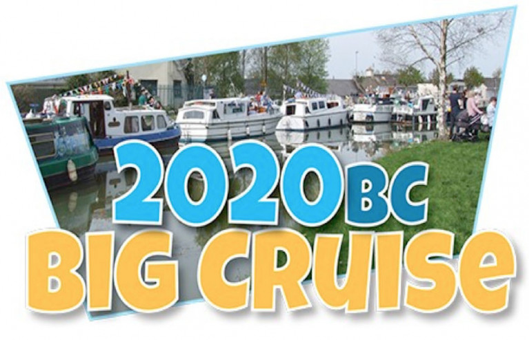
The Inland Waterways Association of Ireland (IWAI) is ringing in the New Year with the launch of its 2020 Big Cruise calendar of events on the inland waterways of the Green & Silver route.

A flotilla of light and fast boats set off at pace on the River Liffey from the sea lock at Grand Canal Dock to Seán Heuston Bridge below Heuston Station this lunchtime (Wednesday 1 January) to kick off the 2020BC initiative.

The date also marks the 60th anniversary to the day the Grand Canal was closed to commercial traffic by CIÉ.

2020BC will centre around a calendar of waterside community celebrations and events to which boaters and other waterway users can travel next year.

This reflects the navigation circuit being very much ‘open for business’ for leisure, pleasure and amenity use.

The 2020BC project is being co-ordinated for IWAI Dublin by longtime waterways advocate Mick Kinahan with support from IWAI’s Kildare, Offaly, Shannon Harbour, Royal Canal and Barrow Branches.

Today’s flotilla also carries some offerings from the Grand Canal to Heuston Station — symbols from locations along the canal’s length, of both past and present commercial and leisure activities.

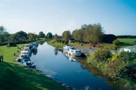
Little known outside the boating community, the Grand Canal is also part of what is known as the Green & Silver: a navigation route comprising the Royal Canal, Camlin River, River Shannon, Grand Canal and River Liffey — and one that the IWAI is keen to promote during 2020BC and beyond.

IWAI president Alan Kelly said: “We are fortunate in IWAI to have experienced volunteers who are fully committed to the promotion of our waterways for the common good and the socio-economic benefit of all.

“We also have an excellent working relationship with Waterways Ireland and with Government departments, local authorities, development associations and community organisations all along the inland waterways network.

“We look forward to 2020 being a year of further positive engagement with all of our waterways partners to promote the development and improvement of our waterways.”

Jim O’Riordan, IWAI Dublin chairperson, added: “IWAI Dublin look forward to 2020BC and are grateful for the support from our peer IWAI branches around the inland waterways network for the project.

“We also want to thank Waterways Ireland who have been involved in helping us plan today’s launch and events for the coming year; and Clontarf and Poolbeg yacht clubs among others who have assisted arrangements for the launch flotilla.

“For 2020BC, what we are promoting is not just about boating, we intend to work with as many communities as possible to develop their interests further in the inland waterways in their vicinities and look forward to meeting many new waterways friends.”

Full details of events for 2020BC will be made available on the IWAI website.

Published in Inland Waterways

The Dublin branch of the Inland Waterways Association of Ireland is working on plans for a rally this summer inspired by the Green & Silver route.

2019 marks the 70th anniversary of the publication of Green & Silver by LTC Rolt, a book which recounted an influential voyage in 1946 from the Shannon to Dublin along the Grand Canal, then back to the Shannon via the Royal Canal, including a turn north to Lough Key and south again to Lough Derg.

The 356km inland waterways route has since become known as the ‘Green & Silver Challenge’ and has been championed by IWAI Dublin since the full navigation of the Royal Canal was reopened in 2010.

Now the Dublin branch is looking to encourage as many boats as possible to join the rally from this May “to show the canals are being used and not just a pretty water feature”.

A provisional date for boats heading to Dublin on the Royal Canal to meet at the 12th Lock in Castleknock has been set for Friday 3 May, with boats on the reverse route along the Grand Canal to meet at Lucan’s 12th lock on Friday 10 May.

Boats would converge on the River Liffey for a two-day rally on the weekend of 18-19 May, with boats heading out on the Grand Canal the following weekend (25-26 May) and on the Royal Canal the week after that (1-2 June).

Prizes are being commissioned for boats that have completed the trip several times, with more on this and confirmed dates for the rally to come from IWAI Dublin in the coming weeks.

Published in Inland Waterways

Dublin Bay

Dublin Bay on the east coast of Ireland stretches over seven kilometres, from Howth Head on its northern tip to Dalkey Island in the south. It's a place most Dubliners simply take for granted, and one of the capital's least visited places. But there's more going on out there than you'd imagine.

The biggest boating centre is at Dun Laoghaire Harbour on the Bay's south shore that is home to over 1,500 pleasure craft, four waterfront yacht clubs and Ireland's largest marina.

The bay is rather shallow with many sandbanks and rocky outcrops, and was notorious in the past for shipwrecks, especially when the wind was from the east. Until modern times, many ships and their passengers were lost along the treacherous coastline from Howth to Dun Laoghaire, less than a kilometre from shore.

The Bay is a C-shaped inlet of the Irish Sea and is about 10 kilometres wide along its north-south base, and 7 km in length to its apex at the centre of the city of Dublin; stretching from Howth Head in the north to Dalkey Point in the south. North Bull Island is situated in the northwest part of the bay, where one of two major inshore sandbanks lie, and features a 5 km long sandy beach, Dollymount Strand, fronting an internationally recognised wildfowl reserve. Many of the rivers of Dublin reach the Irish Sea at Dublin Bay: the River Liffey, with the River Dodder flow received less than 1 km inland, River Tolka, and various smaller rivers and streams.

Dublin Bay FAQs

There are approximately ten beaches and bathing spots around Dublin Bay: Dollymount Strand; Forty Foot Bathing Place; Half Moon bathing spot; Merrion Strand; Bull Wall; Sandycove Beach; Sandymount Strand; Seapoint; Shelley Banks; Sutton, Burrow Beach

There are slipways on the north side of Dublin Bay at Clontarf, Sutton and on the southside at Dun Laoghaire Harbour, and in Dalkey at Coliemore and Bulloch Harbours.

Dublin Bay is administered by a number of Government Departments, three local authorities and several statutory agencies. Dublin Port Company is in charge of navigation on the Bay.

Dublin Bay is approximately 70 sq kilometres or 7,000 hectares. The Bay is about 10 kilometres wide along its north-south base, and seven km in length east-west to its peak at the centre of the city of Dublin; stretching from Howth Head in the north to Dalkey Point in the south.

Dun Laoghaire Harbour on the southside of the Bay has an East and West Pier, each one kilometre long; this is one of the largest human-made harbours in the world. There also piers or walls at the entrance to the River Liffey at Dublin city known as the Great North and South Walls. Other harbours on the Bay include Bulloch Harbour and Coliemore Harbours both at Dalkey.

There are two marinas on Dublin Bay. Ireland's largest marina with over 800 berths is on the southern shore at Dun Laoghaire Harbour. The other is at Poolbeg Yacht and Boat Club on the River Liffey close to Dublin City.

Car and passenger Ferries operate from Dublin Port to the UK, Isle of Man and France. A passenger ferry operates from Dun Laoghaire Harbour to Howth as well as providing tourist voyages around the bay.

Dublin Bay has two Islands. Bull Island at Clontarf and Dalkey Island on the southern shore of the Bay.

The River Liffey flows through Dublin city and into the Bay. Its tributaries include the River Dodder, the River Poddle and the River Camac.

Dollymount, Burrow and Seapoint beaches

Approximately 1,500 boats from small dinghies to motorboats to ocean-going yachts. The vast majority, over 1,000, are moored at Dun Laoghaire Harbour which is Ireland's boating capital.

In 1981, UNESCO recognised the importance of Dublin Bay by designating North Bull Island as a Biosphere because of its rare and internationally important habitats and species of wildlife. To support sustainable development, UNESCO’s concept of a Biosphere has evolved to include not just areas of ecological value but also the areas around them and the communities that live and work within these areas. There have since been additional international and national designations, covering much of Dublin Bay, to ensure the protection of its water quality and biodiversity. To fulfil these broader management aims for the ecosystem, the Biosphere was expanded in 2015. The Biosphere now covers Dublin Bay, reflecting its significant environmental, economic, cultural and tourism importance, and extends to over 300km² to include the bay, the shore and nearby residential areas.

On the Southside at Dun Laoghaire, there is the National Yacht Club, Royal St. George Yacht Club, Royal Irish Yacht Club and Dun Laoghaire Motor Yacht Club as well as Dublin Bay Sailing Club. In the city centre, there is Poolbeg Yacht and Boat Club. On the Northside of Dublin, there is Clontarf Yacht and Boat Club and Sutton Dinghy Club. While not on Dublin Bay, Howth Yacht Club is the major north Dublin Sailing centre.

© Afloat 2020