Menu

Ireland's sailing, boating & maritime magazine

Dublin Bay Boating News and Information

Displaying items by tag: Iúda Naofa

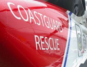
#MarineNotice - The latest Marine Notice from the Department of Transport, Tourism and Sport (DTTAS) details the proper hi-line protocols when receiving assistance from a search and rescue helicopter.

The notice follows the findings of last year’s MCIB report into the sinking of the fishing trawler Iúda Naofa off Scotland in January 2015.

As previously reported on Afloat.ie, it was determined that the crew of the trawler lacked knowhow regarding the use of hi-line, which meant they were unable to release an emergency pump dropped to the vessel on a standard clasp from a UK coastguard helicopter.

Full details are included of Marine Notice No 3 of 2017, a PDF of which is available to read or download HERE.

Published in Rescue

#MCIB - Protocols for SAR helicopter rescues and the use of emergency portable pumps should be included in safety training for fishing vessels.

Those were among the recommendations from the Marine Casualty Investigation Board's (MCIB) report on the sinking of the trawler Iúda Naofa off Scotland a year ago.

As previously reported on Afloat.ie, the Aran Islands registered trawler sank suddenly off the Outer Hebrides on 20 January 2015 after it began taking on water.

The boat's five crew were rescued immediately by an accompanying vessel and the UK coastguard, and none required medical attention, according to the MCIB.

But the board's report into the incident highlighted the lack of knowhow regarding hi-line protocols for helicopter operations among the crew, with only one fisherman on board having any prior knowledge.

As a result the crew were unable to release the emergency pump dropped from the helicopter from its standard clasp, nor determine how to operate it despite the instructions being included – though in this particular situation the flooding was too great for the pump to be of use.

The MCIB was unable to determine the cause of the water ingress without physical evidence from the trawler, which could not be recovered.

It was noted that the vessel had adequate stability for normal working conditions, and that the crew made every effort to save the vessel – but were hampered by flooding in the compartment with the pumps and generators, which rendered them useless.

Also noted was that the while the crew were not all wearing lifejackets or fully zipped up in survival suits, after expressing difficulty working on rescuing their boat with them on, they evacuated the vessel without panic and looked after each other.

The release of the report coincides with a new campaign by Bord Iascaigh Mhara (BIM) to encourage all in the fishing industry to wear personal flotation devices – or PFDs – where appropriate, according to The Irish Times.

BIM's statistics show that more than half of all fishermen in Ireland do not wear a lifejacket or PFD while at sea, despite the availability of free safety gear on subsidised training courses.

It's also despite 36% of fishermen reporting that the know of a colleague who has died at sea.

The Irish Times has much more on the story HERE.

Published in MCIB

Dublin Bay

Dublin Bay on the east coast of Ireland stretches over seven kilometres, from Howth Head on its northern tip to Dalkey Island in the south. It's a place most Dubliners simply take for granted, and one of the capital's least visited places. But there's more going on out there than you'd imagine.

The biggest boating centre is at Dun Laoghaire Harbour on the Bay's south shore that is home to over 1,500 pleasure craft, four waterfront yacht clubs and Ireland's largest marina.

The bay is rather shallow with many sandbanks and rocky outcrops, and was notorious in the past for shipwrecks, especially when the wind was from the east. Until modern times, many ships and their passengers were lost along the treacherous coastline from Howth to Dun Laoghaire, less than a kilometre from shore.

The Bay is a C-shaped inlet of the Irish Sea and is about 10 kilometres wide along its north-south base, and 7 km in length to its apex at the centre of the city of Dublin; stretching from Howth Head in the north to Dalkey Point in the south. North Bull Island is situated in the northwest part of the bay, where one of two major inshore sandbanks lie, and features a 5 km long sandy beach, Dollymount Strand, fronting an internationally recognised wildfowl reserve. Many of the rivers of Dublin reach the Irish Sea at Dublin Bay: the River Liffey, with the River Dodder flow received less than 1 km inland, River Tolka, and various smaller rivers and streams.

Dublin Bay FAQs

There are approximately ten beaches and bathing spots around Dublin Bay: Dollymount Strand; Forty Foot Bathing Place; Half Moon bathing spot; Merrion Strand; Bull Wall; Sandycove Beach; Sandymount Strand; Seapoint; Shelley Banks; Sutton, Burrow Beach

There are slipways on the north side of Dublin Bay at Clontarf, Sutton and on the southside at Dun Laoghaire Harbour, and in Dalkey at Coliemore and Bulloch Harbours.

Dublin Bay is administered by a number of Government Departments, three local authorities and several statutory agencies. Dublin Port Company is in charge of navigation on the Bay.

Dublin Bay is approximately 70 sq kilometres or 7,000 hectares. The Bay is about 10 kilometres wide along its north-south base, and seven km in length east-west to its peak at the centre of the city of Dublin; stretching from Howth Head in the north to Dalkey Point in the south.

Dun Laoghaire Harbour on the southside of the Bay has an East and West Pier, each one kilometre long; this is one of the largest human-made harbours in the world. There also piers or walls at the entrance to the River Liffey at Dublin city known as the Great North and South Walls. Other harbours on the Bay include Bulloch Harbour and Coliemore Harbours both at Dalkey.

There are two marinas on Dublin Bay. Ireland's largest marina with over 800 berths is on the southern shore at Dun Laoghaire Harbour. The other is at Poolbeg Yacht and Boat Club on the River Liffey close to Dublin City.

Car and passenger Ferries operate from Dublin Port to the UK, Isle of Man and France. A passenger ferry operates from Dun Laoghaire Harbour to Howth as well as providing tourist voyages around the bay.

Dublin Bay has two Islands. Bull Island at Clontarf and Dalkey Island on the southern shore of the Bay.

The River Liffey flows through Dublin city and into the Bay. Its tributaries include the River Dodder, the River Poddle and the River Camac.

Dollymount, Burrow and Seapoint beaches

Approximately 1,500 boats from small dinghies to motorboats to ocean-going yachts. The vast majority, over 1,000, are moored at Dun Laoghaire Harbour which is Ireland's boating capital.

In 1981, UNESCO recognised the importance of Dublin Bay by designating North Bull Island as a Biosphere because of its rare and internationally important habitats and species of wildlife. To support sustainable development, UNESCO’s concept of a Biosphere has evolved to include not just areas of ecological value but also the areas around them and the communities that live and work within these areas. There have since been additional international and national designations, covering much of Dublin Bay, to ensure the protection of its water quality and biodiversity. To fulfil these broader management aims for the ecosystem, the Biosphere was expanded in 2015. The Biosphere now covers Dublin Bay, reflecting its significant environmental, economic, cultural and tourism importance, and extends to over 300km² to include the bay, the shore and nearby residential areas.

On the Southside at Dun Laoghaire, there is the National Yacht Club, Royal St. George Yacht Club, Royal Irish Yacht Club and Dun Laoghaire Motor Yacht Club as well as Dublin Bay Sailing Club. In the city centre, there is Poolbeg Yacht and Boat Club. On the Northside of Dublin, there is Clontarf Yacht and Boat Club and Sutton Dinghy Club. While not on Dublin Bay, Howth Yacht Club is the major north Dublin Sailing centre.

© Afloat 2020