Menu

Ireland's sailing, boating & maritime magazine

Dublin Bay Boating News and Information

Displaying items by tag: Leptospirosis

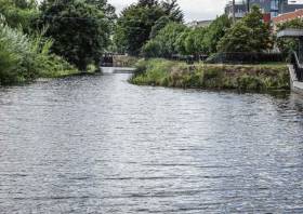
Waterways Ireland have been notified by the HSE of a number of cases of Leptospirosis reported recently following exposure to the water on the Royal Canal in North Dublin.

Individuals are instructed not to engage in swimming, diving or immersive activity such as deliberate capsizing in the waterway pending further advisory.

Any facilities/activity providers are also requested to ensure, to the best of their ability, that clients do not engage in the same activities.

The HSE further advises all individuals partaking in watersport (and in turn for activity providers to advise their clients) of the risk, which is small but real, of acquiring Leptospirosis from water-based activities.

Persons with symptoms (a flu-like illness) within a three-week period after engaging in a water-based activity should seek medical attention immediately, mentioning any watercourse exposure.

Further information on Leptospirosis is available from the HSE website. Other enquiries can be directed to [email protected] or by contacting the Waterways Ireland Communications Office on 071-9650787.

What is Leptospirosis?

Leptospirosis is a bacterial infection frequently found both in domestic and wild animals, which can spread to humans. Leptospirosis in Ireland is usually picked up from rats. The infection is spread through contact with rats, or rat urine generally.

Leptospirosis is a recreational hazard for those who participate in outdoor sports in contaminated areas and has been associated with water sports.

Occupations at risk would include veterinary surgeons, farmers, meat inspectors, butchers, abattoir and sewer workers.

High-risk water includes stagnant, dirty-looking or obviously polluted fresh water found in ditches, drains, ponds, lakes or rivers. Sea water poses less risk.

What precautions should I take?

  • Do not go swimming or boating in water which is known to be or obviously polluted.
  • Cover any cuts or abrasions with a waterproof dressing while swimming or canoeing.
  • Shower thoroughly as soon as possible following water activities.
  • Make sure the sporting clothing you wear minimises your contact with water.
  • Wash your hands after water activity, handling any animal or contaminated clothing and always before eating, drinking or smoking.
  • Clean any cuts acquired during swimming, fishing or other near-water activities. Apply first aid as soon as possible.
    Rinsing dogs who have been swimming in high risk water reduces the risk of infection.
  • High-risk workers should always wear their personal protective equipment and clothing at all times when in high risk situations.
  • If you get a flu-like illness within a three-week period after engaging in any of these activities you should visit your doctor immediately, and tell her or him of your concerns and possible exposure to dirty or stagnant water.
Published in Inland Waterways

Dublin Bay

Dublin Bay on the east coast of Ireland stretches over seven kilometres, from Howth Head on its northern tip to Dalkey Island in the south. It's a place most Dubliners simply take for granted, and one of the capital's least visited places. But there's more going on out there than you'd imagine.

The biggest boating centre is at Dun Laoghaire Harbour on the Bay's south shore that is home to over 1,500 pleasure craft, four waterfront yacht clubs and Ireland's largest marina.

The bay is rather shallow with many sandbanks and rocky outcrops, and was notorious in the past for shipwrecks, especially when the wind was from the east. Until modern times, many ships and their passengers were lost along the treacherous coastline from Howth to Dun Laoghaire, less than a kilometre from shore.

The Bay is a C-shaped inlet of the Irish Sea and is about 10 kilometres wide along its north-south base, and 7 km in length to its apex at the centre of the city of Dublin; stretching from Howth Head in the north to Dalkey Point in the south. North Bull Island is situated in the northwest part of the bay, where one of two major inshore sandbanks lie, and features a 5 km long sandy beach, Dollymount Strand, fronting an internationally recognised wildfowl reserve. Many of the rivers of Dublin reach the Irish Sea at Dublin Bay: the River Liffey, with the River Dodder flow received less than 1 km inland, River Tolka, and various smaller rivers and streams.

Dublin Bay FAQs

There are approximately ten beaches and bathing spots around Dublin Bay: Dollymount Strand; Forty Foot Bathing Place; Half Moon bathing spot; Merrion Strand; Bull Wall; Sandycove Beach; Sandymount Strand; Seapoint; Shelley Banks; Sutton, Burrow Beach

There are slipways on the north side of Dublin Bay at Clontarf, Sutton and on the southside at Dun Laoghaire Harbour, and in Dalkey at Coliemore and Bulloch Harbours.

Dublin Bay is administered by a number of Government Departments, three local authorities and several statutory agencies. Dublin Port Company is in charge of navigation on the Bay.

Dublin Bay is approximately 70 sq kilometres or 7,000 hectares. The Bay is about 10 kilometres wide along its north-south base, and seven km in length east-west to its peak at the centre of the city of Dublin; stretching from Howth Head in the north to Dalkey Point in the south.

Dun Laoghaire Harbour on the southside of the Bay has an East and West Pier, each one kilometre long; this is one of the largest human-made harbours in the world. There also piers or walls at the entrance to the River Liffey at Dublin city known as the Great North and South Walls. Other harbours on the Bay include Bulloch Harbour and Coliemore Harbours both at Dalkey.

There are two marinas on Dublin Bay. Ireland's largest marina with over 800 berths is on the southern shore at Dun Laoghaire Harbour. The other is at Poolbeg Yacht and Boat Club on the River Liffey close to Dublin City.

Car and passenger Ferries operate from Dublin Port to the UK, Isle of Man and France. A passenger ferry operates from Dun Laoghaire Harbour to Howth as well as providing tourist voyages around the bay.

Dublin Bay has two Islands. Bull Island at Clontarf and Dalkey Island on the southern shore of the Bay.

The River Liffey flows through Dublin city and into the Bay. Its tributaries include the River Dodder, the River Poddle and the River Camac.

Dollymount, Burrow and Seapoint beaches

Approximately 1,500 boats from small dinghies to motorboats to ocean-going yachts. The vast majority, over 1,000, are moored at Dun Laoghaire Harbour which is Ireland's boating capital.

In 1981, UNESCO recognised the importance of Dublin Bay by designating North Bull Island as a Biosphere because of its rare and internationally important habitats and species of wildlife. To support sustainable development, UNESCO’s concept of a Biosphere has evolved to include not just areas of ecological value but also the areas around them and the communities that live and work within these areas. There have since been additional international and national designations, covering much of Dublin Bay, to ensure the protection of its water quality and biodiversity. To fulfil these broader management aims for the ecosystem, the Biosphere was expanded in 2015. The Biosphere now covers Dublin Bay, reflecting its significant environmental, economic, cultural and tourism importance, and extends to over 300km² to include the bay, the shore and nearby residential areas.

On the Southside at Dun Laoghaire, there is the National Yacht Club, Royal St. George Yacht Club, Royal Irish Yacht Club and Dun Laoghaire Motor Yacht Club as well as Dublin Bay Sailing Club. In the city centre, there is Poolbeg Yacht and Boat Club. On the Northside of Dublin, there is Clontarf Yacht and Boat Club and Sutton Dinghy Club. While not on Dublin Bay, Howth Yacht Club is the major north Dublin Sailing centre.

© Afloat 2020