Menu

Ireland's sailing, boating & maritime magazine

Dublin Bay Boating News and Information

Displaying items by tag: Marine Economics

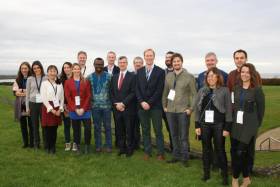
The 10th Annual Marine Economics Policy Research Symposium, recently held at the Marine Institute’s Oranmore headquarters, provided a forum for researchers, scientists, economists and policy makers to present and exchange views on a wide range of topics.

Organised by the Socio-Economic Marine Research Unit (SEMRU) of NUI Galway’s Whitaker Institute with the support of the Marine Institute, the event was a space to discuss issues from the public perceptions of the oceans and marine spatial planning to marine and coastal tourism.

The 10th annual symposium also showcased the international collaborations that have been established between SEMRU and partner institutes through a number of EU projects.

The Marine Institute’s new chief executive Dr Paul Connolly welcomed the researchers, noting that SEMRU “has played a vital role in establishing a sustainable method of valuing our oceans”.

He added that the unit has “also undertaken complex research initiatives across a broad spectrum of areas, such as fisheries, maritime transport tourism and natural capital accounting”.

“Today, economic evidence is available to show the value — market and non-market — of our ocean resources with Ireland's marine sector recognised by Government and the State as an important national asset,” he said.

SEMRU presented the latest economic figures to Government in June 2019 as part of the Our Ocean Wealth Summit.

The latest figures show that Ireland’s ocean economy had a turnover of €6.23 billion and provided employment for 34,132 people (full time equivalents). The total direct and indirect value of Ireland's ocean economy is estimated by SEMRU to be in excess of €4.2 billion GVA (Gross Valued Added), equivalent to 2% of GDP.

Ireland’s integrated marine plan, Harnessing Our Ocean Wealth, outlines the Government’s target to increase the turnover from our ocean economy to exceed €6.4 billion by 2020 and double its value to 2.4% of GDP by 2030.

The symposium welcomed speakers from the Marine Institute; NUI Galwa; Department of Housing, Planning and Local Government; Údarás na Gaeltachta; Galway-Mayo Institute Technology; Trinity College Dublin; Queen’s University Belfast; and ABPmer.

Top women’s surfer turned marine biologist Dr Easkey Britton was among the international list of speakers whose presentations are available to download from the SEMRU website HERE.

Published in Marine Science

Dublin Bay

Dublin Bay on the east coast of Ireland stretches over seven kilometres, from Howth Head on its northern tip to Dalkey Island in the south. It's a place most Dubliners simply take for granted, and one of the capital's least visited places. But there's more going on out there than you'd imagine.

The biggest boating centre is at Dun Laoghaire Harbour on the Bay's south shore that is home to over 1,500 pleasure craft, four waterfront yacht clubs and Ireland's largest marina.

The bay is rather shallow with many sandbanks and rocky outcrops, and was notorious in the past for shipwrecks, especially when the wind was from the east. Until modern times, many ships and their passengers were lost along the treacherous coastline from Howth to Dun Laoghaire, less than a kilometre from shore.

The Bay is a C-shaped inlet of the Irish Sea and is about 10 kilometres wide along its north-south base, and 7 km in length to its apex at the centre of the city of Dublin; stretching from Howth Head in the north to Dalkey Point in the south. North Bull Island is situated in the northwest part of the bay, where one of two major inshore sandbanks lie, and features a 5 km long sandy beach, Dollymount Strand, fronting an internationally recognised wildfowl reserve. Many of the rivers of Dublin reach the Irish Sea at Dublin Bay: the River Liffey, with the River Dodder flow received less than 1 km inland, River Tolka, and various smaller rivers and streams.

Dublin Bay FAQs

There are approximately ten beaches and bathing spots around Dublin Bay: Dollymount Strand; Forty Foot Bathing Place; Half Moon bathing spot; Merrion Strand; Bull Wall; Sandycove Beach; Sandymount Strand; Seapoint; Shelley Banks; Sutton, Burrow Beach

There are slipways on the north side of Dublin Bay at Clontarf, Sutton and on the southside at Dun Laoghaire Harbour, and in Dalkey at Coliemore and Bulloch Harbours.

Dublin Bay is administered by a number of Government Departments, three local authorities and several statutory agencies. Dublin Port Company is in charge of navigation on the Bay.

Dublin Bay is approximately 70 sq kilometres or 7,000 hectares. The Bay is about 10 kilometres wide along its north-south base, and seven km in length east-west to its peak at the centre of the city of Dublin; stretching from Howth Head in the north to Dalkey Point in the south.

Dun Laoghaire Harbour on the southside of the Bay has an East and West Pier, each one kilometre long; this is one of the largest human-made harbours in the world. There also piers or walls at the entrance to the River Liffey at Dublin city known as the Great North and South Walls. Other harbours on the Bay include Bulloch Harbour and Coliemore Harbours both at Dalkey.

There are two marinas on Dublin Bay. Ireland's largest marina with over 800 berths is on the southern shore at Dun Laoghaire Harbour. The other is at Poolbeg Yacht and Boat Club on the River Liffey close to Dublin City.

Car and passenger Ferries operate from Dublin Port to the UK, Isle of Man and France. A passenger ferry operates from Dun Laoghaire Harbour to Howth as well as providing tourist voyages around the bay.

Dublin Bay has two Islands. Bull Island at Clontarf and Dalkey Island on the southern shore of the Bay.

The River Liffey flows through Dublin city and into the Bay. Its tributaries include the River Dodder, the River Poddle and the River Camac.

Dollymount, Burrow and Seapoint beaches

Approximately 1,500 boats from small dinghies to motorboats to ocean-going yachts. The vast majority, over 1,000, are moored at Dun Laoghaire Harbour which is Ireland's boating capital.

In 1981, UNESCO recognised the importance of Dublin Bay by designating North Bull Island as a Biosphere because of its rare and internationally important habitats and species of wildlife. To support sustainable development, UNESCO’s concept of a Biosphere has evolved to include not just areas of ecological value but also the areas around them and the communities that live and work within these areas. There have since been additional international and national designations, covering much of Dublin Bay, to ensure the protection of its water quality and biodiversity. To fulfil these broader management aims for the ecosystem, the Biosphere was expanded in 2015. The Biosphere now covers Dublin Bay, reflecting its significant environmental, economic, cultural and tourism importance, and extends to over 300km² to include the bay, the shore and nearby residential areas.

On the Southside at Dun Laoghaire, there is the National Yacht Club, Royal St. George Yacht Club, Royal Irish Yacht Club and Dun Laoghaire Motor Yacht Club as well as Dublin Bay Sailing Club. In the city centre, there is Poolbeg Yacht and Boat Club. On the Northside of Dublin, there is Clontarf Yacht and Boat Club and Sutton Dinghy Club. While not on Dublin Bay, Howth Yacht Club is the major north Dublin Sailing centre.

© Afloat 2020