Menu

Ireland's sailing, boating & maritime magazine

Dublin Bay Boating News and Information

Displaying items by tag: New Ross Port

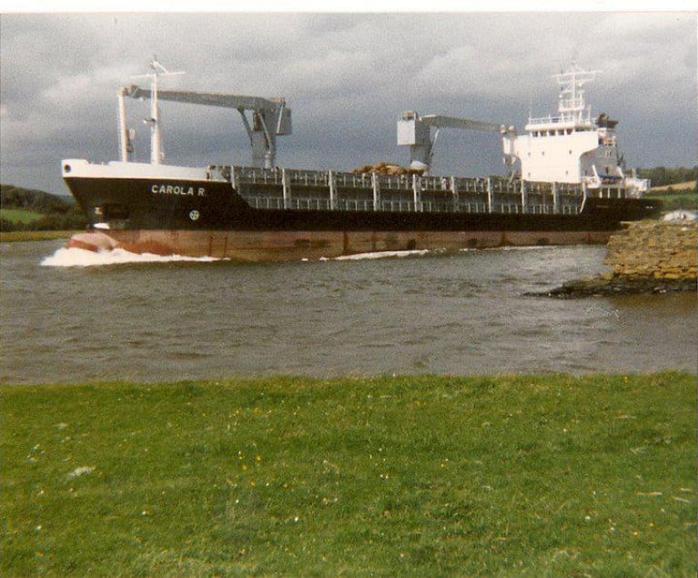
As the New Ross Standard reports, the cost of dredging the inland south-east Irish port and meeting its debts could run to more than €5m, councillors were told at the monthly municipal council meeting.

Director of Services Carolyn Godkin gave an update on how New Ross Port is faring financially at the meeting. Ms Godkin said a dredging cost benefit analysis is being carried out, along with other surveys, including environmental reports.

The 38m mast behind the port office is being removed.

'It's no longer fit for purpose. We have gone to tender on that and we will award a contract over the next few weeks.'

A new International Shipping & Port Security code for Marshmeadows will be sourced by June 30 and a hydrographic date survey also will be carried out within six months to ascertain the depths of the Barrow.

'We have engaged with the Admiralty and a new chart for New Ross.'

Lighting along the Barrow will be improved over the coming year also.

'New Ross is unusual in it's navigational system because the river is so dark. There is not a lot of light from towns and villages. Traditionally river street lighting was used to aid navigation,' Captain Phil Murphy said.

The Lucy junction near Pink Rock is a tricky corner for pilots to take so better lighting will be erected there.

'There are lights there but some need to be repaired. We are looking at what we have and what we need to give additional light to pilots.'

The Port and Pilot Byelaws have been reviewed.

Much more on this story here. 

Published in Irish Ports
Tagged under

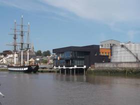
#irishports - New Ross Port is to be transferred to Wexford County Council within the coming months and will lead to great opportunities for the development of the quays area of the town.

As NewRoss Standard writes, this is the view of director of services for economic development with Wexford County Council, Tony Larkin who addressed the monthly meeting of New Ross Municipal District.

Mr Larkin said the 'bottom tier' ports in Ireland are being transferred to local authorities.

'It's New Ross' turn. We have been in negotiations with the Department of Transport for two years. We've been doing due diligence on the port company and I compliment the work of the port company.'

He said the company is being disbanded and will merge into the council.

Mr Larkin said the transfer could occur as soon as May or June, and would have already taken place if not for some cost issues involving the removal of the oil tanks on the quay and the cost of draining the Barrow.

For the transfer to take place three ministers have to sign the transfer letter.

For further reading on this development at the inland port click here.

Published in Irish Ports

Dublin Bay

Dublin Bay on the east coast of Ireland stretches over seven kilometres, from Howth Head on its northern tip to Dalkey Island in the south. It's a place most Dubliners simply take for granted, and one of the capital's least visited places. But there's more going on out there than you'd imagine.

The biggest boating centre is at Dun Laoghaire Harbour on the Bay's south shore that is home to over 1,500 pleasure craft, four waterfront yacht clubs and Ireland's largest marina.

The bay is rather shallow with many sandbanks and rocky outcrops, and was notorious in the past for shipwrecks, especially when the wind was from the east. Until modern times, many ships and their passengers were lost along the treacherous coastline from Howth to Dun Laoghaire, less than a kilometre from shore.

The Bay is a C-shaped inlet of the Irish Sea and is about 10 kilometres wide along its north-south base, and 7 km in length to its apex at the centre of the city of Dublin; stretching from Howth Head in the north to Dalkey Point in the south. North Bull Island is situated in the northwest part of the bay, where one of two major inshore sandbanks lie, and features a 5 km long sandy beach, Dollymount Strand, fronting an internationally recognised wildfowl reserve. Many of the rivers of Dublin reach the Irish Sea at Dublin Bay: the River Liffey, with the River Dodder flow received less than 1 km inland, River Tolka, and various smaller rivers and streams.

Dublin Bay FAQs

There are approximately ten beaches and bathing spots around Dublin Bay: Dollymount Strand; Forty Foot Bathing Place; Half Moon bathing spot; Merrion Strand; Bull Wall; Sandycove Beach; Sandymount Strand; Seapoint; Shelley Banks; Sutton, Burrow Beach

There are slipways on the north side of Dublin Bay at Clontarf, Sutton and on the southside at Dun Laoghaire Harbour, and in Dalkey at Coliemore and Bulloch Harbours.

Dublin Bay is administered by a number of Government Departments, three local authorities and several statutory agencies. Dublin Port Company is in charge of navigation on the Bay.

Dublin Bay is approximately 70 sq kilometres or 7,000 hectares. The Bay is about 10 kilometres wide along its north-south base, and seven km in length east-west to its peak at the centre of the city of Dublin; stretching from Howth Head in the north to Dalkey Point in the south.

Dun Laoghaire Harbour on the southside of the Bay has an East and West Pier, each one kilometre long; this is one of the largest human-made harbours in the world. There also piers or walls at the entrance to the River Liffey at Dublin city known as the Great North and South Walls. Other harbours on the Bay include Bulloch Harbour and Coliemore Harbours both at Dalkey.

There are two marinas on Dublin Bay. Ireland's largest marina with over 800 berths is on the southern shore at Dun Laoghaire Harbour. The other is at Poolbeg Yacht and Boat Club on the River Liffey close to Dublin City.

Car and passenger Ferries operate from Dublin Port to the UK, Isle of Man and France. A passenger ferry operates from Dun Laoghaire Harbour to Howth as well as providing tourist voyages around the bay.

Dublin Bay has two Islands. Bull Island at Clontarf and Dalkey Island on the southern shore of the Bay.

The River Liffey flows through Dublin city and into the Bay. Its tributaries include the River Dodder, the River Poddle and the River Camac.

Dollymount, Burrow and Seapoint beaches

Approximately 1,500 boats from small dinghies to motorboats to ocean-going yachts. The vast majority, over 1,000, are moored at Dun Laoghaire Harbour which is Ireland's boating capital.

In 1981, UNESCO recognised the importance of Dublin Bay by designating North Bull Island as a Biosphere because of its rare and internationally important habitats and species of wildlife. To support sustainable development, UNESCO’s concept of a Biosphere has evolved to include not just areas of ecological value but also the areas around them and the communities that live and work within these areas. There have since been additional international and national designations, covering much of Dublin Bay, to ensure the protection of its water quality and biodiversity. To fulfil these broader management aims for the ecosystem, the Biosphere was expanded in 2015. The Biosphere now covers Dublin Bay, reflecting its significant environmental, economic, cultural and tourism importance, and extends to over 300km² to include the bay, the shore and nearby residential areas.

On the Southside at Dun Laoghaire, there is the National Yacht Club, Royal St. George Yacht Club, Royal Irish Yacht Club and Dun Laoghaire Motor Yacht Club as well as Dublin Bay Sailing Club. In the city centre, there is Poolbeg Yacht and Boat Club. On the Northside of Dublin, there is Clontarf Yacht and Boat Club and Sutton Dinghy Club. While not on Dublin Bay, Howth Yacht Club is the major north Dublin Sailing centre.

© Afloat 2020