Displaying items by tag: Oireachtas
Inland Fisheries Ireland Chief Addresses Oireachtas on New Barrier Programme for Irish Rivers
Inland Fisheries Ireland (IFI) chief executive Francis O’Donnell addressed the Oireachtas on Tuesday (13 February) on the State body’s programme to mitigate barriers to fish passage on Irish rivers.
“Migratory species such as Atlantic salmon, sea trout, sea lamprey, river lamprey, twaite and allis shad and European eel all make long migratory journeys to reproduce,” O’Donnell said. “However, a range of other fish, such as pike, brown trout and bream, live entirely in fresh water but make extended movements along the river system for feeding or to access spawning and nursery areas.
“Any restrictions to fish migrations may have negative consequences for their habitat use, reproductive or feeding capacity and could lead to long-term declines in their population.”
O’Donnell noted that barriers to fish passage run from “small structures such as bridge floors, culverts, sluices to larger structures such as weirs and dams”. These can impact on natural river processes, affecting temperature, flow rate and sediment transport.
IFI is mapping the extent of barriers nationwide, with more than 73,000 potential barriers identified and nearly half of these assessed.
“Of those assessed as a problem, 233 have had follow-up surveys…[which] are required before any mitigation work can be carried out,” O’Donnell said.
IFI’s National Barriers Programme (NBP), developed with the support of two Government departments, runs until 2027 with the aim of addressing water-quality pressures with mitigation works.
“The NBP has estimated that there are potentially 8,500 culverts/bridges, 1,500 weirs and 160 other structures in Irish rivers that represent a barrier to fish passage,” O’Donnell said. “Over the life of the NBP…it is expected that 257 barriers will be mitigated.”
IFI is currently working on improving fish passage at Bretts Weir on the River Nore in Co Kilkenny; Bakery Weir on the River Suir in Cahir, Co Tipperary; Pallas Weir on the River Bann; and the Dalligan Weir on the River Dalligan in Co Waterford.
Those pilot schemes are along with works at Annacotty Weir and Askeaton Weir in Co Limerick, Templederry Bridge in Co Tipperary, Castlecor Weir fish passage in Co Meath, and Bishops Stream in Co Roscommon.
In addition, O’Donnell said IFI is working with the likes of the ESB to understand the impacts of hydroelectricity on migrating salmon and eels, noting that “large barriers on the Erne, Liffey and Shannon systems have brought those populations to near extinction”.
O’Donnell concluded: “Unfortunately, the European eel numbers across Europe have been decimated and Atlantic salmon numbers returning to Ireland compared to the 1970s have been reduced by 80 per cent. The trend is getting worse and there is now a need to really deal with barriers and find solutions if we are going to save two wonders of nature that undertake what is a most amazing migratory journey in the natural world.”
Offshore renewables must not be pursued at the cost of Ireland’s biodiversity, an Oireachtas committee has been told.
According to The Irish Times, members of the Oireachtas Committee on Climate Change heard statements from various environmental and conservation groups who explained how Ireland’s waters and coastal areas are under threat from the effects of climate change as well as pollution and invasive species.
Ellen MacMahon of the Sustainable Water Network noted the important role of wind energy in decarbonising the Irish economy.
But she added that “marine protected areas are often overlooked in the role they can play in addressing the twin climate and biodiversity emergencies”.
Her comments were echoed by Dr Simon Berrow of the Irish Whale and Dolphin Group, who said offshore wind farms “cannot be considered in isolation” from their immediate environments and urged that such green energy projects are “not at further cost to Ireland’s already depleted marine habitats and species”.
The Irish Times has much more on the story HERE.
Committee to Hear Hauliers Facing 'Catastrophic Consequences' Over Brexit
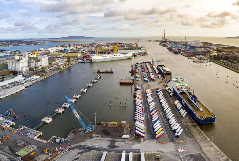
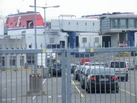
An Oireachtas Committee will hear the Irish Road Haulage Association calling for a single entity to take charge of the free movement of traffic from ports ahead of Brexit.
Its President, Eugene Drennan, reports RTE News, is due before the Oireachtas Committee on Transport and Communications Networks later today.
He will warn politicians that even if a Brexit deal is reached, hauliers are facing "catastrophic consequences" due to delays and obstructions at ports and airports.
Drivers will face checks from Revenue, the Department of Agriculture, the Health Service Executive and An Garda Síochána.
Mr Drennan is also requesting that the Road Safety Authority and Department of Transport take a more lenient approach to licensed hauliers, to ease some of the pressure they will be under.
Accounts at Dún Laoghaire Harbour Must be Published, Says Senator
Financial accounts of Dún Laoghaire Harbour Company must be published and presented to the Oireachtas without delay, a former director of the company has said.
As The Irish Times reports, Independent Senator Victor Boyhan (see call for ferry return) who was a company director of the Dublin Bay harbour for 10 years, said the final 2017 accounts for the defunct company should have been published within six months of its dissolution.
The company was dissolved and control of the harbour was transferred to Dún Laoghaire Rathdown County Council last October,leaving the council with liabilities of almost €40 million as previously reported on Afloat..
Mr Boyhan has warned Minister for Local Government Eoghan Murphy that he and the Government could find themselves open to legal action if they saddle the local authority with this debt.
For more from the newspaper click here.
Afloat.ie adds it is just over five years ago since Stena Line's final ferry sailing on the seasonal-only service took place in September 2014 (see special News feature: Farewell to Stena's HSS, Ships Monthly, June 2015)
It was not until February of the following year that the operator finally confirmed the end of the historic Dun Laoghaire-Holyhead route by consolidating out of Dublin Port with an existing year-round service to the same north Welsh port.


