Displaying items by tag: Port of New Ross

On the coastal narrow road to Hook Lighthouse in Co. Wexford was lined with sea foam as cars arrived on New Year’s Day from 7.30 a.m. for a ceremony that dates back to 1687.
An outcrop of rock behind the 800-year-old Hook Lighthouse was the destination for the Dunbrody Archers, New Ross Municipal District officials and some curious onlookers, all braving the cold to witness a spectacular start to 2022.
The tradition dates from 1687 when the mayor and the corporation of New Ross Town Council claimed their authority over the waters by travelling to Hook and shooting an arrow into the sea from Hook Head Lighthouse.
The Mayor of New Ross, casting the arrow into the sea, symbolises the port of New Ross’s authority over the estuary of the Barrow and the Suir all the way down to Hook Head.
More from the New Ross Standard on the event from the south-east.
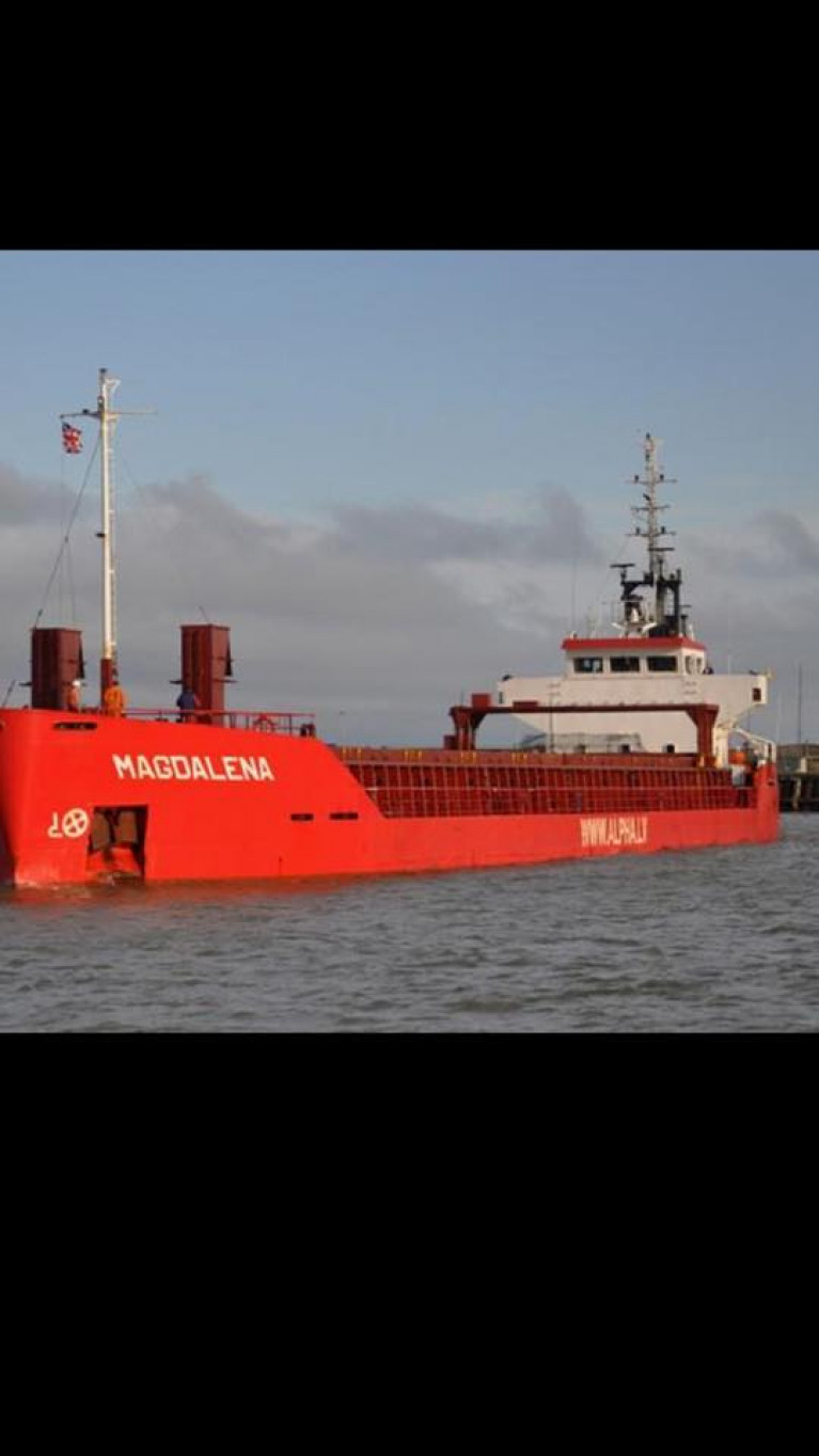
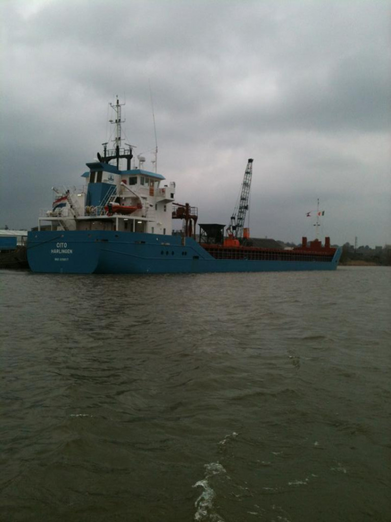
The Port of New Ross will not be able to reopen to shipping traffic on the scale it was hoped this month due to a delay in completing health and safety works.
Executive scientist with Wexford County Council Brendan Cooney said the taking in charge process of New Ross Pier/Port is ongoing.
Speaking at the municipal council meeting, Mr Cooney said health and safety standards are being looked at and a new harbourmaster is being hired.
Mr Cooney said he is hopeful the port can reopen in the next few weeks.
Cllr John Fleming said he is aware there are problems with navigational equipment in the port.
More here from the New Ross Standard on the south-east inland port on the banks of the Barrow.
New Chairman Voted in of New Ross Municiple District
New Ross Standard reports on the handing over of the chains of municipal council power was a mere formality (last) Monday as Fianna Fáil Cllr Michael Whelan was voted in as cathaoirleach for the second time, two days after his party leader was named Taoiseach of a historic coalition.
Taking over from former chairman Cllr John Fleming, who held the role for two consecutive years, the Ballycullane man said it was a proud day for him and for his family.
Cllr Whelan thanked Cllr Fleming for his year in the chair, He said: 'Even though the world has changed very much from where were a few months ago, there are still ongoing events that we should be excited about in the New Ross municipal. Although we can expect the tightening of belts at all levels from national to council level I will make sure the New Ross town and district gets it's fair share,' sounding a note of measured optimism.
He said some exciting projects are in the pipeline which will help with the growth of our town and district.
'The removal of the oil tanks on the entrance into town will improve the look at this entrance point but should also give the opportunity for some kind of development in this area. The High Hill project should be completed in the coming year and this will be a welcome improvement and attraction to that end of town. We will also have the link from the Greenway which I hope will bring New Ross many new exciting opportunities.
We can also promote more along the Norman Way and help re-energise the tourism industry post Covid. We, in this district, are steeped in Norman heritage and have many attractions from Tintern to the Hook Head [lighthouse] and back to the town of New Ross. We also have taken on the Port of New Ross in the last year and have plans to develop the Quay to bring in tours from Waterford initially, but who knows where that could grow to.'
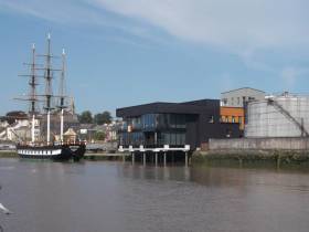
For more on the Co. Wexford town which is also Ireland's most inland port located on the River Barrow click here.
Wexford Council to Abandon New Ross Port to Waterford
At the historic Port of New Ross shipping will soon be run by Belview Port in Waterford, in a controversial move planned by Wexford County Council.
As the New Ross Standard reports, the Director of Services for Economic Development Tony Larkin made the announcement at the first meeting of the new Wexford County Council term on Friday.
In an update to councillors ahead of the imminent transfer of the port from the state to Wexford County Council, Mr Larkin said: 'We are taking over the operation of the port. We have been in due diligence for two years.'
Mr Larkin said he was informed last week that the takeover process has been completed, save for three ministers signing the document which will formally allow the transfer.
'The process of having the ministers sign it has now commenced. Immediately upon transfer all assets and staff will transfer to us and we will have responsibility as the port authority. We are not in the shipping business. We are in discussions with the Port of Waterford at Belview about them acting as our agents managing the shipping for a fee.'
To read further comments from Mr Larkin and more click here.
Iconic Bridge: Vote Will See New Ross Bypass Bridge Named after Rose Kennedy
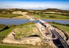
#InlandWaterways - The longest bridge in Ireland will finally be named in a fortnight's time after councillors in Piltown and New Ross voted by a small majority last week in favour of the Rose Fitzgerald Kennedy name at separate council meetings.
Both New Ross and Piltown Municipal District Councils met last week reports The NewRoss Standard as the long-running saga of what to call the new bridge (see previous coverage) took up considerable time at both meetings.
In New Ross, Cllr Michael Sheehan went against his colleagues and opted for the William Marshal Bridge, with the seven other councillors voting for the Rose Fitzgerald Kennedy Bridge.
Over in Piltown, five out of the six sitting councillors voted for the Pink Rock Bridge. However, the fact that a single councillor in Piltown voted in favour of Rose Fitzgerald Kennedy means that, as it stands, the vote is at 8-6 in favour of naming the 887m bridge after John F Kennedy's mother.
New Ross and Piltown councillors will meet together on October 3 at the Rhu Gleen Hotel in Slieverue, where the name will be voted on for a final time. If all 14 councillors from New Ross and Piltown vote as per last week, the iconic bridge will officially be named the Rose Fitzgerald Kennedy Bridge, ending a two-year saga over what to call the impressive structure.
For further reading on the new bridge (click here).
Afloat adds that the structure is located downriver of the Port of New Ross on the River Barrow, but sited before the disused Barrow Bridge which carried the Waterford City-Rosslare Harbour stretch of the Limerick railway line. This smaller section of the railway route line however closed in 2010.
The Barrow Bridge however remains in use albeit for the purposes of permitting shipping traffic to access New Ross. The bridge features a swing-bridge section that pivots to allow ships with up to 6,000 tonnes to transit the bridge and continue navigating upriver.
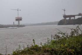
#InlandWaterways - The scale of the New Ross bypass project for the layperson is as dizzying as its bridge over the River Barrow is going to be high.
For starters, the Killkenny People writes the scheme is 26 years in the making - from its humble beginnings in Kilkenny and Wexford County Development Plans in 1993 and 1994 for an additional river crossing around New Ross.
So to begin with, getting the project over the line took decades in terms of route selection, bridge options, an oral hearing, scheme approval, design, Compulsory Purchase Orders, tendering and all that an infrastructural development of this size entails.
Then there’s the task constructing 13.6km of dual carriageway which will boast Ireland’s longest bridge once it is completed.
For further reading on this impressive project, click here.
Port of New Ross to Dispose of Terminal Site
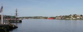
#TerminalSite - The Port of New Ross on the River Barrow, has been a hub for dry and liquid bulk traffic and project cargoes for many years. In 2015, total trade through the Co. Wexford port exceeded 286,000 tonnes.
In order to optimise the use of existing port infrastructure, the port company wishes to dispose of a terminal within the port estate, which is situated in the townland of Marshmeadows, downriver of New Ross.
On behalf of the port company, the Marine Institute is inviting expressions of interest in acquiring the facility. The terminal comprises a jetty and adjoining lands measuring approximately 2 hectares.
New Ross Celtic River Festival

#RIVER FESTIVAL – The inland port of New Ross,Co. Wexford, is to where the Celtic River Festival is to take place over next weekend (25-26 Aug).
The festival has an action packed programme to entertain with plenty of fun-filled activities for all to enjoy. The events are a cruiser treasure hunt, Viking longboat trips, cot-racing, music sessions, Viking camp and medieval fair, a kids workshop and sea scout camp and archery.
For further details visit their facebook page by clicking HERE


