Menu

Ireland's sailing, boating & maritime magazine

Dublin Bay Boating News and Information

Displaying items by tag: Ports & Shippiing News

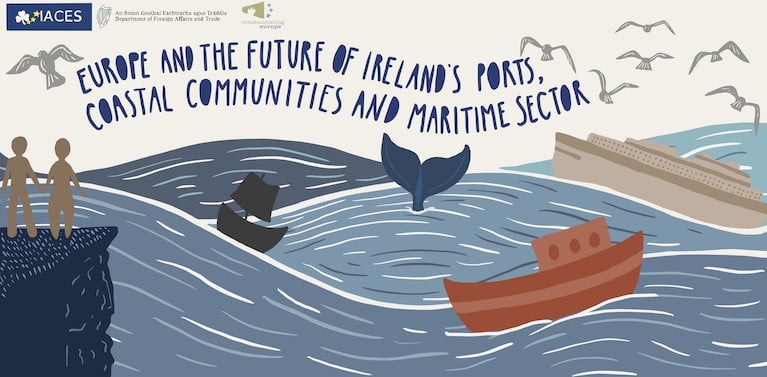
During the process of the UK’s withdrawal from the EU, there was, rightly, a great deal of focus in public debate on the issues confronting Ireland’s border communities. On 20 November 2020, the Irish Association for Contemporary European Studies (IACES) will be holding an online conference which aims to expand the terms of this debate, and to examine and deepen understanding of a key issue in Ireland’s relationship with the EU – that of the future of those coastal and port communities which, at the end of the transition period, will find themselves on a new frontier between the EU and the UK.

Bringing together academics, experts and stakeholders, this online conference and workshop aims to explore the key role played by Ireland’s ports, coastal communities and maritime sector in its membership of the EU; provide a forum in which issues confronting Ireland’s port and coastal communities as a result of Brexit, climate change and the coronavirus pandemic can be discussed; and, crucially, highlight how responses to these challenges are framed and influenced by Ireland’s EU membership.

​The conference will examine contemporary challenges for Ireland's ports, coasts and maritime sector, explore community projects that cross the maritime border between Ireland and Wales, and examine the long history of Ireland's cultural connections with the sea. Attendance is open to all, and further details and registration are available here.

Published in Ports & Shipping

#Ports&ShippingReview – Over the last fortnight, Jehan Ashmore has reported on the shipping scene where Ardmore Shipping was delivered a 25,000dwt tanker newbuild, Ardmore Cheyenne from a Japanese shipyard.

Phase one of work continues on a major €50m investment of Foynes Port to transform the Shannon Estuary port into one of the biggest bulk harbours in Europe.

Rotterdam's new Maasvlakte 2 (MV2) container-terminal run by AMPT has been hitting back over claims of a slower than expected rollout of its operations with delays causing current traffic congestion at Europe's biggest container port.

The International Association of Port Cities (AIVP) will host its AGM for 2015 in Dublin next month ahead of the June Bank Holiday weekend. 'Working Waterfront' is the topic of the two-day meeting.

Due to high levels of interest in the inaugural Maritime Industry Awards (18 June) the entry deadline has been extended for companies to submit in the award categories to 23 April.

Published in Ports & Shipping

Dublin Bay

Dublin Bay on the east coast of Ireland stretches over seven kilometres, from Howth Head on its northern tip to Dalkey Island in the south. It's a place most Dubliners simply take for granted, and one of the capital's least visited places. But there's more going on out there than you'd imagine.

The biggest boating centre is at Dun Laoghaire Harbour on the Bay's south shore that is home to over 1,500 pleasure craft, four waterfront yacht clubs and Ireland's largest marina.

The bay is rather shallow with many sandbanks and rocky outcrops, and was notorious in the past for shipwrecks, especially when the wind was from the east. Until modern times, many ships and their passengers were lost along the treacherous coastline from Howth to Dun Laoghaire, less than a kilometre from shore.

The Bay is a C-shaped inlet of the Irish Sea and is about 10 kilometres wide along its north-south base, and 7 km in length to its apex at the centre of the city of Dublin; stretching from Howth Head in the north to Dalkey Point in the south. North Bull Island is situated in the northwest part of the bay, where one of two major inshore sandbanks lie, and features a 5 km long sandy beach, Dollymount Strand, fronting an internationally recognised wildfowl reserve. Many of the rivers of Dublin reach the Irish Sea at Dublin Bay: the River Liffey, with the River Dodder flow received less than 1 km inland, River Tolka, and various smaller rivers and streams.

Dublin Bay FAQs

There are approximately ten beaches and bathing spots around Dublin Bay: Dollymount Strand; Forty Foot Bathing Place; Half Moon bathing spot; Merrion Strand; Bull Wall; Sandycove Beach; Sandymount Strand; Seapoint; Shelley Banks; Sutton, Burrow Beach

There are slipways on the north side of Dublin Bay at Clontarf, Sutton and on the southside at Dun Laoghaire Harbour, and in Dalkey at Coliemore and Bulloch Harbours.

Dublin Bay is administered by a number of Government Departments, three local authorities and several statutory agencies. Dublin Port Company is in charge of navigation on the Bay.

Dublin Bay is approximately 70 sq kilometres or 7,000 hectares. The Bay is about 10 kilometres wide along its north-south base, and seven km in length east-west to its peak at the centre of the city of Dublin; stretching from Howth Head in the north to Dalkey Point in the south.

Dun Laoghaire Harbour on the southside of the Bay has an East and West Pier, each one kilometre long; this is one of the largest human-made harbours in the world. There also piers or walls at the entrance to the River Liffey at Dublin city known as the Great North and South Walls. Other harbours on the Bay include Bulloch Harbour and Coliemore Harbours both at Dalkey.

There are two marinas on Dublin Bay. Ireland's largest marina with over 800 berths is on the southern shore at Dun Laoghaire Harbour. The other is at Poolbeg Yacht and Boat Club on the River Liffey close to Dublin City.

Car and passenger Ferries operate from Dublin Port to the UK, Isle of Man and France. A passenger ferry operates from Dun Laoghaire Harbour to Howth as well as providing tourist voyages around the bay.

Dublin Bay has two Islands. Bull Island at Clontarf and Dalkey Island on the southern shore of the Bay.

The River Liffey flows through Dublin city and into the Bay. Its tributaries include the River Dodder, the River Poddle and the River Camac.

Dollymount, Burrow and Seapoint beaches

Approximately 1,500 boats from small dinghies to motorboats to ocean-going yachts. The vast majority, over 1,000, are moored at Dun Laoghaire Harbour which is Ireland's boating capital.

In 1981, UNESCO recognised the importance of Dublin Bay by designating North Bull Island as a Biosphere because of its rare and internationally important habitats and species of wildlife. To support sustainable development, UNESCO’s concept of a Biosphere has evolved to include not just areas of ecological value but also the areas around them and the communities that live and work within these areas. There have since been additional international and national designations, covering much of Dublin Bay, to ensure the protection of its water quality and biodiversity. To fulfil these broader management aims for the ecosystem, the Biosphere was expanded in 2015. The Biosphere now covers Dublin Bay, reflecting its significant environmental, economic, cultural and tourism importance, and extends to over 300km² to include the bay, the shore and nearby residential areas.

On the Southside at Dun Laoghaire, there is the National Yacht Club, Royal St. George Yacht Club, Royal Irish Yacht Club and Dun Laoghaire Motor Yacht Club as well as Dublin Bay Sailing Club. In the city centre, there is Poolbeg Yacht and Boat Club. On the Northside of Dublin, there is Clontarf Yacht and Boat Club and Sutton Dinghy Club. While not on Dublin Bay, Howth Yacht Club is the major north Dublin Sailing centre.

© Afloat 2020