Menu

Ireland's sailing, boating & maritime magazine

Dublin Bay Boating News and Information

Displaying items by tag: RosslareRingaskiddy!

As adverse weather impacted February, particularly Storm Darcy's disruption to Dublin Bay shipping, gales also affected Brittany Ferries new 'freight'-ferry network of Ireland-France operations, writes Jehan Ashmore.

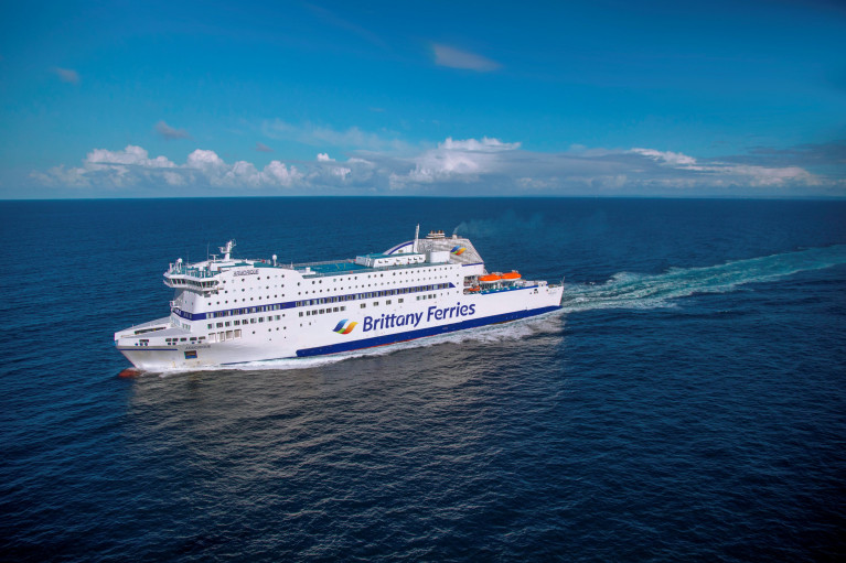
It was during routine tracking this day last week, that Afloat noted with somewhat of a surprise that the French operator's cruiseferry Armorique, had sailed along the south coast from Rosslare Europort to Ringaskiddy in Cork Harbour.

With such inclement weather, Afloat speculated that this was the cause of Armorique's repositioning passage from Leinster to neighbouring Munster. This was indeed the situation as Afloat contacted Brittany Ferries to confirm to the related 'Bypass-Brexit' routes that avoid the UK land-bridge.

A spokesperson from the operator's UK office commented that Armorique’s 20.00 Rosslare-St Malo sailing (last) Thursday and the 20.00 St. Malo-Cork sailing the next day, 19th February, were both cancelled due to the weather.

(These cancelled 'evening' sailing times are shown in bold below from the new freight routes/ added sailing schedule Afloat previously reported).

So given the weather impact on Armorique's four route network roster, this led the 2009 custom built ferry, having to sail in 'ballast' when sailing off the Wexford, Waterford and Cork coasts. The arrival to the southern city port was to retain to the scheduled route roster, with the 18.00 Cork-Roscoff sailing taking place on 20th February.

Day Depart Time Arrive Time (next day)

Monday Roscoff 20:00 Cork 14:00
Tuesday Cork 20:00 Roscoff 14:00
Wednesday Roscoff 20:00 Rosslare 14:00
Thursday Rosslare 20:00 St Malo 17:10
Friday St Malo 20:00 Cork 15:00
Saturday Cork 18:00 Roscoff 12:40

Given the topic of weather, hence the caveat in this timetable to cite sailings subject to weekly variation and change as Afloat previously reported in advance of the inaugural sailing of the new routes/additional service sailings through Rosslare and Cork. 

A week later and today, sees Armorique in Rosslare with a scheduled sailing (this evening at 20.00) along with in port, Isle of Inishmore and Stena Estrid. The E-Flexer ropax last month opened a new Dublin-Cherbourg service but is understood to be off service temporarily to cover Rosslare-Cherbourg ropax Stena Horizon. This smaller ropax is this winter's Irish Sea relief ferry while the Stena fleet are overhauled in dry-docks.

In all the years reporting for Afloat's 'Ferry' News, Armorique's role in operating to such a route rotation involving four routes and between just two nations (Ireland-France) is easily the most intense and complex. The same operator's flagship Pont-Aven on the Cork-Roscoff route (due to reopen in mid-May), which traditionally continues beyond France, by linking Brittany to the UK and from there a UK-Spain route before returning in reverse on this three-route network connecting four nations.

In the previous decades of the '80 and '90's, Irish Ferries operated longer (Rosslare/Cork routes to France), but not to the extent of Armorique's solo running role, as the Irish ferry operator had the use of two ships serving three routes, among them Cork-Cherbourg. The French port is the main ro-ro Brexit-Bypass transport hub for freight hauliers requiring convenient links to EU member state nations and beyond.

Irish Ferries however currently operate the Dublin-Cherbourg route where ropax Epsilon and another chartered in ferry, Mega Express Four provide additional Bypass Brexit services. The latter ferry also runs on the Dublin-Holyhead route with W.B. Yeats taking the roster of Ulysses which is in overhaul. 

Afloat will also delve further into these direct Ireland 'continental mainland' routes (briefly dipping into the past) and those of the present.

Published in Rosslare Europort

Dublin Bay

Dublin Bay on the east coast of Ireland stretches over seven kilometres, from Howth Head on its northern tip to Dalkey Island in the south. It's a place most Dubliners simply take for granted, and one of the capital's least visited places. But there's more going on out there than you'd imagine.

The biggest boating centre is at Dun Laoghaire Harbour on the Bay's south shore that is home to over 1,500 pleasure craft, four waterfront yacht clubs and Ireland's largest marina.

The bay is rather shallow with many sandbanks and rocky outcrops, and was notorious in the past for shipwrecks, especially when the wind was from the east. Until modern times, many ships and their passengers were lost along the treacherous coastline from Howth to Dun Laoghaire, less than a kilometre from shore.

The Bay is a C-shaped inlet of the Irish Sea and is about 10 kilometres wide along its north-south base, and 7 km in length to its apex at the centre of the city of Dublin; stretching from Howth Head in the north to Dalkey Point in the south. North Bull Island is situated in the northwest part of the bay, where one of two major inshore sandbanks lie, and features a 5 km long sandy beach, Dollymount Strand, fronting an internationally recognised wildfowl reserve. Many of the rivers of Dublin reach the Irish Sea at Dublin Bay: the River Liffey, with the River Dodder flow received less than 1 km inland, River Tolka, and various smaller rivers and streams.

Dublin Bay FAQs

There are approximately ten beaches and bathing spots around Dublin Bay: Dollymount Strand; Forty Foot Bathing Place; Half Moon bathing spot; Merrion Strand; Bull Wall; Sandycove Beach; Sandymount Strand; Seapoint; Shelley Banks; Sutton, Burrow Beach

There are slipways on the north side of Dublin Bay at Clontarf, Sutton and on the southside at Dun Laoghaire Harbour, and in Dalkey at Coliemore and Bulloch Harbours.

Dublin Bay is administered by a number of Government Departments, three local authorities and several statutory agencies. Dublin Port Company is in charge of navigation on the Bay.

Dublin Bay is approximately 70 sq kilometres or 7,000 hectares. The Bay is about 10 kilometres wide along its north-south base, and seven km in length east-west to its peak at the centre of the city of Dublin; stretching from Howth Head in the north to Dalkey Point in the south.

Dun Laoghaire Harbour on the southside of the Bay has an East and West Pier, each one kilometre long; this is one of the largest human-made harbours in the world. There also piers or walls at the entrance to the River Liffey at Dublin city known as the Great North and South Walls. Other harbours on the Bay include Bulloch Harbour and Coliemore Harbours both at Dalkey.

There are two marinas on Dublin Bay. Ireland's largest marina with over 800 berths is on the southern shore at Dun Laoghaire Harbour. The other is at Poolbeg Yacht and Boat Club on the River Liffey close to Dublin City.

Car and passenger Ferries operate from Dublin Port to the UK, Isle of Man and France. A passenger ferry operates from Dun Laoghaire Harbour to Howth as well as providing tourist voyages around the bay.

Dublin Bay has two Islands. Bull Island at Clontarf and Dalkey Island on the southern shore of the Bay.

The River Liffey flows through Dublin city and into the Bay. Its tributaries include the River Dodder, the River Poddle and the River Camac.

Dollymount, Burrow and Seapoint beaches

Approximately 1,500 boats from small dinghies to motorboats to ocean-going yachts. The vast majority, over 1,000, are moored at Dun Laoghaire Harbour which is Ireland's boating capital.

In 1981, UNESCO recognised the importance of Dublin Bay by designating North Bull Island as a Biosphere because of its rare and internationally important habitats and species of wildlife. To support sustainable development, UNESCO’s concept of a Biosphere has evolved to include not just areas of ecological value but also the areas around them and the communities that live and work within these areas. There have since been additional international and national designations, covering much of Dublin Bay, to ensure the protection of its water quality and biodiversity. To fulfil these broader management aims for the ecosystem, the Biosphere was expanded in 2015. The Biosphere now covers Dublin Bay, reflecting its significant environmental, economic, cultural and tourism importance, and extends to over 300km² to include the bay, the shore and nearby residential areas.

On the Southside at Dun Laoghaire, there is the National Yacht Club, Royal St. George Yacht Club, Royal Irish Yacht Club and Dun Laoghaire Motor Yacht Club as well as Dublin Bay Sailing Club. In the city centre, there is Poolbeg Yacht and Boat Club. On the Northside of Dublin, there is Clontarf Yacht and Boat Club and Sutton Dinghy Club. While not on Dublin Bay, Howth Yacht Club is the major north Dublin Sailing centre.

© Afloat 2020