Menu

Ireland's sailing, boating & maritime magazine

Dublin Bay Boating News and Information

Displaying items by tag: SafeTrx

#SafeTrx - Irish-developed vessel tracking app SafeTrx has had its latest international launch in Cyprus.

Originally unveiled by Irish Sailing in 2013, the smartphone app makes it easy for boats to allow contacts on shore to monitor their voyages for safety.

The service has since been further developed in co-operation with SAR professionals around the world and is already in use in the UK, Finland, Norway, Germany, the Netherlands, Spain, South Africa and Australia.

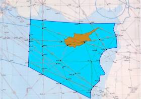
Now the Cypriot Government’s Joint Rescue Coordination Centre (JRCC) in Larnaca joins the list, operating and managing the rollout of SafeTrx for the eastern Mediterranean.

It’s hoped that the Cypriot version of the app — available for iOS and Android as CyJRCCSfTrx — will help reduce loss of life at sea and reduce SAR response times.

The new app includes a further enhancement to SafeTrx’s intelligent alerting system.

In areas of poor coverage, the location of a caller in distress can now be sent via SMS to the JRCC, in addition to the standard high priority SafeTrx data message.

This method was added following offshore testing in Cyprus, and it ensures that the JRCC has the location details when they receive the call, allowing quicker response times.

John Murphy, CEO of SafeTrx developer 8 West Consulting, said: “We welcome the Republic of Cyprus’ JRCC as a new customer and are delighted that their experience and knowledge is coming to the SafeTrx User Group.

“Our recent SafeTrx User Group meeting gathered representatives from many national licensees of SafeTrx in Holland to discuss 2018 developments and the experience of the JRCC in Mediterranean search and rescue of different types will be a valuable enhancement going in to the future.”

As always, Afloat.ie advises boaters and sailors to stick to a standard safety checklist, which includes informing a contact on shore of your plans and expected return time, and confirming that you have adequate means for calling for help - from a suitable VHF radio to flares for signalling distress.

Published in Water Safety
Tagged under

#SafeTrx - Users of the ISA's SafeTrx app are advices that the system will be unavailable tomorrow morning and afternoon (Tuesday 15 September) for an upgrade.

During the planned upgrade from 6am to 3pm, the SafeTrx apps for iOS and Android, as well as the ISA SafeTrx Boater website, will be unavailable.

Following the upgrade, a new version of the app will be available to download for your smartphone, with older versions no longer functioning after tomorrow.

CoastalBoating.net details the changes boaters can expect from the updated SafeTrx app, including a new emergency call feature.

Published in News Update
Tagged under

Dublin Bay

Dublin Bay on the east coast of Ireland stretches over seven kilometres, from Howth Head on its northern tip to Dalkey Island in the south. It's a place most Dubliners simply take for granted, and one of the capital's least visited places. But there's more going on out there than you'd imagine.

The biggest boating centre is at Dun Laoghaire Harbour on the Bay's south shore that is home to over 1,500 pleasure craft, four waterfront yacht clubs and Ireland's largest marina.

The bay is rather shallow with many sandbanks and rocky outcrops, and was notorious in the past for shipwrecks, especially when the wind was from the east. Until modern times, many ships and their passengers were lost along the treacherous coastline from Howth to Dun Laoghaire, less than a kilometre from shore.

The Bay is a C-shaped inlet of the Irish Sea and is about 10 kilometres wide along its north-south base, and 7 km in length to its apex at the centre of the city of Dublin; stretching from Howth Head in the north to Dalkey Point in the south. North Bull Island is situated in the northwest part of the bay, where one of two major inshore sandbanks lie, and features a 5 km long sandy beach, Dollymount Strand, fronting an internationally recognised wildfowl reserve. Many of the rivers of Dublin reach the Irish Sea at Dublin Bay: the River Liffey, with the River Dodder flow received less than 1 km inland, River Tolka, and various smaller rivers and streams.

Dublin Bay FAQs

There are approximately ten beaches and bathing spots around Dublin Bay: Dollymount Strand; Forty Foot Bathing Place; Half Moon bathing spot; Merrion Strand; Bull Wall; Sandycove Beach; Sandymount Strand; Seapoint; Shelley Banks; Sutton, Burrow Beach

There are slipways on the north side of Dublin Bay at Clontarf, Sutton and on the southside at Dun Laoghaire Harbour, and in Dalkey at Coliemore and Bulloch Harbours.

Dublin Bay is administered by a number of Government Departments, three local authorities and several statutory agencies. Dublin Port Company is in charge of navigation on the Bay.

Dublin Bay is approximately 70 sq kilometres or 7,000 hectares. The Bay is about 10 kilometres wide along its north-south base, and seven km in length east-west to its peak at the centre of the city of Dublin; stretching from Howth Head in the north to Dalkey Point in the south.

Dun Laoghaire Harbour on the southside of the Bay has an East and West Pier, each one kilometre long; this is one of the largest human-made harbours in the world. There also piers or walls at the entrance to the River Liffey at Dublin city known as the Great North and South Walls. Other harbours on the Bay include Bulloch Harbour and Coliemore Harbours both at Dalkey.

There are two marinas on Dublin Bay. Ireland's largest marina with over 800 berths is on the southern shore at Dun Laoghaire Harbour. The other is at Poolbeg Yacht and Boat Club on the River Liffey close to Dublin City.

Car and passenger Ferries operate from Dublin Port to the UK, Isle of Man and France. A passenger ferry operates from Dun Laoghaire Harbour to Howth as well as providing tourist voyages around the bay.

Dublin Bay has two Islands. Bull Island at Clontarf and Dalkey Island on the southern shore of the Bay.

The River Liffey flows through Dublin city and into the Bay. Its tributaries include the River Dodder, the River Poddle and the River Camac.

Dollymount, Burrow and Seapoint beaches

Approximately 1,500 boats from small dinghies to motorboats to ocean-going yachts. The vast majority, over 1,000, are moored at Dun Laoghaire Harbour which is Ireland's boating capital.

In 1981, UNESCO recognised the importance of Dublin Bay by designating North Bull Island as a Biosphere because of its rare and internationally important habitats and species of wildlife. To support sustainable development, UNESCO’s concept of a Biosphere has evolved to include not just areas of ecological value but also the areas around them and the communities that live and work within these areas. There have since been additional international and national designations, covering much of Dublin Bay, to ensure the protection of its water quality and biodiversity. To fulfil these broader management aims for the ecosystem, the Biosphere was expanded in 2015. The Biosphere now covers Dublin Bay, reflecting its significant environmental, economic, cultural and tourism importance, and extends to over 300km² to include the bay, the shore and nearby residential areas.

On the Southside at Dun Laoghaire, there is the National Yacht Club, Royal St. George Yacht Club, Royal Irish Yacht Club and Dun Laoghaire Motor Yacht Club as well as Dublin Bay Sailing Club. In the city centre, there is Poolbeg Yacht and Boat Club. On the Northside of Dublin, there is Clontarf Yacht and Boat Club and Sutton Dinghy Club. While not on Dublin Bay, Howth Yacht Club is the major north Dublin Sailing centre.

© Afloat 2020