Displaying items by tag: firing exercises
Live Heli Sniper Firing Exercise Now Under Way
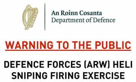
#MarineWarning - The Defence Forces Training Centre is conducting two days of heli sniper live firing exercises in Gormanston Ranges as of this morning, Wednesday 18 July.
As previously reported on Afloat.ie, the danger area includes the air and sea areas contained within a radius of 3 nautical miles centred on Gormanston Aerodrome.
The danger zone also includes an area contained within a segment centred on Gormanston Aerodrome, with a bearing of 15 degrees true through Mosney Railway Station and 106 degrees true through Gormanston Railway Station, seawards for a distance of 10 nautical miles.
For the periods while the range is active, the sea zone within the danger area is excluded to all vessels.
WARNING TO THE PUBLIC AIR CORPS FIRING EXERCISES
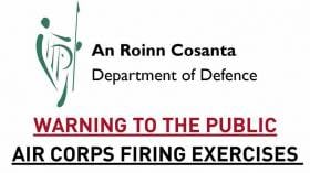
WARNING TO THE PUBLIC AIR CORPS FIRING EXERCISES
On Monday 28th August to Saturday 9th September (inclusive) 2017 (excluding Saturday 2nd and Sunday 3rd September) From 09.00hrs to 17.00hrs
AT GORMANSTON, CO. MEATH
IT IS DANGEROUS FOR PERSONS, SHIPPING, LIVESTOCK OR AIRCRAFT ETC., TO BE WITHIN THE DANGER AREA WHILE FIRING IS IN PROGRESS.
The DANGER AREA (EID1) comprises the lands of GORMANSTON CAMP and the air and sea area contained within a circle having a radius of 3NM (5.4KM) centred on GORMANSTON CAMP with an additional area contained within the segment centred on GORMANSTON CAMP and bearing 015° T, through MOSNEY RAILWAY STATION and 106° T, through GORMANSTON RAILWAY STATION seaward for the distance of 10NM (18.5 KM)
The DANGER AREA extends from SEA LEVEL to a height of 10,000ft AMSL. RED FLAGS will be flown at BEN HEAD and GORMANSTON RAILWAY STATION when exercises are taking place.
OBJECTS found on the RANGES may be HIGHLY DANGEROUS and the PUBLIC ARE WARNED of the risk of handling or interfering with such objects. NO REWARD of any kind will be made for the finding of objects of a military nature on the ranges.
SECRETARY GENERAL
DEPARTMENT OF DEFENCE
Ireland-Bound French Yachts Avoid Danger Off Dorset
#Offshore - A fleet of 20 French yachts racing to Ireland narrowly avoided sailing into serious trouble off the Dorset coast earlier this week.
As BBC News reports, UK coastguard authorities scrambled to warn the yachts via emergency broadcast that they were headed towards an exclusion zone set up for a live firing exercise at Lulworth Ranges.
"It looks like there was a slight error made by the French authorities," said a coastguard spokesperson, who confirmed that the yachts were diverted from their dangerous course after contacting the race director.
According to Practical Boat Owner, the yachts were competing in the Normandy Channel Race which began on Sunday 14 April and continues till this Friday evening.
The race route to and from Caen in northern France traverses a triangle across the Celtic Sea, past the most southwesterly tip of Cornwall, via Tuskar Rock and Fastnet Rock.
Marine Notice: Firing Exercises Off Gormanston & Survey Equipment in Galway Bay
#MARINE WARNING - Seafarers are advised to steer clear of upcoming surface-to-air firing exercises off north Co Dublin, as well as a survey equipment deployment operation in Galway Bay.
Marine Notice No 51 of 2012 outlines that the Defence Forces will be conducting live surface-to-air firing practices at Gormanston Air Defence Range in Co Meath this week on Wednesday 19 and Thursday 20 September from 11am to 3pm each day.
Similar to the exercises conducted this past July, an exclusion zone will be established comprising the land, air and sea areas contained within a radius of three nautical miles centred on Gormanston Aerodrome, with an additional segment centred on the aerodrime and bearing of 015 degree true through Mosney rail station and 106 degrees true through Gormanston rail station seawards for a distance of 10 nautical miles.
The exclusion zone D1 will be enforced by a Naval Service vessel. All mariners in the area are required to remain outside the exclusion zone while the range is active, and are recommended to carefully monitor the radio navigation warnings that will be broadcast throughout the firing period.
Meanwhile, in Galway Bay two Benthic Lander devices will be deployed between 24 and 26 September, to be recovered between 29 and 31 September.
The national research vessel R/V Celtic Voyager (call sign EIQN) - which will host the Science@Sea marine science training scheme this coming November - will carry out the deployment of the 2-3-metre high devices that will monitor sediment movement, current speed and direction, and wave motion at depth.
All vessels, particularly those engaged in fishing, are requested to give the vessel and wide berth of at least 500 metres and keep a sharp lookout.
Details of relevant co-ordinated are included in Marine Notice No 52 of 2012, a PDF of which is available to read or download HERE.
WARNING TO THE PUBLIC - Firing Exercises

WARNING TO THE PUBLIC
AIR CORPS FIRING EXERCISES AND AIR DEFENCE ARTILLERY FIRING EXERCISES
From Tuesday 03 July to
Wednesday 04 July 2012
From 08.00hrs to 18.00hrs
At GORMANSTON, CO. MEATH
IT IS DANGEROUS FOR PERSONS, SHIPPING, LIVESTOCK OR AIRCRAFT ETC., TO BE WITHIN THE DANGER AREA WHILE FIRING IS IN PROGRESS.
The DANGER AREA comprises the lands of GORMANSTON CAMP and the air and sea area contained within a circle having a radius of 3NM (5.4KM) centred on GORMANSTON CAMP with an additional area contained within the segment centred on GORMANSTON CAMP and bearing 015° T, through MOSNEY RAILWAY STATION and 106° T, through GORMANSTON RAILWAY STATION seaward for the distance of 10NM (18.5 KM)
The DANGER AREA extends from SEA LEVEL to a height of 12,000ft.
RED FLAGS will be flown at BEN HEAD and GORMANSTON RAILWAY STATION when exercises are taking place.
OBJECTS found on the RANGES may be
HIGHLY DANGEROUS and the PUBLIC ARE WARNED of the risk of handling or interfering with such objects.
NO REWARD of any kind will be made for the finding of objects of a military nature on the ranges.
MICHAEL HOWARD
SECRETARY GENERAL
DEPARTMENT OF DEFENCE
Warning To The Public - October 2011

On Monday 10th October 2011 from 09.00hrs to 18.00hrs
At GORMANSTON, CO. MEATH
IT IS DANGEROUS FOR PERSONS, SHIPPING, LIVESTOCK OR AIRCRAFT ETC., TO BE WITHIN THE DANGER AREA WHILE FIRING IS IN PROGRESS.
The DANGER AREA comprises the lands of GORMANSTON CAMP and the air and sea area contained within a circle having a radius of 3NM (5.4KM) centred on GORMANSTON CAMP with an additional area contained within the segment centred on GORMANSTON CAMP and bearing 015° T, through MOSNEY RAILWAY STATION and 106° T through GORMANSTON RAILWAY STATION seaward for the distance of 10NM (18.5 KM) The DANGER AREA extends from SEA LEVEL to a height of 12,000ft.
RED FLAGS will be flown at BEN HEAD and GORMANSTON RAILWAY STATION when exercises are taking place.
OBJECTS found on the RANGES may be HIGHLY DANGEROUS and the PUBLIC ARE WARNED of the risk of handling or interfering with such objects.
NO REWARD of any kind will be made for the finding of objects of a military nature on the ranges.
MICHAEL HOWARD
SECRETARY GENERAL
DEPARTMENT OF DEFENCE


