Displaying items by tag: offshore island
Covid Restrictions Protecting Saltee Gannets
COVID-19’s impact on visits to offshore islands may be benefiting the gannet seabird colony on Wexford’s Great Saltee.
A new University College Cork (UCC) study has recorded the level of disturbance to the birds caused by tourists in the summer of 2017.
Great Saltee does not have a warden, and many tourists unwittingly cause a disturbance, leading to parents leaving their nests temporarily, exposing them to predators who quickly seize the opportunity and steal the gannets’ one and only egg, the report says.
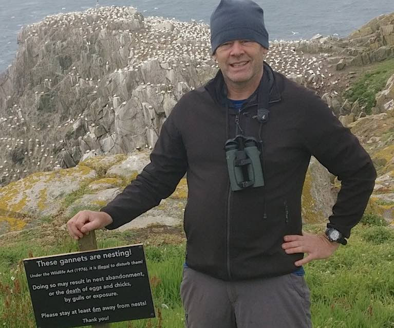
 Gannet colony on the Great Saltee Islands off the County Wexford coast
Many tourists, especially those looking for that perfect photograph of birds on their nests, got too close to the gannets, often to within less than one metre.
This led to a 60% reduction in breeding success compared with birds at undisturbed parts of the colony, according to Debs Allbrook, a UCC masters in science student.
“On one occasion we saw nine disturbance events over a two-hour period. This directly led to eggs from nine gannet nests being stolen by herring gulls, who seem to have learned to watch the interactions between tourists and people,” she said,
“ One photographer ran right through the colony trying to retrieve his camera lens rolling downhill, leading to disturbance of about 30 nests,” she said.
As part of her research, Debs Allbrook tested to see if tourists would pay attention to an information sign warning them that their actions could be damaging.
The sign said: “These birds are breeding. Under the Wildlife Act (1976) it is illegal to disturb nesting birds. Please do not approach the colony as doing so may result in the abandonment of eggs or the death of chicks. Thank you for your consideration.”
The vast majority of people paid attention to the sign. People stayed away from the birds and fewer disturbance events were observed.
“This showed that it was largely lack of knowledge that led to the disturbance in the first place. People did not understand the harm they were causing,” she noted.
“The disturbance often caused confusion in the colony and it only took a second for a gull to zip in and steal an egg,” she said.
The full publication can be accessed now online here


