Menu

Ireland's sailing, boating & maritime magazine

Displaying items by tag: Bangor Coastguard

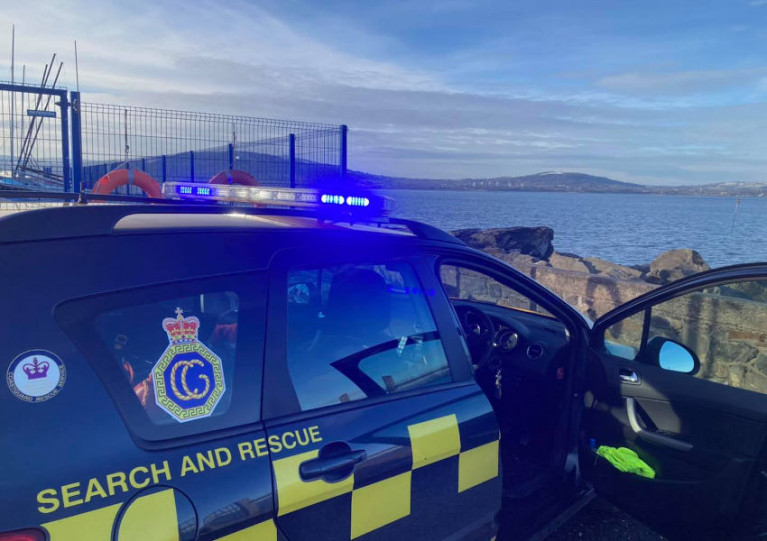
It was multi shout four days for Bangor Coastguard Rescue Team on Belfast Lough when they covered calls some of which resulted in rescue action.

On Thursday (20th) the team attended a yacht offshore reported to have a broken mast and no sign of anyone on board. Thankfully, it was found that the vessel was moored, and no further action was required. Then on Friday (21st), there was a report of an unmanned paddleboard in the Ballyholme Bay area, but it was discovered that it belonged to a BYC member and had blown into the water in the high winds.

The vessel towed to Bangor MarinaThe vessel towed to Bangor Marina

On the Saturday, the team answered a call about possible ordnance near Crawfordsburn Beach east of Bangor on the Belfast Lough coast. Again, there was no danger as it turned out to be a rusted fire extinguisher.

Yesterday (Sunday 23rd), Bangor Lifeboat towed a small broken-down vessel from near the Copeland Island off Donaghadee on the Down coast to Bangor Marina. They headed to Bangor, shadowed by the Coastguard. From the beach at Ballyholme, one of the CRT team spotted what looked like an upturned paddleboard in the water, and the Lifeboat was requested to drop the tow and make best speed to the area. They located the object, and thankfully on this occasion, it was driftwood. The Lifeboat re-established the tow back to the marina, where they were met by Coastguard personnel.

Published in Belfast Lough

The last two days in March were busy for Bangor Coastguard Rescue Team with incidents on Tuesday 30th and Wednesday 31st March in Strangford Lough.

On Tuesday the team responded to a report of a person in the water near the Flood Gates (sometimes called the Tidebank) near Newtownards, at the northern end of the Lough.

The embankment was built in 1811 by Lord Londonderry of Mount Stewart and reclaimed 200 acres of land from the seashore. The area was turned into arable farmland and the bank is a popular elevated 3.3 km linear walking route.

Windsurfer in difficulty

When the team arrived, they found a windsurfer in difficulty and Portaferry Lifeboat was tasked but due to the state of the tide was unable to assist. So the Rescue Team kitted up in water rescue PPE and helped the surfer, who didn't need medical attention, ashore.

Portaferry CRT and the Police Service were also in attendance.

Yesterday (Wednesday) an adult and two children were cut off by the tide at Island Hill on the northwest side of the Lough near Comber.

Actually called Rough Island on which there used to be a farm, the popular small island is reached by a causeway only useable at low tide. It is a popular spot for birdwatching.

As Coastguards kitted up in water rescue PPE to assist the casualties, Paddleboarders in the area came to the rescue by bringing the casualties ashore on their boards.

Published in Coastguard
Tagged under

Bangor Coastguard has issued a warning after a surfer was spotted close to an inbound Stena ferry in Belfast Lough on Monday (25 January) as Afloat reported earlier here.

As the Belfast Telegraph reports, a team from Bangor Coastguard kept an eye on the surfer as he paddled off Holywood in Co Down and made it back to shore.

“After speaking with the casualty it was confirmed he was intending to surf the wash from the superfast inbound to Belfast,” Bangor Coastguard said — adding that the surfer was reminded of “the dangers of being close to such large vessels”.

The Belfast Telegraph has more on the story HERE.

Published in Belfast Lough
Tagged under

About Dublin Port 

Dublin Port is Ireland’s largest and busiest port with approximately 17,000 vessel movements per year. As well as being the country’s largest port, Dublin Port has the highest rate of growth and, in the seven years to 2019, total cargo volumes grew by 36.1%.

The vision of Dublin Port Company is to have the required capacity to service the needs of its customers and the wider economy safely, efficiently and sustainably. Dublin Port will integrate with the City by enhancing the natural and built environments. The Port is being developed in line with Masterplan 2040.

Dublin Port Company is currently investing about €277 million on its Alexandra Basin Redevelopment (ABR), which is due to be complete by 2021. The redevelopment will improve the port's capacity for large ships by deepening and lengthening 3km of its 7km of berths. The ABR is part of a €1bn capital programme up to 2028, which will also include initial work on the Dublin Port’s MP2 Project - a major capital development project proposal for works within the existing port lands in the northeastern part of the port.

Dublin Port has also recently secured planning approval for the development of the next phase of its inland port near Dublin Airport. The latest stage of the inland port will include a site with the capacity to store more than 2,000 shipping containers and infrastructures such as an ESB substation, an office building and gantry crane.

Dublin Port Company recently submitted a planning application for a €320 million project that aims to provide significant additional capacity at the facility within the port in order to cope with increases in trade up to 2040. The scheme will see a new roll-on/roll-off jetty built to handle ferries of up to 240 metres in length, as well as the redevelopment of an oil berth into a deep-water container berth.

Dublin Port FAQ

Dublin was little more than a monastic settlement until the Norse invasion in the 8th and 9th centuries when they selected the Liffey Estuary as their point of entry to the country as it provided relatively easy access to the central plains of Ireland. Trading with England and Europe followed which required port facilities, so the development of Dublin Port is inextricably linked to the development of Dublin City, so it is fair to say the origins of the Port go back over one thousand years. As a result, the modern organisation Dublin Port has a long and remarkable history, dating back over 300 years from 1707.

The original Port of Dublin was situated upriver, a few miles from its current location near the modern Civic Offices at Wood Quay and close to Christchurch Cathedral. The Port remained close to that area until the new Custom House opened in the 1790s. In medieval times Dublin shipped cattle hides to Britain and the continent, and the returning ships carried wine, pottery and other goods.

510 acres. The modern Dublin Port is located either side of the River Liffey, out to its mouth. On the north side of the river, the central part (205 hectares or 510 acres) of the Port lies at the end of East Wall and North Wall, from Alexandra Quay.

Dublin Port Company is a State-owned commercial company responsible for operating and developing Dublin Port.

Dublin Port Company is a self-financing, and profitable private limited company wholly-owned by the State, whose business is to manage Dublin Port, Ireland's premier Port. Established as a corporate entity in 1997, Dublin Port Company is responsible for the management, control, operation and development of the Port.

Captain William Bligh (of Mutiny of the Bounty fame) was a visitor to Dublin in 1800, and his visit to the capital had a lasting effect on the Port. Bligh's study of the currents in Dublin Bay provided the basis for the construction of the North Wall. This undertaking led to the growth of Bull Island to its present size.

Yes. Dublin Port is the largest freight and passenger port in Ireland. It handles almost 50% of all trade in the Republic of Ireland.

All cargo handling activities being carried out by private sector companies operating in intensely competitive markets within the Port. Dublin Port Company provides world-class facilities, services, accommodation and lands in the harbour for ships, goods and passengers.

Eamonn O'Reilly is the Dublin Port Chief Executive.

Capt. Michael McKenna is the Dublin Port Harbour Master

In 2019, 1,949,229 people came through the Port.

In 2019, there were 158 cruise liner visits.

In 2019, 9.4 million gross tonnes of exports were handled by Dublin Port.

In 2019, there were 7,898 ship arrivals.

In 2019, there was a gross tonnage of 38.1 million.

In 2019, there were 559,506 tourist vehicles.

There were 98,897 lorries in 2019

Boats can navigate the River Liffey into Dublin by using the navigational guidelines. Find the guidelines on this page here.

VHF channel 12. Commercial vessels using Dublin Port or Dun Laoghaire Port typically have a qualified pilot or certified master with proven local knowledge on board. They "listen out" on VHF channel 12 when in Dublin Port's jurisdiction.

A Dublin Bay webcam showing the south of the Bay at Dun Laoghaire and a distant view of Dublin Port Shipping is here
Dublin Port is creating a distributed museum on its lands in Dublin City.
 A Liffey Tolka Project cycle and pedestrian way is the key to link the elements of this distributed museum together.  The distributed museum starts at the Diving Bell and, over the course of 6.3km, will give Dubliners a real sense of the City, the Port and the Bay.  For visitors, it will be a unique eye-opening stroll and vista through and alongside one of Europe’s busiest ports:  Diving Bell along Sir John Rogerson’s Quay over the Samuel Beckett Bridge, past the Scherzer Bridge and down the North Wall Quay campshire to Berth 18 - 1.2 km.   Liffey Tolka Project - Tree-lined pedestrian and cycle route between the River Liffey and the Tolka Estuary - 1.4 km with a 300-metre spur along Alexandra Road to The Pumphouse (to be completed by Q1 2021) and another 200 metres to The Flour Mill.   Tolka Estuary Greenway - Construction of Phase 1 (1.9 km) starts in December 2020 and will be completed by Spring 2022.  Phase 2 (1.3 km) will be delivered within the following five years.  The Pumphouse is a heritage zone being created as part of the Alexandra Basin Redevelopment Project.  The first phase of 1.6 acres will be completed in early 2021 and will include historical port equipment and buildings and a large open space for exhibitions and performances.  It will be expanded in a subsequent phase to incorporate the Victorian Graving Dock No. 1 which will be excavated and revealed. 
 The largest component of the distributed museum will be The Flour Mill.  This involves the redevelopment of the former Odlums Flour Mill on Alexandra Road based on a masterplan completed by Grafton Architects to provide a mix of port operational uses, a National Maritime Archive, two 300 seat performance venues, working and studio spaces for artists and exhibition spaces.   The Flour Mill will be developed in stages over the remaining twenty years of Masterplan 2040 alongside major port infrastructure projects.

Source: Dublin Port Company ©Afloat 2020.