


Displaying items by tag: Dublin Array
Marine Notice: Surveys for Dublin Array Offshore Wind Farm
The Department of Transport has been advised by Dublin Array that they will be conducting geophysical, geotechnical and environmental surveys for the Dublin Array offshore wind farm project.
Site investigation operations for the wind farm and the Expert Corridor Route (ECR) between the coast of Dublin and Wicklow will take place between Friday 19 April and the end of July, subject to weather and operational constraints.
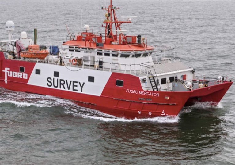
The geophysical survey will be carried out by the vessel Fugro Helmert (callsign C6FT8). During these operations, the vessel will be towing equipment at a depth of up to five metres below the surface and extending some 300 metres astern.
The geotechnical survey will be carried out by the vessel M/V Flat Holm (callsign GHLZ) at fixed stations. The environmental survey will be carried out by the vessel Ros Áine (callsign EIZG5) in daytime hours only.
All vessels will be mobilised from Dun Laoghaire and will be restricted in their ability to manoeuvre, therefore all other mariners are advised to provide a wide berth and navigate with caution in the relevant area.
Coordinates and a map of the survey area, as well as contact details, can be found in Marine Notice No 18 of 2024, attached below.
Dublin Array Wind Farm Appoints New Development Project Director
RWE Renewables Ireland has appointed Vanessa O’Connell as its new Development Project Director for the Dublin Array offshore wind farm.
Dublin Array is a proposed 824MW offshore wind farm, which will be located about 10 kilometres from the coast of counties Dublin and Wicklow.
Vanessa replaces Peter Lefroy, who has been leading the project since 2018, while also being the Offshore Development Head for Ireland. Peter will continue in his role as Offshore Development Head of RWE Ireland & UK West.
Vanessa brings more than 12 years of experience in leadership in the offshore wind sector to RWE. She has worked across all stages of offshore wind projects, encompassing development, construction, and operations, with involvement in nine offshore wind projects.
Vanessa spent over ten years at Ørsted, working on projects such as Hornsea 1 (1.2GW), Burbo Bank Extension (258MW), Walney Extension (659MW), and Barrow (90MW). On Hornsea 1, Vanessa held leadership positions in the commercial function, served on the construction leadership team, and assumed overall accountability for the asset during its transition to the operational phase.
Returning to Ireland over two years ago, Vanessa assumed the role as Head of Inis Offshore Wind. This independent offshore wind developer, backed by Temporis and the Ireland Strategic Investment Fund, focuses on early stage development in Ireland.
Vanessa holds an MSc in Environmental Technology from Imperial College London and a BA in Economics from Trinity College Dublin. She lives in Dun Laoghaire with her husband and two daughters.
Commenting on the appointment, RWE Director of Offshore Development UK & Ireland Danielle Lane said:
“I’m delighted that Vanessa has chosen to join RWE and Dublin Array. Her skills and experience in working in offshore wind will make a great contribution to the project at an important time. Dublin Array is a flagship project in the Irish offshore wind market and Vanessa is joining a strong, established team that will thrive under her leadership.”
Dublin Array
Dublin Array is a proposed offshore wind farm, which will be located on the Kish and Bray Banks, approximately 10km from the coastline of counties Dublin and Wicklow. It is being developed by RWE, one of the world’s leading developers of renewable energy, and Irish renewable energy firm Saorgus Energy. RWE is leading the development on behalf of the partnership.
Once operational, the project will deliver up to 824MW of clean, renewable electricity and will consist of up to 50 wind turbines. This is enough energy to supply around 770,000 homes and reduce Ireland’s annual carbon emissions by over 1.4m tonnes per year. The final decision on the number of turbines will be informed by ongoing surveys and detailed design work.
The Dublin Array project will also bring significant economic benefits during its construction and operation, with over 1,000 construction phase jobs and 80 direct and 160 indirect full-time jobs expected during the 30-year operational phase. Dublin Array’s operations base is expected to be located within Dún Laoghaire, resulting in an estimated €540 million in local expenditure across the Greater Dublin Area.
Dublin Array was awarded its Maritime Area Consent (MAC) in December 2022. A MAC is required for any proposed Irish offshore wind farm development to be able to seek planning permission. Subject to planning permission, the project could be operational by 2028.
Kish Offshore Wind Ltd and Bray Offshore Wind Ltd will be conducting geotechnical investigations on the Dublin Array project site and associated export cable corridor off the coast of counties Dublin and Wicklow from later this month.
The geotechnical investigations will include 27 vibrocores which will be sampled at locations within the offshore wind farm site. Project works will commence on Saturday 29 April and continue through to late May, subject to weather and operational constraints.
Investigations will be conducted within the Kish lease area, Bray lease area and the expert cable corridor, all of which are off the coast of counties Dublin and Wicklow.
Operations will be conducted by the multipurpose vessel Voe Vanguard (callsign MBEN9). The vessel will be positioned at each of the investigation points for approximately two hours, which may extend in the event of inclement weather.
The vessel is supplied with a VHF multi-channel radio and mobile phone. It will be operating 24 hours a day during the survey works and will display relevant lights and shapes as required under COLREGS.
All other vessels operating within the planned area of survey are requested to keep their distance and give a wide berth wherever possible.
Contact details, a map and coordinates of the survey area can be found in Marine Notice No 24 of 2023, attached below.
Marine Notice: Geotechnical Investigations at Kish and Bray Banks for Dublin Array Offshore Wind Farm
The Department of Transport has been advised by Kish Offshore Wind Ltd and Bray Offshore Wind Ltd that geotechnical investigations will be conducted on the Dublin Array offshore wind farm project site off the coast of counties Dublin and Wicklow.
The project works will commence next Saturday 1 April and continue through to late May 2023, subject to weather and operational constraints.
The geotechnical investigation will include approximately seven boreholes which will be drilled at locations within the project work site.
Operations will be conducted by the Dutch Pearl (callsign PBZP), a support vessel/tug, and the Excalibur (callsign YJKQ5), a jack-up barge.
The Excalibur will be positioned at each of the investigation points for several days which may extend in the event of inclement weather. The Dutch Pearl will be assisting the Excalibur in its daily operations and towing the barge between investigation points. The standby tug will be at anchor on the project site and will be conducting transits between the site and Dublin Port.
Both vessels will display the relevant light and shapes as required under COLREGS. Both vessels will keep continuous watch on VHF Channels 16 and 72. During operations, the vessels will be restricted in their ability to manoeuvre. All other vessels are requested to leave a wide berth during the operations.
Contact details, relevant coordinates and a map of the work area ca be found in Marine Notice No 16 of 2023, attached below.
Dublin Array: Recovery of Floating LiDAR Buoy From Bray Bank
Marine Notices No 37 of 2021 and No 44 of 2021 advised of the deployment of two wave buoys and one floating LiDAR buoy at the Dublin Array offshore wind farm on the Bray and Kish Banks.
The two wave buoys were recovered from site in June 2022. Now the Department of Transport has now been advised by Partrac Ltd that the floating LiDAR buoy on Bray Bank is scheduled to be recovered in the period between Thursday 5 and Thursday 19 January 2023, subject to weather and operational constraints.
The floating LiDAR buoy at Latitude 53° 10.645’ N, Longitude 005° 55.785' W has a square footprint with an area of 4 sqm and height of around 4m above the water line. It is yellow in colour and has a St Andrew cross on top.
It also contains a yellow light which emits five flashes every 20 seconds and is visible for up to three nautical miles.
The vessel CT Barnston (callsign MUZU5) will recover the buoy and tow it back to Wicklow Harbour for demobilisation. Dublin Port will be contacted in advance regarding the operations with estimated timings. The buoy will be towed some 30m astern of the CT Branston at a maximum speed of 3.5 knots.
During recovery of the floating LiDAR buoy on Bray Bank, the vessel will be restricted in its ability to manoeuvre. All other vessels are requested to leave a wide berth during the recovery and towing operations. Radio transmissions will be conducted with VTS and other seafarers to notify them of the buoy operations.
Contact details can be found in Marine Notice No 85 of 2022, attached below.
Recovery and Redeployment of Floating Lidar and Wave Buoys on Bray and Kish Banks
Marine Notice 37 of 2021 advised of the deployment of one floating lidar buoy and two wave buoys at the Dublin Array offshore wind farm on the Bray and Kish Banks.
The Department of Transport has now been advised by Partrac Ltd that all three Metocean buoys are scheduled to be serviced soon over a period of two days.
Weather permitting, it is expected that the two wave buoys will be recovered and redeployed in the three-week period between tomorrow, Friday 11 February and Friday 4 March.
The floating lidar buoy will be towed from its location on Bray Bank to Wicklow Harbour for routine maintenance overnight and towed back to Bray Bank for redeployment in its current position. This recovery and redeployment will take place in the three-week period between Thursday 24 February 2022 and Friday 18 March.
The AMS Retriever (callsign MEHI8) will recover and redeploy all three buoys. The floating lidar buoy will be towed some 30 metres astern of the AMS Retriever at a maximum speed of 3.5 knots.
During this time, the vessel will be restricted in its ability to manoeuvre. As such, vessels operating within this area are requested to keep their distance, maintaining a safety zone around the deployment vessel, and pass at minimum speed to reduce vessel wash.
Radio transmissions will be conducted with VTS and other seafarers to notify them of the buoy operations.
Coordinates of the buoy locations and contact details can be found in Marine Notice No 10 of 2022, attached below.
Following the Marine Notice two months ago on the deployment of wave buoys and a floating lidar buoy at the Dublin Array offshore wind farm, a new notice has been issued regarding the lidar buoy’s move to a fixed position.
Partrac Ltd will relocate the floating lidar buoy from its current temporary position at Kish Lighthouse to a new location in Bray Bank some time between this Wednesday 4 August and Tuesday 17 August, weather permitting.
The relocation is expected to take one day. The buoy will then remain in place for 18 months and a further Marine Notice will be issued providing information on the retrieval of the buoy.
The AMS Retriever (callsign MEHI8) will recover the buoy and tow it to its new location. During this work, the vessel will be restricted in its ability to manoeuvre.
As such, all other vessels operating within this area are requested to keep their distance, maintaining a safety zone around the AMS Retriever, and to pass at minimum speed to reduce vessel wash.
Further details including coordinates of the buoy’s new location are included in Marine Notice No 44 of 2021, which can be downloaded below.
Partrac Ltd intend to deploy three Metocean buoys at the Dublin Array offshore wind farm in a one-day operation some time between this Wednesday 9 and Wednesday 23 June, weather permitting.
One floating lidar buoy and two wave buoys will be deployed by the AMS Retriever (callsign MEHI8) which will be displaying all appropriate lights and shapes.
The floating lidar buoy has a square footprint with an area of 4m2 and a height of some 4m above the water line. It is yellow in colour and has a St Andrew’s cross on top.
The wave buoys are spherical in shape with a diameter of around 1.1m. When deployed, the wave buoys appear clear with a yellow hull.
Both the floating lidar buoy and the wave buoys have a yellow light which emits five flashes every 20 seconds. The light is visible for up to three nautical miles.
The floating lidar buoy will be deployed for a period of four to eight weeks. It will then be moved to a permanent position in the south end of Dublin Array where it will be deployed for 18 months. The wave buoys will be deployed for a period of 12 months.
The floating lidar buoy will be towed approximately 30m astern of the AMS Retriever at a maximum speed of four knots.
As such, the vessel will be restricted in its ability to manoeuvre so all other boats operating in proximity are requested to keep their distance, maintaining a safety zone around the deployment vessel and pass at minimum speed to reduce vessel wash.
Details of the buoy locations are included in Marine Notice No 37 of 2021 which can be downloaded below.
Marine Notice: Geophysical Surveys for Dublin Array Wind Farm
Mariners have been given notice of a series of geophysical surveys for the Dublin Array Wind Farm taking place between next week and early May.
The Dublin Array is a project on the Kish and Bray banks some 10 km off the east coast of Ireland, immediately south of Dublin.
As previously reported on Afloat.ie, the proposed Irish-German venture could see as many as 100 wind turbines generate power for more than half a million homes.
Fugro GB Marine Limited has been contracted for the geophysical surveys to characterise the offshore array and export cable search area, including exploring possible landfall options at Shanganagh Park and Poolbeg.
Operations across a total of four vessels are expected to begin next Tuesday 9 February and continue until Tuesday 11 May.
Details of the surveys and their coordinates are included in Fugro’s notice to mariners, which can be downloaded below.

A €1.5 billion offshore wind farm stretching from Booterstown to Greystones could generate enough electricity to power 600,000 homes.
The Irish Times reports on proposals by an Irish-German partnership for the ‘Dublin Array’ offshore energy venture that could see as many as 100 wind turbines installed over 2,440 hectares, partly in Dublin Bay.
Saorgus and Innogy are now seeing a foreshore licence to conduct surveys in the intended locations of the Kish Bank and Bray Bank.
Pledges have been made to work with shipping companies, fishing interests, sailing clubs and other water users during this process, as the venture promises a “meaningful approach to supporting local communities”.
It is also hoped that the project would benefit from new Government supports guaranteeing revenue for renewable energy generators, a scheme which is currently under EU scrutiny.
The Irish Times has much more on the story HERE.


 Michael Murphy Schull Harbour Sailing Club (SHSC), Eric Coogan Heineken Ireland, Mark Murphy, Commodore SHSC, Jack Allen SHSC, Carmel O'Regan SHSC, Cornelious Ndlovu, Schull Harbour Hotel Operations Manager and Derval Murphy SHSC")


