Menu

Ireland's sailing, boating & maritime magazine

Displaying items by tag: Marine Planning Policy Statement

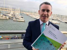
Sixteen different sectors and activities are within the scope of the draft National Marine Planning Framework (NMPF) launched yesterday (Tuesday 12 November).

And plans for a system of designated Strategic Marine Activity Zones among its main ambitions, as previously reported on Afloat.ie.

Commenting on the draft, Damien English, Minister of State for Housing and Urban Development, said: “Our ocean supports a diverse range of economic activities such as seafood, tourism, renewable ocean energy and a wide range of recreational opportunities.

“It contains areas with some of the most productive and diverse resources in the world. Its ecosystem and biodiversity make it an environmental and social treasure.

“As our marine and coastal areas experience more pressures from human activity it is critical that we provide a framework for what activities should and shouldn’t happen in our marine and coastal areas.”

The minister notes that a component of the draft NMPF is its policies relating to renewable energy and action on climate change.

He said: “Climate change is the defining challenge of our generation. The Government’s Climate Action Plan, published in June, highlighted the critical role of marine planning for the delivery of offshore renewable energy. This document sets out the proposed forward-planning framework within which our renewable energy targets can be met.”

The Climate Action Plan commits to increasing the level of electricity generated from renewable sources to 70%, indicatively including at least 3.5GW of offshore renewable energy.

In addition, the draft NMPF reinforces the Government’s stated commitment to move away from oil combustion within heat and transport sectors towards renewables in the coming decade.

Minister English also launched the Government’s new Marine Planning Policy Statement, which was subject to public consultation this past summer and outlines the Government’s vision for the future development of the marine planning system.

It also sets out the overarching policies and principles the Government says it expects marine planning bodies, and other public bodies that engage with the marine planning system, to observe.

Just as the NMPF will be a parallel document to the National Planning Framework, the Marine Planning Policy Statement is a parallel document to the Planning Policy Statement, which underpins the operation of Ireland’s entire land-planning system.

The minister has invited the public and all interested parties to give their views on the draft framework.

“The document we’re publishing is the culmination of two years of engagement and dialogue with the public and stakeholders and across Government,” he said.

“The very constructive engagement with the NMPF Baseline Report, published last year, has had a major influence on this document. Whether you are in the energy sector, a fisherman, want to protect our marine environment, or live in a coastal community and are concerned about your area’s future, please have your say before February 28th.

“We want the finalised plan to be national in every sense — valued, owned and supported by all. Strong public input will help achieve that.”

The National Marine Planning Framework Consultation Draft is available to read or download HERE.

Published in Marine Planning

Feedback from the public and interested stakeholders is being sought on the Government’s Marine Planning Policy Statement by Friday 9 August.

The statement sets out efforts to bring marine planning “into the mainstream of Government functions” as issues surrounding land use, climate change and more come into greater focus.

Earlier this year, it was reported that more than half of submissions in the public consultation on the National Marine Planning Framework Baseline Report concerned the marine environment.

In its own submission, the Irish Marine Federation said barriers to investment and sustainability around the Irish coastline have for “took long stymied growth in the marine sphere”.

The trade body’s chair Paal Janson says its members voices are being heard at regular meetings with Minister of State Damien English in The Custom House, and he looks forward to incorporating feedback from its members on the policy statement consultation draft, which is attached below.

Published in Marine Planning

About Dublin Port 

Dublin Port is Ireland’s largest and busiest port with approximately 17,000 vessel movements per year. As well as being the country’s largest port, Dublin Port has the highest rate of growth and, in the seven years to 2019, total cargo volumes grew by 36.1%.

The vision of Dublin Port Company is to have the required capacity to service the needs of its customers and the wider economy safely, efficiently and sustainably. Dublin Port will integrate with the City by enhancing the natural and built environments. The Port is being developed in line with Masterplan 2040.

Dublin Port Company is currently investing about €277 million on its Alexandra Basin Redevelopment (ABR), which is due to be complete by 2021. The redevelopment will improve the port's capacity for large ships by deepening and lengthening 3km of its 7km of berths. The ABR is part of a €1bn capital programme up to 2028, which will also include initial work on the Dublin Port’s MP2 Project - a major capital development project proposal for works within the existing port lands in the northeastern part of the port.

Dublin Port has also recently secured planning approval for the development of the next phase of its inland port near Dublin Airport. The latest stage of the inland port will include a site with the capacity to store more than 2,000 shipping containers and infrastructures such as an ESB substation, an office building and gantry crane.

Dublin Port Company recently submitted a planning application for a €320 million project that aims to provide significant additional capacity at the facility within the port in order to cope with increases in trade up to 2040. The scheme will see a new roll-on/roll-off jetty built to handle ferries of up to 240 metres in length, as well as the redevelopment of an oil berth into a deep-water container berth.

Dublin Port FAQ

Dublin was little more than a monastic settlement until the Norse invasion in the 8th and 9th centuries when they selected the Liffey Estuary as their point of entry to the country as it provided relatively easy access to the central plains of Ireland. Trading with England and Europe followed which required port facilities, so the development of Dublin Port is inextricably linked to the development of Dublin City, so it is fair to say the origins of the Port go back over one thousand years. As a result, the modern organisation Dublin Port has a long and remarkable history, dating back over 300 years from 1707.

The original Port of Dublin was situated upriver, a few miles from its current location near the modern Civic Offices at Wood Quay and close to Christchurch Cathedral. The Port remained close to that area until the new Custom House opened in the 1790s. In medieval times Dublin shipped cattle hides to Britain and the continent, and the returning ships carried wine, pottery and other goods.

510 acres. The modern Dublin Port is located either side of the River Liffey, out to its mouth. On the north side of the river, the central part (205 hectares or 510 acres) of the Port lies at the end of East Wall and North Wall, from Alexandra Quay.

Dublin Port Company is a State-owned commercial company responsible for operating and developing Dublin Port.

Dublin Port Company is a self-financing, and profitable private limited company wholly-owned by the State, whose business is to manage Dublin Port, Ireland's premier Port. Established as a corporate entity in 1997, Dublin Port Company is responsible for the management, control, operation and development of the Port.

Captain William Bligh (of Mutiny of the Bounty fame) was a visitor to Dublin in 1800, and his visit to the capital had a lasting effect on the Port. Bligh's study of the currents in Dublin Bay provided the basis for the construction of the North Wall. This undertaking led to the growth of Bull Island to its present size.

Yes. Dublin Port is the largest freight and passenger port in Ireland. It handles almost 50% of all trade in the Republic of Ireland.

All cargo handling activities being carried out by private sector companies operating in intensely competitive markets within the Port. Dublin Port Company provides world-class facilities, services, accommodation and lands in the harbour for ships, goods and passengers.

Eamonn O'Reilly is the Dublin Port Chief Executive.

Capt. Michael McKenna is the Dublin Port Harbour Master

In 2019, 1,949,229 people came through the Port.

In 2019, there were 158 cruise liner visits.

In 2019, 9.4 million gross tonnes of exports were handled by Dublin Port.

In 2019, there were 7,898 ship arrivals.

In 2019, there was a gross tonnage of 38.1 million.

In 2019, there were 559,506 tourist vehicles.

There were 98,897 lorries in 2019

Boats can navigate the River Liffey into Dublin by using the navigational guidelines. Find the guidelines on this page here.

VHF channel 12. Commercial vessels using Dublin Port or Dun Laoghaire Port typically have a qualified pilot or certified master with proven local knowledge on board. They "listen out" on VHF channel 12 when in Dublin Port's jurisdiction.

A Dublin Bay webcam showing the south of the Bay at Dun Laoghaire and a distant view of Dublin Port Shipping is here
Dublin Port is creating a distributed museum on its lands in Dublin City.
 A Liffey Tolka Project cycle and pedestrian way is the key to link the elements of this distributed museum together.  The distributed museum starts at the Diving Bell and, over the course of 6.3km, will give Dubliners a real sense of the City, the Port and the Bay.  For visitors, it will be a unique eye-opening stroll and vista through and alongside one of Europe’s busiest ports:  Diving Bell along Sir John Rogerson’s Quay over the Samuel Beckett Bridge, past the Scherzer Bridge and down the North Wall Quay campshire to Berth 18 - 1.2 km.   Liffey Tolka Project - Tree-lined pedestrian and cycle route between the River Liffey and the Tolka Estuary - 1.4 km with a 300-metre spur along Alexandra Road to The Pumphouse (to be completed by Q1 2021) and another 200 metres to The Flour Mill.   Tolka Estuary Greenway - Construction of Phase 1 (1.9 km) starts in December 2020 and will be completed by Spring 2022.  Phase 2 (1.3 km) will be delivered within the following five years.  The Pumphouse is a heritage zone being created as part of the Alexandra Basin Redevelopment Project.  The first phase of 1.6 acres will be completed in early 2021 and will include historical port equipment and buildings and a large open space for exhibitions and performances.  It will be expanded in a subsequent phase to incorporate the Victorian Graving Dock No. 1 which will be excavated and revealed. 
 The largest component of the distributed museum will be The Flour Mill.  This involves the redevelopment of the former Odlums Flour Mill on Alexandra Road based on a masterplan completed by Grafton Architects to provide a mix of port operational uses, a National Maritime Archive, two 300 seat performance venues, working and studio spaces for artists and exhibition spaces.   The Flour Mill will be developed in stages over the remaining twenty years of Masterplan 2040 alongside major port infrastructure projects.

Source: Dublin Port Company ©Afloat 2020.