


Displaying items by tag: warning
Hauliers in UK Warn of 'Significant Gaps' in Brexit Border Preparations
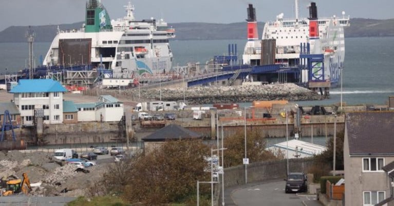
In the UK, groups representing the country's freight and logistics industries have warned of significant gaps in the British government's border preparations for the end of the Brexit transition period on 31 December.
Eight organisations, including the Road Haulage Association (RHA), are seeking an urgent meeting with ministers.
They have written to Cabinet Office Minister Michael Gove, who is overseeing the UK's Brexit preparations, to highlight fears the UK-EU supply chain "will be severely disrupted" from January if issues are not resolved.
The group wants a meeting with Mr Gove, Chancellor Rishi Sunak and Transport Secretary Grant Shapps to discuss areas including IT systems and physical border infrastructure.
The letter states: "As key participants in the supply chain who will be required to deliver a functional operating border for GB and EU traders next year, we have visibility of the current state of preparedness which as it stands has significant gaps.
More from RTE News here.
Strong Gales Bring Status Yellow Warning To Start The New Year

#Weather - It's a poor start to the New Year as Met Éireann has issued a Status Yellow warning for small craft.
Southerly gales have developed this morning and will be continuing throughout the day in all coastal waters, with the strongest gusts expected on the Irish Sea.
For anyone who must be at sea today, be careful out there.
Cork & Kerry Braced For Storm-Force Winds As 'Status Red' Declared
#WeatherWarning - Cork and Kerry are currently under a Status Red weather warning from Met Éireann as wind speeds rise to as much as 85km/h with gusts threatening to hit an incredible 160km/h by this afternoon (Wednesday 12 February).
Meanwhile an Orange alert has been issued for Wexford, Galway, Mayo, Clare, Limerick and Waterford and for mariners on all coasts, with gusts of up to 130km/h expected in the coming hours as the latest in an unusually persistent succession of storms sweeps in from the Atlantic.
And it seems no part of the country will be spared from the wind assault, with Status Yellow (for winds justing 100 to 110km/h) declared for most other counties.
TheJournal.ie reports that the high winds and seas will be accompanied by rain, sleet and snow, with thundery showers and spot flooding a possibility.
Batten Down the Hatches as Storm Approaches Ireland

#storm – Ireland is bracing itself for a fast aproaching southwest gale or strong gale at first this evening on coasts from Loop Head to Fair Head to Roches Point and on the Irish Sea according to Met Eireann. The state forecaster who has issued a status orange alert says northwest or cyclonic gale to storm force winds expected for a time tonight in the South Irish Sea. The forecast follows a Coastguard warning to the public to be careful on exposed westerly coasts, cliffs, piers, harbour walls, beaches, and promenades.
West to Northwest gales are expected to develop later tonight and tomorrow morning on all sea areas; with winds increasing to strong gale force at times tomorrow afternoon on coasts from Wicklow Head to Loop Head to Fair Head and on the South Irish Sea.

Marine Notice No. 41 of 2013
Notice to all Shipowners, Fishing Vessel Owners, Agents, Shipmasters, Skippers, Fishermen, Yachtsmen and Seafarers
Air to Ground Live Fire Practices, Danger Area D1,
Gormanston Air Defence Range, Co. Meath.
The Department of Transport, Tourism and Sport has been advised by the Defence Forces that the "Flying Training School", Irish Air Corps, will conduct live Air to Surface firing practices on the following dates:
Ranges active from:
From 9 th September 2013 to 14 th September 2013 inclusive;
From 16 th September 2013 to 21 st September 2013 inclusive;
From 23 rd September 2013 to 27 th September 2013 inclusive.
Time: 08:00 to 17:00 Hours daily.
The danger area comprises the lands of Gormanston Aerodrome and the Air and Sea areas contained within a radius of 3 nautical miles centred on Gormanston Aerodrome with an additional area contained within a segment centred on Gormanston Aerodrome and bearing of 015º degrees true, through Mosney Railway Station and 106º degrees true, through Gormanston Railway Station seawards for a distance of 10 nautical miles.
Surface area to be engaged will be the beach area inside the 'D1' at Gormanston.
For the periods whilst the Range is active the sea zone within the danger area is excluded to all vessels. A Naval Service patrol vessel will enforce the exclusion zone. The exclusion zone 'D1' is indicated on British Admiralty Chart No. 44.
All vessels are advised that they are required to remain outside of the exclusion zone whilst the Range is active. All vessels in the area are recommended to carefully monitor the Radio Navigation Warnings that will be broadcast during the firing period.
Director General,
Irish Maritime Administration,
Department of Transport, Tourism and Sport,
Leeson Lane, Dublin 2, Ireland.
For any technical assistance in relation to this Marine Notice, please contact:
The Marine Survey Office, Leeson Lane, Dublin 2, tel: +353-(0)1-678 3400.
For general enquiries, please contact the Maritime Safety Policy Division, tel: +353-(0)1-678 3418.
Written enquiries concerning Marine Notices should be addressed to:
Maritime Safety Policy Division, Dept. of Transport, Tourism and Sport, Leeson Lane, Dublin 2, Ireland.
email: [email protected] or visit us at: www.dttas.ie
15/08/2013
Safety on the Water Urged During Heatwave
Irish Water Safety has stressed the importance of vigilance and caution to avoid drowning tragedies during our current heat wave. Many people nationwide are enjoying trips to waterways nationwide however further tragedies are always a danger with water temperatures still so low in many bathing places.
Cold water and currents on open water require more energy than swimming in a pool.
Many people are not used to open water swimming at present so they should exercise great care if swimming especially as the water temperature is hovering close to a cool 10 degrees. All activities should include the wearing of a correctly fitting and well maintained lifejacket with crotch strap at all times when on or near water.
Vital water-safety advice...
Ireland is blessed with some of the most beautiful swimming locations in the world. This advice is designed to teach children and adults important water safety messages vital to these open-water environments. The rules of water safety may seem familiar, however people often take them for granted and risk their lives if not adhered to:
- Wear a Personal Flotation Device such as a Lifejacket. Find out what device suits your needs at www.iws.ie.
- Avoid unsupervised areas. Never swim alone or after dark and do not stay in the water too long as you risk hypothermia.
- Stay vigilant abroad. The picture-postcard scenes at venues abroad can often mask hidden dangers. Beaches and swimming pools may not be guarded and warning signs may differ.
- Learn swimming and lifesaving. Irish Water Safety has swimming and lifesaving classes for children and adults.
- Take lessons when you try a new water sport. Start your lessons, if they're available, before your trip. Be sure you tell a responsible adult, where you plan to go.
- Never go alone. You'll be safer and have more fun if you pair up with another adult for water sports. If one of you gets into trouble, the other can help - and call for additional help if necessary. Always wear a Personal Flotation Device.
- Watch for changing weather. Be prepared to get out of the water and take cover if the skies look threatening.
- Avoid alcohol. Water sports and alcohol don't mix. Tragically, alcohol is often a factor in adult deaths from drowning or injuries incurred in the water. Alcohol impairs judgment, balance and coordination - all essential for swimming and boating well and avoiding hazards in the water.
- Watch children constantly. Children are irresistibly attracted to water. Take the time to protect your children from the dangers of water.
- Lifejackets Checklist
Visually Check all lifejackets and buoyancy aids for the following deficiencies:
Ensure CO2 Cartridges have not been punctured and are secured firmly
Ensure all zips, buckles, fasteners and webbing straps are functioning correctly and adjusted to fit the user
Check that their lights, if fitted are operating correctly
Ensure that Automatic Inflation devices if fitted are fully serviced and in date
Check that the valve or lifejacket is not leaking by inflating the lifejacket overnight
Discard any faulty lifejackets by destroying them
- In Marine Emergencies, call 999 or 112 and ask for Marine Rescue.
Water-related tragedies happen in the blink of an eye and it is a tragedy that an average of 146 lives are lost to drowning each year. Make sure you return safely to shore - and ultimately back home - by playing it safe.
Marine Notice on Pipeline Survey in Celtic Sea

#NEWS UPDATE - The latest Marine Notice from the Department of Transport, Tourism and Sport (DTTAS) advises on a pipeline survey in the Celtic Sea next month.
PSE Kinsale Energy Limited will be commencing the survey of the 24" Gas Export Pipeline on 6 March 2012 using the Marine Institute vessel RV Celtic Voyager (call sign EIQN). The survey is expected to last 1 to 2 days, depending on weather conditions.
The survey will take place along the existing pipeline route in the Celtic Sea, between the shoreline at Inch Beach in Co Cork and gas platform 'Alpha'.
The RV Celtic Voyager will display appropriate lights and signals, and will be towing side scan sonar with cables of up to 200m long. A Radio Navigation Warning will be issued via the Irish Coast Guard (schedule Bravo, four times a day) prior to the vessel's arrival at the survey area. The vessel will also keep a listening watch on VHF Channel 16.
All vessels, particularly those engaged in fishing, are requested to give the RV Celtic Voyager and her towed equipment a wide berth and keep a sharp lookout in the relevant areas.
Further details for seafarers, including relevant co-ordinates, are included in Marine Notice No 7 of 2012, a PDF of which is available to read and download HERE.
Ireland Battens Down the Hatches for Hurricane Katia

Ireland has battened down the hatches because of fears Hurricane Katia would wreak widespread havoc with storm-force winds and giant waves. The Coast Guard has issued a weather alert warning people to stay away from cliff edges. Boaters are also warned of the dangers of walking near exposed quays.
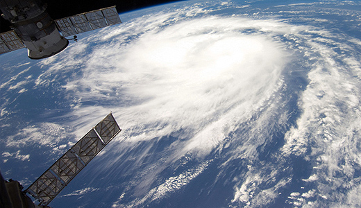
Hurricane Katia as seen from the space station
Coast Guard Advises Caution in Severe Weather

The Irish Coast Guard has advised members of the public to take care in the current severe weather conditions, particularly around the coast and in exposed areas.
Sea Activities
Avoid sea or water-based activities today if possible.
Cliff Walking
There is safety in numbers. Always let someone know when and where you are going, and when you are expected to return. Stay well away from cliff edges, both top and bottom. Don't attempt to rescue people or pets if they fell over a cliff edge. If assistance is needed dial 999 or 112 and ask for the Coast Guard.
Beware of Tides on Busy UK Bank Holiday

Coastguard coordination centres have dealt with at least eight different incidents this afternoon involving a total of 16 people who have become cut off by incoming tides at different places around the coast.
In Pembrokeshire, six people were rescued from the water by Little Haven RNLI lifeboat at Setlands Beach near Broad Haven and at St Dogmaels the Cardigan RNLI inshore lifeboat recovered a woman who was stuck thigh deep in mud.
Humber Coastguard was alerted to two people and their dogs trapped by a fast rising tide near Bridlington. They were unsure of their location and as rescue units began searching for them, the couple were fortunately spotted by Hornsea Rescue lifeboat who recovered them from the water in a distressed condition.
Mike Bill, Coastguard Watch Manager at Humber Coastguard says,
"Coastguards are warning people at the coast to check tide times to ensure you are not caught out. Talk about how the tides work with your family and make sure everyone understands how tides work and what the dangers are when walking at the coast."


. He learned his sailing in the Royal Cork at Crosshaven but left Ireland (as did many others) in 1985 and is now so into America’s West Coast sailing scene that he owns a classic Cal 40")


 Michael Murphy Schull Harbour Sailing Club (SHSC), Eric Coogan Heineken Ireland, Mark Murphy, Commodore SHSC, Jack Allen SHSC, Carmel O'Regan SHSC, Cornelious Ndlovu, Schull Harbour Hotel Operations Manager and Derval Murphy SHSC")

