


Displaying items by tag: RV Celtic Voyager
Fond Memories of Guinness Barges on the Liffey
#INLAND WATERWAYS - As Derek Evans writes in The Irish Times, the recent discovery of the first Guinness merchant vessel - sunk a century ago by a German torpedo in the Irish Sea - rekindled memories of the brewery's boats on the Liffey in the 1950s.
He writes: "Living close to Stoneybatter, I often took time to stand on Queen Street Bridge as the barges, filled with Guinness barrels, slowly made their way from James’s Gate to Sir John Rogerson’s Quay.
"I remember clearly the skipper standing beside the open wheelhouse in his navy blue polo-neck jumper, captain’s hat and pipe... The skipper always had a smile and a wave before he would disappear for a few moments under the white cloud."
He also recalls the hoisting of the barrells at Butt Bridge onto the Guinness cargo vessels - like the WM Barkley, the Lady Grania or Gwendolen Guinness - for transport to Liverpool.
As previously reported on Afloat.ie, the wreck of the WM Barkley was captured in high-resolution images taken from the national research vessel RV Celtic Voyager off the coast of Dublin.
The Irish Times has more on the story HERE.
Taoiseach Announces Marine Jobs On Visit of RV Celtic Explorer

An Taoiseach Enda Kenny visited the Marine Institute's research vessel RV Celtic Explorer in Dublin Port today, where he announced the creation of 92 jobs in the marine sector, writes Jehan Ashmore.
"Ireland is now recognised as an emerging power in Marine Research and Innovation," said the Taoiseach. Of the new positions, 64 will be generated in the seafood processing sector. This follows a €3.5m Seafood Processing Business Investment Scheme administered by Bord Iascaigh Mhara (BIM). In the area of marine research, 28 jobs have been created through funding of €2m from an International SmartOcean Graduate Programme.
SmartOcean is a collaboration between IRCSET (Irish Research Council for Science Engineering and Technology), the Marine Institute, five Irish universities and key multinationals and SME Information and Communication Technology (ICT) companies to provide funding for 28 research posts.
The Taoiseach said: "This has been achieved through the mapping of the 90% of Irish national territory that lies under the Atlantic, the creation of a quarter of a billion Euros worth of marine research infrastructure, and the fostering of strong linkages between industry and research centres, all of which will support employment opportunities in key areas of potential growth in the marine sector."
During the tour of the RV Celtic Explorer, the Taoiseach who was accompanied by Minister for Agriculture, Marine and Food, Simon Coveney, welcomed the expansion of Ireland's capabilities in the international shipping services sector, which is expected to attract additional jobs to the country.
Ireland's emerging international shipping services sector has continued to grow, underpinned by a number of investments in new and second hand ships over the last twelve months by such companies as Arklow Shipping and the Mainport Group, as well as foreign direct investments by D'Amico and Ardmore shipping.
As reported on Afloat.ie, RV Celtic Explorer had arrived yesterday into Dublin Port, having completed a fisheries demersal survey which started in Galway on 23 September. Initially she had docked at Ocean Pier but she subsequently shifted berths to Sir John Rogersons Quay for today's reception of An Taoiseach. According to her survey schedule she is due to depart tomorrow on a herring acoustic survey which is to take place in the Celtic Sea and off the south-west coast.
- Dublin Port
- BIM
- Marine Institute
- marine science
- Arklow Shipping Ltd
- Bord Iascaigh Mhara
- Ports and Shipping News
- Ardmore Shipping
- Mainport Group
- D'Amico
- Irish marine jobs
- An Taoiseach Enda Kenny
- SmartOcean
- RV Celtic Explorer
- RV Celtic Voyager
- Sir John Rogersons Quay
- Irish research vessels
- Simon Coveney

According to the vessels survey schedules, RV Celtic Explorer had today completed fisheries demersal surveys which started in Galway on 23 September. The near fortnight-long survey was conducted in the ICES area VI, under the direction of chief scientist, Dave Stokes.
On Friday she embarks on a herring acoustic survey which is to take place in the Celtic Sea and the south-west. This survey will be under chief scientist Ciaran O'Donnell and is to de-mobilise in Cork on 27 October. To read more about her 2011 survey programme click HERE.
Across Dublin Bay in neighbouring Dun Laoghaire, the 31m RV Celtic Voyager is currently nearing the end of a month-long hydrography survey of the Celtic Sea. The survey had started in Howth Harbour on 17 September under chief scientist Kevin Sheehan. For the time-being she remains moored in Dun Laoghaire prior to resuming survey work which will continue until the vessel de-mobilises in Rosslare in mid-October. To find out more about her remaining surveys for this year click HERE.
On the surveys outlined they are conducted on behalf of Marine Institute scientists, though the vessels are also allocated ship-time for use of third parties. These include government departments and agencies, universities, research institutes and industry. For further information on the research vessels, survey schedules etc can be found by visiting: www.marine.ie/home/Research+Vessels.htm
Marine Notice: Hydrographic Survey off Dundalk
The latest Marine Notice from the DTTAS advises all seafarers near Dundalk Bay and Carlingford Lough to give a wide berth to the hydrographic and oceanographic survey operation in the area this month.
The RV Celtic Voyager (callsign EIQN) will be carrying out survey operations between Kildeel and Clogherhead till 15 September.
The vessel will display lights and markers and will be towing different sensors from time to time with a single cable of up to 100m long.
Deployment of water level recording equipment will be necessary on the seabed at certain locations. These will be marked with appropriate buoys and lights as well as Irish Coast Guard radio notices.
Details of the survey area are included in a PDF of Marine Notice No 44 of 2011, which is available to read or download HERE.
Waterford: Where Tallships and Science Meet
This was the RV Keary's first INFOMAR survey leg of 2011 and it was also the first time that both vessels have worked in tandem. The mapping of the estuary was from an area just west of the city's Rice Bridge to the open sea at the mouth of Waterford Harbour.
The estuary was mapped before in 2007 using the Marine Institutes larger vessel the RV Celtic Voyager, which covered the harbour approaches from the 10m contour to greater depth offshore. Both RV Keary and RV Geo overlapped their coverage with this previous data, producing a comprehensive and seamless seabed map of the area.
RV Keary is constructed of marine grade aluminium and was custom built in 2008 for the (GSI) by Veecraft Marine of Capetown, South Africa.
The 15m craft with a draft of just 2m is equipped with an extensive range of highly sophisticated technology. She has an open working area at the aft-deck to conduct operations and is licensed to carry up to 12 personnel. For further vessel characteristics click HERE.
The 34-tonne craft made her 7,000 mile delivery voyage from the African continent to Europe. She was firstly transported on the deck of a cargoship to Rotterdam. After unloading at the Dutch port the 22-knot capable craft set off with several calls along the UK south coast to include loading bunkers before finally reaching Dun Laoghaire, from where she entered service in April 2009.
Mussel Dredgers Make a Fleeting Trawl of Dalkey Sound
Two mussel dredger-trawlers made a rare transit of Dalkey Sound, last Friday, writes Jehan Ashmore.
The sound which is located to the south of Dublin Bay is not used by commercial traffic but is frequented by pleasure-craft, local fishing boats from Dun Laoghaire. In addition to occasional traffic by the Irish Naval Service, Marine Institute research vessel RV Celtic Voyager, the GSI's RV Keary and foreign tall-ships.
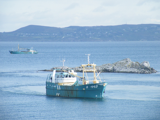
Dublin Bay. Photo Jehan Ashmore/ShipSNAPS
The vessels were making a southerly direction as they headed across Dublin Bay towards Dalkey Island. Mytilus lowered a mussel cage bucket into the sound which was dragged on two separate occasions over a short distance running parallel between the island and the coast.
The operation was all too brief as the Mytilus then proceeded into Killiney Bay followed closely astern by Branding. Upon entering the neighbouring bay, both vessels conducted dredging activity before continuing south beyond Bray Head.
Mussel grounds are located throughout certain hotspots in the Irish Sea and earlier this month, it is reported that there was a notable increase in mussel dredgers in Bangor, Northern Ireland. The dredgers were the Mytilus and Branding which berthed at the Co. Down harbour after a lengthy period of relative inactivity.
Mytilus was built in The Netherlands by Scheepwerf Van Os Yerseke B.V. and appeared in an episode of the successful BBC TV series 'Coast'. At the time of the broadcast she was registered at Beaumaris, Anglesey and was seen working in the northern approaches of the Menai Straits. The fishery grounds are ideally suited for the growing processes required in farmed mussel production.
Branding was also built by a Dutch shipyard, Kooieman in 1988 and her design is typical of the mussel dredgers based in Wexford. The market for mussels is mainly from the northern European countries of Belgium, France and the Netherlands.
- Dublin Bay
- Coast
- Marine Institute
- Northern Ireland
- naval service
- Dublin Bay News
- Anglesey
- Ports and Shipping News
- Island News
- RV Celtic Voyager
- TallShips
- RV Keary
- Geological Survey of Ireland
- GSI
- Mussel dredgers
- Mussel trawlers
- Mytilus
- Branding
- Dalkey Sound
- Fishery
- Menai Strait
- Beaumaris
- Banger
- Fish news
- BBC
- BBC TV series 'Coast'
- Belfastregistered
- Wexfordregistered
- Dutchbuilt
- Mussel markets
- Killiney Bay
- Bray Head
Irish to Lead Europe in Research Vessel Productivity

These figures compare favourably with our European counterparts, reflecting a high level of activity on national and international research and monitoring programmes.
Work duties in 2011 for the Galway based vessels will range from fisheries surveys to underwater mapping and from climate studies to deepwater surveys with the remotely operated submersible ROV Holland 1. The work schedule will facilitate training missions and to carry out essential maintenance work on Ireland's network of data buoys that, in parallel to their research function, supply the vital information on which weather and shipping forecasts are based.
The increased activity of the research vessels reflects the growing imperative to understand and sustainably manage the economic potential of our offshore marine territories, an area over ten times that of Ireland itself.
A major role of the ships' workload will be commercial fish stock assessments. Together they are to devote 141 days on stock surveys in support of the sustainable management of Ireland's fisheries.
The RV Celtic Voyager will conduct underwater television surveys of valuable prawn stocks off the Aran Islands, the Irish and Celtic Seas, working on blue whiting, a survey of herring stocks in the north-west. In addition a comprehensive 54-day annual Irish Groundfish Survey which will take place in stages all around the Irish coast from September to December.
The survey will be the largest undertaken by an Irish research vessel and is essential to providing the scientific data used to inform the annual quota negotiations required in Brussels each year.
For the 2011 schedule for both vessels is available to view by clicking HERE and the Maritime Institute website click this link.
At 65.5m RV Celtic Explorer (2,425grt) accommodates 35 personnel and up to 21 scientists and 31.4m RV Celtic Voyager (340grt) with up to 8 scientists and a maximum endurance of 14-day days. For detailed technical specifications of the Dutch built vessels, RV Celtic Explorer, click here to download a PDF file and for the RV Celtic Voyager click here
For further information contact: Dr John Joyce, Communications Manager of Marine Institute on 087 2250871


 linking Spain.")


 Michael Murphy Schull Harbour Sailing Club (SHSC), Eric Coogan Heineken Ireland, Mark Murphy, Commodore SHSC, Jack Allen SHSC, Carmel O'Regan SHSC, Cornelious Ndlovu, Schull Harbour Hotel Operations Manager and Derval Murphy SHSC")


