Menu

Ireland's sailing, boating & maritime magazine

Displaying items by tag: SOCAT

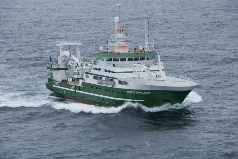
Surface ocean carbon dioxide observations from Irish waters collected by the Marine Institute’s RV Celtic Explorer have been published in the 2023 version of the Surface Ocean CO2 Atlas (SOCAT).

With over 42 million surface ocean CO2 measurements from across the globe, SOCAT is a key dataset for quantifying the evolving ocean uptake and sink for CO2.

This data provides scientists, climate researchers and international policy makers with essential information on ocean carbon dioxide measurements. And such observations are essential to understand current and project future climate change as well as for monitoring changes in ocean chemistry and predicting the impacts of these changes.

Atmospheric carbon dioxide concentrations continue to rise rapidly and currently are at about 420 parts per million (ppm), up from 280ppm in preindustrial times.

The current atmospheric level would be significantly higher, and climate change even more pronounced, but for our global ocean absorbing about a quarter of CO2 emissions from human activities each year.

There is, however, a cost: Absorbing additional CO2 increases the acidity of seawater. This process is known as ocean acidification, and it may have dramatic consequences for marine life, as detailed in a recent assessment by OSPAR.

If sea water is too acidic, it can make it difficult for marine organisms such as coral, oysters and mussels to form shells and skeletons. The impacts of ocean acidification and warming could also extend up the food chain, affecting fisheries and aquaculture, threatening food security for millions of people.

Evin McGovern at the Marine Institute, who was co-convenor of the international expert group that produced the OSPAR Ocean Acidification assessment said: “High-quality measurements of surface ocean carbon dioxide are needed for a better understanding of the impact of ocean-atmosphere interactions on climate. The Marine Institute is contributing to global science, providing advanced scientific knowledge which will help inform policy and our response to a changing ocean.”

Ocean and atmospheric CO2 measurements have been collected on the RV Celtic Explorer since 2017. This year Ireland joined the Integrated Carbon Observing Station (ICOS), a European Infrastructure network supporting standardised high-precision carbon flux measurements between atmosphere, land and the ocean, and the RV Celtic Explorer was adopted as an ICOS Ocean “station”.

In Ireland, marine CO2 measurements are also collected at fixed stations and additional CO2 observing capacity will be available on the new national research vessel, the RV Tom Crean, extending the coverage.

Published in Marine Science

Surface ocean carbon dioxide observations collected by the Marine Institute’s RV Celtic Explorer have been published in the 2020 version of the Surface Ocean Carbon Atlas (SOCAT).

These data provide scientists, climate researchers and international policy makers with essential information on ocean carbon dioxide measurements.

About 36 billion tonnes of carbon dioxide are added to the atmosphere each year as a result of human activities. The ocean absorbs about one-quarter of these emissions, which helps to slow down climate change by removing CO2 from the atmosphere.

However, absorbing additional CO2 increases the acidity of seawater. This process is known as ocean acidification, and it could have dramatic consequences for marine life.

The impacts of ocean acidification would extend up the food chain, threatening food security for millions of people

If sea water is too acidic, it can make it difficult for marine organisms such as coral, oysters and mussels to form shells and skeletons.

Ocean acidification may impact some plankton species, which form the base of marine food webs and would impact larger animals like fish and whales.

The impacts of ocean acidification would extend up the food chain, affecting fisheries and aquaculture, threatening food security for millions of people, as well as the tourism industry.

Ocean acidification is a global problem. The European Union has committed to cut its greenhouse gas emissions by at least 40% below 1990 levels by 2030 and aims to be climate-neutral — an economy with net-zero greenhouse gas emissions — by 2050.

To understand the Earth’s changing climate, it is essential to collect high-quality data on surface ocean CO2 levels.

Since 2017, the Marine institute has been measuring dissolved carbon dioxide (pCO2) in Irish and Atlantic surface waters using a General Oceanics pCO2 system on board the RV Celtic Explorer. This system enables near-continuous and high-accuracy carbon dioxide measurements in surface water and the atmosphere when the vessel is at sea.

The close collaboration between the Marine Institute and P&O Maritime Services, with support from GEOMAR in Germany, has resulted in the successful collection of this data.

SOCAT has become a milestone in research co-ordination, data access, climate research and in informing policy

The high-quality measurements of CO2 collected by the Marine Institute are now included in the 2020 version of the Surface Ocean Carbon Atlas (SOCAT) and fill “a notable data gap”, according to the Irish State agency for marine research.

The Marine Institute submitted data from nine surveys in 2017 and a further 15 surveys in 2018 to SOCAT, whose data set os used globally by climate researchers and contribute to the work of the Intergovernmental Panel on Climate Change (IPCC).

SOCAT has become a milestone in research co-ordination, data access, climate research and in informing policy, the Marine Institute says.

And this work further contributes to collaborative research on ocean carbon and acidification undertaken over the last decade by the institute and NUI Galway.

Margot Cronin, chemist at the Marine Institute, said: “Measuring carbon dioxide in Irish and Atlantic waters provides essential data that increases the understanding of our oceans and climate.

“The Marine Institute is contributing to global science, providing advanced scientific knowledge which will help inform policy and our response to a changing ocean.”

As previously reported on Afloat.ie, the Marine Institute’s latest Oceans of Learning series focuses on our changing ocean climate with videos, interactive activities and downloadable resources.

Published in Marine Science

Irish Fishing industry 

The Irish Commercial Fishing Industry employs around 11,000 people in fishing, processing and ancillary services such as sales and marketing. The industry is worth about €1.22 billion annually to the Irish economy. Irish fisheries products are exported all over the world as far as Africa, Japan and China.

FAQs

Over 16,000 people are employed directly or indirectly around the coast, working on over 2,000 registered fishing vessels, in over 160 seafood processing businesses and in 278 aquaculture production units, according to the State's sea fisheries development body Bord Iascaigh Mhara (BIM).

All activities that are concerned with growing, catching, processing or transporting fish are part of the commercial fishing industry, the development of which is overseen by BIM. Recreational fishing, as in angling at sea or inland, is the responsibility of Inland Fisheries Ireland.

The Irish fishing industry is valued at 1.22 billion euro in gross domestic product (GDP), according to 2019 figures issued by BIM. Only 179 of Ireland's 2,000 vessels are over 18 metres in length. Where does Irish commercially caught fish come from? Irish fish and shellfish is caught or cultivated within the 200-mile exclusive economic zone (EEZ), but Irish fishing grounds are part of the common EU "blue" pond. Commercial fishing is regulated under the terms of the EU Common Fisheries Policy (CFP), initiated in 1983 and with ten-yearly reviews.

The total value of seafood landed into Irish ports was 424 million euro in 2019, according to BIM. High value landings identified in 2019 were haddock, hake, monkfish and megrim. Irish vessels also land into foreign ports, while non-Irish vessels land into Irish ports, principally Castletownbere, Co Cork, and Killybegs, Co Donegal.

There are a number of different methods for catching fish, with technological advances meaning skippers have detailed real time information at their disposal. Fisheries are classified as inshore, midwater, pelagic or deep water. Inshore targets species close to shore and in depths of up to 200 metres, and may include trawling and gillnetting and long-lining. Trawling is regarded as "active", while "passive" or less environmentally harmful fishing methods include use of gill nets, long lines, traps and pots. Pelagic fisheries focus on species which swim close to the surface and up to depths of 200 metres, including migratory mackerel, and tuna, and methods for catching include pair trawling, purse seining, trolling and longlining. Midwater fisheries target species at depths of around 200 metres, using trawling, longlining and jigging. Deepwater fisheries mainly use trawling for species which are found at depths of over 600 metres.

There are several segments for different catching methods in the registered Irish fleet – the largest segment being polyvalent or multi-purpose vessels using several types of gear which may be active and passive. The polyvalent segment ranges from small inshore vessels engaged in netting and potting to medium and larger vessels targeting whitefish, pelagic (herring, mackerel, horse mackerel and blue whiting) species and bivalve molluscs. The refrigerated seawater (RSW) pelagic segment is engaged mainly in fishing for herring, mackerel, horse mackerel and blue whiting only. The beam trawling segment focuses on flatfish such as sole and plaice. The aquaculture segment is exclusively for managing, developing and servicing fish farming areas and can collect spat from wild mussel stocks.

The top 20 species landed by value in 2019 were mackerel (78 million euro); Dublin Bay prawn (59 million euro); horse mackerel (17 million euro); monkfish (17 million euro); brown crab (16 million euro); hake (11 million euro); blue whiting (10 million euro); megrim (10 million euro); haddock (9 million euro); tuna (7 million euro); scallop (6 million euro); whelk (5 million euro); whiting (4 million euro); sprat (3 million euro); herring (3 million euro); lobster (2 million euro); turbot (2 million euro); cod (2 million euro); boarfish (2 million euro).

Ireland has approximately 220 million acres of marine territory, rich in marine biodiversity. A marine biodiversity scheme under Ireland's operational programme, which is co-funded by the European Maritime and Fisheries Fund and the Government, aims to reduce the impact of fisheries and aquaculture on the marine environment, including avoidance and reduction of unwanted catch.

EU fisheries ministers hold an annual pre-Christmas council in Brussels to decide on total allowable catches and quotas for the following year. This is based on advice from scientific bodies such as the International Council for the Exploration of the Sea. In Ireland's case, the State's Marine Institute publishes an annual "stock book" which provides the most up to date stock status and scientific advice on over 60 fish stocks exploited by the Irish fleet. Total allowable catches are supplemented by various technical measures to control effort, such as the size of net mesh for various species.

The west Cork harbour of Castletownbere is Ireland's biggest whitefish port. Killybegs, Co Donegal is the most important port for pelagic (herring, mackerel, blue whiting) landings. Fish are also landed into Dingle, Co Kerry, Rossaveal, Co Galway, Howth, Co Dublin and Dunmore East, Co Waterford, Union Hall, Co Cork, Greencastle, Co Donegal, and Clogherhead, Co Louth. The busiest Northern Irish ports are Portavogie, Ardglass and Kilkeel, Co Down.

Yes, EU quotas are allocated to other fleets within the Irish EEZ, and Ireland has long been a transhipment point for fish caught by the Spanish whitefish fleet in particular. Dingle, Co Kerry has seen an increase in foreign landings, as has Castletownbere. The west Cork port recorded foreign landings of 36 million euro or 48 per cent in 2019, and has long been nicknamed the "peseta" port, due to the presence of Spanish-owned transhipment plant, Eiranova, on Dinish island.

Most fish and shellfish caught or cultivated in Irish waters is for the export market, and this was hit hard from the early stages of this year's Covid-19 pandemic. The EU, Asia and Britain are the main export markets, while the middle Eastern market is also developing and the African market has seen a fall in value and volume, according to figures for 2019 issued by BIM.

Fish was once a penitential food, eaten for religious reasons every Friday. BIM has worked hard over several decades to develop its appeal. Ireland is not like Spain – our land is too good to transform us into a nation of fish eaters, but the obvious health benefits are seeing a growth in demand. Seafood retail sales rose by one per cent in 2019 to 300 million euro. Salmon and cod remain the most popular species, while BIM reports an increase in sales of haddock, trout and the pangasius or freshwater catfish which is cultivated primarily in Vietnam and Cambodia and imported by supermarkets here.

The EU's Common Fisheries Policy (CFP), initiated in 1983, pooled marine resources – with Ireland having some of the richest grounds and one of the largest sea areas at the time, but only receiving four per cent of allocated catch by a quota system. A system known as the "Hague Preferences" did recognise the need to safeguard the particular needs of regions where local populations are especially dependent on fisheries and related activities. The State's Sea Fisheries Protection Authority, based in Clonakilty, Co Cork, works with the Naval Service on administering the EU CFP. The Department of Agriculture, Food and Marine and Department of Transport regulate licensing and training requirements, while the Marine Survey Office is responsible for the implementation of all national and international legislation in relation to safety of shipping and the prevention of pollution.

Yes, a range of certificates of competency are required for skippers and crew. Training is the remit of BIM, which runs two national fisheries colleges at Greencastle, Co Donegal and Castletownbere, Co Cork. There have been calls for the colleges to be incorporated into the third-level structure of education, with qualifications recognised as such.

Safety is always an issue, in spite of technological improvements, as fishing is a hazardous occupation and climate change is having its impact on the severity of storms at sea. Fishing skippers and crews are required to hold a number of certificates of competency, including safety and navigation, and wearing of personal flotation devices is a legal requirement. Accidents come under the remit of the Marine Casualty Investigation Board, and the Health and Safety Authority. The MCIB does not find fault or blame, but will make recommendations to the Minister for Transport to avoid a recurrence of incidents.

Fish are part of a marine ecosystem and an integral part of the marine food web. Changing climate is having a negative impact on the health of the oceans, and there have been more frequent reports of warmer water species being caught further and further north in Irish waters.

Brexit, Covid 19, EU policies and safety – Britain is a key market for Irish seafood, and 38 per cent of the Irish catch is taken from the waters around its coast. Ireland's top two species – mackerel and prawns - are 60 per cent and 40 per cent, respectively, dependent on British waters. Also, there are serious fears within the Irish industry about the impact of EU vessels, should they be expelled from British waters, opting to focus even more efforts on Ireland's rich marine resource. Covid-19 has forced closure of international seafood markets, with high value fish sold to restaurants taking a large hit. A temporary tie-up support scheme for whitefish vessels introduced for the summer of 2020 was condemned by industry organisations as "designed to fail".

Sources: Bord Iascaigh Mhara, Marine Institute, Department of Agriculture, Food and Marine, Department of Transport © Afloat 2020