Menu

Ireland's sailing, boating & maritime magazine

Displaying items by tag: Tyrone

Anglers in Northern Ireland have described a “massacre” on a Co Tyrone river after a slurry spill resulted in a major fish kill incident, prompting an official investigation into the source.

The spill on the Claggan River was discovered last weekend with Ballinderry Rivers Trust reporting that “thousands of litres of slurry” were moving downstream to the Killymoon River near Cookstown.

According to Coagh Angling Club, a “massacre” of fish — including young salmon and native dollaghan, as well as breeding and baby trout and eggs — was witnessed several miles upstream of its waters.

On Tuesday (29 March) another incident was reported on a tributary above Coagh weir, where the waters appeared “green with slurry”.

The club’s John Hagan told the Belfast Telegraph that it will take years to recover from the environmental damage.

“We don’t know the full environmental impact of it just yet, but we do know that there's probably about 12-15 miles of river near the source of the Ballinderry which is just dead,” he said.

The Belfast Telegraph has more on the story HERE.

Published in Angling

Works to restore watercourses impacted by a bogslide in the North West last year could take “a number of years” to complete, according to the Loughs Agency.

As previously reported on Afloat.ie, anglers in Donegal and Tyrone fear that the peat slippage near a wind farm development at Meenbog has made an important salmon fishery uninhabitable.

Video of the incident, which saw thousands of tonnes of bogland slide into the River Derg system, went viral on social media in early November 2020.

A working group was established in the wake of the incident and this multi-agency, cross-border group continues to meet on an ongoing basis to coordinate the plan of action, the Loughs Agency says.

“Construction works on the windfarm site where the peat slide originated remain suspended, with the exception of the maintenance of measures required to mitigate the threat of further pollution or those required to safeguard health and safety,” it adds.

Following a direction to the windfarm developer from the Environment Protection Agency (EPA), an updated assessment by independent consultants of peat stability on the site is currently under way.

In addition, a “phased approach to the restoration of areas impacted by the peat slide” has been adopted, the Loughs Agency says.

The first phase began in the last few weeks, undertaken by the windfarm developer under direction of Donegal County Council and the Northern Ireland Environment Agency, and involves restoration of the lower reaches of the Shruhangarve stream and a planting scheme “to mitigate against the deterioration of the peat slide scar”.

The Loughs Agency says it has appointed a fisheries scientist to coordinate further restoration works that may be required for the Mourne Beg and other rivers downstream, and which may require statutory consent.

But it also advises that “given the seasonal restrictions that may apply”, such remediation works “will take a number of years to complete”.

Published in Angling

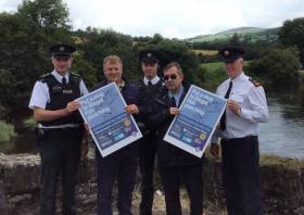
The Loughs Agency has teamed up with police on both sides of the border and a local wildlife group in a joint initiative to tackle fish poaching in Co Tyrone, as Independent.ie reports.

‘Operation Silver Fin’ will take on the scourge of wildlife crime in the area, with a focus on enforcing existing fishing regulations to protect an important angling resource.

Fish poaching, which uses long lines and nets, is only permitted in certain areas — while anyone angling requires a licence and must follow strict rules around where, when and how they fish.

Independent.ie has more on the story HERE.

Published in Angling

#Angling - Hundreds of thousands of rainbow trout escaped from a commercial fish farm in Co Tyrone last year, according to the Loughs Agency.

BBC News has details on the cross-border body’s report into the incident on the River Strule at Newtownstewart in August 2017, which estimates some 387,000 female rainbow trout entered the river system.

Despite concerns over potential widespread impact on the wild salmon and trout fishery in the area, it’s believed the majority are still concentrated in the lower Strule, lower Derg and upper Mourne.

Local anglers are asked to continue taking the farmed fish from these rivers and reporting their catches, particularly from important spawning grounds, as mass removal is not an option.

Published in Angling

#Angling - Plans are afoot to turn Roughan Lough in Co Tyrone into a training lake for Northern Ireland's angling team, as the Tyrone Times reports.

New fishing stands and access for the differently abled are among the plans of the new Roughan Anging Club, which has a 10-year lease on the 50-acre lake that was until three decades ago stocked by the northern region predecessor to Inland Fisheries Ireland.

Reputed to be full of large pike, its intended that the waters will be stocked with rainbow trout and make it a new destination for anglers across Ireland and beyond.

The Tyrone Times has more on the story HERE.

Published in Angling

#WaterSafety - Four more people have drowned in separate incidents around Ireland as the heatwave continues.

As RTÉ News reports, a 24-year-old man died while swimming in the sea near Ardara in Co Donegal yesterday afternoon (20 July).

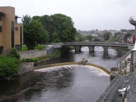
Later, the body of a second victim was recovered from the Shrule River in Newtownstewart, Co Tyrone after getting into difficulty.

A third man in his 60s is was drowned after failing to return from a swim in a quarry near Carrick-on-Suir. His body was recovered earlier today.

The tragedies follow news of a 19-year-old who drowned while swimming with friends in Lough Leane in Killarney on Friday evening (19 July).

And a woman in her 30s was lucky to be rescued after getting into difficulty swimming in the River Nore near Kilkenny. She is currently in a serious but stable condition in hospital.

Irish Water Safety have renewed their appeal for the public to take extra care when taking to the water during this extraordinary hot weather that had already claimed seven lives as of Thursday last.

Published in Water Safety

#ANGLING - The first wild Atlantic spring salmon of 2012 was caught Sunday on the River Liffey in exceptional circumstances, The Irish Times reports.

Though the river is closed for salmon fishing as stocks are currently below sustainable levels, Inland Fisheries Ireland sanctioned a special catch-and-release club event for survey reasons at Islandbridge in the capital.

Declan Briggs – a 47-year veteran of the Dublin and District Salmon Anglers' Association - landed the 8.5lb beauty using a wooden Devon lure at 9.50am.

“This is my first time to catch the first fish. I’m absolutely delighted," he said.

Elsewhere in Ireland, Briggs' catch was mirrored by Tyrone man Ian Martin, who caught the northern region's first salmon on the year on the River Drownes near Bundoran.

The Irish Times has more on the story HERE.

Published in Angling
Northern Ireland is recovering after Hurricane Katia left power cuts and travel distruption in its wake.
As previously reported on Afloat.ie, the remains of Hurrican Katia had been expected to strike hardest in the northern half of Ireland.
The Belfast Telegraph reports that Derry, Antrim and Tyrone were worst hit by winds that reached speeds of up to 120kph on Monday.
There was widespread disruption to rail and ferry services, while drivers reported hazardous conditions. The Foyle Bridge was closed to all high-sided vehiches for a time.
Some 700 homes across Northern Ireland suffered a blackout when powerlines were cut and by falling trees and windborne debris, though power was mostly restored by Tuesday evening.
Though downgraded to tropical storm status after crossing the Atlantic, Katia's high winds wreaked similar havoc south of the border, with power cuts to over 13,000 homes in six different counties - half of them in Donegal alone.
Wind gusts of an incredible 137kmh were recorded on Arranmore Island.
The Belfast Telegraph has more on the story HERE.

Northern Ireland is recovering after Hurricane Katia left power cuts and travel distruption in its wake.

As previously reported on Afloat.ie, the remains of Hurrican Katia had been expected to strike hardest in the northern half of Ireland.

The Belfast Telegraph reports that Derry, Antrim and Tyrone were worst hit by winds that reached speeds of up to 120kph on Monday.

There was widespread disruption to rail and ferry services, while drivers reported hazardous conditions. The Foyle Bridge was closed to all high-sided vehiches for a time.

Some 700 homes across Northern Ireland suffered a blackout when powerlines were cut and by falling trees and windborne debris, though power was mostly restored by Tuesday evening.

Though downgraded to tropical storm status after crossing the Atlantic, Katia's high winds wreaked similar havoc south of the border, with power cuts to over 13,000 homes in six different counties - half of them in Donegal alone.

Wind gusts of an incredible 137kmh were recorded on Arranmore Island.

The Belfast Telegraph has more on the story HERE.

Published in Weather

Ireland's offshore islands

Around 30 of Ireland's offshore islands are inhabited and hold a wealth of cultural heritage.

A central Government objective is to ensure that sustainable vibrant communities continue to live on the islands.

Irish offshore islands FAQs

Technically, it is Ireland itself, as the third largest island in Europe.

Ireland is surrounded by approximately 80 islands of significant size, of which only about 20 are inhabited.

Achill island is the largest of the Irish isles with a coastline of almost 80 miles and has a population of 2,569.

The smallest inhabited offshore island is Inishfree, off Donegal.

The total voting population in the Republic's inhabited islands is just over 2,600 people, according to the Department of Housing.

Starting with west Cork, and giving voting register numbers as of 2020, here you go - Bere island (177), Cape Clear island (131),Dursey island (6), Hare island (29), Whiddy island (26), Long island, Schull (16), Sherkin island (95). The Galway islands are Inis Mór (675), Inis Meáin (148), Inis Oírr (210), Inishbofin (183). The Donegal islands are Arranmore (513), Gola (30), Inishboffin (63), Inishfree (4), Tory (140). The Mayo islands, apart from Achill which is connected by a bridge, are Clare island (116), Inishbiggle (25) and Inishturk (52).

No, the Gaeltacht islands are the Donegal islands, three of the four Galway islands (Inishbofin, like Clifden, is English-speaking primarily), and Cape Clear or Oileán Chléire in west Cork.

Lack of a pier was one of the main factors in the evacuation of a number of islands, the best known being the Blasket islands off Kerry, which were evacuated in November 1953. There are now three cottages available to rent on the Great Blasket island.

In the early 20th century, scholars visited the Great Blasket to learn Irish and to collect folklore and they encouraged the islanders to record their life stories in their native tongue. The three best known island books are An tOileánach (The Islandman) by Tomás Ó Criomhthain, Peig by Peig Sayers, and Fiche Blian ag Fás (Twenty Years A-Growing) by Muiris Ó Súilleabháin. Former taoiseach Charles J Haughey also kept a residence on his island, Inishvickillaune, which is one of the smaller and less accessible Blasket islands.

Charles J Haughey, as above, or late Beatle musician, John Lennon. Lennon bought Dorinish island in Clew Bay, south Mayo, in 1967 for a reported £1,700 sterling. Vendor was Westport Harbour Board which had used it for marine pilots. Lennon reportedly planned to spend his retirement there, and The Guardian newspaper quoted local estate agent Andrew Crowley as saying he was "besotted with the place by all accounts". He did lodge a planning application for a house, but never built on the 19 acres. He offered it to Sid Rawle, founder of the Digger Action Movement and known as the "King of the Hippies". Rawle and 30 others lived there until 1972 when their tents were burned by an oil lamp. Lennon and Yoko Ono visited it once more before his death in 1980. Ono sold the island for £30,000 in 1984, and it is widely reported that she donated the proceeds of the sale to an Irish orphanage


Yes, Rathlin island, off Co Antrim's Causeway Coast, is Ireland's most northerly inhabited island. As a special area of conservation, it is home to tens of thousands of sea birds, including puffins, kittiwakes, razorbills and guillemots. It is known for its Rathlin golden hare. It is almost famous for the fact that Robert the Bruce, King of Scots, retreated after being defeated by the English at Perth and hid in a sea cave where he was so inspired by a spider's tenacity that he returned to defeat his enemy.

No. The Aran islands have a regular ferry and plane service, with ferries from Ros-a-Mhíl, south Connemara all year round and from Doolin, Co Clare in the tourist season. The plane service flies from Indreabhán to all three islands. Inishbofin is connected by ferry from Cleggan, Co Galway, while Clare island and Inishturk are connected from Roonagh pier, outside Louisburgh. The Donegal islands of Arranmore and Tory island also have ferry services, as has Bere island, Cape Clear and Sherkin off Cork. How are the island transport services financed? The Government subsidises transport services to and from the islands. The Irish Coast Guard carries out medical evacuations, as to the RNLI lifeboats. Former Fianna Fáíl minister Éamon Ó Cuív is widely credited with improving transport services to and from offshore islands, earning his department the nickname "Craggy island".

Craggy Island is an bleak, isolated community located of the west coast, inhabited by Irish, a Chinese community and one Maori. Three priests and housekeeper Mrs Doyle live in a parochial house There is a pub, a very small golf course, a McDonald's fast food restaurant and a Chinatown... Actually, that is all fiction. Craggy island is a figment of the imagination of the Father Ted series writers Graham Linehan and Arthur Mathews, for the highly successful Channel 4 television series, and the Georgian style parochial house on the "island" is actually Glenquin House in Co Clare.

Yes, that is of the Plassey, a freighter which was washed up on Inis Oírr in bad weather in 1960.

There are some small privately owned islands,and islands like Inishlyre in Co Mayo with only a small number of residents providing their own transport. Several Connemara islands such as Turbot and Inishturk South have a growing summer population, with some residents extending their stay during Covid-19. Turbot island off Eyrephort is one such example – the island, which was first spotted by Alcock and Brown as they approached Ireland during their epic transatlantic flight in 1919, was evacuated in 1978, four years after three of its fishermen drowned on the way home from watching an All Ireland final in Clifden. However, it is slowly being repopulated

Responsibility for the islands was taking over by the Department of Rural and Community Development . It was previously with the Gaeltacht section in the Department of Media, Tourism, Arts, Culture, Sport and the Gaeltacht.

It is a periodic bone of contention, as Ireland does not have the same approach to its islands as Norway, which believes in right of access. However, many improvements were made during Fianna Fáíl Galway West TD Éamon Ó Cuív's time as minister. The Irish Island Federation, Comdháil Oileáin na hÉireann, represents island issues at national and international level.

The 12 offshore islands with registered voters have long argued that having to cast their vote early puts them at a disadvantage – especially as improved transport links mean that ballot boxes can be transported to the mainland in most weather conditions, bar the winter months. Legislation allowing them to vote on the same day as the rest of the State wasn't passed in time for the February 2020 general election.

Yes, but check tide tables ! Omey island off north Connemara is accessible at low tide and also runs a summer race meeting on the strand. In Sligo, 14 pillars mark the way to Coney island – one of several islands bearing this name off the Irish coast.

Cape Clear or Oileán Chléire is the country's most southerly inhabited island, eight miles off the west Cork coast, and within sight of the Fastnet Rock lighthouse, also known as the "teardrop of Ireland".
Skellig Michael off the Kerry coast, which has a monastic site dating from the 6th century. It is accessible by boat – prebooking essential – from Portmagee, Co Kerry. However, due to Covid-19 restrictions, it was not open to visitors in 2020.
All islands have bird life, but puffins and gannets and kittiwakes are synonymous with Skellig Michael and Little Skellig. Rathlin island off Antrim and Cape Clear off west Cork have bird observatories. The Saltee islands off the Wexford coast are privately owned by the O'Neill family, but day visitors are permitted access to the Great Saltee during certain hours. The Saltees have gannets, gulls, puffins and Manx shearwaters.
Vikings used Dublin as a European slaving capital, and one of their bases was on Dalkey island, which can be viewed from Killiney's Vico road. Boat trips available from Coliemore harbour in Dalkey. Birdwatch Ireland has set up nestboxes here for roseate terns. Keep an eye out also for feral goats.
Plenty! There are regular boat trips in summer to Inchagoill island on Lough Corrib, while the best known Irish inshore island might be the lake isle of Innisfree on Sligo's Lough Gill, immortalised by WB Yeats in his poem of the same name. Roscommon's Lough Key has several islands, the most prominent being the privately-owned Castle Island. Trinity island is more accessible to the public - it was once occupied by Cistercian monks from Boyle Abbey.

©Afloat 2020