


Displaying items by tag: Geological Survey of Ireland
Mapping Ireland’s seabed, how scientists predict flooding and how to grow your own volcano are themes of an open day hosted by the Geological Survey of Ireland (GSI) and National Museum of Ireland this weekend.
The free “Down to Earth” open day event takes place on Saturday next, May 7th, at the National Museum of Ireland - Decorative Arts and History, Collins Barracks, Dublin.
GSI scientists will be on hand to “bring land and seabed mapping to life, to show the importance of groundwater, and reveal the secrets of Irish fossils,” the organisers state.
They will be joined by colleagues from DIAS (Dublin Institute for Advanced Studies), iCRAG (the Science Foundation Ireland research centre in applied sciences), Met Éireann, and Teagasc to answer questions on earthquakes, the metals we need for life, weather and flooding, and soil.
Members of the public are invited to “try and stump the geologist” by bringing a favourite rock or fossil to have it identified by a geology curator from the National Museum of Ireland.
Sustainable arts experts ReCreate will be running workshops for those families who would like to design some geology inspired art.
The open day takes its inspiration from “Down to Earth- Exploring Ireland’s Geology”, which is currently on exhibition.
Booking is not required, and members of the public can drop in to Collins Barracks, Dublin from 11 am on Saturday, May 7th.
GSI Charter Central Fisheries Cutter

#RESEARCH VESSEL CHARTER - The Geological Survey of Ireland (GSI) have chartered the Cosantoir Bradan from the Central Fisheries Board
The fisheries patrol cutter is to be used in conjunction with the RV Keary for survey work, including bottom survey of all coastal regions around Ireland.
The 15m catamaran inshore research vessel is currently undergoing modifications and refurbishing works at Arklow Marine Services yard.
Waterford: Where Tallships and Science Meet
This was the RV Keary's first INFOMAR survey leg of 2011 and it was also the first time that both vessels have worked in tandem. The mapping of the estuary was from an area just west of the city's Rice Bridge to the open sea at the mouth of Waterford Harbour.
The estuary was mapped before in 2007 using the Marine Institutes larger vessel the RV Celtic Voyager, which covered the harbour approaches from the 10m contour to greater depth offshore. Both RV Keary and RV Geo overlapped their coverage with this previous data, producing a comprehensive and seamless seabed map of the area.
RV Keary is constructed of marine grade aluminium and was custom built in 2008 for the (GSI) by Veecraft Marine of Capetown, South Africa.
The 15m craft with a draft of just 2m is equipped with an extensive range of highly sophisticated technology. She has an open working area at the aft-deck to conduct operations and is licensed to carry up to 12 personnel. For further vessel characteristics click HERE.
The 34-tonne craft made her 7,000 mile delivery voyage from the African continent to Europe. She was firstly transported on the deck of a cargoship to Rotterdam. After unloading at the Dutch port the 22-knot capable craft set off with several calls along the UK south coast to include loading bunkers before finally reaching Dun Laoghaire, from where she entered service in April 2009.
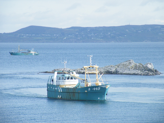
Mussel Dredgers Make a Fleeting Trawl of Dalkey Sound
Two mussel dredger-trawlers made a rare transit of Dalkey Sound, last Friday, writes Jehan Ashmore.
The sound which is located to the south of Dublin Bay is not used by commercial traffic but is frequented by pleasure-craft, local fishing boats from Dun Laoghaire. In addition to occasional traffic by the Irish Naval Service, Marine Institute research vessel RV Celtic Voyager, the GSI's RV Keary and foreign tall-ships.
Dublin Bay. Photo Jehan Ashmore/ShipSNAPS
The vessels were making a southerly direction as they headed across Dublin Bay towards Dalkey Island. Mytilus lowered a mussel cage bucket into the sound which was dragged on two separate occasions over a short distance running parallel between the island and the coast.
The operation was all too brief as the Mytilus then proceeded into Killiney Bay followed closely astern by Branding. Upon entering the neighbouring bay, both vessels conducted dredging activity before continuing south beyond Bray Head.
Mussel grounds are located throughout certain hotspots in the Irish Sea and earlier this month, it is reported that there was a notable increase in mussel dredgers in Bangor, Northern Ireland. The dredgers were the Mytilus and Branding which berthed at the Co. Down harbour after a lengthy period of relative inactivity.
Mytilus was built in The Netherlands by Scheepwerf Van Os Yerseke B.V. and appeared in an episode of the successful BBC TV series 'Coast'. At the time of the broadcast she was registered at Beaumaris, Anglesey and was seen working in the northern approaches of the Menai Straits. The fishery grounds are ideally suited for the growing processes required in farmed mussel production.
Branding was also built by a Dutch shipyard, Kooieman in 1988 and her design is typical of the mussel dredgers based in Wexford. The market for mussels is mainly from the northern European countries of Belgium, France and the Netherlands.
- Dublin Bay
- Coast
- Marine Institute
- Northern Ireland
- naval service
- Dublin Bay News
- Anglesey
- Ports and Shipping News
- Island News
- RV Celtic Voyager
- TallShips
- RV Keary
- Geological Survey of Ireland
- GSI
- Mussel dredgers
- Mussel trawlers
- Mytilus
- Branding
- Dalkey Sound
- Fishery
- Menai Strait
- Beaumaris
- Banger
- Fish news
- BBC
- BBC TV series 'Coast'
- Belfastregistered
- Wexfordregistered
- Dutchbuilt
- Mussel markets
- Killiney Bay
- Bray Head
Germanischer Lloyd Award to Maritime Management
in Ireland.
"Achieving ISO 14001 accreditation, an internationally recognised green standard, shows our respect of the sensitive marine environment and has been well received by our international and Irish clients. It is of particular significance to our clients involved in underwater exploration and scientific research and those involved in the transport of agricultural produce either refrigerated or in bulk."
Maritime Management has an international client base with a diverse range of vessels. Services include technical, operational and crewing for specialist passenger ships, cargoships, refrigerated cargo ships and specialist vessels such as the exploration vessel EV Nautilus.
The vessel is managed on behalf of the famous undersea explorer Dr. Robert Ballard, who is known best for his discovery of the Titanic, PT 109 and the Bismark. Over the last two years Maritime Management has carried out major work to adapt the vessel to suit the requirements of broadcasters National Geographic and CBS.
The work carried outon the vessel has the ground breaking ability to broadcast live HD video from the ocean floor. This enabled scientific teams from the USA and around the world to interact in real time with the underwater operations. To read more about the work of the EV Nautilus and the mapping of underwater volcanoes, life forms,shipwrecks and more click here.
Maritime Management's projects in Ireland have included the design and construction of the Geological Survey of Ireland (GSI) RV Keary, a small yet high-tech survey vessel which was built in South Africa. The 15m asymmetrical catamaran is constructed of aluminium and has a speed of 15 knots. The craft has a Marine Survey Office P5 license for 12 passengers. For further technical details click here.


