Menu

Ireland's sailing, boating & maritime magazine

Displaying items by tag: marine mapping

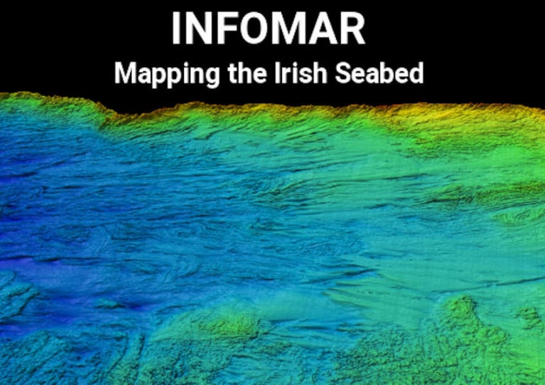
Hydrographic and geophysical survey operations will be undertaken by INFOMAR in the Celtic Sea and Atlantic Ocean between April and October this year, according to a recent Marine Notice from the Department of Transport, Tourism and Sport.

Covering some 125,000 sq km of underwater territory, INFOMAR will produce integrated mapping products covering the physical, chemical and biological features of the seabed.

Both Marine Institute vessels, the RV Celtic Voyager (callsign EIQN) and RV Celtic Explorer (callsign EIGB), will be employed for these survey operations, towing a magnetometer sensor with a single cable of up to 200m in length and a Moving Vessel Profiler cable of variable length up to a maximum of 200m.

Geological Survey Ireland will also operate four vessels, the RV Keary (callsign EI-GO-9), RV Geo (callsign EI-DK-6), RV Mallet (callsign EI-SN-9) and RV Lir (call sign EI-HI-2).

All vessels will display appropriate lights and markers and will be listening on VHF Channel 16 throughout the course of the survey.

Further details, including co-ordinates of the survey areas, are included in Marine Notice No 11 of 2020, a PDF of which is available to download below.

Published in News Update

Minister for Natural Resources, Fergus O'Dowd, T.D. today set out details of upcoming projects in the National Marine Mapping Programme (INFOMAR), and pledged Government commitment of €15m for the next 5 years, for the continuation of what he called "the most valuable resource for marine research and development in Ireland and beyond".

Covering some 125,000 square kilometres of underwater territory, the INFOMAR project is producing new mapping and integrated products covering the Irish maritime space. It provides seabed surveys, which are used in all activities from planning for offshore renewable energy projects to ensuring shipping lanes are safely charted.

Commenting today, Minister O'Dowd said: 'I am delighted to announce the continuation of the INFOMAR project. This is a world class undertaking which is providing crucial information towards the development of Ireland's 220 million acres that lie under the sea. I am particularly pleased to see the programme focus on adding value to the data and ensuring INFOMAR plays it's part in developing jobs and growth,"

The decision to continue the project was taken following a second full independent review of its operations by PricewaterhouseCoopers. The initial review, undertaken in 2008, concluded that the benefits to the state of completing the project are between 4 and 6 times the cost. The second review showed the project to be on track and recommended accelerated development of business and educational applications. Dublin Business Innovation Centre (DBIC) have now been contracted to work with the project on this area, including new products, apps, and educational resources.

In the eight years since it began, the INFOMAR project has conducted detailed surveys along the SouthWest, South and East coasts and completed mapping of most Irish bays and harbours including, Dublin, Cork, Shannon and Galway. To date the programme has helped produce:
New navigational charts
Shipwreck maps and books
New Marine Special Areas of Conservation
Data to underpin Foreshore Licensing
Maps for offshore renewable planning, cable and pipeline routes
Ireland's largest digital database of marine information

The programme is funded by Department of Communications , Energy and Natural Resources and managed by Geological Survey of Ireland (GSI), in conjunction with the Marine Institute (MI). Mapping is carried out using all of the states marine research vessels, the Celtic Explorer and Voyager managed by MI and the Keary, Geo and Cosantoir Bradan managed by GSI. The next phase of the project will include mapping of Lough Foyle, Lough Swilly, Broadhaven Bay, Youghal, Dungarvan and Drogheda. It will also see the launch of a range of new services, reports and apps.

Published in Marine Science
Tagged under

Royal National Lifeboat Institute (RNLI) in Ireland Information

The Royal National Lifeboat Institution (RNLI) is a charity to save lives at sea in the waters of UK and Ireland. Funded principally by legacies and donations, the RNLI operates a fleet of lifeboats, crewed by volunteers, based at a range of coastal and inland waters stations. Working closely with UK and Ireland Coastguards, RNLI crews are available to launch at short notice to assist people and vessels in difficulties.

RNLI was founded in 1824 and is based in Poole, Dorset. The organisation raised €210m in funds in 2019, spending €200m on lifesaving activities and water safety education. RNLI also provides a beach lifeguard service in the UK and has recently developed an International drowning prevention strategy, partnering with other organisations and governments to make drowning prevention a global priority.

Irish Lifeboat Stations

There are 46 lifeboat stations on the island of Ireland, with an operational base in Swords, Co Dublin. Irish RNLI crews are tasked through a paging system instigated by the Irish Coast Guard which can task a range of rescue resources depending on the nature of the emergency.

Famous Irish Lifeboat Rescues

Irish Lifeboats have participated in many rescues, perhaps the most famous of which was the rescue of the crew of the Daunt Rock lightship off Cork Harbour by the Ballycotton lifeboat in 1936. Spending almost 50 hours at sea, the lifeboat stood by the drifting lightship until the proximity to the Daunt Rock forced the coxswain to get alongside and successfully rescue the lightship's crew.

32 Irish lifeboat crew have been lost in rescue missions, including the 15 crew of the Kingstown (now Dun Laoghaire) lifeboat which capsized while attempting to rescue the crew of the SS Palme on Christmas Eve 1895.

FAQs

While the number of callouts to lifeboat stations varies from year to year, Howth Lifeboat station has aggregated more 'shouts' in recent years than other stations, averaging just over 60 a year.

Stations with an offshore lifeboat have a full-time mechanic, while some have a full-time coxswain. However, most lifeboat crews are volunteers.

There are 46 lifeboat stations on the island of Ireland

32 Irish lifeboat crew have been lost in rescue missions, including the 15 crew of the Kingstown (now Dun Laoghaire) lifeboat which capsized while attempting to rescue the crew of the SS Palme on Christmas Eve 1895

In 2019, 8,941 lifeboat launches saved 342 lives across the RNLI fleet.

The Irish fleet is a mixture of inshore and all-weather (offshore) craft. The offshore lifeboats, which range from 17m to 12m in length are either moored afloat, launched down a slipway or are towed into the sea on a trailer and launched. The inshore boats are either rigid or non-rigid inflatables.

The Irish Coast Guard in the Republic of Ireland or the UK Coastguard in Northern Ireland task lifeboats when an emergency call is received, through any of the recognised systems. These include 999/112 phone calls, Mayday/PanPan calls on VHF, a signal from an emergency position indicating radio beacon (EPIRB) or distress signals.

The Irish Coast Guard is the government agency responsible for the response to, and co-ordination of, maritime accidents which require search and rescue operations. To carry out their task the Coast Guard calls on their own resources – Coast Guard units manned by volunteers and contracted helicopters, as well as "declared resources" - RNLI lifeboats and crews. While lifeboats conduct the operation, the coordination is provided by the Coast Guard.

A lifeboat coxswain (pronounced cox'n) is the skipper or master of the lifeboat.

RNLI Lifeboat crews are required to follow a particular development plan that covers a pre-agreed range of skills necessary to complete particular tasks. These skills and tasks form part of the competence-based training that is delivered both locally and at the RNLI's Lifeboat College in Poole, Dorset


While the RNLI is dependent on donations and legacies for funding, they also need volunteer crew and fund-raisers.

© Afloat 2020