


Displaying items by tag: Marine Spatial Planning
The Spatial Squeeze - Competing for the Maritime Space
The “Spatial Squeeze” is a term you can expect to hear quite a lot about in the immediate future.
It’s all to do with the increasing competition for space in the offshore sector. Wind energy developers require space for wind-generating turbines, and those who already use that space find themselves pushed out.
Irish fishing organisations are expressing concern about developers choosing sites for windfarms “in the best fishing areas".
The Irish Sea could become an area of difficulty.
“Mutual respect must be given. For large wind farm developers, most of the first phase of applications for wind farms is in the rich Irish Sea fishing and spawning grounds,” according to the major fish producer organisations who said in a recent statement that: “Unfortunately, international experience indicates that the co-location of Offshore Wind with trawl fisheries is not possible. At present, we are experiencing a gold rush approach, as developers compete for space. We must defend our communities. The correct pathway must involve the recognition of traditional pre-existing fishing rights.”
The Norwegian marine insurance representative organisation. Det Norske Veritas (DNV), founded in Oslo in 1864, has issued a study of increasing demand for ocean space – ‘Ocean’s Future to 2050.’ This identifies growth in offshore wind power as a key driving force leading to a nine-fold increase in demand for ocean space by the middle of the century. By then, it predicts, “offshore wind will require ocean space equivalent to the landmass of Italy.
“The growth will be particularly pronounced in regions with long coastlines and presently have low penetration of offshore wind. Demand for ocean space is set to grow fifty-fold in the Indian Subcontinent and thirty-fold in North America and the Middle East. In all other regions, the demand for marine space should grow between five-and eight-fold.”
The Seafood Offshore Renewable Energy Group was set up by the Minister for Housing, Local Government and Heritage, Darragh O’Brien, “to facilitate discussion on matters arising from the interaction of the seafood and offshore renewable energy industries, to promote and share best practice and to encourage liaison with other sectors in the marine environment.”
While there is general agreement, it seems – and public support about the future importance of wind energy all may not be going smoothly in getting agreement between the various interests.
Lack of enough information has been identified as a particular problem. The Irish Islands Marine Resource Organisation is on the group, and its representative is Enda Conneely, who is my Podcast guest:
Podcast below
Maritime Area Planning Bill is Not Solely Designed “to Help the Offshore Renewable Sector Get What it Needs”, Warns Coastwatch's Karin Dubsky
The new Maritime Area Planning Bill is not solely designed “to help the offshore renewable sector get what it needs”, Coastwatch co-ordinator Karin Dubsky has warned.
The legislation, which marks a first for the State in marine planning, is “for all of us, and we have to watch that there isn’t a shortcut”, Dubsky said.
Her environmental group has called on the Government to specify protection of seagrass beds in the new legislation which comes before the Oireachtas this term.
Seagrass or Zostera marina is the inshore equivalent of coral reefs or tropical rainforests in nurturing habitats for diverse species and helping to filter sediments and keep shorelines stable.
“Seagrass can be found in sandy, muddy areas, such as near the high tide mark in Sligo. Short seagrass lawns have been well studied by the Environmental Protection Authority,”Dubsky said.
“The seagrass meadows rich in molluscs, fish and lobster are more difficult to find and the roots of this grass like to find shelter and clean water,”she said.
“Seagrass is incredibly important for climate change adaptation, and the meadows are totally understudied in Ireland,”she said
“Present legislation is chaotic, so it needs to be listed and mapped for protection,”she said.
“If the new Bill can state that seagrass is protected wherever it occurs, that would be very positive, “she said
Several Irish seagrass habitats are threatened by an invasive species known as “wire weed” or Sargassum muticum, she explained.
“These are some of our most valuable blue carbon habitats”, Dubsky said.
She hosted a special event at St Patrick’s Bridge near Kilmore Quay in Co Wexford last week to highlight the issue.
The new Maritime Area Planning Bill is geared to ensure regulated development of offshore wind farms, but gives local authorities a role in managing inshore coastal areas, she pointed out.
By specifying certain habitats requiring protection, this would empower local authorities to protect seagrass and to remove invasive species like Sargassum muticum, Dubsky said.
Seagrass beds in Co Wexford, in Bantry Bay, Co Cork and at Fenit in Tralee bay, Co Kerry are at risk from the invasive species, which is at its most dense in May and June, she said.
She said the protection needs to be acted upon now, as planned separate legislation on marine protected areas could take some years.
“There is huge potential to get things right, but also a huge potential to miss the boat as there is so much marine and coastal development now,”she said.
Karin Dubsky spoke to Wavelengths below
The Marine Institute is recruiting for a number of temporary roles relating to marine spatial planning and the Marine Strategy Framework Directive (MSFD).
These eight positions include three team leader roles, in environmental data reporting and co-ordination, data services co-ordination, and biogeochemistry; and three scientific and technical officer roles, as data analyst, spatial data analyst and services developer, and in marine biodiversity and foodwebs, respectively.
In addition, there is a competition for a section manager to support marine spatial planning policy and MSP/MSFD co-ordination, and an executive officer (administrative assistant) role to support the MSP and MSFD teams.
All roles form part of the Service Level Agreement with the Department of Housing, Planning & Local Government delivering outputs relating to marine spatial planning, the MSFD and related activities.
The posts are all located in Galway and in place until 31 December 2023. Applications should be submitted no later than 12 noon on Tuesday 30 June. All details on these roles and how to apply are on the Marine Institute website HERE.

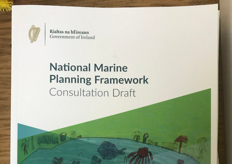
Due to the current situation regarding Covid-19, upcoming public events on the National Marine Planning Framework planned for Kinsale next Monday 23 March and Wexford on Tuesday 31 March have been cancelled.
Department of Housing, Planning and Local Government says its Marine Planning Policy and Development team are available via [email protected] to answer any queries in relation to the draft framework.
The closing date for the receipt of submissions for the public consultation on the draft remains 3pm on the Thursday 9 April.
Marine Spatial Planning Meetings Resume This Evening In Arklow
Public meetings to discuss marine spatial planning and the Government’s draft national framework resume this evening in Arklow, with a focus on offshore renewable energy.
The Arklow Bay Hotel will host the event from 6pm to 8pm, with speakers from the Department of Housing, Planning and Local Government; Department of Communications, Climate Action and Environmental; Sustainable Energy Authority of Ireland (SEAI); and Irish Wind Energy Association (IWEA).
The next event on the calendar is next Monday 17 February, at St Laurence’s in TU Dublin, Grangegorman from 11am to 1pm, with a focus on the marine environment.
Previously postponed events in Killybegs (on fisheries, LYIT School of Tourism), Kinsale (also fisheries, Kinsale Hotel & Spa) and Wexford town (ports and harbours, Wexford Town Library) have been rescheduled for Monday 2 March, Monday 23 March and Tuesday 31 March respectively, all from 6pm to 8pm.
Foreshore Planning: Irish Sailing Urge Sailors to Have a Say at Marine Planning Framework Consultations
As Afloat reported yesterday, the Government launched its Consultation Draft of the National Marine Planning Framework (NMPF). Lead by the Department of Housing, Planning and Local Government (DHPLG), the draft document aims to create a “co-ordinated and coherent approach to decision-making and governance” in respect to marine planning. It includes planning for development proposals by sports, recreation and tourism bodies, which in turn covers the all-important Foreshore Licence.
Applying for a Foreshore Licence
Currently, any change or introduction of infrastructure below the high-water mark, e.g. marinas, pontoons, slipways, moorings, must apply for a Foreshore Licence. The application is divided up between two Departments (Department of Agriculture, Food & the Marine, and the Department of Communications, Climate Action & Environment) and can be a very time consuming, expensive and cumbersome process in some cases taking a number of years to complete which is a deterrent for any provider looking to develop facilities along the foreshore. There is also no link currently to local authority planning. As a result, we have very poor marine infrastructure around our coasts. The aim of the NMPF is to create a more streamlined approach for developing marine infrastructure and link applications and planning to local authorities and county development plans.
Irish Sailing & the Advisory Group
Harry Hermon, CEO of Irish Sailing sits on the Advisory Group working with the DHPLG on the proposed framework. The Advisory Group is made up of representatives from sport, tourism, fisheries, environmental agencies, local government, harbours, energy, and many others with an interest in the marine.
As Hermon describes it “we’ve been advocating continuously on this for many years so that members of the sailing community can work closely with local authorities to develop infrastructure on a county basis. If this goes through, clubs and centres will be able to apply directly to their local authority instead of the cumbersome and convoluted process that exists currently. I urge everyone to attend the Consultation Meetings set up by the Department and have their voices heard”.
Planning Policies
In the 196-page document, there are two key areas that are perhaps most relevant for sailing organisations: the sections on “Sport and Recreation” p.158, and “Tourism” p.168. The sections lay out a series of planning policies which include objectives to increase participation in water-based sports, improve access to marine and coastal resources, and the sustainable development of outdoor recreation facilities.
You can read the full document here
Get Your Voice Heard
The Department has set up regional public events outlined here, and you can read the full list here
|
Date |
Time |
Venue |
|
21/11/2019 |
14:00 – 16:00 |
Greenhills Hotel, Limerick |
|
21/11/2019 |
18:00 – 20:00 |
Greenhills Hotel, Limerick |
|
26/11/2019 |
14:00 – 16:00 |
Town Hall, Westport |
|
26/11/2019 |
18:00 – 20:00 |
Town Hall, Westport |
|
02/12/2019 |
14:00 – 16:00 |
Connaught Hotel, Galway |
|
02/12/2019 |
18:00 – 20:00 |
Connaught Hotel, Galway |
|
10/12/2019 |
14:00 – 16:00 |
Meadowlands Hotel, Tralee |
|
10/12/2019 |
18:00 – 20:00 |
Meadowlands Hotel, Tralee |
Marine Spatial Planning for Ireland: Government Publishes Plan

The steps towards delivering a planning system for the seas around Ireland has been set–out by Government this week.
Minister for Housing, Planning and Local Government Eoghan Murphy and Minister Damien English published the 'roadmap' on Wednesday. 'Towards a Marine Spatial Plan for Ireland' is a 'roadmap' for the development of Ireland’s first marine spatial plan which ultimately aims to balance the different demands for using the sea including the need to protect the marine environment. It's about planning when and where human activities take place at sea. It’s about ensuring these activities are as efficient and sustainable as possible.
As an island nation, with sovereign rights over one of the largest marine areas in Europe, Ireland’s economy, culture and society is inextricably linked to the sea. Our marine environment is a national asset that yields multiple commercial and non-commercial benefits in terms, for example of seafood, tourism, recreation, renewable energy, oil and gas, cultural heritage, and biodiversity. The future sustainable development of our marine area affects many people. In order to create places and spaces where people can work, live and enjoy, those with an interest can have their say in the marine planning process.
Driven by the EU, it will ultimately give local or national authorities new powers beyond the current system of foreshore licensing requirements, effectively introducing a planning system for our seas.
This week's publication 'roadmap' document marks the first stage in the development of Ireland’s marine spatial plan.
Minister Murphy said that:
“Ireland is a maritime nation and we derive so much of our cultural, social and economic identity from our relationship with the seas that surround us. We are fortunate to have one of the largest and richest marine resources of all EU Member States. The Government has set out clear and ambitious objectives under Harnessing Our Ocean Wealth (HOOW) - Ireland’s integrated marine plan - to enable our marine potential to be realised. For example, we aim to double the value of our ocean wealth to 2.4% of GDP by 2030 and increase the turnover from our ocean economy to exceed €6.4bn by 2020. Reaching these goals will mean significant growth in seafood production and aquaculture, maritime transport, marine renewable energy, marine biotechnology and ICT, marine and coastal tourism and leisure. At the same time, we also recognise the importance of our rich marine biodiversity and ecosystems to our ocean wealth. We need a marine spatial plan to provide a coherent strategic spatial framework encompassing all plans and sectoral policies for the marine area that also ensures the sustainable management of our marine environment.”
The MSP for Ireland, which will be developed over the next 3 years, will provide a coherent framework in which specific sectoral policies and objectives can be realised. It is intended to become a decision making tool for regulatory authorities and policy makers into the future in a number of ways including, decisions on individual consent applications which will have to have regard to the provisions of the plan in the same way that terrestrial plans form part of the decision making tool-kit in the on-land planning process. It is also intended to form a key input to the development of future sectoral policies, similar to role of the National Planning Framework, Ireland 2040, in terms of terrestrial sectoral policy development.
Minister English, who has specific responsibility for implementation of the Maritime Spatial Planning Directive, said that:
“a clear framework for MSP, as a parallel to the National Planning Framework, Ireland2040, will bring a new level of coherence to how we plan and manage our marine resource. For example, a marine spatial plan will support sustainable environmental management of marine areas, improved certainty and predictability for private investments, lower transaction costs for maritime businesses and improved competitiveness for our marine sectors, improved use of sea space and coexistence of uses in coastal zones and marine waters. The plan will also ensure that our coastal regions and communities continue to be attractive places to live and work.”


