Menu

Ireland's sailing, boating & maritime magazine

Dublin Bay Boating News and Information

Displaying items by tag: Log Books

Salmon and sea trout anglers who fished during the 2022 season are being reminded to return their logbooks and any unused gill tags at the end of the season.

Inland Fisheries Ireland (IFI) is encouraging such anglers to return their angling logbooks — setting out their fishing and catch record — and any unused gill tags from 2022 if they have finished fishing for this year or once the season has closed.

Under the Wild Salmon and Sea Trout Tagging Scheme, anglers can return these in one of three ways:

  • Using the postage pre-paid business return envelope that was supplied at the time of licence purchase (preferred option).
  • Posting the logbook and unused gill tags to the Inland Fisheries Ireland office address that is displayed on their licence or logbook.
  • Scanning and emailing logbook and licence documents to IFI at [email protected]. Important: if you are choosing this option, please scan all sides of documents, including continuation pages, to ensure that the licence names and number can be correctly linked to the logbook.

On average, 70% of anglers in Ireland return their logbooks and these returns provide vital information regarding the status and management of our wild Atlantic Salmon and Sea Trout stocks into the future.

In accordance with the Wild Salmon and Sea Trout Tagging Scheme, anglers in Ireland are required by law to return their completed logbook and all unused tags to the issuing office of IFI within seven days of licence expiry, and no later than Wednesday 19 October.

As part of the scheme, an angler must attach a valid gill tag to a salmon (any size) or sea trout (over 40cm) harvested, immediately on landing. They must enter details of their catch and/or gill tag used into their logbook.

Questions or queries should be directed to [email protected] and IFI says it will respond as quickly as possible.

Published in Angling

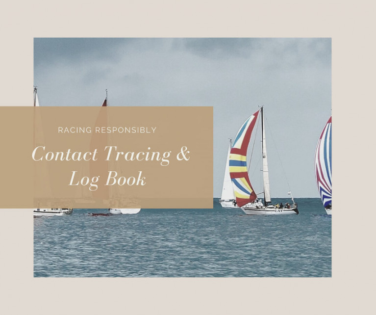
The return of racing at yacht, sailing and boat clubs around Ireland this week is hugely welcomed by all.

But as pointed out on Afloat.ie last Friday, we are being asked to make safety of a new kind our priority while coronavirus remains a threat.

Contact tracing of all crew is a critical part of this in order to prevent any return to lockdown and keep boats on the water this year.

There’s no better way to do this than with a log book from Viking Marine, with plenty of space to record the details of your journeys afloat — including those invited aboard. See the Viking Marine range HERE.

Published in Viking Marine
Tagged under

Dublin Bay

Dublin Bay on the east coast of Ireland stretches over seven kilometres, from Howth Head on its northern tip to Dalkey Island in the south. It's a place most Dubliners simply take for granted, and one of the capital's least visited places. But there's more going on out there than you'd imagine.

The biggest boating centre is at Dun Laoghaire Harbour on the Bay's south shore that is home to over 1,500 pleasure craft, four waterfront yacht clubs and Ireland's largest marina.

The bay is rather shallow with many sandbanks and rocky outcrops, and was notorious in the past for shipwrecks, especially when the wind was from the east. Until modern times, many ships and their passengers were lost along the treacherous coastline from Howth to Dun Laoghaire, less than a kilometre from shore.

The Bay is a C-shaped inlet of the Irish Sea and is about 10 kilometres wide along its north-south base, and 7 km in length to its apex at the centre of the city of Dublin; stretching from Howth Head in the north to Dalkey Point in the south. North Bull Island is situated in the northwest part of the bay, where one of two major inshore sandbanks lie, and features a 5 km long sandy beach, Dollymount Strand, fronting an internationally recognised wildfowl reserve. Many of the rivers of Dublin reach the Irish Sea at Dublin Bay: the River Liffey, with the River Dodder flow received less than 1 km inland, River Tolka, and various smaller rivers and streams.

Dublin Bay FAQs

There are approximately ten beaches and bathing spots around Dublin Bay: Dollymount Strand; Forty Foot Bathing Place; Half Moon bathing spot; Merrion Strand; Bull Wall; Sandycove Beach; Sandymount Strand; Seapoint; Shelley Banks; Sutton, Burrow Beach

There are slipways on the north side of Dublin Bay at Clontarf, Sutton and on the southside at Dun Laoghaire Harbour, and in Dalkey at Coliemore and Bulloch Harbours.

Dublin Bay is administered by a number of Government Departments, three local authorities and several statutory agencies. Dublin Port Company is in charge of navigation on the Bay.

Dublin Bay is approximately 70 sq kilometres or 7,000 hectares. The Bay is about 10 kilometres wide along its north-south base, and seven km in length east-west to its peak at the centre of the city of Dublin; stretching from Howth Head in the north to Dalkey Point in the south.

Dun Laoghaire Harbour on the southside of the Bay has an East and West Pier, each one kilometre long; this is one of the largest human-made harbours in the world. There also piers or walls at the entrance to the River Liffey at Dublin city known as the Great North and South Walls. Other harbours on the Bay include Bulloch Harbour and Coliemore Harbours both at Dalkey.

There are two marinas on Dublin Bay. Ireland's largest marina with over 800 berths is on the southern shore at Dun Laoghaire Harbour. The other is at Poolbeg Yacht and Boat Club on the River Liffey close to Dublin City.

Car and passenger Ferries operate from Dublin Port to the UK, Isle of Man and France. A passenger ferry operates from Dun Laoghaire Harbour to Howth as well as providing tourist voyages around the bay.

Dublin Bay has two Islands. Bull Island at Clontarf and Dalkey Island on the southern shore of the Bay.

The River Liffey flows through Dublin city and into the Bay. Its tributaries include the River Dodder, the River Poddle and the River Camac.

Dollymount, Burrow and Seapoint beaches

Approximately 1,500 boats from small dinghies to motorboats to ocean-going yachts. The vast majority, over 1,000, are moored at Dun Laoghaire Harbour which is Ireland's boating capital.

In 1981, UNESCO recognised the importance of Dublin Bay by designating North Bull Island as a Biosphere because of its rare and internationally important habitats and species of wildlife. To support sustainable development, UNESCO’s concept of a Biosphere has evolved to include not just areas of ecological value but also the areas around them and the communities that live and work within these areas. There have since been additional international and national designations, covering much of Dublin Bay, to ensure the protection of its water quality and biodiversity. To fulfil these broader management aims for the ecosystem, the Biosphere was expanded in 2015. The Biosphere now covers Dublin Bay, reflecting its significant environmental, economic, cultural and tourism importance, and extends to over 300km² to include the bay, the shore and nearby residential areas.

On the Southside at Dun Laoghaire, there is the National Yacht Club, Royal St. George Yacht Club, Royal Irish Yacht Club and Dun Laoghaire Motor Yacht Club as well as Dublin Bay Sailing Club. In the city centre, there is Poolbeg Yacht and Boat Club. On the Northside of Dublin, there is Clontarf Yacht and Boat Club and Sutton Dinghy Club. While not on Dublin Bay, Howth Yacht Club is the major north Dublin Sailing centre.

© Afloat 2020