Menu

Ireland's sailing, boating & maritime magazine

Dublin Bay Boating News and Information

Displaying items by tag: PRIMROSE

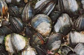
#Shellfish - Predicting risk and impact of harmful algal bloom events that cause impact to the shellfish aquaculture sector (PRIMROSE) is a new €2.7-million marine science project led by the Marine Institute.

The project is funded by the Interreg Atlantic Area Operational Programme and includes 10 research and SME partners from five countries along the Atlantic Arc from southern Spain to the Shetland Islands.

During the next three years, the PRIMROSE project will form a network of scientists and industry members to produce an inter-regional toxin and microbiological advisory and forecasting capability to the European aquaculture industry.

“The project will produce applications based on reusing existing monitoring data, modelled coastal hydrodynamics, satellite and other novel aerial observations, meteorological, historical and recent trend data to predict and give early warning of toxic blooms and elevated microbiological events,” said project coordinator Joe Silke, from the Marine Institute.

“This will allow fish and shellfish farmers to adapt their culture and harvesting practices in time, in order to reduce potential losses.”

The Marine Institute will implement the lead role of co-ordinating the project and ensure that all the work packages, actions, deliverables and results are achieved.

Already a strong partnership approach has been established during the project preparation. By consolidating and further developing the regional knowledge capital that exists, the consortium is confident of a successful outcome.

Partners will participate in a suite of six work packages and will develop a sustainable product that will be largely automated to predict and produce regular published reports for the long term once the project is finished.

In recent years, there has been much discussion of satellites being able to track surface algal blooms. Understanding biological phenomena in the ocean requires a complex approach, though there is some merit in using satellite derived chlorophyll images to delineate high biomass near surface algal blooms.

Much cutting edge harmful algal bloom research work has focused on subsurface profiles, where certain species are present in thin layers of limited geographical extent often associated with strong density interfaces. Phytoplankton blooms, micro-algal blooms, toxic algae, red tides, or harmful algae, are all terms for naturally occurring phenomena.

Clearly, in order for a toxic, harmful algal bloom, or a microbiological forecast to be realistic, physical factors including changes in water column structure and transport pathways are necessary.

“PRIMROSE is the next step towards providing an operational advisory service by integrating physical oceanographic drivers with a variety of biotoxin, phytoplankton count and microbiological data,” said Silke. “A distributed advisory service and a network of thematic experts distributed across the participating countries will then network to provide regular advisory products and forecasts of impending toxic and harmful algal events.”

PRIMROSE brings together experts in the areas of modelling, Earth observation, harmful algal bloom and microbiological monitoring programmes and end users to assemble a number of key data sets and build upon and explore new forecasting options.

The consortium includes three UK partners (Seafood Shetland, Scottish Association for Marine Science and Plymouth Marine Lab) two Irish partners (Marine Institute and Bantry Marine Research Station), one partner in France (IFREMER), three in Spain (AZTI, Instituto Oceanographico Espanol and AGAPA) and one in Portugal (Institute Technico Superior/University of Lisboa).

The Marine Institute recently issued a recruitment call for a data analyst and project co-ordinator for the PRIMROSE project, as previously reported on Afloat.ie.

Published in Marine Science

Dublin Bay

Dublin Bay on the east coast of Ireland stretches over seven kilometres, from Howth Head on its northern tip to Dalkey Island in the south. It's a place most Dubliners simply take for granted, and one of the capital's least visited places. But there's more going on out there than you'd imagine.

The biggest boating centre is at Dun Laoghaire Harbour on the Bay's south shore that is home to over 1,500 pleasure craft, four waterfront yacht clubs and Ireland's largest marina.

The bay is rather shallow with many sandbanks and rocky outcrops, and was notorious in the past for shipwrecks, especially when the wind was from the east. Until modern times, many ships and their passengers were lost along the treacherous coastline from Howth to Dun Laoghaire, less than a kilometre from shore.

The Bay is a C-shaped inlet of the Irish Sea and is about 10 kilometres wide along its north-south base, and 7 km in length to its apex at the centre of the city of Dublin; stretching from Howth Head in the north to Dalkey Point in the south. North Bull Island is situated in the northwest part of the bay, where one of two major inshore sandbanks lie, and features a 5 km long sandy beach, Dollymount Strand, fronting an internationally recognised wildfowl reserve. Many of the rivers of Dublin reach the Irish Sea at Dublin Bay: the River Liffey, with the River Dodder flow received less than 1 km inland, River Tolka, and various smaller rivers and streams.

Dublin Bay FAQs

There are approximately ten beaches and bathing spots around Dublin Bay: Dollymount Strand; Forty Foot Bathing Place; Half Moon bathing spot; Merrion Strand; Bull Wall; Sandycove Beach; Sandymount Strand; Seapoint; Shelley Banks; Sutton, Burrow Beach

There are slipways on the north side of Dublin Bay at Clontarf, Sutton and on the southside at Dun Laoghaire Harbour, and in Dalkey at Coliemore and Bulloch Harbours.

Dublin Bay is administered by a number of Government Departments, three local authorities and several statutory agencies. Dublin Port Company is in charge of navigation on the Bay.

Dublin Bay is approximately 70 sq kilometres or 7,000 hectares. The Bay is about 10 kilometres wide along its north-south base, and seven km in length east-west to its peak at the centre of the city of Dublin; stretching from Howth Head in the north to Dalkey Point in the south.

Dun Laoghaire Harbour on the southside of the Bay has an East and West Pier, each one kilometre long; this is one of the largest human-made harbours in the world. There also piers or walls at the entrance to the River Liffey at Dublin city known as the Great North and South Walls. Other harbours on the Bay include Bulloch Harbour and Coliemore Harbours both at Dalkey.

There are two marinas on Dublin Bay. Ireland's largest marina with over 800 berths is on the southern shore at Dun Laoghaire Harbour. The other is at Poolbeg Yacht and Boat Club on the River Liffey close to Dublin City.

Car and passenger Ferries operate from Dublin Port to the UK, Isle of Man and France. A passenger ferry operates from Dun Laoghaire Harbour to Howth as well as providing tourist voyages around the bay.

Dublin Bay has two Islands. Bull Island at Clontarf and Dalkey Island on the southern shore of the Bay.

The River Liffey flows through Dublin city and into the Bay. Its tributaries include the River Dodder, the River Poddle and the River Camac.

Dollymount, Burrow and Seapoint beaches

Approximately 1,500 boats from small dinghies to motorboats to ocean-going yachts. The vast majority, over 1,000, are moored at Dun Laoghaire Harbour which is Ireland's boating capital.

In 1981, UNESCO recognised the importance of Dublin Bay by designating North Bull Island as a Biosphere because of its rare and internationally important habitats and species of wildlife. To support sustainable development, UNESCO’s concept of a Biosphere has evolved to include not just areas of ecological value but also the areas around them and the communities that live and work within these areas. There have since been additional international and national designations, covering much of Dublin Bay, to ensure the protection of its water quality and biodiversity. To fulfil these broader management aims for the ecosystem, the Biosphere was expanded in 2015. The Biosphere now covers Dublin Bay, reflecting its significant environmental, economic, cultural and tourism importance, and extends to over 300km² to include the bay, the shore and nearby residential areas.

On the Southside at Dun Laoghaire, there is the National Yacht Club, Royal St. George Yacht Club, Royal Irish Yacht Club and Dun Laoghaire Motor Yacht Club as well as Dublin Bay Sailing Club. In the city centre, there is Poolbeg Yacht and Boat Club. On the Northside of Dublin, there is Clontarf Yacht and Boat Club and Sutton Dinghy Club. While not on Dublin Bay, Howth Yacht Club is the major north Dublin Sailing centre.

© Afloat 2020