


Displaying items by tag: Captain Bligh
Captains Cook and Bligh and Their Place in Valentine's Day Maritime History
February the 14th is mostly known as Valentine’s Day, but it has a significance in maritime history far removed from romantic exploits – other, of course, than the romanticism of sailing the seas…..!
In 1813, it was the day when the first-ever United States Naval warship rounded the legendary Cape Horn and entered the Pacific Ocean. This was the frigate Essex, commanded by Capt. David Porter, and that was thirty-five years after Valentine’s Day in 1778 when the legendary Paul Jones, he of the US Navy during the Revolutionary War or ‘the American War of Independence’ against Britain, however, you wish to view it, took the first-ever salute to the Stars and Stripes flag of the United States in a European country. That took place at Quiberon when the French supported the States in their war against the British in America ….. He was in command of the US-flagged sloop-of-war, the Ranger, in which he had raided British waters, captured several merchant ships and caused chaos for the Royal Navy which sought, but failed to catch him in the Irish Sea.
On another Valentine’s Day, in 1840, officers from the USS Vincennes, a 703-ton Boston-class sloop-of-war, then at peace, were exploring the Antarctic and officers from it made the first landing on a piece of floating ice.
Those were all sailing ships of the time and, sails needing masts to fly them aloft, a problem in that regard would lead to a tragedy on yet another Valentine’s Day, particularly noted in maritime history for the killing of maritime legend Captain James Cook, the great navigator, on February 14, 1779.
Cook led three voyages charting areas of the globe for Great Britain. On his third and what proved to be, final voyage, he got to the Islands of Hawaii, which he had first sighted over a year before he was killed there…….. After being around there for over a year, the natives who had first welcomed his expedition got tired of the British as the British did of the natives… As the two ships of the expedition – HMS Resolution and HMS Discovery eventually headed for home, gales damaged the mainmast of the Resolution so badly that it could fly enough sail and it had to return to Kealakekua Bay in the Hawaii Islands…..
What happened then is described by an officer in the ship’s official log:
“Our return to this bay was as disagreeable to us as it was to the inhabitants, for we were tired of each other. They had been oppressed and were weary of our alliance...It was evident from the looks of the natives as well as every other appearance that our friendship was now at an end…”
While the Resolution was anchored in the Bay, the Hawaiians had allegedly begun stealing from the foreigners. One of the ship’s two longboats were stolen. To try to obtain its return, Cook and his men attempted to kidnap the Chief of Hawaii. That was a bad decision.
The Chief, given to understand he was being invited to the ship headed off with Cook and his men, his sons following. But his wife was more perceptive of the British and suspected otherwise that he was being abducted… A confrontation followed in which crowds of natives faced Cook and his men. When the Chief refused to go further down the beach to a ship’s boarding boat, Cook and his men aimed their guns at the natives. With the flat of his sword, Cook struck Chief Kana-ina who then grappled with him and struck the navigator on the head with a shark-toothed club he was carrying.
Cook fell to the sand. A melee developed, and Cook was fatally stabbed. His sailors and marines opened fire on the natives. Four marines were killed, others injured as they retreated to their landing boat to get back to the Resolution. Natives were also killed, thought to include the Island’s Chief.
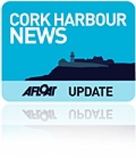
 A photo of the painting ‘Death of Captain Cook’ is described as being by an eyewitness, John Webber
A young officer on watch duty aboard the Resolution, that Valentine’s Day in the Hawaii islands was William Bligh who would become Captain of HMS Bounty and also a major part of maritime history. He claimed to have seen Cook's dead body dragged up the beach to a hill where it was torn to pieces by the natives.
As Captain, Bligh had a reputation for a volatile temper, often clashing with fellow officers and crewmen. On April 28, 1789, near Tahiti, the crew of the Bounty mutinied against him.
 A 1790 aquatint by Robert Dodd envisages the Bounty mutineers setting William Bligh and 18 supporters adrift via Wikipaedia
Poolbeg Yacht Club to host Lecture on "Captain Bligh"

#LECTURE – Captain Bligh is the topic of the next lecture organised by the Dublin Bay Old Gaffers Association, held in the Poolbeg Yacht & Boat Club, Dublin Port on 20 November.
The illustrated talk (8pm) is to be presented by Sean Cullen, Senior Hydrographer, INFOMAR and whose predecessor was the Irish National Seabed Survey.
In addition limited copies of a new stunning publication "Warships, U-Boats & Liners - A Guide to Shipwrecks Mapped in Irish Waters" will be made available to purchase. The book which was launched today, showcases some of the more spectacular and important shipwrecks in Irish waters.
All are welcome to attend the DBOGA lecture programme noting there will be a door contribution for the RNLI.
The 162 gross tonnes tug had served a career of nearly three decades in Dublin Port, after entering service in 1972. Prior to working in Irish waters the 100ft tug spent the previous decade operating in the UK as Appelsider for Lawson-Batey Tugs Ltd who chartered her to Tyne Tugs Ltd. For historical record and photos click HERE.
In 1998 the Dublin Port Company disposed of the Coliemore alongside her running mate Clontarf (1963/178grt) the former Cluain Tarbh, also built from the same Yorkshire shipyard on the banks of the River Humber.
Initially they were towed to Liverpool but they later appeared at Cork Dockyard in 1999. The Clontarf remained there for a year until she was sold to Barcazas Dominicia SA, Santo Domingo in the Dominican Republic. For photo of the tug in far distant waters click HERE. It was intended Coliemore would follow her Caribbean counterpart but her sale fell-through.
The vessel's ownership eventually transferred to Cork Dockyard where her scrap value will pay for her long-term berthing fees. The tug recently made her final short journey under tow from her berth at the former Verolme Cork Dockyard (VCD) to the facilities slipway where work to break-up the vessel began.
Coliemore and her fleet-mates were given the traditional naming theme of Dublin Bay coastal suburbs spelt in Irish. The naming policy was used by the Dublin Ports & Docks Board (DP&DB) which operated the fleet remained until transferred to the Dublin Port Company established in 1997.
The last tugs to carry the traditional names, Ben Eadar (Howth), Cluain Tarbh (Clontarf) and Deilginis (Dalkey) are now up laid-up awaiting to be sold, to read more click HERE.
Between the 14-16th centuries Dalkey Sound became increasingly important as larger vessels with deeper drafts could no longer enter the port in Dublin due to the dangers of constantly shifting sandbanks and swallow channels in Dublin Bay.
The nearest alternative was for vessels to anchor off Dalkey Island and in the relative shelter of Dalkey Sound where cargoes for the capital where transferred to and fro by lighters to the coastline along Dalkey at Coliemore, which became the principle port for Dublin. Some of the cargo was stored temporally in the medieval castles in Dalkey, otherwise it was directly transported by horse and cart across the plateau to the city.
It was not until the 17th century that the issue of accessing the port of Dublin was resolved, with the completion of the harbour walls that enabled shipping to return on a frequent basis. Captain Bligh of the 'Mutiny on the Bounty' completed mapping Dublin Bay in 1803 which became the most accurate chart at the time and this aided to the safety of mariners.
The fortunes of Dublin's shipping trade increased due to the combination of an easier and safer navigational channel and deeper depths along the quaysides. This led to the eventual demise of shipping using Dalkey. The present-day harbour structure at Coliemore Harbour was constructed in 1868 and is home to a humble fleet of recreational boats and a passenger-ferry service to the island.
- Howth
- Dublin Bay
- Dublin Port
- Clontarf
- Dublin Port Company
- dalkey
- coliemore harbour
- Dalkey Island
- Port of Dublin
- Ports and Shipping News
- Cork Harbour News
- Verolme Cork Dockyard
- VCD
- Dalkey Sound
- Mutiny on the Bounty
- Dublin Port Tugs
- Deilginis
- Captain Bligh
- Dublin port tugs for sale
- Coliemore
- Coliemore tug
- Cork Dockyard
- Cork Dockyard Rushbrooke
- Cluain Tarbh tug
- Ben Eadar tug
- Deilginis tug
- Richard Dunston (Hessle) Yorkshire
- River Humber
- Dublin Ports & Docks Board
- DP & DB
- Cork Dockyard shiprepairers
- Irish shipbuilding


 Sarah Phelan (6 yrs) and Sophie Costello (8 yrs)")
 totalled 227 tonnes in Q4, 2022 and in the same quarter for last year, it amounted to 246, an increase of 8 %.")
 has launched four new container vessels in a bid to drive sustainability across the shipping centre. The newbuild quartet, named to reflect their striking colours, BG Green (in service, with ‘scrubber’ at the stern), BG Blue, BG Red, and BG Orange, uses state-of-the-art scrubbers and is designed to help its customers significantly reduce carbon emissions.")


, at the sod-turning event for the new Deep Water Quay Development at the Rossaveal Fishery Harbour Centre. (Forbairt Ché Dhomhain, Lárionad Chuan Iascaigh Ros An Mhíl) in February")

: helm Nathan Burke, station mechanic and coxswain Kieran ‘Colley’ O’Connell and helm Gary Hayes")
