Menu

Ireland's sailing, boating & maritime magazine

Inland afloat headers


Displaying items by tag: Irish Lights

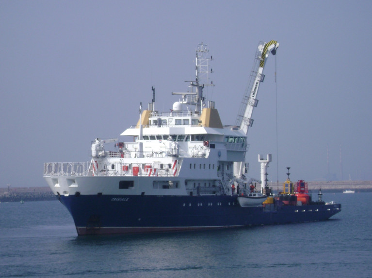
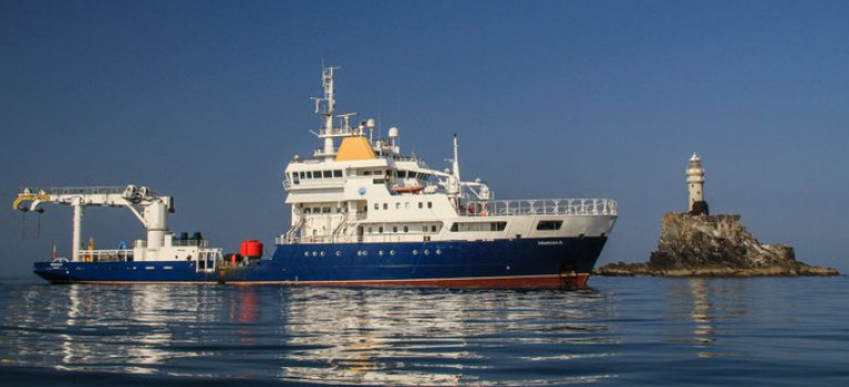
A vacancy at sea is sought from the Commissioners of Irish Lights for the position of an Operations Officer on board their aids to navigation management and maintenance tender ILV Granuaile.

The role in Irish Lights will be both challenging and rewarding role based on the multi-purpose and dynamic positioning system (DP) Class 1 vessel ILV Granuaile.

Afloat adds the Irish flagged ILV Granuaile built in 2000 has along its 80m length an aft work deck and associated 20-tonne crane in addition at the fo'c'sle a heli-deck. The 2,625 gross tonnage ship's homeport is Dun Laoghaire Harbour and location of CIL's head office and adjoining marine depot facility.

For much more details on the ship, the role of the vacancy and requirement to apply, click here and the Candidate Briefing Pack (download) for further information.

Closing date for applications is Friday, 30 October 2020.

Applicants should apply by emailing a CV and cover letter to Susan Murdock at [email protected]

Note in addition CIL currently includes a Vacancy for Data Analyst - eNavigation and Maritime Services, for more click here.

Published in Jobs

All three General Lighthouse Authorities (GLA) of the UK and Ireland - Trinity House, the Northern Lighthouse Board and Irish Lights - will discontinue their Differential GPS (DGPS) service in March 2022.

The GLAs made this decision after carefully considering the results from an extensive consultation carried out with stakeholders and service users. They will cease transmission of the signal after 31 March 2022.

It was in 1995 that the GLAs introduced DGPS as part of the mix of marine aids to navigation (AtoN) provided to safeguard mariners within their combined waters and to help protect the environment. The system became fully operational in 1997. The system consists of 14 DGPS reference stations, six far-field monitoring sites and three monitoring and control sites. The system is operated as a single AtoN, operated and maintained by the three GLAs.

Dr Alan Grant, GLA DGPS System Director, said: “After careful consideration of the results of the consultation process, the three GLAs have concluded that their DGPS system is now redundant. Today’s GNSS are able to meet all but the most stringent accuracy requirements, and position integrity can be provided by alternative means (RAIM or other visual and electronic aids to navigation).

“The GLAs recognise the need to provide adequate notice and support continuity of service going forward. As such, the DGPS system will remain operational until 31 March 2022, at which point the signals will cease.”

Background

Marine radiobeacon DGPS was developed by the GLAs to counter Selective Availability (SA), a deliberate error added to the civilian GPS service to degrade its positional accuracy. The DGPS correction to the position error meant an improvement in accuracy from approximately 50m to around 5m.

In addition to improving the estimated position accuracy, by assessing whether the error is within a given threshold, the reference station is able to monitor the performance of the GPS constellation and identify any faults. Faulty satellites are removed from the position solution, providing position integrity for the mariner.

SA was discontinued in 2000 and GPS now offers the civilian user a position accurate to around 3-5m. DGPS still improves positional accuracy - now enabling positions in the region of 1-2m - but it is the position integrity function that is most often cited as the main benefit of DGPS.

While marine radiobeacon DGPS is not mandated by the International Maritime Organization for carriage on SOLAS vessels, it is provided for in all maritime receiver standards and the spectrum is allocated internationally.

Consultation 

The infrastructure required to run the service is approaching the end of its design life; the GLAs conducted a stakeholder consultation to assess the requirements for the service going forward, surveying and interviewing stakeholders from across the maritime sector and beyond.

Of the responses received, 86% were from mariners and maritime operators, operating a wide range of vessels including ferries, container ships, tankers, liquid natural gas carriers, bulk carriers and leisure craft.

The survey resulted in a mix of responses, with the majority of mariners reporting that they use the DGPS system for accuracy improvements and integrity, while others reported that they do not use it.

All mariners reported using GPS today with around 40% also making use of GLONASS, and around 9% using Galileo too. From the response received, it is expected that more mariners will move to multi-constellation receivers, making use of GPS, GLONASS, Galileo and BeiDou over the next five to ten years.

Maritime Safety 

Following a change in maritime receiver standards in 2003, all receivers now include Receiver Autonomous Integrity Monitoring (RAIM). RAIM is a means of determining whether the resulting position estimate is safe to use through an algorithm within the receiver.

Differential corrections are also available from other sources, including Satellite Based Augmentation Systems (SBAS), which are primarily provided for aviation users. Work is under way in Europe to introduce a maritime service to EGNOS, the European SBAS. This service is expected to be available around 2022.

Vessels that need high accuracy position and integrity for operations mainly utilise a number of commercial satellite-based services; the decision to discontinue DGPS has no operational impact on these services.

The GLAs advise mariners to consider their use of DGPS and to plan for its discontinuance accordingly. Mariners should check their GNSS receiver(s) to confirm the presence of RAIM and consider upgrading to type-approved SBAS receiving equipment when available.

The GLAs encourage mariners to use all available AtoN - whether visual or electronic - to support their safe passage and the protection of the environment.

To download a PDF copy of the full DGPS article by Dr Alan Grant click here

Published in Lighthouses

Numbering a handful of men that still tend Ireland's lighthouses, but a move, writes Independent.ie, to renewable energy is bringing their unique way of life to an close.

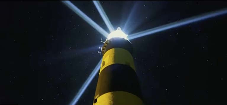
'I can think of no other edifice constructed by man as altruistic as a lighthouse," George Bernard Shaw once said. "They were built only to serve."

Even after the leap in navigational technology represented by GPS, they maintain that historical function: shining a light for miles around, warning sailors and ships of dangers lurking beneath the surface.

The way they are powered is changing, though, and with it the work of the people who tend them.

The tradition of constantly manned lighthouses ended on March 24, 1997, but the lightkeepers' cottages are still inhabited for weeks at a time by maintenance staff who service the lights' diesel-powered motors.

Today, Irish Lights workers travel to sites including Fastnet Rock off Co Cork, Tuskar Rock off Co Wexford, Inishtrahull Island off Co Donegal, Slyne Head off Clifden in Co Galway and Kish Tower in Dublin Bay.

By 2025, however, all lighthouses, beacons and buoys dotted around the coast and in Irish waters will be powered by renewables. The amount of work for technicians who stay at remote lighthouses will fall.

To read more here including from Yvonne Shields O'Connor, chief executive of Irish Lights which is withdrawing from lighthouses' accommodation quarters.

Published in Lighthouses

Transportation by sea is the most important means of connecting Ireland to international markets, according to one of Ireland’s leading maritime authorities.

Speaking on IALA World Aids to Navigation Day (AtoN) on Wednesday, July 1, the CEO of Irish Lights, the organisation responsible for delivering maritime safety services on an all-island basis, highlighted that maritime transport accounts for more than 90% of Ireland’s international trade, in volume terms.

(Afloat adds that IALA is an organisation of the International Association of Marine Aids to Navigation and Lighthouse Authorities). 

“Food, fuel, medical supplies and other essential goods are transported by sea, and as an island nation, Ireland’s dependence on open, safe maritime channels cannot be overstated. This was particularly evident through the recent Covid-19 pandemic,” said Yvonne Shields O'Connor.

Irish Lights, the organisation responsible for safe navigation at sea, uses its network of lighthouses, beacons, buoys and virtual and electronic Aids to Navigation to ensure safe passage. Both onshore and at sea, Aids to navigation, also known as AtoN, are critical to navigation and enhance safety and provide security to marine users, from large vessels transporting essential goods, to fishing and leisure users and more.

“Our seafood industry contributes €1.22 billion to Irish GDP and is a vital part of our coastal economy. Aids to Navigation are critical to the safe operation of over 2,300 fishing vessels registered in Ireland and Northern Ireland and many more foreign vessels working in our waters.The leisure fleet returning to the water following the Covid-19 restrictions is heavily dependent on the Aids to Navigation provided by Irish Lights and by Local Lighthouse Authorities such as County Councils, Ports and Harbours,” said Ms Shields O’Connor.

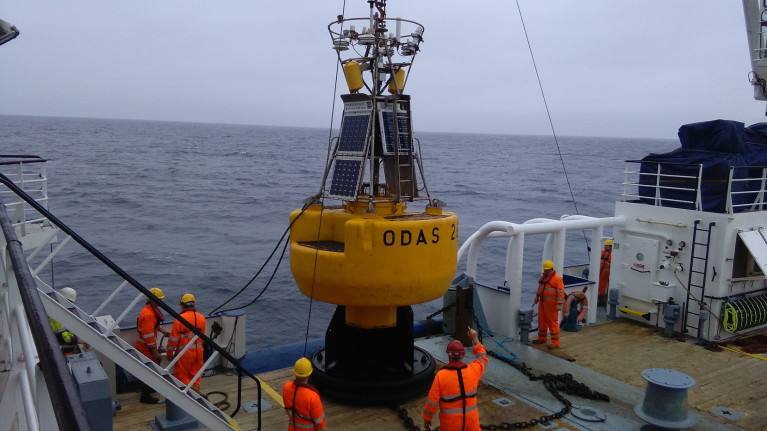
Aids to Navigation today are a technologically advanced mix of visual aids such as lighthouses, buoys, and beacons; and electronic aids such as Radar Beacons (Racon), Automatic Identification Systems (AIS) and Differential GPS (DGPS). The use of solar, battery and LED technology is facilitating improved services to the mariner and the use of renewable energy for our AtoN systems.

Keeping maritime channels operating effectively will continue to be ever more important as economic activity increases and as tourism and leisure intensifies over the summer.

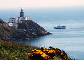
A great summer activity to consider is a visit to one of Irish Lights lighthouses, all of which are functioning Aids to Navigation.

There are 14 Lighthouses accessible to the public through the Great Lighthouses of Ireland partnership www.greatlighthouses.com Irish Lights works hard to ensure that these sites, together with our modern buoys, beacons and radio AtoN, will continue to provide a range of technologically relevant services to all mariners.

Published in Lighthouses

The national crisis has brought an increasing focus and appreciation of just how vital the role of lighthouses and essential maritime safety services is to maintain the security of supply chains and the commercial survival of our island, say the Commissioners of Irish Lights.

The organisation has made a video to pay tribute to health care colleagues as part of tonight's RTÉ's #ShineYourLight / #LonraighdoSholas campaign that asks that we come together as a country in this time of darkness to shine a light in our homes and show that light really can reach us all.

Everyone is encouraged to shine a light at 9 pm, 11 April to acknowledge their tremendous and heroic work.

Published in Lighthouses

The Commissioners of Irish Lights continues to provide essential services to maritime trade for Ireland, north and south during the Covid-19 crisis. 

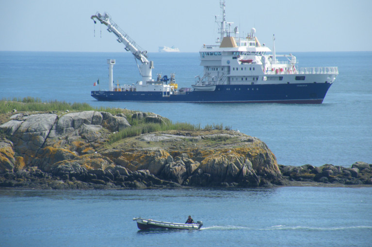
In an update yesterday on operational activity, Irish Lights announced that their ILV Granuaile and coastal teams provide important maintenance for marine aids to navigation, vital for the safe movement of food, fuel, medical, hygiene and other supplies.

Our 24-hour emergency number remains open as always in the event of a need to report an aid to navigation that is not functioning correctly – +353 (1) 2801996.

In line with government advice in relation to a range of public health and safety measures to delay the spread of the COVID-19 virus, Irish Lights has put in place working arrangements to protect our employees and to keep them safe, while at the same time continuing to allow us to deliver our essential safety at sea services.

The Irish Lights facility in Dun Laoghaire Harbour is open on a restricted-access basis. The office and buoy yard remains accessible for essential operational requirements, and will continue to support the work of Irish Lights around the coast and at sea. Deliveries will be accepted, please phone ahead to reception at 01 271 5400 in advance.

Business operations continue with the majority of our employees working from home. They can be contacted as normal by email or phone.

Essential maintenance and outage response work continues around the coast, and revised health and safety measures have been put in place for the protection of employees working in coastal locations. ILV Granuaile operations and essential buoy maintenance work, outage response, and wreck response continue. Extra precautions are being undertaken to ensure optimal health and safety standards on the vessel.

Requirements are being reviewed on an ongoing basis, please see CIL's website or Twitter for further updates.

The next Glenua lecture is to be held this coming Thursday 6th February (and not the following week as previously advertised). 

The venue will be at Poolbeg Yacht & Boat Club, Ringsend, Dublin and where an entry contribution of €5 will be in aid of the RNLI.

The subject of the lecture (starting at 20.00) is: “The Fastnet Lighthouse - history, evolution and iconic status”

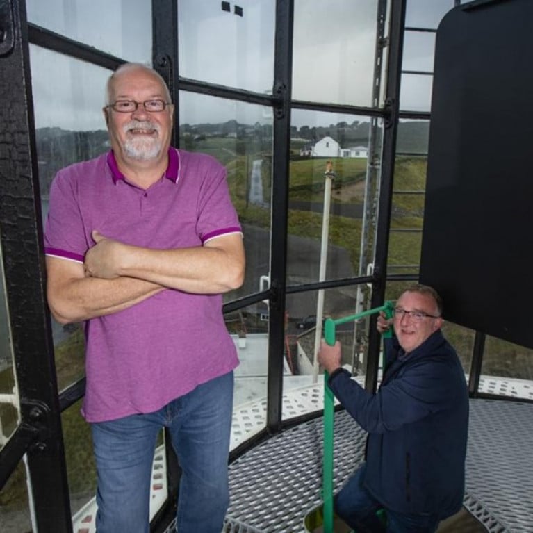
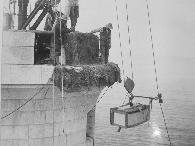
The speaker is Alan McCann who worked as an engineer for over twenty years for the Commissioners of Irish Lights. He has extensive knowledge of the history and technical evolution of Irish lighthouses. His engineering experience includes the design, installation and maintenance of both lighthouse equipment and floating aids. He was heavily involved in the automation of the Fastnet in the late 1980's.

Fastnet is the tallest and widest rock lighthouse tower in Ireland and Great Britain. It was a monumental achievement when completed in 1904. The graceful upward curve of the new lighthouse is composed of more than 2,000 interlocking granite blocks quarried in Cornwall. It is still a vital navigational aid, despite automation in 1989. Its iconic status is undiminished, not least because of the biennial Fastnet Yacht Race which in 1979 was the occasion of the greatest yacht-racing disaster ever witnessed.

Alan’s illustrated talk will trace the architectural and navigational evolution of the Fastnet rock tower from the 1850's to the present day. He will cover, not only the technology but also the arduous life of the people involved, especially that of the resident colony of up to twenty-two workers, building the new lighthouse over 7 seasons and the subsequent generations of light-keepers.

Published in Dublin Bay

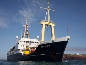
Irish Lights counterpart serving the waters of England, Wales and the Channel Islands, Trinity House has launched a Vessel Replacement Project to commission the design and build of a vessel to replace THV Patricia. The vessel was delivered in 1982 and is reaching the end of its operational life.

The announcement was made at a launch event at Trinity House in London yesterday, during London International Shipping Week (LISW19). Attending the event was Maritime Minister Nusrat Ghani and where a contract notice was issued to the shipbuilding industry to open the procurement process.

The Minister announced her support for the project in July 2019, following a comprehensive Fleet Review that concluded that the three General Lighthouse Authorities of the UK and Ireland (Trinity House, Northern Lighthouse Board and Irish Lights) require seven vessels to deliver their critical aids to navigation service.

The new vessel will look to harness technological and environmental innovation to ensure that Trinity House continues to provide over 600 critical aids to navigation—such as lighthouses and buoys—for ships and seafarers in some of the most dangerous waters in the world, guiding them into safe channels away from hazards and wrecks.

Nusrat Ghani, Maritime Minister, said: “95% of our imports and exports are transported to and from the UK by sea and, with our waters becoming even busier, dealing with incidents quickly and efficiently is more important than ever. This new ship will support the General Lighthouse Authority to help future-proof their fleet and continue to support maritime trade for generations to come.”

Captain Ian McNaught, Executive Chairman of Trinity House, said: “We were pleased to hear that the Maritime Minister was content for us to move the Vessel Replacement Project closer towards the design and build phase. While we must ensure that value for money is central to the design, we will also be looking for new, tested and robust technologies in the vessel design; these technologies will need to offer high performance and resilience and also reduce our environmental impact.”

Published in Lighthouses

The General Lighthouse Authority which is responsible for England, Wales, Channel Islands and Gibraltar, Trinity House is joining aids to navigation authorities around the world to mark the first ever World Marine Aids to Navigation Day held today, July 1st.

In addition to Trinity House, Afloat adds the other GLA counterparts are the Commissioners of Irish Lights and the Northern Lighthouse Board responsible for Scottish waters and the Isle of Man. Today's inaugural event is established to celebrate and promote the role of marine aids to navigation (AtoNs) and highlight the importance of safety at sea.

The body behind the day is IALA (the International Association of Marine Aids to Navigation and Lighthouse Authorities), a non-profit international technical association established in 1957 to gather together marine aids to navigation authorities, manufacturers, consultants and scientific and training institutes from all parts of the world.

IALA’s 305 members—whether national or industrial—assemble across a number of committees and working groups to exchange and compare their experiences and achievements, with a view to drafting and publishing IALA Standards, Recommendations and Guidelines.

The aim of IALA—to which Trinity House subscribes and contributes—is to foster the safe, economic and efficient movement of vessels, through improvement and harmonisation of aids to navigation worldwide and other appropriate means, for the benefit of the maritime community and the protection of the environment. Trinity House was a founding member of IALA in 1957.

The idea of launching the World Marine Aids to Navigation Day annually on 1 July was agreed at IALA’s 2018 conference in the Republic of Korea.

As a focal point for highlighting the importance of aids to navigation as a service for all mariners, Trinity House has chosen to emphasise its statutory duty as an auditor and inspector of local aids to navigation, rather than its more well-known duty as a provider of general aids to navigation such as lighthouses, lightvessels and buoys.

Local aids to navigation are owned and operated by Local Lighthouse Authorities rather than Trinity House, but the powers and duties granted to Trinity House by the Merchant Shipping Act 1995 require it to audit and inspect over 11,000 local AtoNs. The work is carried out by Trinity House’s Inspector of Seamarks and the Local AtoN Manager, both of whom enjoy meeting local operators and seeing so many often-hidden corners of the nation.

Inspector of Seamarks Captain Graeme Proctor says of the cyclical inspection schedule: “It’s a lot like painting the Forth Bridge, but I really enjoy meeting local Harbour Masters and their teams. It is hard work and a lot of long days, but there will often be a cup of tea waiting for me in the harbour office in the winter and we do enjoy an ice cream by the seaside in the summer months. Although it may not be the most famous of Trinity House’s contributions to maritime Britain, it’s a vital role for safety and is great for keeping us in touch with local aids to navigation providers and the marine users themselves.”

Maritime Minister Nusrat Ghani said: “Lighthouses have a place in all of our hearts but their longstanding role can never be underestimated. Aids to navigation are crucial to keeping people safe at sea, alerting them to potential dangers. Our lighthouse authorities, including Trinity House, do a fantastic job of keeping our lighthouses, buoys and other assistance vessels in good condition around the clock.”

Trinity House and IALA encourage everyone with an appreciation of the various types of marine aid to navigation to take to social media to share their favourite AtoNs with #WAtoNDay.

Published in Lighthouses

#lighthouses -  Contributory feedback from marine users of navigational aids is been sought from Irish Lights of its Aids to Navigation provision around the coasts of Ireland. 

Every five years, the General Lighthouse Authorities (GLA), comprising Irish Lights, Northern Lighthouse Board and Trinity House in the UK, conduct this review to assess AtoN requirements.

Over time changes can occur which affect Aids to Navigation requirements and their development such as trade patterns, vessel types and volume, the seabed, development of offshore projects or changes in technology. The review will include individual AtoN and systems of AtoN to ensure international standards are met.

All users of marine Aids to Navigation are invited to contribute to the review by commenting on the usefulness and usability of existing AtoN provided by the GLA. Input is particularly welcome on any proposed requirement for the provision of additional AtoN; improvements to the current mix of AtoN; technological developments or additional services. Feedback is also welcomed on Irish Lights data service which provides near real time meteorological information.

Emphasising the critical importance of user input Captain Robert McCabe, Director of Operations and Navigation Services, Irish Lights said, “International standards require average availability ranging from 97 percent to 99.8 percent and Marine Aids to Navigation must serve all users of the sea, from small leisure and fishing craft to large liners and cargo vessels. Input from experienced users is essential to the process of defining the correct mix of Aids to Navigation. Local knowledge and experience built through time at sea cannot be replaced by desktop analysis no matter how modern and sophisticated the tools may be”.

Responses should be submitted before 30th July 2019 by emailing [email protected] or write to Navigation Services, Commissioners of Irish Lights, Harbour Road, Dun Laoghaire, Co. Dublin.

Published in Lighthouses
Page 4 of 8

General Information on using Waterways Ireland inland navigations

Safety on the Water

All users of the navigations are strongly recommended to make themselves aware of safety on the water for whatever activity they are involved in and to read the advice offered by the various governing bodies and by:

The Dept. of Transport, Ireland: www.gov.ie/transport and The Maritime and Coastguard Agency, UK, The RNLI – Water Safety Ireland for information in terms of drowning prevention and water safety.

Registration of Vessels

All vessels using the Shannon Navigation, which includes the Shannon-Erne Waterways and the Erne System must be registered with Waterways Ireland. Only open undecked boats with an engine of 15 horsepower or less on the Shannon Navigation, and vessels of 10 horsepower or less on the Erne System, are exempt. Registration is free of charge.

Craft registration should be completed online at: https://www.waterwaysireland.org/online-services/craft-registration

Permits for use of the Grand and Royal Canals and the Barrow Navigation

All vessels using the Grand and Royal Canals and the Barrow Navigation must display appropriate valid Permit(s) i.e A Combined Mooring and Passage Permit (€126) and if not intending to move every five days, an Extended Mooring Permit (€152).

Permit applications should be completed online at: https://www.waterwaysireland.org/online-services/canal-permits

Passage on the Royal and Grand Canals – Dublin Area

For boat passage through the locks east of Lock 12 into / out of Dublin on either the Royal or Grand Canals, Masters are requested to contact the Waterways Ireland Eastern Regional Office (M-F 9.30am-4.30pm) on tel: +353(0)1 868 0148 or email [email protected] prior to making passage in order to plan the necessary lock-keeping assistance arrangements.

On the Grand Canal a minimum of two days notice prior to the planned passage should be given, masters should note that with the exception of pre-arranged events, a maximum of 2 boats per day will be taken through the locks, travelling either east or west.

Movements in or out of the city will be organised by prior arrangement to take place as a single movement in one day. Boaters will be facilitated to travel the system if their passage is considered to be safe by Waterways Ireland and they have the valid permit(s) for mooring and passage.

Newcomen Lifting Bridge

On the Royal Canal two weeks’ notice of bridge passage (Newcomen Lifting Bridge) is required for the pre-set lift date, and lock assistance will then also be arranged. A minimum of 2 boats is required for a bridge lift to go ahead.

Waterways Ireland Eastern Regional Office (Tel: +353(0)1 868 0148 or [email protected] ) is the point of contact for the bridge lift.

A maximum number of boats passing will be implemented to keep to the times given above for the planned lifts (16 for the Sat / Sun lifts & 8 for the weekday lifts). Priority will be given on a first come first served basis.

On day of lift, boaters and passengers must follow guidance from Waterways Ireland staff about sequence of passage under bridge & through Lock 1, and must remain within signed and designated areas.

Events Held on the Waterways

All organised events taking place on the waterways must have the prior approval of Waterways Ireland. This is a twelve week process and application forms must be accompanied with the appropriate insurance, signed indemnity and risk assessment. The application should be completed on the Waterways Ireland events page at :

https://www.waterwaysireland.org/online-services/event-approval

Time Limits on Mooring in Public Harbours

On the Shannon Navigation and the Shannon-Erne Waterway craft may berth in public harbours for five consecutive days or a total of seven days in any one month.

On the Erne System, revised Bye Laws state that: No master or owner shall permit a vessel, boat or any floating or sunken object to remain moored at or in the vicinity of any public mooring, including mooring at any other public mooring within 3 kilometres of that location, for more than 3 consecutive days and shall not moor at that same mooring or any other public mooring within 3 kilometres of that location within the following 3 consecutive days without prior permission by an authorised official.

Winter Mooring on the Shannon Navigation and Shannon Erne Waterway

Winter mooring may be availed of by owners during the period 1 Nov to 31 Mar by prior arrangement and payment of a charge of €63.50 per craft. Craft not availing of Winter Mooring must continue to comply with the “5 Day Rule”. Winter Mooring applications should be completed online at : https://www.waterwaysireland.org/online-services/winter-moorings-booking

Owners should be aware that electricity supply and water supply to public moorings is disconnected for the winter months. This is to protect against frost damage, to reduce running costs and to minimise maintenance requirements during the winter months.

Vessel owners are advised that advance purchasing of electricity on the power bollards leading up to the disconnection date should be minimal. Electricity credit existing on the bollards will not be recoverable after the winter decommissioning date. Both services will be reinstated prior to the commencement of the next boating season.

Smart Cards

Waterways Ireland smart cards are used to operate locks on the Shannon Erne Waterway, to access the service blocks, to use the pump-outs along the navigations, to avail of electrical power at Waterways Ireland jetties.

Berthing in Public Harbours

Masters are reminded of the following:

  • Equip their vessel with mooring lines of appropriate length and strength and only secure their craft to mooring bollards and cleats provided for this purpose.
  • Ensure the available berth is suitable to the length of your vessel, do not overhang the mooring especially on finger moorings on floating pontoon moorings.
  • Ensure mooring lines, electric cables and fresh water hoses do not create a trip hazard on public jetties for others users.
  • Carry sufficient fenders to prevent damage to your own vessel, other vessels and WI property.
  • Allow sufficient space between your vessel and the vessel ahead /astern (c.1m) for fire safety purposes and /or to recover somebody from the water.
  • Do not berth more than two vessels side by side and ensure there is safe access/egress at all times between vessels and onto the harbour itself.
  • Do not berth in such a way to prevent use of harbour safety ladders, slipways or pump-outs.
  • Do not allow the bow of your vessel to overhang the walkway of a floating mooring thus creating a hazard for others with an overhanging anchor or bow fendering.
  • Animals are not allowed to be loose or stray at any time.
  • Harbour and jetty infrastructure such as railings, power pedestals, fresh water taps, electric light poles, safety bollards, ladders etc are not designed for the purpose of mooring craft , they will not bear the strain of a vessel and will be damaged.
  • At Carrybridge on the Erne System, Masters of vessels are not permitted to use stern on mooring. Masters of vessels must use the mooring fingers for mooring of vessels and for embarkation / disembarkation from vessels.

Passenger Vessel Berths

Masters of vessels should not berth on passenger vessel berths where it is indicated that an arrival is imminent. Passenger vessels plying the navigations generally only occupy the berths to embark and disembark passengers and rarely remain on the berths for extended periods or overnight.

Lock Lead-in Jetties

Lead-in jetties adjacent to the upstream and downstream gates at lock chambers are solely for the purpose of craft waiting to use the lock and should not be used for long term berthing.

Vessel Wake

Vessel wake, that is, the wave generated by the passage of the boat through the water, can sometimes be large, powerful and destructive depending on the hull shape and engine power of the vessel. This wake can be detrimental to other users of the navigation when it strikes their craft or inundates the shoreline or riverbank. Masters are requested to frequently look behind and check the effect of their wake / wash particularly when passing moored vessels, on entering harbours and approaching jetties and to be aware of people pursuing other activities such as fishing on the riverbank.

Speed Restriction

A vessel or boat shall not be navigated on the Shannon Navigation at a speed in excess of 5 kph when within 200 metres of a bridge, quay, jetty or wharf, when in a harbour or canal or when passing within 100 metres of a moored vessel or boat.

Vessels navigating the Shannon-Erne Waterway should observe the general 5 kph speed limit which applies along the waterway. This is necessary in order to prevent damage to the banks caused by excessive wash from vessels.

Vessels navigating the Erne System should observe the statutory 5kt / 6mph / 10kph speed limit areas.

A craft on the Royal and Grand canals shall not be navigated at a speed in excess of 6km per hour.

A craft on the Barrow Navigation shall not be navigated at a speed in excess of 11km per hour except as necessary for safe navigation in conditions of fast flow.

Bank Erosion

Narrow sections of all the navigations are particularly prone to bank erosion due to the large wash generated by some craft. Masters are requested to be vigilant and to slow down to a speed sufficient to maintain steerage when they observe the wash of their craft inundating the river banks.

Unusual Waterborne Activity

Unusual waterborne vessels may be encountered from time to time, such as, hovercraft or amphibious aircraft / seaplanes. Masters of such craft are reminded to apply the normal “Rule of the Road” when they meet conventional craft on the water and to allow extra room to manoeuvre in the interest of safety.

Sailing Activity

Mariners will encounter large numbers of sailing dinghies from late June to August in the vicinity of Lough Derg, Lough Ree and Lower Lough Erne. Sailing courses are marked by yellow buoys to suit weather conditions on the day. Vessels should proceed at slow speed and with due caution and observe the rules of navigation when passing these fleets, as many of the participants are junior sailors under training.

Rowing

Mariners should expect to meet canoes and vessels under oars on any part of the navigations, but more so in the vicinity of Athlone, Carrick-on-Shannon, Coleraine, Enniskillen and Limerick. Masters are reminded to proceed at slow speed and especially to reduce their wash to a minimum when passing these craft as they can be easily upset and swamped due to their very low freeboard and always be prepared to give way in any given traffic situation.

Canoeing

Canoeing is an adventure sport and participants are strongly recommended to seek the advice of the sport’s governing bodies i.e Canoeing Ireland and the Canoe Association of Northern Ireland, before venturing onto the navigations.

Persons in charge of canoes are reminded of the inherent danger to these craft associated with operating close to weirs, sluice gates, locks and other infrastructure particularly when rivers are in flood and large volumes of water are moving through the navigations due to general flood conditions or very heavy localised precipitation e.g. turbulent and broken water, stopper waves. Shooting weirs is prohibited without prior permission of Waterways Ireland.

Canoeists should check with lockkeepers prior entering a lock to ensure passage is done in a safe manner. Portage is required at all unmanned locks.

Canoe Trail Network – "Blueways"

Masters of powered craft are reminded that a canoe trail network is being developed across all navigations and to expect more organised canoeing along these trails necessitating slow speed and minimum wash when encountering canoeists, rowing boats etc

Rockingham and Drummans Island Canals – Lough Key

It is expected that work on Rockingham and Drummans Island Canals on Lough Key will be completed in 2021. Access to these canals will be for non-powered craft only, eg canoes, kayaks, rowing boats.

Fast Powerboats and Personal Watercraft (Jet Skis)

Masters of Fast Powerboats (speed greater than 17kts) and Personal Watercraft (i.e.Jet Skis) are reminded of the inherent dangers associated with high speed on the water and especially in the confines of small bays and narrow sections of the navigations. Keeping a proper look-out, making early alterations to course and /or reducing speed will avoid conflict with slower vessels using the navigation. Personal Watercraft are not permitted to be used on the canals.

Towing Waterskiers, Wakeboarders, Doughnuts etc

Masters of vessels engaged in any of these activities are reminded of the manoeuvring constraints imposed upon their vessel by the tow and of the added responsibilities that they have to the person(s) being towed. These activities should be conducted in areas which are clear of conflicting traffic. It is highly recommended that a person additional to the master be carried to act as a “look-out” to keep the tow under observation at all times.

Prohibition on Swimming

Swimming in the navigable channel, particularly at bridges, is dangerous and is prohibited due to the risk of being run over by a vessel underway in the navigation.

Age Restrictions on operating of powered craft

In the Republic of Ireland, Statutory Instrument 921 of 2005 provides the legal requirements regarding the minimum age for operating of powered craft. The Statutory Instrument contains the following requirements:

- The master or owner of a personal watercraft or a fast power craft shall take all reasonable steps to ensure that a person who has not attained the age of 16 years does not operate or control the craft

- The master or owner of a pleasure craft powered by an engine with a rating of more than 5 horse power or 3.7 kilowatts shall take all reasonable steps to ensure that a person who has not attained the age of 12 years does not operate or control the craft.

Lifejackets and Personal Flotation Devices (PFDs)

Lifejackets and PFD’s are the single most important items of personal protective equipment to be used on a vessel and should be worn especially when the vessel is being manoeuvred such as entering / departing a lock, anchoring, coming alongside or departing a jetty or quayside.

In the Republic of Ireland, Statutory Instrument 921 of 2005 provides the legal requirements regarding the wearing of Personal Flotation Devices. The Statutory Instrument contains the following requirements:

- The master or owner of a pleasure craft (other than a personal watercraft) shall ensure, that there are, at all times on board the craft, sufficient suitable personal flotation devices for each person on board.

- A person on a pleasure craft (other than a personal watercraft) of less than 7 metres length overall shall wear a suitable personal flotation device while on board an open craft or while on the deck of decked craft, other than when the craft is made fast to the shore or at anchor.

- The master or owner of a pleasure craft (other than a personal watercraft) shall take all reasonable steps to ensure that a person who has not attained the age of 16 years complies with paragraph above.

- The master or owner of a pleasure craft (other than a personal watercraft), shall take all reasonable steps to ensure that a person who has not attained the age of 16 years wears a suitable personal flotation device while on board an open craft or while on the deck of a decked craft other than when it is made fast to the shore or at anchor.

- The master or owner of a pleasure craft (other than a personal watercraft) shall take all reasonable steps to ensure that a person wears a suitable personal flotation device, at all times while – (a) being towed by the craft, (b) on board a vessel or object of any kind which is being towed by the craft.

Further information is available at: http://www.irishstatutebook.ie/eli/2005/si/921/made/en/print

Firing Range Danger Area – Lough Ree

The attention of mariners is drawn to the Irish Defence Forces Firing Range situated in the vicinity of buoys No’s 2 and 3, on Lough Ree on the Shannon Navigation. This range is used regularly for live firing exercises, throughout the year, all boats and vessels should stay clear of the area marked with yellow buoys showing a yellow "X" topmark and displaying the word "Danger".

Shannon Navigation, Portumna Swing Bridge Tolls

No attempt should be made by Masters’ of vessels to pay the bridge toll while making way through the bridge opening. Payment will only be taken by the Collector from Masters when they are secured alongside the jetties north and south of the bridge.

Navigating from Killaloe to Limerick on the Shannon Navigation

The navigation from Killaloe to Limerick involves passage through Ardnacrusha locks, the associated headrace and tailrace and the Abbey River into Limerick City. Careful passage planning is required to undertake this voyage. Considerations include: lock passage at Ardnacrusha, water flow in the navigation, airdraft under bridges on Abbey River in Limerick, state of tide in Limerick

Users are advised to contact the ESB Ardnacrusha hydroelectric power station (00353 (0)87 9970131) 48 hours in advance of commencing their journey to book passage through the locks at Ardnacrusha. It is NOT advised to undertake a voyage if more than one turbine is operating (20MW), due to the increased velocity of flow in the navigation channel, which can be dangerous. To ascertain automatically in real time how many turbines are running, users can phone +353 (0)87 6477229.

For safety reasons the ESB has advised that only powered craft with a capacity in excess of 5 knots are allowed to enter Ardnacrusha Headrace and Tailrace Canals.

Passage through Sarsfield Lock should be booked on +353-87-7972998, on the day prior to travel and it should be noted also that transit is not possible two hours either side of low water.

A Hydrographic survey in 2020 of the navigation channel revealed that the approach from Shannon Bridge to Sarsfield Lock and the Dock area has silted up. Masters of vessels and water users are advised to navigate to the Lock from Shannon bridge on a rising tide one or two hours before High Tide.

Lower Bann Navigation

The attention of all users is drawn to the “Users Code for the Lower Bann”, in particular to that section covering “Flow in the River” outlining the dangers for users both on the banks and in the navigation, associated with high flow rates when the river is in spate. Canoeists should consult and carry a copy of the “Lower Bann Canoe Trail” guide issued by the Canoe Association of Northern Ireland. Users should also contact the DfI Rivers Coleraine, who is responsible for regulating the flow rates on the river, for advisory information on the flow rates to be expected on any given day.

DfI Rivers Coleraine. Tel: 0044 28 7034 2357 Email: [email protected]

Lower Bann Navigation – Newferry – No wake zone

A No Wake Zone exists on the Lower Bann Navigation at Newferry. Masters of vessels are requested to proceed at a slow speed and create no wake while passing the jetties and slipways at Newferry.

Overhead Power Lines (OHPL) and Air draft

All Masters must be aware of the dangers associated with overhead power lines, in particular sailing vessels and workboats with cranes or large air drafts. Voyage planning is a necessity in order to identify the location of overhead lines crossing the navigation.

Overhead power line heights on the River Shannon are maintained at 12.6metres (40 feet) from Normal Summer level for that section of navigation, masters of vessels with a large air draft should proceed with caution and make additional allowances when water levels are high.

If a vessel or its equipment comes into contact with an OHPL the operator should NOT attempt to move the vessel or equipment. The conductor may still be alive or re-energise automatically. Maintain a safe distance and prevent third parties from approaching due to risk of arcing. Contact the emergency services for assistance.

Anglers are also reminded that a minimum ground distance of 30 metres should be maintained from overhead power lines when using a rod and line.

Submarine Cables and Pipes

Masters of vessels are reminded not to anchor their vessels in the vicinity of submarine cables or pipes in case they foul their anchor or damage the cables or pipes. Look to the river banks for signage indicating their presence.

Water Levels - Precautions

Low Water Levels:

When water levels fall below normal summer levels masters should be aware of:

Navigation

To reduce the risk of grounding masters should navigate on or near the centreline of the channel, avoid short cutting in dog-legged channels and navigating too close to navigation markers.

Proceeding at a slow speed will also reduce “squat” effect i.e. where the vessel tends to sit lower in the water as a consequence of higher speed.

Slipways

Reduced slipway length available under the water surface and the possibility of launching trailers dropping off the end of the concrete apron.

More slipway surface susceptible to weed growth requiring care while engaged in launching boats, from slipping and sliding on the slope. Note also that launching vehicles may not be able to get sufficient traction on the slipway once the craft is launched to get up the incline.

Bank Erosion

Very dry riverbanks are more susceptible to erosion from vessel wash.

Lock Share

Maximising on the number of vessels in a lock will ensure that the total volume of water moving downstream is decreased. Lock cycles should be used for vessels travelling each way.

High Water Levels:

When water levels rise above normal summer level masters should be aware of:

Navigation

Navigation marks will have reduced height above the water level or may disappear underwater altogether making the navigable channel difficult to discern.

In narrow sections of the navigations water levels will tend to rise more quickly than in main streams and air draft at bridges will likewise be reduced.

There will also be increased flow rates particularly in the vicinity of navigation infrastructure such as bridges, weirs, locks etc where extra care in manoeuvring vessels will be required.

Harbours and Jetties

Due care is required in harbours and at slipways when levels are at or near the same level as the harbour walkways' as the edge will be difficult to discern especially in reduced light conditions. It is advised that Personal Flotation Devices be worn if tending to craft in a harbour in these conditions.

Slipways

Slipways should only be used for the purpose of launching and recovering of water craft or other objects from the water. Before using a slipway it should be examined to ensure that the surface has sufficient traction/grip for the intended purpose such as launching a craft from a trailer using a vehicle, that there is sufficient depth of water on the slipway to float the craft off the trailer before the concrete apron ends and that the wheels of the trailer do not drop off the edge of the slipway. That life-saving appliances are available in the vicinity, that the vehicle is roadworthy and capable of coping with the weight of the trailer and boat on the incline. It is recommended that slipway operations are conducted by two persons.

Caution to be Used in Reliance upon Aids to Navigation

The aids to navigation depicted on the navigation guides comprise a system of fixed and floating aids to navigation. Prudent mariners will not rely solely on any single aid to navigation, particularly a floating aid to navigation. With respect to buoys, the buoy symbol is used to indicate the approximate position of the buoy body and the ground tackle which secures it to the lake or river bed. The approximate position is used because of the practical limitations in positioning and maintaining buoys in precise geographical locations. These limitations include, but are not limited to, prevailing atmospheric and lake/river conditions, the slope of and the material making up the lake/river bed, the fact that the buoys are moored to varying lengths of chain, and the fact that the buoy body and/or ground tackle positions are not under continuous surveillance. Due to the forces of nature, the position of the buoy body can be expected to shift inside and outside the charted symbol.

Buoys and perches are also moved out of position or pulled over by those mariners who use them to moor up to instead of anchoring. To this end, mariners should always monitor their passage by relating buoy/perch positions with the published navigation guide. Furthermore, a vessel attempting to pass close by always risks collision with a yawing buoy or with the obstruction that the buoy or beacon/perch marks.

Masters of Vessels are requested to use the most up to date Navigation guides when navigating on the Inland Waterways.

Information taken from Special Marine Notice No 1 of 2023