Displaying items by tag: Aran Islands
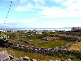
Tourists Banned from Aran Islands
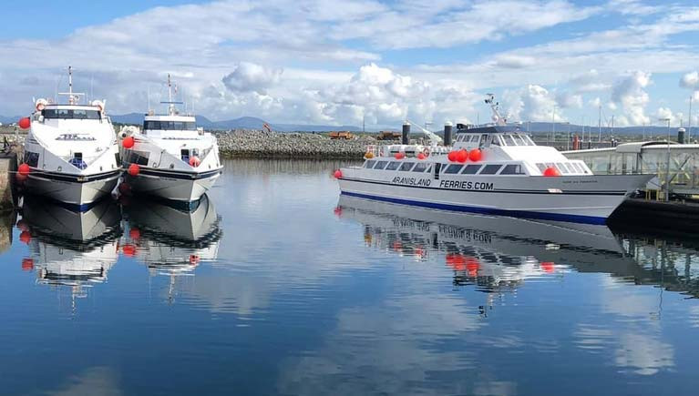
No tourists are permitted to travel between the Aran Islands and Galway during current Covid-19 restrictive measures, Island Ferries has said.
The private company has also said one vessel will serve all three islands daily for “essential/emergency services only “ under a revised timetable.
“Emergency/ essential workers and those providing essential services such as doctors, Gardaí and others require transport to and from the islands,” Island Ferries has said in a statement.
The company had initially signalled that it was cancelling all ferry services but said that it had made the amendments in consultation with representatives of the emergency services on the islands and on foot of the new restrictions announced by Taoiseach Leo Varadkar on Friday.
“ Tourists are not permitted to travel, under any circumstances. Furthermore, we implore upon all islanders not to make any unnecessary journeys,”it says.
Earlier this month, the Inis Mór co-op, Comharchumann Forbartha Árann Teo , appealed to visitors to stay away from the islands during the current public health crisis, stating the majority of residents supported this stance. A vote had been taken which was 94 per cent in favour of the restrictions.
The two islands of Inis Meáín and Inis Oírr also supported this stance.
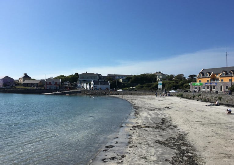
Galway Bay FM reports that residents on Inis Mór in the Aran Islands are appealing for tourists and other visitors to stay away for the next fortnight to limit the spread of COVID-19.
Comharchumann Forbartha Árann Teo issued a statement saying residents have overwhelmingly voted in favour of limiting travel to or from Inis Mór until Sunday 29 March.
In addition, islanders are asked to avoid travel to and from the mainland for the rest of this month’s containment period.
Marine Notice: ADCP Deployment Off Aran Islands
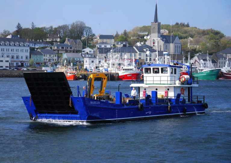
The Department of Transport, Tourism and Sport advises that University College Dublin intends to deploy an Acoustic Doppler Current Profiler (ADCP) sub-surface installation off the Aran Islands this Friday 28 February, weather permitting.
The deployment will occur around 0.6 nautical miles from Eeragh Lighthouse on Rock Island, off Inishmore, in a direction of 235°. The exact location co-ordinates are 53° 08' 34.437" N, 9° 52' 14.040" W.
The one-day deployment will be carried out by the MV Madelen (Callsign: EI4990). The vessel will display appropriate lights and signals.
Navigational warnings will be issued by radio when the marker buoy deployment takes place. Yellow, spherical marker buoys, 40cm in diameter, will be used. They will flash amber every five seconds.
For more information on this deployment visit www.highwave-project.eu
Operator to Aran Islands Travels to India as Part of Major Sales Mission
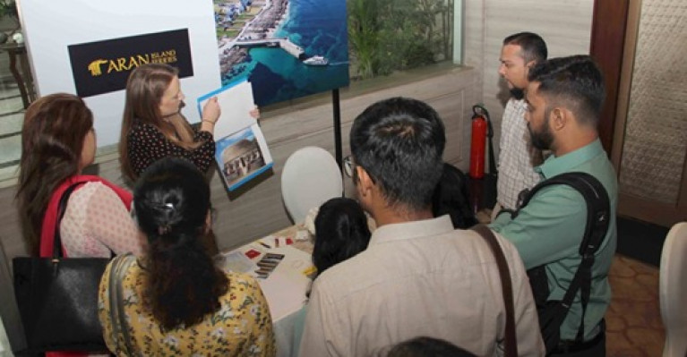
West coast operator, Aran Island Ferries travelled to India last week as part of Tourism Ireland’s sales mission in the country.
The delegation, writes GalwayDaily, of Irish tourism companies, which included hoteliers and visitor attractions, met hundreds of tour operators and travel agents in Mumbai and New Delhi.
The companies also met influential travel journalists and bloggers.
The aim of the sales mission was to build awareness of the many things to see and do on a holiday in Ireland and encourage tour operators and travel agents in India to include Ireland in their programmes and brochures for 2020 and beyond.
More here on this story.
Aran Islands Put Forward Clean Energy Agenda As Transition Plans Published
The Aran Islands were this week among six offshore communities across the European Union to publish their plans to transition to clean energy, as TheJournal.ie reports.
Comharchumann Fuinneamh Oileáin Árann Teo (CFOAT) helped develop the transition plan that was published in tandem with the Clean Energy for EU Islands Forum held in Croatia from 20-22 November.
As previously reported on Afloat.ie, the local energy co-operative has set an ambitious target for the islands to be self-sustainable for energy generated from the waves, wind and sun by 2022.
CFOAT manager Avril Ní Shearcaigh said the plan “acts as a road map for the islands as we pursue our goal of carbon neutrality by 2022, and reflects the enthusiasm and drive of our community to be more sustainable and self-sufficient”.
That drive to become “energy independent” took on a new urgency in 2016 when Isis Meáin and Inis Oírr lost their connection to the national grid for several weeks.
Emergency generators were shipped in after almost 400 residents were left without power for four days by the undersea cable fault.
TheJournal.ie has more on the story HERE.
Aran Islands RNLI Responds to Two Medical Evacuation Requests
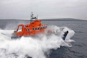
Aran Islands RNLI has responded to consecutive calls for help today to carry out two medical evacuations.
The volunteer crew were first asked to launch their all-weather lifeboat David Kirkaldy, at 11.25 am by the Irish Coast Guard.
An elderly man required medical attention on the Island of Inis Meáin.
The lifeboat launched under Coxswain Pete Hanscombe and a full crew.
Weather conditions were moderate at the time with a force 3 light South-East wind.
Once alongside the pier in Inis Meain, the patient was transferred safely aboard the lifeboat and brought under the supervision of the volunteer crew members. While preparing to leave the pier in Inis Meain, the lifeboat received another call, this time to go to the aid of a woman on Inis Mór who was also in need of further medical attention.
The lifeboat headed straight for Inis Mór and once alongside the pontoon, the patient was transferred safely aboard and put under the supervision of the lifeboat crew. The lifeboat then proceeded on to Rossaveal harbour where the crew transferred the patients on to a waiting ambulance.
Speaking after the call out, Aran Islands RNLI Coxswain Pete Hanscombe said: ‘This was a busy morning for the volunteer crew members, but they responded quickly and both patients were transferred safely and quickly to the Ambulance in Rossaveal. We would like to wish both patients a speedy recovery.’
Cemetery Works On Inis Mór Among Coastal Protection Projects Funded By €750K Grant
Galway Bay FM reports that almost €100,000 has been ring-fenced for the completion of coastal protection works on Inis Mór in the Aran Islands.
The works will focus on arresting erosion at the island’s coastal cemetery, which locals fear will bear the brunt of more extreme weather in the future.
The funding comes from a grant of more than €750,000 from the Department of Culture, Heritage and the Gaeltacht to complete improvement works on a number of the Ireland’s coastal islands.
Besides Inis Mór, the list includes Whiddy Island, Bear Island, Hare Island and Sherkin Island in Co Cork; Inis Bigil, Clare Island and Inishturk in Co Mayo; and Oileán an Bhráighe, Árainn Mhór and Gabhla in Co Donegal.
Aviation First Across Atlantic Corridor With Drone Doctor Flight to Aran Islands
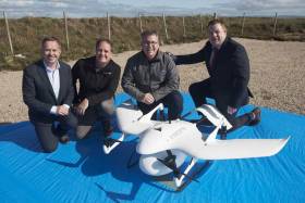
An aviation “first” has been recorded on the Atlantic corridor between Connemara and the Aran Islands with the delivery of medication by a drone writes Lorna Siggins
The Wingcopter 178 Heavy Lift drone flew diabetes prescription medications and a collection of a patient blood sample almost 22 km across from Connemara airport in Indreabhán to the largest Aran island of Inis Mór last Friday.
The return leg was slightly shorter at 21.6km, and both flights were completed on a single set of batteries, amounting to 32 minutes of flight time.
The DiabetesDrone project was led by NUI Galway (NUIG), and run in partnership with several industry experts and stakeholders.
It was supported by the Irish Aviation Authority and took place between commercial flights to and from Connemara and the Aran islands - showing that future deliveries of this kind could take place within “planned drone corridors”, according to NUIG.
The project participants noted that it is “crucial that people with diabetes have access to their lifesaving medicine at all times, which is often challenging in remote geographic regions and in times of natural disasters”.
“Recent severe weather events, including storms Emma and Ophelia, demonstrated a clear need to develop the capability to deliver insulin and other critical medications (such as glucagon) in times of crisis,” they noted.
NUIG professor of medical device technology Prof Derek O’Keeffe said that island and rural communities could become isolated for days after a severe weather event and might need emergency medicine deliveries.
“To date, medical drones have demonstrated success, for example in delivering blood, defibrillators and human organs for transplant. This #DiabetesDrone project represents another milestone in the use of drones to improve patient care,” he said.
Aran island GP Dr Marian Broderick said that the drone technology offered "endless possibilities" for island communities.
The drone supplied by Survey Drones Ireland was equipped with an insulated parcel delivery box for the payload. The devices reach destinations of up to 100 km distance in less than an hour.
The drone was launched from Connemara Airport using a combination of software - one for the pre-flight checklist and one for the mission flight, and was connected via Vodafone Ireland’s “Internet of Things” network, and flew a pre-planned flight path using “Q Ground Control” software.
US ‘Rescue Boat’ Found Near Aran Islands Causes A Stir
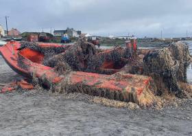
An apparent coastguard vessel from the United States has washed up in the Aran Islands today (Tuesday 3 September).
In a post on their Facebook page, the Doolin Ferry Company reported spotting an object in the water on the way to Inis Oírr that turned out to be an upturned boat.
With the help of a local fishing boat and a number of islanders, the red boat was brought onto the beach and investigated for clues — the biggest being its serial number.
That identified the vessel as “Fast Military Rescue Boat”.
It’s not yet clear how long the boat has been in the water, and how it came to drift to Ireland’s shores.
But the ferry company’s appeal for more information has potentially identified it as boat built in 2015 for use in gunnery training by the US Navy.
David K Hunt of Alabama-based Silver Ships says the vessel is a “foam collar boat” used for target practice.
“We do air collar boats that are intended to sink, not float to Ireland,” he added.
Two Medical Evacuations For Aran Islands Lifeboat On Wednesday
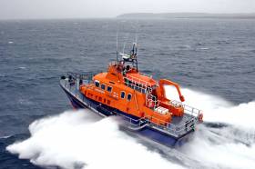
Two people were evacuated from the Aran Islands for medical reasons by the area’s RNLI lifeboat yesterday (Wednesday 28 August).
At 4.50pm the all-weather lifeboat David Kirkaldy called to launch from Inis Mór to neighbouring Inis Meain where an elderly man had been injured in a fall.
Under coxswain John O’Donnell and a full crew onboard, the Severn class lifeboat braved difficulty conditions, with choppy 1.5-metres seas and Force 5-6 west to south-westerly wind, to transfer the casualty to the waiting ambulance in Rossaveal.
Later in the evening, just after 11pm, the volunteer crew were called out for another medevac, this time to a sick man elsewhere on Inis Mór who required further treatment, Aran Islands RNLI says.
Despite the even worse conditions at sea, the man was safely transferred to Rossaveal and the waiting paramedics.
O’Donnell said later: “Yesterday was a busy one for the volunteer crew members but they are always ready to answer the call and happy to help out. We would like to wish both patients a speedy recovery.”


